priz1234
Member
- Joined
- Jun 10, 2020
- Messages
- 232
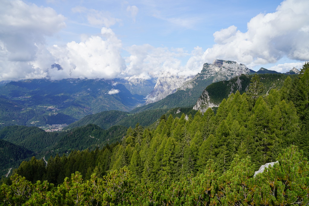
I had been wanting to visit the Dolomites for a very long time and after doing some research it seemed like the best way to see them would be doing one of the Alta Vias. I ended up deciding on the Alta Via 1 and I am glad I did. The Dolomites are such an impressive mountain range and the Alta Via 1 allowed us to see so many great parts of the mountains. There had been some questions on the forum here about the Alta Via 1 so I'll include some of the logistics in this trip report as well.
We hiked the Alta Via 1 from north to south and did it in 7 days from August 26th to September 1st. Here are the rifugios we stayed at.
Booking the rifugios was a little bit of a pain. There is no one system where you can book multiple rifugios and each rifugio has their own way to make the bookings. One of them we could book directly on the website, some of them had a form you needed to fill out and then they would respond in a couple days or a week with options and others you just had to send an email to see if they had any availability. Some respond pretty quickly and others may take awhile to respond. If you want to do the Alta Via 1 I would recommend booking the rifugios VERY early. We booked ours in January of 2023 for a trip at the end of August and there were some rifugios that were already full. This did cause us to have a longer first day than expected and since I had already booked the rest of the rifugios we had a pretty short second day. It may have been a little more difficult for us to book them since we had 4 people but I would still recommend booking them well in advance. Only 1 of the rifugios we had to pay in full in advance. The rest of them asked for a 20 euro per person deposit and you would pay the rest at the rifugio.
Getting to the Tralihead
We flew into the Venice airport and arrived in Venice the night of August 24th. We spent that night and the next morning in Venice. The public transport from Venice to the start of the trail is actually pretty good. We booked a bus with Cortina Express that took us from the Venice Airport to the city of Cortina D'ampezzo. We stayed one night in Cortina D'ampezzo and bought some snacks for along the trail while we were in town.
The first day of the hike we had a 13.5 mile day and so we knew we had to be on the first bus to the trailhead if we wanted to make it to our first rifugio that night. We would have a shorter than usual day since the first bus doesn't leave Cortina D'ampezzo until 8am and it is an hour and a half trip to the lake. To get to Lago di Braies from Cortina D'ampezzo you actually have to take 2 busses. The 445 from Cortina to Toblach and then the 442 from Toblach to the lake. To book the 445 I downloaded the mobile app suedtirolmobil. This one didn't have to be booked in advance but was easy to purchase on the app. Since Lago di Braies is so popular, I did have to prebook a ticket on the 442 bus from this website https://www.prags.bz/en.
Our first rifugio of the trip was Rifugio Lavarella which is 13.5 miles from Lago Di Briaes. There was a group of 4 of us and 2 members of our group did not think they could make the 13.5 miles since we had a later start in the day. The 445 bus makes multiple stops along the way to Toblach so they got off at a stop called Podestagno and hiked from there to Rifugio Lavarella. Me and my wife continued on the busses and made it to the lake with no problems.
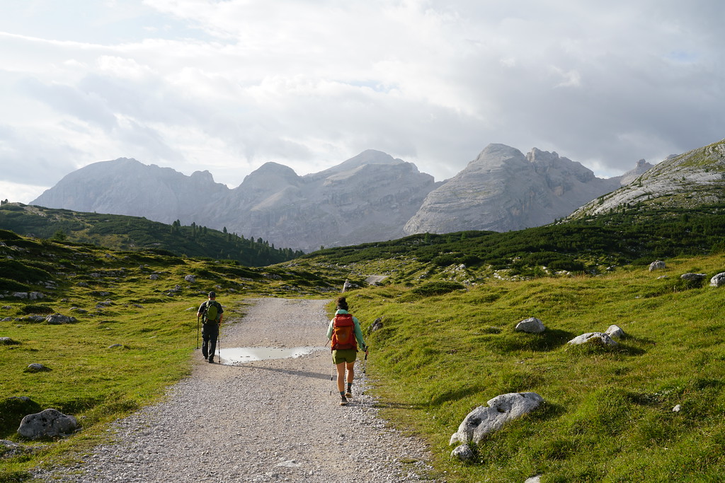
Day 1 - Lago Di Braies to Rifugio Lavarella - 13.5 Miles - 5000ft gain 3300ft descent
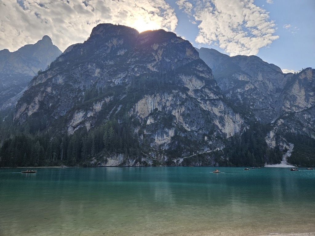
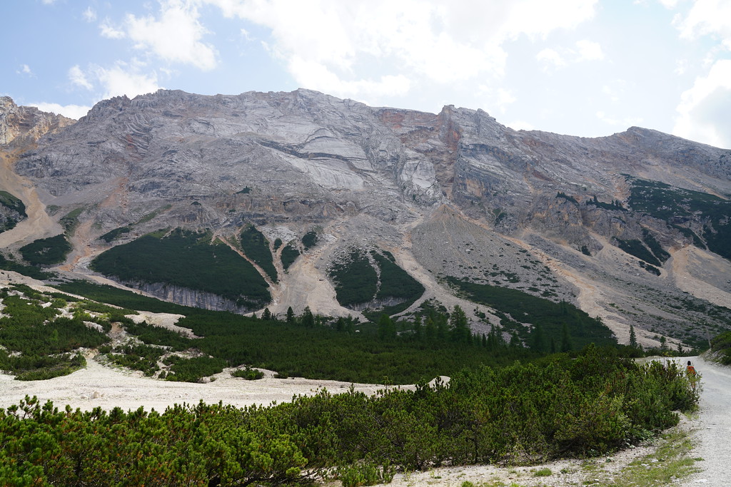
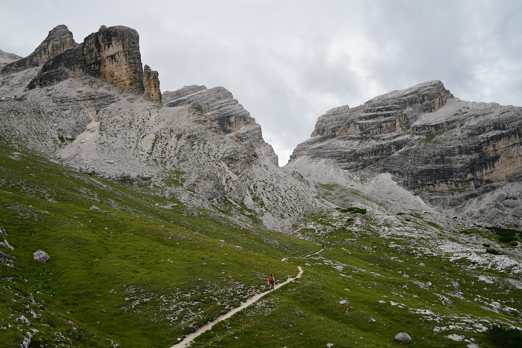
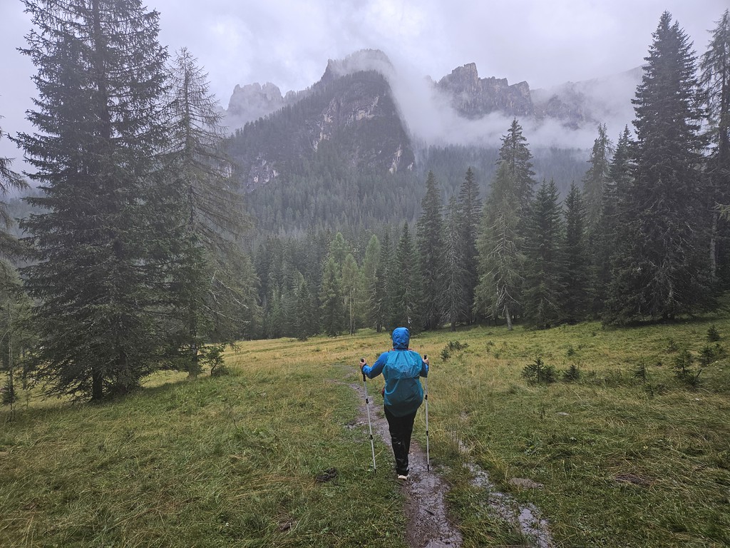
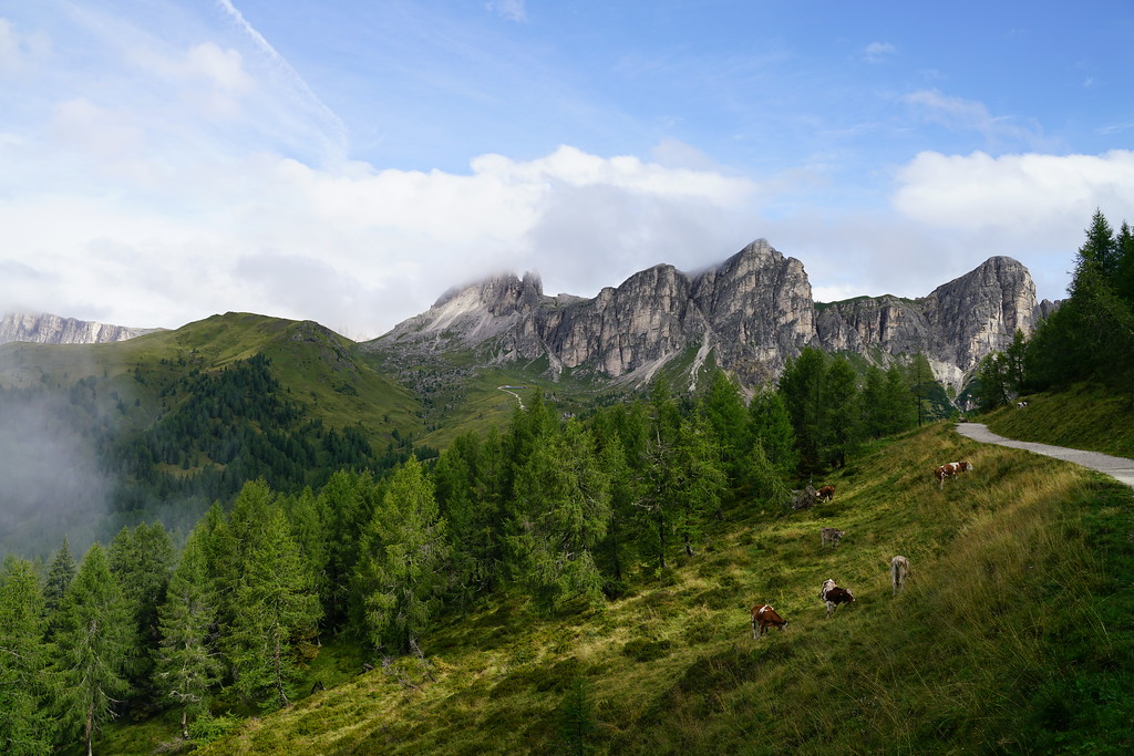
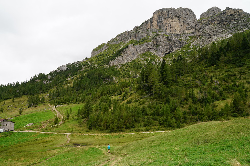
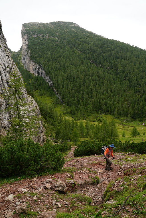
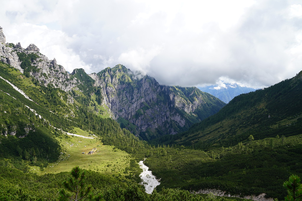
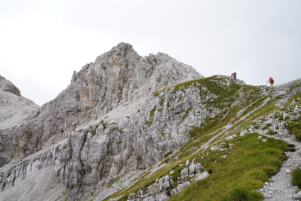
The lake is a very short walk from the bus stop and after arriving I understand why this lake is so popular. It is such a beautiful lake with such towering cliffs behind it. There are actually two trails around the lake and I wasn't sure which one is the better option. Standing at the lake it looked like the west option was the easier path so we took that one and had a couple nice views of the lake along the way.
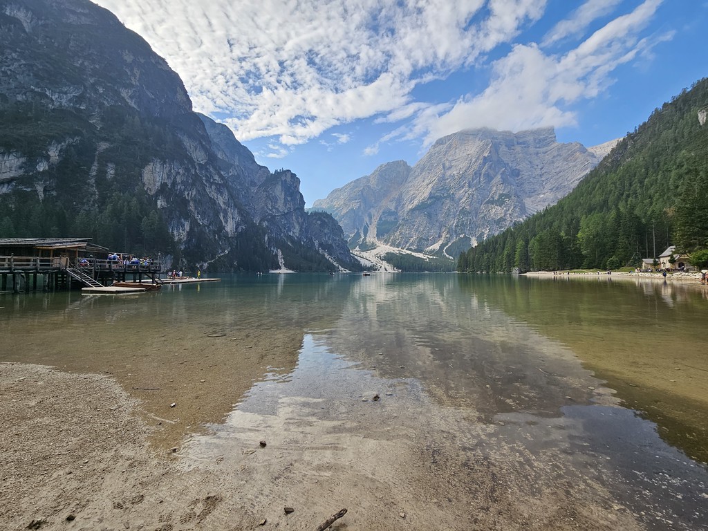
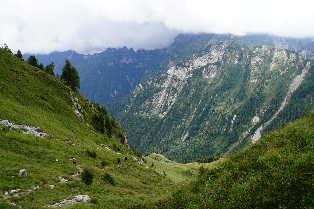
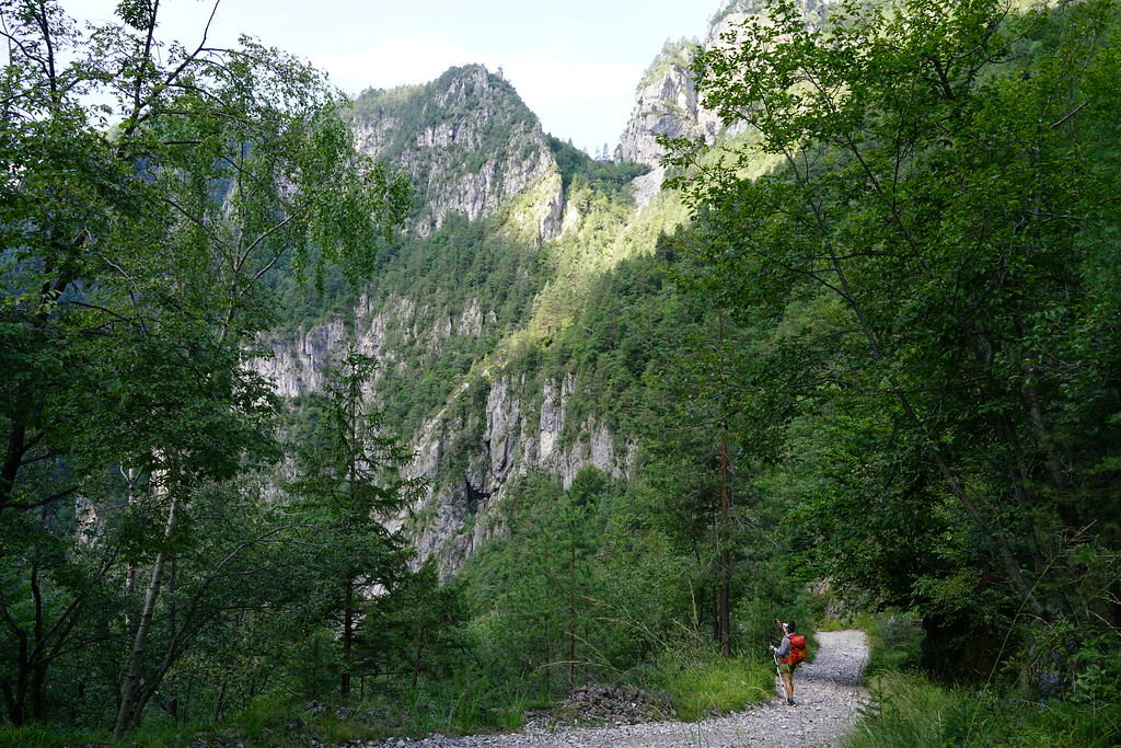
Once we reached the other side of the lake I got the first taste of the steepness of the dolomites. It was also extremely hot. This is already one of the biggest climbs of the entire trail and with the heat, this was probably the toughest climb of the entire trip. We also made it harder on ourselves due to the fact that we had a shortened time to reach our rifugio for the night so we were trying to move pretty fast.
This first day is really the only day where I felt my scheduling of the trip was not so great. If I were to do this same itinerary again I would stay in Toblach the night before instead of Cortina D'ampezzo so you could get an earlier start. My original plan and what I would try to do again for a 7 day alta via 1 trip would be to stay at rifugio sennes, fodara vedla, or Pederu the first night. Those three rifugios were full when I booked my trip and I booked my huts in order from the end of the hike to the start of the hike so that is why Rifugio Lavarella ended up being our first night. Most people we talked to on the trail had stayed in Rifugio Lavarella or Rifugio Fanes (right next to Lavarella) on their second night.
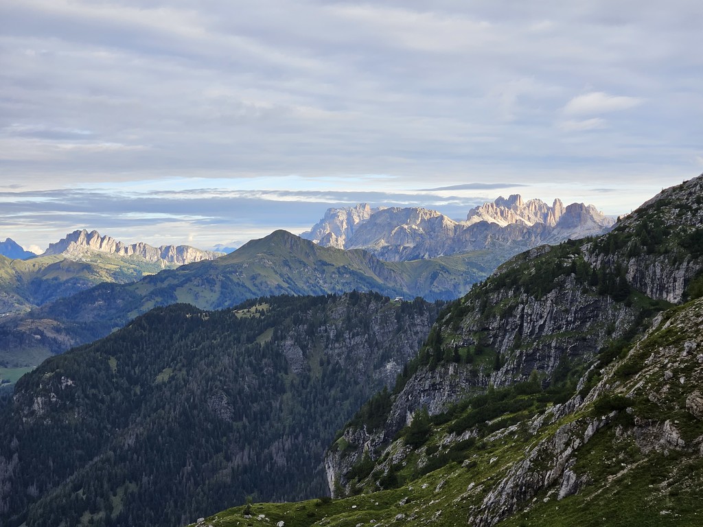
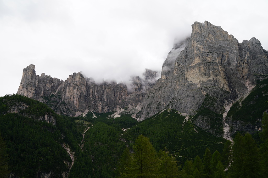
Enough of those logistics for day 1. The climb was tough for those various reasons but was an incredible introduction to the scenery of the Dolomites.
From the top of the pass you can see rifugio Biella which is where we had planned to stop for lunch. We had never been to a mountain hut anywhere in Europe so we weren't quite sure what to expect when arriving at this first one. We dropped our packs outside and went inside to figure out how to get food. We found out you need to find a table and then they come and take your order. Since we were in a little bit of a hurry this day we just ordered some sandwiches and took them to go. It was a fine sandwich but they were pretty fast so we were happy as we ate the sandwiches on the trail. We also bought some water here since we had drank so much on the climb and the water at this hut was not potable.
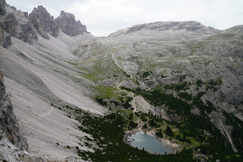
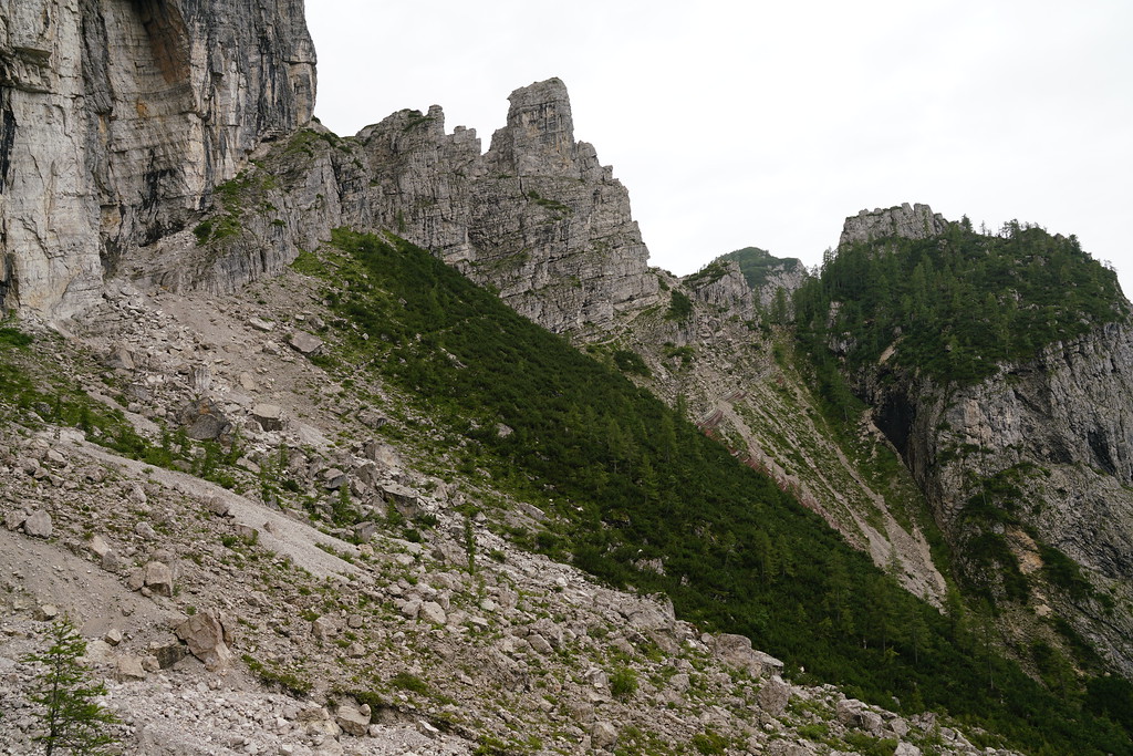
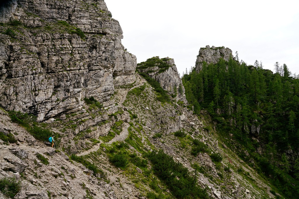
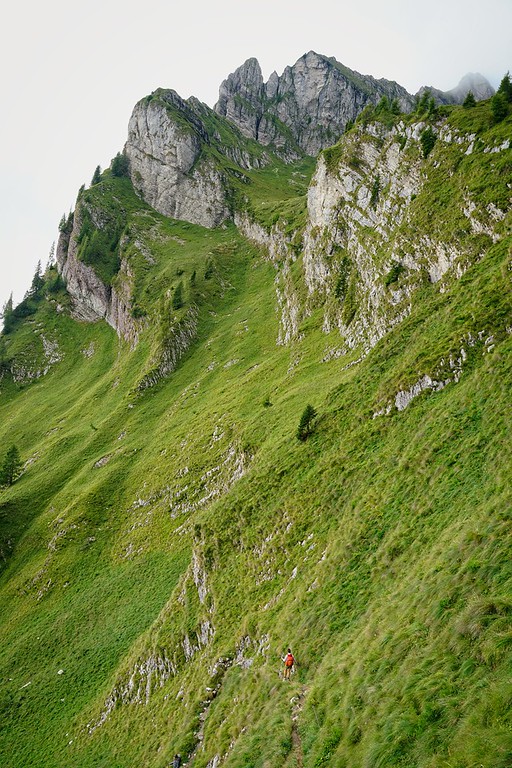
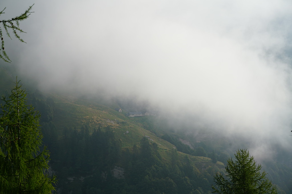
The views in this section of trail were incredible and we could even see the valley where Rifugio Lavarealla sat (it looked like a long ways away). We eventually reached Rifugio Sennes but did not stop at all. Not too far past Rifugio Sennes the trail splits for a mile or two. One trail leads to Rifugio Fodara Vedla and the other is a shorter distance. We opted for the shorter distance since we didn't need anything from the rifugio. Once the trails met back up continued on a steep decent into the next valley. Part of this was one of the steepest dirt roads I have ever seen.
In the bottom of the valley was rifugio Pederu. We didn't stop but there were a lot of people outside of this rifugio. Probably because you can actually drive to this one. From Rifugio Pederu you again have two options for a trail. You can take a shorter but steeper trail or a longer, less steep dirt road. We felt done with steep trails for the day so we opted for the dirt road. I ended up being happy with our choice as it was mostly a pretty mellow grade and had great views along the way. The downside was there was no shade along the way and it was still very hot.
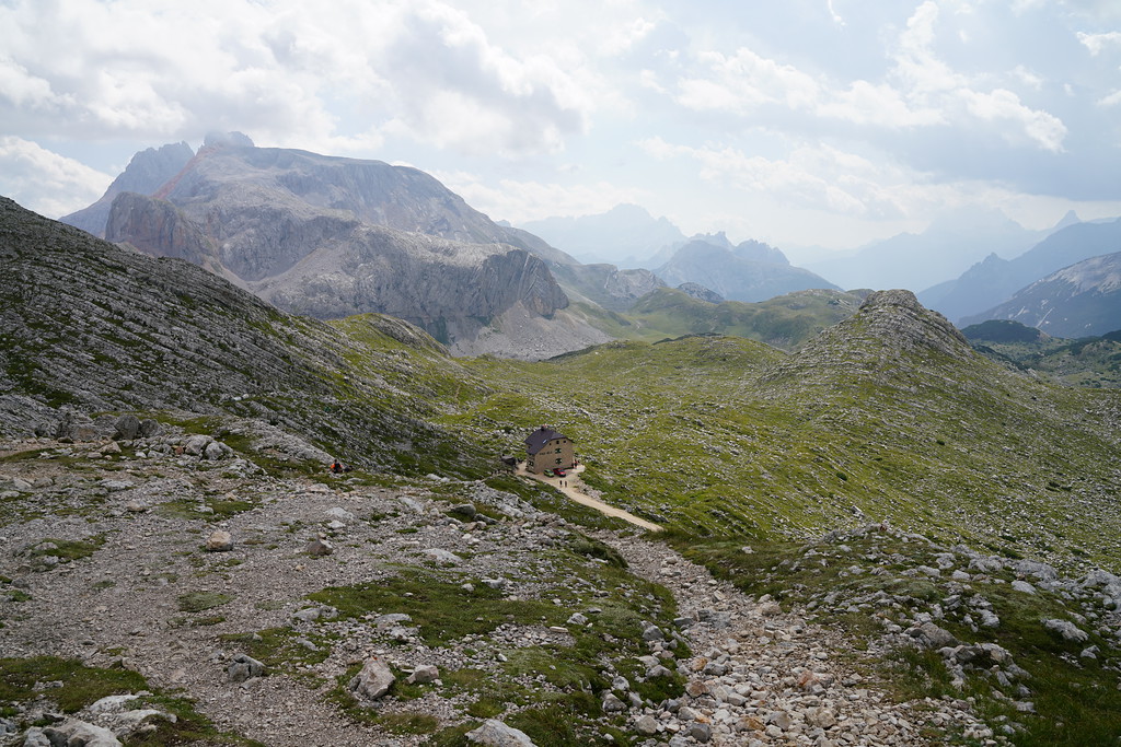
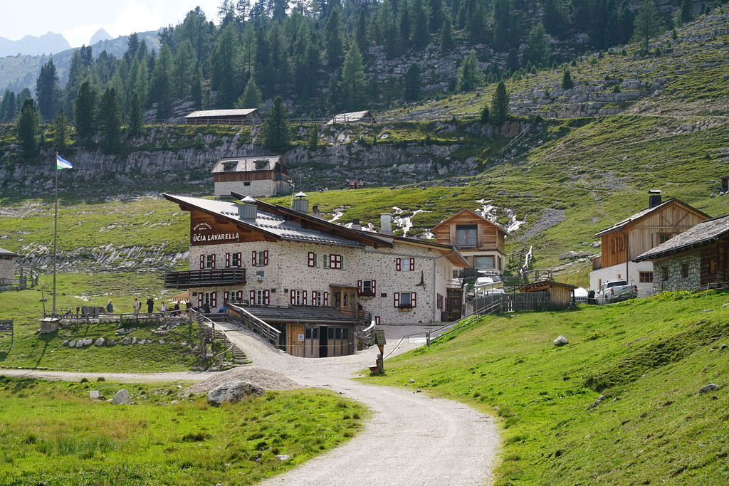
We made it up to Rifugio Lavarella at about 3:30. So we actually ended up making pretty good time still. The other two members of our group had beat us there so they had us checked in. This was probably our best room and one of the nicest rifugios we stayed at along the trail. This room only had two beds, had a decent amount of space and even had a sink with potable water in our room. This rifugio also had free showers but we did not use them here. After seeing our room we just hung out at the hut getting some cold beer. Rifugio Lavaralla actually has it's own brewery and it says it is one of the highest breweries in Europe. Staying at these rifugios felt like luxury to me, I'm used to backpacking or car camping even on international trips so to have a cold beer, a bed and hot nice dinner cooked for me was pretty nice. When we booked Rifugio Lavarella there wasn't half board option so dinner was not included and they had a decent sized menu of what you could order. The food was very good here but was probably one of the least good of the rifugios we stayed at.
Day 2 - Rifugio Lavarella to Rifugio Scotoni - 6.8 Miles - 2050ft of gain 2200ft of descent
If I remember right, they served breakfast at 7am. This might be the last time I mention breakfast because every hut we stayed at had essentially the exact same breakfast. Plain yogurt with some granola, bread, meat and cheese. Some had some cakes or eggs but overall they were all about the same and were good.
Because of my issues booking the rifugios this was a pretty short day but we still decided to get up early and pack everything up before breakfast because there was a threat of thunderstorms early in the afternoon. There isn't really a whole lot to mention about on this day. Looking back on the trip though, the middle 5 miles of this day are some of my favorite of the trip. The views were absolutely incredible.
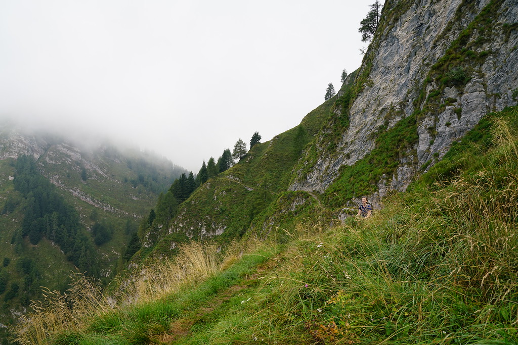
Rifugio Scotoni is about 0.5 miles off of the Alta Via and there are two routes you can take to get there. Both have about the same amount of elevation gain and decent and the same distance. One goes over a high pass and then drops down to Scotoni where you will backtrack up the next day. The other drops down into a valley and then climbs up to scotoni. Our group split up again in this section. Me and my wife went over the pass and this is the option I would recommend after talking to the other members of our group. The pass has some incredible views and the trail down the pass is iconic.
Rifugio Scotoni overall was probably the nicest rifugio we stayed at. We had a room with 4 beds and our own shower in the room. The food, beer and wine was great. We got the hut at about 11:30 so we actually ended up eating lunch and dinner here and everything we ordered was delicious. Scotoni also, didn't have a half board option so we had to order and pay for our dinner there.
Day 3 - Rifugio Scotoni to Rifugio Croda Da Lago - 11.6 Miles - 5100ft of gain 4900ft of descent
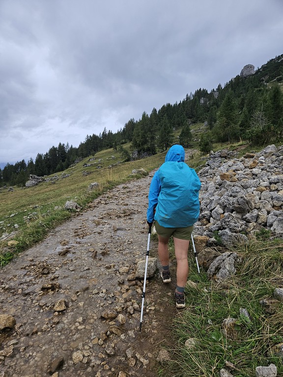
It rained. A lot.
The photos from this day will almost all be from my phone since it rained all day except for the last mile of the hike.
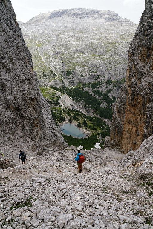
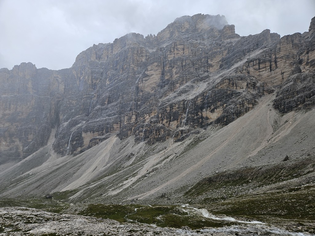
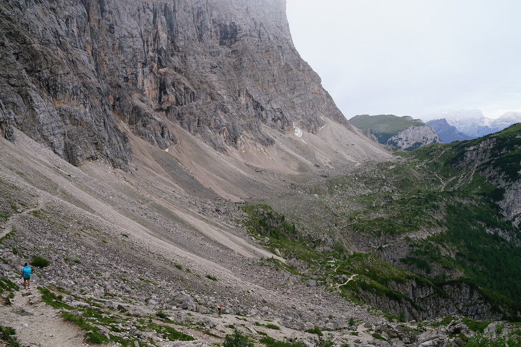
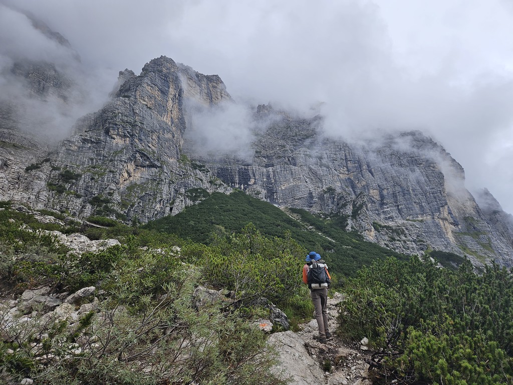
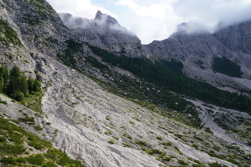
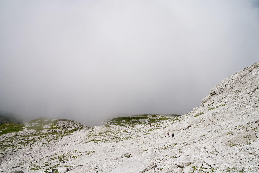
The pass below Rifugio Lagazuoi is one of the highest points on the trail and this is the pass we had to hike over today. We had been checking the forecast and had seen it was supposed to be very rainy today. We didn't notice the wind warning though which may have changed our decision. We debated two options, just deal with the rain and hike over the pass or we could hike down to a small town and ride a bus up to passo falzarego where we would be passing by if we chose the hiking option anyways. There wasn't lighting predicted so we decided to just hike over the pass. It was already raining pretty hard as we backtracked up part of the trail we hiked down the day before. Once we got back up to lago di lagazuoi we got our first taste of the wind.
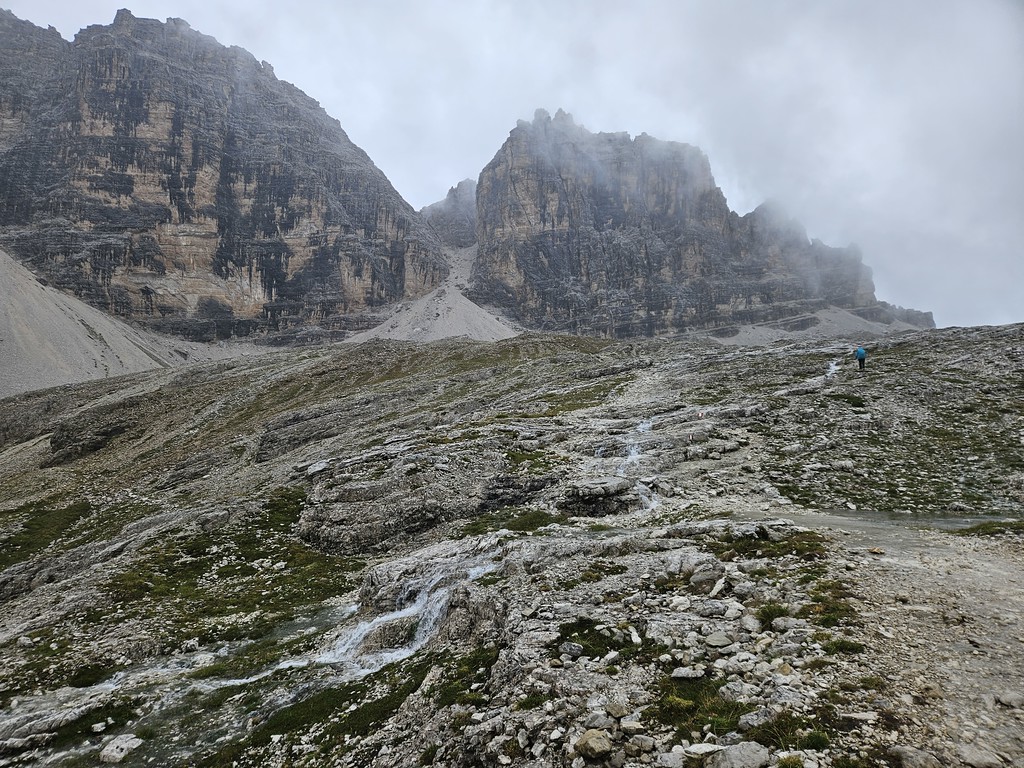
From the lake we continued up the trail towards the pass. As we climbed the rain stayed pretty strong and the wind continued to get worse and was blowing straight into my face. I tried to look up as much as I could since there were some amazing waterfalls coming off of the cliffs around us. About a half mile from the pass we stopped behind a large rock for a minute and a few of us put more jackets on since it was getting cold and rain gear had started to sock through. Right about here we got our first view of Rifugio Lagazoui but it didn't last long as fog rolled in as well.
We had planned on hiking up to Rifugio Lagazuoi so we could walk through the world war 1 tunnels but with the weather decided against it.
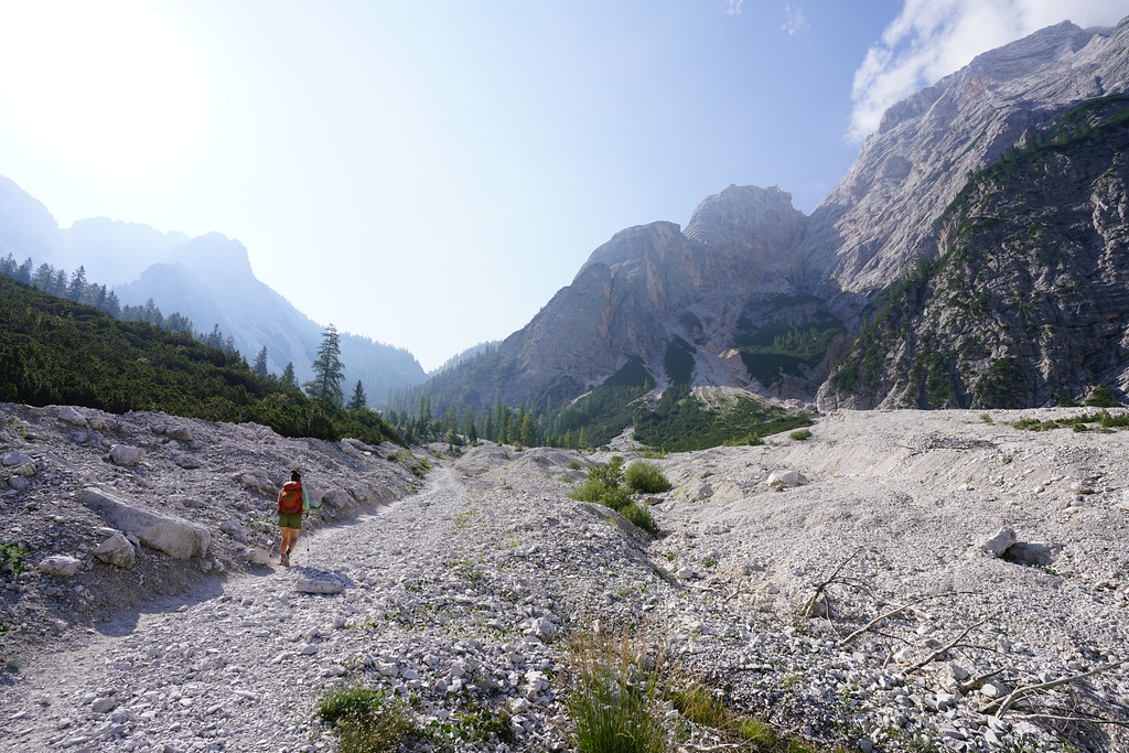
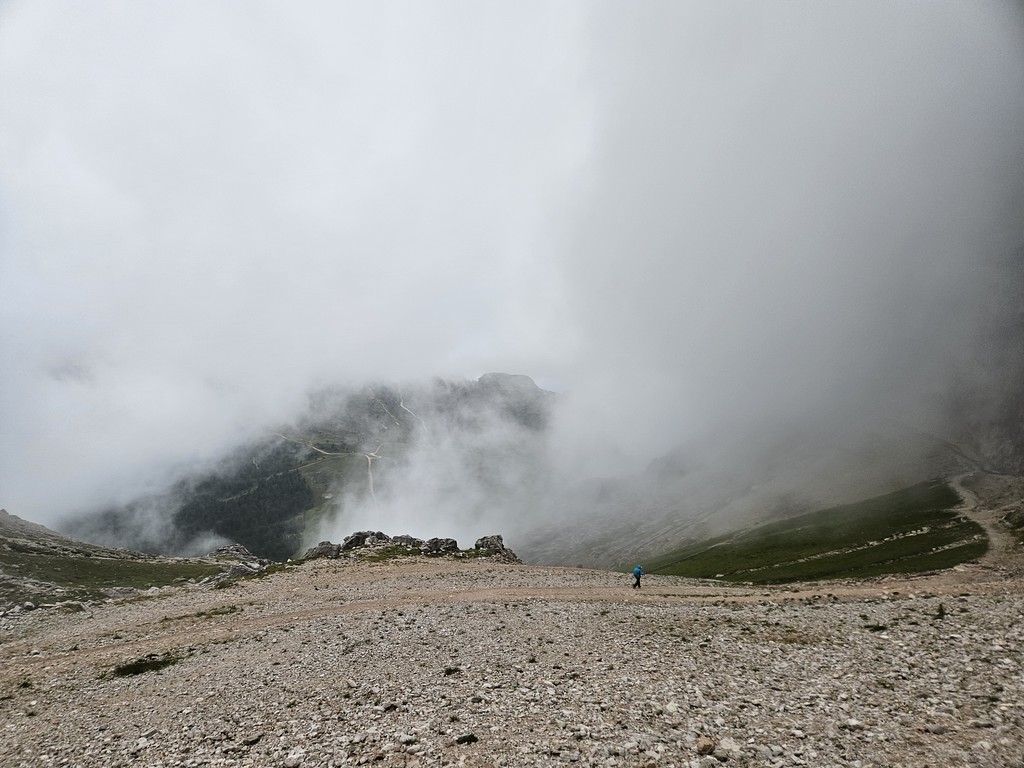
The fog got dense enough that we could no longer see the red and white painted on the rocks anymore showing us where the trail went and we lost the trail for a few minutes in a section that was very rocky and tough to follow the main trail without being able to see ahead. Luckily we weren't off trail long and we eventually made it to the top of the pass where the wind was fierce. I could barely stand while bracing myself with both of my trekking poles. One member of our group even laid down on the ground because they could barely stand during a particular gust of wind. There are a couple of different routes from the top of the pass and we took the shortest and steepest option which just went straight down a ski slope. It was still raining on this side of the pass but not as heavy and was a lot less windy. We eventually made our way back onto the main trail and made it down to the paved road that goes to Passo Falzarego. At this point, we were pretty wet but since the wind had died down it wasn't too cold anymore. Also, going over the pass ended up being the worst of the weather for the day. Still rained on us essentially the entire day but was not as heavy and the wind wasn't nearly as bad. We seemed to be some of the only people hiking today as we only saw one other group of 3 on our way up and over the pass and many of the people we talked to throughout the rest of the hike mentioned they took a taxi for a section of their hike that day.
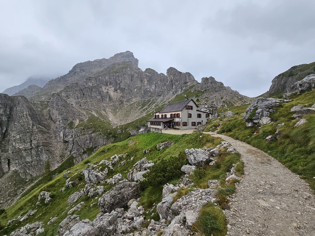
Our next goal for the day was to make our way up to Rifugio Scioiatolli for lunch. Nothing too interesting happened on the climb up to the rifugio but it was very odd once we arrived at the rifugio. It was a huge rifugio but there was only one other person getting lunch and there were 4 waitresses. It just felt empty and weird. Lunch was great there, got some hot drinks and food but it almost seemd to make us colder by sitting in the rifugio since we had gotten so wet.
From Rifugio Scoiatolli we would diverge from the main Alta Via 1 and get on an alternate that would take us to Rifugio Croda Da Lago. The first part of this alternate took us steep down into another canyon which was very muddy due to all of the rain.
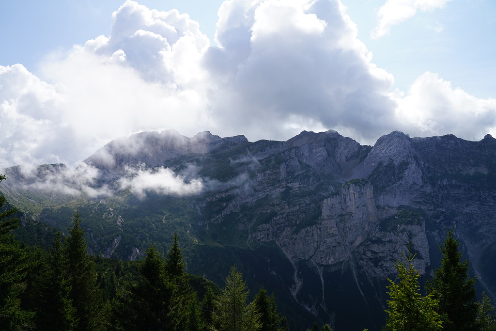
We crossed another road and then started our climb up to Croda Da Lago. This section was mostly in the trees but this is where our luck for the day turned around. Right before we reached an amazing viewpoint the rain stopped and clouds lifted and we were treated with some amazing views over Cortina D'ampezzo. The rain also stayed away for the last mile of our hike but started again after we had been at the rifugio for about an hour.
Rifugio Croda Da Lago may have been my favorite rifugio we stayed at. It wasn't the nicest but it was in such a cool location and the food was almost as good as scotoni. We did get a little lucky here with the rooms. We were in a room with 6 beds but nobody showed up in two of the beds so our group had our own room once again. Many of the huts we stayed at had a heated shoe room or boot warmers but Croda Da Lago did not which would have been nice on this day.
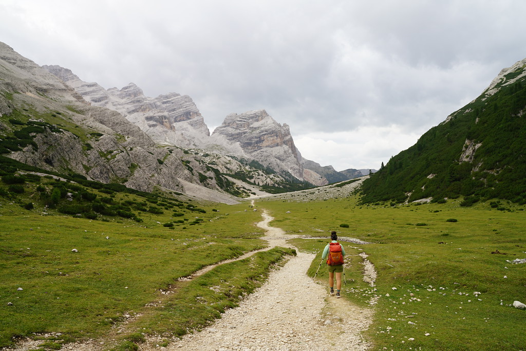
Day 4 - Rifugio Croda Da Lago to Rifugio Coldai - 10.6 Miles - 3100ft of gain 2800ft of descent
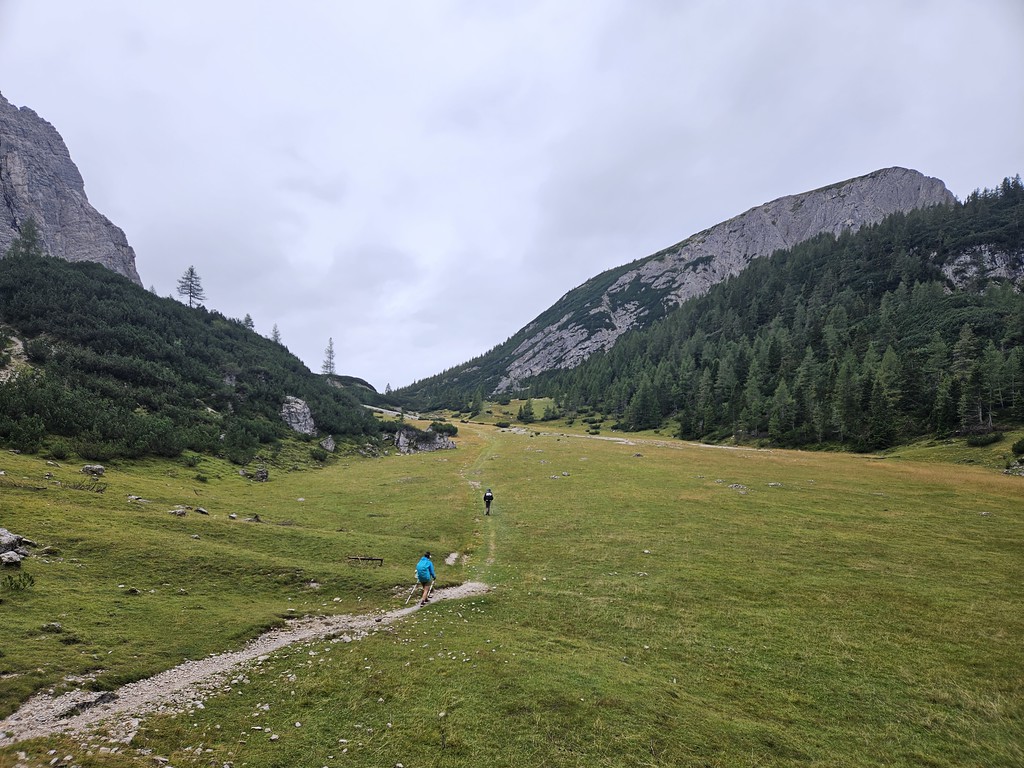
By the morning, the weather had cleared but there was still rain forecasted throughout the day but it did not look like it was supposed to be nearly as bad as the day before. The first few miles of this day was another one of my favorite sections on the entire trail.
After about 2.5 miles we hit a dirt road and it rained on us for about 30 minutes as we made our way to rifugio citta di fiume.
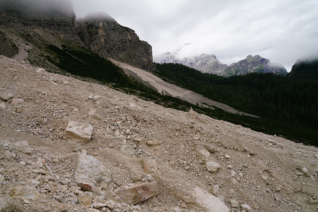
At rifugio Citta di Fiume there was a caution sign saying there was rockslides. We decided to still go on the trail sine the way around was quite a bit longer. The rock slides really weren't bad at all but they seemed pretty recent as there was no trail across them.
We ended up stopping at rifugio Passo Staulanza for lunch where we got some great pasta. From Passo Staulanza the trail follows the paved road for a little under a mile.
We then turned up a dirt road and started the climb to Rifugio Coldai. During the climb the rain hit us again. It was kind of annoying since we had been dry for most of the day and ended up getting wet for just the last mile of the hike.
Rifugio Coldai is situated in a pretty crazy spot and we had great views from our room. We ended up getting our own room again that had 4 beds but this room was tiny. It barely fit those 4 beds. This rifugio was so loud when people were walking by the room in the hallway or in the rooms above. Don't know if I need to keep mentioning the food but it was very good here as well. I think Rifugio Coldai is actually the biggest rifugio we stayed in as our guide book said it had 88 beds. It didn't seem too crowded or worse than any other rifugios though.
Overall this day was the easiest besides our short day 2. There wasn't that much elevation gain compared to other days and you were on pretty big and wide trails for a lot of the day.
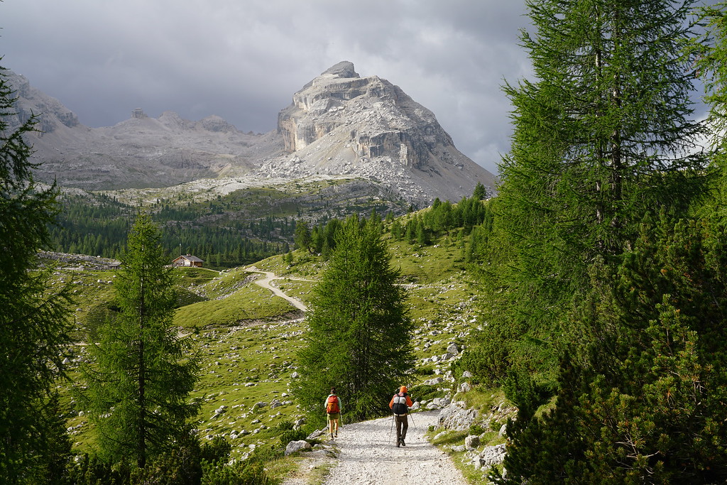
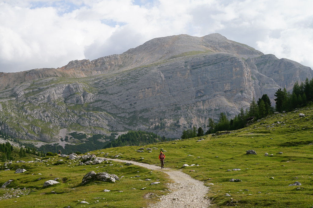
Day 5 - Rifugio Coldai to Rifugio Carestiato - 12.2 Miles - 4400ft of gain 4600ft of descent
Once again there was rain forecasted throughout the day today. Unlike yesterday, it did rain off and on almost the entire day. It never rained hard but was hard enough that I kept on taking my camera in and out of my bag all day.
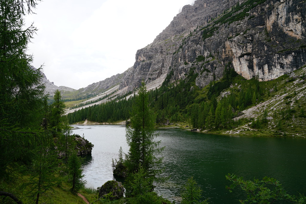
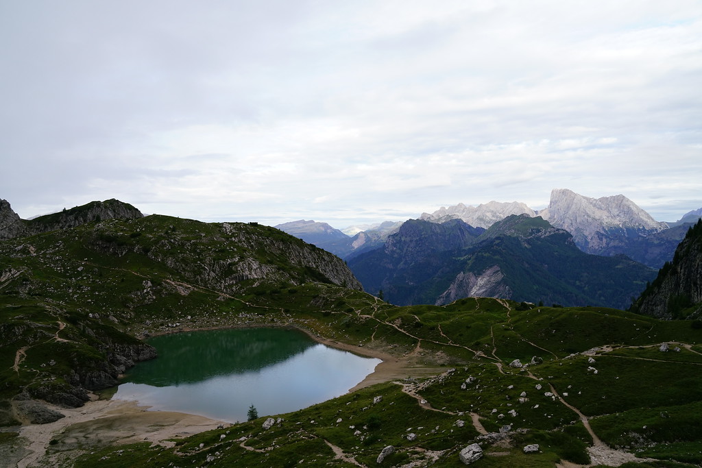
The start of this day was incredible. You are very close to the top of a pass from Coldai and the view from the other side is amazing and even has a lake there as well.
There is a pretty big descent and climb not too far past the lake and after that climb you can make a side trip to rifugio Tissi. We had planned on going up there because I heard there was a good view but the clouds had rolled in at this point and we didn't think it was worth the hike up there without a view. The next section of the trail was beautiful and we went in and out of the rain throughout.
We stopped at rifugio Vazzoler and had the best lunch of the entire trip. It was better than a lot of the dinners. If you want good food this might be the place to stay.
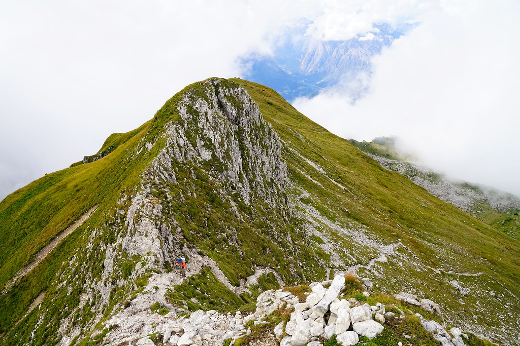
Not too far after leaving the rifugio we hit a section of trail I thought was going to be easy but actually ended up being one of the toughest of the entire trail. It's tough to say why it felt so hard but there were a few miles here that had short very steep sections. It was all either very rocky, lots of roots, slippery from the rain, steep drops on your side and few short sections where the trail was basically gone. It was such a cools section of trail too though.
After getting to a pass labeled forcella del camp on my map the trail was pretty easy going the rest of the way to rifugio carestiato.
This was another nice rifugio that had great food and again we had our own room with 4 beds. The only annoying thing about his rifugio was there were only 3 restrooms and each had a shower in them so there was always a wait to get into the restrooms.
Day 6 - Rifugio Carestiatio to Rifugio Pian de Fontana - 12.6 Miles - 4800ft of gain 5000ft of descent
This was the first day since day 1 where there was no chance of rain. The start of today was very easy with a mile hike to get to the road and Passo Duran. From here, we had a little over a mile of walking on the paved road.
The only other rifugio we would pass today would be rifugio Pramperet but it is slightly off trail so we had decided we weren't going to be stopping there. So the night before we ordered a packed lunch from carestiato. This was something we could have done at the other rifugios but this was the first day we felt like we needed to get a packed lunch. The trail on the way to pramperet had a couple of miles in the trees as well as some really great views.
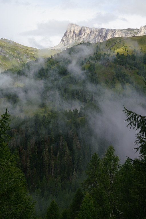
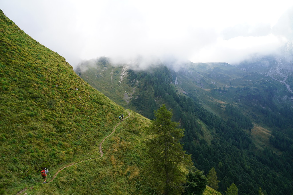
After the turnoff to Premperet we started the long steep climb up to another pass. As far as steepness goes, this was probably a similar climb to the one from lago di Braies but the temperature was much cooler today and we had a lot of cloud cover. It was a little too much cloud cover though as fog rolled in and kept us from having too many views from the top of the pass. The fog did give some more atmosphere and interesting views though.
We then started the STEEP descent down to Pian De Fontana. This was probably the steepest on trail descent I have ever done. The views were incredible though.

This was probably the least nice rifugio we stayed at on the trail but was still great and I would recommend staying here because of the location on the trail. This hut is only like halfway down a huge descent and so if you don't stay here you would have to do a crazy amount of descending in a single day. It is also only 7 miles from the end of the trail which makes it a pretty easy last day. This was the first rifugio where we didn't have our own room. The room we stayed in probably had 12 beds.
Day 7 - Rifugio Pian de Fontana to end of trail - 7 miles - 1500ft of gain 4400ft of descent
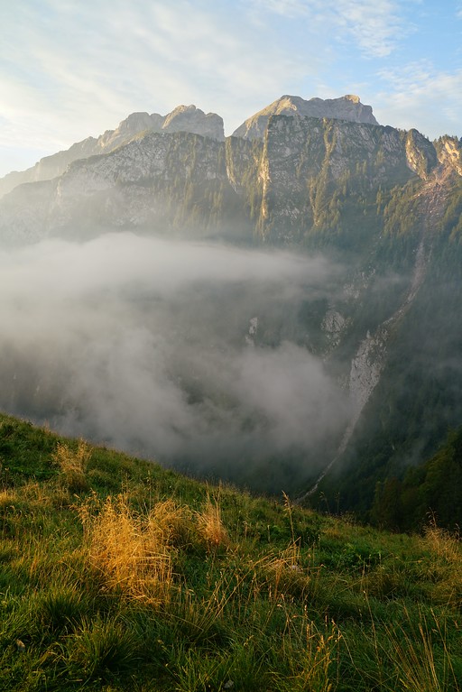
Some very cool mist in the morning.
The day starts out with a steep descent followed by a long steep climb and then right into another steep descent. There is a sidehill section before the second big descent which is very cool.
After the second steep descent the next few miles are very easy going and on a dirt road.
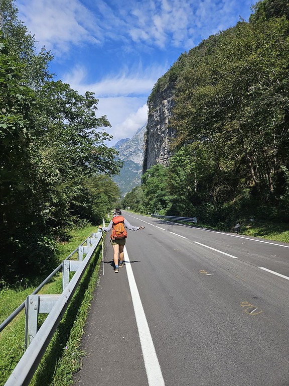
The last half mile leaves the road and gets very steep again. Once you hit the main paved road you need to take a right and the bus stop is a couple hundred yards down the road. I can't remember what the bus number was but at Pian De Fontana we were able to get the bus schedule so we knew about when to be there. This bus will take you to the main bus and train station in Belluno where you can get transportation wherever you need to go. For us, we were staying in the dolomites for a couple more days so we ended up renting a car in Belluno.
Speaking of after the trip, if you need a good campground to stay at near Cortina d'ampezzo I would recommend International Camping Olympia. We weren't there in the busies time of the year but it wasn't too crowded, had a lot of showers, decent bathrooms and had a really good pizza restaurant in the campground. It was also in a pretty good central location where we could do more day hikes from.
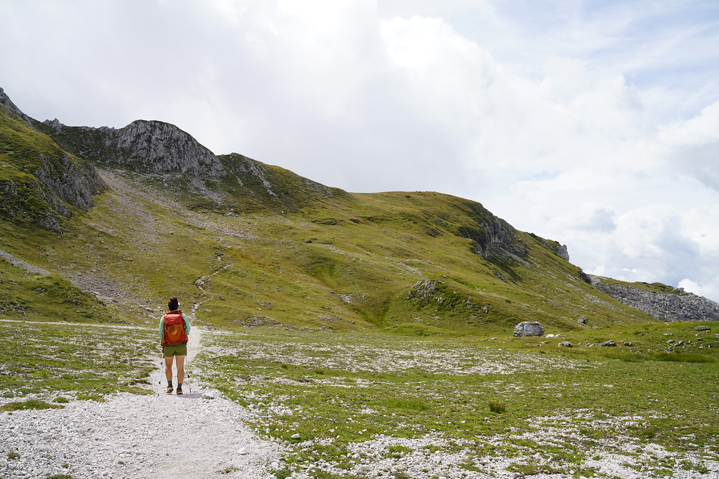
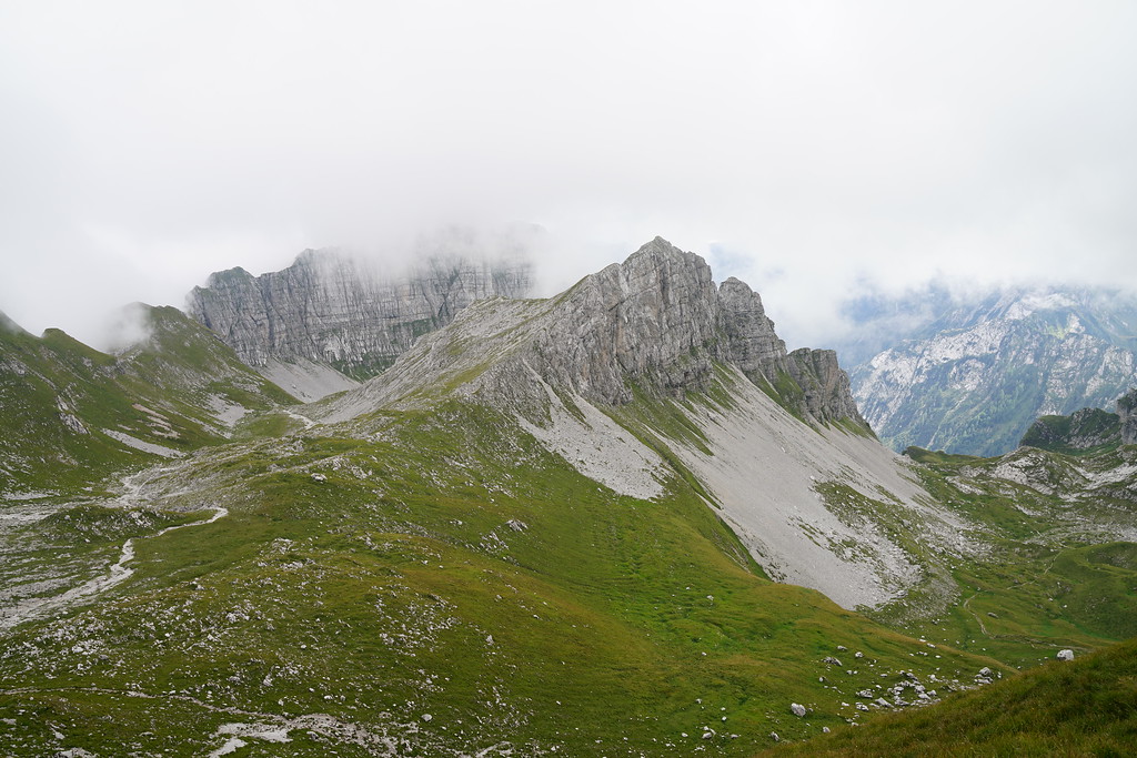
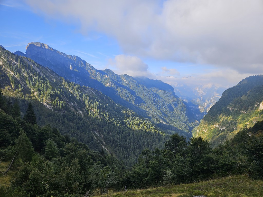
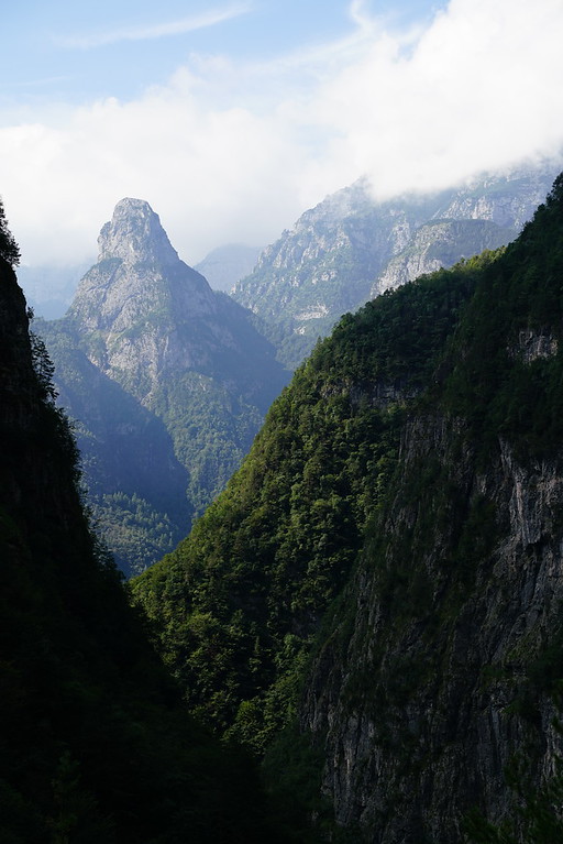
Here are some other thoughts I had about the Alta Via 1 I thought would mention. The mountains here are incredible and very steep. The Alta Via 1 was pretty crowded on the northern parts of the trail but if your going into it knowing it will be crowded it isn't too bad. It still wasn't as bad as hiking on some of the popular trails in the national parks in the United States. The southern end of the trail was less crowded but we were still around people pretty often. Most of the people we saw towards the end of the trail were also people hiking the Alta Via 1.
We didn't know any Italian or German before starting the trail and while it would have been helpful at times its not necessary to know much of either language. Most people we ran into spoke at least basic english. Everybody we ran into was very nice and I don't have any complaints about any of the staff at any of the huts. They were all great. We didn't see many Americans on the trail, I would say it was mostly people from Germany and Italy and weirdly enough a lot of people from Australia.
I had read of people running into issues with navigation but there is a lot of signs and as long as you know the names of places you are heading to navigation was pretty easy. I did use Gaia and had a map downloaded. Most of the time I knew which direction to go but did use Gaia to confirm.
We brought cash to pay at the huts but most of the ones we stayed at accepted credit cards.
Most of the huts we stopped at had potable water. I brought a filter but never used it. We only bought water at one rifugio and that was on the first day at Rifugio Biella. The only two huts we stopped at that said they did not have potable water were rifugio Biella and Rifugio Passo Staulanza. There are probably more that do not have potable water but there were a lot of them we did not stop at.
I had been wanting to go to the dolomites for years before this trip and it did not disappoint. The Dolomites are an incredible mountain range and even after spending 10 days in those mountains, there is still so much to do out there. Hopefully someday I'll be back and can do one of the other Alta Vias in those mountains.
We hiked the Alta Via 1 from north to south and did it in 7 days from August 26th to September 1st. Here are the rifugios we stayed at.
- Rifugio Lavarella
- Rifugio Scotoni
- Rifugio Croda Da Lago
- Rifugio Coldai
- Rifugio Carestiatio
- Rifugio Pian de Fontana
Booking the rifugios was a little bit of a pain. There is no one system where you can book multiple rifugios and each rifugio has their own way to make the bookings. One of them we could book directly on the website, some of them had a form you needed to fill out and then they would respond in a couple days or a week with options and others you just had to send an email to see if they had any availability. Some respond pretty quickly and others may take awhile to respond. If you want to do the Alta Via 1 I would recommend booking the rifugios VERY early. We booked ours in January of 2023 for a trip at the end of August and there were some rifugios that were already full. This did cause us to have a longer first day than expected and since I had already booked the rest of the rifugios we had a pretty short second day. It may have been a little more difficult for us to book them since we had 4 people but I would still recommend booking them well in advance. Only 1 of the rifugios we had to pay in full in advance. The rest of them asked for a 20 euro per person deposit and you would pay the rest at the rifugio.
Getting to the Tralihead
We flew into the Venice airport and arrived in Venice the night of August 24th. We spent that night and the next morning in Venice. The public transport from Venice to the start of the trail is actually pretty good. We booked a bus with Cortina Express that took us from the Venice Airport to the city of Cortina D'ampezzo. We stayed one night in Cortina D'ampezzo and bought some snacks for along the trail while we were in town.
The first day of the hike we had a 13.5 mile day and so we knew we had to be on the first bus to the trailhead if we wanted to make it to our first rifugio that night. We would have a shorter than usual day since the first bus doesn't leave Cortina D'ampezzo until 8am and it is an hour and a half trip to the lake. To get to Lago di Braies from Cortina D'ampezzo you actually have to take 2 busses. The 445 from Cortina to Toblach and then the 442 from Toblach to the lake. To book the 445 I downloaded the mobile app suedtirolmobil. This one didn't have to be booked in advance but was easy to purchase on the app. Since Lago di Braies is so popular, I did have to prebook a ticket on the 442 bus from this website https://www.prags.bz/en.
Our first rifugio of the trip was Rifugio Lavarella which is 13.5 miles from Lago Di Briaes. There was a group of 4 of us and 2 members of our group did not think they could make the 13.5 miles since we had a later start in the day. The 445 bus makes multiple stops along the way to Toblach so they got off at a stop called Podestagno and hiked from there to Rifugio Lavarella. Me and my wife continued on the busses and made it to the lake with no problems.
Day 1 - Lago Di Braies to Rifugio Lavarella - 13.5 Miles - 5000ft gain 3300ft descent
The lake is a very short walk from the bus stop and after arriving I understand why this lake is so popular. It is such a beautiful lake with such towering cliffs behind it. There are actually two trails around the lake and I wasn't sure which one is the better option. Standing at the lake it looked like the west option was the easier path so we took that one and had a couple nice views of the lake along the way.
Once we reached the other side of the lake I got the first taste of the steepness of the dolomites. It was also extremely hot. This is already one of the biggest climbs of the entire trail and with the heat, this was probably the toughest climb of the entire trip. We also made it harder on ourselves due to the fact that we had a shortened time to reach our rifugio for the night so we were trying to move pretty fast.
This first day is really the only day where I felt my scheduling of the trip was not so great. If I were to do this same itinerary again I would stay in Toblach the night before instead of Cortina D'ampezzo so you could get an earlier start. My original plan and what I would try to do again for a 7 day alta via 1 trip would be to stay at rifugio sennes, fodara vedla, or Pederu the first night. Those three rifugios were full when I booked my trip and I booked my huts in order from the end of the hike to the start of the hike so that is why Rifugio Lavarella ended up being our first night. Most people we talked to on the trail had stayed in Rifugio Lavarella or Rifugio Fanes (right next to Lavarella) on their second night.
Enough of those logistics for day 1. The climb was tough for those various reasons but was an incredible introduction to the scenery of the Dolomites.
From the top of the pass you can see rifugio Biella which is where we had planned to stop for lunch. We had never been to a mountain hut anywhere in Europe so we weren't quite sure what to expect when arriving at this first one. We dropped our packs outside and went inside to figure out how to get food. We found out you need to find a table and then they come and take your order. Since we were in a little bit of a hurry this day we just ordered some sandwiches and took them to go. It was a fine sandwich but they were pretty fast so we were happy as we ate the sandwiches on the trail. We also bought some water here since we had drank so much on the climb and the water at this hut was not potable.
The views in this section of trail were incredible and we could even see the valley where Rifugio Lavarealla sat (it looked like a long ways away). We eventually reached Rifugio Sennes but did not stop at all. Not too far past Rifugio Sennes the trail splits for a mile or two. One trail leads to Rifugio Fodara Vedla and the other is a shorter distance. We opted for the shorter distance since we didn't need anything from the rifugio. Once the trails met back up continued on a steep decent into the next valley. Part of this was one of the steepest dirt roads I have ever seen.
In the bottom of the valley was rifugio Pederu. We didn't stop but there were a lot of people outside of this rifugio. Probably because you can actually drive to this one. From Rifugio Pederu you again have two options for a trail. You can take a shorter but steeper trail or a longer, less steep dirt road. We felt done with steep trails for the day so we opted for the dirt road. I ended up being happy with our choice as it was mostly a pretty mellow grade and had great views along the way. The downside was there was no shade along the way and it was still very hot.
We made it up to Rifugio Lavarella at about 3:30. So we actually ended up making pretty good time still. The other two members of our group had beat us there so they had us checked in. This was probably our best room and one of the nicest rifugios we stayed at along the trail. This room only had two beds, had a decent amount of space and even had a sink with potable water in our room. This rifugio also had free showers but we did not use them here. After seeing our room we just hung out at the hut getting some cold beer. Rifugio Lavaralla actually has it's own brewery and it says it is one of the highest breweries in Europe. Staying at these rifugios felt like luxury to me, I'm used to backpacking or car camping even on international trips so to have a cold beer, a bed and hot nice dinner cooked for me was pretty nice. When we booked Rifugio Lavarella there wasn't half board option so dinner was not included and they had a decent sized menu of what you could order. The food was very good here but was probably one of the least good of the rifugios we stayed at.
Day 2 - Rifugio Lavarella to Rifugio Scotoni - 6.8 Miles - 2050ft of gain 2200ft of descent
If I remember right, they served breakfast at 7am. This might be the last time I mention breakfast because every hut we stayed at had essentially the exact same breakfast. Plain yogurt with some granola, bread, meat and cheese. Some had some cakes or eggs but overall they were all about the same and were good.
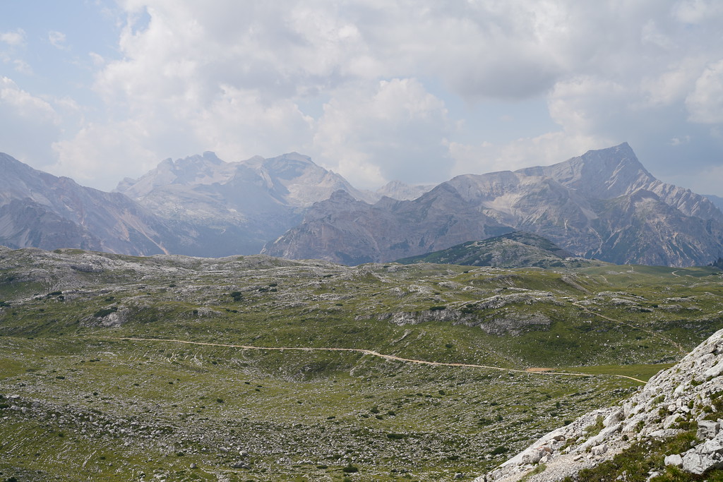
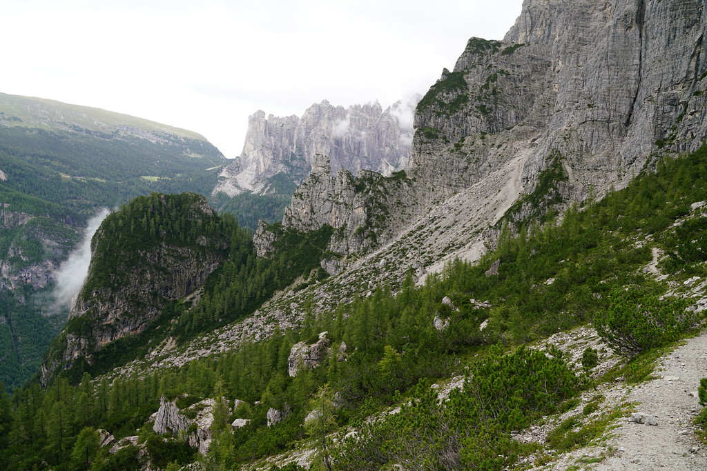
Because of my issues booking the rifugios this was a pretty short day but we still decided to get up early and pack everything up before breakfast because there was a threat of thunderstorms early in the afternoon. There isn't really a whole lot to mention about on this day. Looking back on the trip though, the middle 5 miles of this day are some of my favorite of the trip. The views were absolutely incredible.
Rifugio Scotoni is about 0.5 miles off of the Alta Via and there are two routes you can take to get there. Both have about the same amount of elevation gain and decent and the same distance. One goes over a high pass and then drops down to Scotoni where you will backtrack up the next day. The other drops down into a valley and then climbs up to scotoni. Our group split up again in this section. Me and my wife went over the pass and this is the option I would recommend after talking to the other members of our group. The pass has some incredible views and the trail down the pass is iconic.
Rifugio Scotoni overall was probably the nicest rifugio we stayed at. We had a room with 4 beds and our own shower in the room. The food, beer and wine was great. We got the hut at about 11:30 so we actually ended up eating lunch and dinner here and everything we ordered was delicious. Scotoni also, didn't have a half board option so we had to order and pay for our dinner there.
Day 3 - Rifugio Scotoni to Rifugio Croda Da Lago - 11.6 Miles - 5100ft of gain 4900ft of descent
It rained. A lot.
The photos from this day will almost all be from my phone since it rained all day except for the last mile of the hike.
The pass below Rifugio Lagazuoi is one of the highest points on the trail and this is the pass we had to hike over today. We had been checking the forecast and had seen it was supposed to be very rainy today. We didn't notice the wind warning though which may have changed our decision. We debated two options, just deal with the rain and hike over the pass or we could hike down to a small town and ride a bus up to passo falzarego where we would be passing by if we chose the hiking option anyways. There wasn't lighting predicted so we decided to just hike over the pass. It was already raining pretty hard as we backtracked up part of the trail we hiked down the day before. Once we got back up to lago di lagazuoi we got our first taste of the wind.
From the lake we continued up the trail towards the pass. As we climbed the rain stayed pretty strong and the wind continued to get worse and was blowing straight into my face. I tried to look up as much as I could since there were some amazing waterfalls coming off of the cliffs around us. About a half mile from the pass we stopped behind a large rock for a minute and a few of us put more jackets on since it was getting cold and rain gear had started to sock through. Right about here we got our first view of Rifugio Lagazoui but it didn't last long as fog rolled in as well.
We had planned on hiking up to Rifugio Lagazuoi so we could walk through the world war 1 tunnels but with the weather decided against it.
The fog got dense enough that we could no longer see the red and white painted on the rocks anymore showing us where the trail went and we lost the trail for a few minutes in a section that was very rocky and tough to follow the main trail without being able to see ahead. Luckily we weren't off trail long and we eventually made it to the top of the pass where the wind was fierce. I could barely stand while bracing myself with both of my trekking poles. One member of our group even laid down on the ground because they could barely stand during a particular gust of wind. There are a couple of different routes from the top of the pass and we took the shortest and steepest option which just went straight down a ski slope. It was still raining on this side of the pass but not as heavy and was a lot less windy. We eventually made our way back onto the main trail and made it down to the paved road that goes to Passo Falzarego. At this point, we were pretty wet but since the wind had died down it wasn't too cold anymore. Also, going over the pass ended up being the worst of the weather for the day. Still rained on us essentially the entire day but was not as heavy and the wind wasn't nearly as bad. We seemed to be some of the only people hiking today as we only saw one other group of 3 on our way up and over the pass and many of the people we talked to throughout the rest of the hike mentioned they took a taxi for a section of their hike that day.
Our next goal for the day was to make our way up to Rifugio Scioiatolli for lunch. Nothing too interesting happened on the climb up to the rifugio but it was very odd once we arrived at the rifugio. It was a huge rifugio but there was only one other person getting lunch and there were 4 waitresses. It just felt empty and weird. Lunch was great there, got some hot drinks and food but it almost seemd to make us colder by sitting in the rifugio since we had gotten so wet.
From Rifugio Scoiatolli we would diverge from the main Alta Via 1 and get on an alternate that would take us to Rifugio Croda Da Lago. The first part of this alternate took us steep down into another canyon which was very muddy due to all of the rain.
We crossed another road and then started our climb up to Croda Da Lago. This section was mostly in the trees but this is where our luck for the day turned around. Right before we reached an amazing viewpoint the rain stopped and clouds lifted and we were treated with some amazing views over Cortina D'ampezzo. The rain also stayed away for the last mile of our hike but started again after we had been at the rifugio for about an hour.
Rifugio Croda Da Lago may have been my favorite rifugio we stayed at. It wasn't the nicest but it was in such a cool location and the food was almost as good as scotoni. We did get a little lucky here with the rooms. We were in a room with 6 beds but nobody showed up in two of the beds so our group had our own room once again. Many of the huts we stayed at had a heated shoe room or boot warmers but Croda Da Lago did not which would have been nice on this day.
Day 4 - Rifugio Croda Da Lago to Rifugio Coldai - 10.6 Miles - 3100ft of gain 2800ft of descent
By the morning, the weather had cleared but there was still rain forecasted throughout the day but it did not look like it was supposed to be nearly as bad as the day before. The first few miles of this day was another one of my favorite sections on the entire trail.
After about 2.5 miles we hit a dirt road and it rained on us for about 30 minutes as we made our way to rifugio citta di fiume.
At rifugio Citta di Fiume there was a caution sign saying there was rockslides. We decided to still go on the trail sine the way around was quite a bit longer. The rock slides really weren't bad at all but they seemed pretty recent as there was no trail across them.
We ended up stopping at rifugio Passo Staulanza for lunch where we got some great pasta. From Passo Staulanza the trail follows the paved road for a little under a mile.
We then turned up a dirt road and started the climb to Rifugio Coldai. During the climb the rain hit us again. It was kind of annoying since we had been dry for most of the day and ended up getting wet for just the last mile of the hike.
Rifugio Coldai is situated in a pretty crazy spot and we had great views from our room. We ended up getting our own room again that had 4 beds but this room was tiny. It barely fit those 4 beds. This rifugio was so loud when people were walking by the room in the hallway or in the rooms above. Don't know if I need to keep mentioning the food but it was very good here as well. I think Rifugio Coldai is actually the biggest rifugio we stayed in as our guide book said it had 88 beds. It didn't seem too crowded or worse than any other rifugios though.
Overall this day was the easiest besides our short day 2. There wasn't that much elevation gain compared to other days and you were on pretty big and wide trails for a lot of the day.
Day 5 - Rifugio Coldai to Rifugio Carestiato - 12.2 Miles - 4400ft of gain 4600ft of descent
Once again there was rain forecasted throughout the day today. Unlike yesterday, it did rain off and on almost the entire day. It never rained hard but was hard enough that I kept on taking my camera in and out of my bag all day.
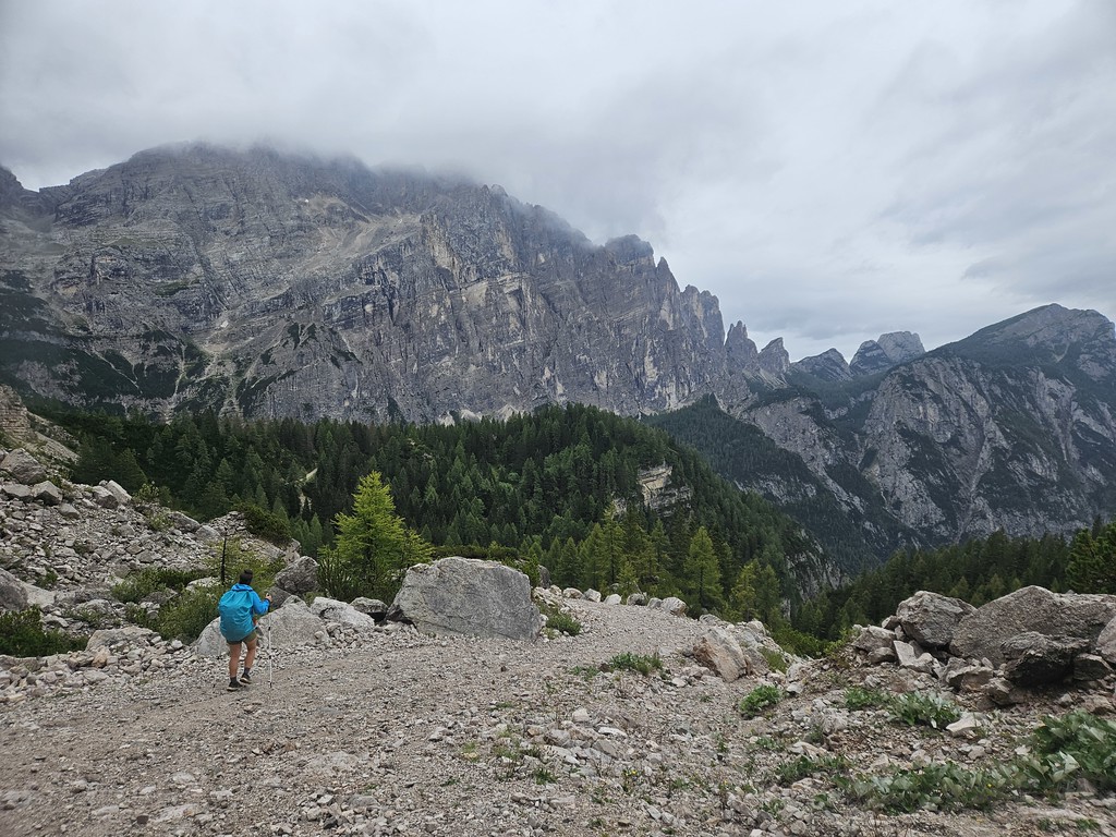
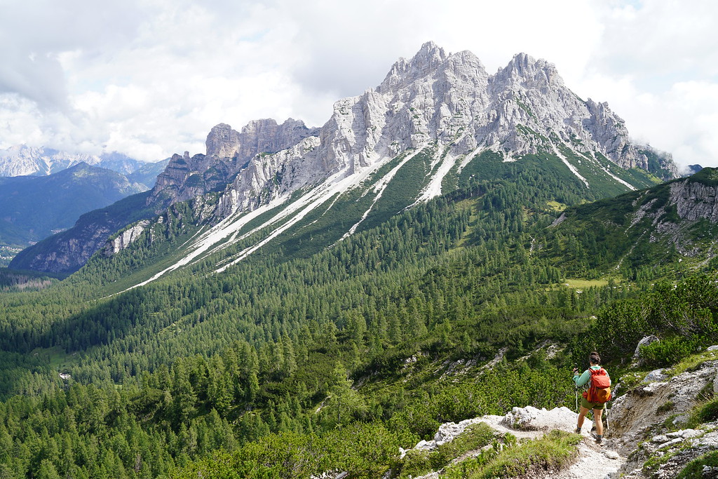
The start of this day was incredible. You are very close to the top of a pass from Coldai and the view from the other side is amazing and even has a lake there as well.
There is a pretty big descent and climb not too far past the lake and after that climb you can make a side trip to rifugio Tissi. We had planned on going up there because I heard there was a good view but the clouds had rolled in at this point and we didn't think it was worth the hike up there without a view. The next section of the trail was beautiful and we went in and out of the rain throughout.
We stopped at rifugio Vazzoler and had the best lunch of the entire trip. It was better than a lot of the dinners. If you want good food this might be the place to stay.
Not too far after leaving the rifugio we hit a section of trail I thought was going to be easy but actually ended up being one of the toughest of the entire trail. It's tough to say why it felt so hard but there were a few miles here that had short very steep sections. It was all either very rocky, lots of roots, slippery from the rain, steep drops on your side and few short sections where the trail was basically gone. It was such a cools section of trail too though.
After getting to a pass labeled forcella del camp on my map the trail was pretty easy going the rest of the way to rifugio carestiato.
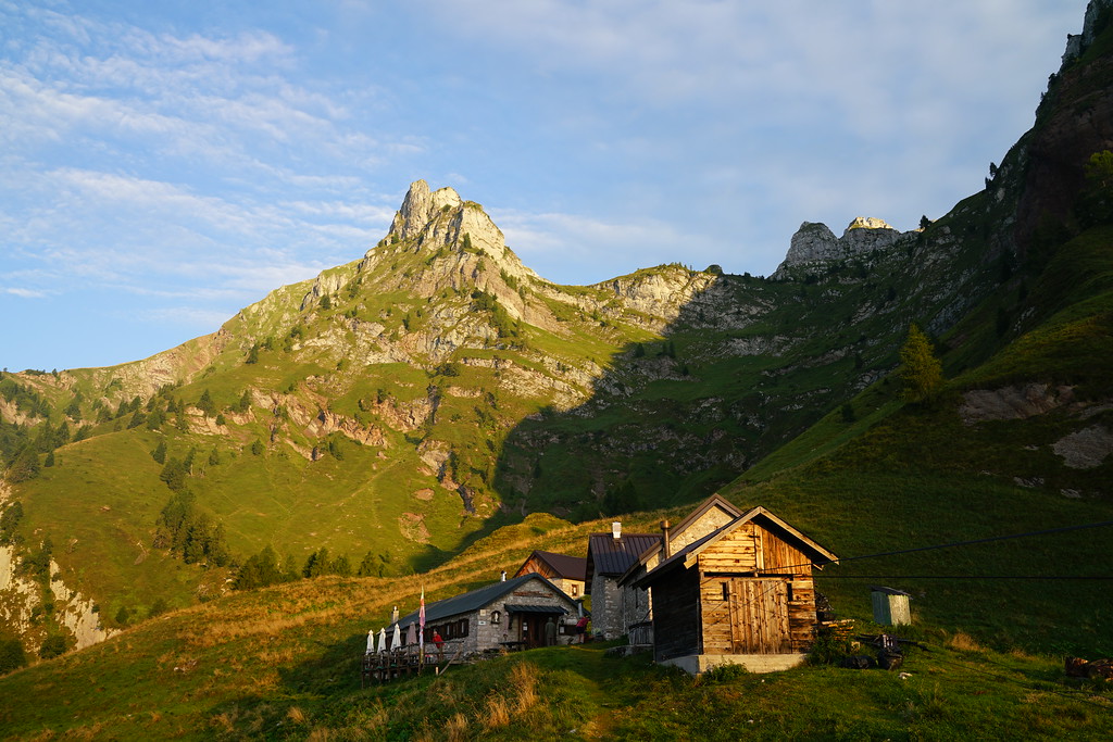
This was another nice rifugio that had great food and again we had our own room with 4 beds. The only annoying thing about his rifugio was there were only 3 restrooms and each had a shower in them so there was always a wait to get into the restrooms.
Day 6 - Rifugio Carestiatio to Rifugio Pian de Fontana - 12.6 Miles - 4800ft of gain 5000ft of descent
This was the first day since day 1 where there was no chance of rain. The start of today was very easy with a mile hike to get to the road and Passo Duran. From here, we had a little over a mile of walking on the paved road.
The only other rifugio we would pass today would be rifugio Pramperet but it is slightly off trail so we had decided we weren't going to be stopping there. So the night before we ordered a packed lunch from carestiato. This was something we could have done at the other rifugios but this was the first day we felt like we needed to get a packed lunch. The trail on the way to pramperet had a couple of miles in the trees as well as some really great views.
After the turnoff to Premperet we started the long steep climb up to another pass. As far as steepness goes, this was probably a similar climb to the one from lago di Braies but the temperature was much cooler today and we had a lot of cloud cover. It was a little too much cloud cover though as fog rolled in and kept us from having too many views from the top of the pass. The fog did give some more atmosphere and interesting views though.
We then started the STEEP descent down to Pian De Fontana. This was probably the steepest on trail descent I have ever done. The views were incredible though.
This was probably the least nice rifugio we stayed at on the trail but was still great and I would recommend staying here because of the location on the trail. This hut is only like halfway down a huge descent and so if you don't stay here you would have to do a crazy amount of descending in a single day. It is also only 7 miles from the end of the trail which makes it a pretty easy last day. This was the first rifugio where we didn't have our own room. The room we stayed in probably had 12 beds.
Day 7 - Rifugio Pian de Fontana to end of trail - 7 miles - 1500ft of gain 4400ft of descent
Some very cool mist in the morning.
The day starts out with a steep descent followed by a long steep climb and then right into another steep descent. There is a sidehill section before the second big descent which is very cool.
After the second steep descent the next few miles are very easy going and on a dirt road.
The last half mile leaves the road and gets very steep again. Once you hit the main paved road you need to take a right and the bus stop is a couple hundred yards down the road. I can't remember what the bus number was but at Pian De Fontana we were able to get the bus schedule so we knew about when to be there. This bus will take you to the main bus and train station in Belluno where you can get transportation wherever you need to go. For us, we were staying in the dolomites for a couple more days so we ended up renting a car in Belluno.
Speaking of after the trip, if you need a good campground to stay at near Cortina d'ampezzo I would recommend International Camping Olympia. We weren't there in the busies time of the year but it wasn't too crowded, had a lot of showers, decent bathrooms and had a really good pizza restaurant in the campground. It was also in a pretty good central location where we could do more day hikes from.
Here are some other thoughts I had about the Alta Via 1 I thought would mention. The mountains here are incredible and very steep. The Alta Via 1 was pretty crowded on the northern parts of the trail but if your going into it knowing it will be crowded it isn't too bad. It still wasn't as bad as hiking on some of the popular trails in the national parks in the United States. The southern end of the trail was less crowded but we were still around people pretty often. Most of the people we saw towards the end of the trail were also people hiking the Alta Via 1.
We didn't know any Italian or German before starting the trail and while it would have been helpful at times its not necessary to know much of either language. Most people we ran into spoke at least basic english. Everybody we ran into was very nice and I don't have any complaints about any of the staff at any of the huts. They were all great. We didn't see many Americans on the trail, I would say it was mostly people from Germany and Italy and weirdly enough a lot of people from Australia.
I had read of people running into issues with navigation but there is a lot of signs and as long as you know the names of places you are heading to navigation was pretty easy. I did use Gaia and had a map downloaded. Most of the time I knew which direction to go but did use Gaia to confirm.
We brought cash to pay at the huts but most of the ones we stayed at accepted credit cards.
Most of the huts we stopped at had potable water. I brought a filter but never used it. We only bought water at one rifugio and that was on the first day at Rifugio Biella. The only two huts we stopped at that said they did not have potable water were rifugio Biella and Rifugio Passo Staulanza. There are probably more that do not have potable water but there were a lot of them we did not stop at.
I had been wanting to go to the dolomites for years before this trip and it did not disappoint. The Dolomites are an incredible mountain range and even after spending 10 days in those mountains, there is still so much to do out there. Hopefully someday I'll be back and can do one of the other Alta Vias in those mountains.
Last edited:

")