AbinadiWitness
Member
- Joined
- Oct 25, 2017
- Messages
- 33
This is actually part one of a two-part trip report on my first major backpacking trip of 2017; there was a bit too much epicness to fit into a single post without requiring an epic amount of reading time...but they're both very worth checking out. ")

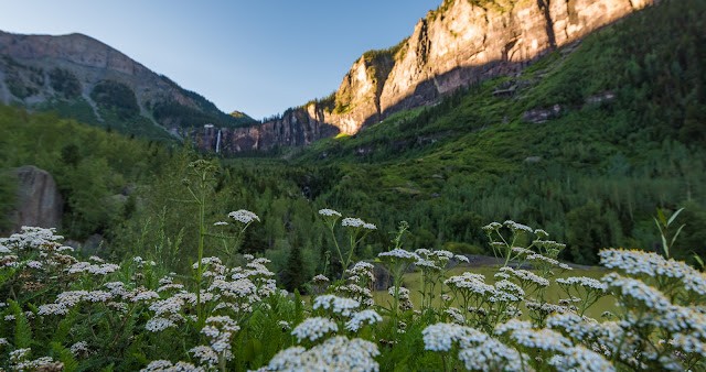
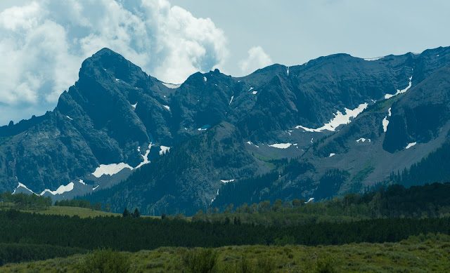
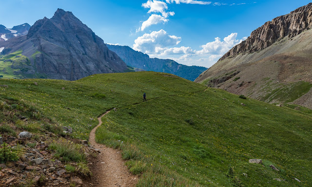
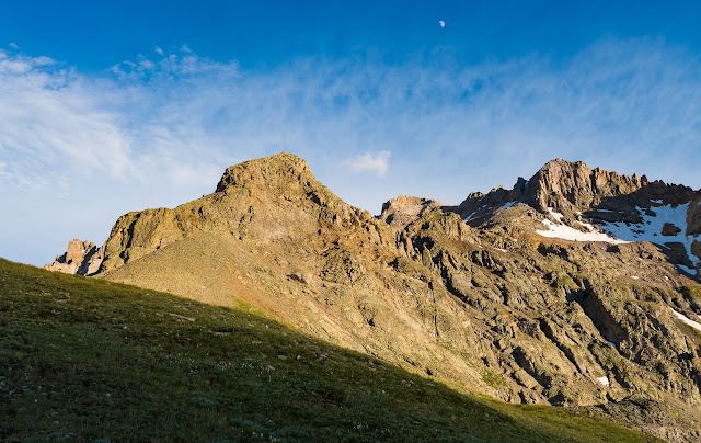
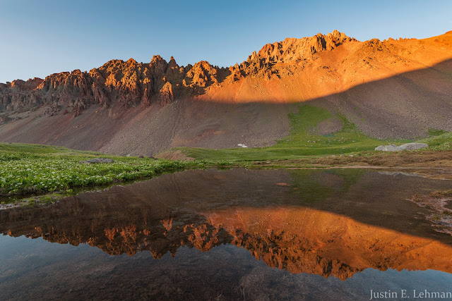
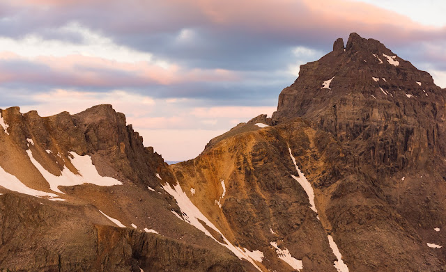
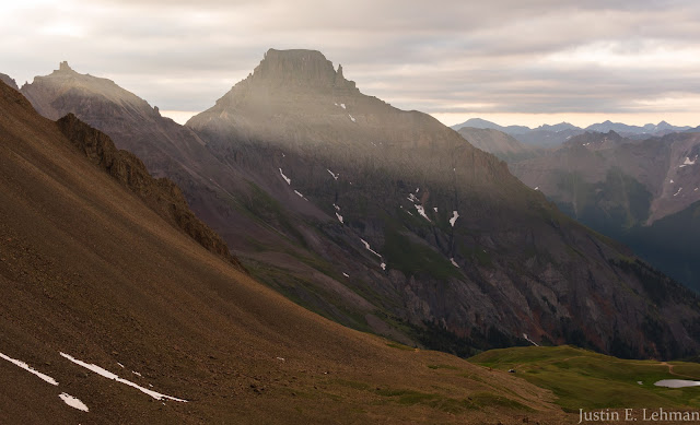
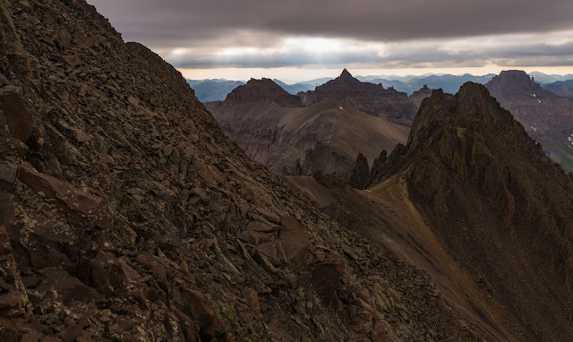
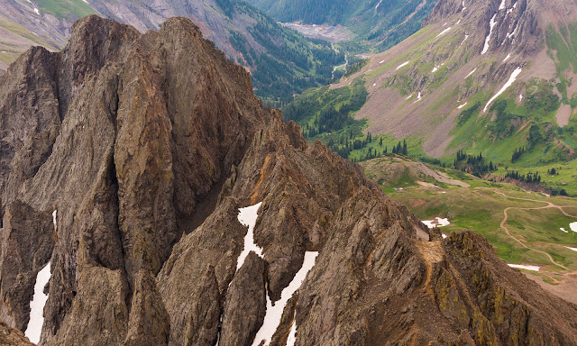
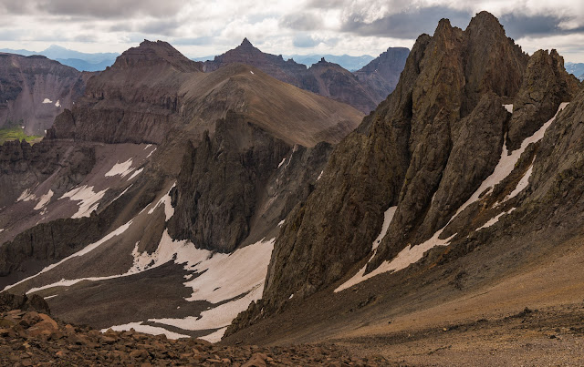
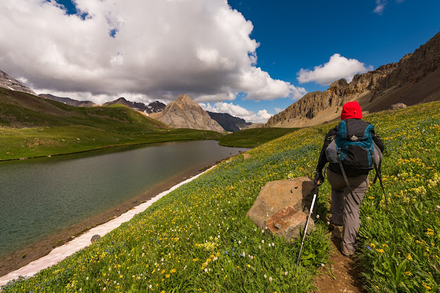
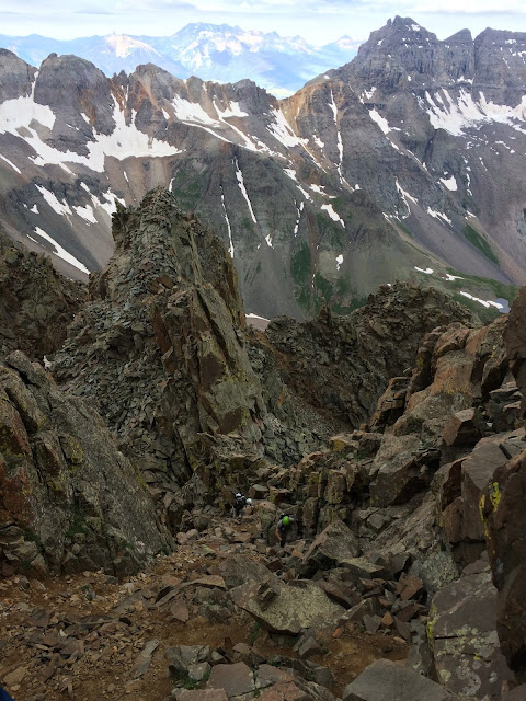
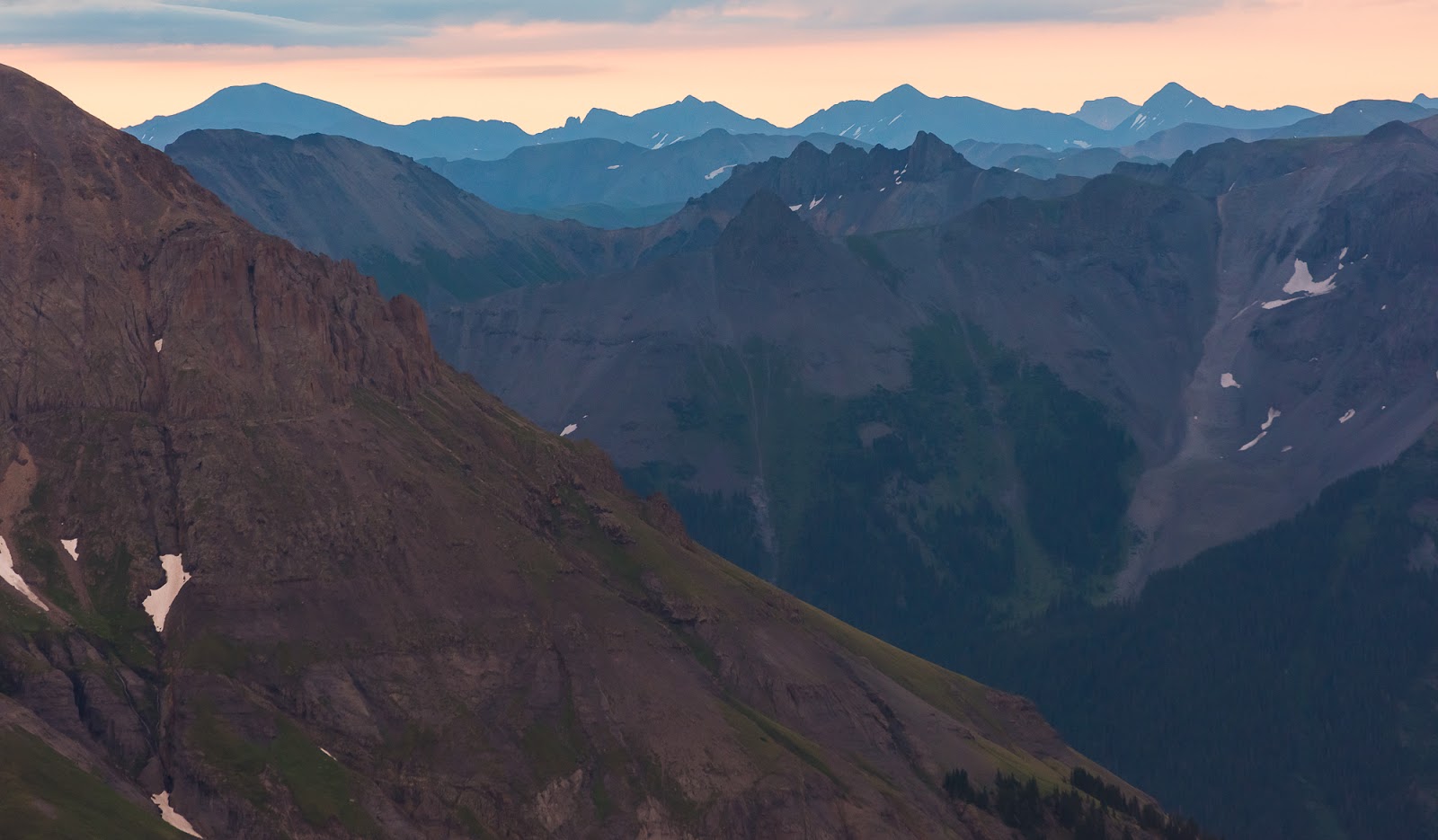
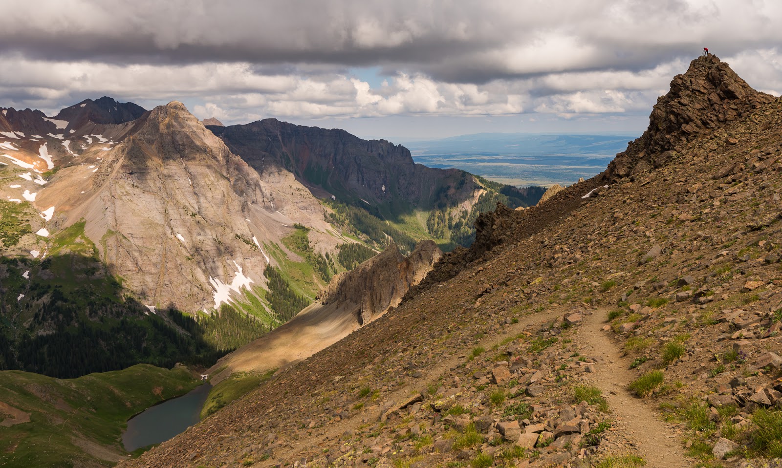
Views while ascending to Blue Lakes Pass en route to climb Mount Sneffels' SW Ridge.
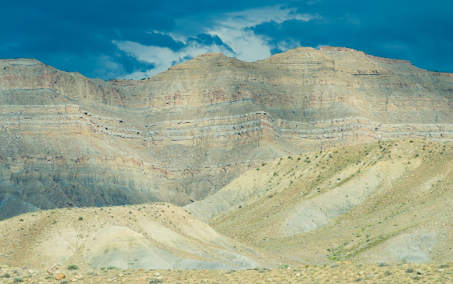
Dramatic cliffs on the drive through Utah; taken through the car window (hence the slightly blue tint).
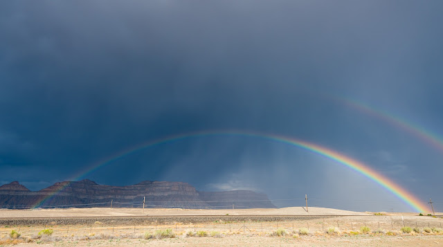
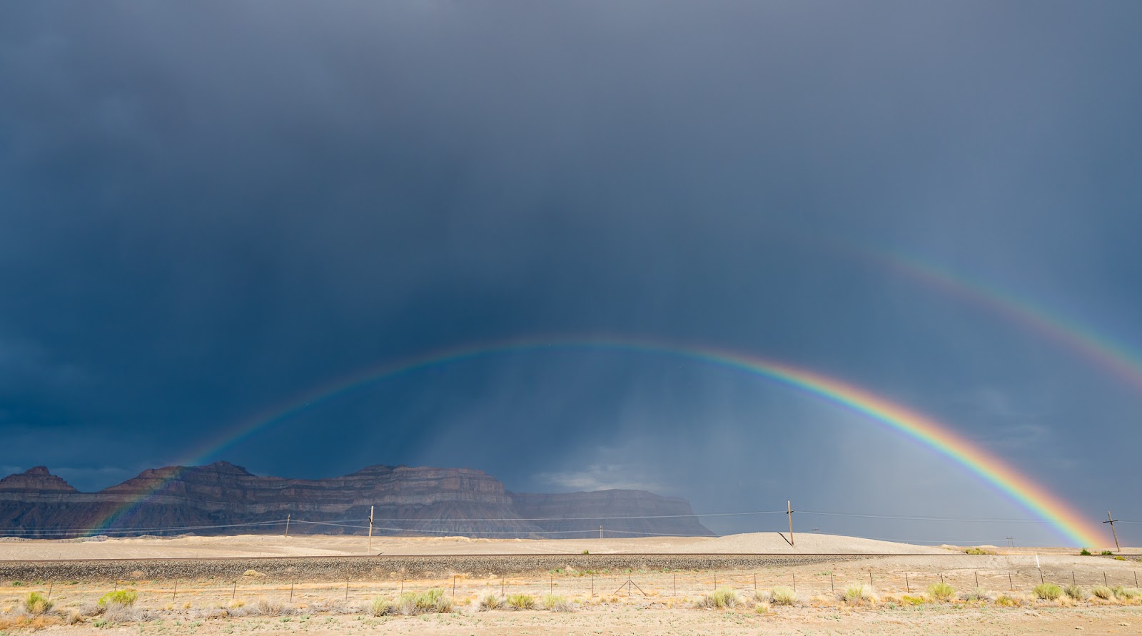
One of the most vivid rainbows I've ever seen...certainly worth pulling over for during our drive out...
One of the most vivid rainbows I've ever seen...certainly worth pulling over for during our drive out...

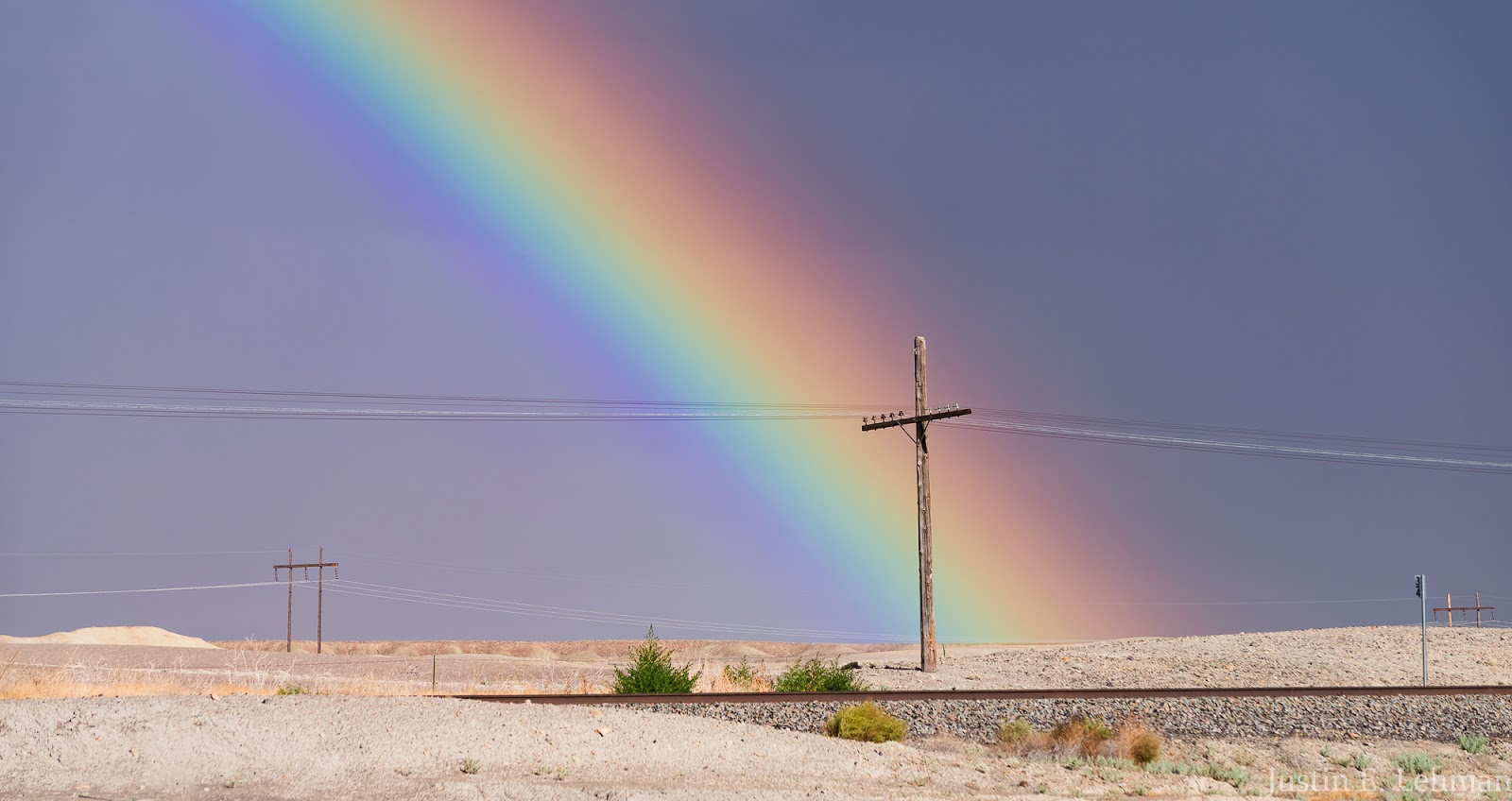
My favorite shot of that particularly vivid rainbow we saw.

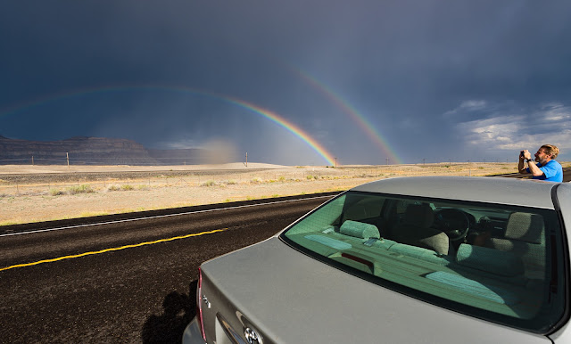
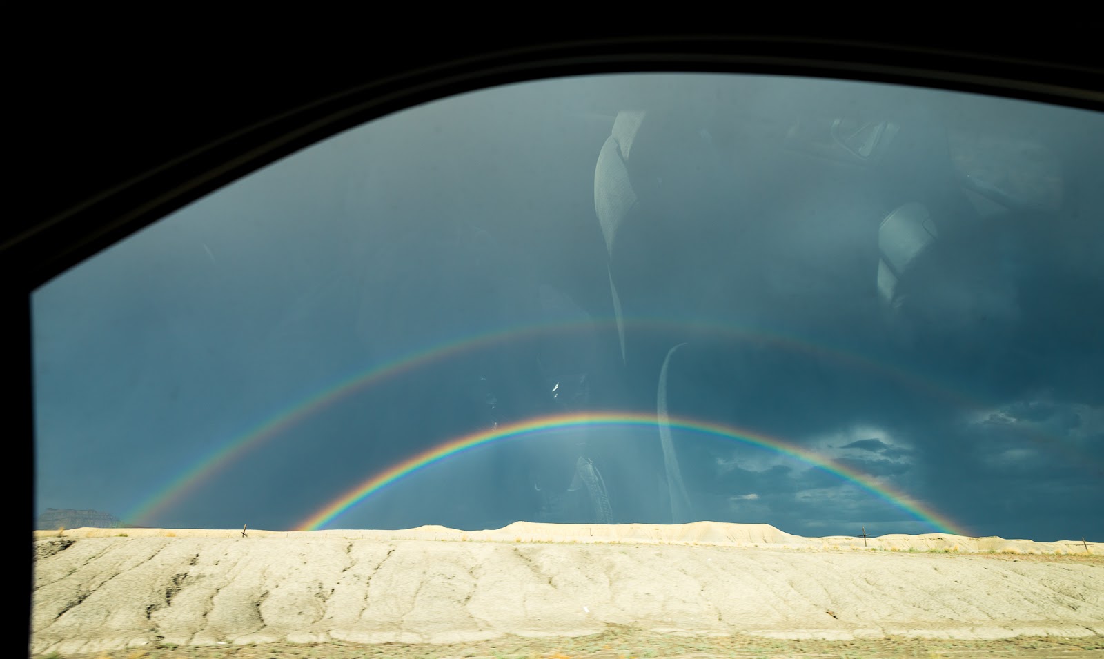
One of the most vivid rainbows I've ever seen...through the car window while driving again., but showing a bit of how bright the double rainbow got as well...amazing!
The second out-of-the-ordinary thing from our journey down was when Claron took us on some strange alternate route to get to Telluride, CO; I had planned to cross through Grand Junction, CO, then on through Montrose and out to Telluride from there, but somehow we ended up passing through Moab and then Monticello, UT and taking some roads I'd never traveled before. We ended up pulling in to our camp area just outside Telluride between 11:00 PM and midnight. Amazingly, we found one spot open at a "walk-in" campsite that required a 50-100 foot walk from the dirt parking area - all the other sites we saw were ocupied; all of us in our little group were, collectively, surprised the campground was so busy on a Sunday night into Monday. We made camp quickly and were happy that the following morning didn't require too early a rise time.

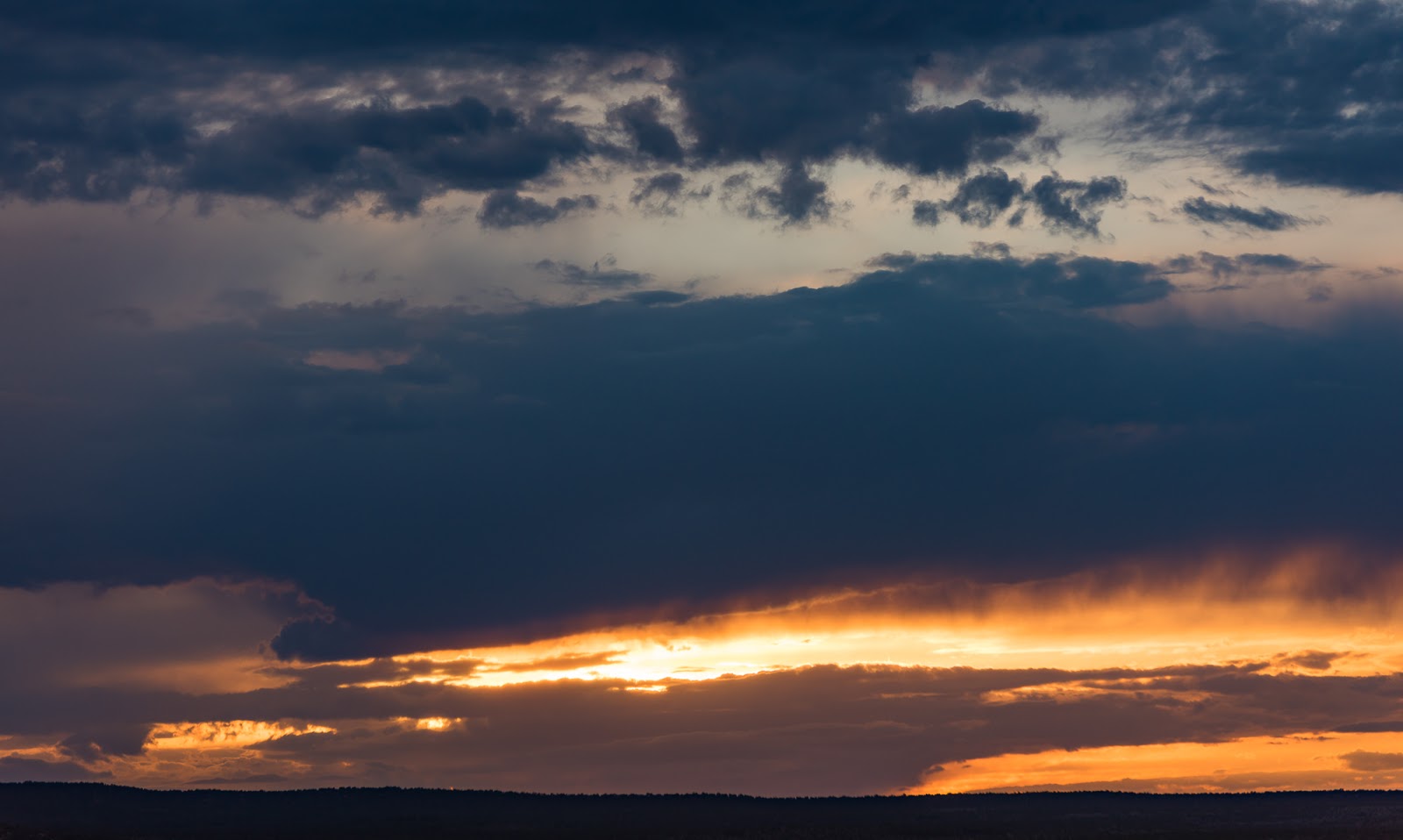
Quick sunset shot out the back windshield of the car on the way out...somewhere near Monticello, UT.
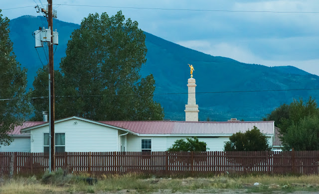
Caught this shot of the steeple and Angel Moroni statue that tops the Monticello Utah Temple of The Church of Jesus Christ of Latter-day Saints. The building in the foreground isn't part of the Temple.
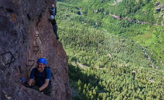
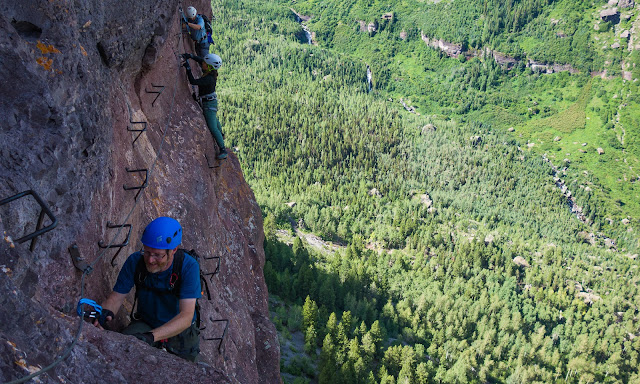
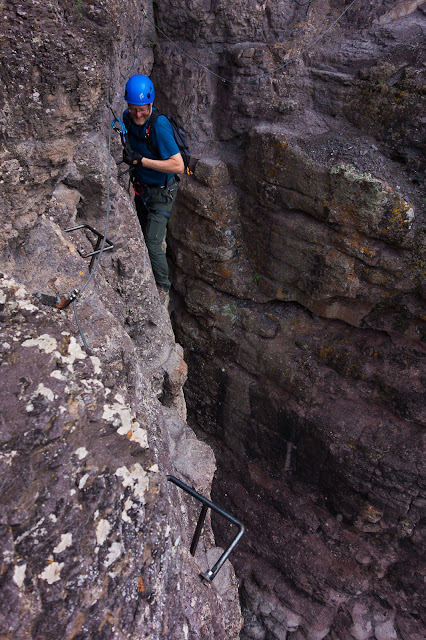
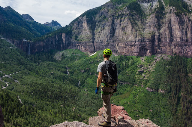
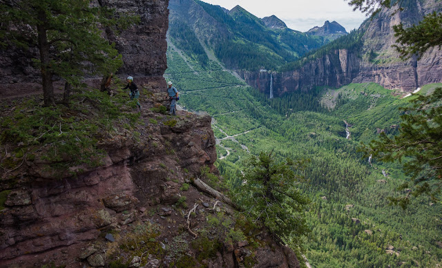
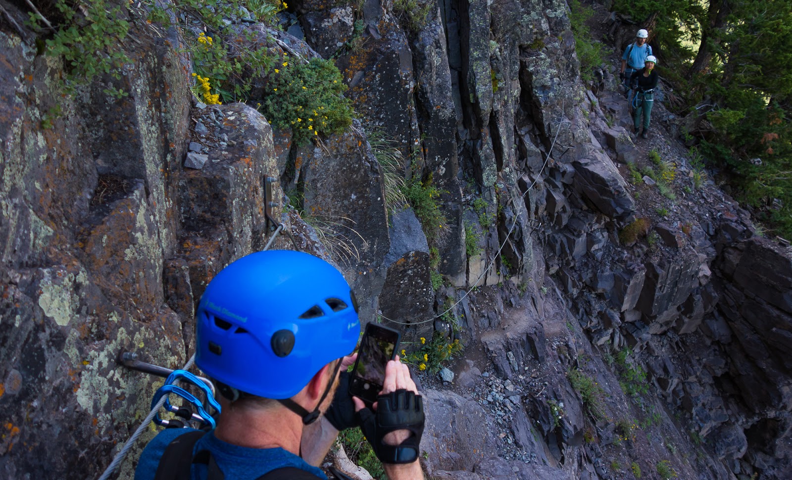
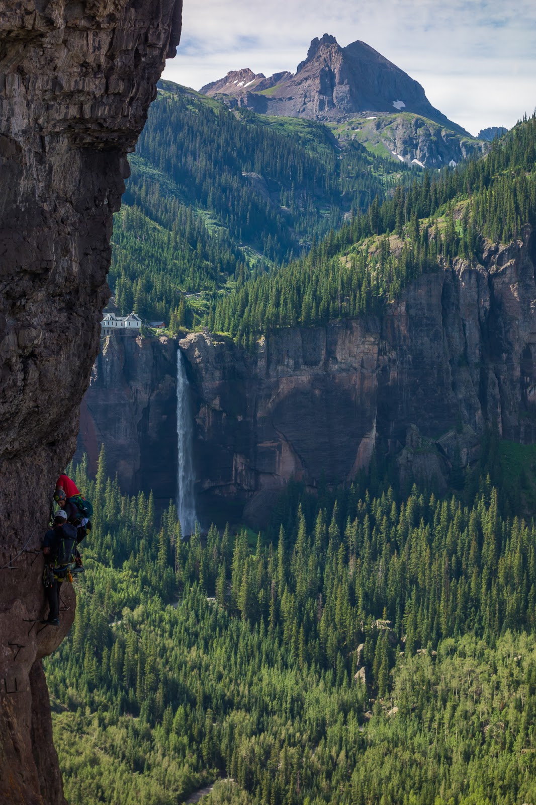
I caught this pic from near the parking area while waiting for Matt and Sarah to arrive so we could start the via ferrata route.

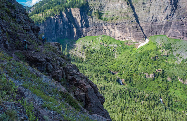
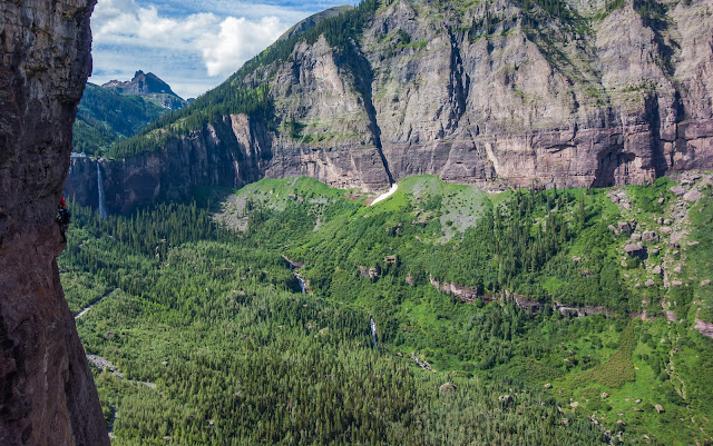
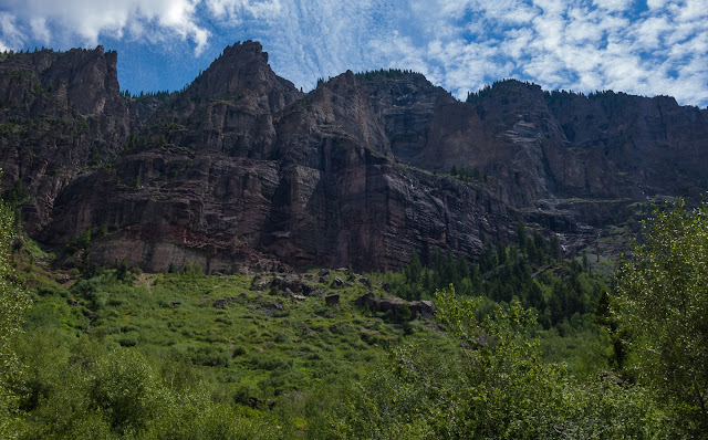
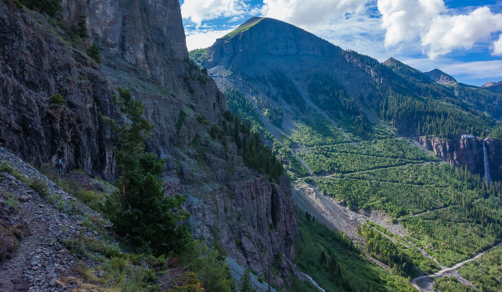
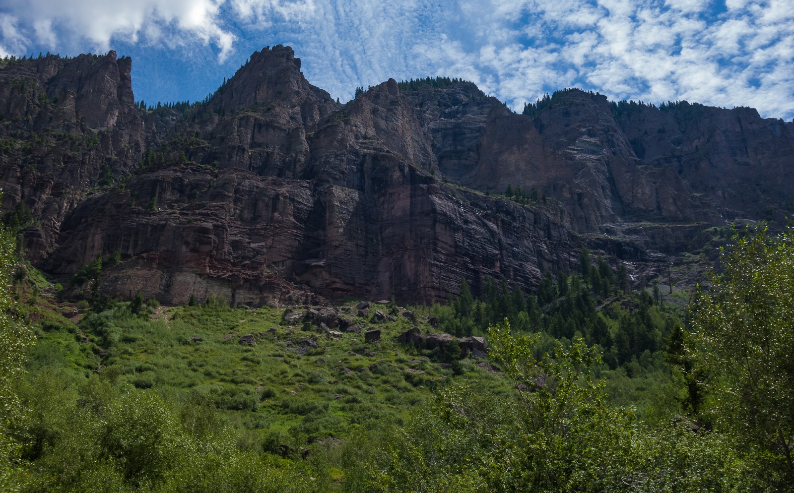
Later in the morning; shots of the cliffs near the via ferrata. The route goes up the other side of the box canyon (not visible here).
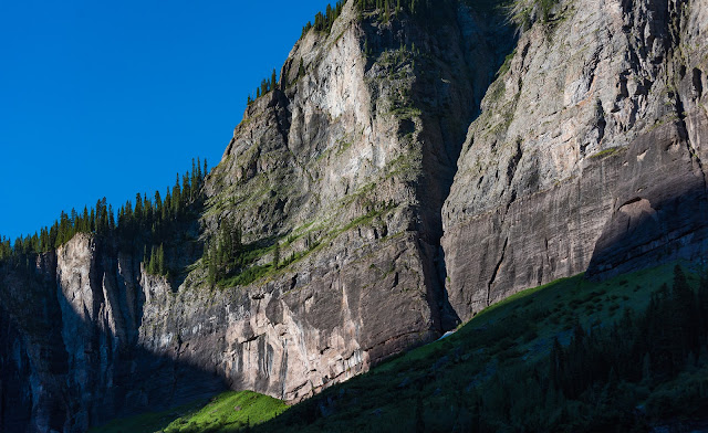
Later in the morning; shots of the cliffs near the via ferrata. The route goes up the other side of the box canyon (not visible here).
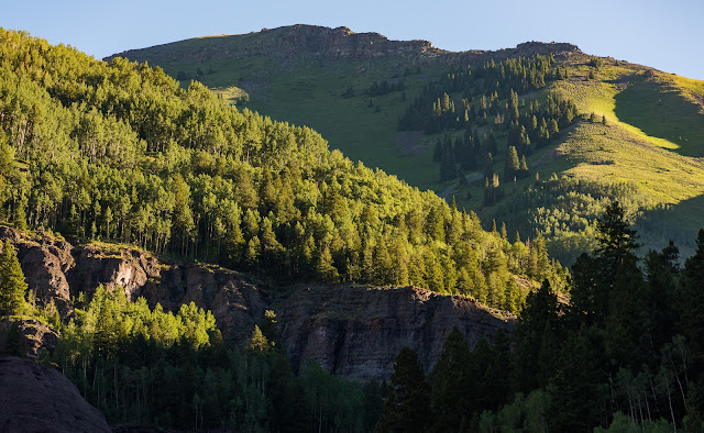
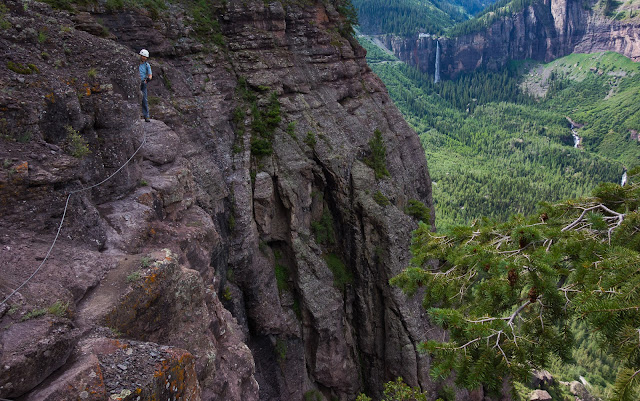
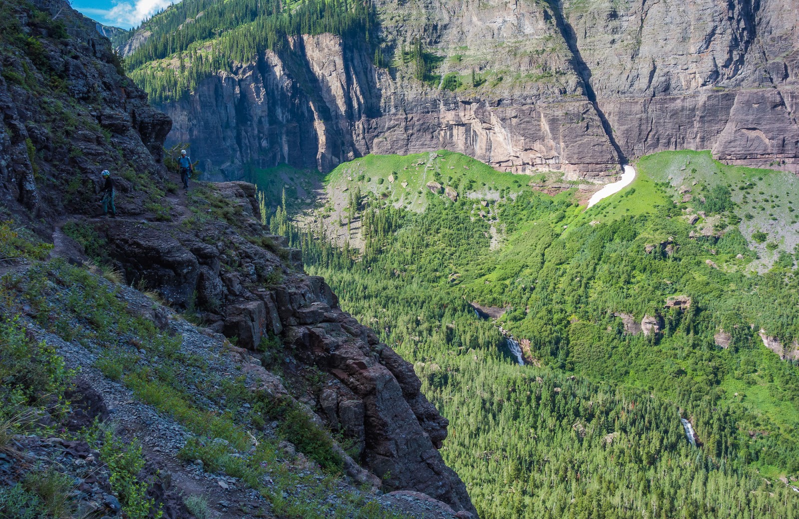
Scenes near the via ferrata route.
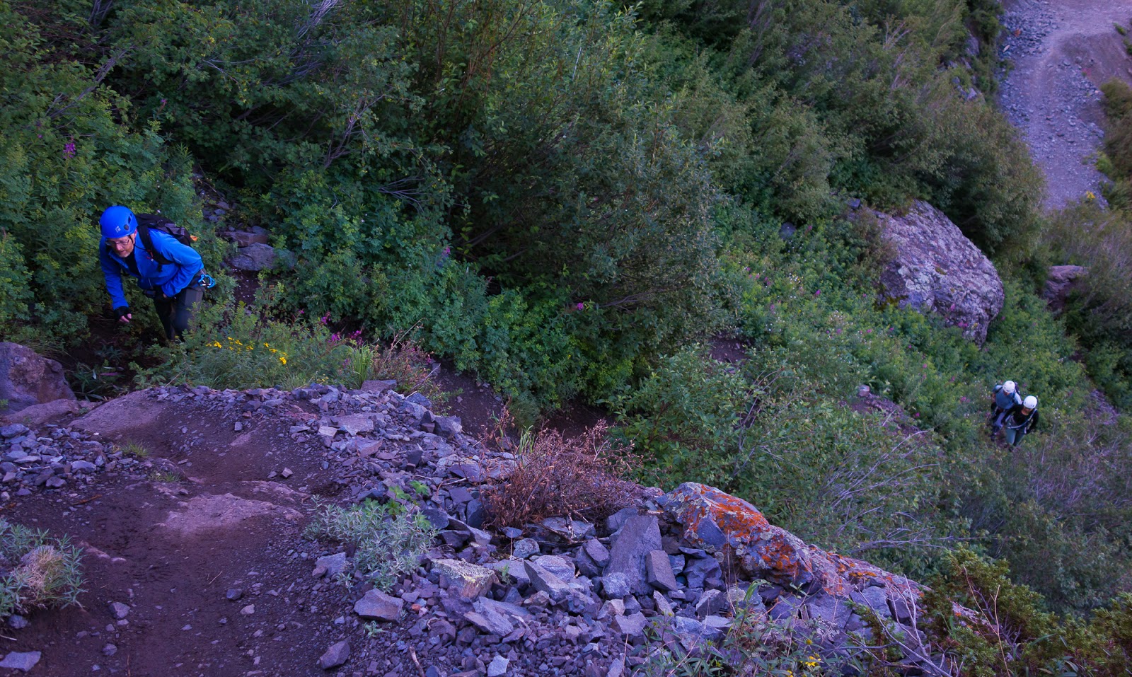
Getting to the start of the via ferrata was pretty straight-forward; you switchback up the jeep road a bit nearly to the top of the prominent cliffs at the end of the box canyon the route starts in - passing pretty close to a lovely waterfall - then there's another kind of a (slightly) wider parking area near the end of one of the switchbacks near Ajax Peak, and there are some lighter use-trails that start climbing from there and drawing nearer to the cliffs...if that sounds a little nebulous that's because it is...all the best in your efforts to find the start of the trail.
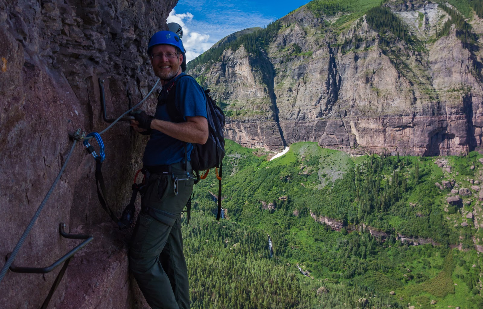
***The remainder of the shots from the via ferrata were taken with my small Sony RX100 camera; after the via ferrata the shots were taken with my Nikon D810 set up. Also, most of the rest of the via ferrata route detail will come from the following photos and the captions associated with them...***
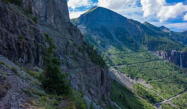
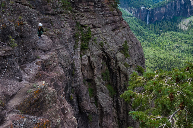
Views from along the trail up to the via ferrata.
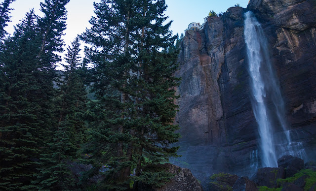
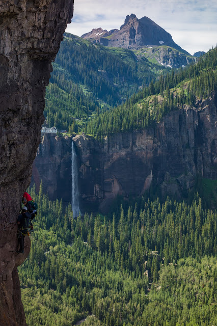
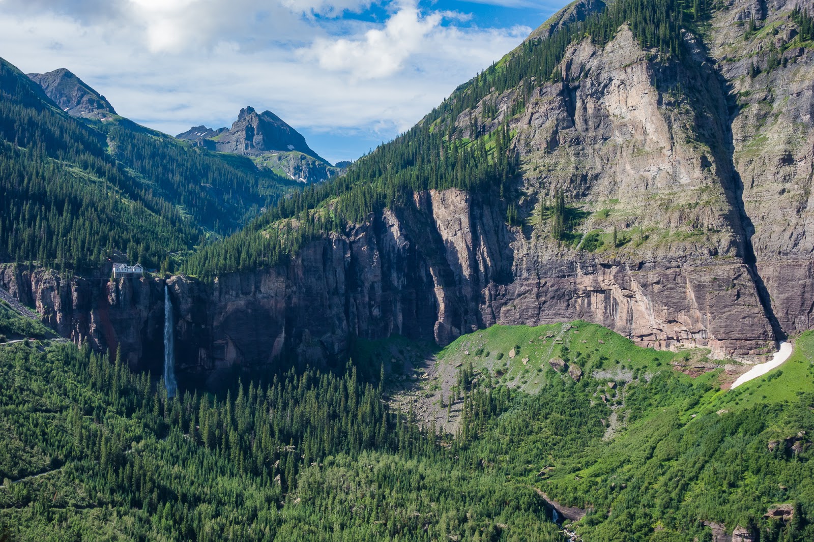
The trail passes very close to Colorado's scenic Bridal Veil Falls.
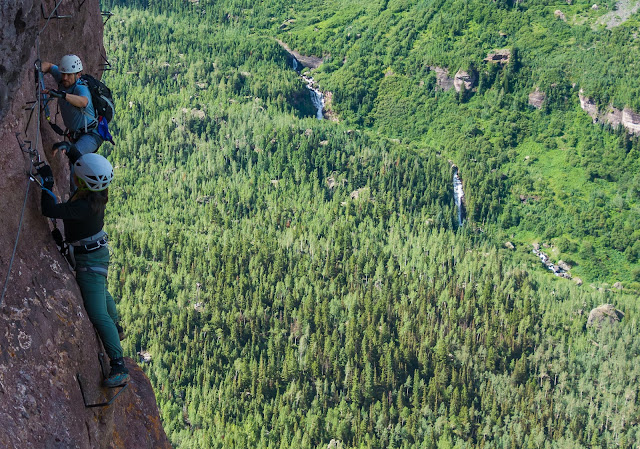
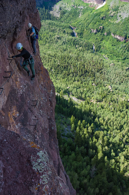
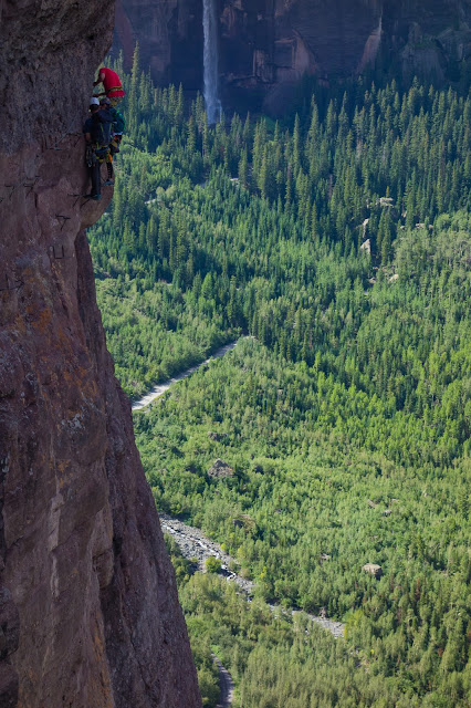
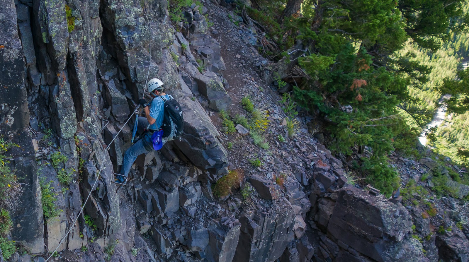
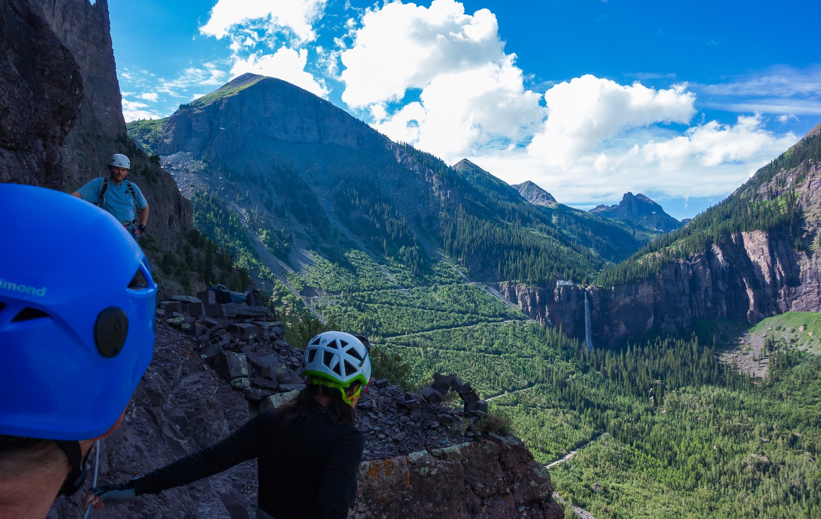
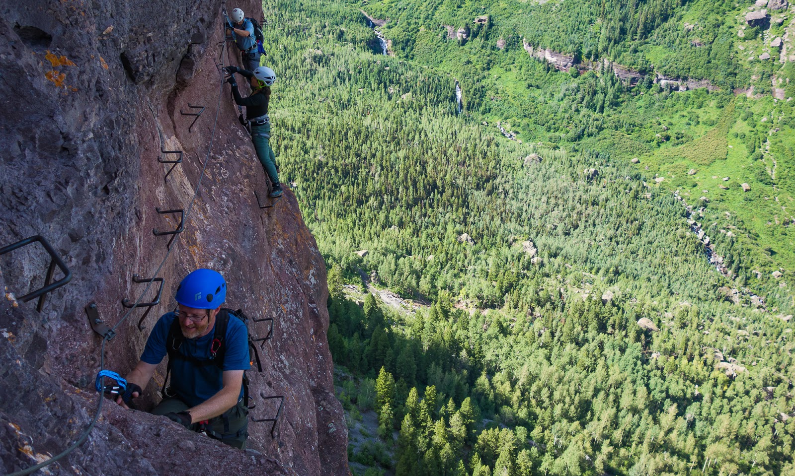
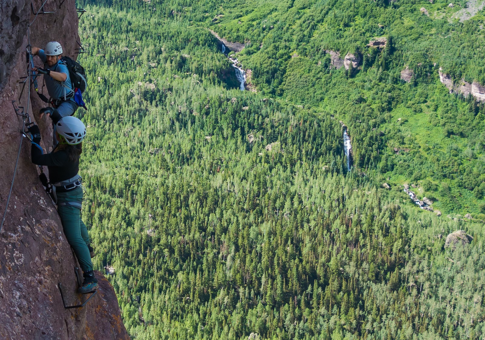
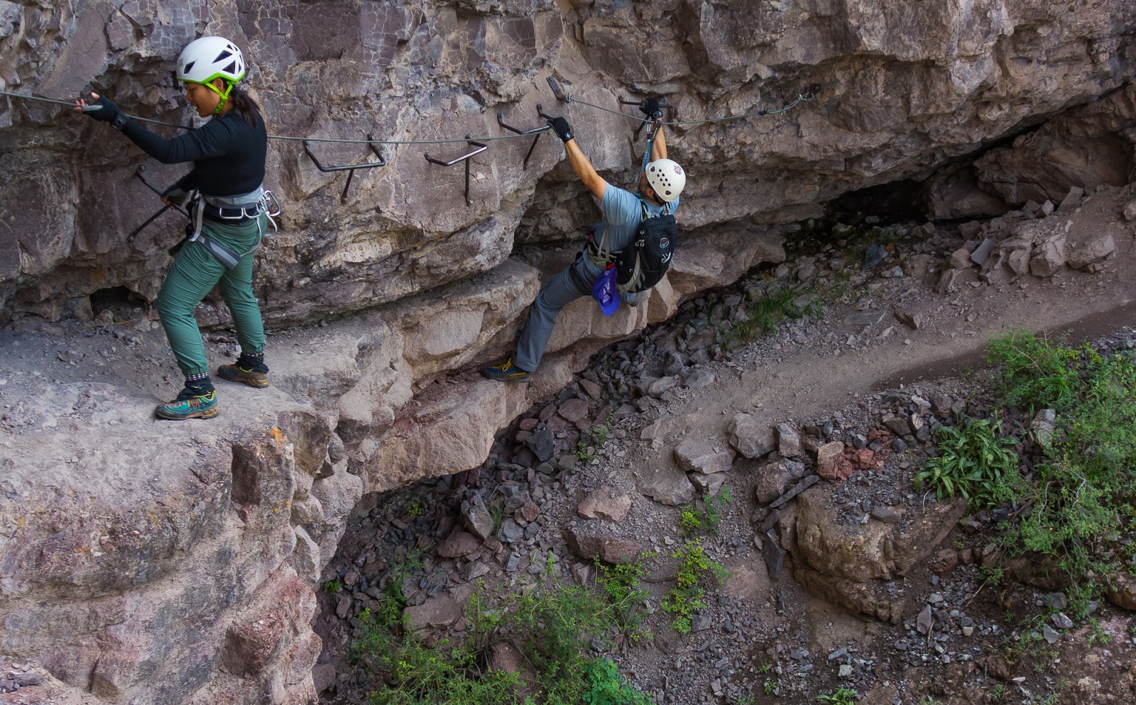
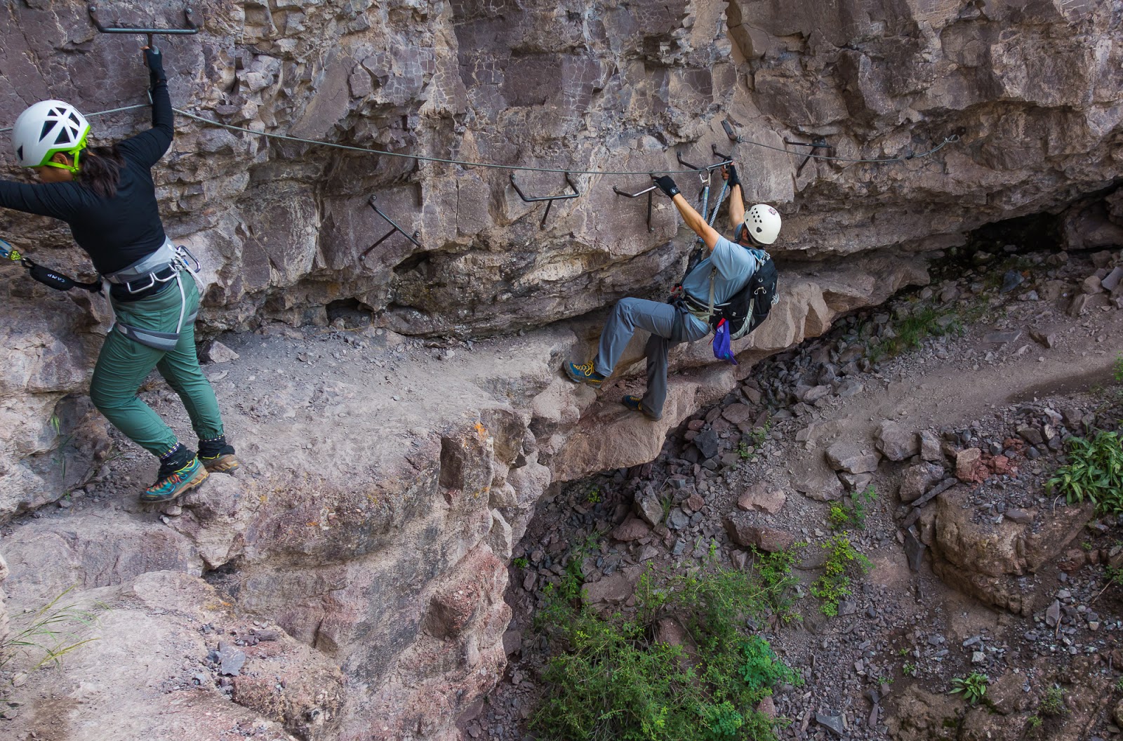
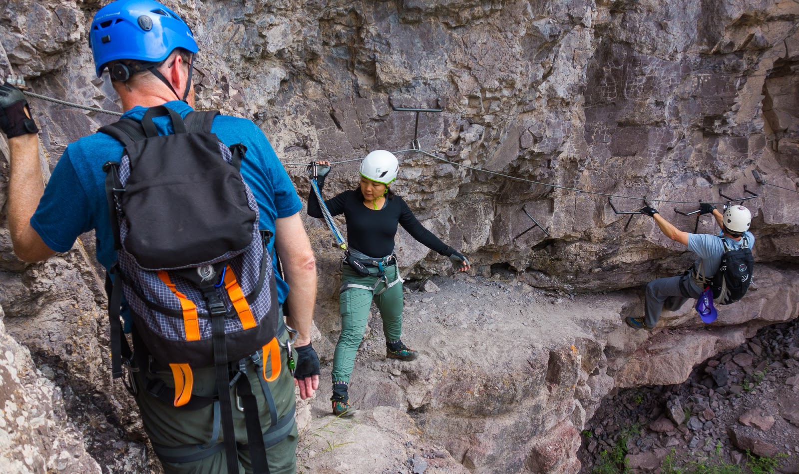
Via ferrata scenes.
Via ferrata scenes.

Via ferrata scenes.
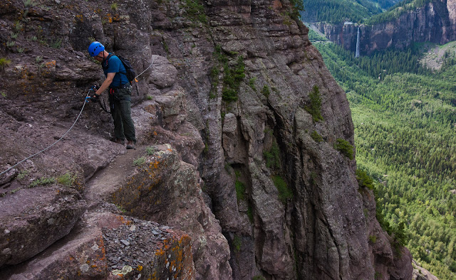
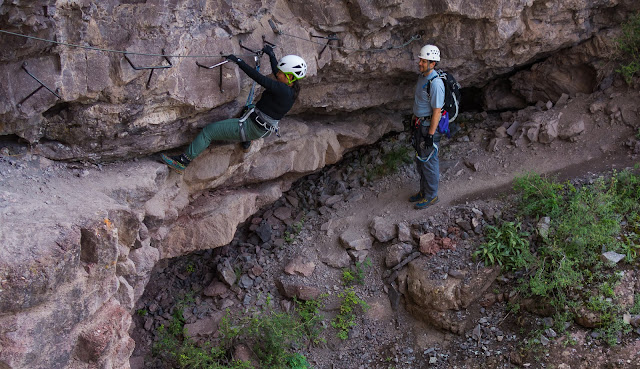
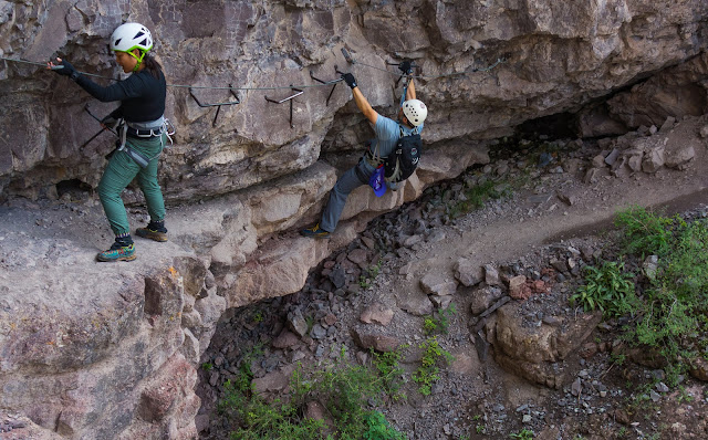
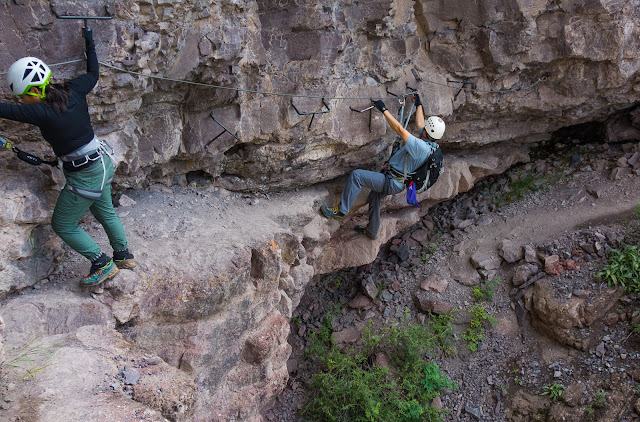
Sarah makes some moves on a cabled portion of the via ferrata route.
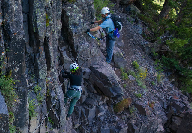
Sarah makes some moves on a cabled portion of the via ferrata route.
Matt gets in on the via ferrata cabled action.
Via ferrata scenes.

Via ferrata scenes.
Via ferrata scenes.
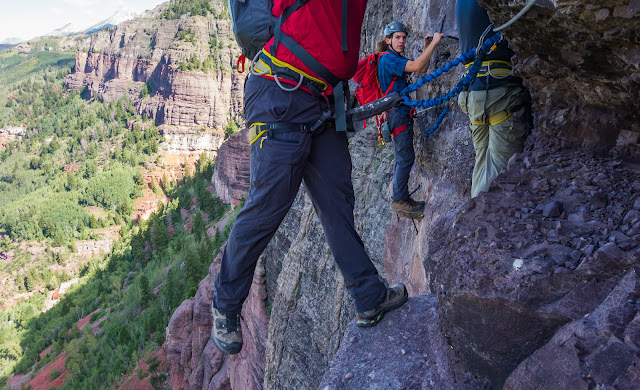
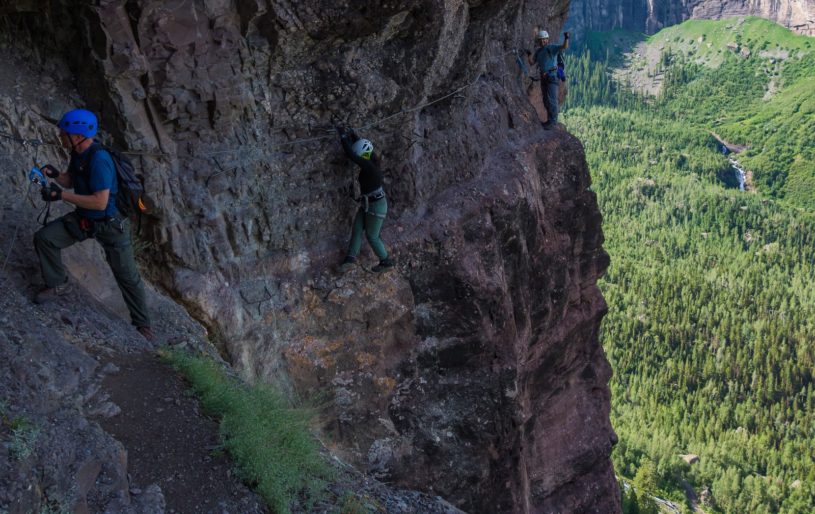
Waiting...and more waiting at "The Main Event" as the most-exposed section of the via ferrata route is called. The gentleman in the middle wasn't entirely comfortable with exposed heights...he, and another gentleman were part of a small guided group (led by the guy with the red backpack seen here); their guide was trying to coach him through how to move along the holds on this section...but it was slow going, so we stood here longer than anywhere else on the route. There isn't really any feasible way to pass people on this section, so we had to wait for them to complete this part before we started, then we were able to pass them as they took a break on the other side of this section. We weren't sure what someone who was uncomfortable with exposure to heights was doing on a via ferrata route anyway...
Waiting...and more waiting at "The Main Event" as the most-exposed section of the via ferrata route is called. The gentleman in the middle wasn't entirely comfortable with exposed heights...he, and another gentleman were part of a small guided group (led by the guy with the red backpack seen here); their guide was trying to coach him through how to move along the holds on this section...but it was slow going, so we stood here longer than anywhere else on the route. There isn't really any feasible way to pass people on this section, so we had to wait for them to complete this part before we started, then we were able to pass them as they took a break on the other side of this section. We weren't sure what someone who was uncomfortable with exposure to heights was doing on a via ferrata route anyway...

Matt's "patient face" while we wait some more before starting "The Main Event".
One more shot of the last guy in that slow-moving group before he goes around the bend on"The Main Event". This part of the route you're on a vertical cliff face holding on to metal handholds and stepping on similar (or identical) metal handholds with tremendous exposure right under you; it's a good time.
Via ferrata scenes.

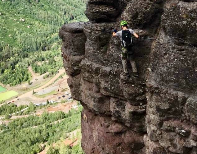
I (carefully) snagged this picture of Mitch along "The Main Event" section of the route. To get this I had to balance on a small set of metal footholds while holding on to a metal handhold with my left hand while getting the camera out, turning it on, framing the shot and taking it and then putting the camera away while in that relatively precarious position. Other than the small metal footholds I was on at the time and the hold my left hand was clinging to there was nothing under me for hundreds of feet.
Mitch gets ready to complete "The Main Event" section of the via ferrata. Matt and Sarah can be seen a little further back on the route.
Mitch gets ready to complete "The Main Event" section of the via ferrata. Matt and Sarah can be seen a little further back on the route.
Sarah and Matt working their way along "The Main Event".
Sarah and Matt working their way along "The Main Event".

Having a great time on the via ferrata.
Some shots of a group coming along after us that give a better sense of the extreme exposure on "The Main Event" portion of the route.
Some shots of a group coming along after us that give a better sense of the extreme exposure on "The Main Event" portion of the route.
Some shots of a group coming along after us that give a better sense of the extreme exposure on "The Main Event" portion of the route.
Mitch makes an exposed clip into the cable on the adjacent wall that required a bit of a reach to get secured.
Mitch coming along another exposed portion of the route.
Mitch coming along another exposed portion of the route.
Sarah rounds a corner on the route.
...and there's Matt too...
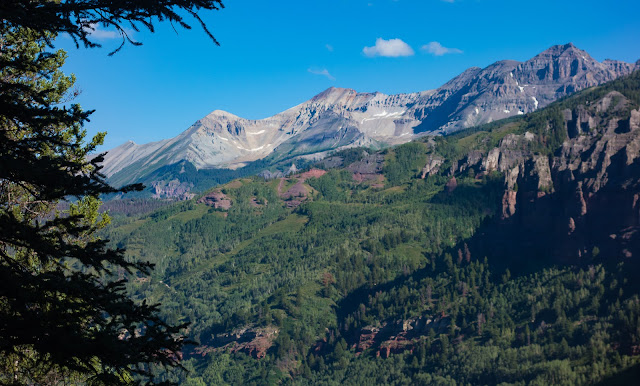
Beautiful views along the way.
This section felt a bit like a light bouldering problem; pretty physical in nature - very leaned back while moving across the exposed section.
This section felt a bit like a light bouldering problem; pretty physical in nature - very leaned back while moving across the exposed section.
This section felt a bit like a light bouldering problem; pretty physical in nature - very leaned back while moving across the exposed section.

This section felt a bit like a light bouldering problem; pretty physical in nature - very leaned back while moving across the exposed section.
Sarah and Matt continue along one of the many exposed ledges on the route; much of the length of these exposed ledges were not protected with cables to clip into...Mostly, when the exposure became excessive, there were cables...but there were some cables in unnecessary places that were less-exposed than some places that didn't have cables...
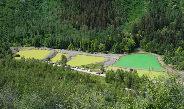
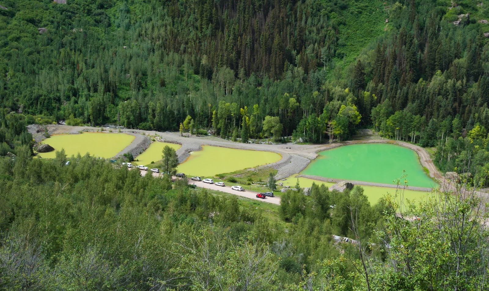
Mining tailing ponds near the parking area...apparently now far busier than when we started - we were one of only a handful of cars when we started hiking...
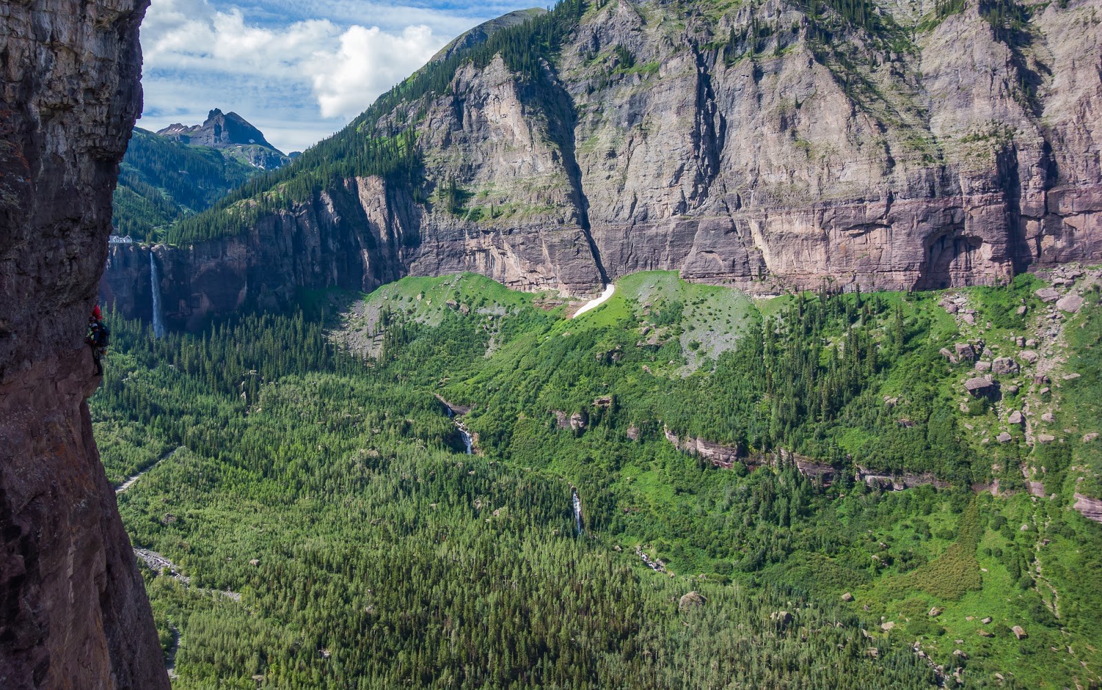
Looking back up at cliffs we'd traversed on the route as we descended back to the car. What fun!

Me, on an exposed section of the via ferrata.
Apparently I trust my own grip pretty well...Such a sweet route!
After we'd completed the varied and enjoyable via ferrata route we met back at the parking area to discover that Claron wasn't back yet. We'd estimated about three hours for our trip and that's about what it took; we could've done it faster (and still kept things plenty safe) but there were some slower groups ahead of us at times. Anyway, after not too long (maybe about 20 minutes) Claron came rolling up the road after we had decided to ride back into Telluride with Matt and Sarah to try and find him...We flagged Claron down when we saw him in his car and he turned around to follow us into Telluride. We made the collective decision to find a lunch spot in Telluride and found a nice sandwich place that was good (don't remember what it was called...maybe "The Baker and The Butcher" - that seems right...). Once we'd finished lunch there we parted ways - Claron, Mitch, and I together, and Matt and Sarah together - to head to the Blue Lakes Trailhead where we'd begin the next major stretch of our hike. It took us an hour to an hour and a half to get to the trailhead for the Blue Lakes area, and we found the parking area pretty populated, which was a bit unexpected for a Monday afternoon (it was mostly full). We got our gear together and configured our packs for the hike in before getting underway. Matt and Sarah had already started up the trail, they having arrived sometime before us.

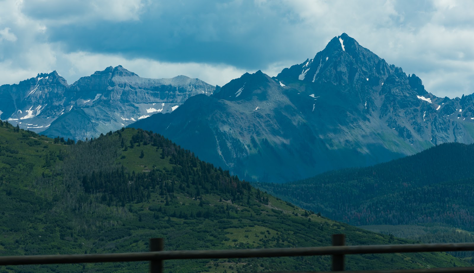
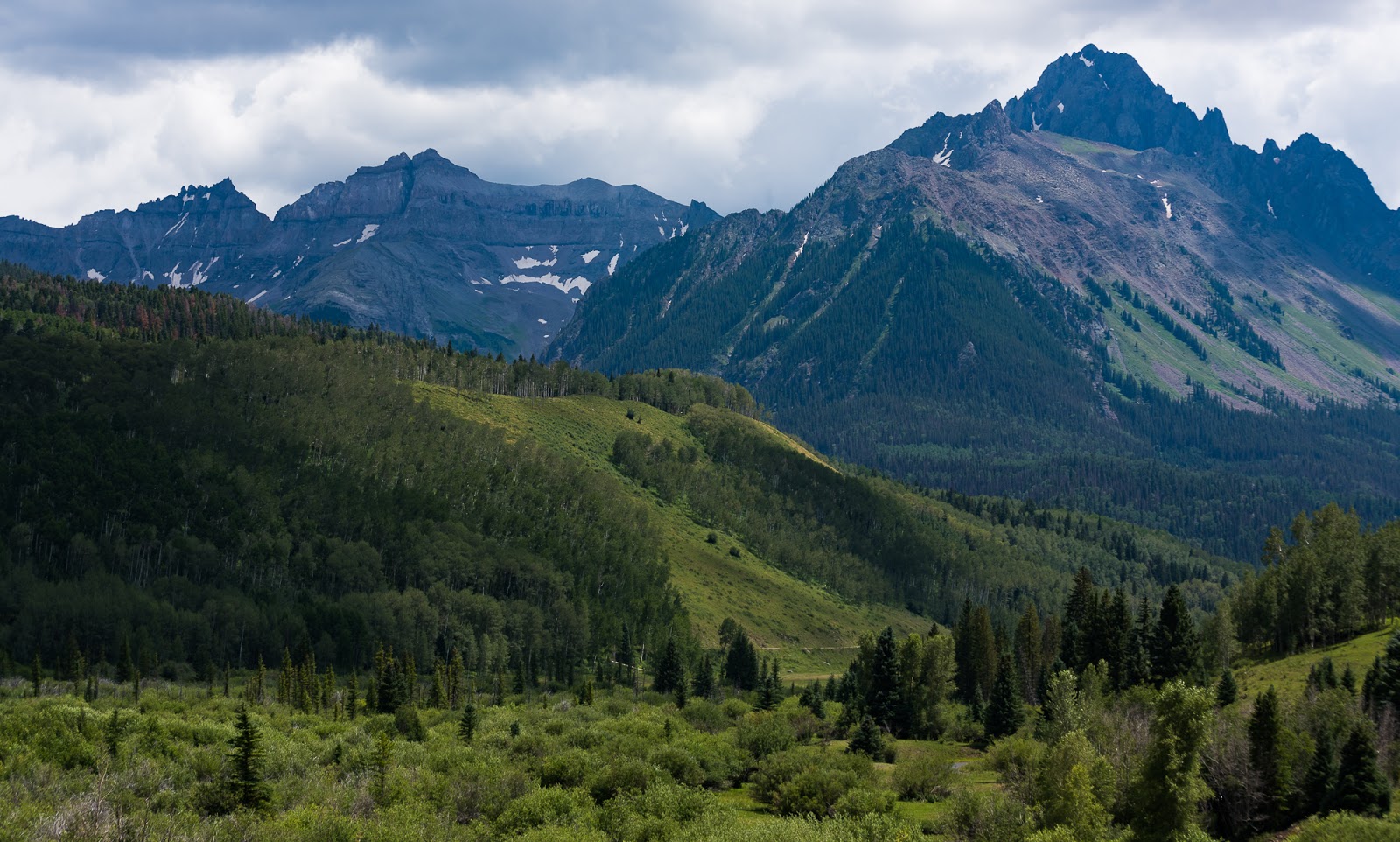
Views from the drive to the Blue Lakes Trailhead; taken through the car window.
Views from the drive to the Blue Lakes Trailhead; taken through the car window.
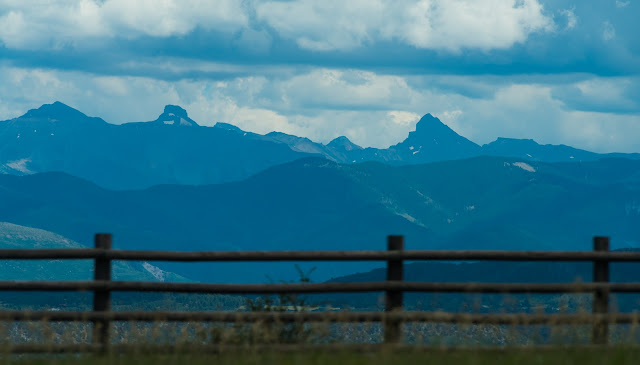
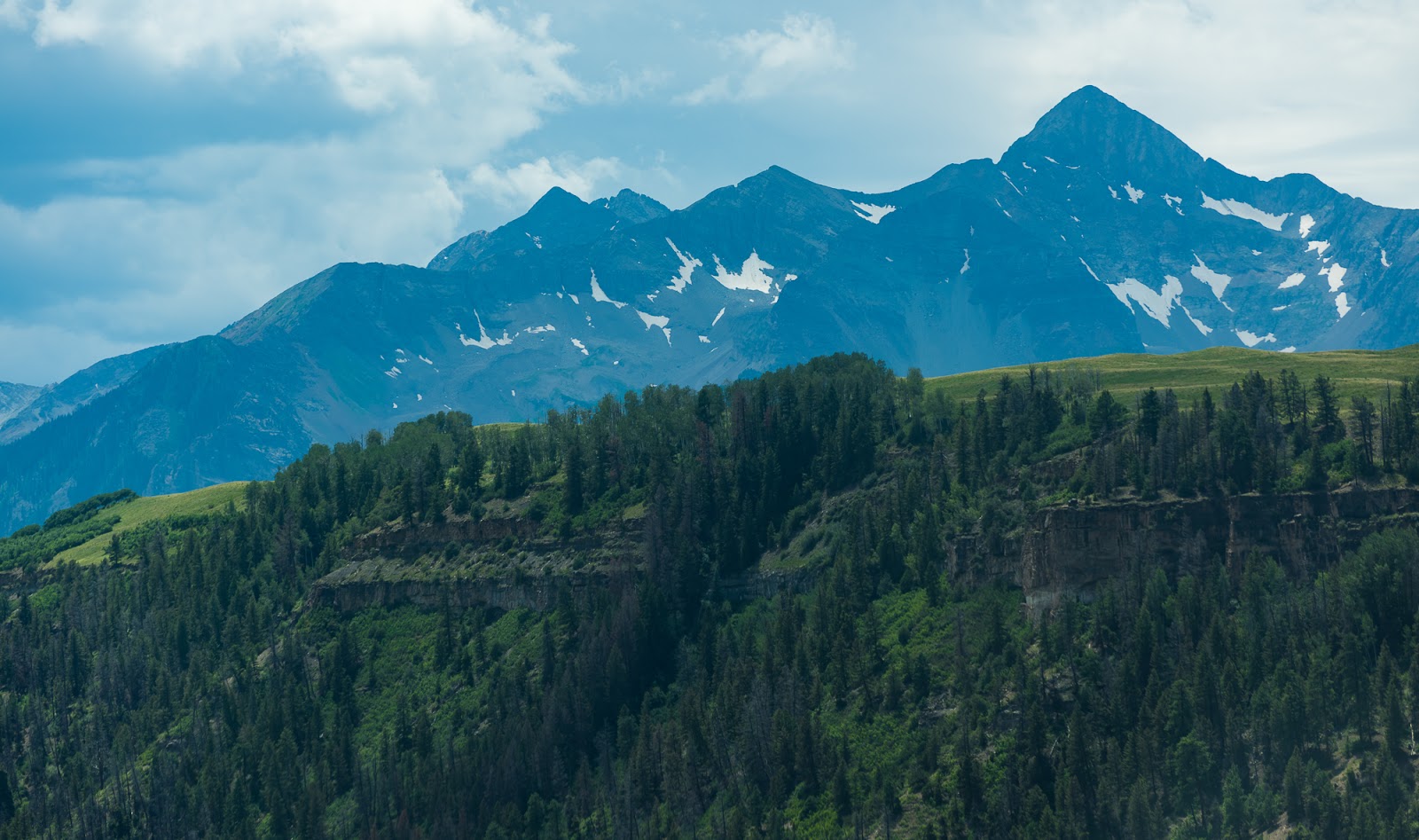
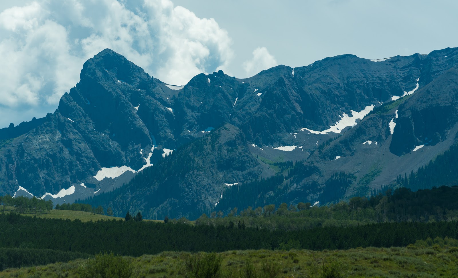
Wetterhorn Peak, one of our later peak goals for this trip, is the prominent peak on the right here; seen through the car window on the way to the Blue Lakes TH.

Mount Sneffels, looking epic on the right side here; taken through the car window.

I rolled the window down for this one (Mount Sneffels is on the right here) - during part of the dirt road portion of the drive in to the Blue Lakes TH; we found the road very passable in our passenger car.

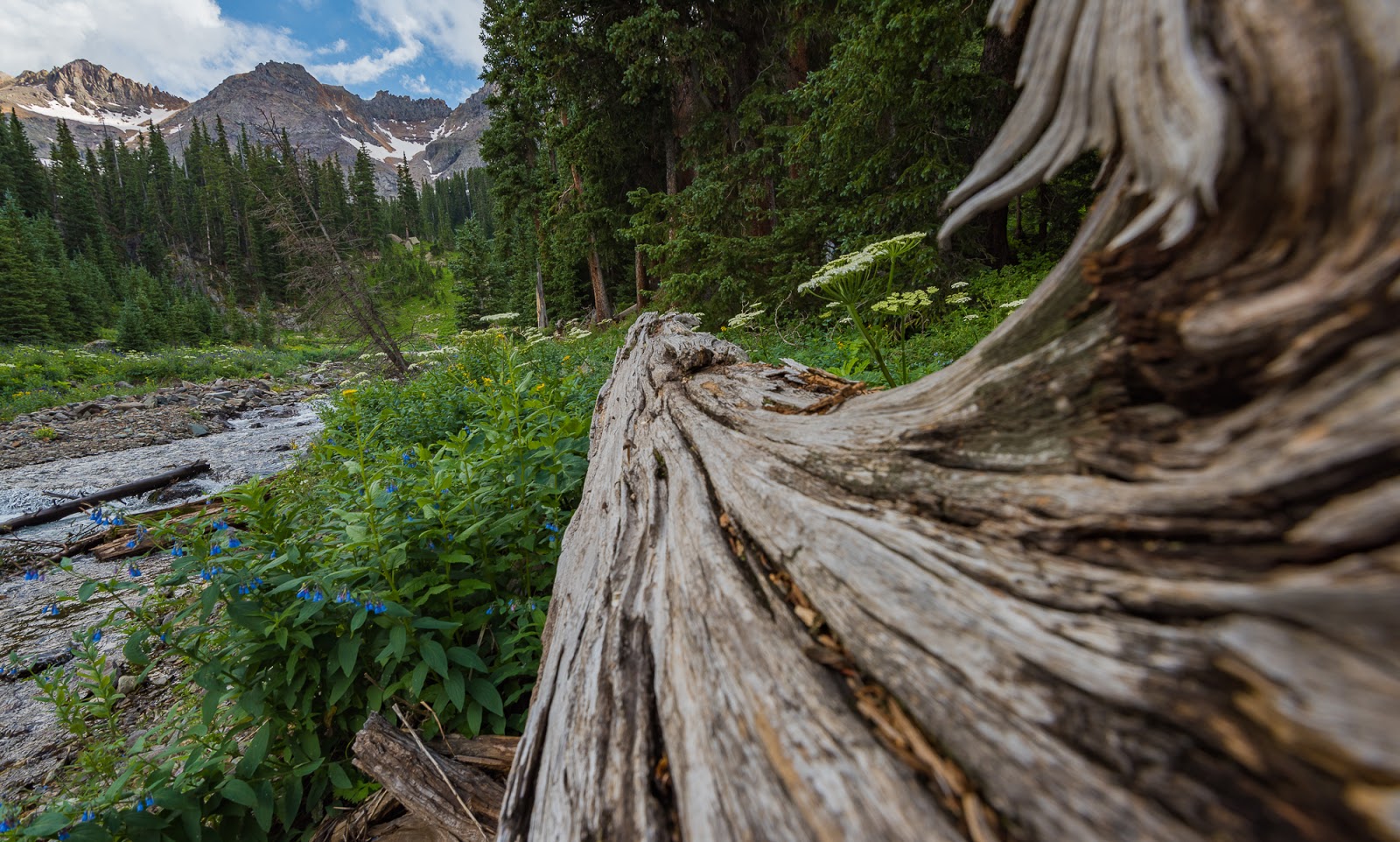
We caught up with Sarah and Matt on the trail about when we hit the official start of the Mount Sneffels Wilderness. Lovely forested terrain while working up to the Blue Lakes.
Gorgeous!
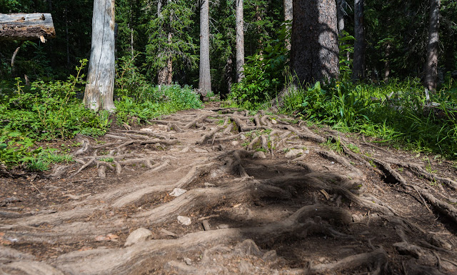
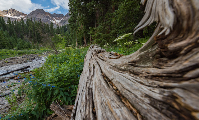
This section of trail was really neat with the thickly intertwining tree roots protruding from the surface of the ground.
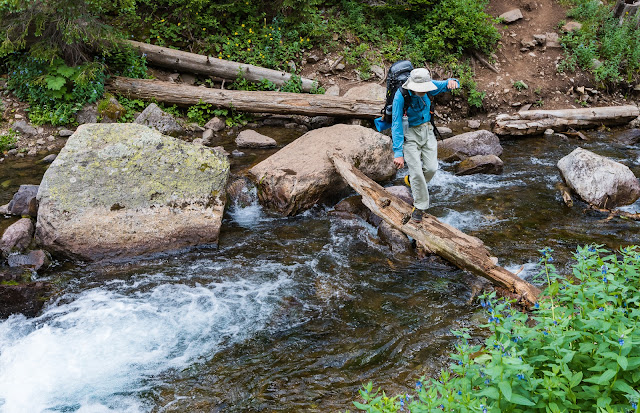
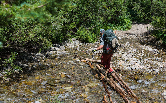
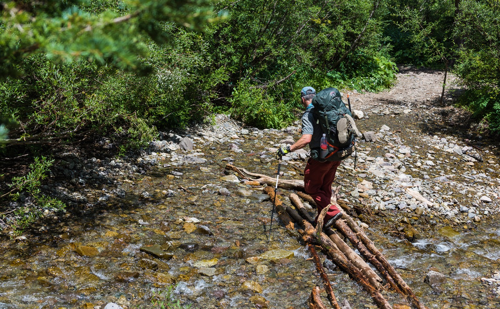
Claron rocking the most challenging stream crossing required on the route (it wasn't bad, but this was the "most interesting" one...).
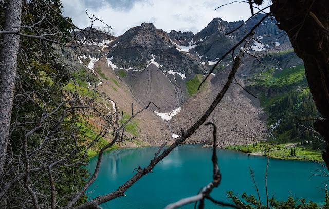
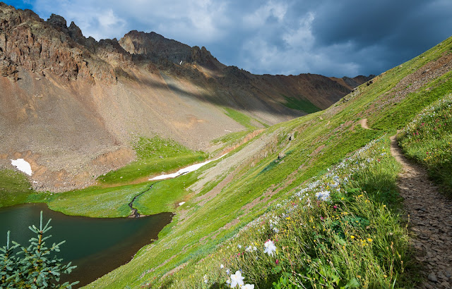
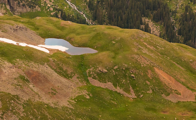
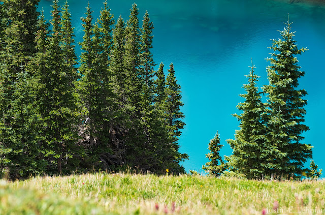
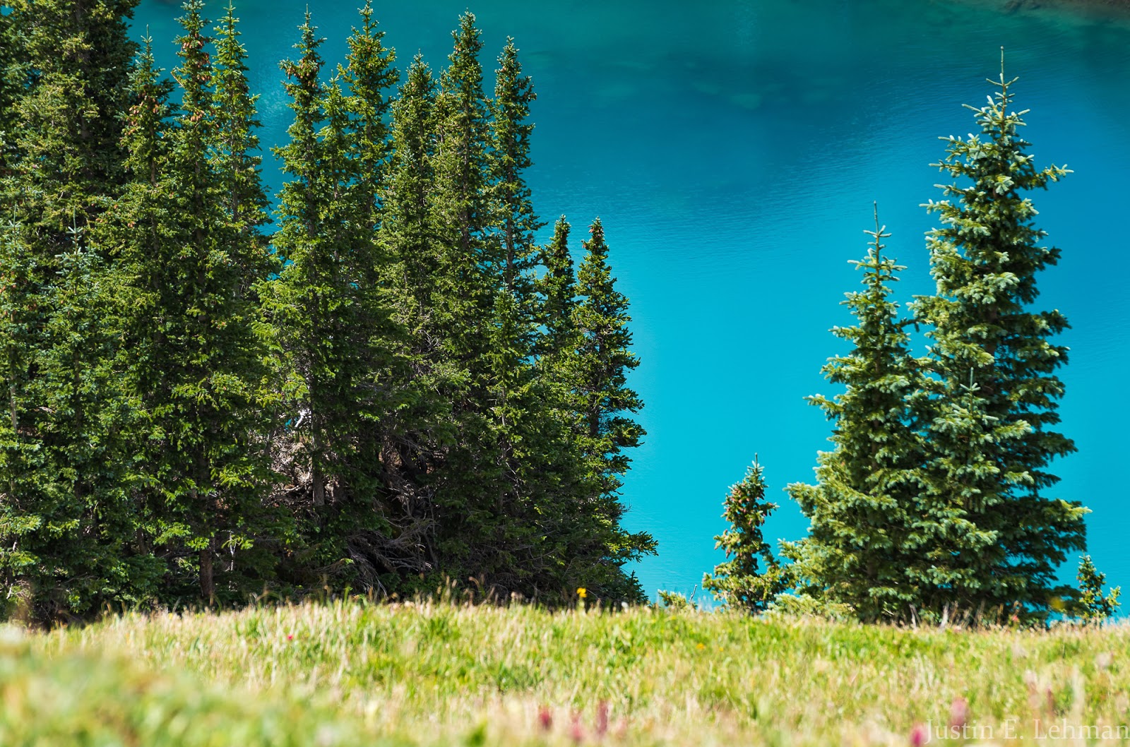
Lower Blue Lake. While it was overcast when this picture was taken, when the sun hits this water it is spectacularly blue - one of the most colorfully beautiful lakes I've ever seen.
On our ascent we did notice there were a fairly large number of day-hikers, so that raised our hopes about not having to keep a crowded campsite up high. We had talked about meeting up at Middle Blue Lake, but were likely aiming for Upper Blue Lake if the views/solitude proved better there (as I expected they would). The ascent trail averages about 1,000 feet of gain per mile - so, your average "steep" trail. Things don't get seriously steep at any point until just after Lower Blue Lake while heading to Middle Blue Lake - that's a good steep trail to haul a big pack up and will definitely get your attention.
Lower Blue Lake with a little bit of indirect sun on it. Also, check out all those bloomin' flowers and Claron coming up the very steep trail between Lower and Middle Blue Lakes.
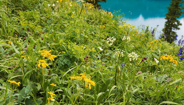
Flower close-up with a little snippet of Lower Blue Lake in the background.
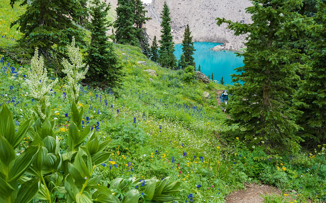
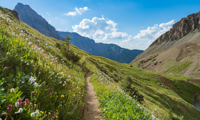
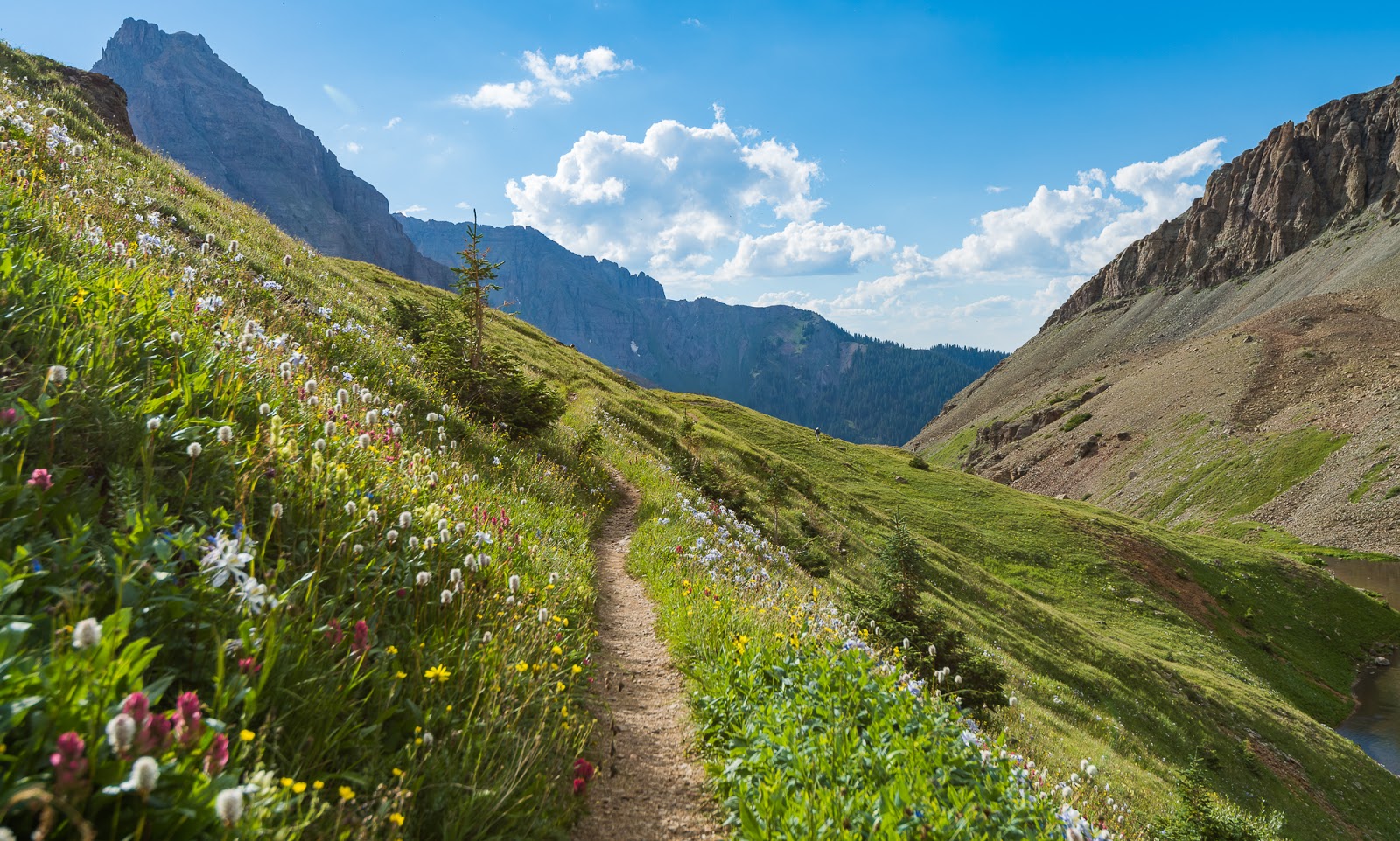
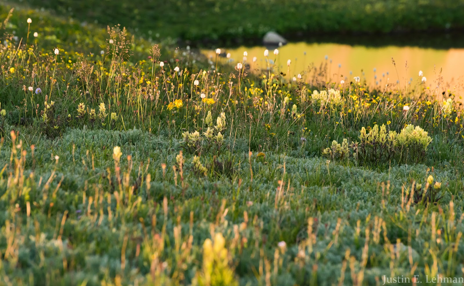
After the steep march from Lower to Middle Blue Lake (Middle is located down in a valley the trail rises about by 200 feet or so) things even out and the climbing to Upper Blue Lake is gentle and the views are glorious. Our whole hike out here was attended with a great proliferation of wildflowers - I think we timed this hike well with being able to catch the blooming flowers near the peak of their intensity. Summers are short in the high country, and the flower bloom even shorter, so to be among such beautiful mountains, lakes and streams and to have that beauty further augmented by the flowers was a repeatedly amazing sight.
Terrain above Middle Blue Lake on the way up to Upper Blue Lake; that's Mitch coming along the trail there.
Looking over Middle Blue Lake on the way to Upper Blue Lake.
Looking back across flower-strewn hillsides at the trail we'd taken past Middle Blue Lake; if you look close at the enlarged version of this picture you might be able to see Claron out there on the trail somewhere...he really is there...can you see him?
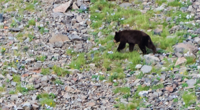
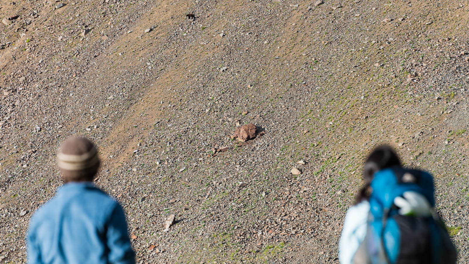
My first bear seen in the wild while I've been hiking! Traversing steep talus slopes over 12,000 feet above sea level like it's no big deal...

Terrain around Upper Blue Lake.
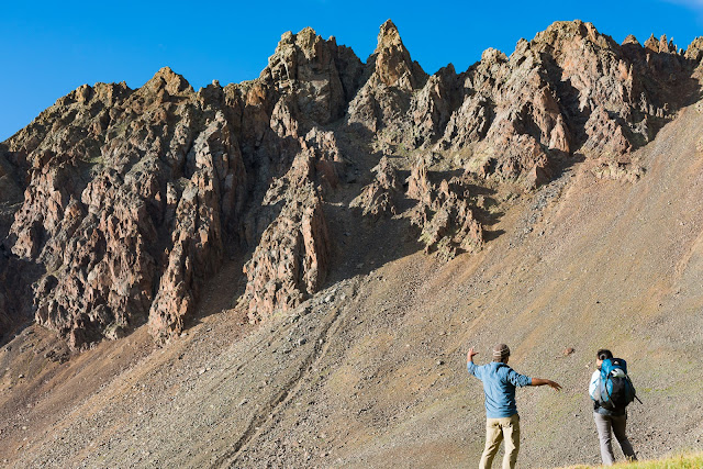
A Colorado local, who - with his son - was the only other party camping near Upper Blue Lake, is telling Sarah some story while they watch the bear traversing the slopes across the lake opposite from our campsite.
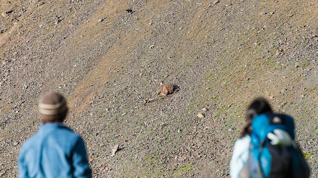
Bear-watching...
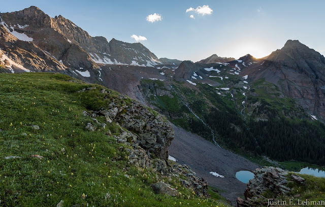
After the excitement with the bear had wrapped up most of our group went to have dinner but, being a landscape photographer, I gathered up my gear and set out to capture what views I could of the area during the golden hour and the sunset. I'd never been to this area so I didn't know exactly how things would go with the light, but I had done some research in advance to get ideas of at least generally how the light would strike various parts of the landscape. It's always an adventure, even with pre-planning to capture and find the most ideal places in a given area. I had a lot of fun running around the hills near our camp looking for unique vantage points of this very scenic high basin.

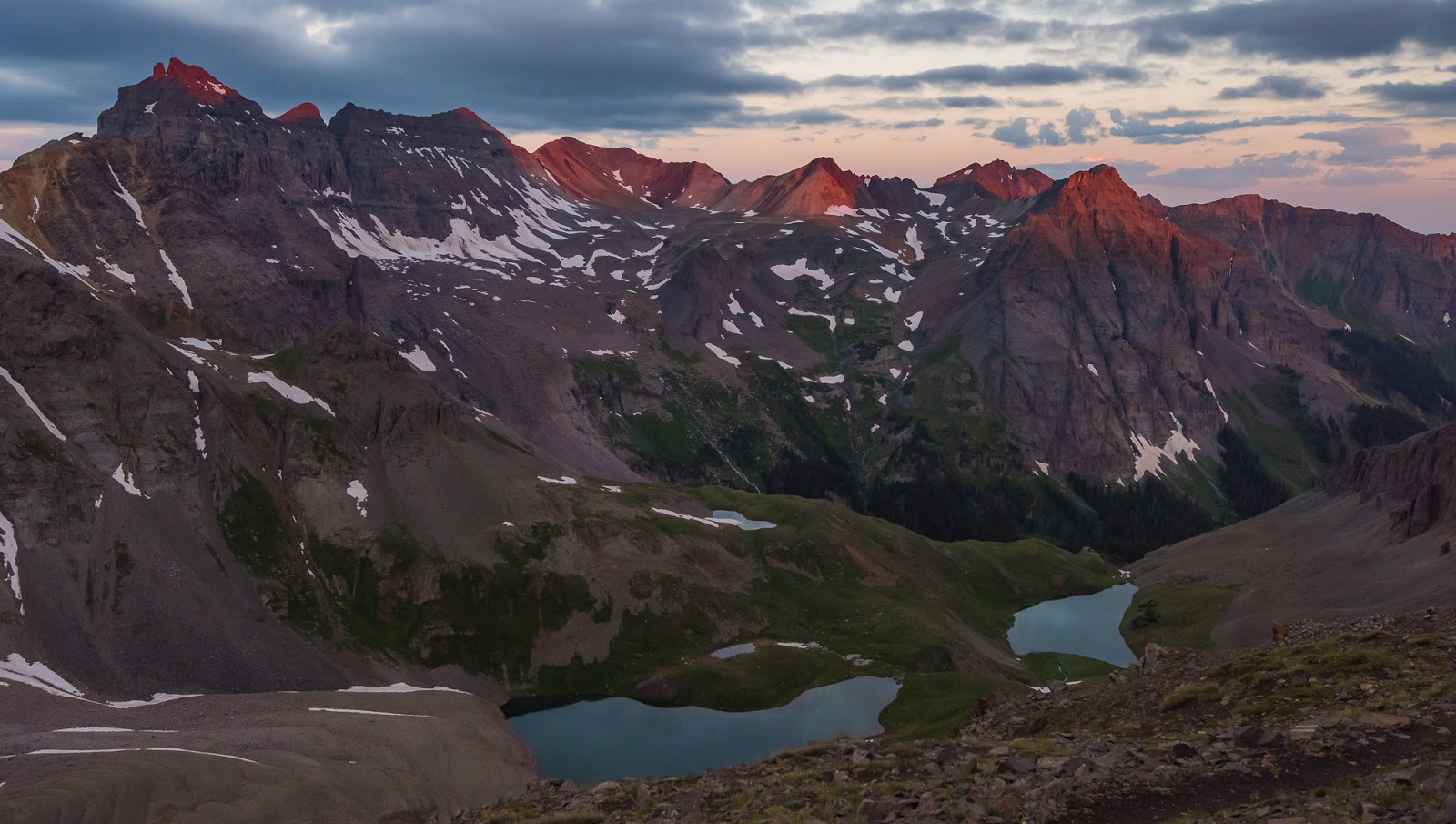
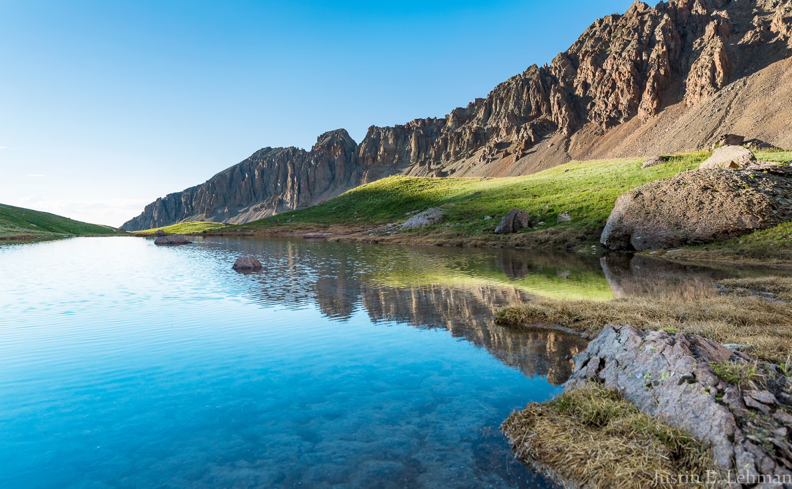
Evening sun over a small tarn near our campsite.

This reminds me of a view I've seen from somewhere in the Alps in Europe. Gorgeous!
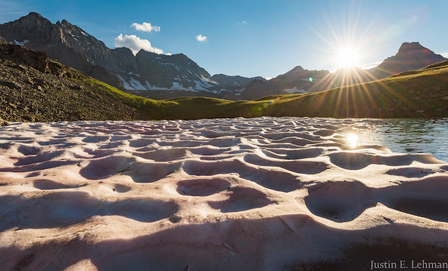
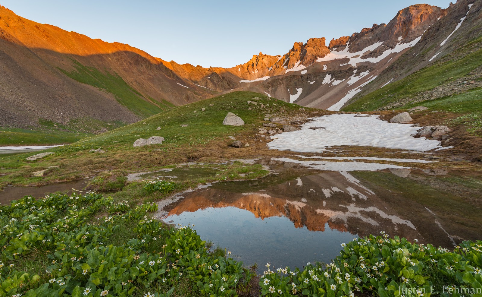
Otherworldly perspectives from the edge of a partially frozen tarn I came across while exploring.
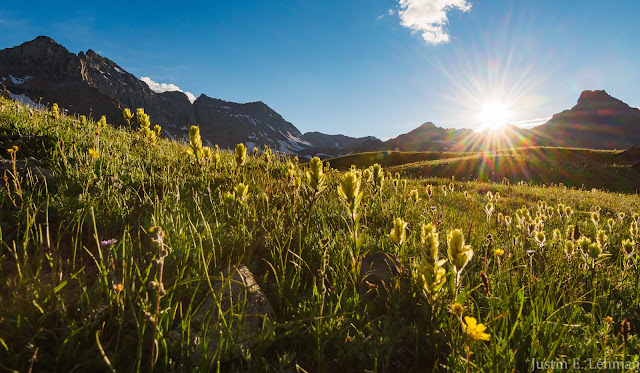
High flower meadows + a sunburst + glorious peaks = a good time!
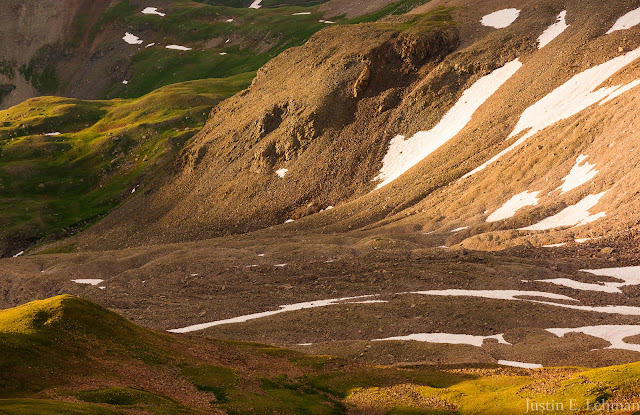
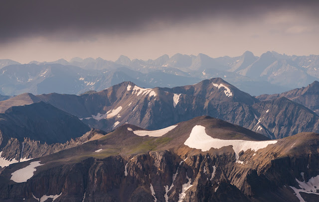
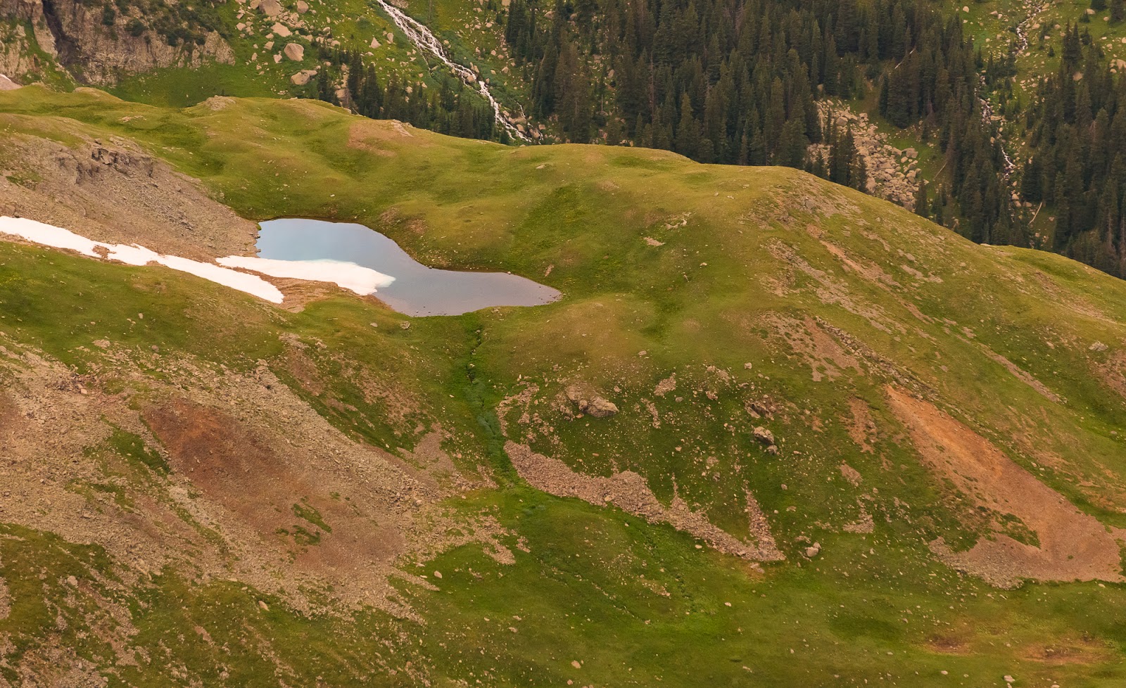
Terrain above Upper Blue Lake.
Looking down on Lower Blue Lake from somewhere above Upper Blue Lake.
I love this peak - it borders Lower Blue Lake and is super-dramatic.

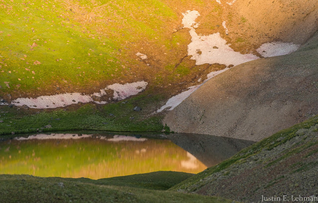
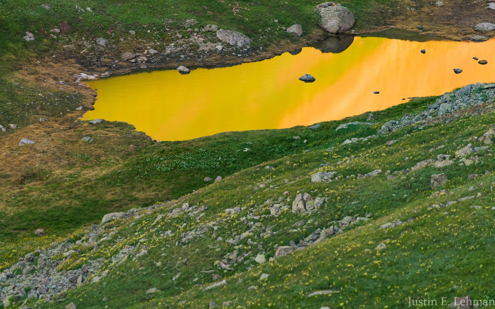
The interestingly-colored water is being illuminated by the reflection of the warm sunset light bouncing off the high peaks and cliffs above where I was standing - this effect led to some interesting shots of brightly colored water in the midst of shading, rolling tundra country I was passing through - you'll see those soon; the effect was stunning.
More terrain above Upper Blue Lake.
Neat reflected light as the sunset progresses.
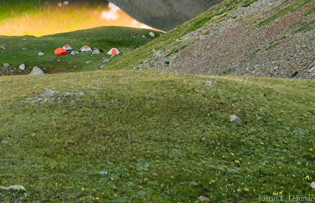
Our little campsite and reflected light on Upper Blue Lake.
Part of our view of Mount Sneffels' imposing ruggedness. Very impressive face here!
This came out a little impressionistic as I caught this slightly blurred reflection shot at a higher shutter speed.

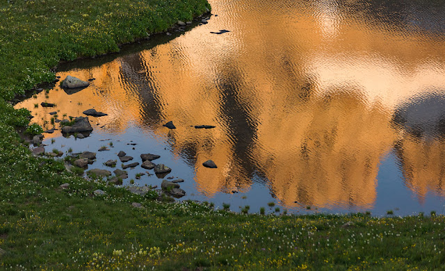
I really liked this reflection shot - far more about the reflected light than about any specific reflection of form. Very cool to see!
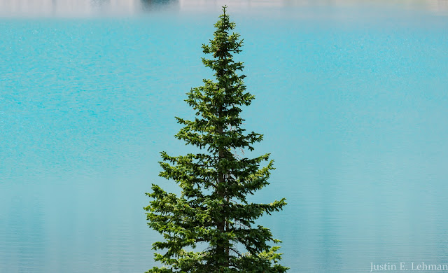
Mount Sneffels reflected in a small tarn I found in my wanderings.
Rugged terrain above Upper Blue Lake reflected in a small flower-lined tarn at sunset.
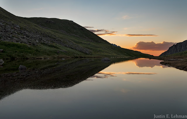
A late view of the fading sunset across the tarn adjacent to our camping area; I like the way the clouds combine to frame things with the reflection here.
After the sunset had concluded I went back to camp and enjoyed a nice warm dinner in the fading evening light. Someone remarked about how they enjoyed the deeper red light and colors at the last part of the day - so I decided to break my camera out and make some sort of interesting shot that showed those colors. After that last sunset shot I retired to the tent (Claron and I shared a tent for the duration of this trip) in preparation for our 4:30 AM rise time the following morning. We'd made arrangements to meet Jeff at the top of Blue Lakes Pass at 6:00 AM and so we allowed ourselves time to wake up, load up, and pack up the little-over-a-mile to the top of the pass and around 1,200 feet of elevation gain from camp.
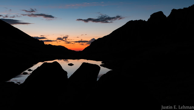
I had my gear all put away and was about to eat dinner when someone commented on how lovely the deep red was near the horizon, so I decided to grab my stuff and try to make an interesting capture of the last part of the sunset; I'm pleased with the result.
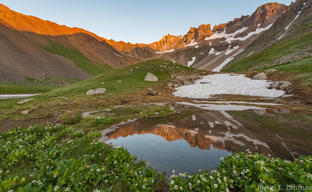
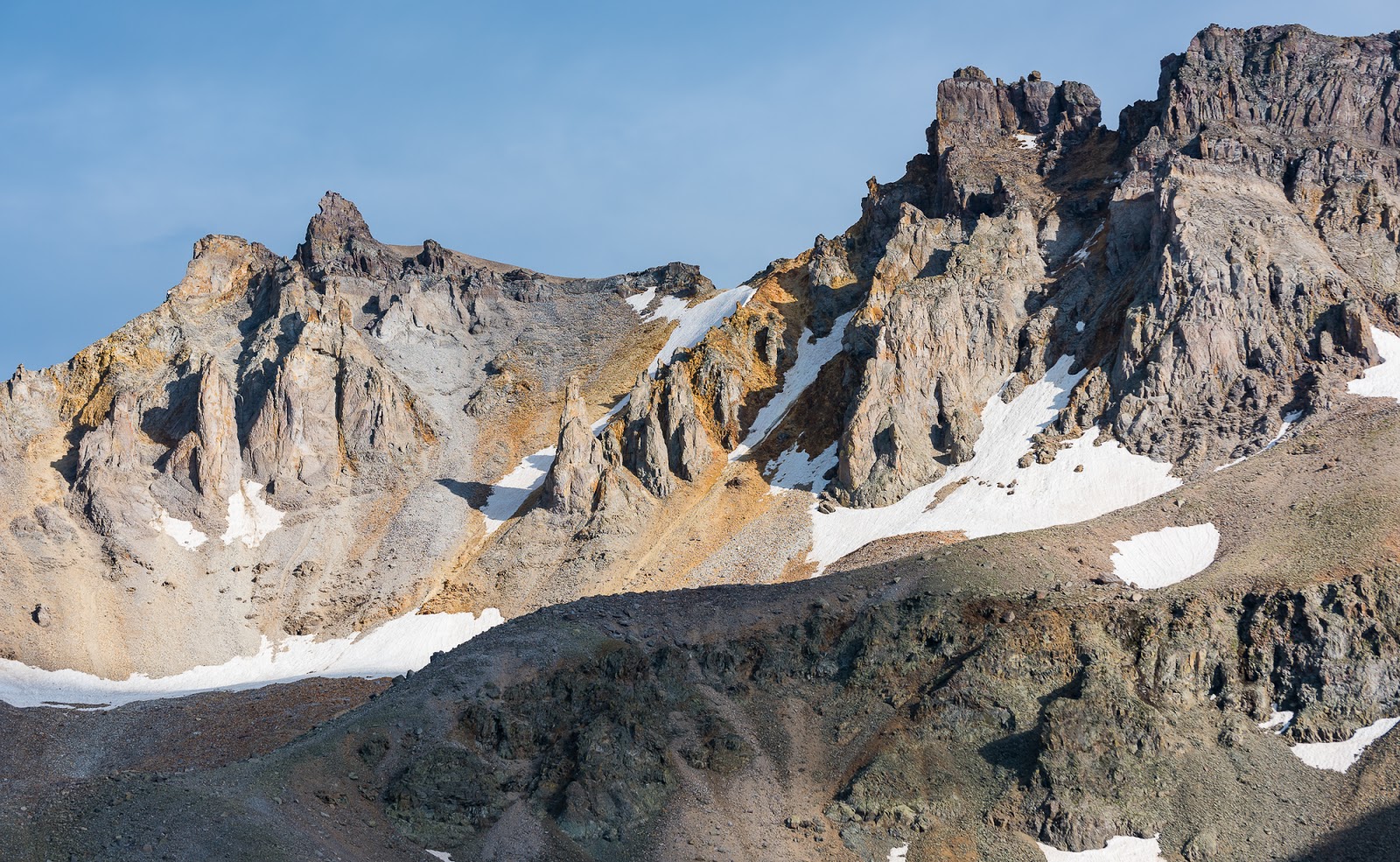
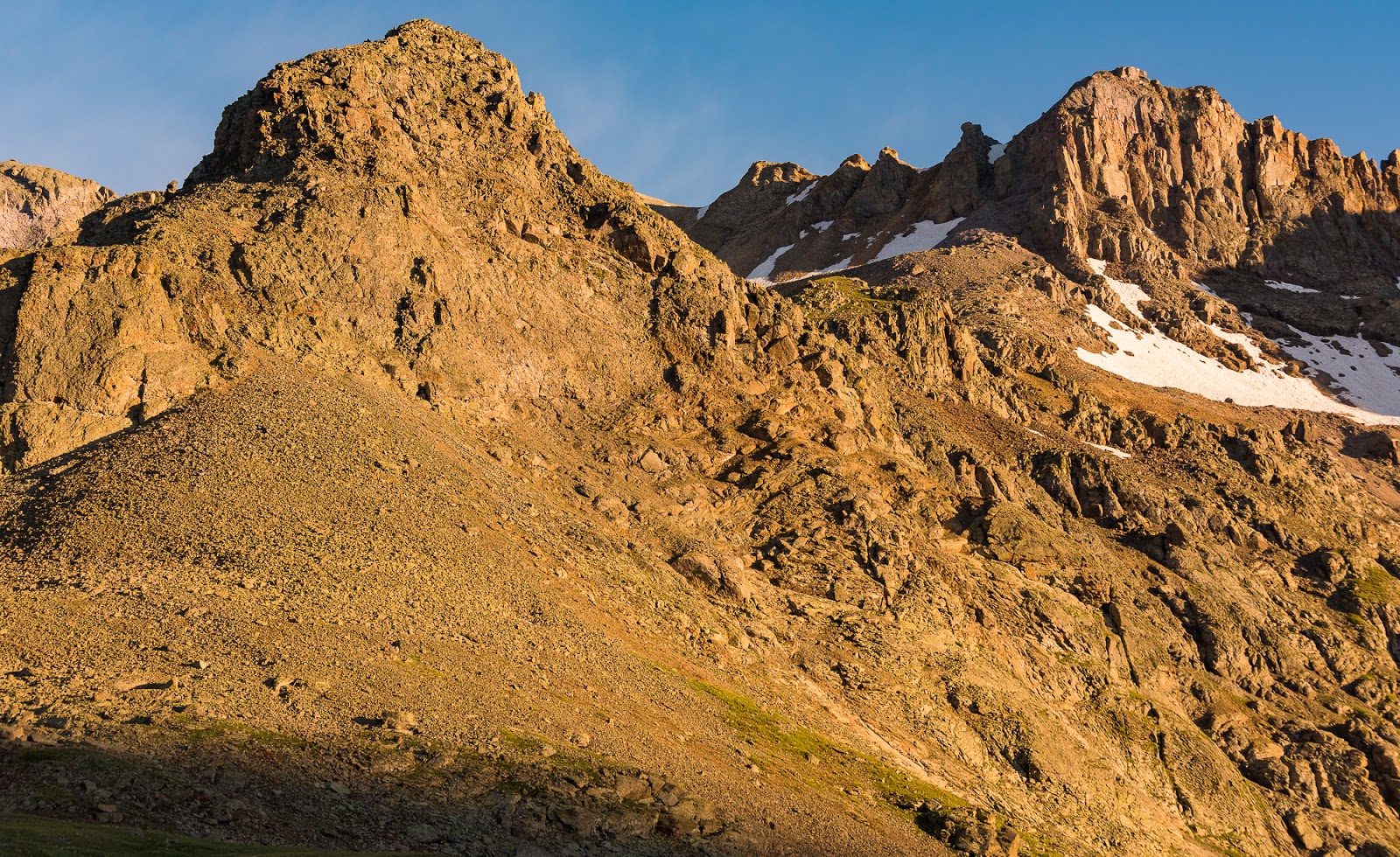
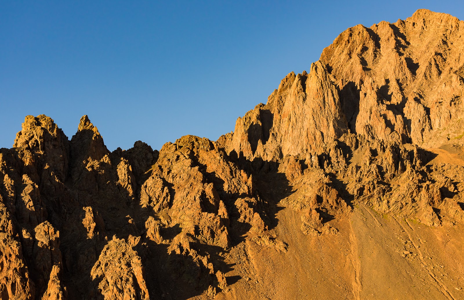
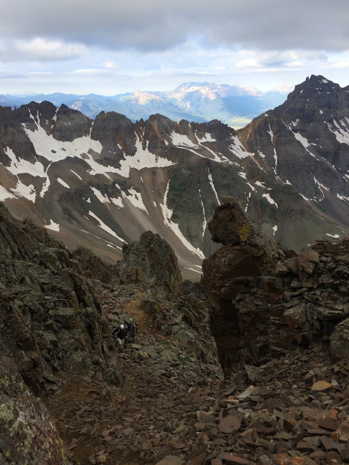
Fantastically rugged terrain seen from Blue Lakes Pass, about 12,800 feet up; Dallas Peak is the prominent peak on the right here.

Glimpses out into the ocean of peaks around Mount Sneffels.
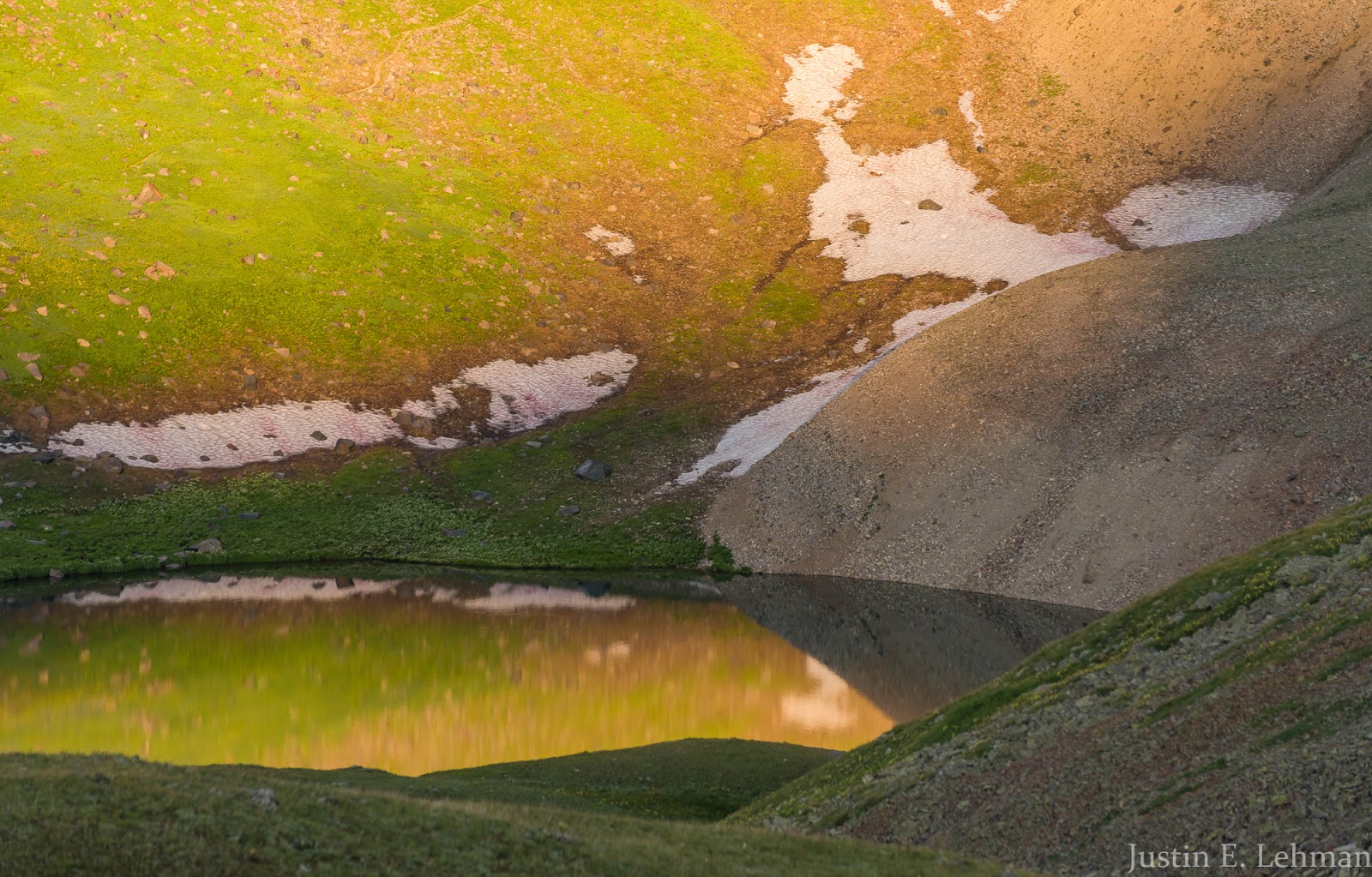
Views from Blue Lakes Pass of the small partially frozen tarn I'd photographed the night previous...perspective is a powerful thing...
I loved this view of Gilpin Peak from Blue Lakes Pass - such beautiful light!
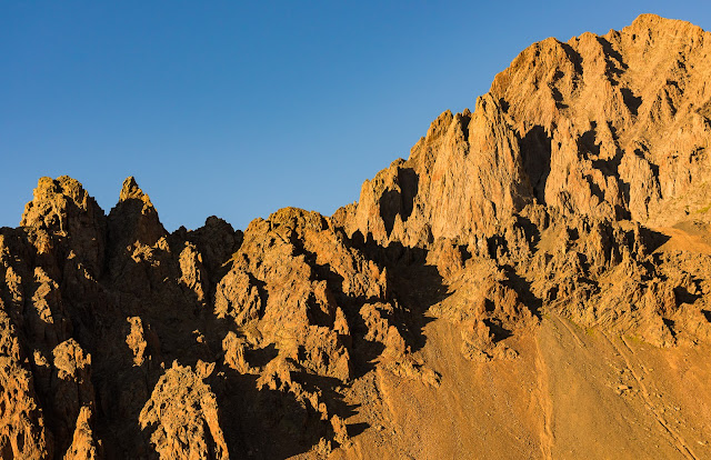
Super-dramatic terrain seen from Blue Lakes Pass under outstanding morning light.

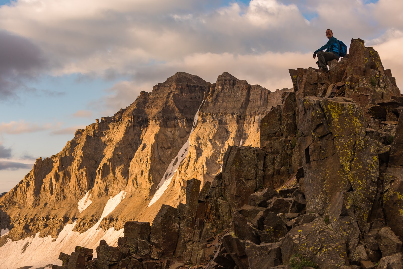
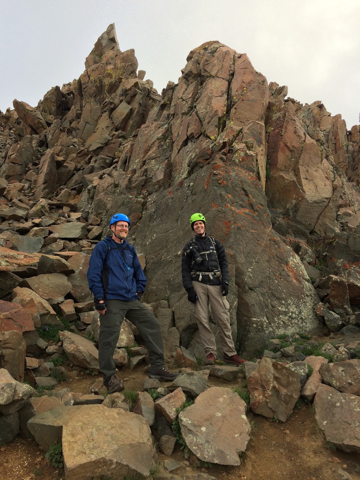
David being epic, as per usual.

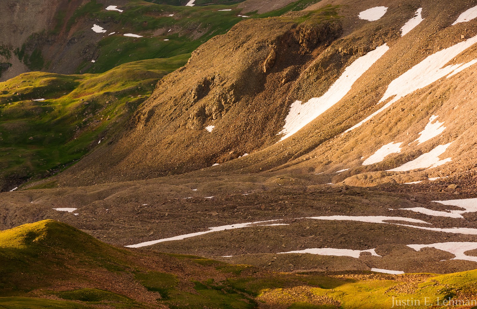
Terrain detail from Blue Lakes Pass.

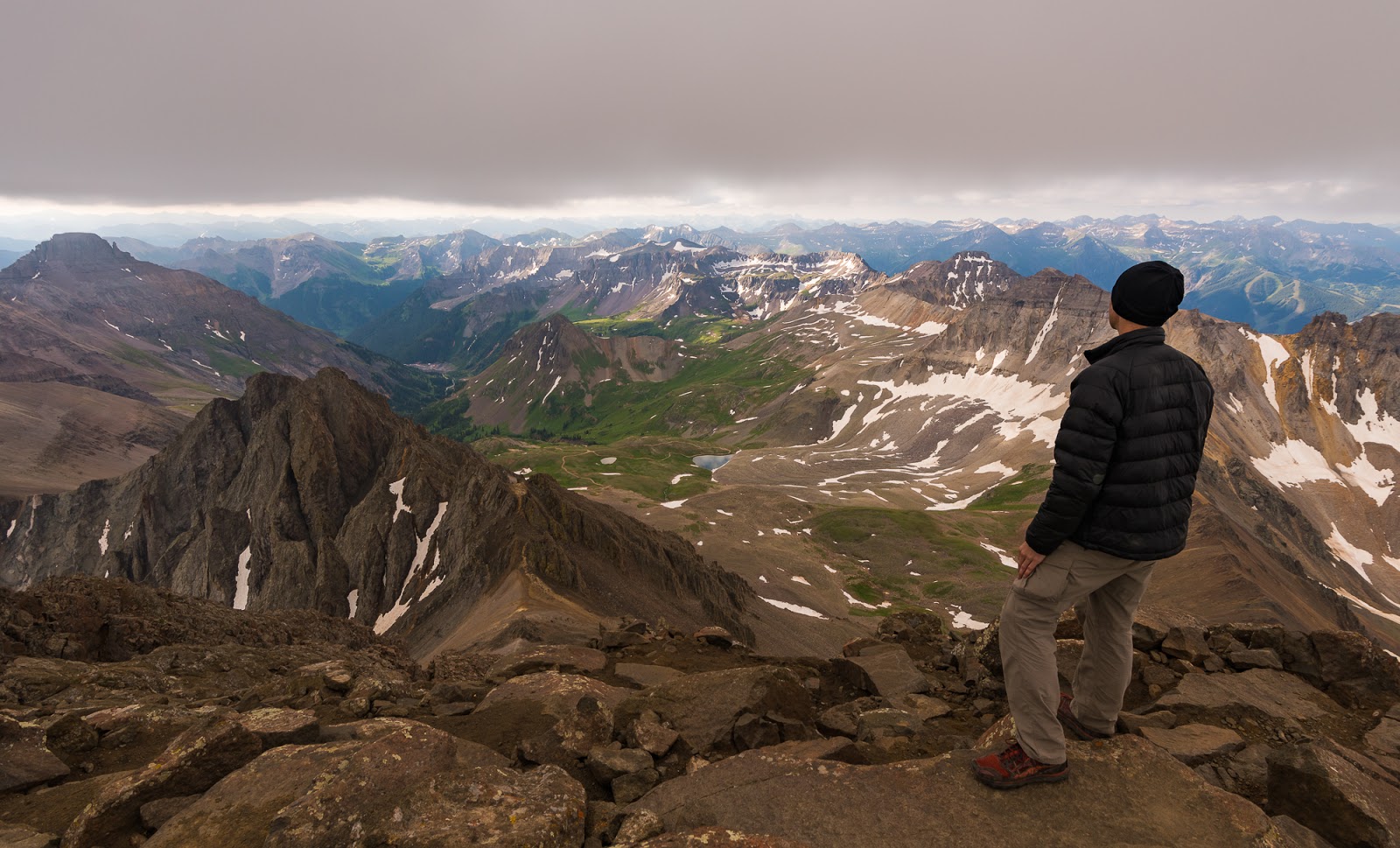
Mitch takes in the views from Blue Lakes Pass.
Neat moment where the light was breaking across the ridge into the Yankee Boy Basin.
I love the way the high tundra out here looks under this low, warm light! Having a little snow still extant at this time of year was an added treat.
Wide view over Yankee Boy Basin from Blue Lakes Pass.
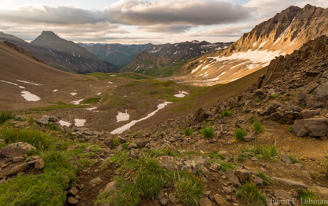
Really wide view of Yankee Boy Basin from Blue Lakes Pass.

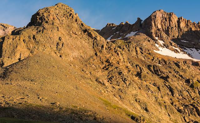
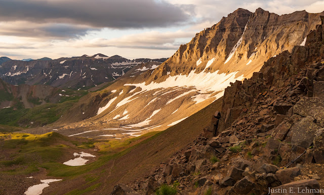
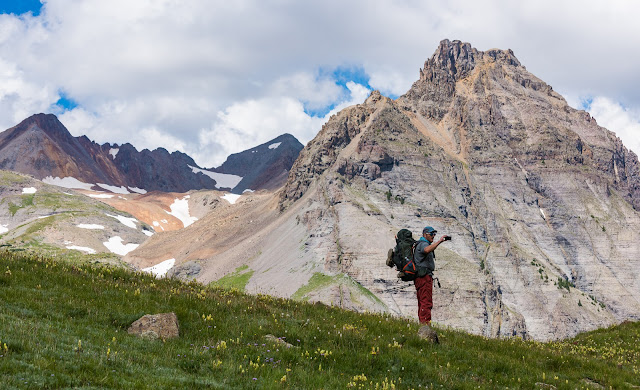
Awesome terrain along Mount Sneffels' SW Ridge, overlooking Gilpin Peak and Yankee Boy Basin.
Claron skilfully ascending challenging terrain on the SW Ridge of Mount Sneffels.
Claron skilfully ascending challenging terrain on the SW Ridge of Mount Sneffels.

If you look close you can see Jeff with his red backpack working up the SW Ridge.
The SW Ridge of Mount Sneffels is, indeed, steep and loose, but I found myself not noticing nearly as much; terrain that had felt challenging to me or uncomfortably loose on my past attempt I cruised up almost without noticing in most cases. There were a few challenging spots where the scrambling was in the "definitely don't make a mistake here" zone, but nothing felt overly-desperate or scary, and I certainly didn't meet an impassable obstacle...in fact, I didn't even recognize the crux (hardest part) until I reflected on the ridge retrospectively later that day...Turns out my perceived growth as a hiker and climber translated into actual growth.
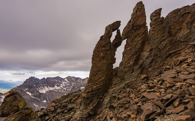
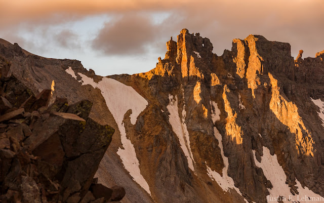
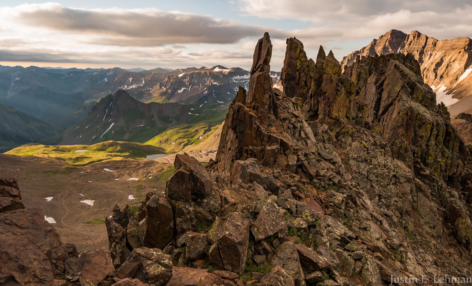
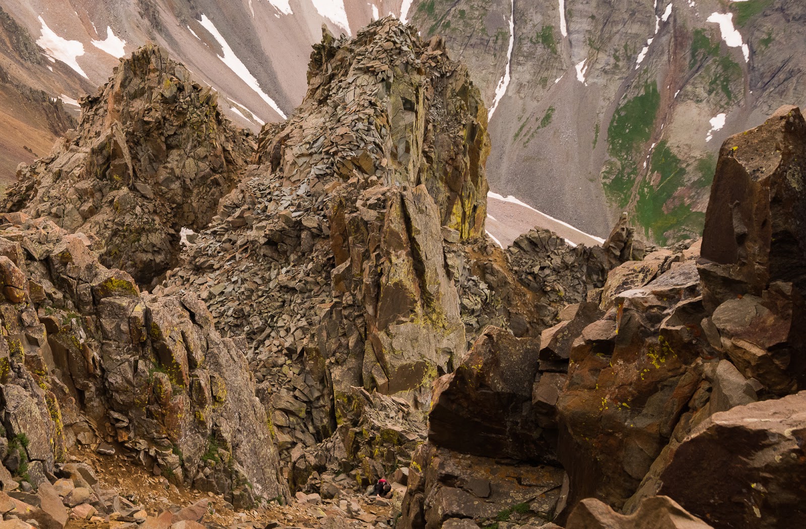
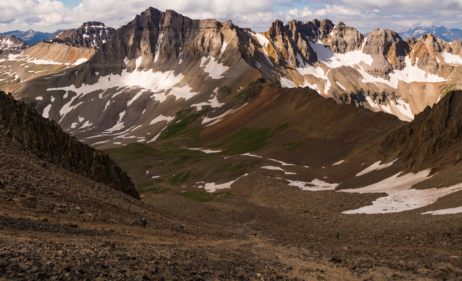
The famous "Kissing Camels" formation along the way up the Mount Sneffels SW Ridge. I had no idea how big these were, though I'd seen them in photos taken by others before our ascent...turns out they're not all that big - they're about 10-15 feet tall.
Jeff is just left of center here, about to come up past the "Kissing Camels" formation on the ridge.
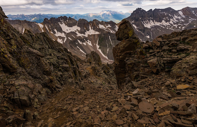
Neat views out toward Teakettle Mountain from the SW Ridge of Mount Sneffels.
As you get higher up the rock generally solidifies and the scrambling grows more enjoyable.

Claron and Jeff coming up the higher reaches of Mount Sneffels' SW Ridge.

One of my favorite "people pictures" from this whole trip - Matt and Sarah taking in the fantastic views from Mount Sneffels' summit.
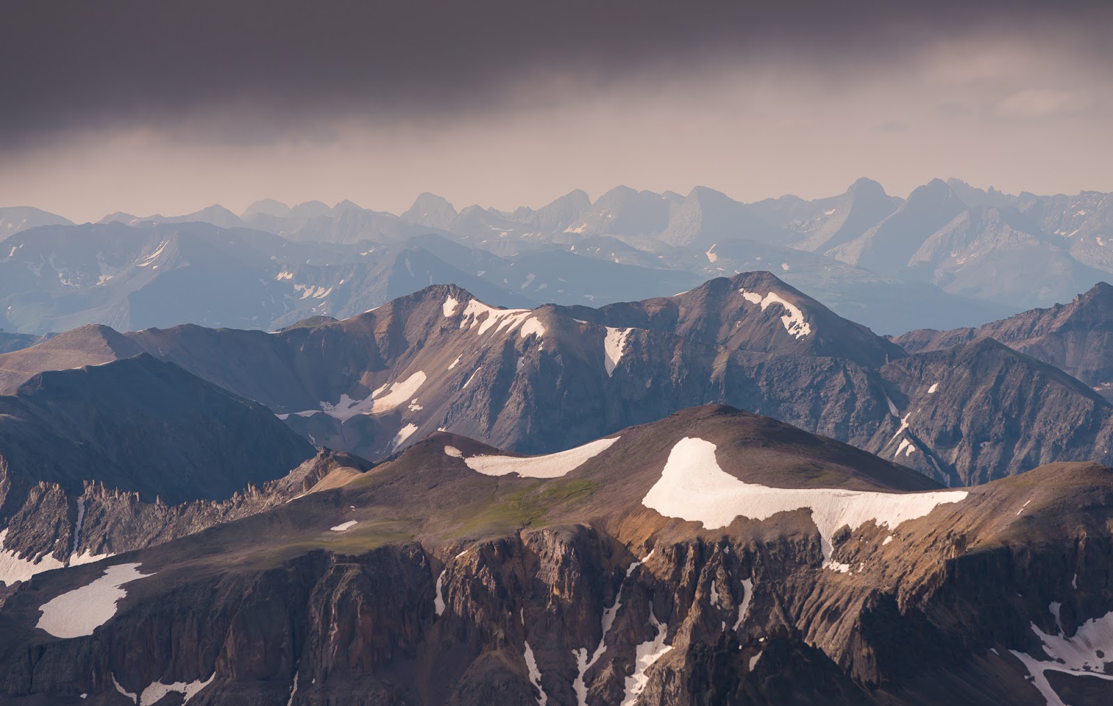
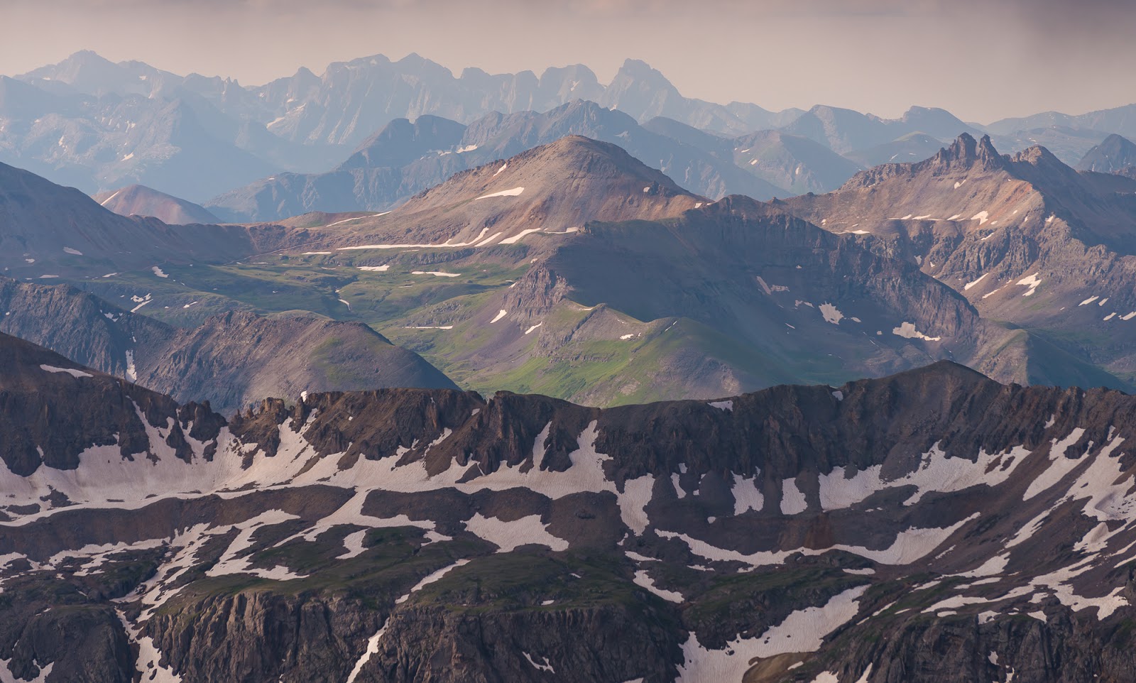
The haze in the air and overcast skies add a bit of mystery to this neat "gray-scaled" view of Wetterhorn Peak superimposed against the taller and more-distant Uncompahgre Peak a little over 30 miles beyond Mount Sneffels (seen on the upper right here).
This was a neat sight, from the summit of Mount Sneffels. Off on the right is a view of the Grenadier Range, where some friends and I did a short backpacking trip in 2016. We climbed Arrow Peak (13,809 feet) and visited parts of Vestal Peak (13,870 feet); Arrow Peak remains one of the finest single-peak scrambles I've ever had the pleasure of experiencing. The Grenadiers are the curved, interestingly sloping peaks near the upper right, and extending back toward the center from there. Nice to see old friends again.
This very dramatic shorter peak is called Kismet (13,694 feet); it's one of Mount Sneffels' neighbors.

This was another view I particularly enjoyed. The tall peaks in upper-center here (way out in the distance) are part of the Chicago Basin 14ers - Mount Eolus, North Eolus (unranked), Sunlight Peak, and Windom Peak. Two weeks after this trip I'd be aiming for all those peaks with my friend Dave, who had joined us on this trip for Mount Sneffels. Neat to catch a glimpse of what we hoped and aimed our future would be.

Matt's looking at me and Sarah's looking at someone else...whatever works, I guess (at least in this case).
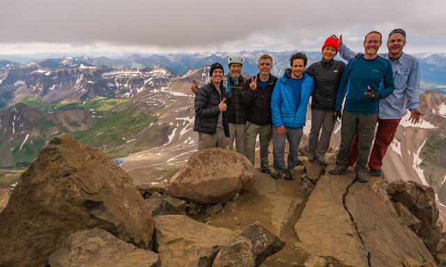
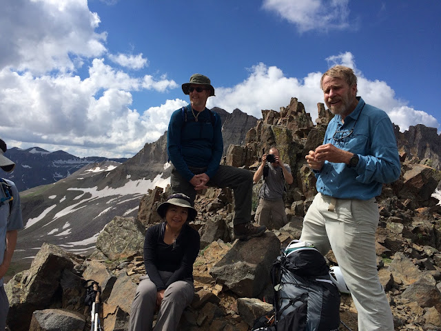
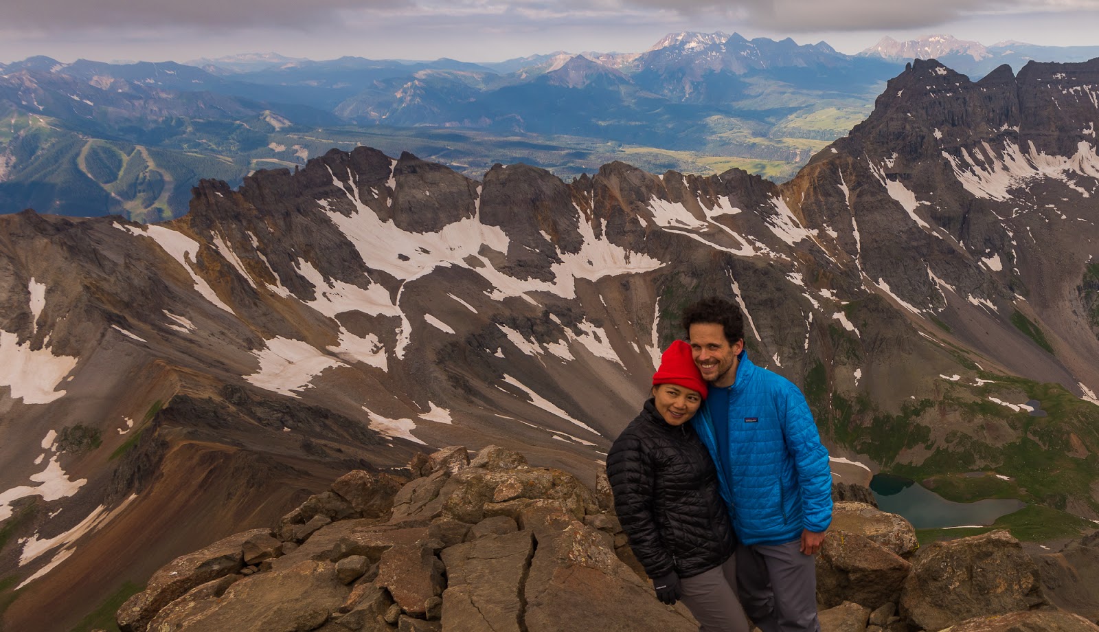
Group summit shot on top of Mount Sneffels. (L to R: Me, Claron, JEff, Matt, Sarah, Mitch, and Dave [being Dave]...Great group to share a sweet route and amazing summit with.
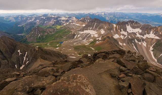
Mount Sneffels summit view - oriented more to Yankee Boy Basin (left side) than the Blue Lakes side (right). Gorgeous country out here!
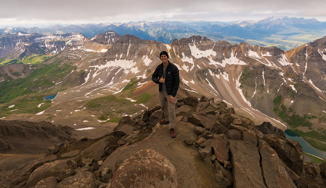
Me, at long last, on the summit of Mount Sneffels (14,150 feet) via the SW Ridge!

Me, at long last, on the summit of Mount Sneffels (14,150 feet) via the SW Ridge!
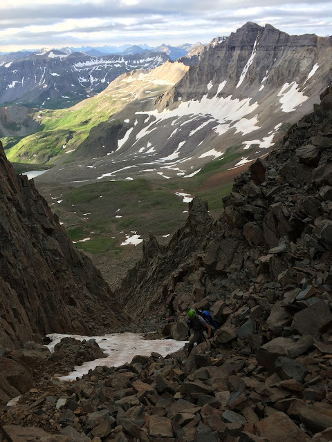
A broad view across the top of the Lavender Col just before I began my descent.

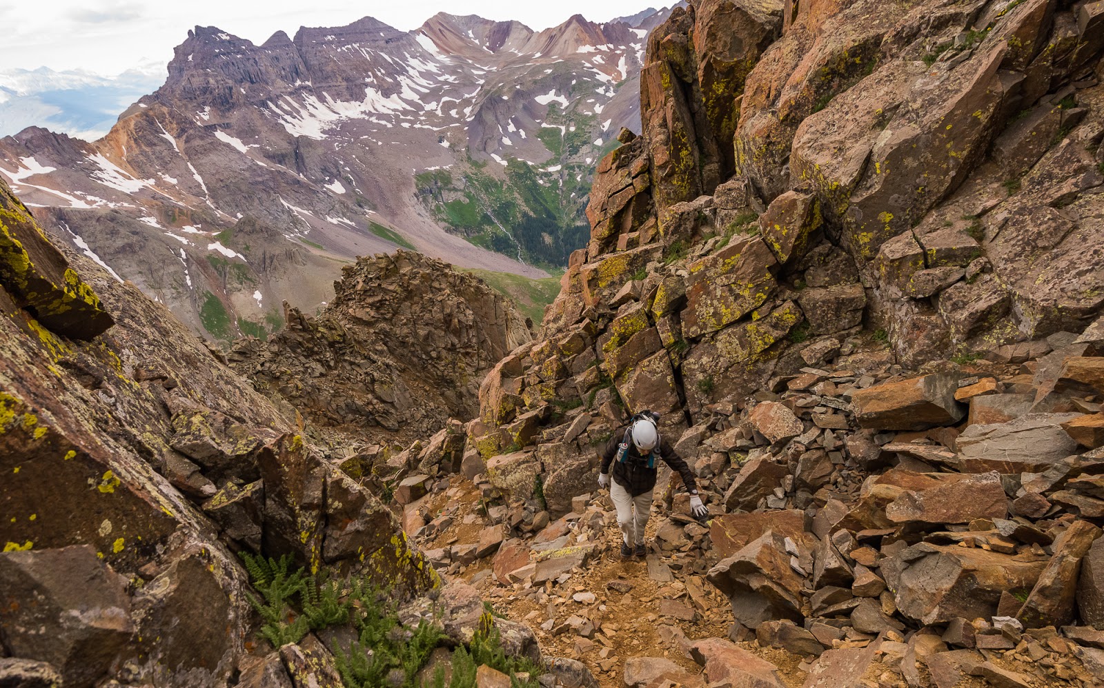
Looking down the Lavender Col...a great big slope of steep, loose garbage rock...definitely not my favorite thing to descend...and I was glad when I got to the bottom.
Working back up to Blue Lakes Pass after descending Lavender Col.
As it happened, Claron misplaced his wallet...it wasn't anywhere he thought it might be, and he largely disassembled his pack up there and wandered around on the pass up and down looking for it, only to find that it, as far as he could tell, wasn't anywhere he thought it wouldn't be either...He gave us some ideas as to where we might check down near our campsite at Upper Blue Lake and we all said we'd keep an eye out. Not much fun, but so it was.
A the top of Blue Lakes Pass with two other small groups of people (following our ascent back to the Pass after dropping down the Lavender Col on our descent into Yankee Boy Basin - looking back up the SW Ridge of Mount Sneffels that we'd ascended. This was about the time Claron realized his wallet wasn't with him...

Switchbacking down to Upper Blue Lake from Blue Lakes Pass.
We made a quick descent from Blue Lakes Pass down to our camp near Upper Blue Lake and soon had things torn down. Happily, Dave found Claron's missing wallet near where we'd stashed our food some distance from our campsite - and that was a good thing; it would alleviate a lot of stress for Claron (though we wouldn't be able to share the news till a number of hours later, after we'd packed out to the trailhead and driven to Montrose where we'd arranged to meet at a favorite restaurant of mine there, Pahgre's (named after Uncompahgre Peak, the tallest mountain in the San Juan's - their motto is "Pizza at its peak.", though they serve various Italian-esque offerings there).
Sarah hikes past super-rugged terrain on the way down from Blue Lakes Pass.
Sarah hikes on to our group campsite just above Upper Blue Lake.
Middle Blue Lake Detail.
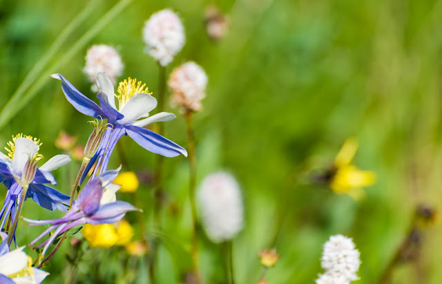
Beautiful columbines, Colorado's state flower, that we passed while descending toward Upper Blue Lake.
Dave, catching another glorious view with his phone camera as we begin our descent; this was above Middle Blue Lake, shortly before we began the steep drop down to Lower Blue Lake.
As I'd hoped, we were blessed to get some beautiful and direct sunlight on Lower Blue Lake - which proved the most vividly colored of the three Blue Lakes. Stunning!
As I'd hoped, we were blessed to get some beautiful and direct sunlight on Lower Blue Lake - which proved the most vividly colored of the three Blue Lakes. Stunning!
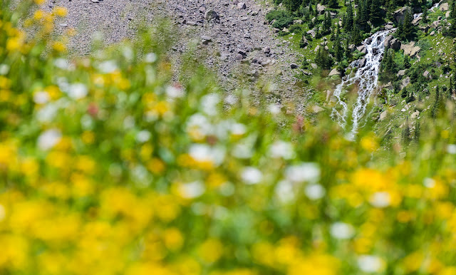
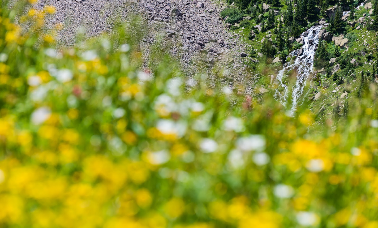
A pretty, flowery waterfall.
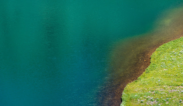
Minimalism against Lower Blue Lake. It was interesting the way the color of the lake shifted as we got nearer to the surface. Seen from above the Lower Blue Lake (in direct sunlight) is intensely blue, but here it's a much less intense hue, though still lovely.
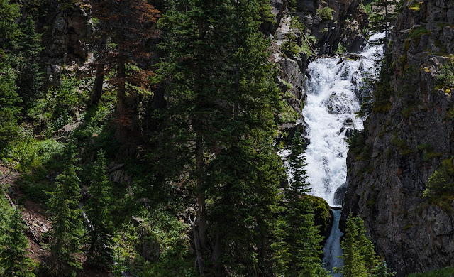
Waterfall seen on the way out toward the Blue Lakes TH.
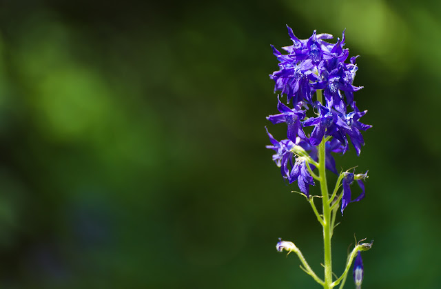
I like these kind of photographs that isolate a vibrant subject against a blurred background - particularly if that vibrant subject is a beautiful flower.

More lovely flowers along the Blue Lakes Trail.
Dave crossing a stream on the Blue Lakes Trail.
***Some photos from the trip by Dave.***

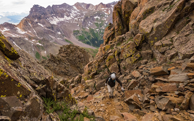
Mitch and I somewhere on Mount Sneffels SW Ridge.
Me working up one of the many steep gullies of Mount Sneffels' SW Ridge.
Me and Claron coming up Mount Sneffels' SW Ridge (I'm the green helmet near lower-center).

Claron and I getting up toward the "Kissing Camels" formation.
Dave took a picture of me taking a picture of other people on the summit of Mount Sneffels...I don't think the picture I was taking here "made the final cut" to be preserved...oh well.
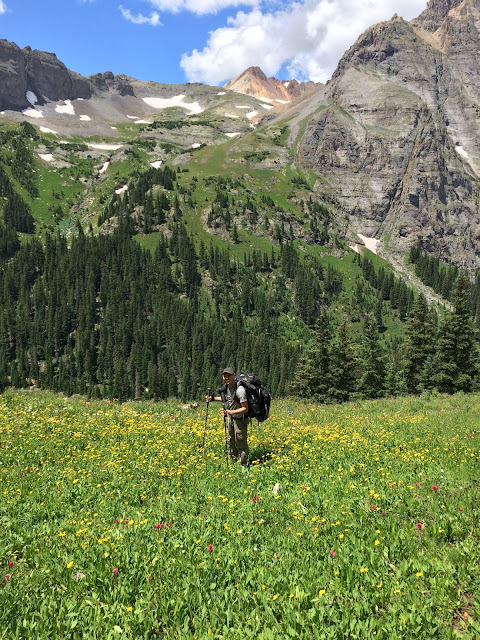
Don't mind me, just waltzing through the wildflowers with my home away from home strapped to my back.
***Some photos from the trip by Claron.***

Mitch and I putting our packs together at our parking area at the Blue Lakes TH.

Fun group summit shot on top of Mount Sneffels with our hearty crew. (Starting at front left and snaking back: Claron, Me, Jeff, Sarah, Mitch, Matt, and Dave [classily missing the photobomb opportunity so as not to steal the spotlight from all the rest of us together...] - Great folks here!)
CHECK IT OUT!
[ Soli Deo Gloria! ]
Views while ascending to Blue Lakes Pass en route to climb Mount Sneffels' SW Ridge.
I spent, with various others, the better part of a week in the San Juan Range of southwestern Colorado. In all, we summited three 14,000+ foot peaks and one 13,000+ foot peak, as well as completing the interesting and exciting via ferrata route near Telluride, CO. This post covers the Telluride via ferrata as well as our ascent of Mount Sneffels via the class 3 SW Ridge route.
There will be a lot of cumulative detail from the photo captions as this trip report - following my consistent habit - is very photo-intensive; I'll include other detail along the way as needed to tell the story, though, and to help you have a better sense of the lovely adventure this trip was for all who participated.
The logistical arrangements for this trip were more complicated than any I'd previously undertaken to lead; at most there would be seven of us at one place, coming from various approaches at various times and linking up at a predetermined place before pursuing a common destination - sometimes there would be as few as three of us...so that was fun to coordinate and actually carry out...
For me, the trip officially began Sunday afternoon as Claron, Mitch, and I met up at my apartment where I loaded my gear into Claron's car - this was the first major backpacking trip I'd ever done where I hadn't driven myself out there - which was a nice change, and one that allowed me to capture pictures of the drive in to various areas without having to stop, so there's more of that kind of thing along the way on this trip than what you'd see in previous years.
Our drive down was routine, with a couple of exceptions. First, out in the desert of Utah, near the San Rafael Swell area, we drove past a lovely storm with thick rain that was lit just right to produce one of the most vivid rainbows we'd seen in a long time; at one point we could see the full spans of a double rainbow, which is always a visual treat.

Dramatic cliffs on the drive through Utah; taken through the car window (hence the slightly blue tint).
One of the most vivid rainbows I've ever seen...certainly worth pulling over for during our drive out...

One of the most vivid rainbows I've ever seen...certainly worth pulling over for during our drive out...
My favorite shot of that particularly vivid rainbow we saw.
One of the most vivid rainbows I've ever seen...through the car window while driving again., but showing a bit of how bright the double rainbow got as well...amazing!
Quick sunset shot out the back windshield of the car on the way out...somewhere near Monticello, UT.
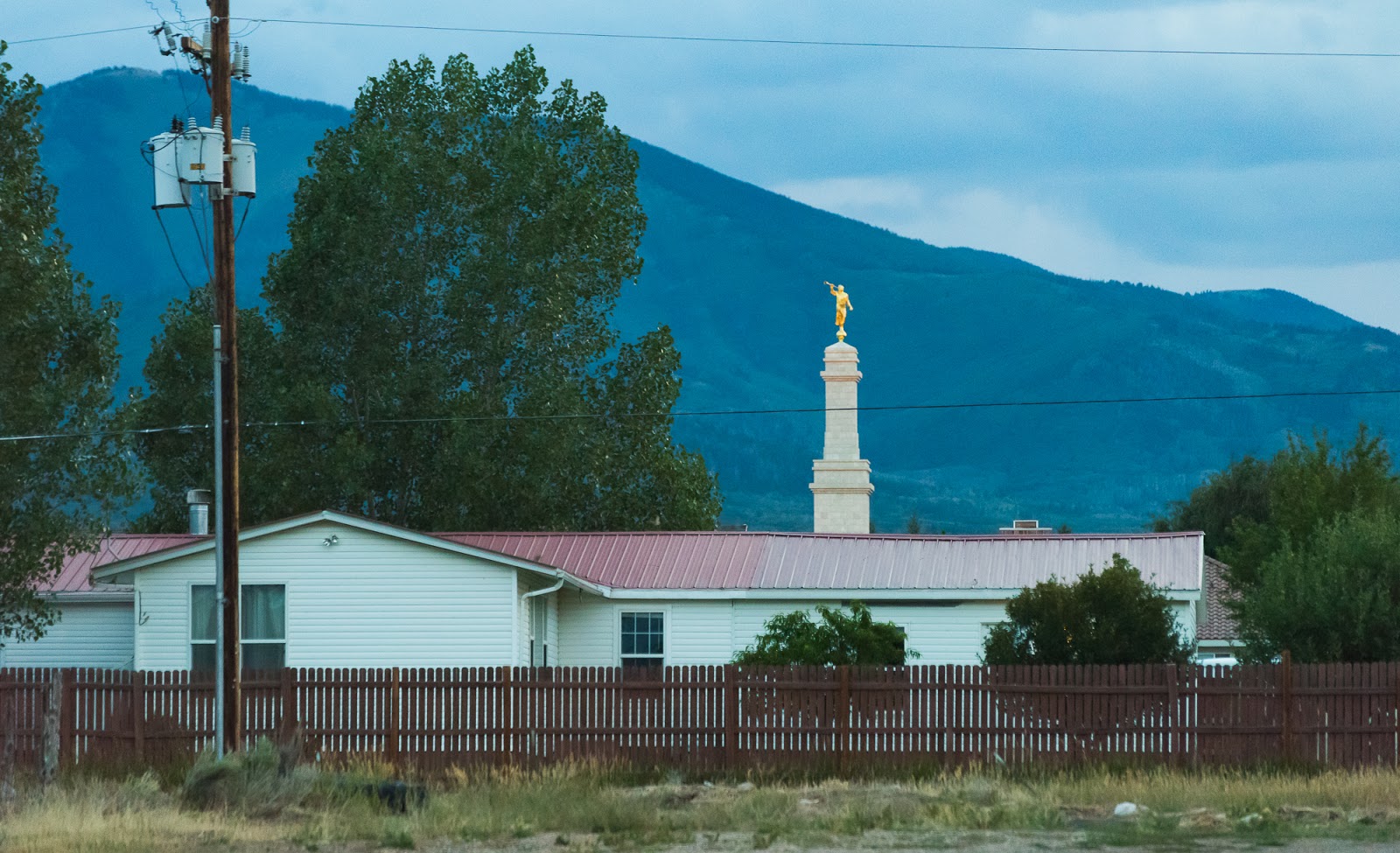
Caught this shot of the steeple and Angel Moroni statue that tops the Monticello Utah Temple of The Church of Jesus Christ of Latter-day Saints. The building in the foreground isn't part of the Temple.
We woke up around 7:00 AM on Monday and got things torn down at our camp outside Telluride; this was the only "formal" campsite we stayed at on the main part of our trip - everywhere else was a custom backcountry location we selected based on the various areas we were in and our objectives at each; there was one other formalized campsite we stayed at but that was not part of our original plan and doesn't figure in until late in the "Part 2" of this trip report...so, more on that later.
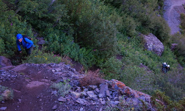
We found what we thought was the trailhead for the via ferrata just a bit outside Telluride; there really aren't any signs or overt visual indicators that you're in the right place. We parked in a large dirt pull-out area just before a sign that the rest of the road was high-clearance 4WD recommended; happily, this appeared to be the right place, and after spending some time there Matt and Sarah rolled up and joined us at the "trailhead". Claron had driven us to the route but was not going to do it with us, so he dropped us off and left to go do whatever on his own while Mitch, Matt, Sarah, and I did the via ferrata route (Claron talked about exploring the town of Telluride a bit but ended up taking a nice nap during most of the time).
We found what we thought was the trailhead for the via ferrata just a bit outside Telluride; there really aren't any signs or overt visual indicators that you're in the right place. We parked in a large dirt pull-out area just before a sign that the rest of the road was high-clearance 4WD recommended; happily, this appeared to be the right place, and after spending some time there Matt and Sarah rolled up and joined us at the "trailhead". Claron had driven us to the route but was not going to do it with us, so he dropped us off and left to go do whatever on his own while Mitch, Matt, Sarah, and I did the via ferrata route (Claron talked about exploring the town of Telluride a bit but ended up taking a nice nap during most of the time).

I caught this pic from near the parking area while waiting for Matt and Sarah to arrive so we could start the via ferrata route.
Later in the morning; shots of the cliffs near the via ferrata. The route goes up the other side of the box canyon (not visible here).
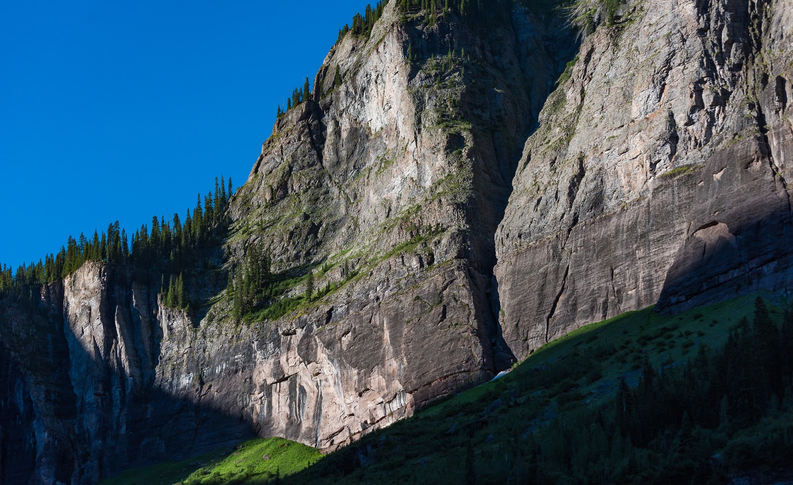
Later in the morning; shots of the cliffs near the via ferrata. The route goes up the other side of the box canyon (not visible here).

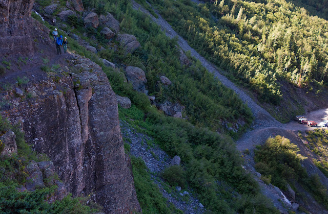
Scenes near the via ferrata route.
***The remainder of the shots from the via ferrata were taken with my small Sony RX100 camera; after the via ferrata the shots were taken with my Nikon D810 set up. Also, most of the rest of the via ferrata route detail will come from the following photos and the captions associated with them...***

Views from along the trail up to the via ferrata.

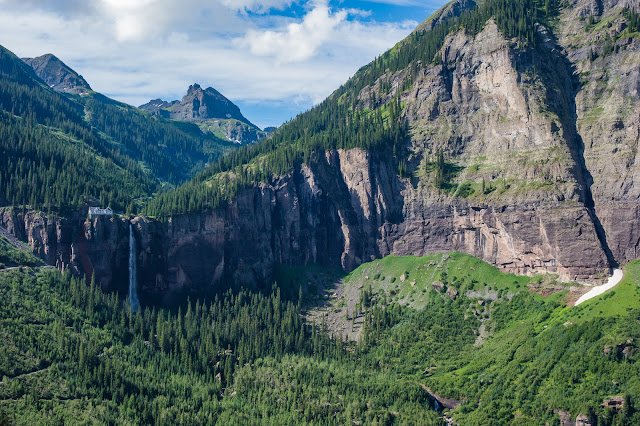
The trail passes very close to Colorado's scenic Bridal Veil Falls.
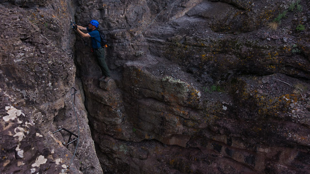
Via ferrata scenes.

Via ferrata scenes.
Via ferrata scenes.

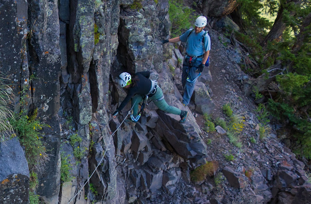
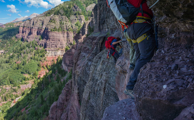
Sarah makes some moves on a cabled portion of the via ferrata route.

Sarah makes some moves on a cabled portion of the via ferrata route.
Matt gets in on the via ferrata cabled action.
Via ferrata scenes.
Via ferrata scenes.
Via ferrata scenes.

Waiting...and more waiting at "The Main Event" as the most-exposed section of the via ferrata route is called. The gentleman in the middle wasn't entirely comfortable with exposed heights...he, and another gentleman were part of a small guided group (led by the guy with the red backpack seen here); their guide was trying to coach him through how to move along the holds on this section...but it was slow going, so we stood here longer than anywhere else on the route. There isn't really any feasible way to pass people on this section, so we had to wait for them to complete this part before we started, then we were able to pass them as they took a break on the other side of this section. We weren't sure what someone who was uncomfortable with exposure to heights was doing on a via ferrata route anyway...

Waiting...and more waiting at "The Main Event" as the most-exposed section of the via ferrata route is called. The gentleman in the middle wasn't entirely comfortable with exposed heights...he, and another gentleman were part of a small guided group (led by the guy with the red backpack seen here); their guide was trying to coach him through how to move along the holds on this section...but it was slow going, so we stood here longer than anywhere else on the route. There isn't really any feasible way to pass people on this section, so we had to wait for them to complete this part before we started, then we were able to pass them as they took a break on the other side of this section. We weren't sure what someone who was uncomfortable with exposure to heights was doing on a via ferrata route anyway...
Matt's "patient face" while we wait some more before starting "The Main Event".

One more shot of the last guy in that slow-moving group before he goes around the bend on"The Main Event". This part of the route you're on a vertical cliff face holding on to metal handholds and stepping on similar (or identical) metal handholds with tremendous exposure right under you; it's a good time.
Via ferrata scenes.
I (carefully) snagged this picture of Mitch along "The Main Event" section of the route. To get this I had to balance on a small set of metal footholds while holding on to a metal handhold with my left hand while getting the camera out, turning it on, framing the shot and taking it and then putting the camera away while in that relatively precarious position. Other than the small metal footholds I was on at the time and the hold my left hand was clinging to there was nothing under me for hundreds of feet.

Mitch gets ready to complete "The Main Event" section of the via ferrata. Matt and Sarah can be seen a little further back on the route.
Mitch gets ready to complete "The Main Event" section of the via ferrata. Matt and Sarah can be seen a little further back on the route.
Sarah and Matt working their way along "The Main Event".

Sarah and Matt working their way along "The Main Event".
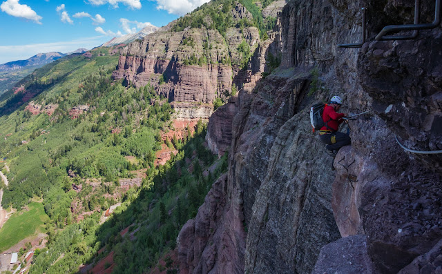
Having a great time on the via ferrata.
Some shots of a group coming along after us that give a better sense of the extreme exposure on "The Main Event" portion of the route.
Some shots of a group coming along after us that give a better sense of the extreme exposure on "The Main Event" portion of the route.

Some shots of a group coming along after us that give a better sense of the extreme exposure on "The Main Event" portion of the route.

Mitch makes an exposed clip into the cable on the adjacent wall that required a bit of a reach to get secured.

Mitch coming along another exposed portion of the route.

Mitch coming along another exposed portion of the route.

Sarah rounds a corner on the route.

...and there's Matt too...

Beautiful views along the way.

This section felt a bit like a light bouldering problem; pretty physical in nature - very leaned back while moving across the exposed section.
This section felt a bit like a light bouldering problem; pretty physical in nature - very leaned back while moving across the exposed section.
This section felt a bit like a light bouldering problem; pretty physical in nature - very leaned back while moving across the exposed section.
This section felt a bit like a light bouldering problem; pretty physical in nature - very leaned back while moving across the exposed section.

Sarah and Matt continue along one of the many exposed ledges on the route; much of the length of these exposed ledges were not protected with cables to clip into...Mostly, when the exposure became excessive, there were cables...but there were some cables in unnecessary places that were less-exposed than some places that didn't have cables...
Mining tailing ponds near the parking area...apparently now far busier than when we started - we were one of only a handful of cars when we started hiking...
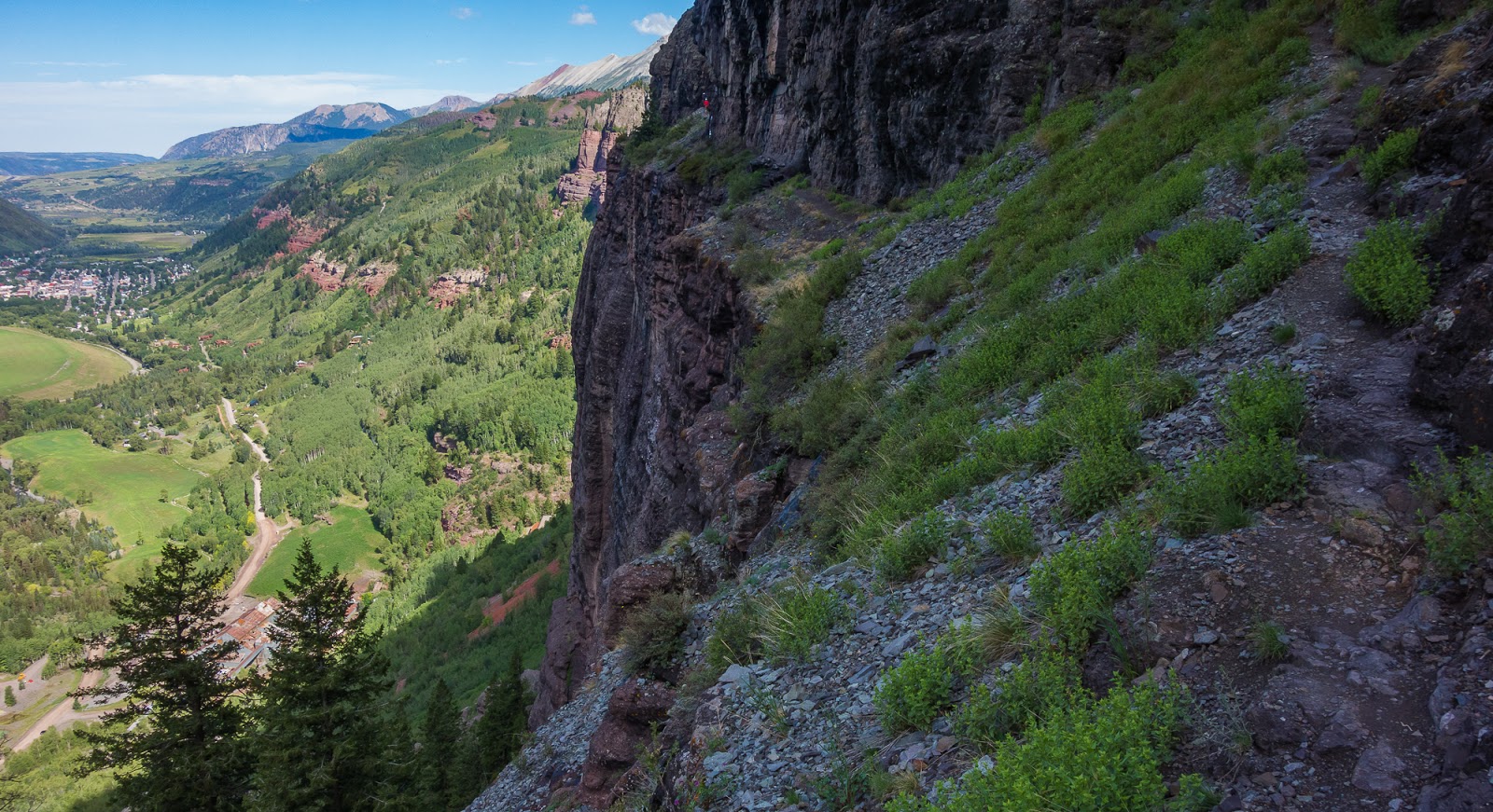
Looking back up at cliffs we'd traversed on the route as we descended back to the car. What fun!
***Some shots by Mitch***
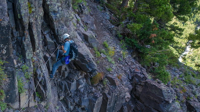
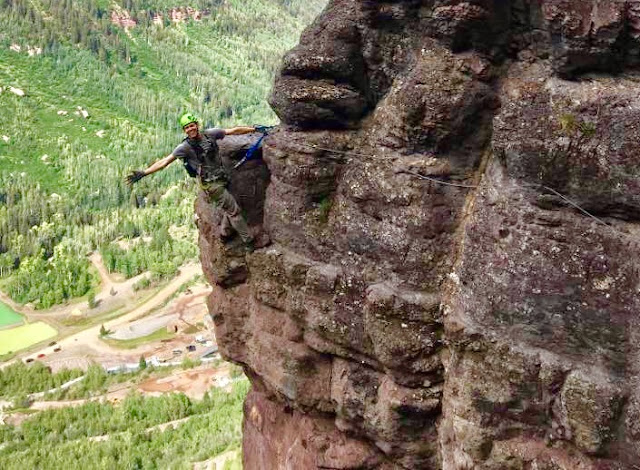
Me, on an exposed section of the via ferrata.

Apparently I trust my own grip pretty well...Such a sweet route!
Views from the drive to the Blue Lakes Trailhead; taken through the car window.
Views from the drive to the Blue Lakes Trailhead; taken through the car window.

Wetterhorn Peak, one of our later peak goals for this trip, is the prominent peak on the right here; seen through the car window on the way to the Blue Lakes TH.
Mount Sneffels, looking epic on the right side here; taken through the car window.
I rolled the window down for this one (Mount Sneffels is on the right here) - during part of the dirt road portion of the drive in to the Blue Lakes TH; we found the road very passable in our passenger car.
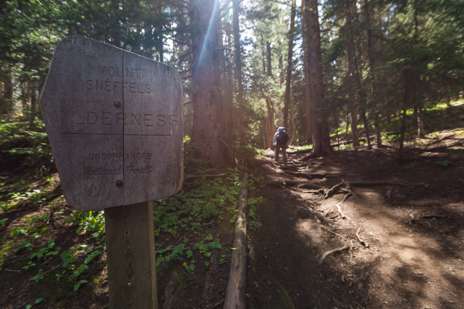
We caught up with Sarah and Matt on the trail about when we hit the official start of the Mount Sneffels Wilderness. Lovely forested terrain while working up to the Blue Lakes.
Gorgeous!
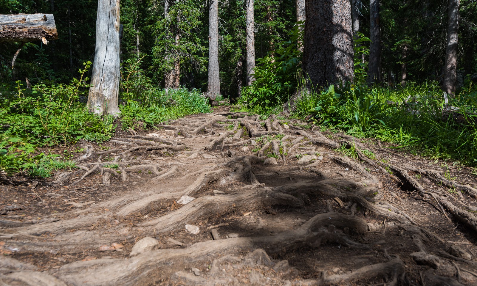
This section of trail was really neat with the thickly intertwining tree roots protruding from the surface of the ground.
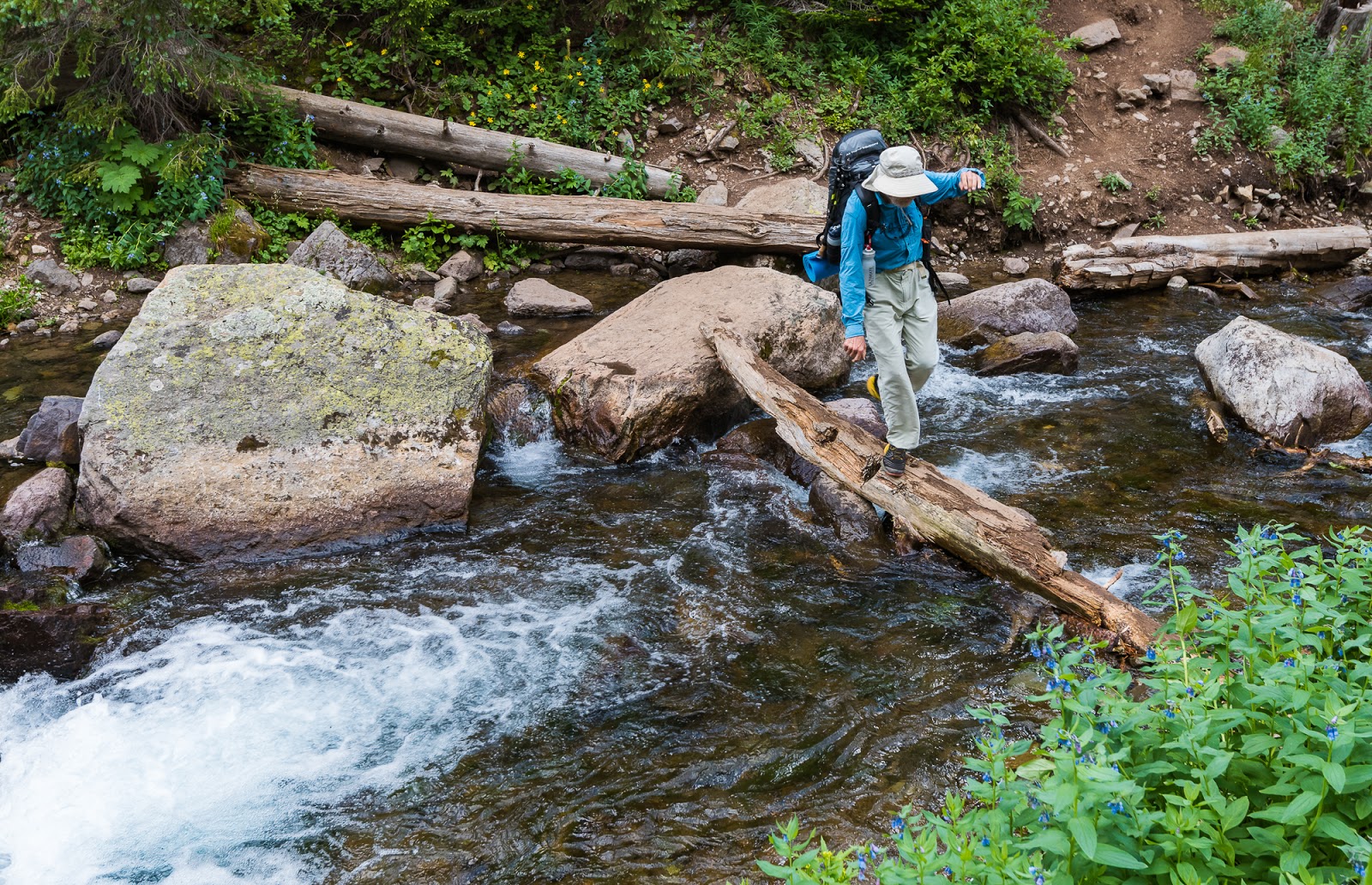
Claron rocking the most challenging stream crossing required on the route (it wasn't bad, but this was the "most interesting" one...).

Lower Blue Lake. While it was overcast when this picture was taken, when the sun hits this water it is spectacularly blue - one of the most colorfully beautiful lakes I've ever seen.

Lower Blue Lake with a little bit of indirect sun on it. Also, check out all those bloomin' flowers and Claron coming up the very steep trail between Lower and Middle Blue Lakes.

Flower close-up with a little snippet of Lower Blue Lake in the background.

Terrain above Middle Blue Lake on the way up to Upper Blue Lake; that's Mitch coming along the trail there.

Looking over Middle Blue Lake on the way to Upper Blue Lake.
Looking back across flower-strewn hillsides at the trail we'd taken past Middle Blue Lake; if you look close at the enlarged version of this picture you might be able to see Claron out there on the trail somewhere...he really is there...can you see him?
We found, somewhat to my surprise (and I imagine to their surprise at our appearance as well) one other tent up above Upper Blue Lake - a local-dwelling father and son combo who were backpacking through the area. We set up about 100 feet away from them in an area that looked large enough to us to facilitate the few tents our little group would bring together up there before our attempt on Mount Sneffels the following day.
We had one friend, Dave, who decided to drive from Utah ad hike in separately just to do Mount Sneffels as an overnighter (sounds like my kind of crazy trip) since he was able to get a couple of days off. Dave was already up there at Upper Blue Lake but he hadn't set up his own camp yet; he'd been exploring the area and waiting for us to get there; it was good to see him.
Soon enough all the people meeting at Blue Lakes to camp had arrived; one gentleman who'd be joining us for the duration of our peakbagging endeavors was going to be driving all night (literally) to join us at the top of Blue Lakes Pass the following day, but he'd be approaching from the Yankee Boy Basin side, opposite of where we were staying near the Blue Lakes. At our camp we had Matt and Sarah, Dave, Claron, Mitch, and myself; the gentleman meeting us on the pass the following morning was Jeff.
Camp set-up went normally. One bit of excitement was when Sarah pointed out the fact that there was an adult bear roaming across the hillside on the other side of Upper Blue Lake. We were all interested in the bear - for multiple reasons - and took a while watching it traversing the steep, high scree slopes across the lake. We were a bit amazed to see a bear so high up. Our camp was at about 11,800 feet above sea level (above tree line in this area) and the bear was roaming slopes higher than we were - likely over 12,000 feet above sea level. As many times as I've been outside and deep in various wilderness areas this was the first bear I've ever seen in the wild while hiking; I had previously seen one other bear in the wild two years previous to this while driving to an area in the La Sal Mountains of southern Utah, but they've been surprisingly/happily a rare sight. We had no issues with the bear during our time out there, but it always adds an interesting element to the trip knowing they're in the same area as you.

My first bear seen in the wild while I've been hiking! Traversing steep talus slopes over 12,000 feet above sea level like it's no big deal...
Terrain around Upper Blue Lake.
A Colorado local, who - with his son - was the only other party camping near Upper Blue Lake, is telling Sarah some story while they watch the bear traversing the slopes across the lake opposite from our campsite.
Bear-watching...
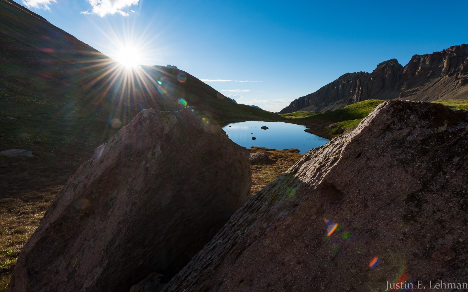
Evening sun over a small tarn near our campsite.
This reminds me of a view I've seen from somewhere in the Alps in Europe. Gorgeous!

Otherworldly perspectives from the edge of a partially frozen tarn I came across while exploring.

High flower meadows + a sunburst + glorious peaks = a good time!

Terrain above Upper Blue Lake.

Looking down on Lower Blue Lake from somewhere above Upper Blue Lake.

I love this peak - it borders Lower Blue Lake and is super-dramatic.
The interestingly-colored water is being illuminated by the reflection of the warm sunset light bouncing off the high peaks and cliffs above where I was standing - this effect led to some interesting shots of brightly colored water in the midst of shading, rolling tundra country I was passing through - you'll see those soon; the effect was stunning.
More terrain above Upper Blue Lake.
Neat reflected light as the sunset progresses.
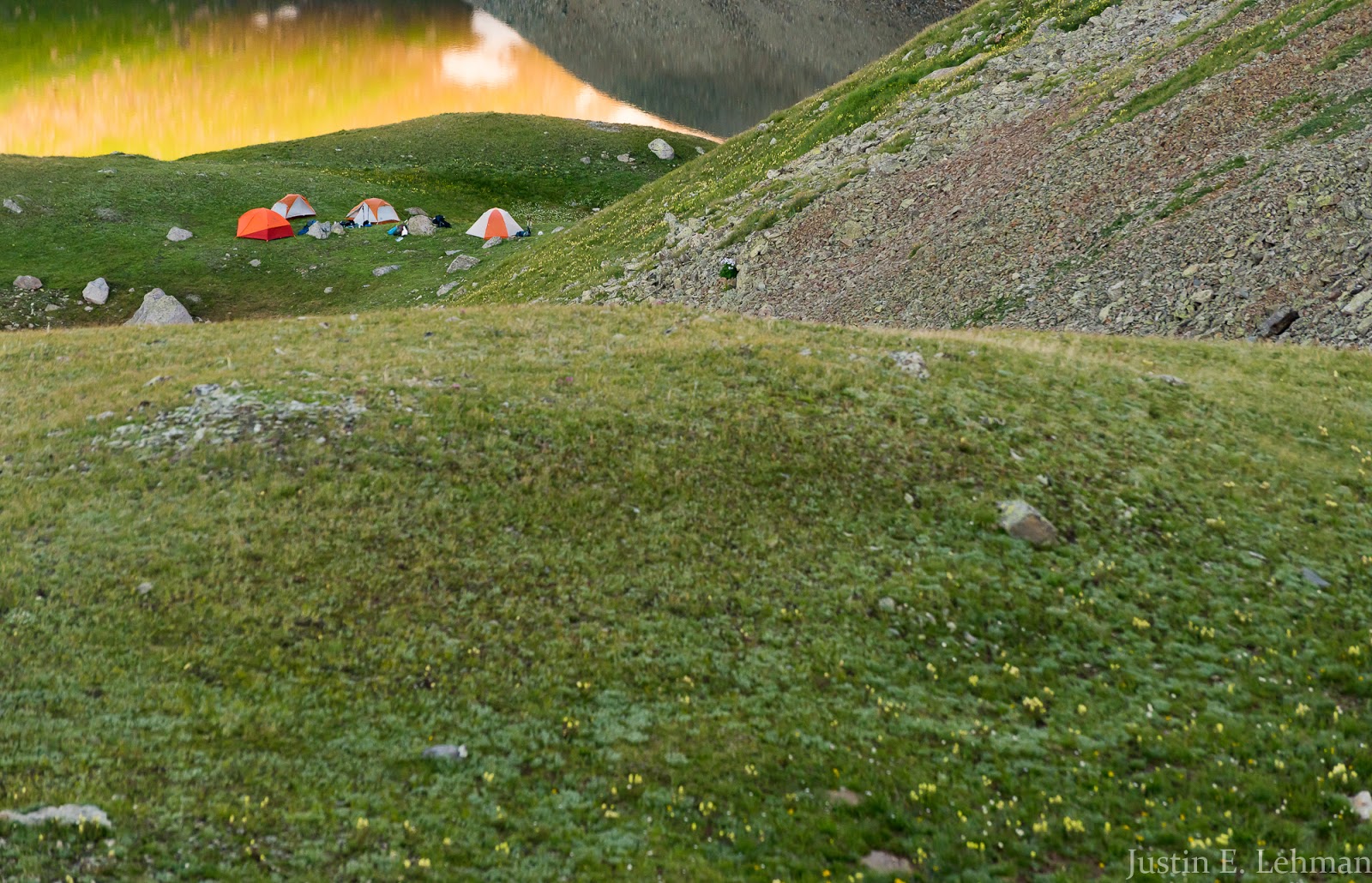
Our little campsite and reflected light on Upper Blue Lake.
Part of our view of Mount Sneffels' imposing ruggedness. Very impressive face here!

This came out a little impressionistic as I caught this slightly blurred reflection shot at a higher shutter speed.
I really liked this reflection shot - far more about the reflected light than about any specific reflection of form. Very cool to see!

Mount Sneffels reflected in a small tarn I found in my wanderings.
Rugged terrain above Upper Blue Lake reflected in a small flower-lined tarn at sunset.

A late view of the fading sunset across the tarn adjacent to our camping area; I like the way the clouds combine to frame things with the reflection here.

I had my gear all put away and was about to eat dinner when someone commented on how lovely the deep red was near the horizon, so I decided to grab my stuff and try to make an interesting capture of the last part of the sunset; I'm pleased with the result.
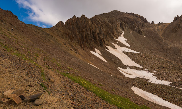
The following morning we were up and going before dawn - pounded down some quick breakfast and began our march around Upper Blue Lake to gain the steep, switchbacking trail that would lead us up to Blue Lakes Pass, right around 13,000 feet up. Happily, the ascent trail up to the high pass was much more pleasant than it looked like it would be from afar; there are some looser sections, but for the most part it goes at a not-terrible grade (steepness-wise) and is on decent terrain. We ended up getting started at various times - Matt and Sarah left earliest and so arrived sooner, and the rest of us went out in various little groups thereafter. Dave and I arrived at the pass about the same. We got to Blue Lakes Pass a little behind schedule (about 6:20 AM) but found Jeff wasn't there.
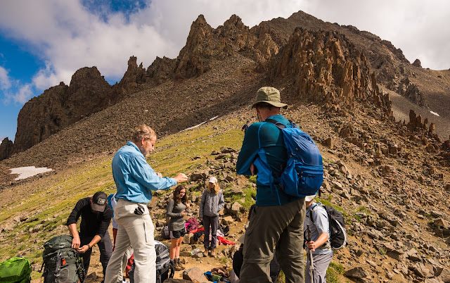
We all waited around for a while till everyone that had camped together at Upper Blue Lake had gotten up to the pass, which didn't take too long. Claron was the last one up but he had a pretty good excuse to be. All of us took light summit-geared packs up to the top of the pass except Claron, who brought his full pack up to the top of the pass with him. Here's the story: Jeff had to drive from Utah literally all night to get to Yankee Boy Basin and then hike up to Blue Lakes Pass on time to join us for the SW Ridge of Mount Sneffels, so we knew he'd be super tired. After hiking Mount Sneffels we'd have a multi-hour drive (about 4 hours total) ahead of us to get to the trailhead in another part of the San Juan Range where the next stages of our adventure would be...so our plan was to have Claron bring his gear up to Blue Lakes Pass, we all do the SW Ridge on Sneffels together, then descend via the standard Lavender Col route. Everyone but Jeff would hike back up to Blue Lakes Pass from Yankee Boy Basin (a shorter hike than what's required from the Blue Lakes side) and then Claron would grab his pack, meet Jeff at the upper parking area in Yankee Boy Basin and he'd drive to Montrose, CO while Jeff slept and we'd hike back down to our camp at Upper Blue Lake, tear down, and pack out before meeting up in Montrose for a group lunch. Jeff and Claron would arrive a good while before us since they wouldn't have to tear down camp and had a shorter approach from the Yankee Boy Basin/Ouray, CO area than what we'd have hiking out from the Blue Lakes trailhead area that was closer to Ridgway, CO - thus was the plan, anyway...but, it's now about 6:30 AM and there was still no sign of Jeff at the pass...
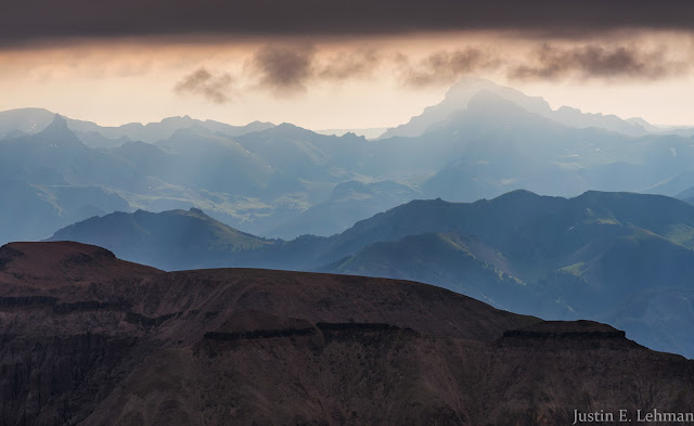
Matt and Sarah decided to get going up the route while the rest of us opted to hang out for a while longer to see if Jeff showed up. While we were waiting around, looking for signs of Jeff ascending through Yankee Boy Basin, I employed the time wandering around taking photographs of the area from the high pass. Among more average moments, there were a few instances of outstanding light through the somewhat overcast skies, and the views from Blue Lakes Pass, overlooking the Blue Lakes and Yankee Boy Basins at the same time, are stunning - blissfully rugged areas out there.
We all waited around for a while till everyone that had camped together at Upper Blue Lake had gotten up to the pass, which didn't take too long. Claron was the last one up but he had a pretty good excuse to be. All of us took light summit-geared packs up to the top of the pass except Claron, who brought his full pack up to the top of the pass with him. Here's the story: Jeff had to drive from Utah literally all night to get to Yankee Boy Basin and then hike up to Blue Lakes Pass on time to join us for the SW Ridge of Mount Sneffels, so we knew he'd be super tired. After hiking Mount Sneffels we'd have a multi-hour drive (about 4 hours total) ahead of us to get to the trailhead in another part of the San Juan Range where the next stages of our adventure would be...so our plan was to have Claron bring his gear up to Blue Lakes Pass, we all do the SW Ridge on Sneffels together, then descend via the standard Lavender Col route. Everyone but Jeff would hike back up to Blue Lakes Pass from Yankee Boy Basin (a shorter hike than what's required from the Blue Lakes side) and then Claron would grab his pack, meet Jeff at the upper parking area in Yankee Boy Basin and he'd drive to Montrose, CO while Jeff slept and we'd hike back down to our camp at Upper Blue Lake, tear down, and pack out before meeting up in Montrose for a group lunch. Jeff and Claron would arrive a good while before us since they wouldn't have to tear down camp and had a shorter approach from the Yankee Boy Basin/Ouray, CO area than what we'd have hiking out from the Blue Lakes trailhead area that was closer to Ridgway, CO - thus was the plan, anyway...but, it's now about 6:30 AM and there was still no sign of Jeff at the pass...
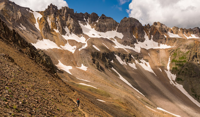
Matt and Sarah decided to get going up the route while the rest of us opted to hang out for a while longer to see if Jeff showed up. While we were waiting around, looking for signs of Jeff ascending through Yankee Boy Basin, I employed the time wandering around taking photographs of the area from the high pass. Among more average moments, there were a few instances of outstanding light through the somewhat overcast skies, and the views from Blue Lakes Pass, overlooking the Blue Lakes and Yankee Boy Basins at the same time, are stunning - blissfully rugged areas out there.

Fantastically rugged terrain seen from Blue Lakes Pass, about 12,800 feet up; Dallas Peak is the prominent peak on the right here.
Glimpses out into the ocean of peaks around Mount Sneffels.
Views from Blue Lakes Pass of the small partially frozen tarn I'd photographed the night previous...perspective is a powerful thing...

I loved this view of Gilpin Peak from Blue Lakes Pass - such beautiful light!

Super-dramatic terrain seen from Blue Lakes Pass under outstanding morning light.
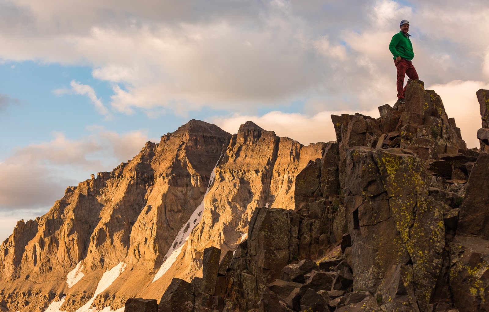
David being epic, as per usual.
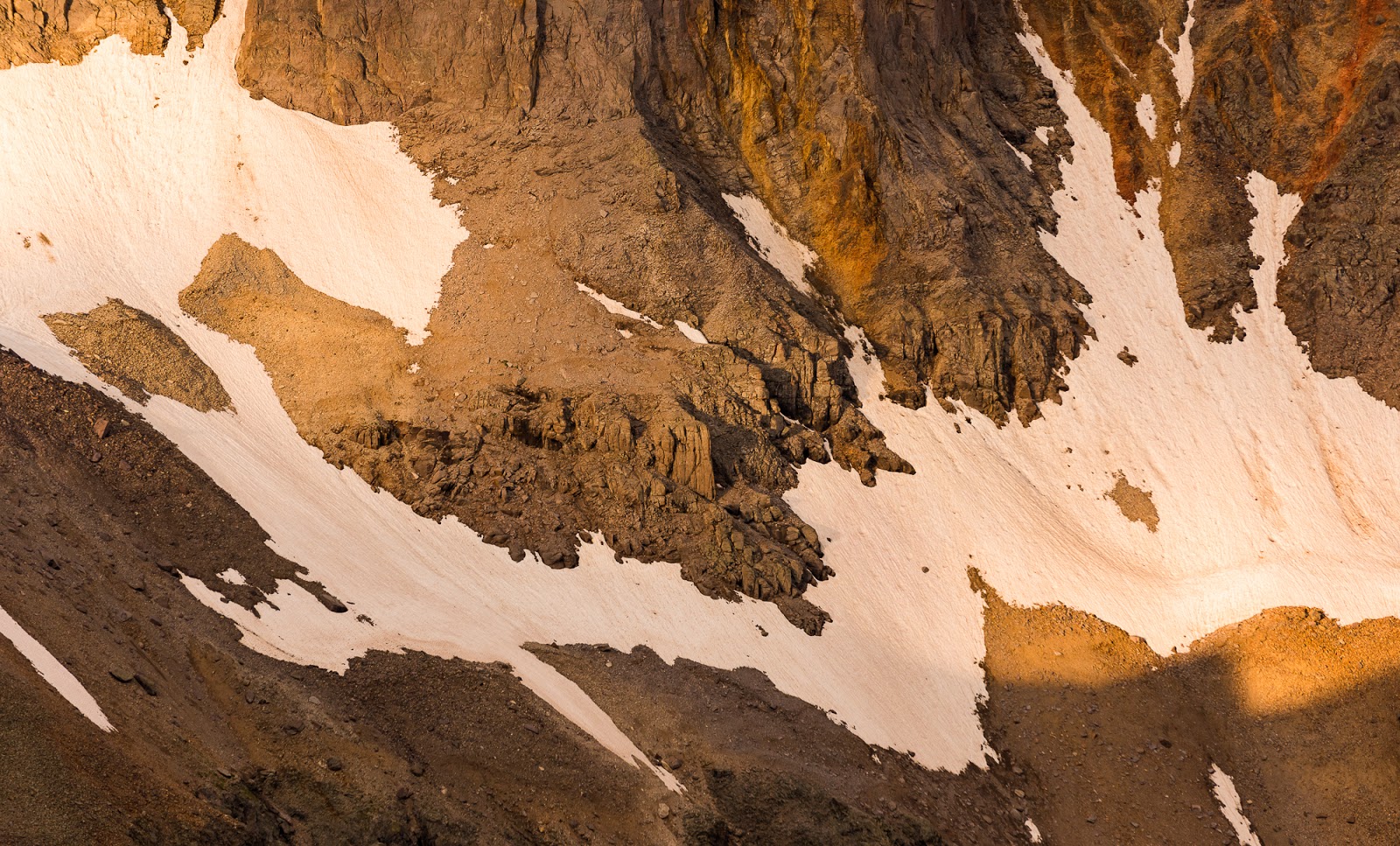
Terrain detail from Blue Lakes Pass.
Mitch takes in the views from Blue Lakes Pass.

Neat moment where the light was breaking across the ridge into the Yankee Boy Basin.
I love the way the high tundra out here looks under this low, warm light! Having a little snow still extant at this time of year was an added treat.

Wide view over Yankee Boy Basin from Blue Lakes Pass.

Really wide view of Yankee Boy Basin from Blue Lakes Pass.
Awesome terrain along Mount Sneffels' SW Ridge, overlooking Gilpin Peak and Yankee Boy Basin.
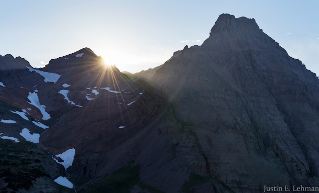
Closer to 7:00 AM, after watching for Jeff or his vehicle (we could see the upper parking area in Yankee Boy Basin from Blue Lakes Pass) without any sign of him we heard someone shouting for us from near the base of the Lavender Col route - it was Jeff! He had been heading toward the wrong route and ended up not parking at the high parking area...we shouted back at him and motioned for him to come on up to the pass, which he did in pretty short order, and - after a short breather on his part - we were off!
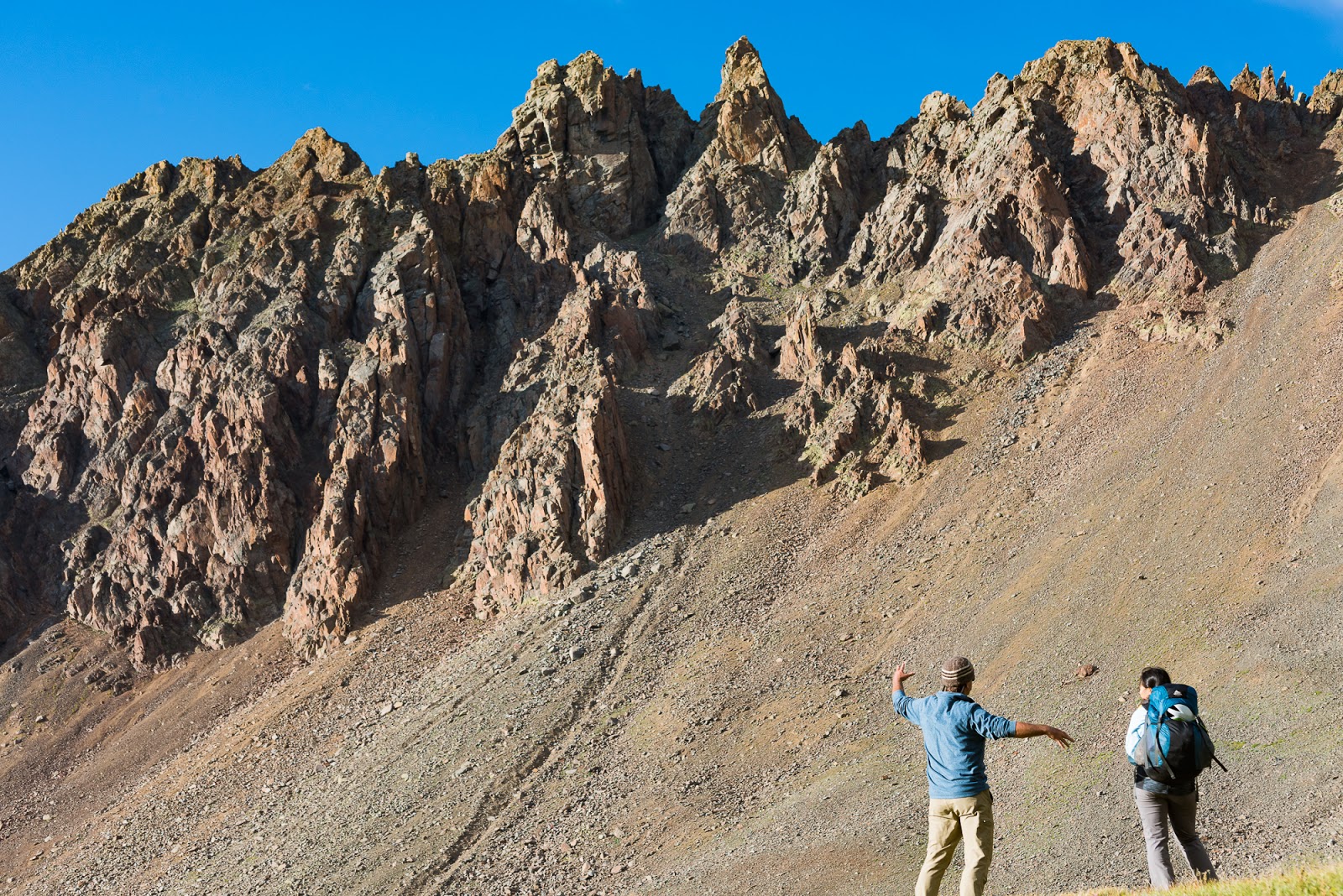
Now, this SW Ridge of Mount Sneffels was a particularly significant thing for me, seeing as this route was part of a very short list of peaks/routes I'd attempted that I had physically not been able to finish. Back in 2015 I did a trip that included Mount Sneffels as well as Wetterhorn Peak (which we'd be aiming for later on this trip). I ended up doing that trip as a solo and hit a section of ridgeline I couldn't figure out how to safely negotiate, so I turned back a few hundred feet shy of the summit. As a result of my past defeat, Mount Sneffels had been on my list since 2015; now I was approaching the same SW Ridge as a vastly more experienced hiker with a lot more strength from rock climbing and bouldering training for the last year and a half or so, and many, many more exposed peaks successfully navigated in other areas, so I was both determined and hopeful for a successful summit this time around. I was also very interested to see how I would interface with the ridge - which I remembered as being pretty sketchy and loose from my 2015 ascent.
Now, this SW Ridge of Mount Sneffels was a particularly significant thing for me, seeing as this route was part of a very short list of peaks/routes I'd attempted that I had physically not been able to finish. Back in 2015 I did a trip that included Mount Sneffels as well as Wetterhorn Peak (which we'd be aiming for later on this trip). I ended up doing that trip as a solo and hit a section of ridgeline I couldn't figure out how to safely negotiate, so I turned back a few hundred feet shy of the summit. As a result of my past defeat, Mount Sneffels had been on my list since 2015; now I was approaching the same SW Ridge as a vastly more experienced hiker with a lot more strength from rock climbing and bouldering training for the last year and a half or so, and many, many more exposed peaks successfully navigated in other areas, so I was both determined and hopeful for a successful summit this time around. I was also very interested to see how I would interface with the ridge - which I remembered as being pretty sketchy and loose from my 2015 ascent.
Claron skilfully ascending challenging terrain on the SW Ridge of Mount Sneffels.

Claron skilfully ascending challenging terrain on the SW Ridge of Mount Sneffels.
If you look close you can see Jeff with his red backpack working up the SW Ridge.

The famous "Kissing Camels" formation along the way up the Mount Sneffels SW Ridge. I had no idea how big these were, though I'd seen them in photos taken by others before our ascent...turns out they're not all that big - they're about 10-15 feet tall.

Jeff is just left of center here, about to come up past the "Kissing Camels" formation on the ridge.

Neat views out toward Teakettle Mountain from the SW Ridge of Mount Sneffels.

As you get higher up the rock generally solidifies and the scrambling grows more enjoyable.
Claron and Jeff coming up the higher reaches of Mount Sneffels' SW Ridge.
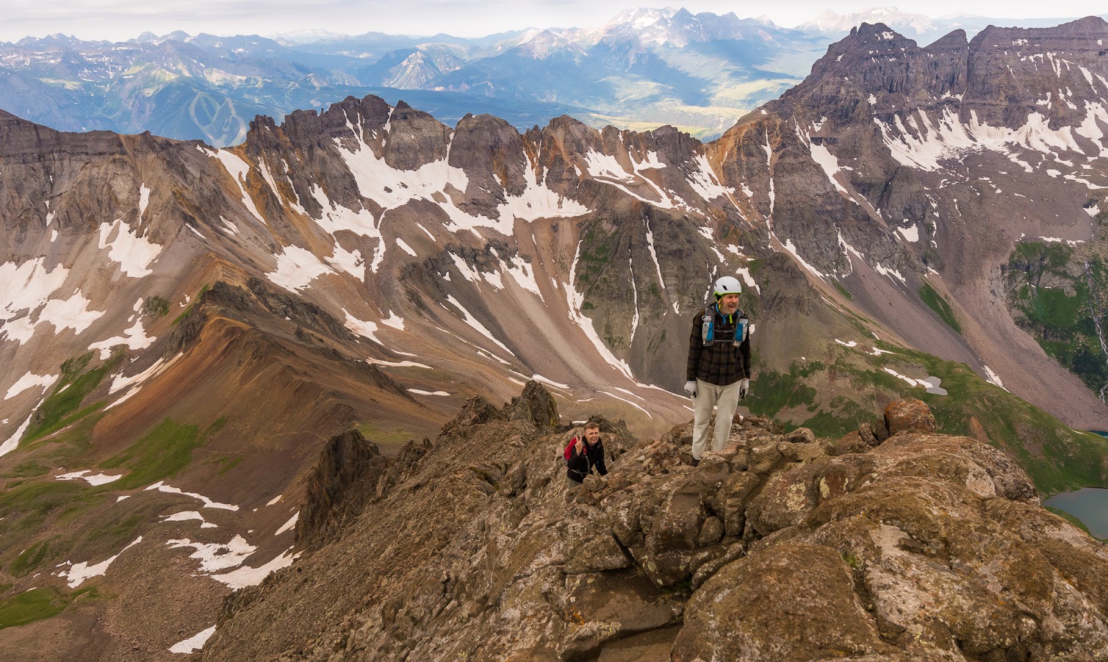
Not too long and I, with my friends, was on the summit of Mount Sneffels (14,150 feet) at long last! It was a great feeling, and the scrambling along the ridge got more enjoyable the further we ascended. For experienced scramblers the SW Ridge of Mount Sneffels represents an exciting alternative to the looseness of the standard ascent/descent route at Lavender Col; I highly recommend it to those with experience on exposed terrain. Sneffels is pretty attainable for most hikers (still with some class 2/3 scrambling near the top) via the standard Lavender Col route. The SW Ridge is considered one of the "classic 14er routes" in Colorado and it's understandable, now, having been there.
All seven summit hopefuls now having successfully made the transition into summit attainers, we had our individual and collective summit revels. Photos were taken, conversations were had, and that sweet glory of attaining an honorable goal was enjoyed by all.
All seven summit hopefuls now having successfully made the transition into summit attainers, we had our individual and collective summit revels. Photos were taken, conversations were had, and that sweet glory of attaining an honorable goal was enjoyed by all.
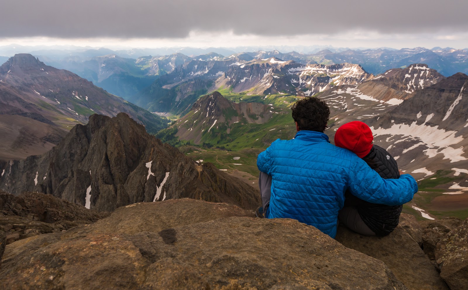
One of my favorite "people pictures" from this whole trip - Matt and Sarah taking in the fantastic views from Mount Sneffels' summit.

The haze in the air and overcast skies add a bit of mystery to this neat "gray-scaled" view of Wetterhorn Peak superimposed against the taller and more-distant Uncompahgre Peak a little over 30 miles beyond Mount Sneffels (seen on the upper right here).
This was a neat sight, from the summit of Mount Sneffels. Off on the right is a view of the Grenadier Range, where some friends and I did a short backpacking trip in 2016. We climbed Arrow Peak (13,809 feet) and visited parts of Vestal Peak (13,870 feet); Arrow Peak remains one of the finest single-peak scrambles I've ever had the pleasure of experiencing. The Grenadiers are the curved, interestingly sloping peaks near the upper right, and extending back toward the center from there. Nice to see old friends again.

This very dramatic shorter peak is called Kismet (13,694 feet); it's one of Mount Sneffels' neighbors.
This was another view I particularly enjoyed. The tall peaks in upper-center here (way out in the distance) are part of the Chicago Basin 14ers - Mount Eolus, North Eolus (unranked), Sunlight Peak, and Windom Peak. Two weeks after this trip I'd be aiming for all those peaks with my friend Dave, who had joined us on this trip for Mount Sneffels. Neat to catch a glimpse of what we hoped and aimed our future would be.
Matt's looking at me and Sarah's looking at someone else...whatever works, I guess (at least in this case).

Group summit shot on top of Mount Sneffels. (L to R: Me, Claron, JEff, Matt, Sarah, Mitch, and Dave [being Dave]...Great group to share a sweet route and amazing summit with.

Mount Sneffels summit view - oriented more to Yankee Boy Basin (left side) than the Blue Lakes side (right). Gorgeous country out here!

Me, at long last, on the summit of Mount Sneffels (14,150 feet) via the SW Ridge!
Me, at long last, on the summit of Mount Sneffels (14,150 feet) via the SW Ridge!
Having enjoyed some time at the summit and captured all the requisite photos that were desired (amongst all parties) we decided to head down...only to realize that while most of us had read up pretty extensively on ascending the SW Ridge none of us (apart from me) had any idea of how the descent down to the top of the Lavender Col was supposed to go. The Col itself is obvious, but there's a fair amount of complicated terrain between there and, having never ascended the Lavender Col route, we didn't have the memory of our ascent there to aid us on the way down...so we had a lovely route-finding adventure and it seemed we all took pretty divergent paths on our way down to the Lavender Col's top, but make it we did - one and all.
Of the descent on Lavender Col, I'll only say it was about as loose and terrible as expected. A tip: Descending on the somewhat larger rocks is far better than trying to descend on the "more open areas" - especially avoid the light-colored areas...the rocks there tend to be like ball-bearings (which are not so fun to descend long ,steep slopes on...). Amazingly, we caused almost no rockfall that put anyone in danger...rocks moved quite consistently, but never seemed to slide far enough to become a problem for anyone else around or below. I did hear several significant rockfalls falling down into the Col from somewhere high on the SW Ridge - apparently dislodged by someone's ascent there, but we were well-away from the ridge on our descent, mostly being toward the middle or left side (looking down from the top of the Col). We all made it fine, and everyone but Jeff headed back up Blue Lakes Pass. Jeff headed back down to the upper parking area to wait for Claron (who, as you may recall, had carried his big pack up to Blue Lakes Pass earlier that morning and was going to pack down with Jeff and drive for a while so Jeff could sleep).
Of the descent on Lavender Col, I'll only say it was about as loose and terrible as expected. A tip: Descending on the somewhat larger rocks is far better than trying to descend on the "more open areas" - especially avoid the light-colored areas...the rocks there tend to be like ball-bearings (which are not so fun to descend long ,steep slopes on...). Amazingly, we caused almost no rockfall that put anyone in danger...rocks moved quite consistently, but never seemed to slide far enough to become a problem for anyone else around or below. I did hear several significant rockfalls falling down into the Col from somewhere high on the SW Ridge - apparently dislodged by someone's ascent there, but we were well-away from the ridge on our descent, mostly being toward the middle or left side (looking down from the top of the Col). We all made it fine, and everyone but Jeff headed back up Blue Lakes Pass. Jeff headed back down to the upper parking area to wait for Claron (who, as you may recall, had carried his big pack up to Blue Lakes Pass earlier that morning and was going to pack down with Jeff and drive for a while so Jeff could sleep).

A broad view across the top of the Lavender Col just before I began my descent.
Looking down the Lavender Col...a great big slope of steep, loose garbage rock...definitely not my favorite thing to descend...and I was glad when I got to the bottom.

Working back up to Blue Lakes Pass after descending Lavender Col.

A the top of Blue Lakes Pass with two other small groups of people (following our ascent back to the Pass after dropping down the Lavender Col on our descent into Yankee Boy Basin - looking back up the SW Ridge of Mount Sneffels that we'd ascended. This was about the time Claron realized his wallet wasn't with him...
Switchbacking down to Upper Blue Lake from Blue Lakes Pass.

Sarah hikes past super-rugged terrain on the way down from Blue Lakes Pass.

Sarah hikes on to our group campsite just above Upper Blue Lake.

Middle Blue Lake Detail.

Beautiful columbines, Colorado's state flower, that we passed while descending toward Upper Blue Lake.

Dave, catching another glorious view with his phone camera as we begin our descent; this was above Middle Blue Lake, shortly before we began the steep drop down to Lower Blue Lake.
As I'd hoped, we were blessed to get some beautiful and direct sunlight on Lower Blue Lake - which proved the most vividly colored of the three Blue Lakes. Stunning!

As I'd hoped, we were blessed to get some beautiful and direct sunlight on Lower Blue Lake - which proved the most vividly colored of the three Blue Lakes. Stunning!
A pretty, flowery waterfall.

Minimalism against Lower Blue Lake. It was interesting the way the color of the lake shifted as we got nearer to the surface. Seen from above the Lower Blue Lake (in direct sunlight) is intensely blue, but here it's a much less intense hue, though still lovely.
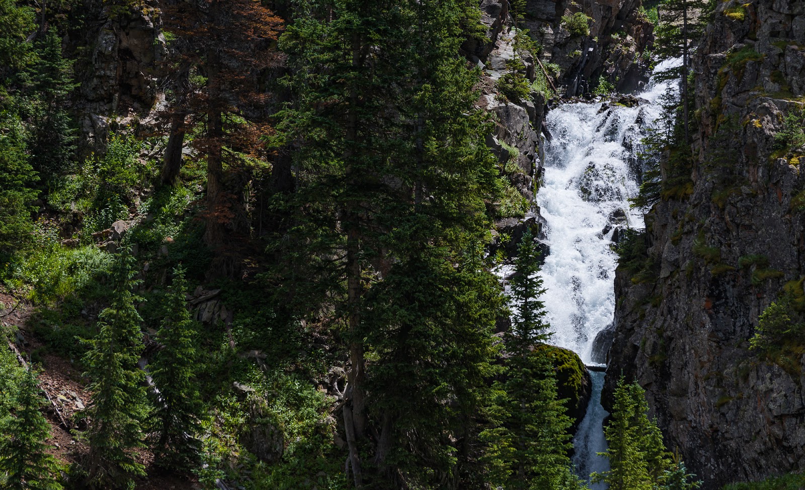
Waterfall seen on the way out toward the Blue Lakes TH.

I like these kind of photographs that isolate a vibrant subject against a blurred background - particularly if that vibrant subject is a beautiful flower.
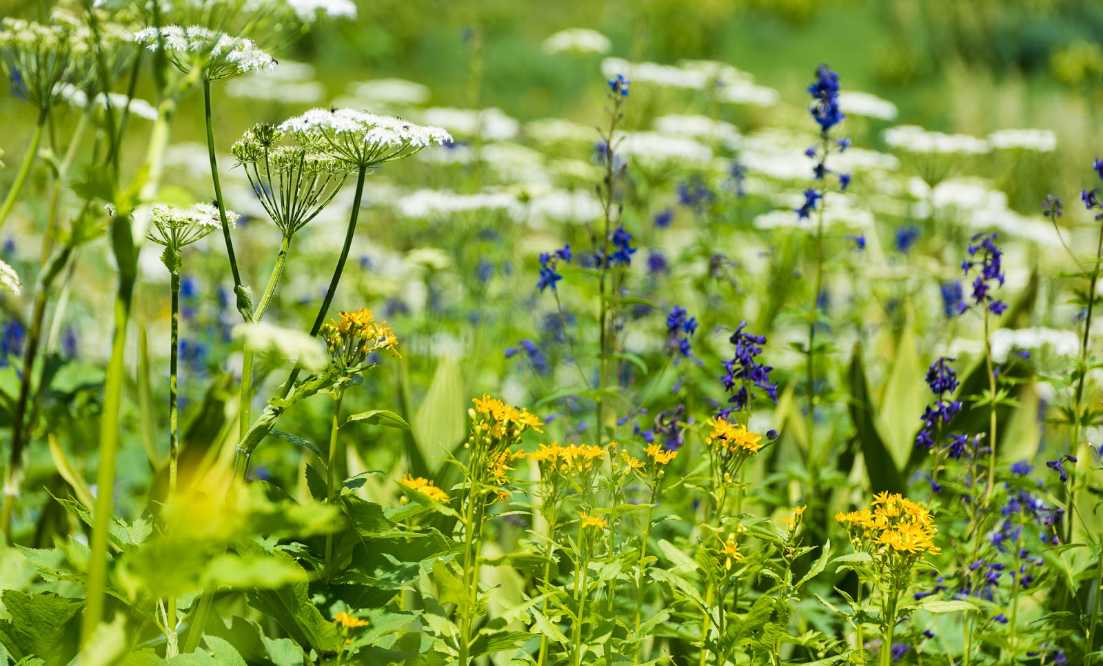
More lovely flowers along the Blue Lakes Trail.
Dave crossing a stream on the Blue Lakes Trail.
***Some photos from the trip by Dave.***
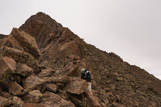
Mitch and I somewhere on Mount Sneffels SW Ridge.

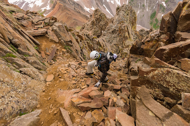
Me working up one of the many steep gullies of Mount Sneffels' SW Ridge.

Me and Claron coming up Mount Sneffels' SW Ridge (I'm the green helmet near lower-center).
Claron and I getting up toward the "Kissing Camels" formation.

Dave took a picture of me taking a picture of other people on the summit of Mount Sneffels...I don't think the picture I was taking here "made the final cut" to be preserved...oh well.

Don't mind me, just waltzing through the wildflowers with my home away from home strapped to my back.
***Some photos from the trip by Claron.***
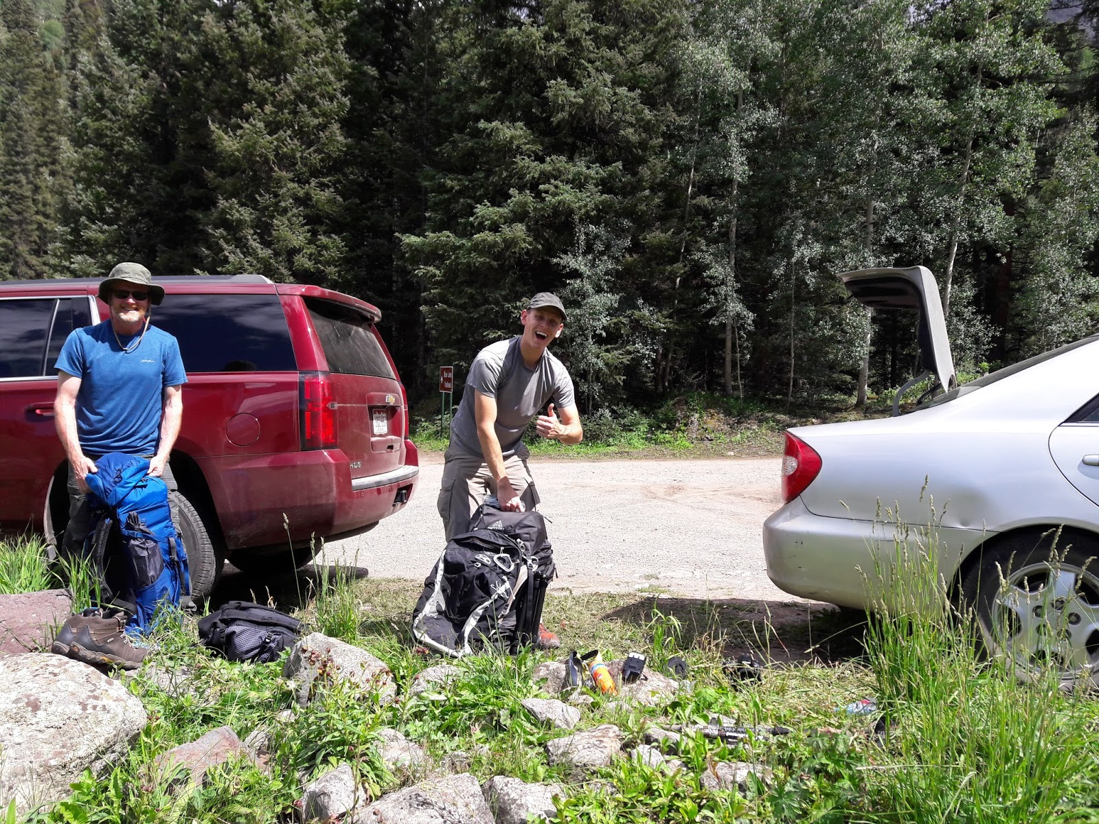
Mitch and I putting our packs together at our parking area at the Blue Lakes TH.
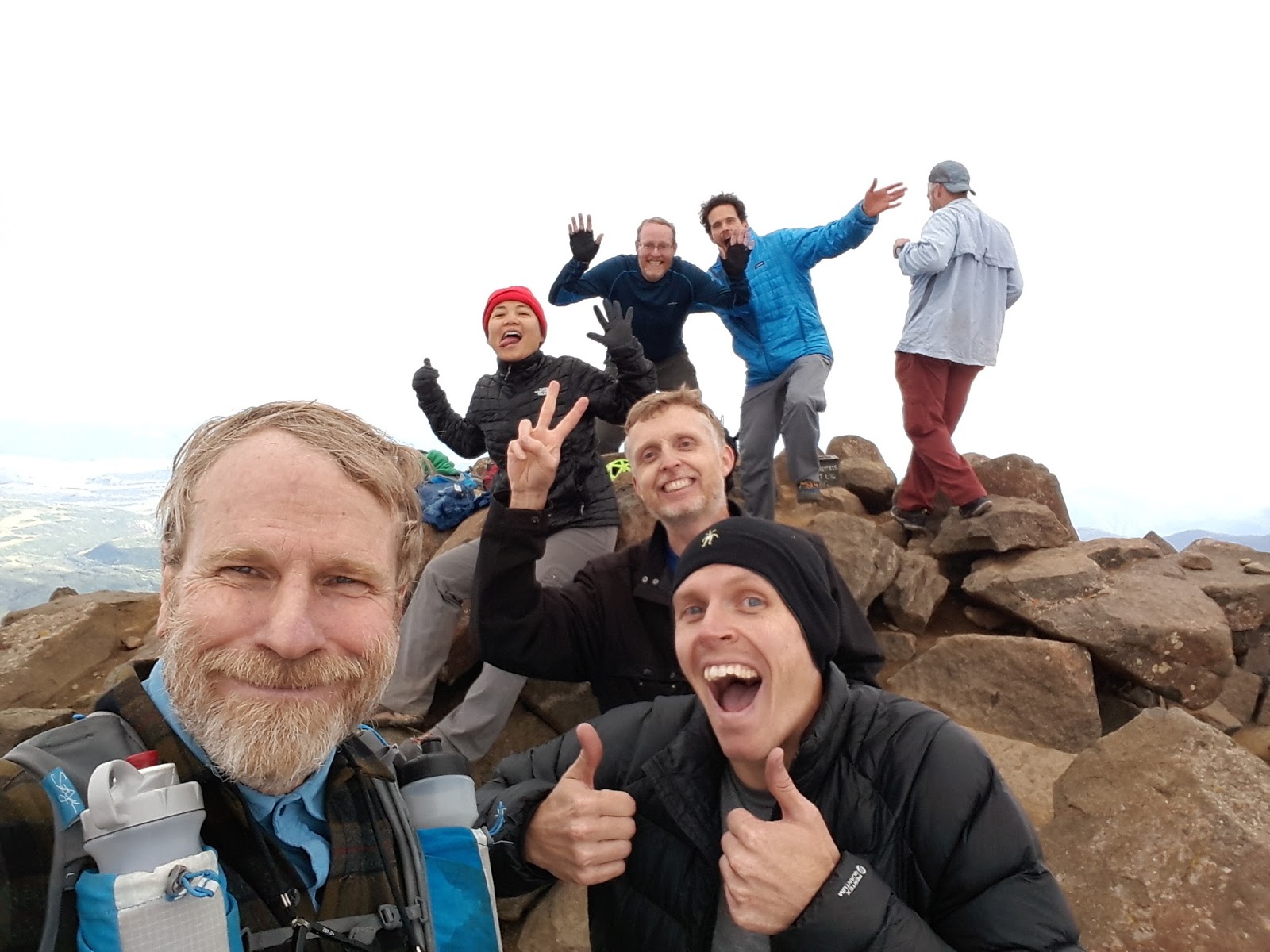
Fun group summit shot on top of Mount Sneffels with our hearty crew. (Starting at front left and snaking back: Claron, Me, Jeff, Sarah, Mitch, Matt, and Dave [classily missing the photobomb opportunity so as not to steal the spotlight from all the rest of us together...] - Great folks here!)
THE ADVENTURE CONTINUES IN Part 2: Wetterhorn, Matterhorn, and Uncompahgre Peaks, and Black Canyon of the Gunnison National Park - Colorado Trip # 1 - 2017
CHECK IT OUT!
[ Soli Deo Gloria! ]