- Joined
- Dec 2, 2019
- Messages
- 182
I had hiked portions of the Boulder Mail Trail (BMT) as day-hikes several times previously, but had always wanted to walk its entire length from the old Boulder airstrip to the town of Escalante.
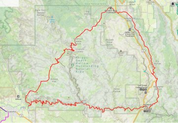
The hike I had planned would be a 'triangular' loop route, starting at the Escalante River Trailhead, with the BMT forming the 2nd 'side' of the triangle. The final portion would be the well-known hike along the river from Escalante, finishing back at the trailhead.
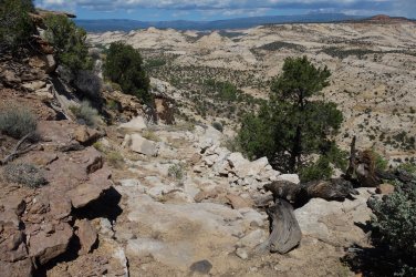
The tricky part in planning the hike was the first section from the river trailhead, north to the airstrip, through an area that is little visited. I found most of the information I needed from a trip report on Debra Van Winegarden's excellent website. Her route starts 4 miles north of the Escalante River Trailhead at the roadside and drops east into Dry Hollow along an old constructed cattle trail (called the Claude V. Cutoff), before paralleling Highway 12 for a further 8 miles.
Gaia GPS map
.
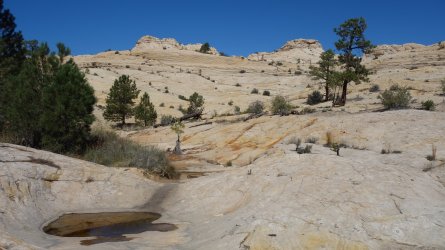
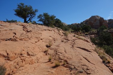
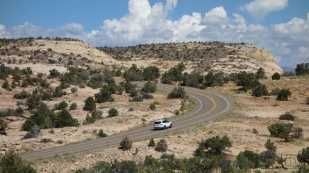
Starting at the trailhead, I briefly followed the riverside trail eastwards before clambering up onto the slickrock surrounds. After the initial scramble up, I got quite the surprise when I emerged from the small gulley. There was, in fact, and old wagon trail which wound its way along the sandy washes and around the imposing slickrock domes. The surrounding terrain was quite a bit more complicated than I had imagined, so having this constructed route to follow was a godsend. I presume that this trail was originally built to link Escalante and Boulder. I lost the trail in the sandy areas several times, and presumed that it had petered out, but it would always reappear, and amazingly I was able to follow it right across the Haymaker Bench, all the way to the highway. This section was a fascinating and fun walk.
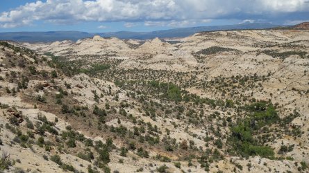
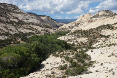
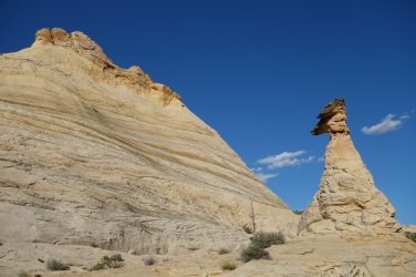
After dropping into Dry Hollow, Debra's route follows the higher ground to the east, but I decided to follow the main drainage instead. This perhaps wasn't the best choice since the walking was, for the most part, across angled slickrock and boulder fields, or thrashing through annoying vegetation. This eventually got rather tedious. The views were very pretty, with some tremendous tall sandstome hoodoos, but I was quite glad to finally scramble out of the canyon after a few miles, and camp close to the Boulder airstrip.
.Starting at the trailhead, I briefly followed the riverside trail eastwards before clambering up onto the slickrock surrounds. After the initial scramble up, I got quite the surprise when I emerged from the small gulley. There was, in fact, and old wagon trail which wound its way along the sandy washes and around the imposing slickrock domes. The surrounding terrain was quite a bit more complicated than I had imagined, so having this constructed route to follow was a godsend. I presume that this trail was originally built to link Escalante and Boulder. I lost the trail in the sandy areas several times, and presumed that it had petered out, but it would always reappear, and amazingly I was able to follow it right across the Haymaker Bench, all the way to the highway. This section was a fascinating and fun walk.
After dropping into Dry Hollow, Debra's route follows the higher ground to the east, but I decided to follow the main drainage instead. This perhaps wasn't the best choice since the walking was, for the most part, across angled slickrock and boulder fields, or thrashing through annoying vegetation. This eventually got rather tedious. The views were very pretty, with some tremendous tall sandstome hoodoos, but I was quite glad to finally scramble out of the canyon after a few miles, and camp close to the Boulder airstrip.
.
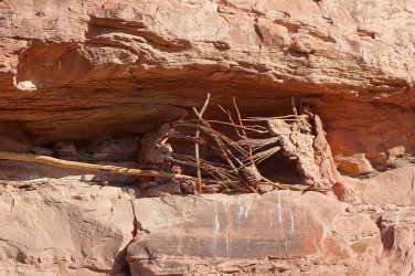
Granary in the cliffs close to the trailhead
.
.
Old Wagon Trail
.
.
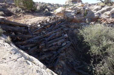
Impressive road construction
.
.
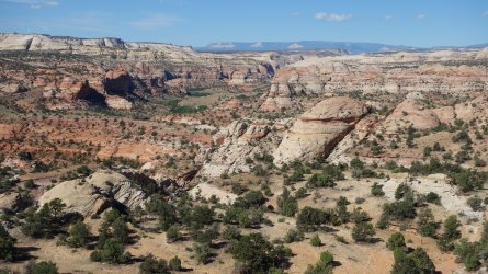
Looking back south-west along the Escalante River, with the pink cliffs of Bryce Canyon (?) in the very far distance
.
.
Emerging close to Highway 12, after crossing the Haymaker Bench via the old wagon trail
.
.
An old cattle trail (Claude V. Cutoff) from the plateau down to Dry Hollow
.
.
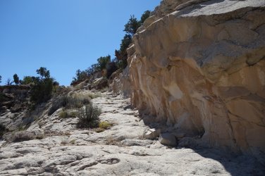
A clearly blasted route through the cliffs
.
.
Descending into Dry Hollow
.
.
Following Dry Hollow northwards
.
.
Sandstone hoodoo
.
.
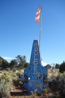
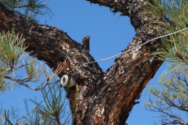
My second day would follow the Boulder Mail Trail (BMT), south-west in the direction of the Escalante township. This trail follows an old packhorse mail route established in ~1910 to link the towns of Boulder and Escalante. A basic telephone line was also constructed a little later, with many poles and wires still evident today.
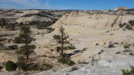
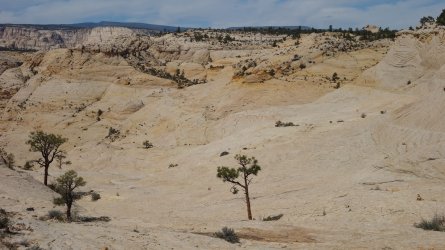
The initial couple of miles of the BMT cross a wide, sandy stretch towards Sand Creek and are relatively unremarkable but, before long, the route emerges onto some stunning slickrock expanses. The hiking across the vast areas of white and yellow sandstone that form the Slickrock Saddle Bench is a glorious experience. The best is yet to come of course ! After another mile or so of superb walking, one emerges at the edge of a plateau, to be greeted by one of the best views in the entire south-west: Death Hollow is straight below. An incredible sight.
It initially appears impossible to get down into the canyon, but the old constructed pack horse route allows for a circuitous but relatively straightforward descent, so long as you don't mind a little exposure.
Once in the depths of Death Hollow, there is a lovely stream, a couple of sandy beaches, and tall ponderosa pines. It is an idyllic setting. Well, almost ! Unfortunately, the majority of the area is covered in enormous poison ivy bushes, which makes hiking alongside the waterway a rather treacherous experience. Long sleeves and long pants are a requirement here (machete optional !).
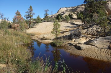
After a couple of miles, the trail climbs steeply out of the canyon, and makes its way back onto the slickrock benches once more. The views are again spectacular, and after another mile or so the route descends into the very pretty surrounds of Mamie Creek. Although there wasn't running water when I was there, there were several very large pools of good water. It turned out to be the perfect little valley for a relaxing evening stroll and as a campsite for the night.
.The initial couple of miles of the BMT cross a wide, sandy stretch towards Sand Creek and are relatively unremarkable but, before long, the route emerges onto some stunning slickrock expanses. The hiking across the vast areas of white and yellow sandstone that form the Slickrock Saddle Bench is a glorious experience. The best is yet to come of course ! After another mile or so of superb walking, one emerges at the edge of a plateau, to be greeted by one of the best views in the entire south-west: Death Hollow is straight below. An incredible sight.
It initially appears impossible to get down into the canyon, but the old constructed pack horse route allows for a circuitous but relatively straightforward descent, so long as you don't mind a little exposure.
Once in the depths of Death Hollow, there is a lovely stream, a couple of sandy beaches, and tall ponderosa pines. It is an idyllic setting. Well, almost ! Unfortunately, the majority of the area is covered in enormous poison ivy bushes, which makes hiking alongside the waterway a rather treacherous experience. Long sleeves and long pants are a requirement here (machete optional !).
After a couple of miles, the trail climbs steeply out of the canyon, and makes its way back onto the slickrock benches once more. The views are again spectacular, and after another mile or so the route descends into the very pretty surrounds of Mamie Creek. Although there wasn't running water when I was there, there were several very large pools of good water. It turned out to be the perfect little valley for a relaxing evening stroll and as a campsite for the night.
.
Boulder airstrip
...............................
.
.
Following the Boulder Mail Trail across the slickrock
.
.
Old telephone line
.
.
Descending from the Slickrock Saddle Bench
.
.
Incredible view of Death Hollow
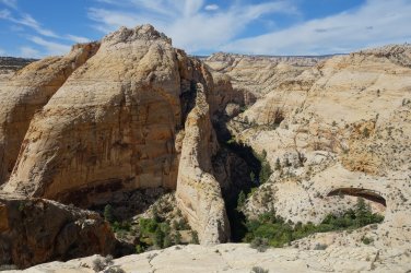
.
.
Wonderful slickrock
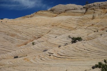
.
.
Idyllic Death Hollow
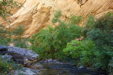
.
.
Old telephone line
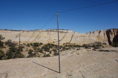
.
.
Mamie Creek pools
.
.
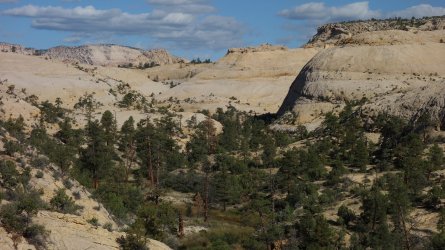
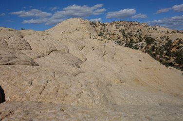
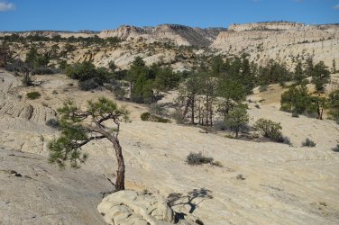
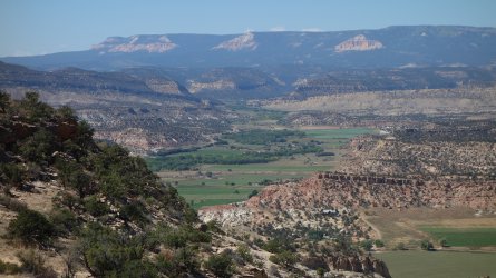
A straightforward, but steep route out of Mamie Creek, provides the perfect start to the day, with views of some magnificent white sandstone formations to be enjoyed. A lovely walk across the high sandy bench of Antone Flat eventually leads to distant views of the Escalante township, and its surrounding cultivated farmland. It's a melancholy feeling descending the pretty slickrock now, since before too long, the incredible Boulder Mail Trail will end.
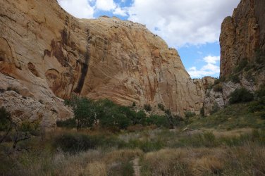
Of course, where one superb trail ends, another one begins, and before I know it, I'm heading eastwards on the final leg of the journey, along the Escalante River. Slightly disappointingly, there isn't much of a river at all in these early stages; it's a mere trickle of water. The walking, however, between steep red sandstone walls is very enjoyable. The easiest route is generally across the sandy short-cuts between the river meanders.
By late afternoon, I'm beginning to think about setting up camp for the night, when things start to get a bit more exciting. Suddenly, there is a dramatic increase in vegetation beside the stream, and before too long, I'm struggling to find a route between the meanders. It now seems necessary to walk alongside the river to make progress. Why the sudden change I wonder ? Pretty soon I realise that I've now reached the junction of Death Hollow, which is emptying the considerable contents of its stream into the Escalante River. Rather than fight my way through the bushes this evening, it's time to stop for the day, and enjoy a nice mug of tea at my riverside camp.
.Of course, where one superb trail ends, another one begins, and before I know it, I'm heading eastwards on the final leg of the journey, along the Escalante River. Slightly disappointingly, there isn't much of a river at all in these early stages; it's a mere trickle of water. The walking, however, between steep red sandstone walls is very enjoyable. The easiest route is generally across the sandy short-cuts between the river meanders.
By late afternoon, I'm beginning to think about setting up camp for the night, when things start to get a bit more exciting. Suddenly, there is a dramatic increase in vegetation beside the stream, and before too long, I'm struggling to find a route between the meanders. It now seems necessary to walk alongside the river to make progress. Why the sudden change I wonder ? Pretty soon I realise that I've now reached the junction of Death Hollow, which is emptying the considerable contents of its stream into the Escalante River. Rather than fight my way through the bushes this evening, it's time to stop for the day, and enjoy a nice mug of tea at my riverside camp.
.
Exiting Mamie Creek
.
.
Beautiful sandstone surrounds
.
.
Traversing Antone Flat
.
.
Pretty pools
.
.
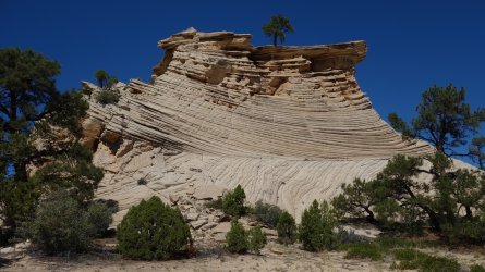
Magnificent sandstone formation
.
.
Looking towards Escalante
.
.
Escalante River Canyon
.
.
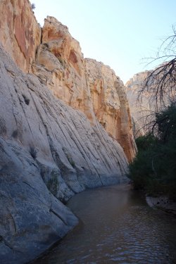
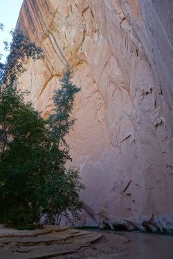
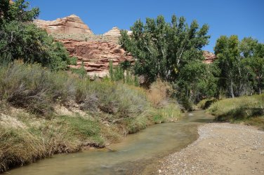
As I set off on the final day of my hike along the Escalante River, I soon realise that there isn't much point in trying to find a route through the thick vegetation; instead, it would be much easier to just change into my Crocs, and walk in the river itself. Although, the distance covered was longer, this was a really enjoyable way to travel through the canyon. And, as the day heated up, it was wonderfully cooling.
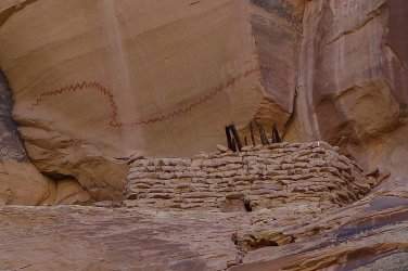
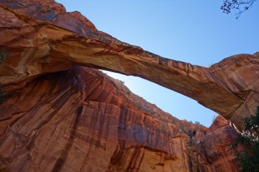
As I made my way along the river, I did head out to visit Cliff House Arch, Escalante Natural Bridge, and some wonderful ancient rock-art and ruins.
I was back at my car at the Escalante River Trailhead by 11am, after just over 3 days and 53 miles of superb walking.
.As I made my way along the river, I did head out to visit Cliff House Arch, Escalante Natural Bridge, and some wonderful ancient rock-art and ruins.
I was back at my car at the Escalante River Trailhead by 11am, after just over 3 days and 53 miles of superb walking.
.
Strolling along the river
...
 .....
.....
.
.
Ancient ruin and pictograph
.
.
Escalante Natural Bridge
.
.
Completing the hike along the Escalante River
.
.
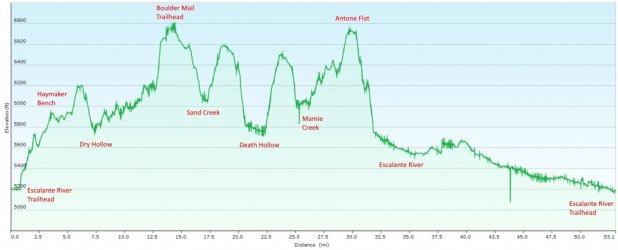
Elevation profile
Last edited:

