- Joined
- Jul 23, 2013
- Messages
- 1,665
For some time now, I've been wanting to bag Delano Peak of the Tushar Range in Fishlake National Forest down in Southwest Utah. Delano Peak is the highest peak in the Tushars, the third highest range in Utah, beneath the Uintas and La Sals. Standing 12,169 feet above sea level, It is also the highest peak of two Utah counties: Beaver and Piute. For those aiming to bag all the county high points in Utah, like myself, it offers a twofer.
Initially, I thought I'd end up hiking it the typical way which is to drive up from Beaver to the west and then hike the route up the western face of it. However, after studying out maps a bit more, I saw that it could be done from the east via Bullion Canyon just outside of Marysvale, but with a few more miles of hiking. Logistically, approaching it from the east actually made more sense for me, because I could make a drive over from Torrey whenever my family was visiting down there. A prime opportunity presented itself when my family recently went down for the weekend of July 24. Due to the distance I still had to drive to the trailhead, the seasonal weather pattern, the distance up the trail and so forth, I opted to make it an overnight backpacking trip. Little did I know just what a treat I'd be in for.
Day 1
Sunday - July 23, 2017
After spending the morning with my family, I rounded up my dog Sophie and set off for the small town of Marysvale early in the afternoon and then on up into Bullion Canyon to the west where I'd park at the trailhead for an area called Miners Park. I had only driven through Marysvale a couple times in the past on trips out to Bryce Canyon and have never really spent any time in the Tushars except on the western side not far up from Beaver where I had participated in a youth camp for a few nights as a teenager.
I had looked up all I could on Bullion Canyon and couldn't find much about the trail up it beyond a somewhat popular 60 foot waterfall down in the lower canyon called Bullion Falls within the first mile of the trail that lots of ATV enthusiasts like to pull over and hike up to, in addition to visiting the Miners Park area itself, as a side trip off the Piute Trail. The Piute Trail is a 275 mile loop through Fishlake National Forest designated for ATV enthusiasts with no official beginning or end, however Marysvale is a major stopping point for riders needing to refuel, grab a bite to eat, restock supplies, and even just stay a night. In fact, half the traffic through town consisted of ATV's and with it being a state holiday weekend (Pioneer Day was the next day), it was pretty active on this Sunday afternoon.
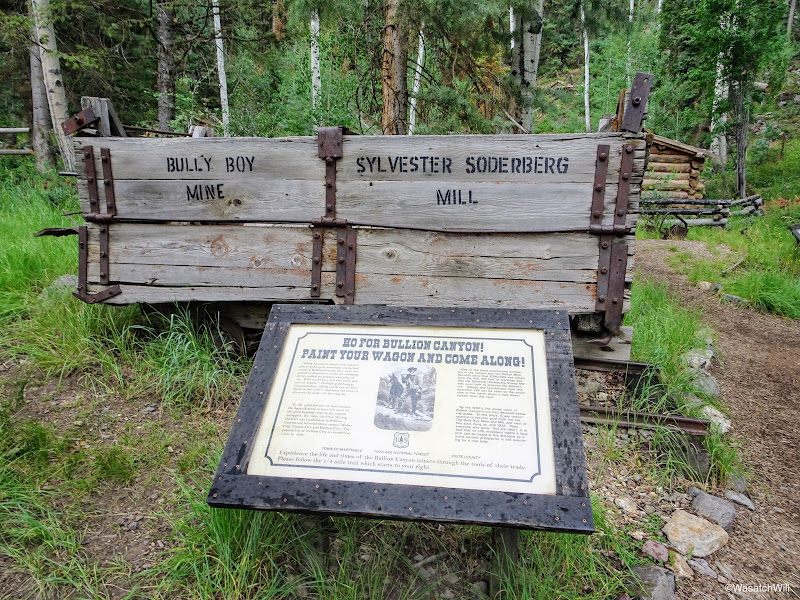
The area up Bullion Canyon and west of Marsyvale, called Miners Park, is called so because in the late 1800's and early 1900's, lower Bullion Canyon had also been the site of a very active gold mining operation and community. Lots of mining relics and old structures remain through out lower Bullion Canyon, so much so, that an actual park in the area has been created to showcase a collection of various pieces of mining history with an interpretive trail through it all. Beyond that, there is a brochure that can be picked up at various shops and stops in town that enables drivers and ATV riders to self-guide themselves along a Canyon of Gold tour throughout the lower canyon with numbered signs and stops where the guide then explains the history behind each stop.
So, beyond all the info about the Piute Trail that ran through the area, and a bit about Miners Park and Bullion Falls, I had nothing to go on but the map I had prepared with my route.
The route I sought to do was a lollipop loop plus a side trip up to Delano Peak and back. I would head up Bullion Canyon, steering to the right at a fork halfway up and then go on to seek out a site to camp up in an area called Bullion Pasture. From there the plan was to follow a trail through a spot called The Pocket, and then connect into a junction with the South Fork Pine Creek Trail and a "trail" up to Delano Peak the following morning. After Delano, I'd close the loop by taking the South Fork trail back down to connect with the main trail down Bullion Canyon and ultimately back down to the trailhead the following afternoon.
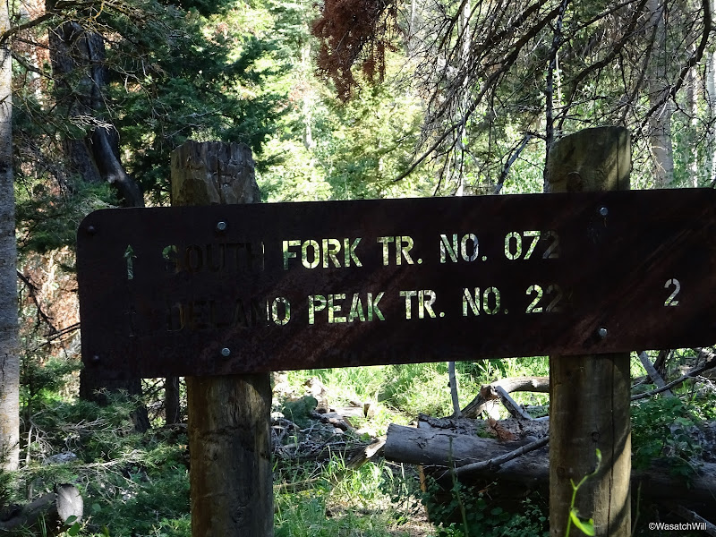
In traveling up to the trailhead out of Marysvale, there were plenty of ATV's sharing the road, most on their way back to town, but once I reached the trailhead itself, I was surprised to find few others there. Only one other group had turned up to hike up to Bullion Falls a mile up the trail. It could have been because of weather in the area (there was a light thundershower lingering around) or because of the time of day, or some combination of both.
At any rate, I let Sophie out, loaded up my gear, and set off hoping for the best regarding the weather. Forecast was up to 40-50% chance of isolated thundershowers through the evening before they were supposed to clear out for the morning.

Mileage sign at trailhead
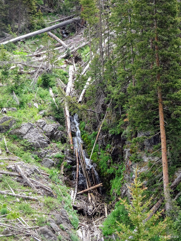
Very soon after starting up the trail, there was a sign directing my attention to the left where I could see another waterfall, called Cascade Falls, across the canyon.

Cascade Falls
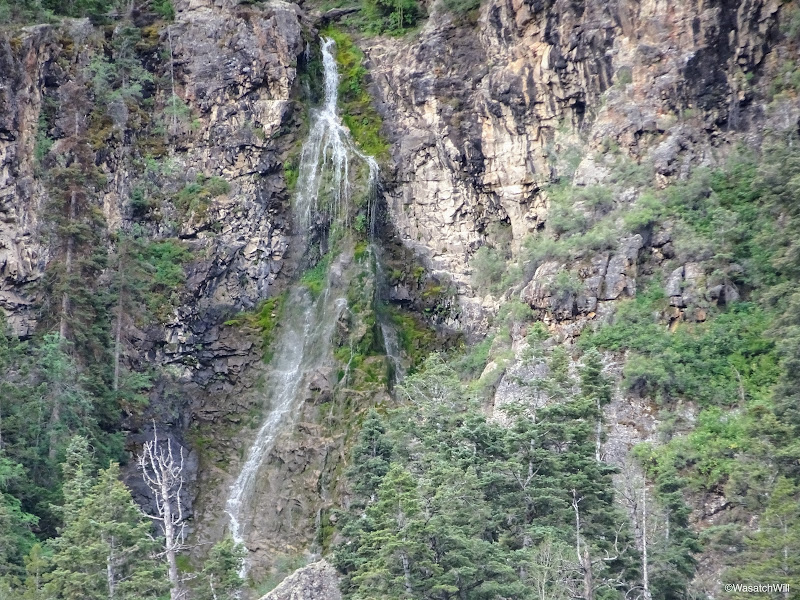
Cascade Falls
Shortly after passing the viewpoint for Cascade Falls, I walked through another trailhead, officially signed as Miners Park Trailhead. This was the point where ATV's could not go further and riders had to park their ATVs before continuing on up to Bullion Falls. Where I had parked further down was a small lot for standard vehicles.
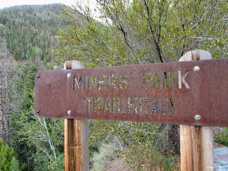
Miners Park Trailhead sign
What's left of trailhead board
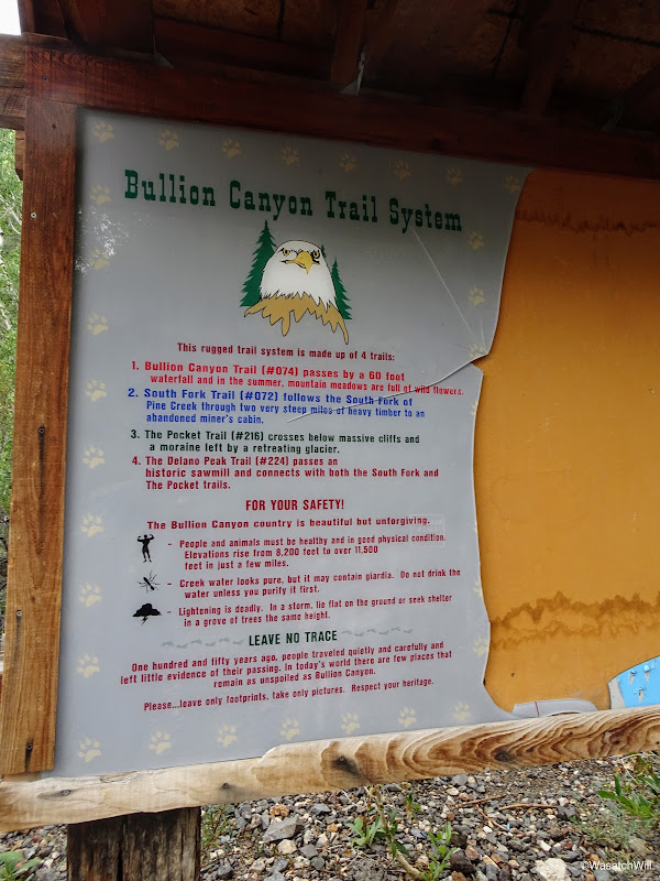
In reading over what was left of the trailhead board, I could see that the route I had mapped out for myself consisted of all the trails described on the board.
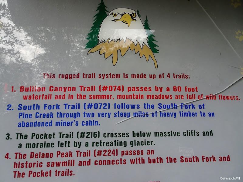
I incorporated all four of these trails
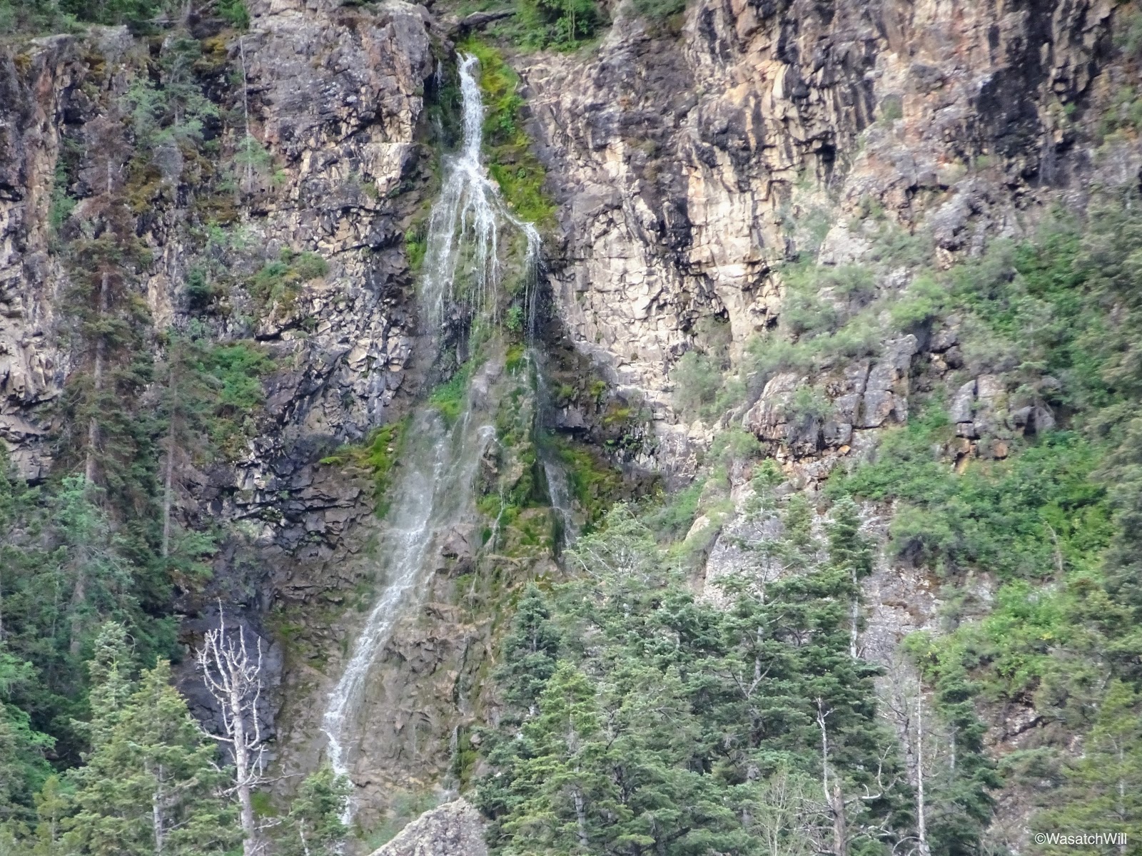
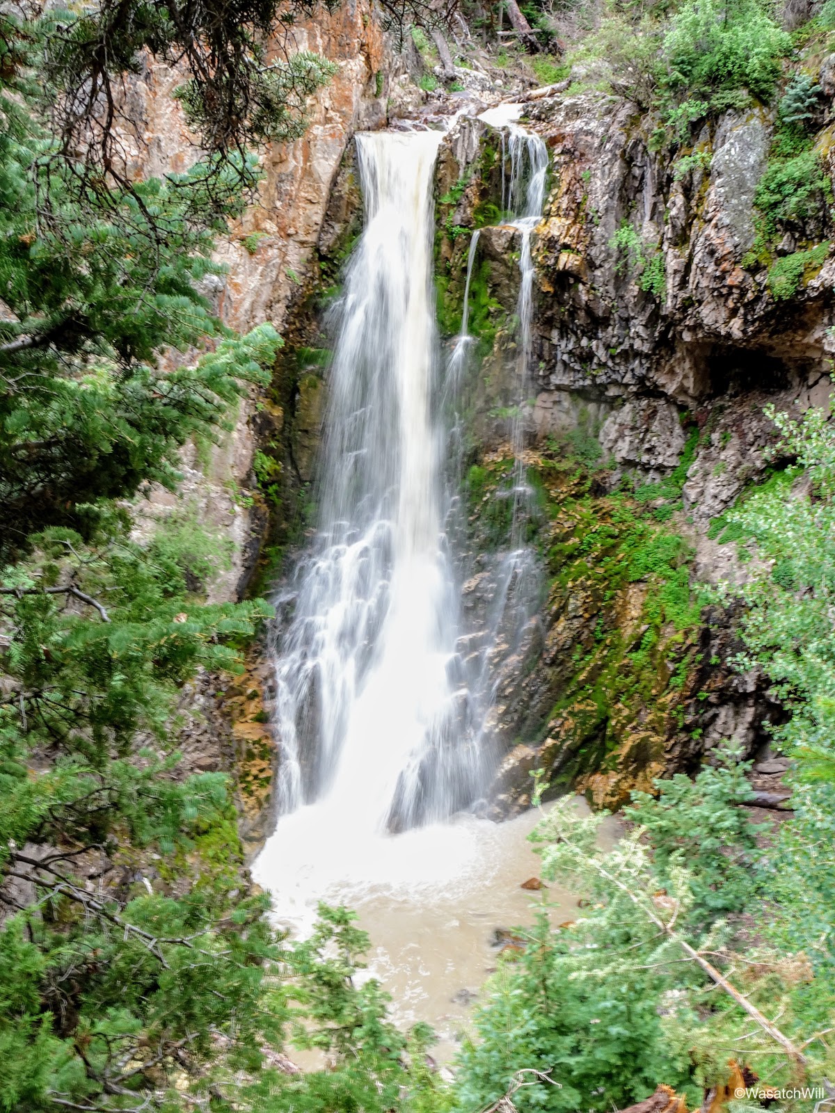
As I hiked on, the sound of Bullion Falls was quickly followed by the sight of the falls. I stepped on down to a good viewpoint but opted to hold back from descending down to the bottom. It can be done with careful scrambling and down-climbing, and the group ahead of me had proceeded to do so, but it is very steep and slick, with a hand-line someone had set up for one particular spot. Having only my dog as company, I did not want to jeopardize my chances of finishing out my trip.
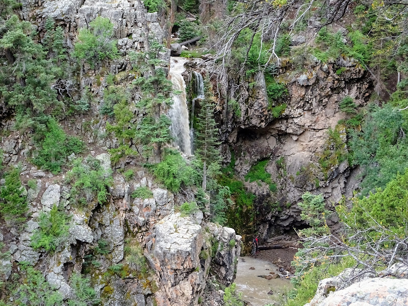
Bullion Falls begins to come into view

Bullion Falls

Longer exposure of Bullion Falls
While viewing the falls, a light rain began to sprinkle down from the sky and not knowing if it would get worse before it got better, I took the time to throw on a light poncho I had brought along.
Just around a corner of the trail from the falls was a sign saying the trail was closed due to a rock slide. Normally I would heed such a sign, but in this case I could see no rock slide around, so I decided I'd continue on until I could at least see and evaluate the alleged rock slide for myself. I also figured that if it was really that hazardous, there ought to be some yellow tape across the trail as well.
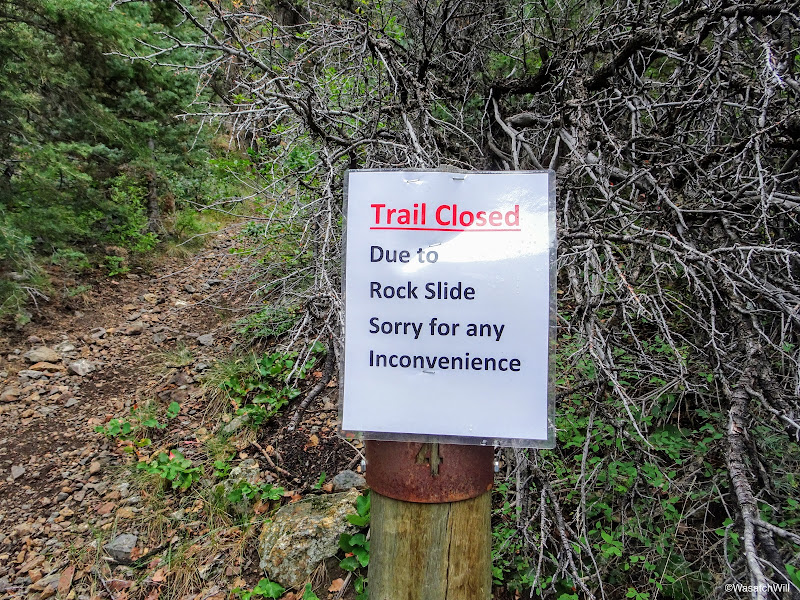
Trail Closed...uh oh!
Progressing up canyon anyways
Just before arriving at the rock slide
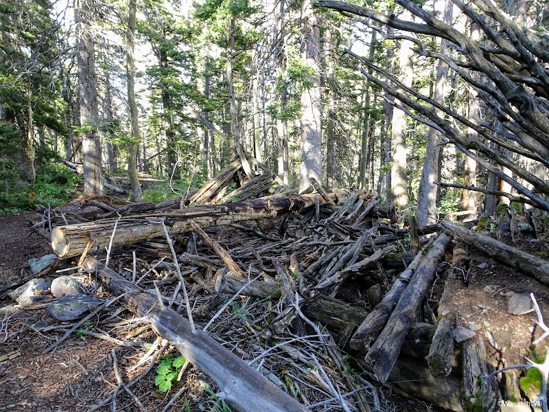
After about another quarter mile, including some high-climbing switchbacks, I encountered what must have been the rock slide. Unfortunately, I did not think to actually take a picture of it, but I did shoot some video of it which can be viewed at 6:12 into my trip video at the bottom of the post. I questioned in my mind how long ago the trail closed sign had been posted. Perhaps it had been placed there earlier in the spring, when perhaps there could have considerable snow and ice mixed into the slide making it much riskier and hazardous. At this point in the season however, there was no trace of snow or ice amongst it and there was nothing more hazardous looking about it than any other trail with a small section of moderate exposure. In fact, there really was no deadly cliff lying in wait below the slide to take anyone over if they were to slip and take a tumble down the slide as there was elsewhere nearby along the side of the trail. It also looked like others had gone on across and actually stabilized and leveled out what rocks were covering the trail.
I proceeded along.
Looking back down canyon after crossing rock slide
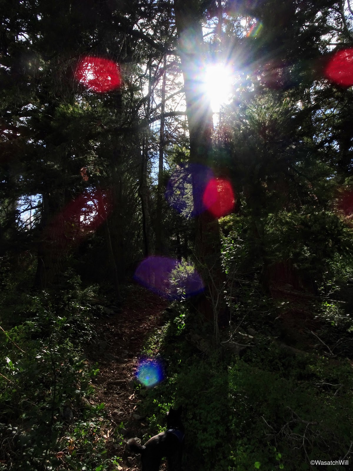
Just after passing over the rock slide, the trail took me into a thickly wooded area for a little way. While going through the first section of woods, the weather began to break and the sun was unmasked.

The sun makes emerges
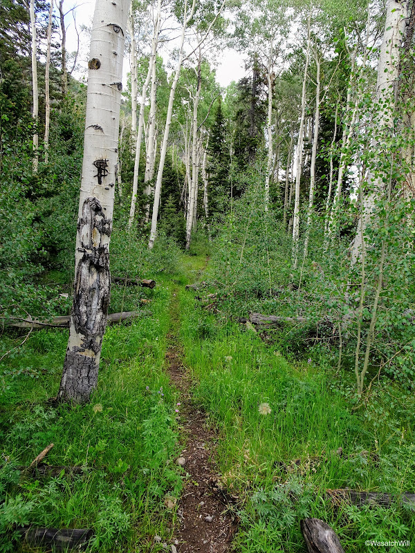
Into the woods
Before long, I was in a small clearing where I could see that the weather was turning to my favor, at least for the next while. The storm that had been over me was now retreating to the east behind me and blue skies with light white clouds were to the west ahead.
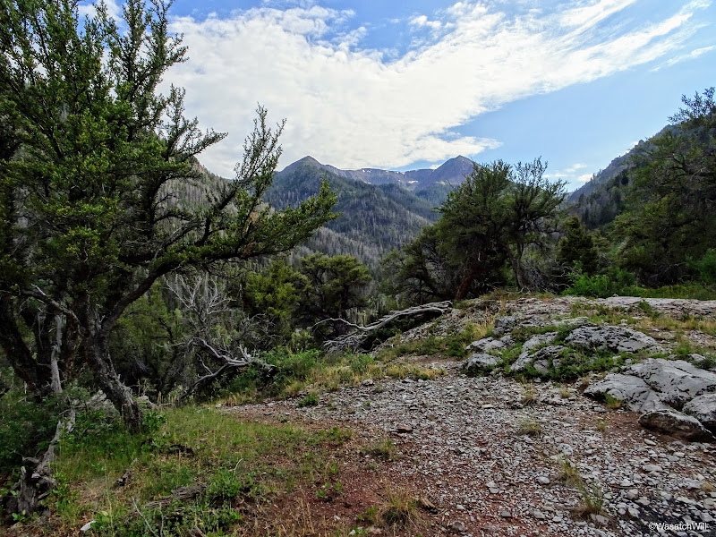
A brief clearing
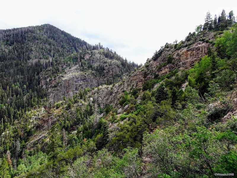
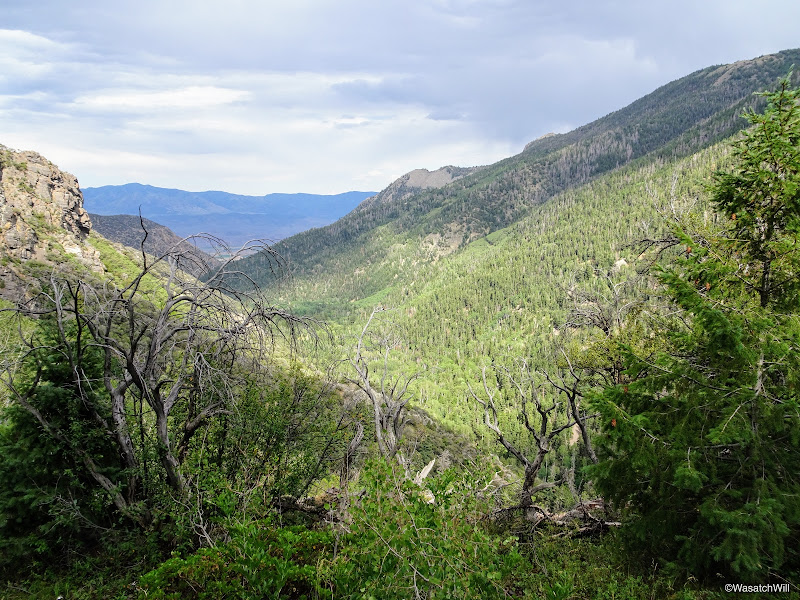
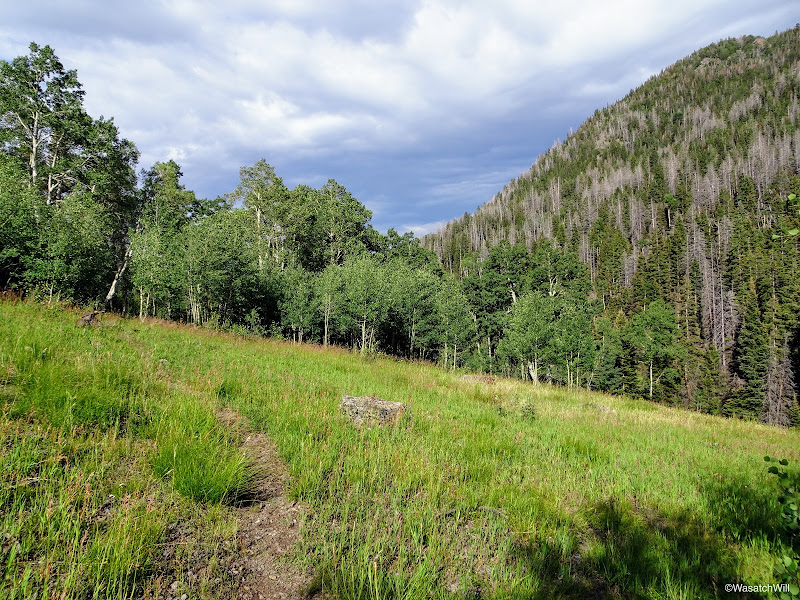
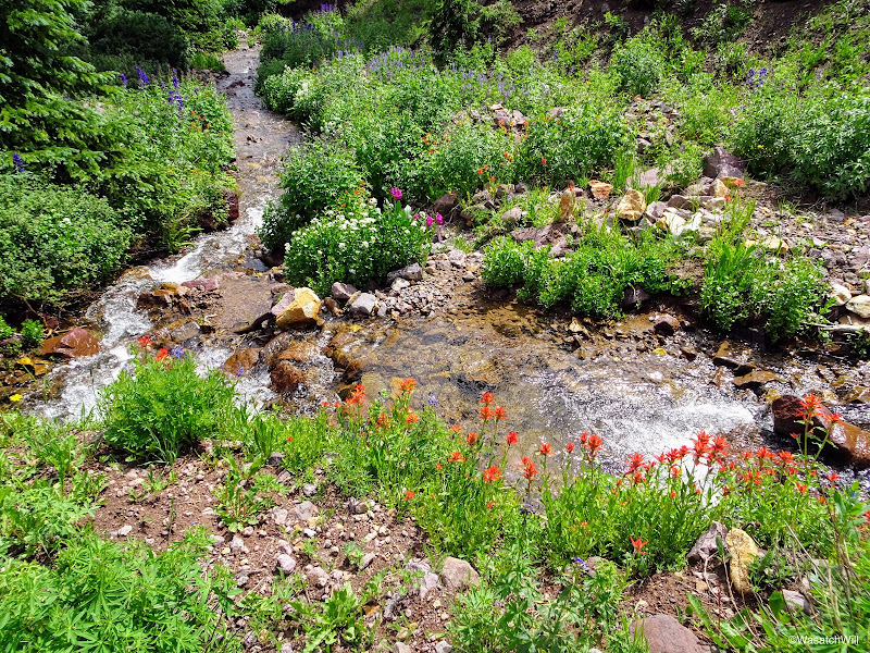
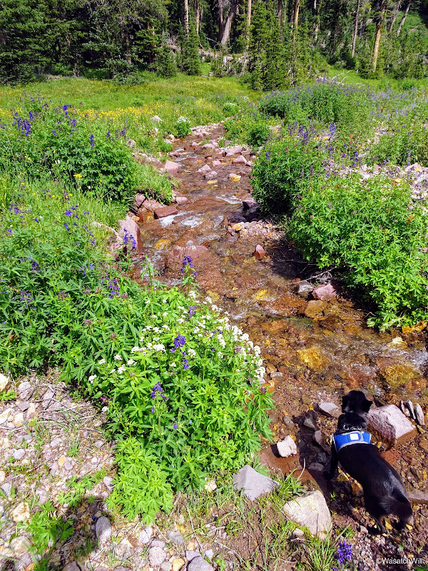
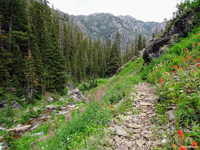
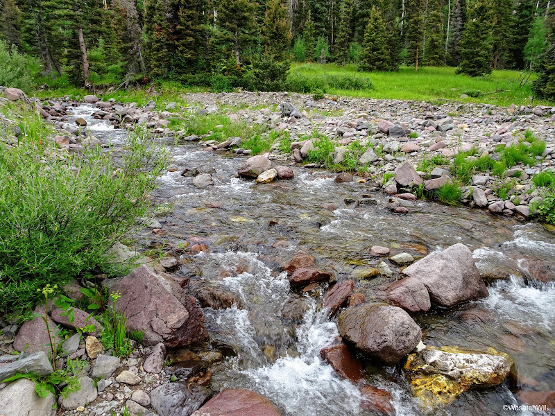
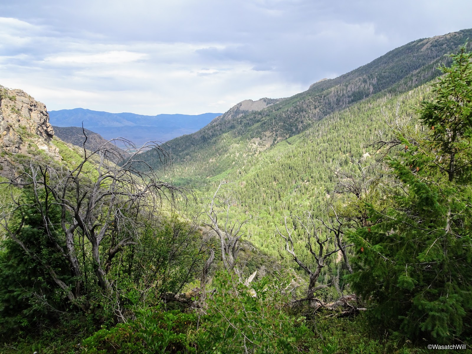
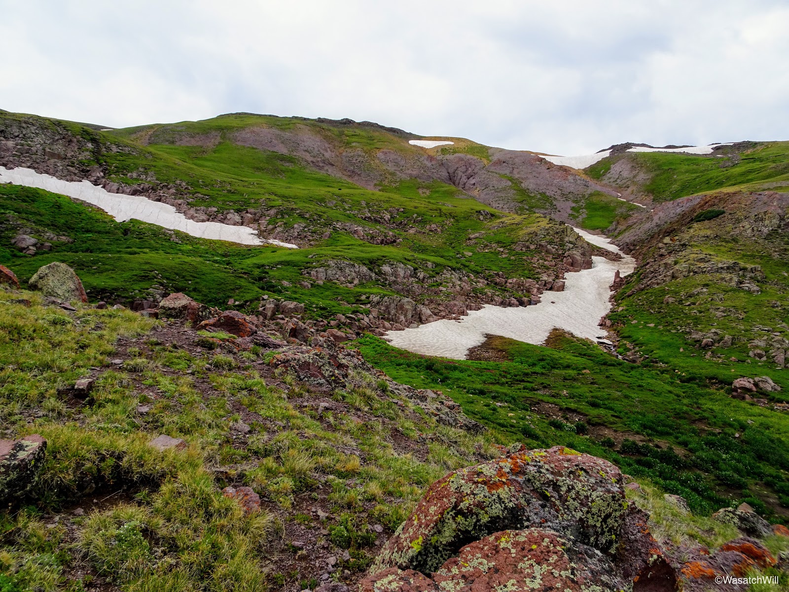
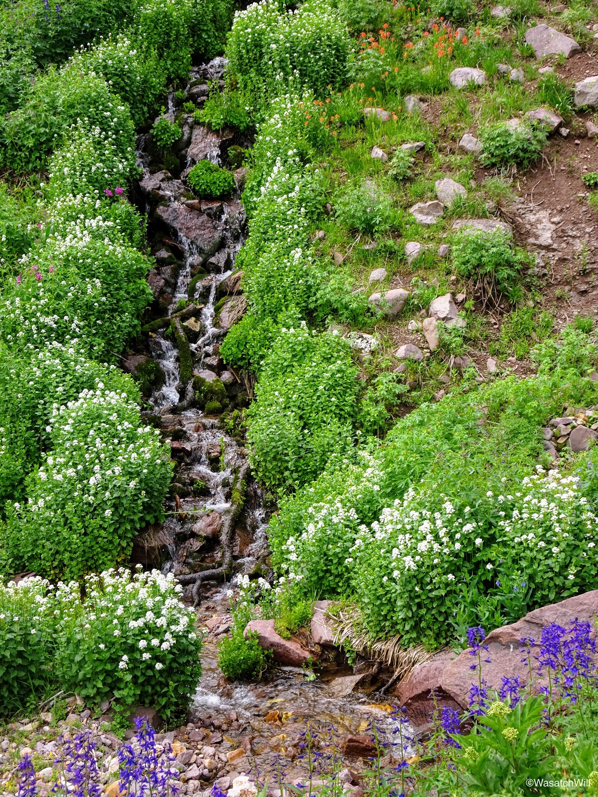
As I continued up the trail, the landscape was almost continually changing with sections of thickly wooded areas, mixed in with meadows of grasses and flowers, followed by crossings over tributary streams flowing into Pine Creek which the trail would run parallel to all the way up the canyon.
Tributary of Pine Creek

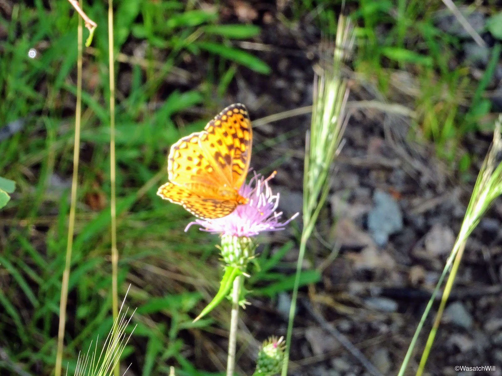
Great Spangled Fritillary
The retreating storm
After about two miles from the start, which was halfway up, I reached the fork with South Fork Pine Creek and it's accompanying trail. For a more direct route up to Delano Peak, I could have taken the left and gone straight up and sought out a camp in the upper drainage of South Fork and was thus tempted to do so. Because I really wanted to still see the Pocket aglow from the eastern sun in the morning, I chose to keep to my original plan. In hindsight, I'm very happy I did.
Junction with South Fork...halfway up
2 more miles to Bullion Pasture
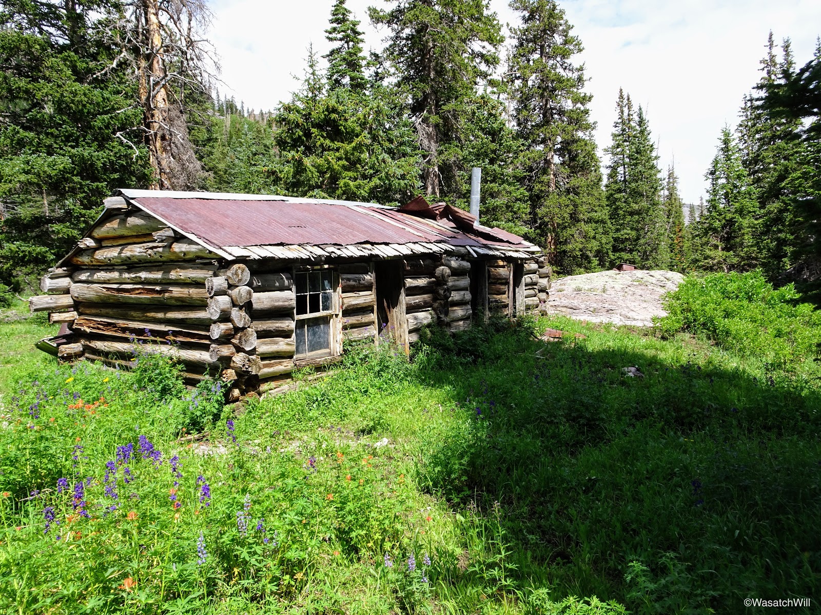
Shortly after the trail (and creek) fork, sits the remains of an old cabin structure, likely remnants from the mining operations that took place further down canyon.

What's left of an old cabin
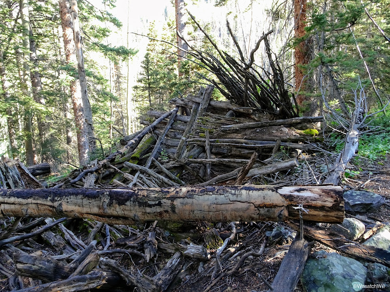
What's left of the other end of the old cabin
Another angle on the old cabin
The forest floor soon gave way to a green carpet made by a low-growing plant. Pictures and video don't do this spot justice. It was really neat, something I would've only expected to find in the forests of the Northwest and other similar environments.

Green carpet

Trail marker and green carpet
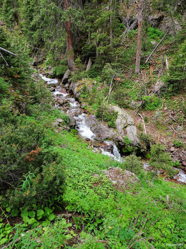
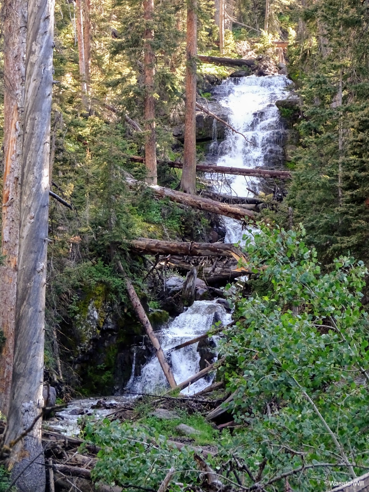
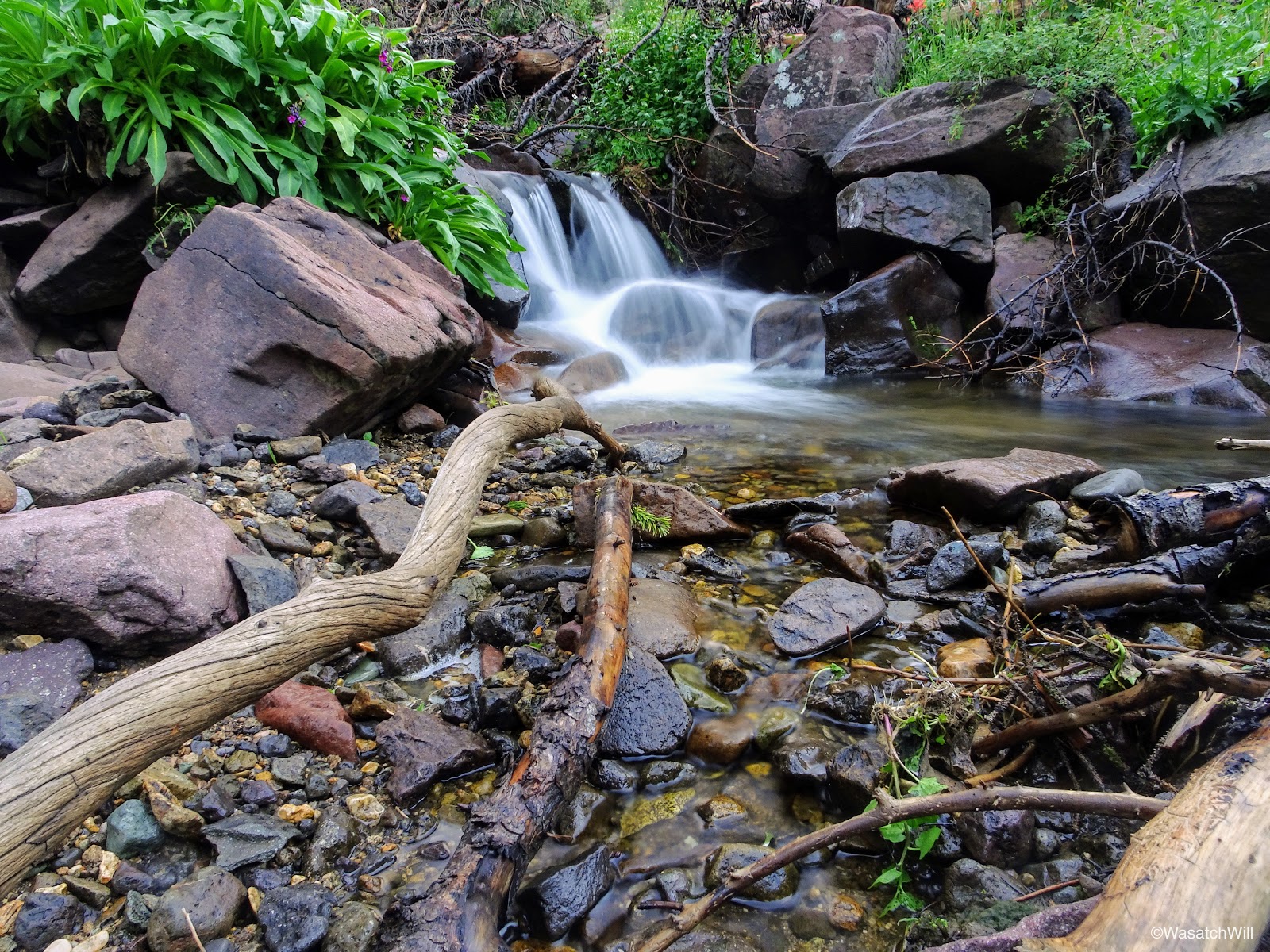
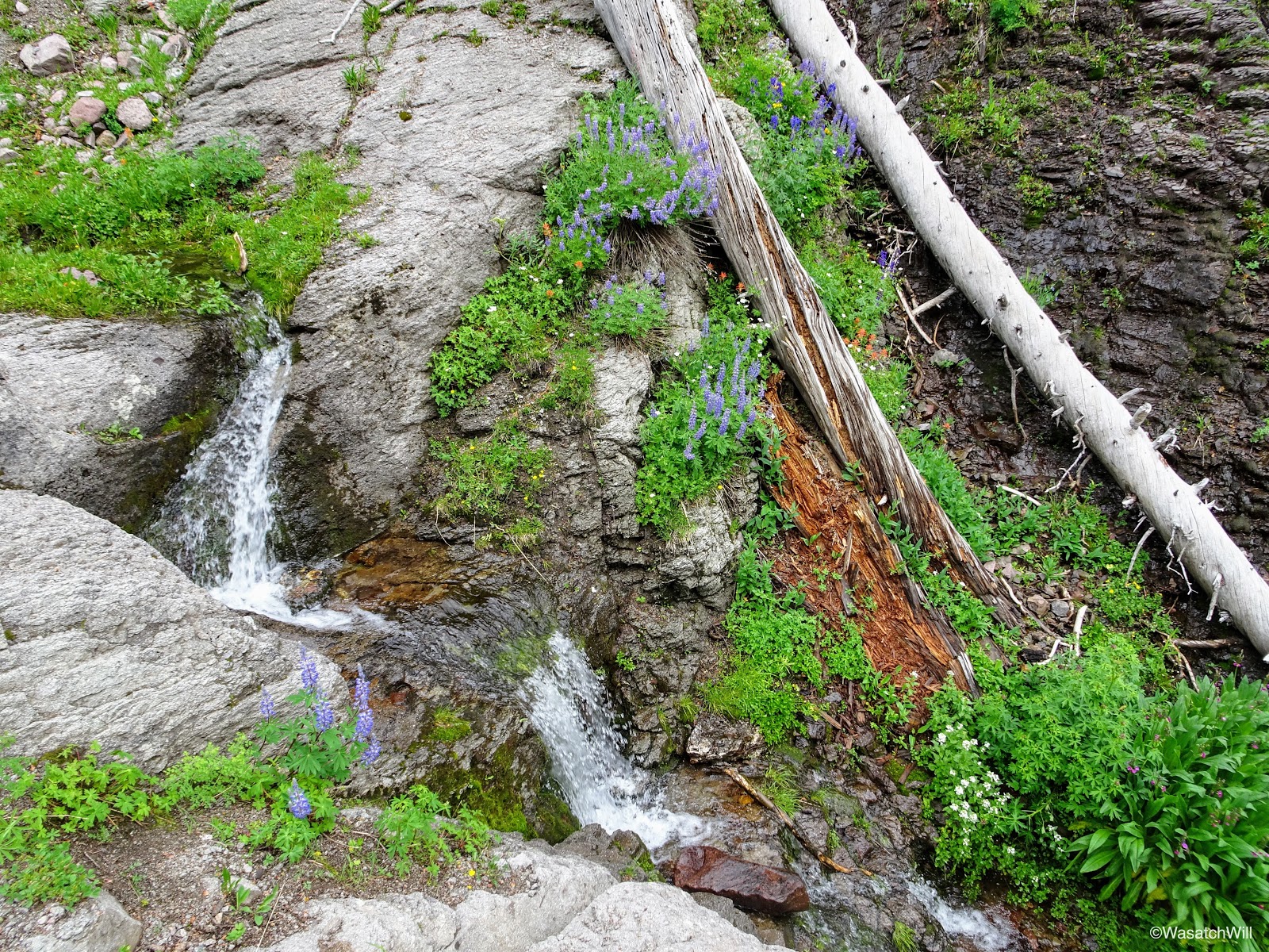
Further on up the trail was a waterfall just visible from the trail. These falls (and many others up both forks of the canyon) were not marked or named on the map. So in my mind, I kept it simple and just named these particular falls, "Pine Creek Falls".
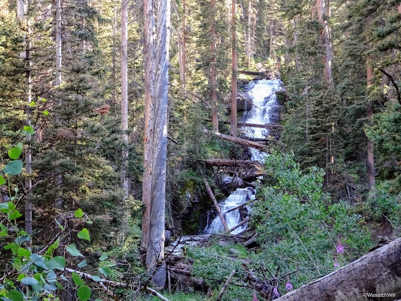
"Pine Creek" Falls

"Pine Creek" Falls
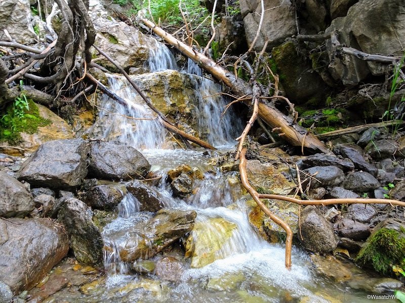
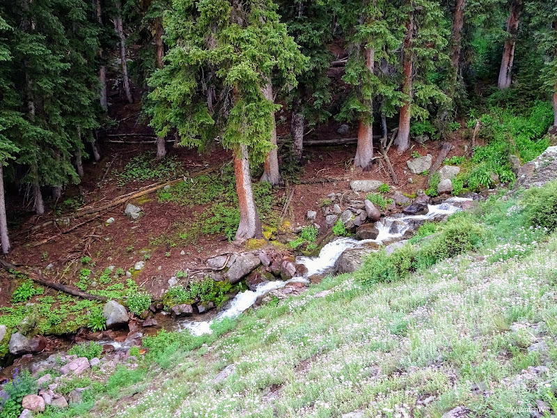
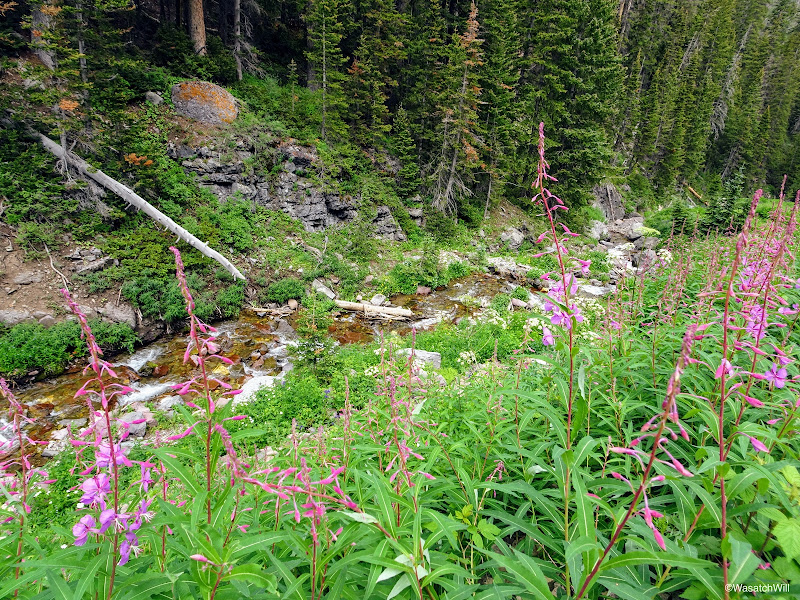
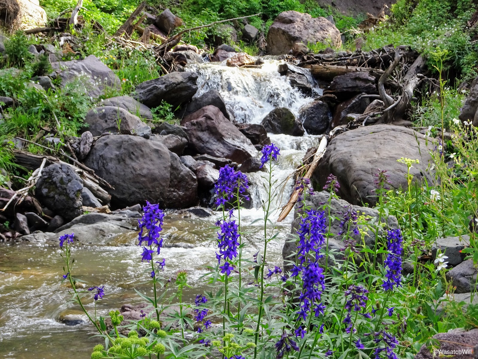
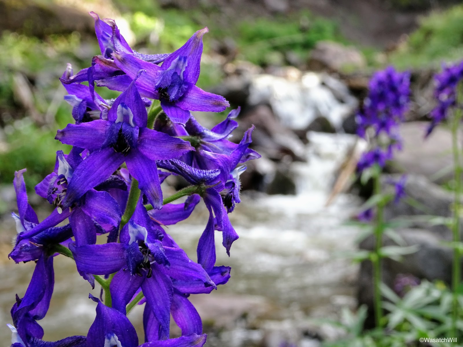
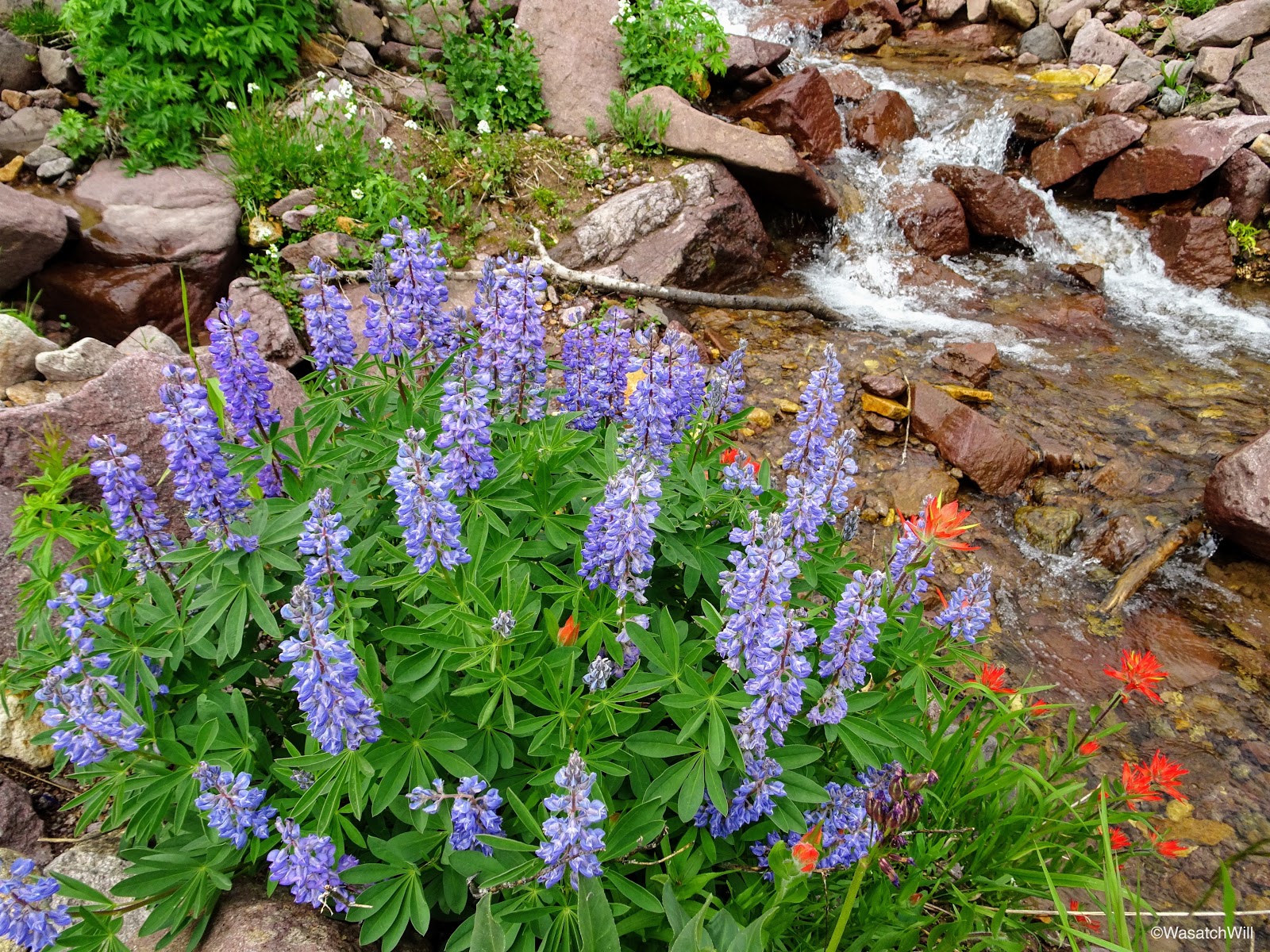
Not long after passing by "Pine Creek Falls", I descended down from the trail to a nice spot along the creek featuring some smaller falls and patches of various flowers for a bit of a rest.

Larkspurs and Pine Creek

Larkspurs and Pine Creek

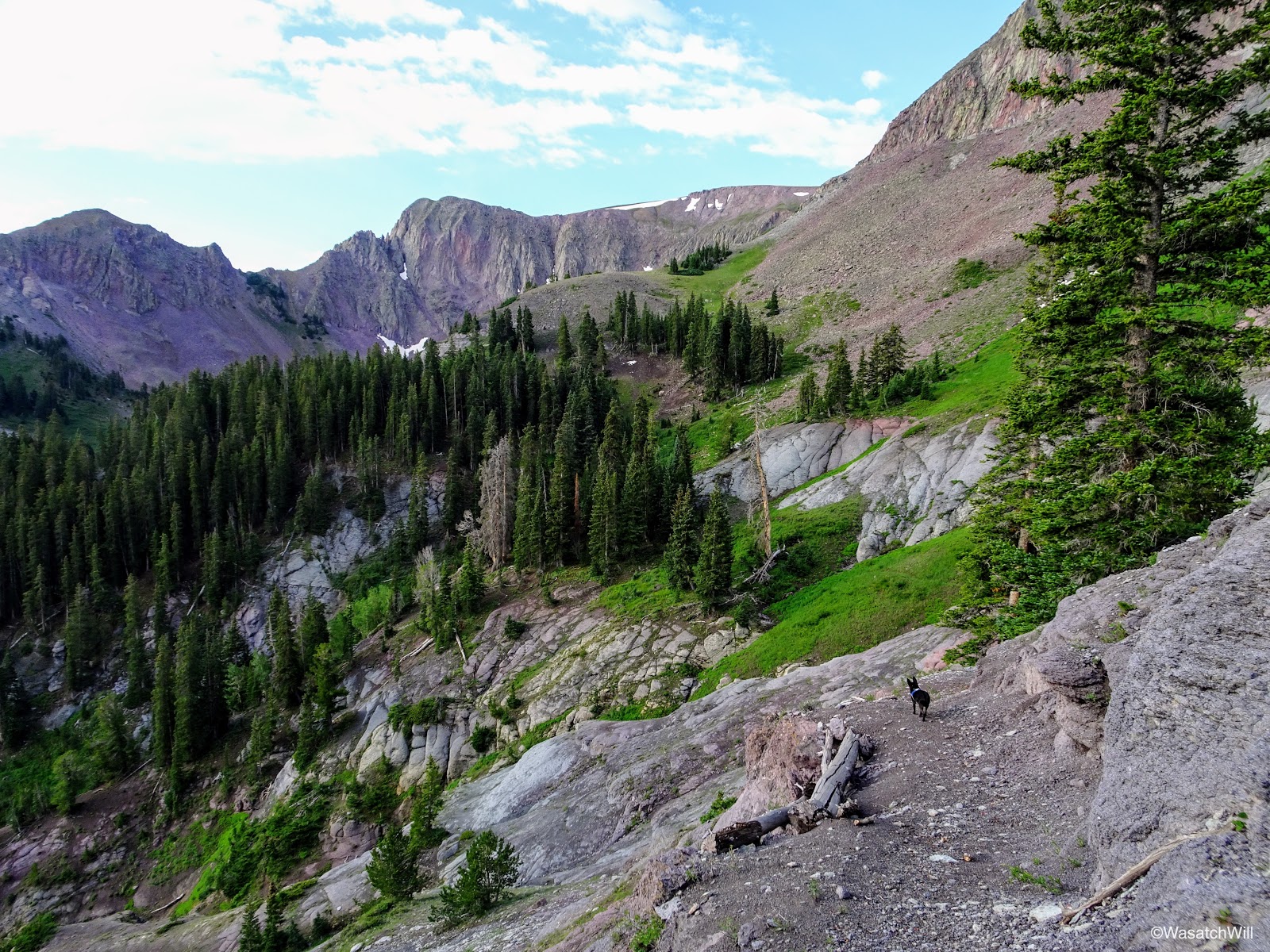
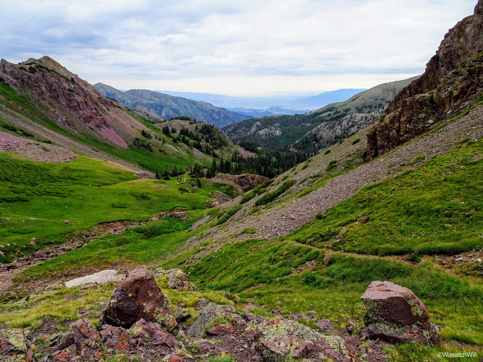
Fireweed
Back up on the trail, I continued to ascend up toward Bullion Pasture. The thicker forests the trail had been meandering through cleared away to larger meadows with broad views of the mountains at the upper reaches of the canyons. In the final approach up into Bullion Pasture, the trail would seemingly kiss the banks of the creek only to switchback up the slope and then repeat a few times.

Higher up in Bullion Canyon
Pine Creek
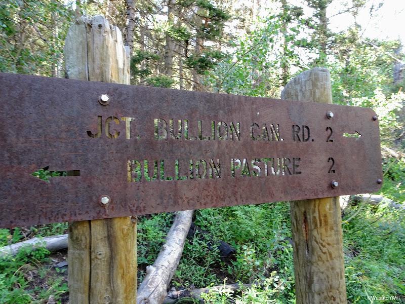
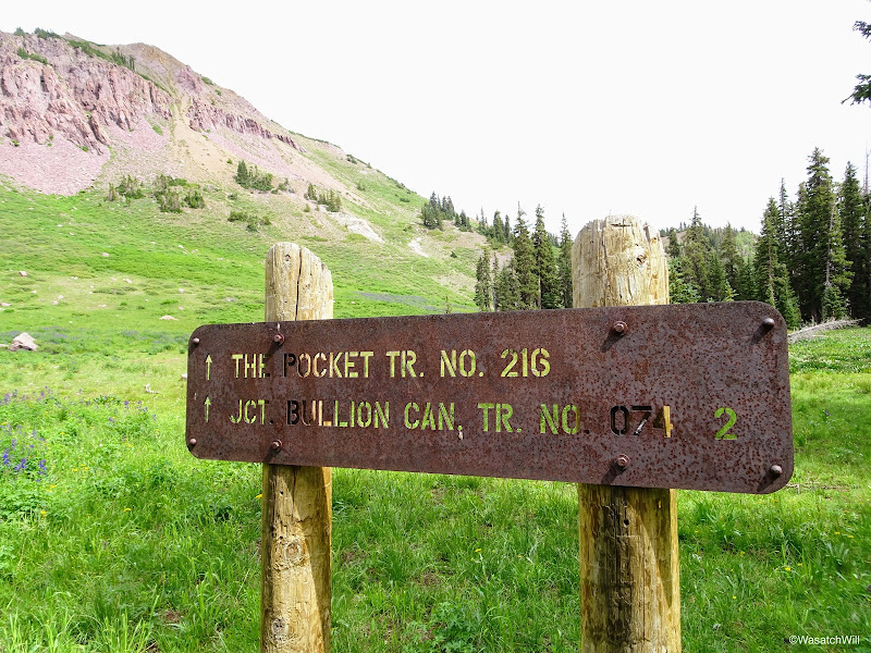
Finally, I had arrived in Bullion Pasture and there reached the junction with the Pocket trail that I intended to take the following morning in order to connect me with the next junction over with the route up to Delano Peak. For this evening though, I moved on past it in search of a site to camp.
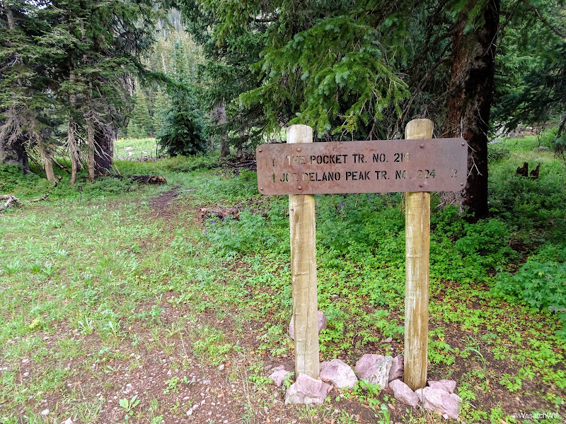
Junction with the Pocket Trail
Bullion Pasture
A little ways up the hill from the junction I left the trail and crossed over the creek where I found a pleasant little area to set up camp for the evening.

Pine Creek and Bullion Pasture
While I set up camp, Sophie sat still guarding a chipmunk she had chased up a tree. She was not to be distracted.
Sophie on guard
By now the clouds were starting to gather back in and it wasn't looking like I'd be falling asleep with any views of the stars. With camp all setup, I went a few hundred feet further out where I cooked up some dinner and hung up my food before returning to my tent to retire for the evening.

Camp
Day 2
Monday - July 24, 2017
In the morning I was treated to a spectacular sunrise.
Morning view from camp
Sunrise from near camp
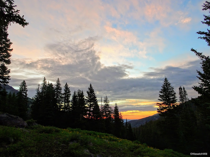
Sunrise from near camp

Sunrise from near camp

Sunrise lens flare
Once the morning show faded away, I took a few moments to snap up some shots of the creek near my camp.
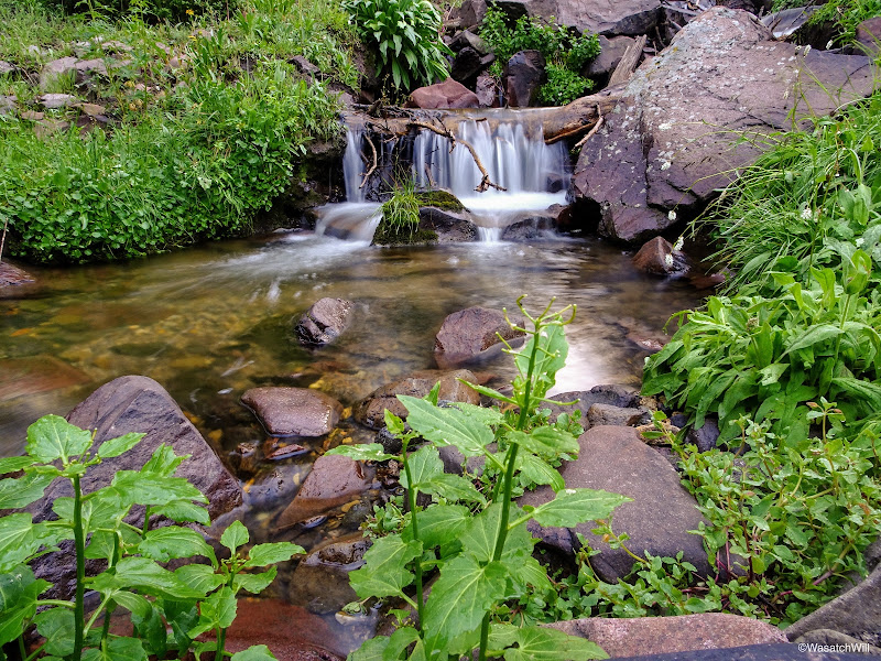
Pine Creek near camp

Pine Creek near camp
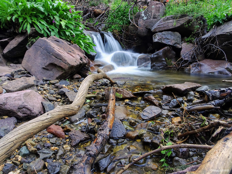
Pine Creek near camp
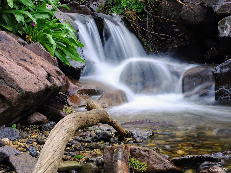
Pine Creek near camp
I then broke camp, gathered my food, took out some breakfast to go, and got back on the trail.
Ready to break camp
Back at the junction, I joined up with the Pocket Trail and made my way up into the Pocket.
Back to hike the Pocket Trail
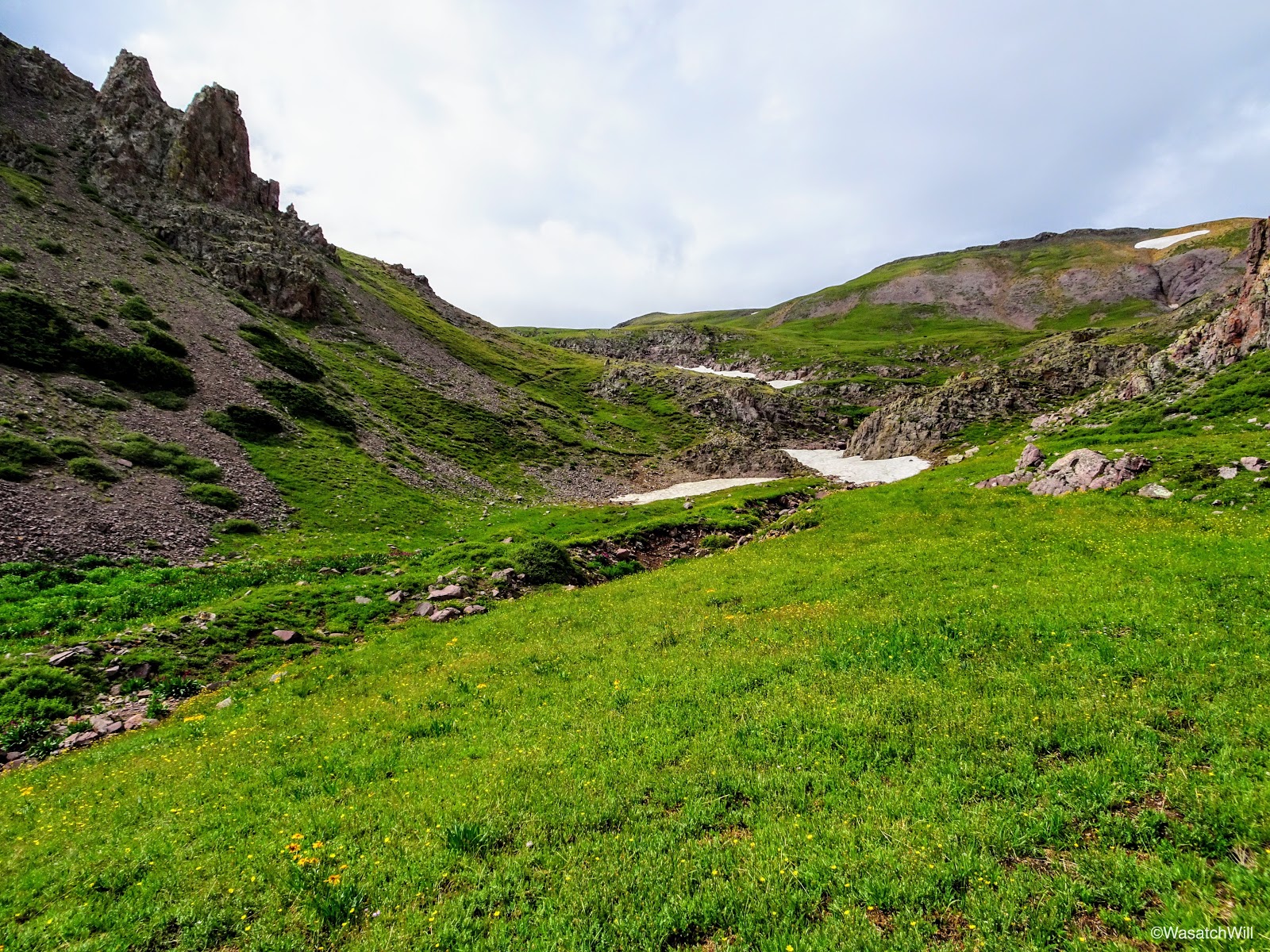
Prior to the Pocket, there was another beautiful little cirque to wander through.
Entering the cirque prior to the Pocket
The cirque prior to the Pocket
Along the Pocket Trail
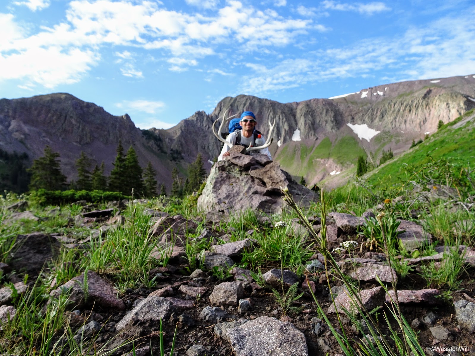
Upon entering the Pocket, there was a set of deer antlers there to greet me. I'm not sure how long they'll remain there, but it was nice to see whoever set them up there didn't prize them for whatever money they could have cashed them in for.
Deer antlers upon arrival into the Pocket
Somewhat blurry photo of myself with the deer antlers at the Pocket
I expected the Pocket to be pretty, but wow...once again, I was surprised and impressed.
Entering the Pocket
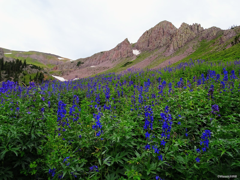
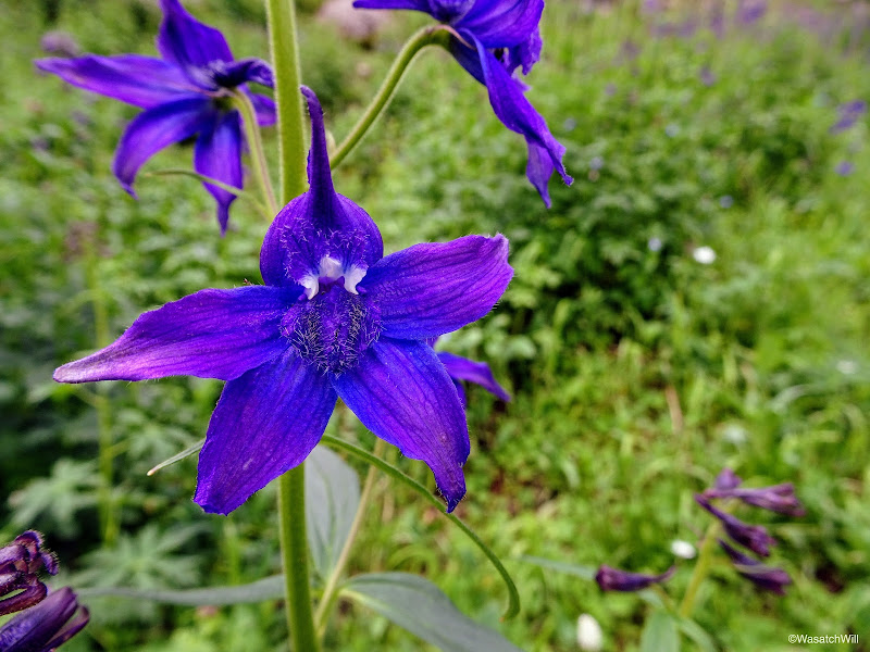
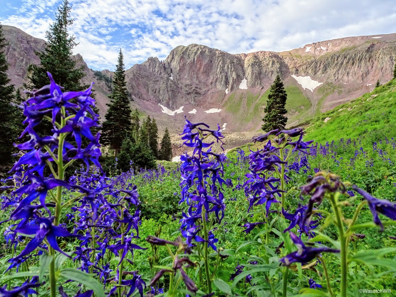
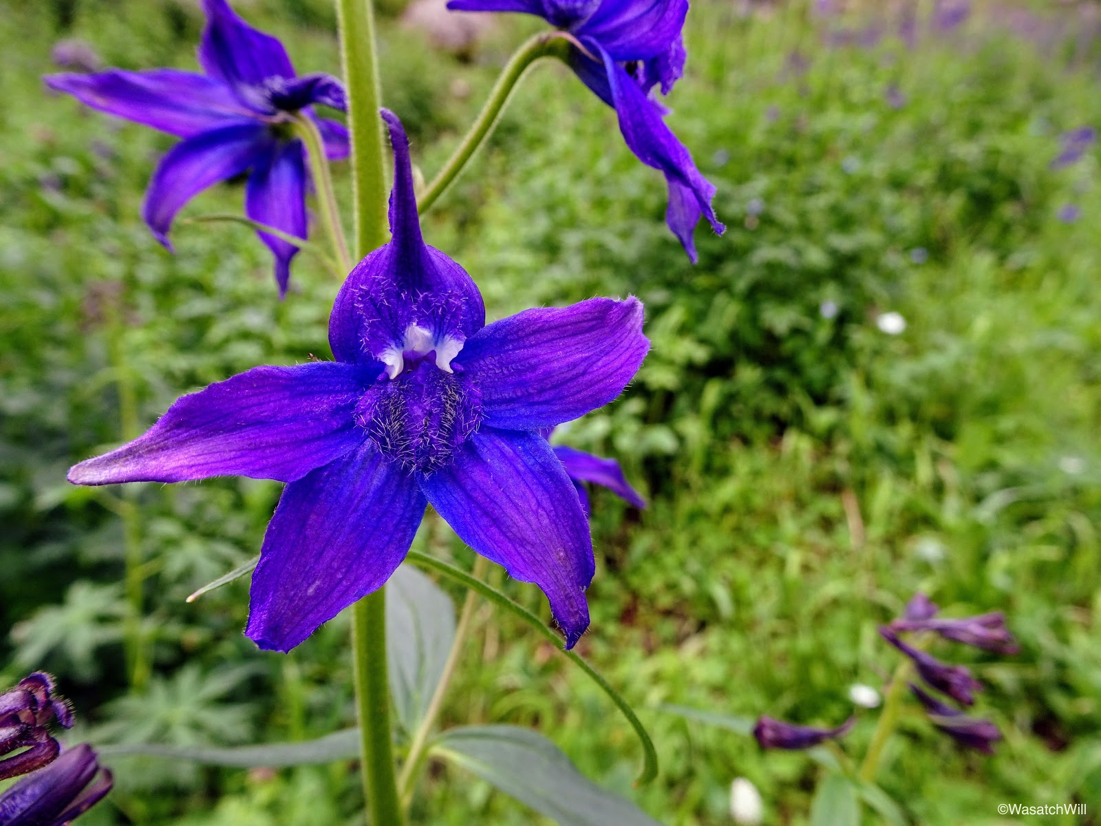
The upper meadows were packed with beautiful violet Larkspur flowers. With how much there was, this would not be a good place to run cattle. Given that there was no livestock in the area, and few signs of human impact beyond the trail itself and the markers along the way, it was very pristine. How was this area so pristine while other actual designated wilderness areas I've visited were so full of human impact? The answer alluded me. Short of having any lakes, this was a gem of an alpine paradise.

So many Larkspurs!
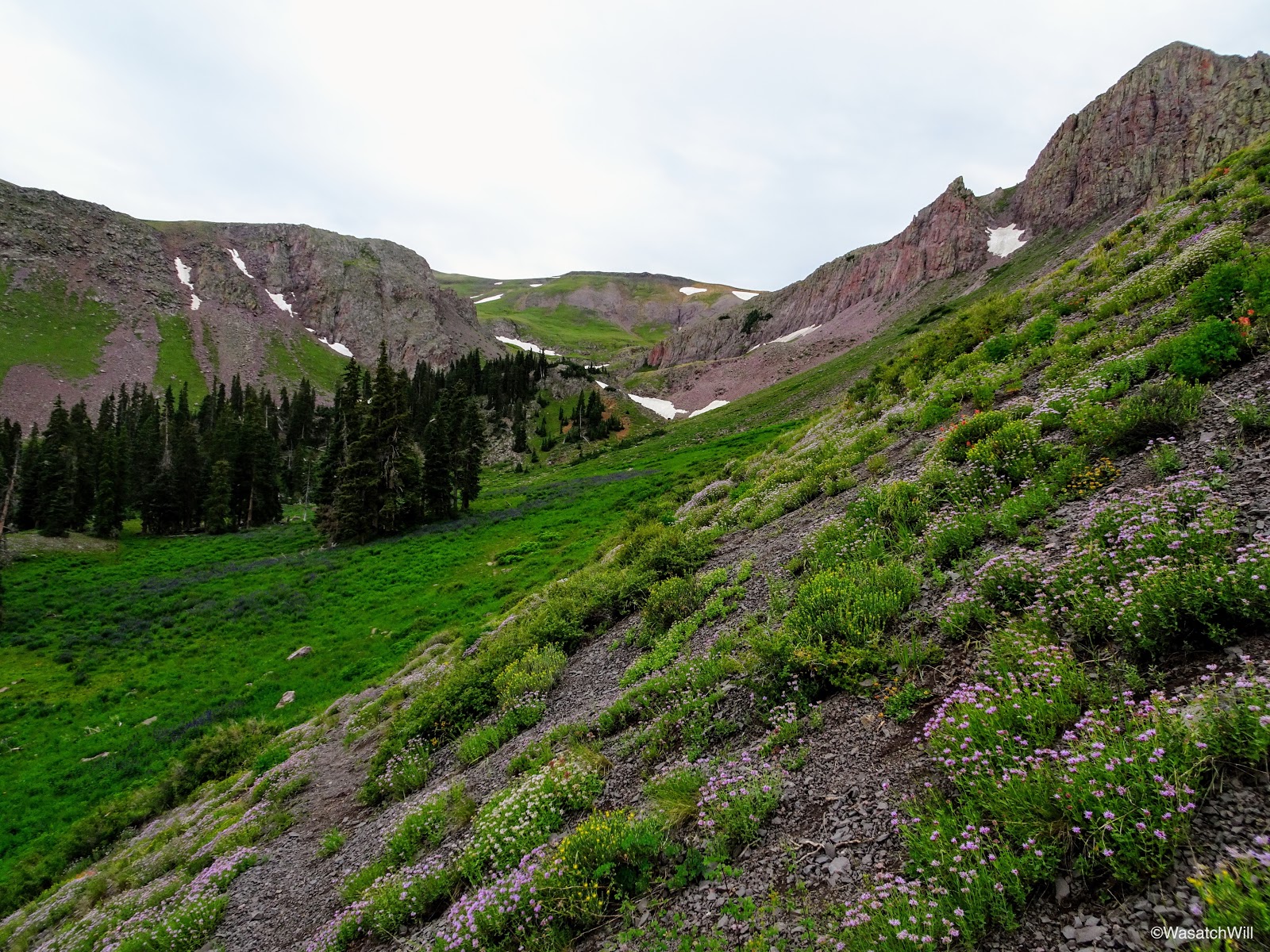
From the Pocket, I continued on over to the junction for Delano Peak. Clouds began to thicken, shutting out much of the blue sky there had been up to this point.
Looking back north from across the other side of the Pocket
Cairn looking back along the Pocket Trail
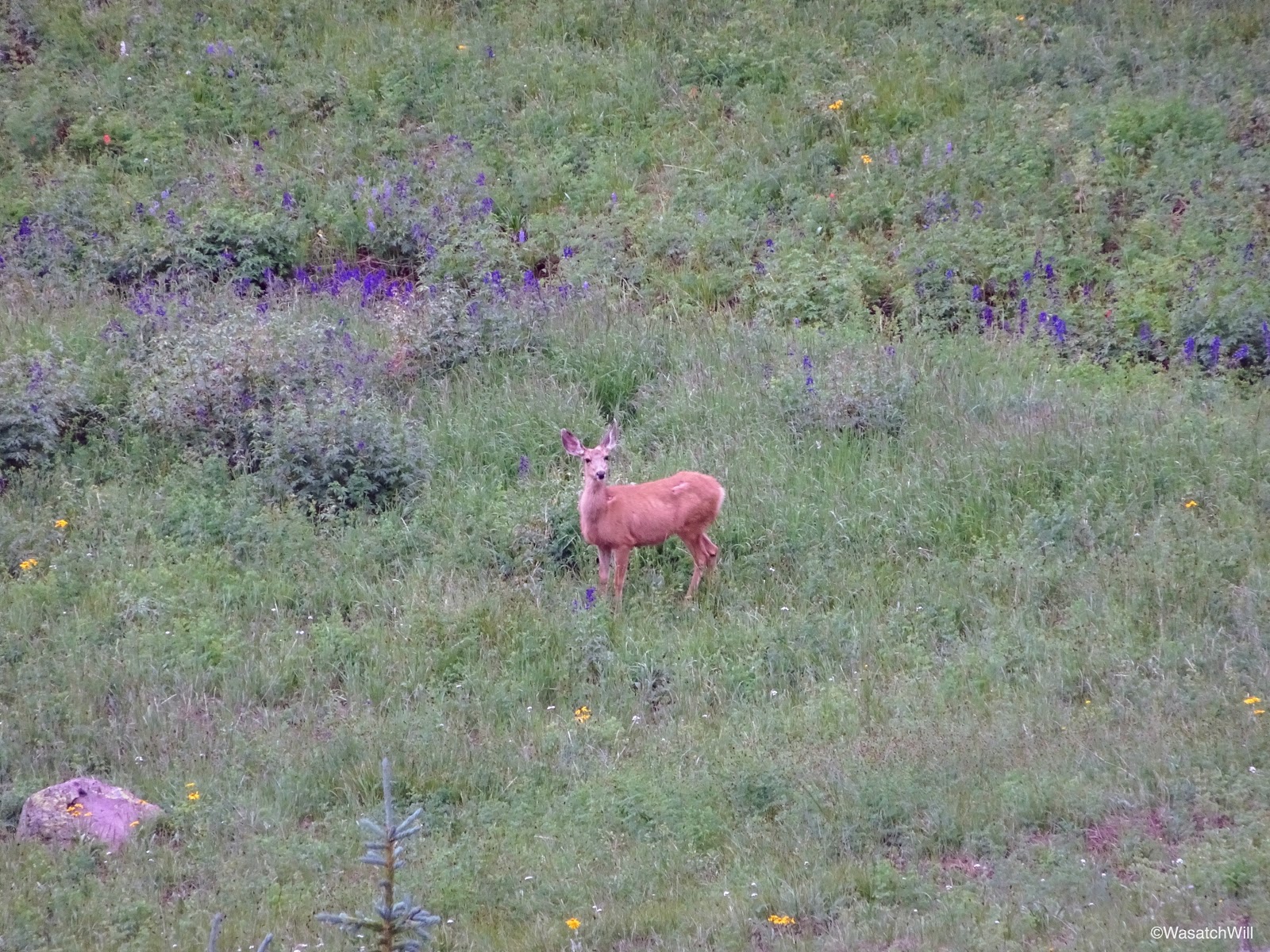
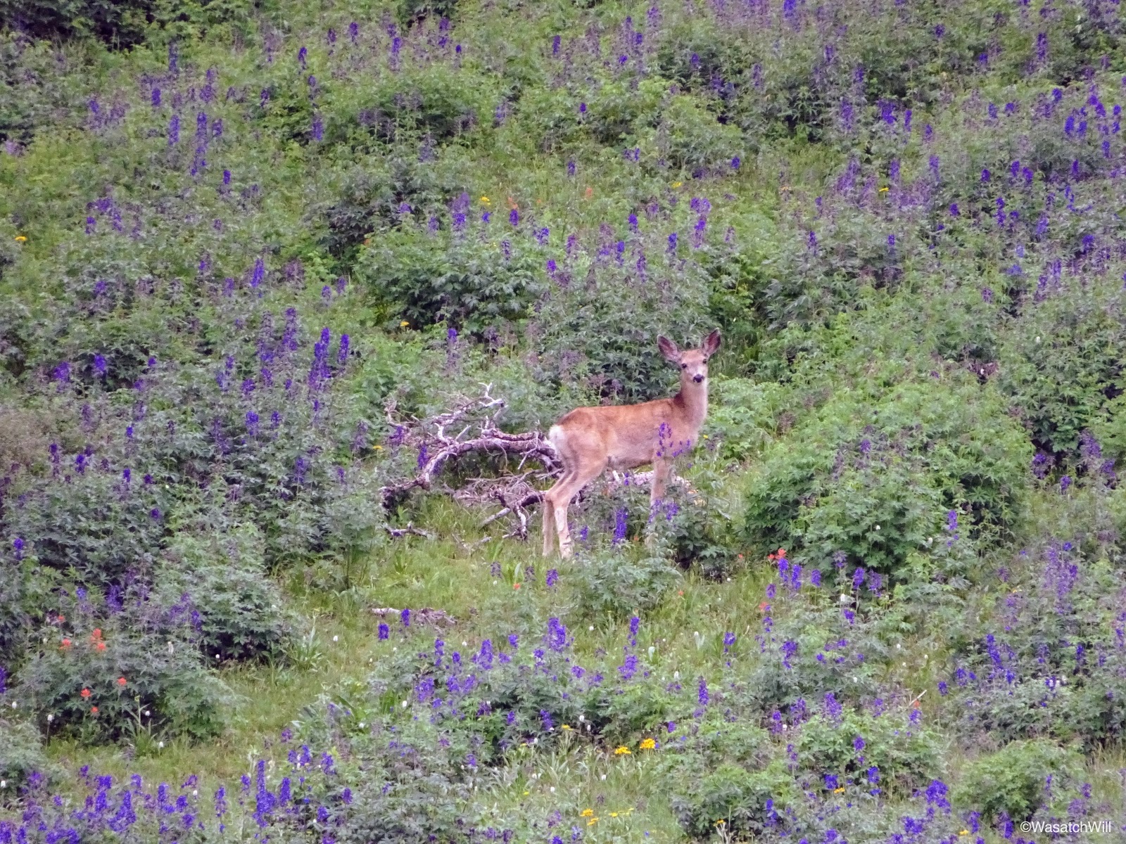
Just before descending the final stretch down to the junction I was after, I observed a couple deer down in the meadows below.

Deer #1 down in meadow
Deer #2 down in meadow
Approaching the junction for Delano Peak and South Fork trails
Once again, I was immersed into a huge field of Larkspurs among other flowers.
Many more Larkspurs
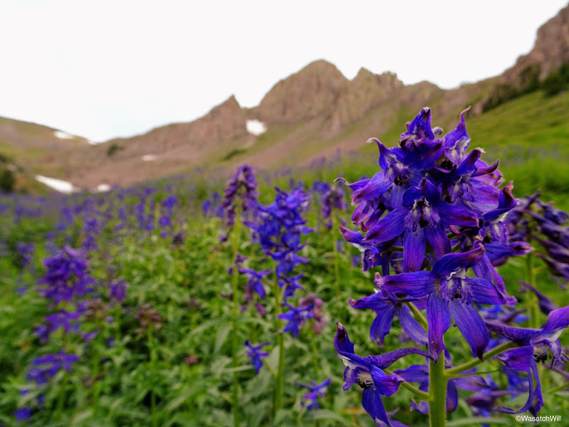
Larkspur closeup
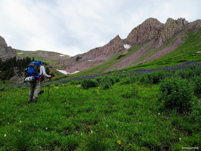
Admiring the beauty of the Larkspur field against an unnamed peak

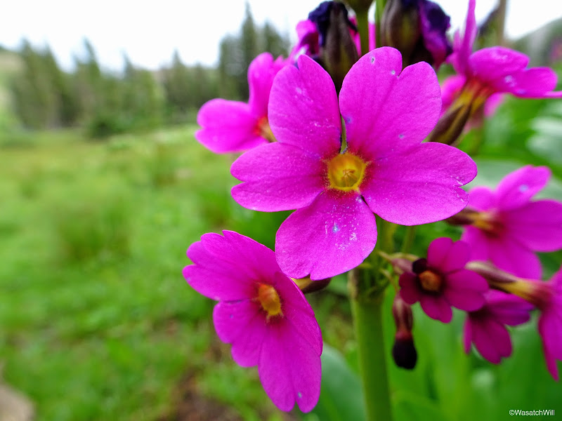
Primrose
Once at the junction, I dropped my pack and evaluated the skies. Hardly any trace of blue sky to be seen anywhere, but nothing all that dark anywhere along the visible horizon either. It was not quite 10 am yet and the peak sat only a mile up, so I determined I would be ok. After all, the forecast did not show any chance of thunderstorm activity over the area until the afternoon.
I transferred over some essentials into my little summit pack and up I went.
Heading up to Delano Peak
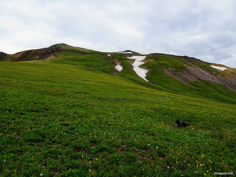
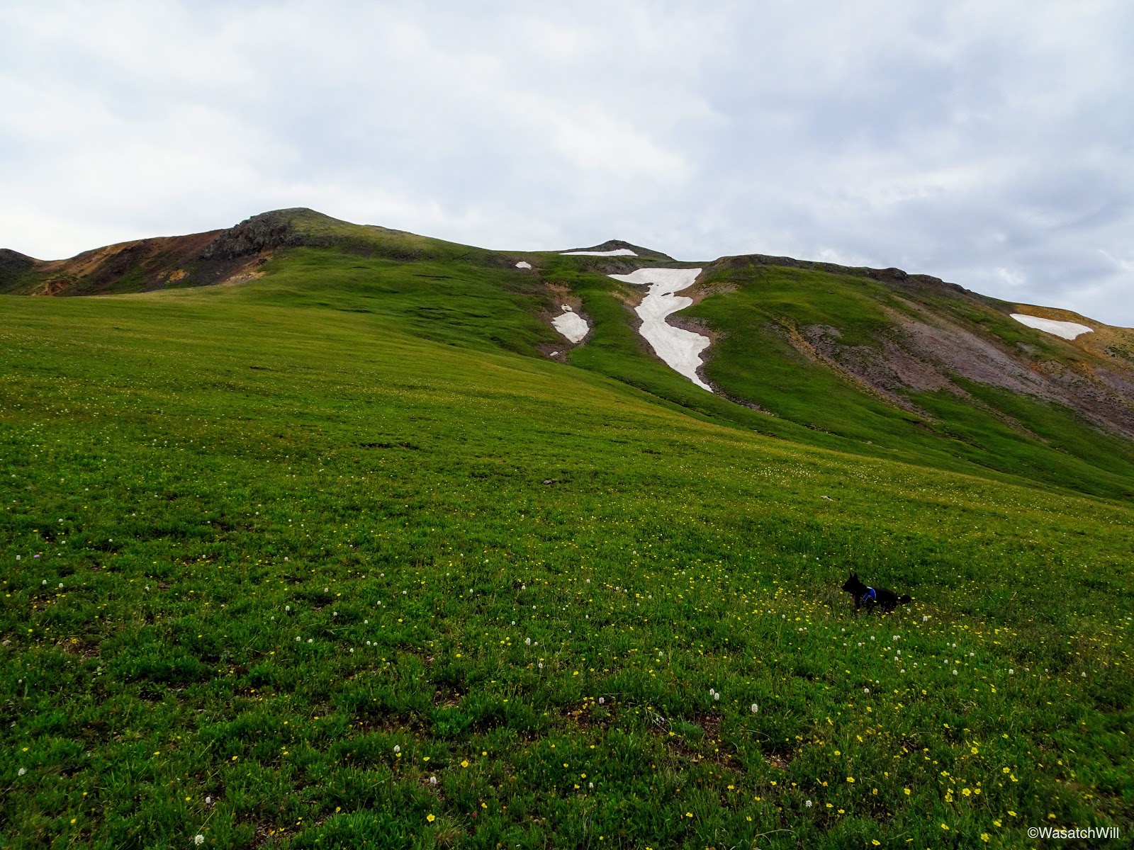
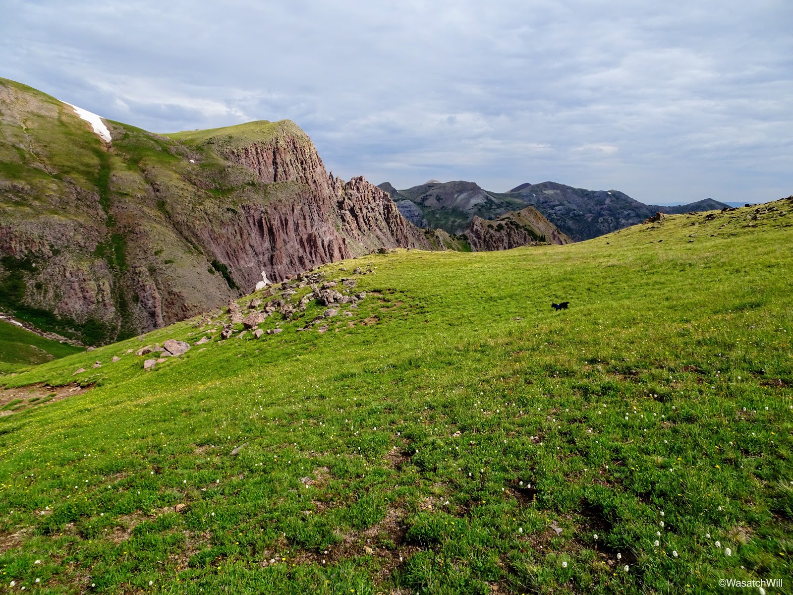
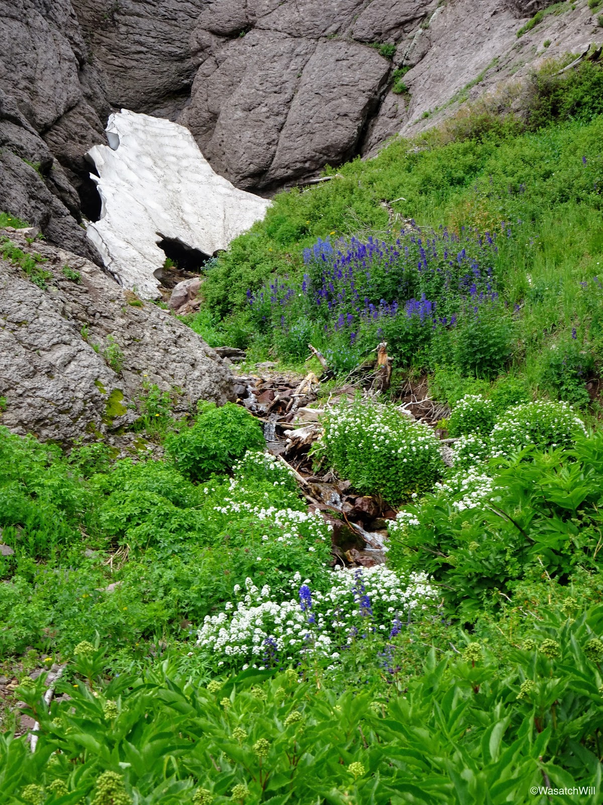
Once again, I was blown away by the scenery, and now greenery, before me. How could I still be in Utah, I wondered? This was looking a lot more like pictures I'd seen of places like Ireland or Iceland. Having spent a couple years throughout New Zealand in my past, I'd say this even resembled parts of that paradisiacal country.
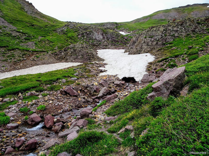
Snow bridge

Sophie scanning for marmots and the like

So much green!
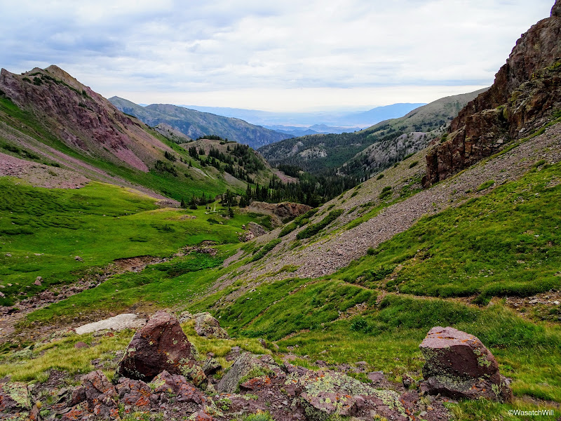
Looking back downward
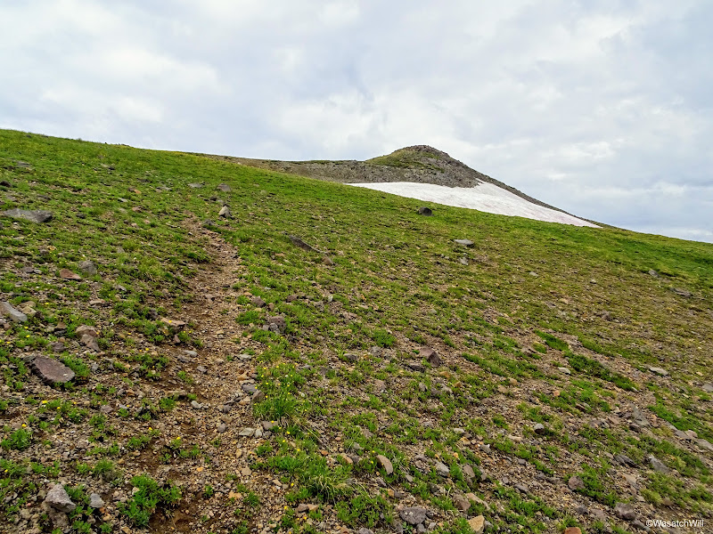
The trail appeared on and off until finally fading away as it gained a saddle in the broad ridge. Once on the ridge, it was almost a straight shoot through the high tundra toward the peak. Off in the distance, I saw what I can only believe to be a gray fox scampering up ahead of me, but by the time I could get my camera back out and turned on, it was out of sight.
Delano Peak off in the distance (middle)
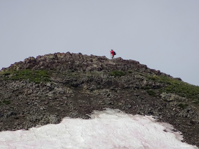
From a distance I could see that there was somebody else up there taking in the view, the first person I had seen since passing Bullion Falls the day before. They would be long gone by the time I got up there, however.

A hiker on Delano Peak
As I got within a quarter mile of the peak, a faint trail emerged once again.
Regaining a faint trail with Delano Peak above right
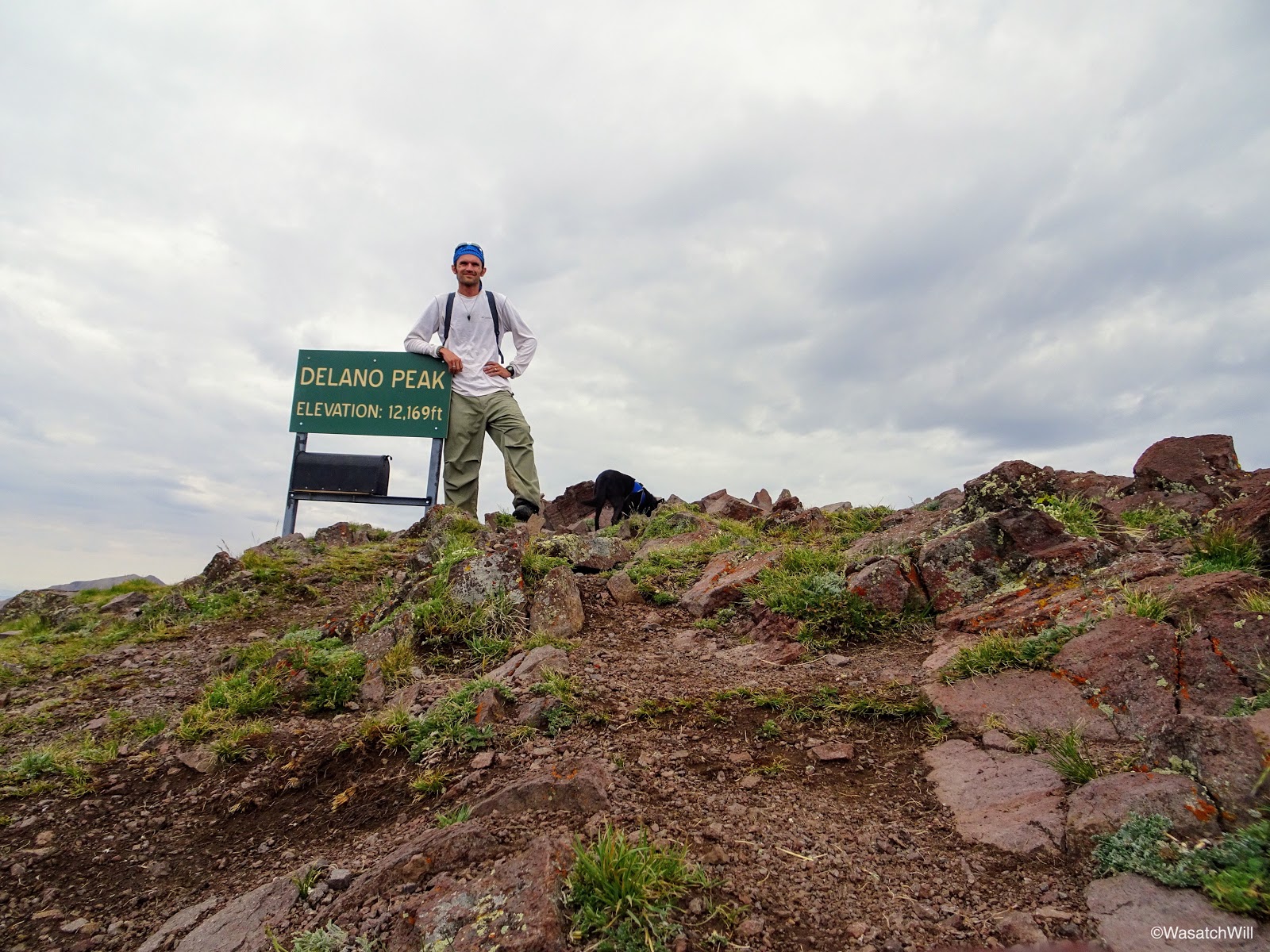
At last, I could go no higher and arrived on the summit of Delano Peak with nobody else in sight.
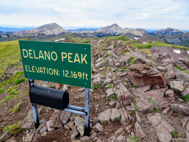
Delano Peak Summit

A distant selfie on the summit
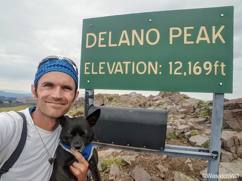
A closer-up summit selfie with Sophie
Delano Peak is named after Columbus Delano who served as Secretary of the Interior for the Ulysses S. Grant administration during the years 1869-1877.
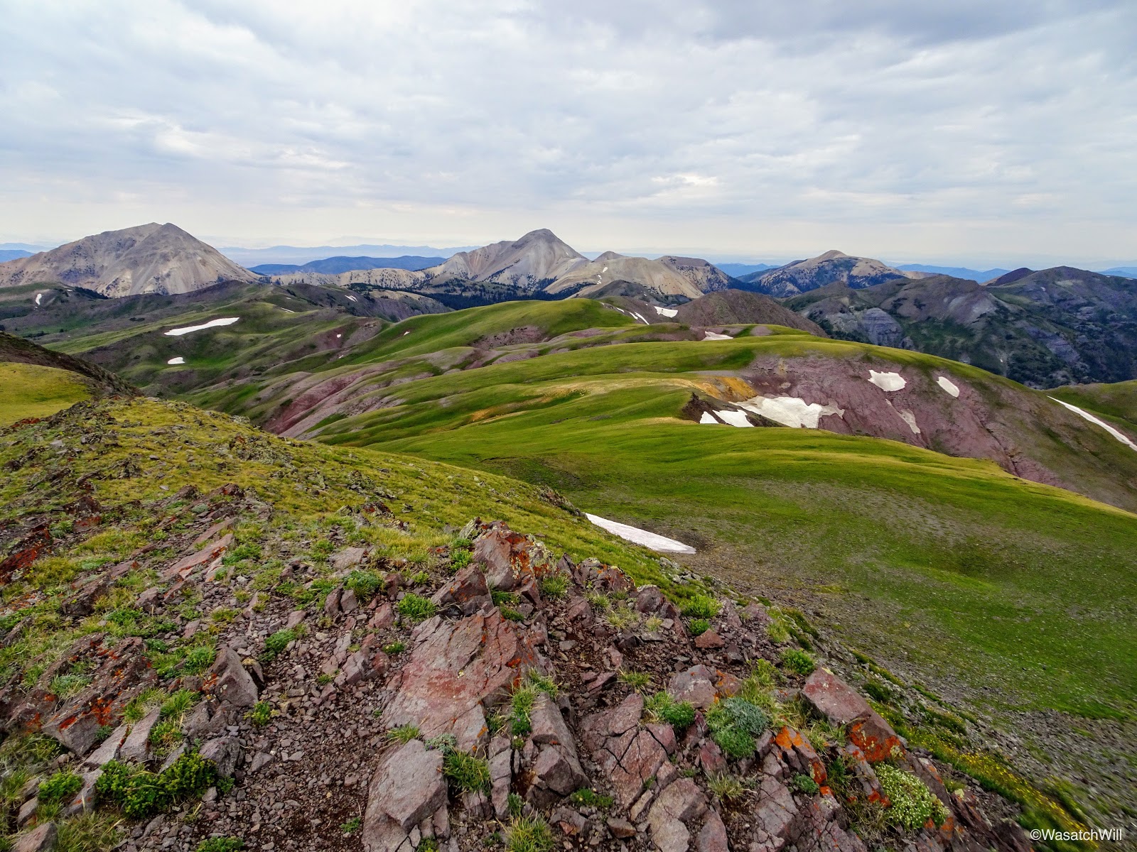
The views were spectacular with a muted but somewhat glowing green hue blanketing much of the landscape below. Patches of snow provided a nice accent. I had been hoping for clearer skies, but the light cloud cover actually added to the ambience of the whole scene.

Looking eastward from Delano

360 Pano from Delano Peak
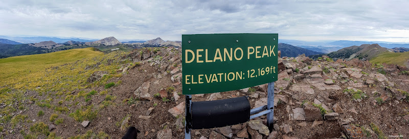
180 Pano from Delano Peak

Signing the register
I did not linger very long, as much as I would have enjoyed it. I did not want to give the weather any more opportunity to stir up something bad while I was up there and I was also eager to return back to my family to enjoy the remainder of the day with them. So back on down Sophie and I went, ever enjoying the magnificent views all the way back to the pack.
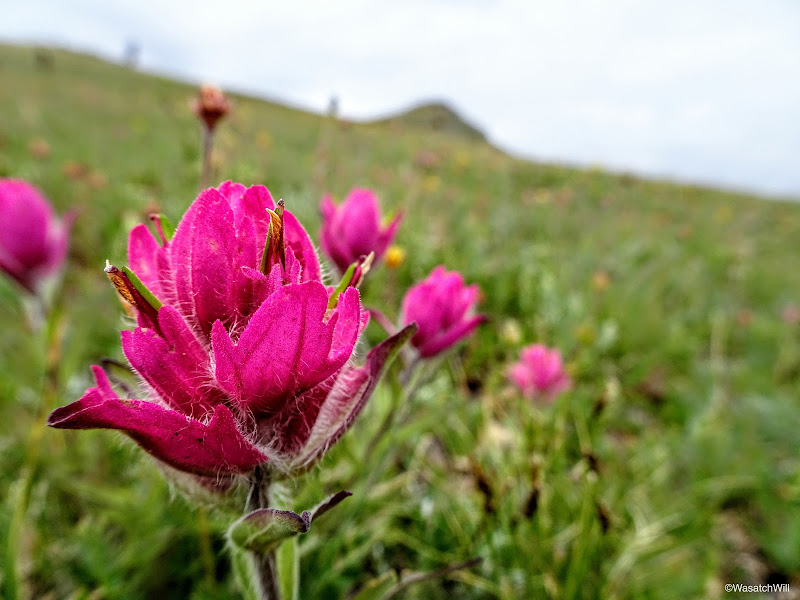
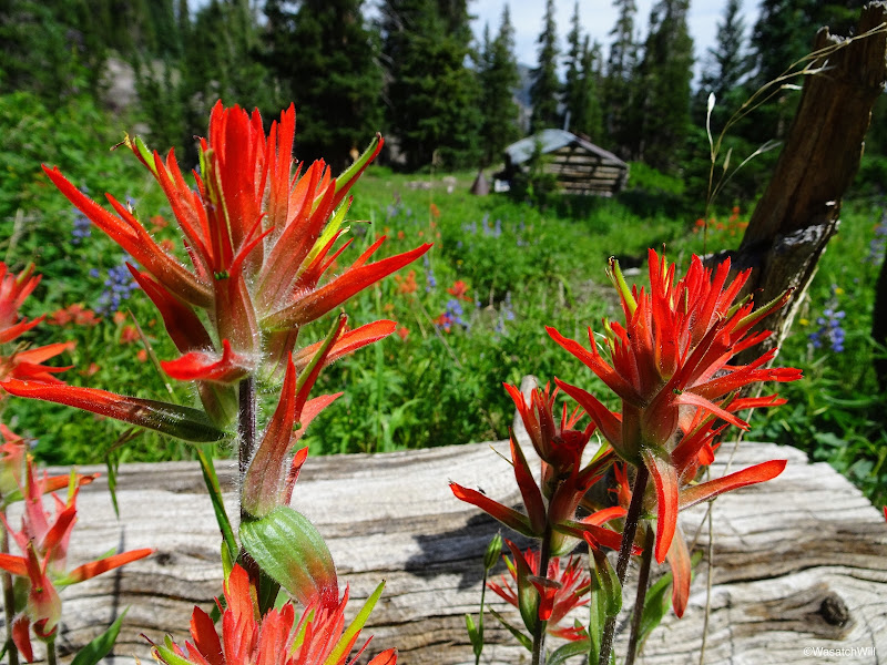
Pink Indian Paintbrush beneath Delano Peak
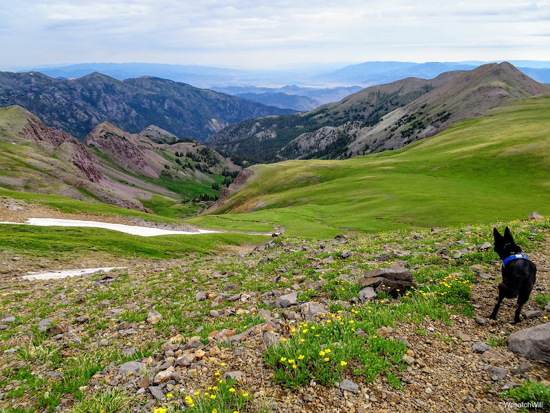
Sophie surveys the route back down...that, or she just spotted another little critter
Part way down, I looked back up at the peak and could see another person on the summit. As I said earlier in the post, there is a much shorter way up the west face of the peak. Due to that route being so much shorter, and being in closer proximity with the I-15 corridor out of Beaver, it is by far the more traveled route up to the peak.
Another hiker gets their turn on Delano
But in my case, the extra miles just gave me all the more scenery to savor.

Descending the fields of green
Rejoining the trail back down
Looking back up toward Delano Peak
Looking back downward again
And looking back up again
Another shot of some Larkspurs and the unnamed peak
Back at the junction, I reclaimed my pack and began the two mile descent down the South Fork Trail back to the junction with the Bullion Canyon trail where I'd close out the lollipop loop.
Back at the trail junction
Primrose
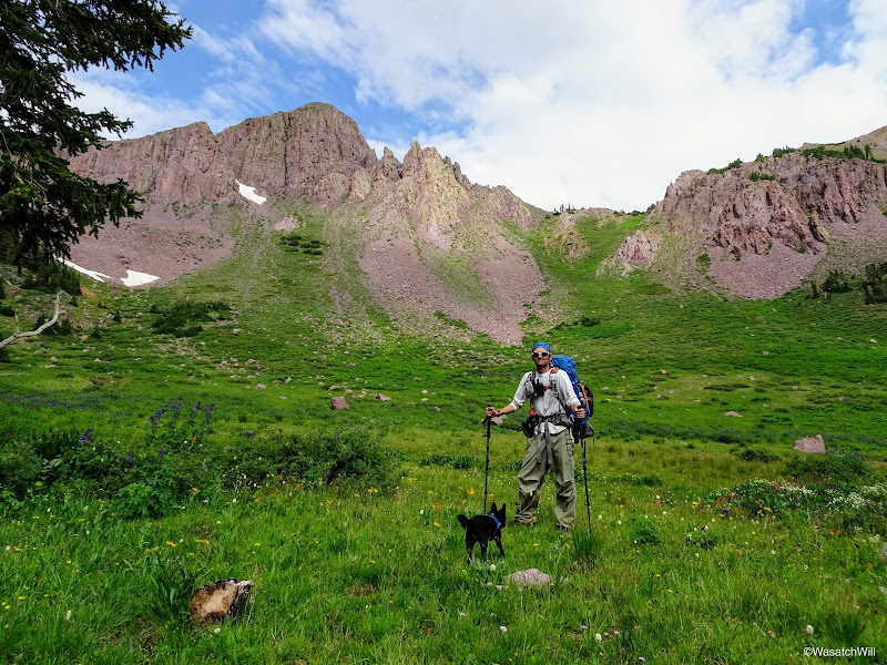
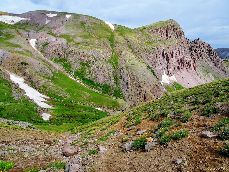
Posing with the unnamed peak
Shortly after heading down, I passed by a spot where the South Fork of Pine Creek flowed through a meadow full of flowers of just about every color. The beauty just kept on coming!
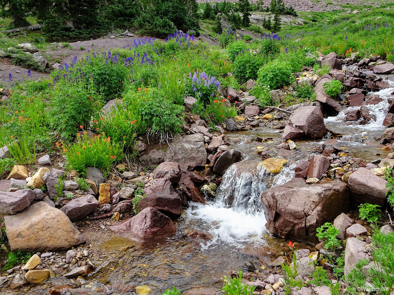
Upper South Fork Pine Creek sandwiched by an array of wild flowers
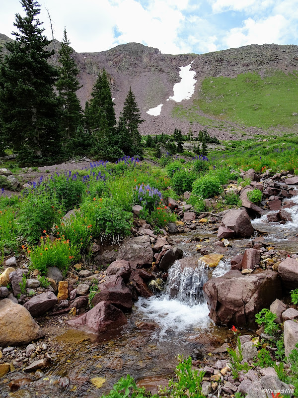
Upper South Fork Pine Creek

Bluebells and Indian Paintbrush along South Fork Pine Creek
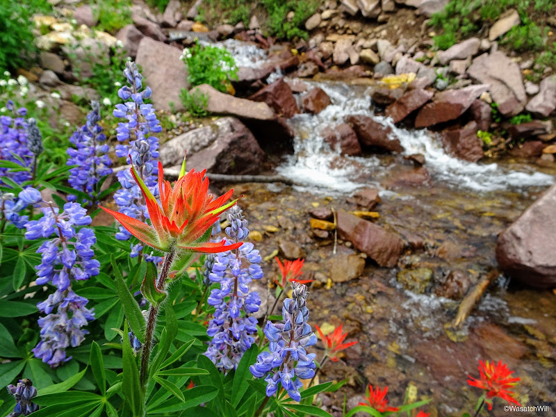
Bluebells and Indian Paintbrush along South Fork Pine Creek
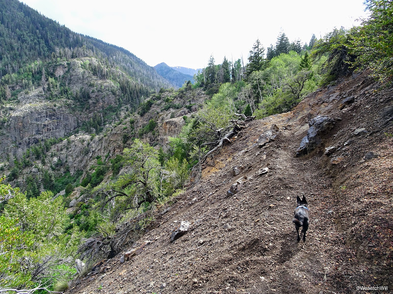
I continued to meander on down the slope. The trail faded away at times, leaving me to navigate and route-find on my own, occasionally checking my GPS to ensure I wasn't getting too far off track. The sights remained delightful.

Small cascading tributary of South Fork Pine Creek
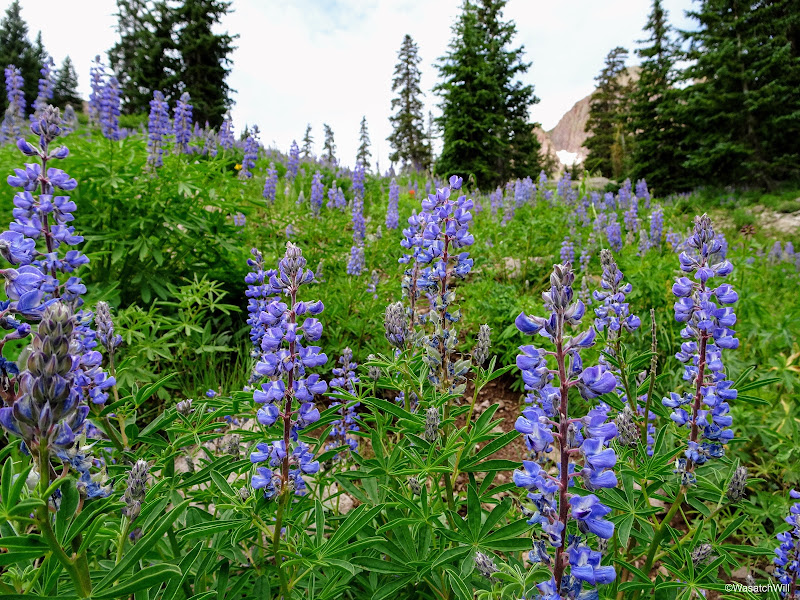
A field of Lupines
Larkspur

Another little tributary of South Fork Pine Creek
And another cascading tributary of South Fork Pine Creek
More flowers surrounding South Fork Pine Creek
Soon enough, I reached a creek crossing where I was able to pick up a more defined trail that remained so for the remainder of the route down.
Crossing South Fork Pine Creek to recapture the trail
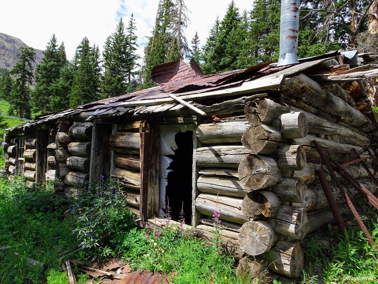
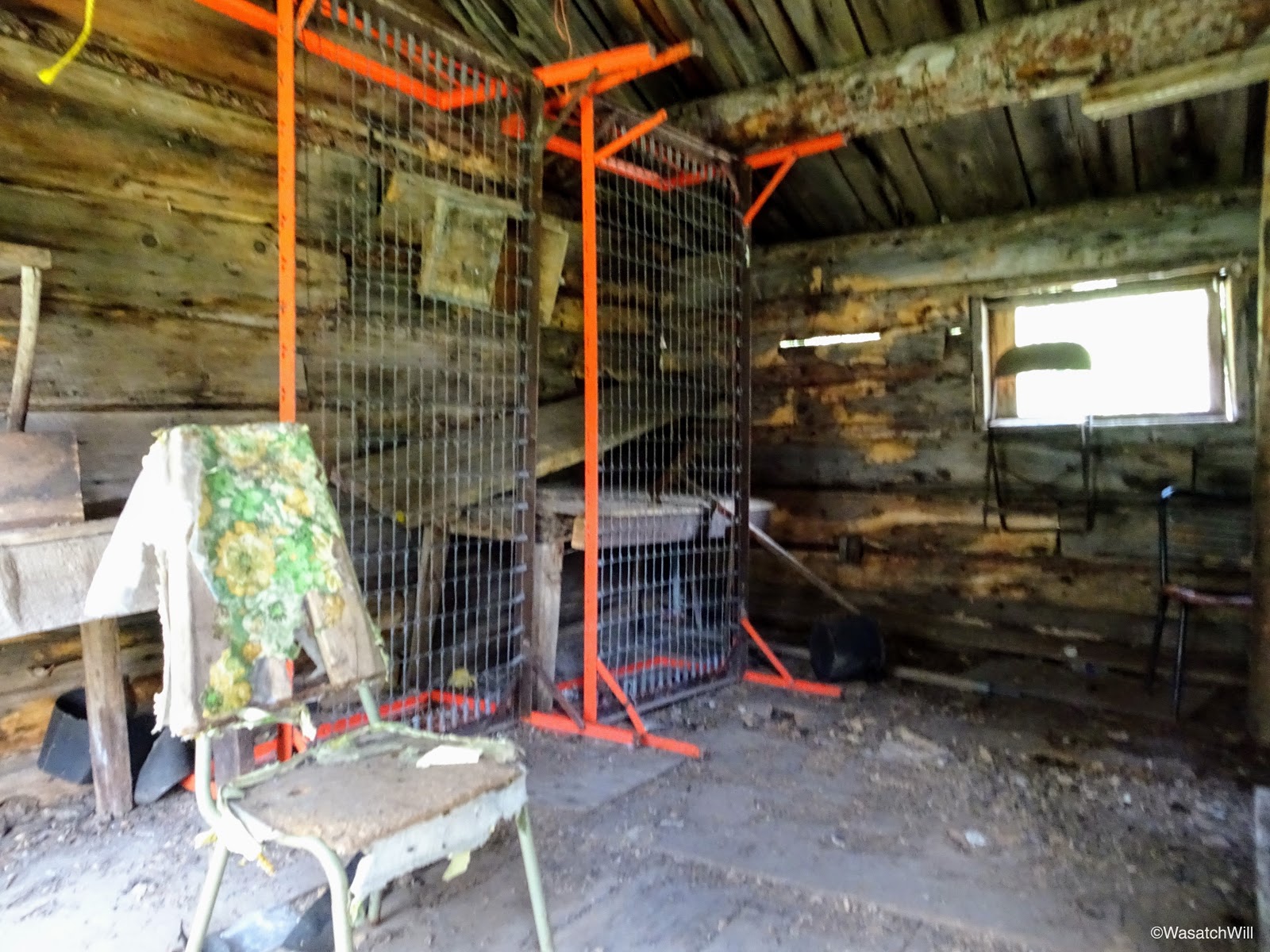
As I continued down, I came up on another older cabin, this time, one with it's roof still in tact. It too was a cabin, likely built in the late 1800's to serve as housing quarters for a miner. Relics, older and newer, were found scattered about, inside and out.
Indian Paintbrush with old miner cabin in the background

Old miner cabin

Other side of old miner cabin
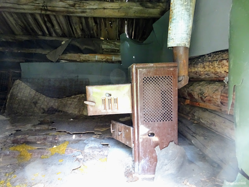
Old stove inside one of the cabin rooms
Looking inside the other room

Old kitchen inside cabin
Old relics from the cabin

Close-up of the relics

Another relic close-up
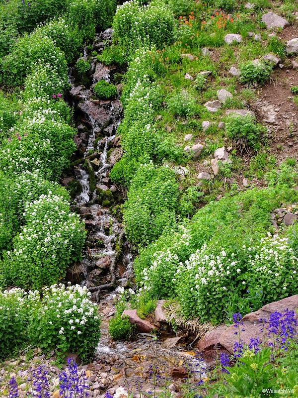
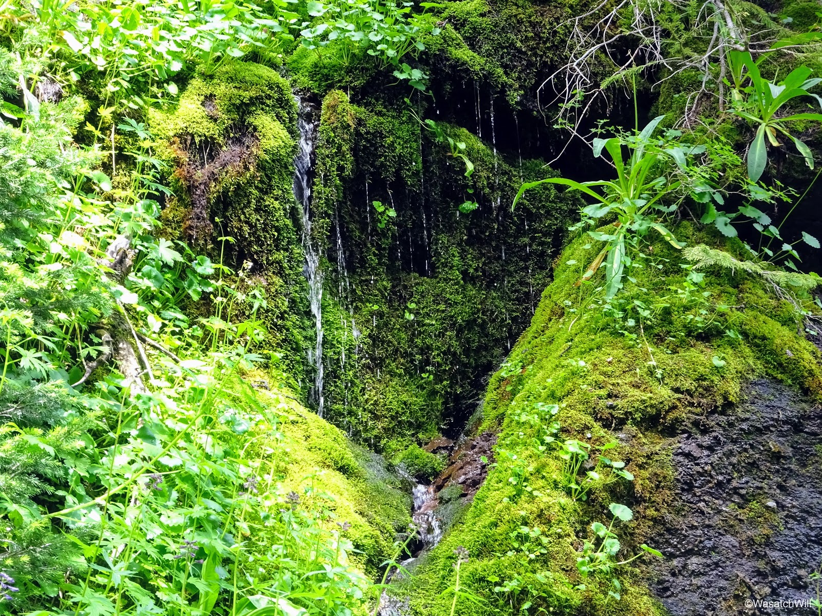
As I continued on down, I passed by another interesting and unique spot where some green algae and moss covered a large section of rock face off the side of the trail. With some trickling strands of water flowing off it, it presented a scene from a rain forest jungle.
'Mini' rain-forest
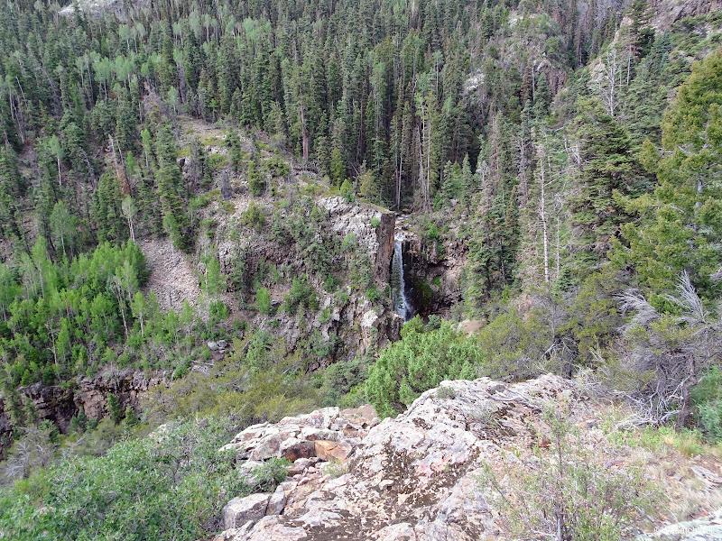
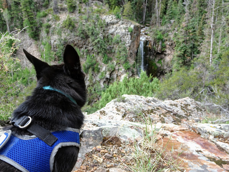
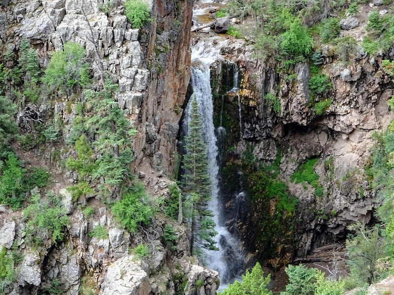
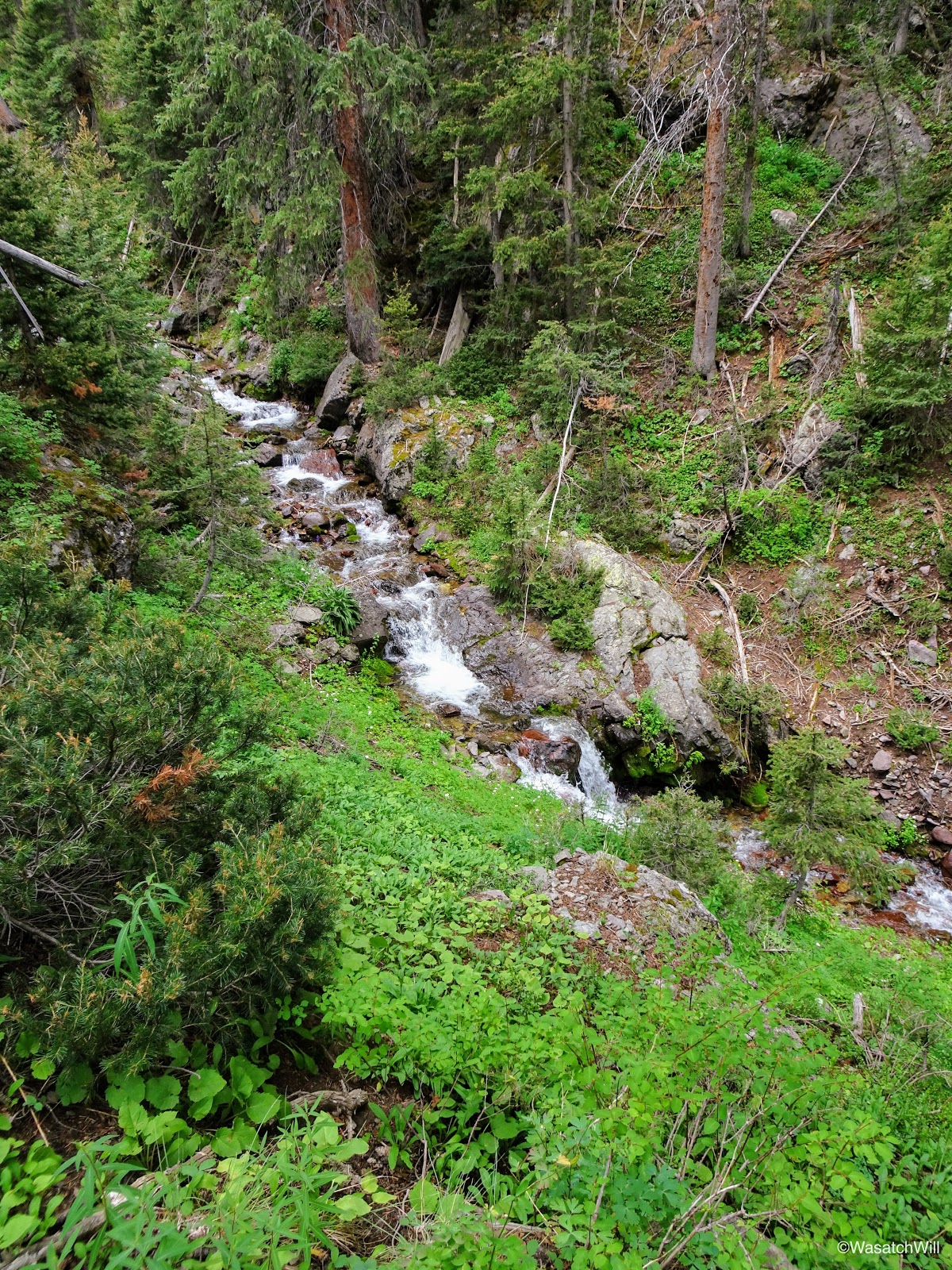
A good way down from the jungle scene was another waterfall way off the trail flowing down South Fork Pine Creek.
Distant waterfall along South Fork Pine Creek
And further down, yet another waterfall well away from the trail.
Another waterfall along South Fork Pine Creek
The trail continued to descend steeply down through some thick stands of conifers before crossing the creek yet again (there are a few creek crossings with this trail) where it then rode the flower-packed slope of the South Fork while the creek continued downward.
Following the trail above South Fork Pine Creek
A batch of Fireweed above South Fork Pine Creek
Cascading South Fork Pine Creek
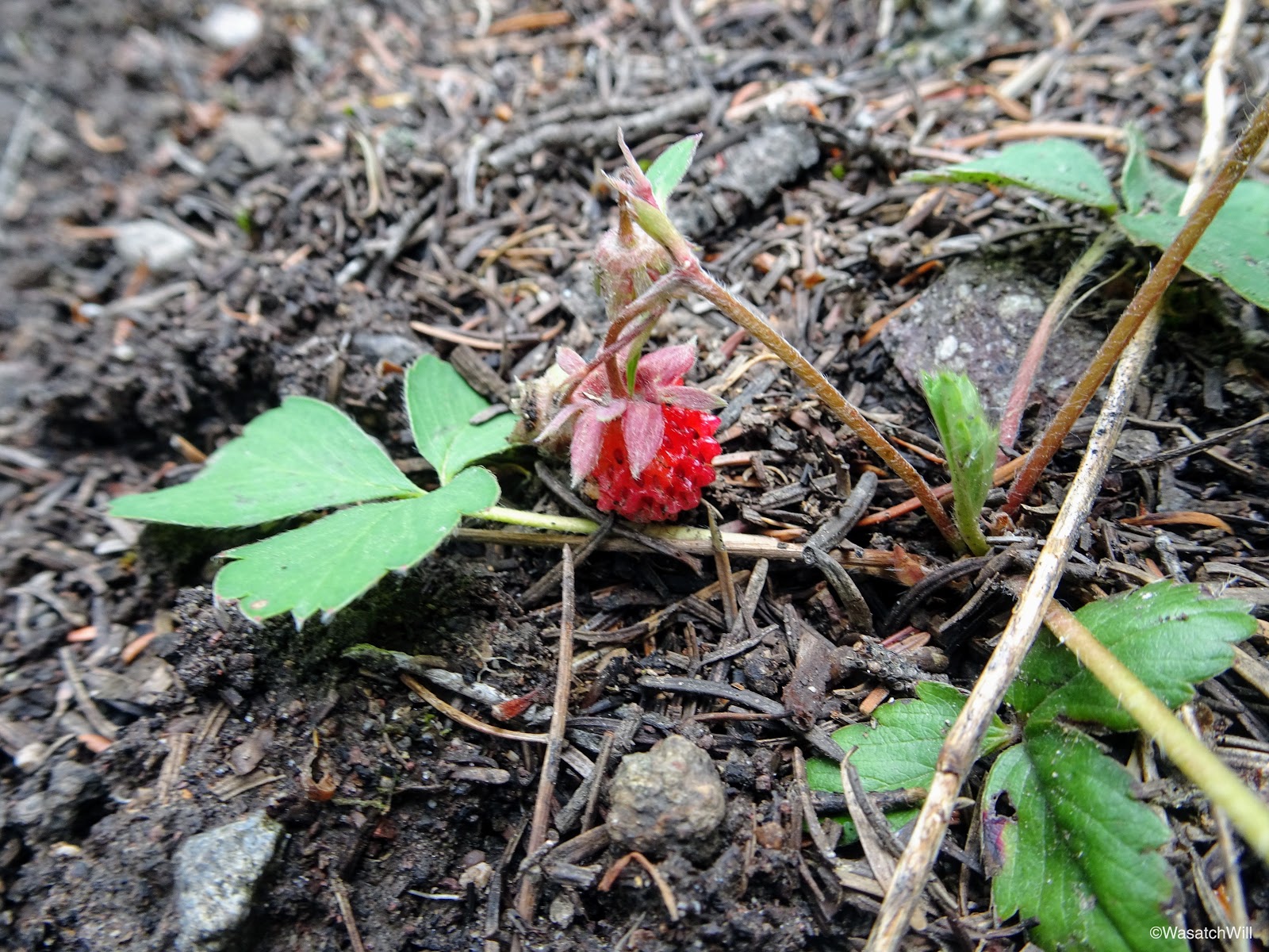
The trail then began to switch back downward to catch up with the creek's elevation loss and then veered away from the creek for a ways through another wooded section. Here, wild alpine strawberries could be found across the forest floor, however, the berries themselves were few and far between.

Wild alpine strawberry
Soon, the trail reached the biggest creek crossing of the trip. At this crossing, Pine Creek and its South Fork had already merged upstream, making for a very wide creek. Water was shallow enough to not pose a danger, but it didn't make it any less cold. I marched right on through with little effort and against her own will, Sophie forced herself to follow along. For her little legs, it took much more effort, but she handled it like a champ. Luckily, she forgave me for not thinking to just carry her over myself.
The big creek crossing
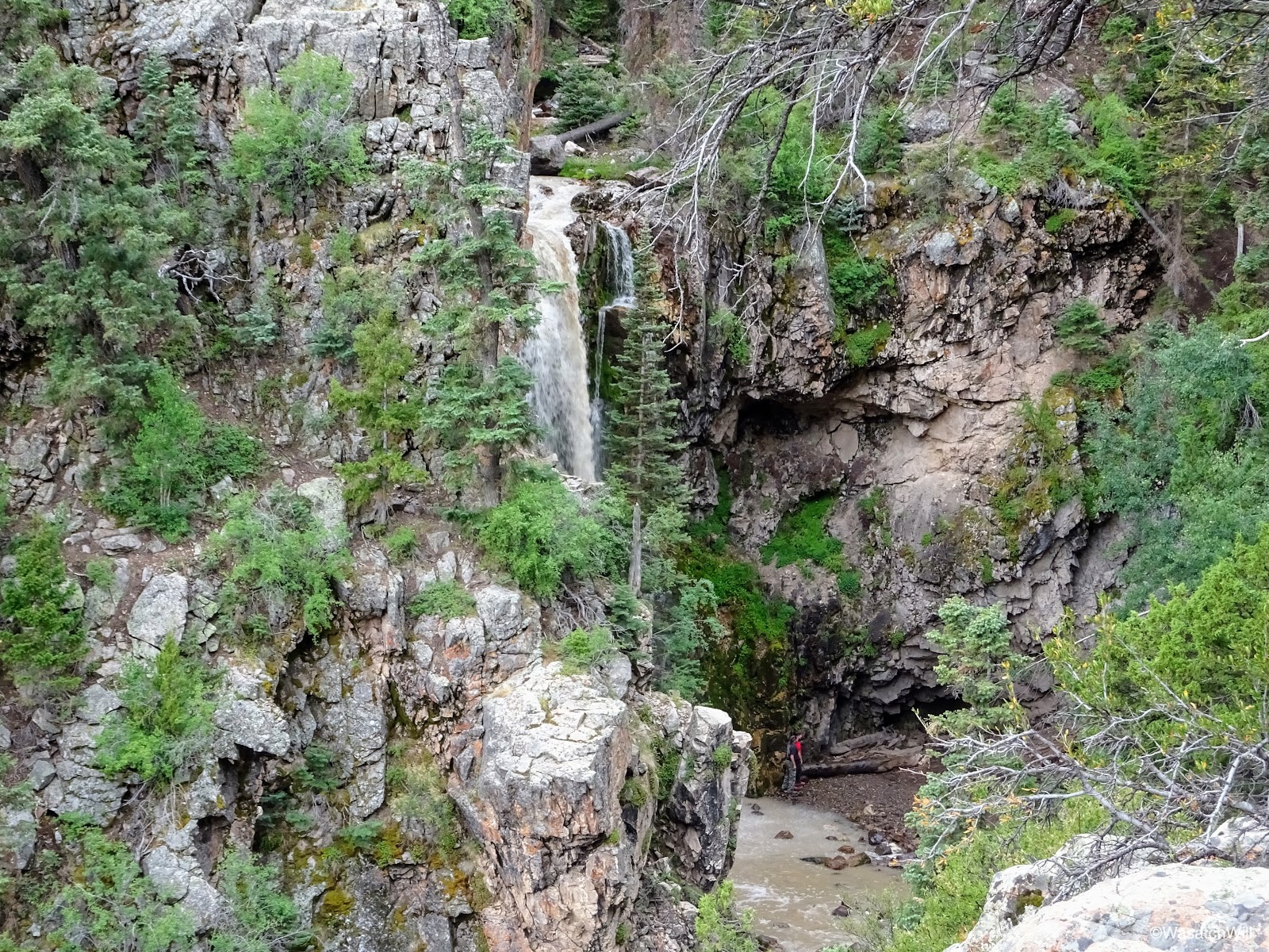
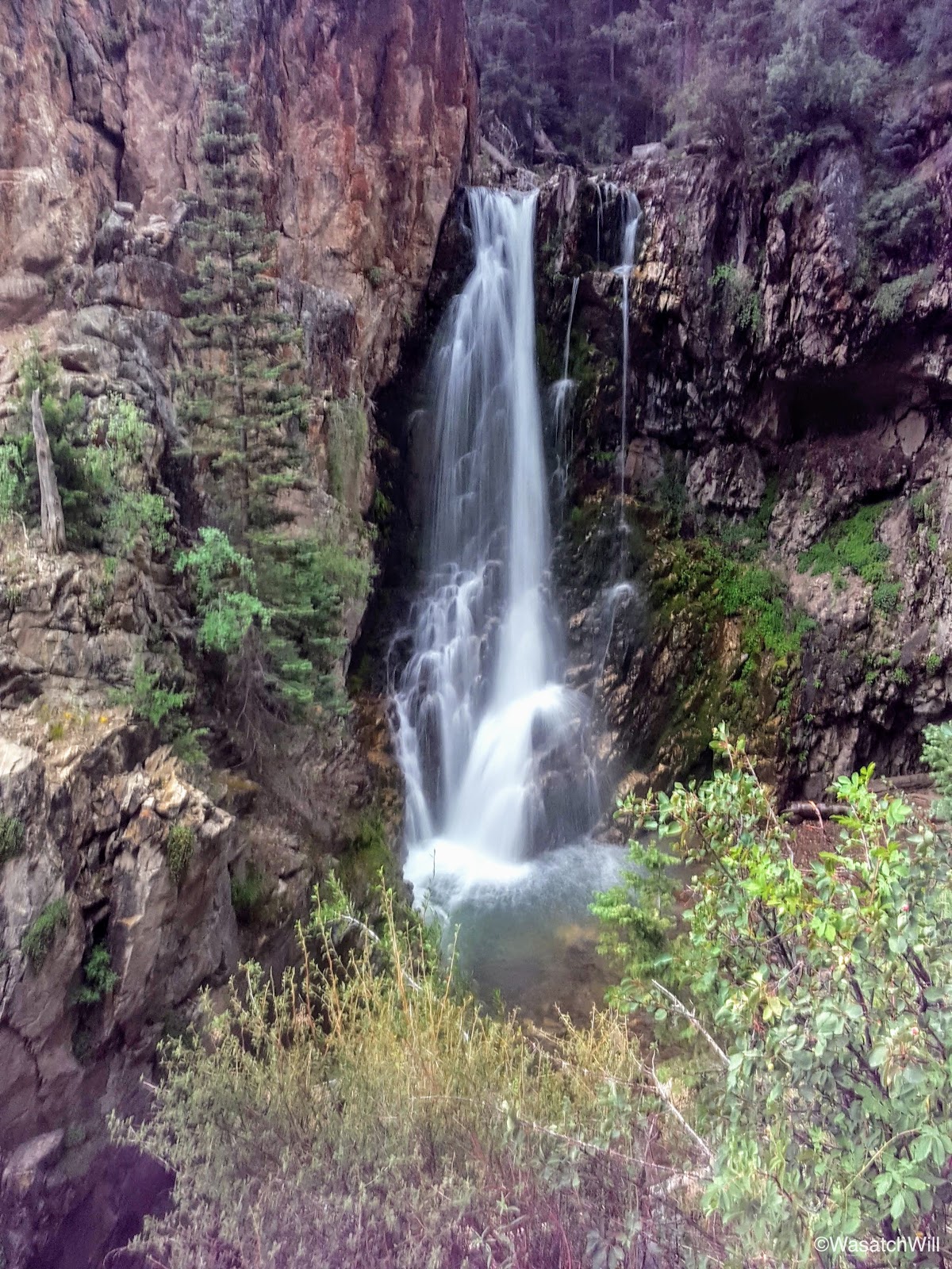
Back on the main Bullion Canyon trail, I worked my way back down the rest of the canyon, where I encountered a couple of day hikers on their way up the trail just before crossing back over the rock slide myself. Aside from the two different people I saw on Delano from afar, this was the only time I encountered anybody on the trail above Bullion Falls.
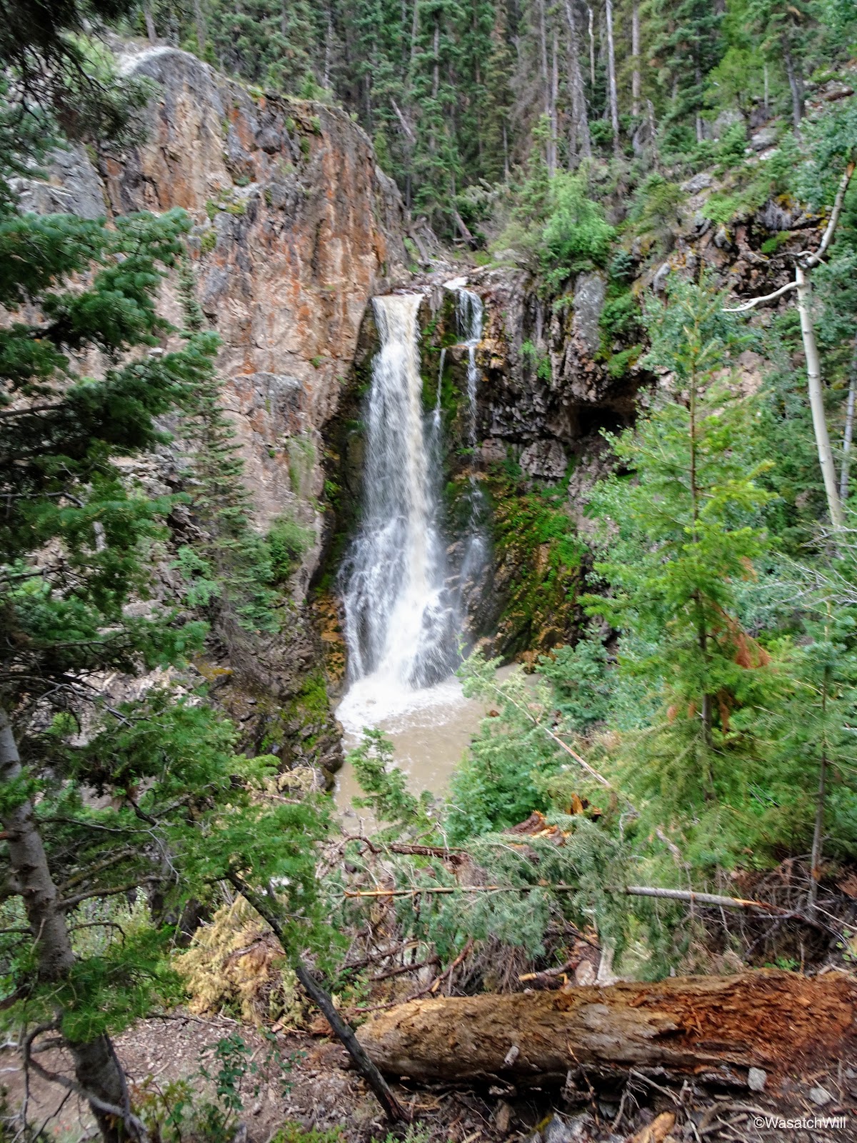
We paused for another view of Bullion Falls on the way down. Again it was tempting to make the effort to go all the way down to their base, but nobody else was around, darker clouds were looming with a bit of rain starting to fall and thunder in the distance. Sophie wouldn't have been happy about it either. I resisted the temptation and just enjoyed the view from above.
Approaching Bullion Falls
Sophie observing the falls
Closer-up shot of Bullion Falls
Wider shot of Bullion Falls

Longer exposure of Bullion Falls
Once back at the car, we loaded up and drove another quarter mile up the road to check out the remains of Webster City (aka Bullion City) and the actual Miners Park.
Webster City sign
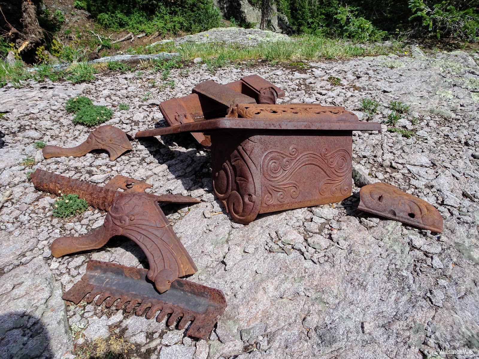
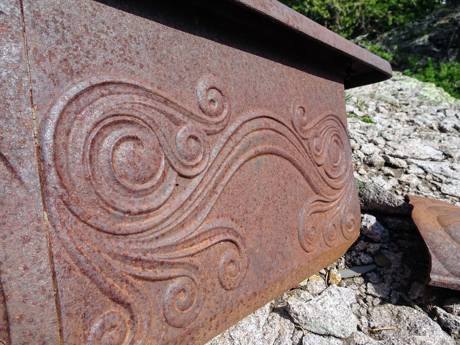
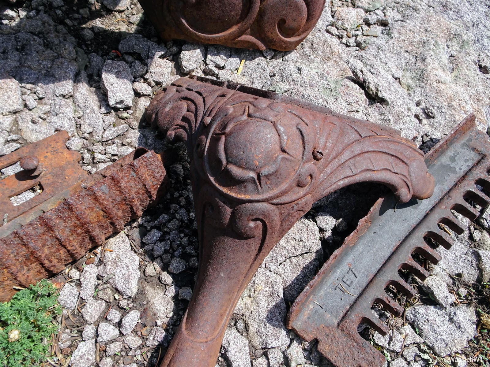
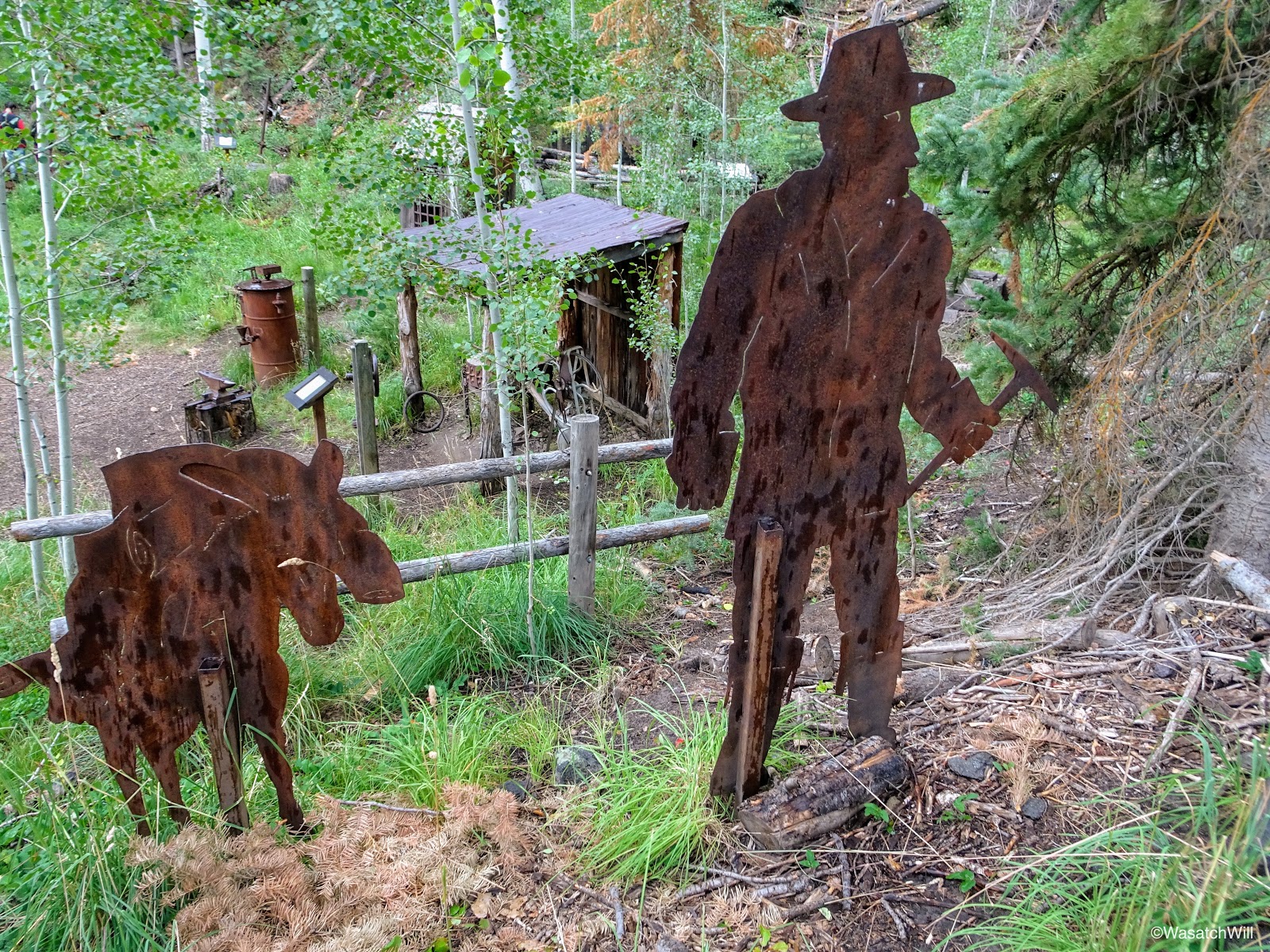
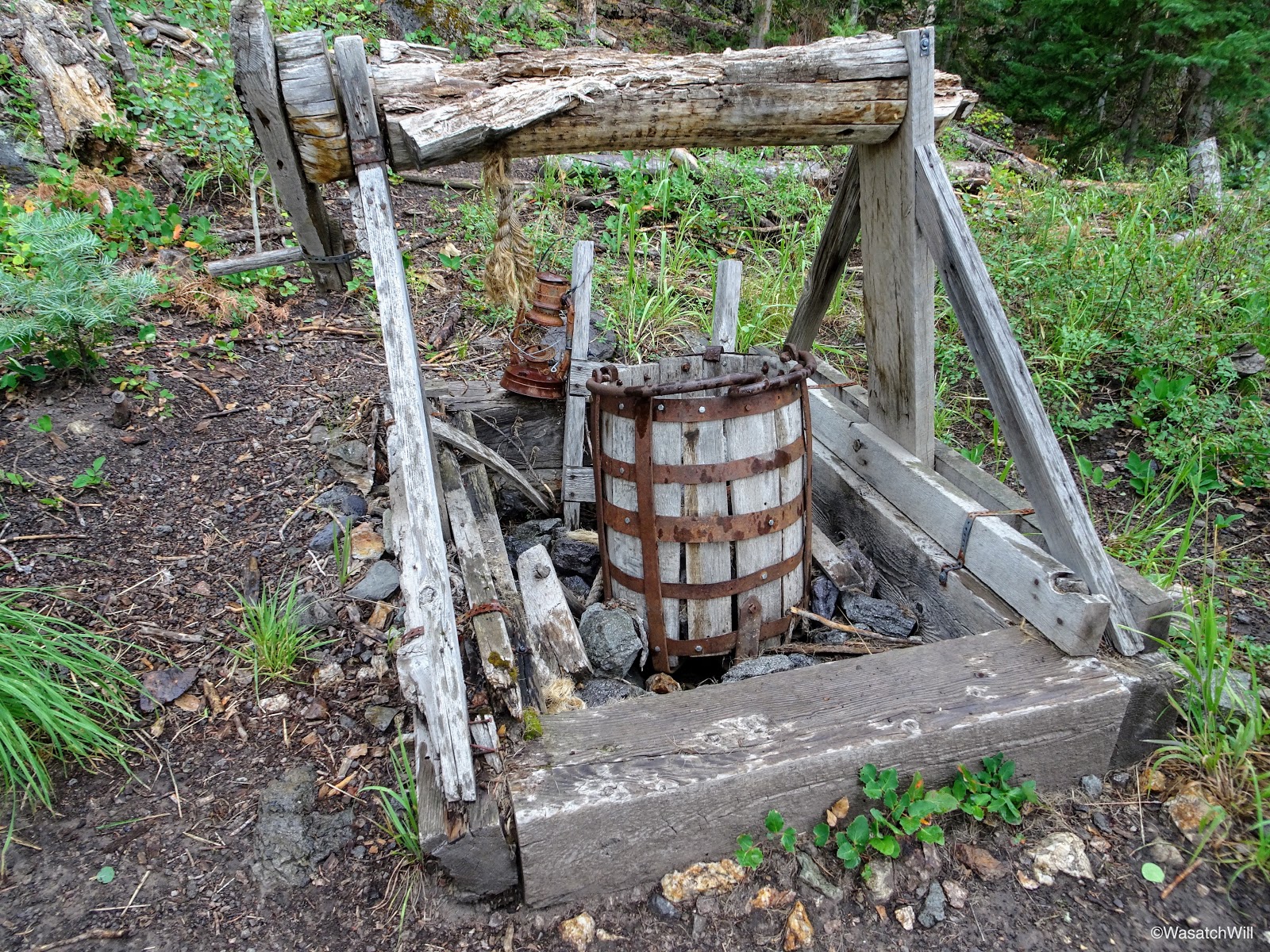
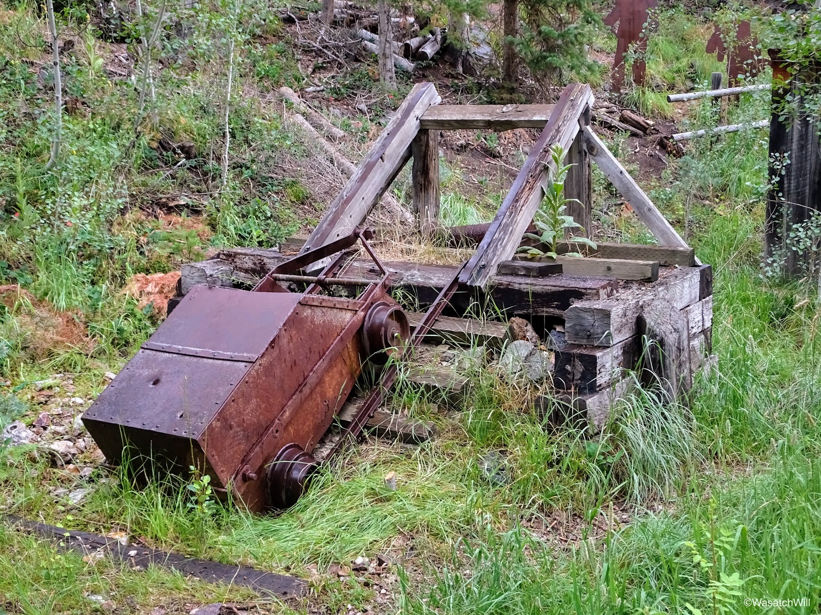
Again, Miners Park is a little park with interpretive trail maintained by the Forest Service to offer a quick glance into the history of the mining operations that formerly took place in this part of the canyon. Quite a collection of mining relics and artifacts can be found on display here.
Miners Park sign
Intro to Miners Park
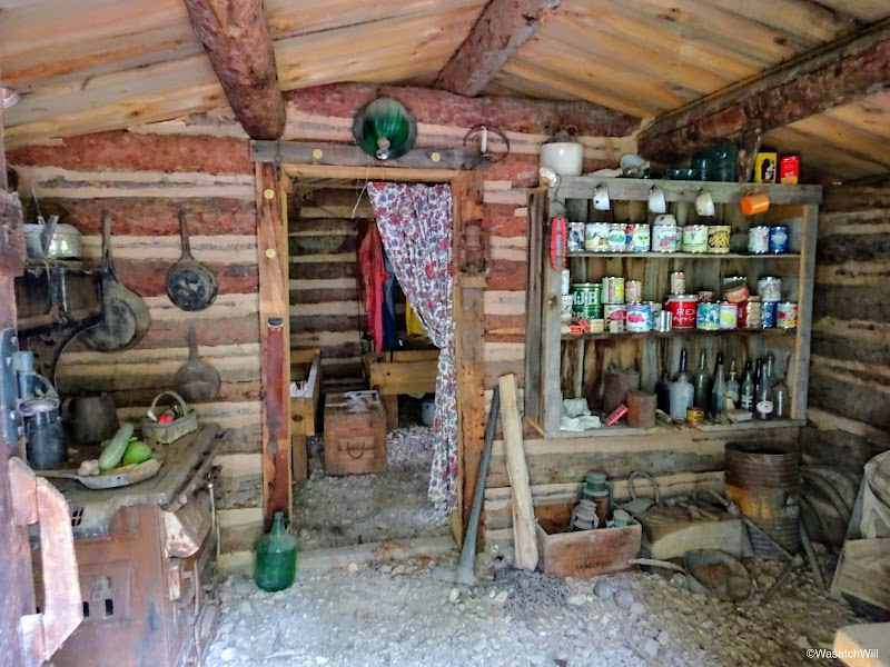
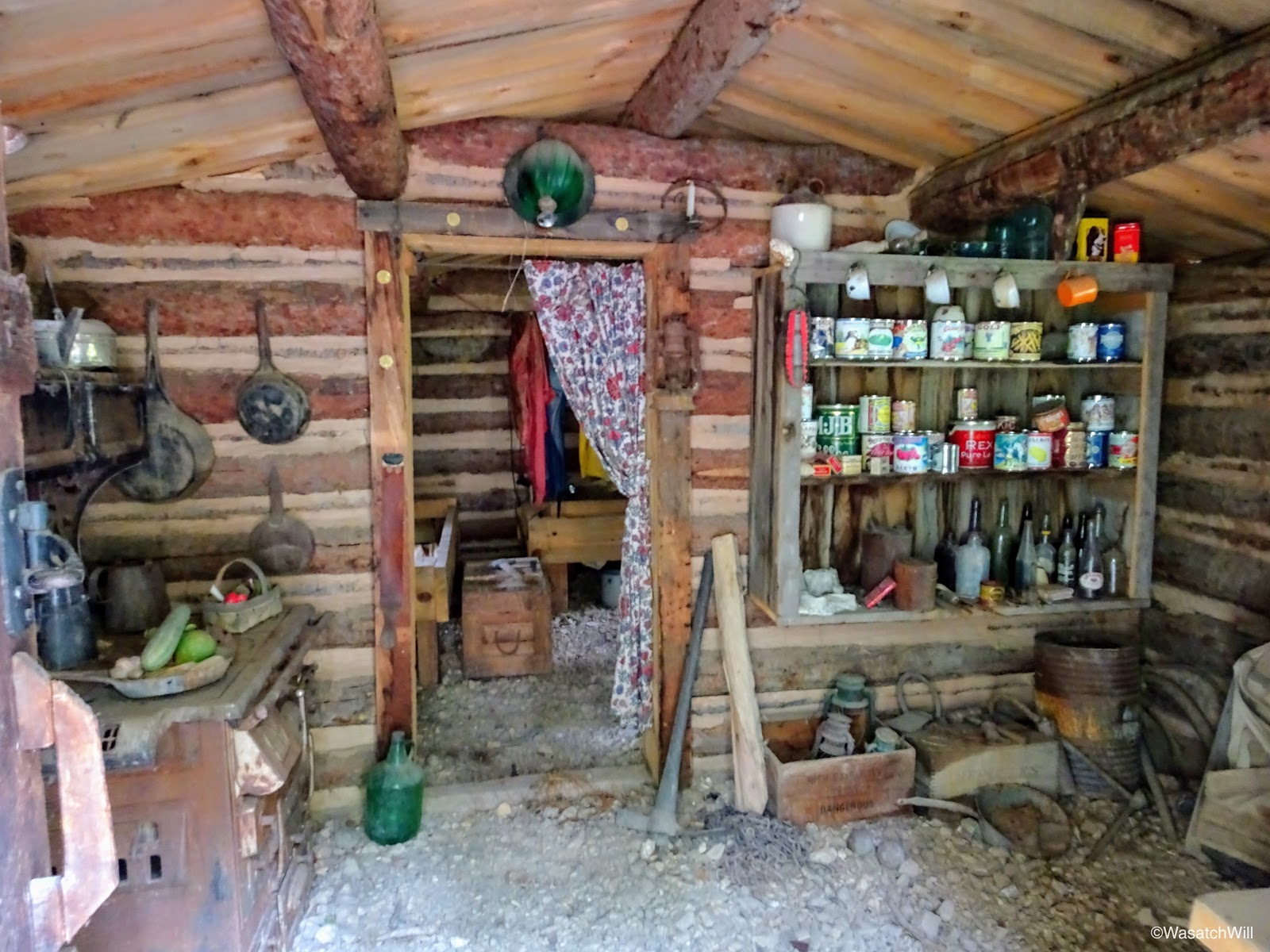
Inside Dalton Cabin
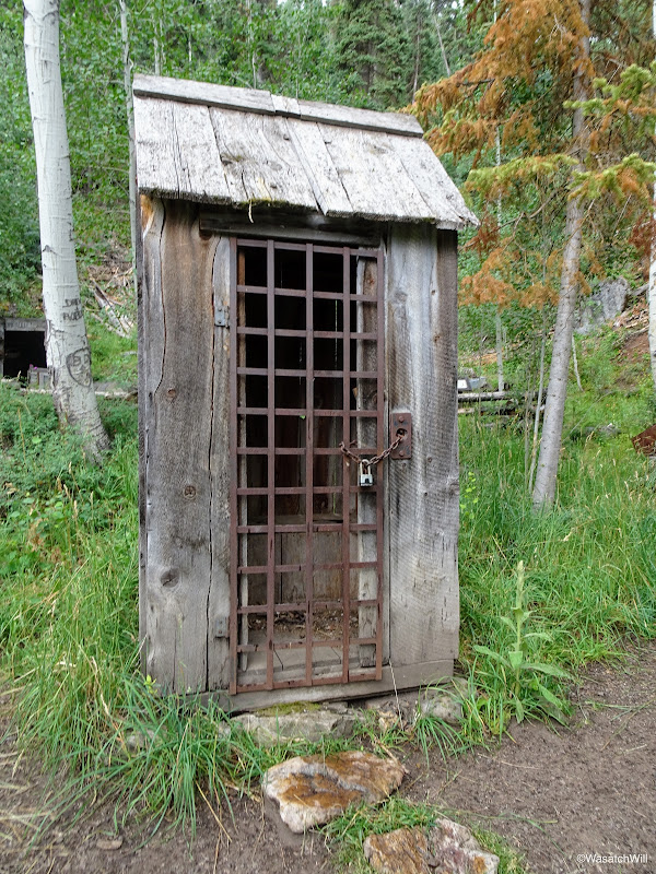
Locked up outhouse

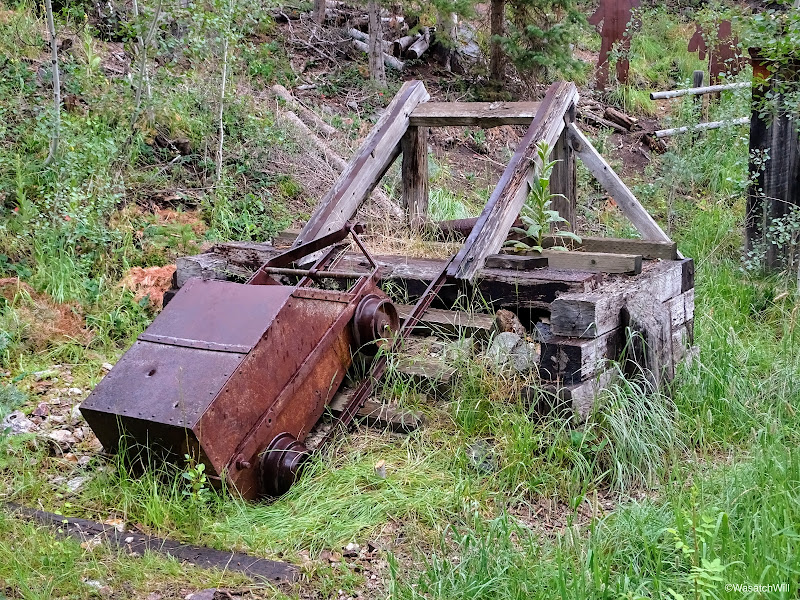
Mining tunnel and cart

Mining cart
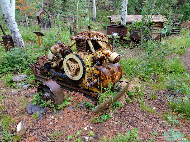
Old air compressor

Sheet metal silhouette sculptures
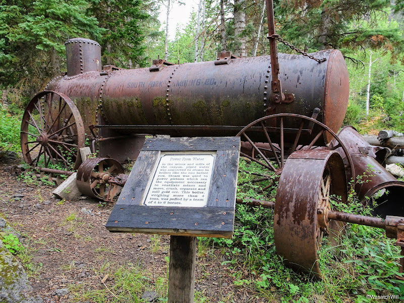
Old boiler
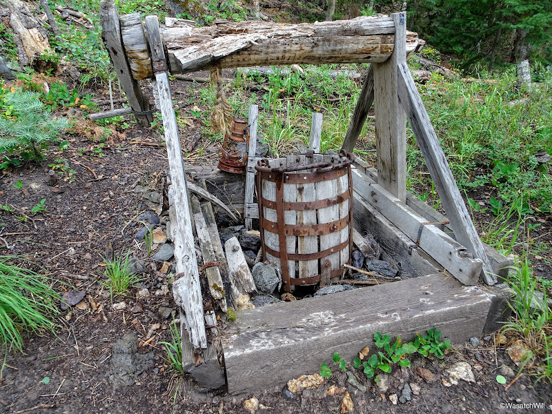
Mine shaft replica

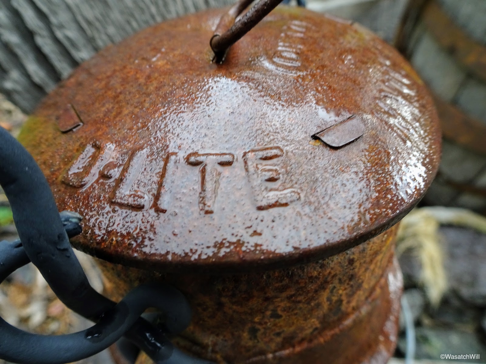
Old lantern
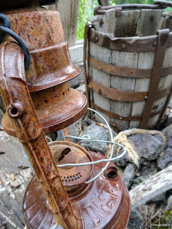
Old lantern
Another mining cart display
Even the pit toilet restrooms follow the theme, perhaps the most decorative pit toilet structure I've ever seen.
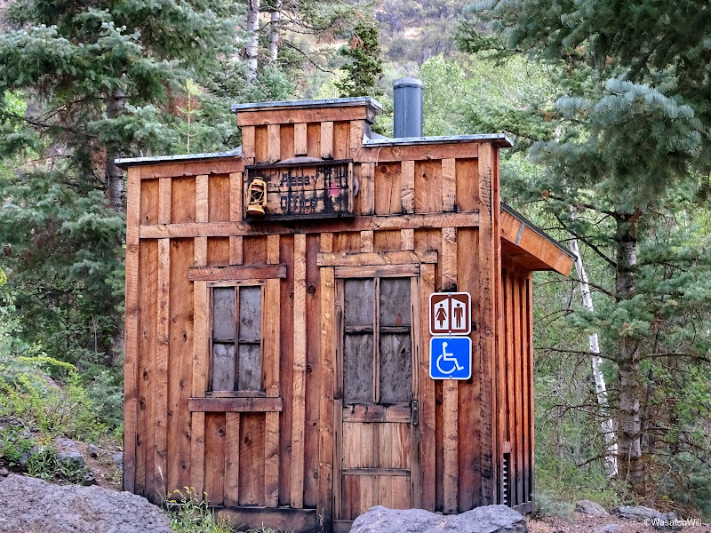
The contemporary pit toilets
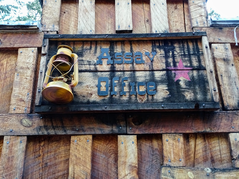
AKA - the "Assay Office"
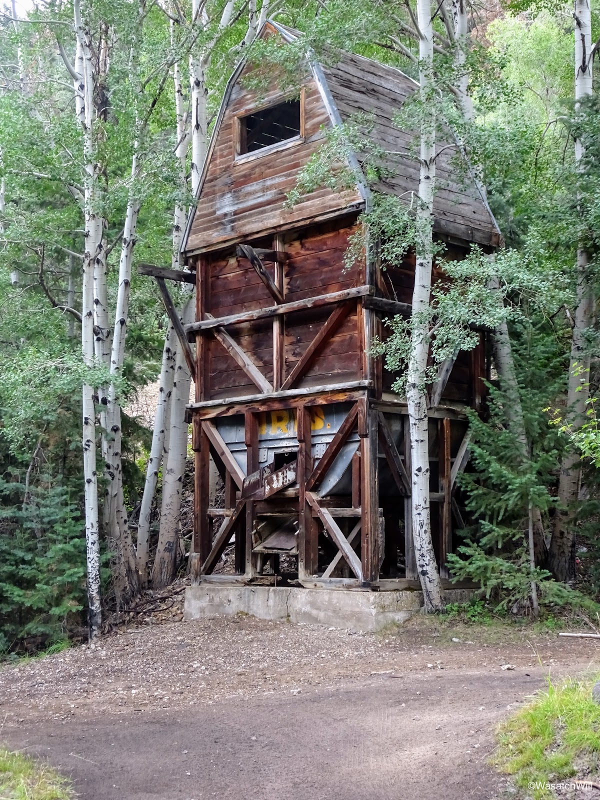
On the way out, I pulled over to have a view of the old mining mills. Private Property and No Trespassing signs abound, so it is not appropriate to go any closer than the main road takes you. Not only is it private property, but it's assumed that with the age and condition of these old mills, it could be dangerous and hazardous to allow people up close views of them, given the temptation many would have to enter into them or climb on them.

Old mining mill
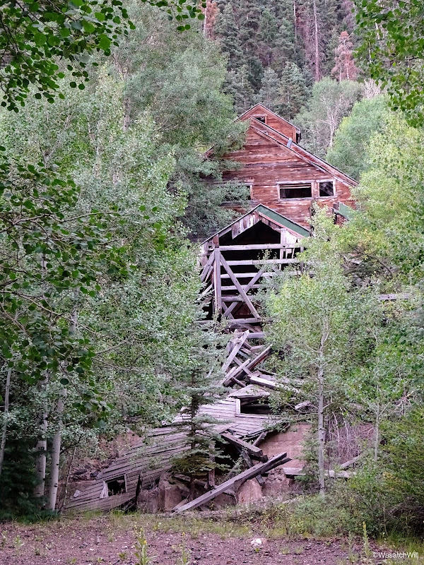
Old mining mill
On my way back to rejoin my family and in-laws in Torrey, I picked up some dinner to take home in addition to some pies, root beer, apple beer, and ice cream. After all, it was Pioneer Day for the state of Utah which celebrates the day the first Mormon pioneer wagon train arrived in the Salt Lake Valley where they would ultimately erect what is now Salt Lake City in a barren desert valley. Many who aren't devout with their faith and many who aren't of the Mormon faith at all now celebrate it as "Pie'n'Beer Day". I like it! But as a devout Mormon myself, however, I don't drink the real beer, so I adapted. And our whole family was able to indulge in the sweets!
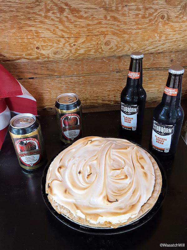
Pie-n-beer!
Some final thoughts on the trail...I'm not sure if it had to do with the "Trail Closed" sign or if the Bullion Canyon trails really just don't see a whole lot of foot traffic, but I was astounded to find myself the only one present up there for the night on what was a three day weekend for much of the state of Utah, especially when considering alternate access into Bullion Pasture and the Pocket from the Bullion Pasture trailhead just a mile up the northeast edge of Bullion Pasture. Perhaps the road up to the Bullion Pasture trailhead was still impassable due to some lingering snowdrift from the big winter we had across the West. Or perhaps the Tushars are simply seen by outsiders as more of the ATV destination that they are rather than a destination for good hiking all while their backcountry beauty is kept secret by the locals.
Instead of writing this all up with pictures and video, perhaps I should be keeping it a secret too...
Video:
Initially, I thought I'd end up hiking it the typical way which is to drive up from Beaver to the west and then hike the route up the western face of it. However, after studying out maps a bit more, I saw that it could be done from the east via Bullion Canyon just outside of Marysvale, but with a few more miles of hiking. Logistically, approaching it from the east actually made more sense for me, because I could make a drive over from Torrey whenever my family was visiting down there. A prime opportunity presented itself when my family recently went down for the weekend of July 24. Due to the distance I still had to drive to the trailhead, the seasonal weather pattern, the distance up the trail and so forth, I opted to make it an overnight backpacking trip. Little did I know just what a treat I'd be in for.
Day 1
Sunday - July 23, 2017
After spending the morning with my family, I rounded up my dog Sophie and set off for the small town of Marysvale early in the afternoon and then on up into Bullion Canyon to the west where I'd park at the trailhead for an area called Miners Park. I had only driven through Marysvale a couple times in the past on trips out to Bryce Canyon and have never really spent any time in the Tushars except on the western side not far up from Beaver where I had participated in a youth camp for a few nights as a teenager.
I had looked up all I could on Bullion Canyon and couldn't find much about the trail up it beyond a somewhat popular 60 foot waterfall down in the lower canyon called Bullion Falls within the first mile of the trail that lots of ATV enthusiasts like to pull over and hike up to, in addition to visiting the Miners Park area itself, as a side trip off the Piute Trail. The Piute Trail is a 275 mile loop through Fishlake National Forest designated for ATV enthusiasts with no official beginning or end, however Marysvale is a major stopping point for riders needing to refuel, grab a bite to eat, restock supplies, and even just stay a night. In fact, half the traffic through town consisted of ATV's and with it being a state holiday weekend (Pioneer Day was the next day), it was pretty active on this Sunday afternoon.
The area up Bullion Canyon and west of Marsyvale, called Miners Park, is called so because in the late 1800's and early 1900's, lower Bullion Canyon had also been the site of a very active gold mining operation and community. Lots of mining relics and old structures remain through out lower Bullion Canyon, so much so, that an actual park in the area has been created to showcase a collection of various pieces of mining history with an interpretive trail through it all. Beyond that, there is a brochure that can be picked up at various shops and stops in town that enables drivers and ATV riders to self-guide themselves along a Canyon of Gold tour throughout the lower canyon with numbered signs and stops where the guide then explains the history behind each stop.
So, beyond all the info about the Piute Trail that ran through the area, and a bit about Miners Park and Bullion Falls, I had nothing to go on but the map I had prepared with my route.
The route I sought to do was a lollipop loop plus a side trip up to Delano Peak and back. I would head up Bullion Canyon, steering to the right at a fork halfway up and then go on to seek out a site to camp up in an area called Bullion Pasture. From there the plan was to follow a trail through a spot called The Pocket, and then connect into a junction with the South Fork Pine Creek Trail and a "trail" up to Delano Peak the following morning. After Delano, I'd close the loop by taking the South Fork trail back down to connect with the main trail down Bullion Canyon and ultimately back down to the trailhead the following afternoon.
In traveling up to the trailhead out of Marysvale, there were plenty of ATV's sharing the road, most on their way back to town, but once I reached the trailhead itself, I was surprised to find few others there. Only one other group had turned up to hike up to Bullion Falls a mile up the trail. It could have been because of weather in the area (there was a light thundershower lingering around) or because of the time of day, or some combination of both.
At any rate, I let Sophie out, loaded up my gear, and set off hoping for the best regarding the weather. Forecast was up to 40-50% chance of isolated thundershowers through the evening before they were supposed to clear out for the morning.
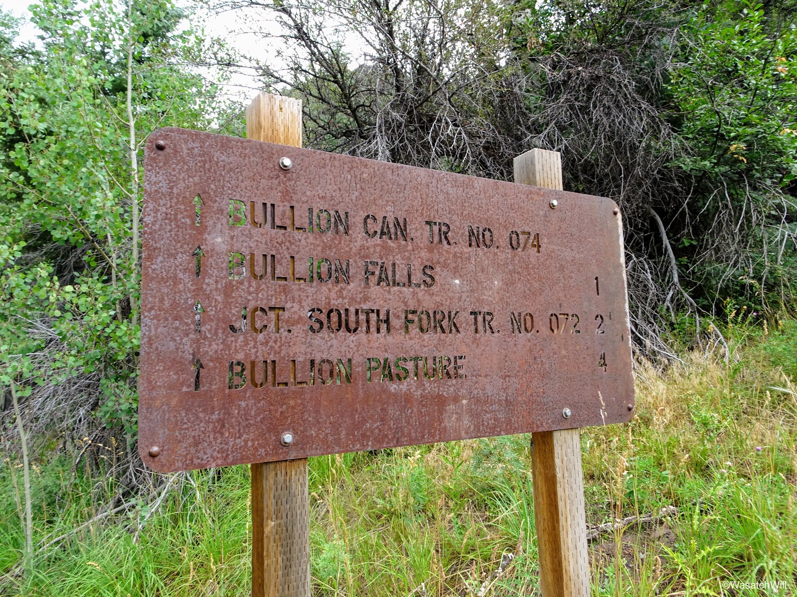
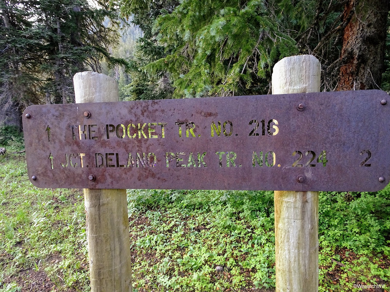
Mileage sign at trailhead
Very soon after starting up the trail, there was a sign directing my attention to the left where I could see another waterfall, called Cascade Falls, across the canyon.
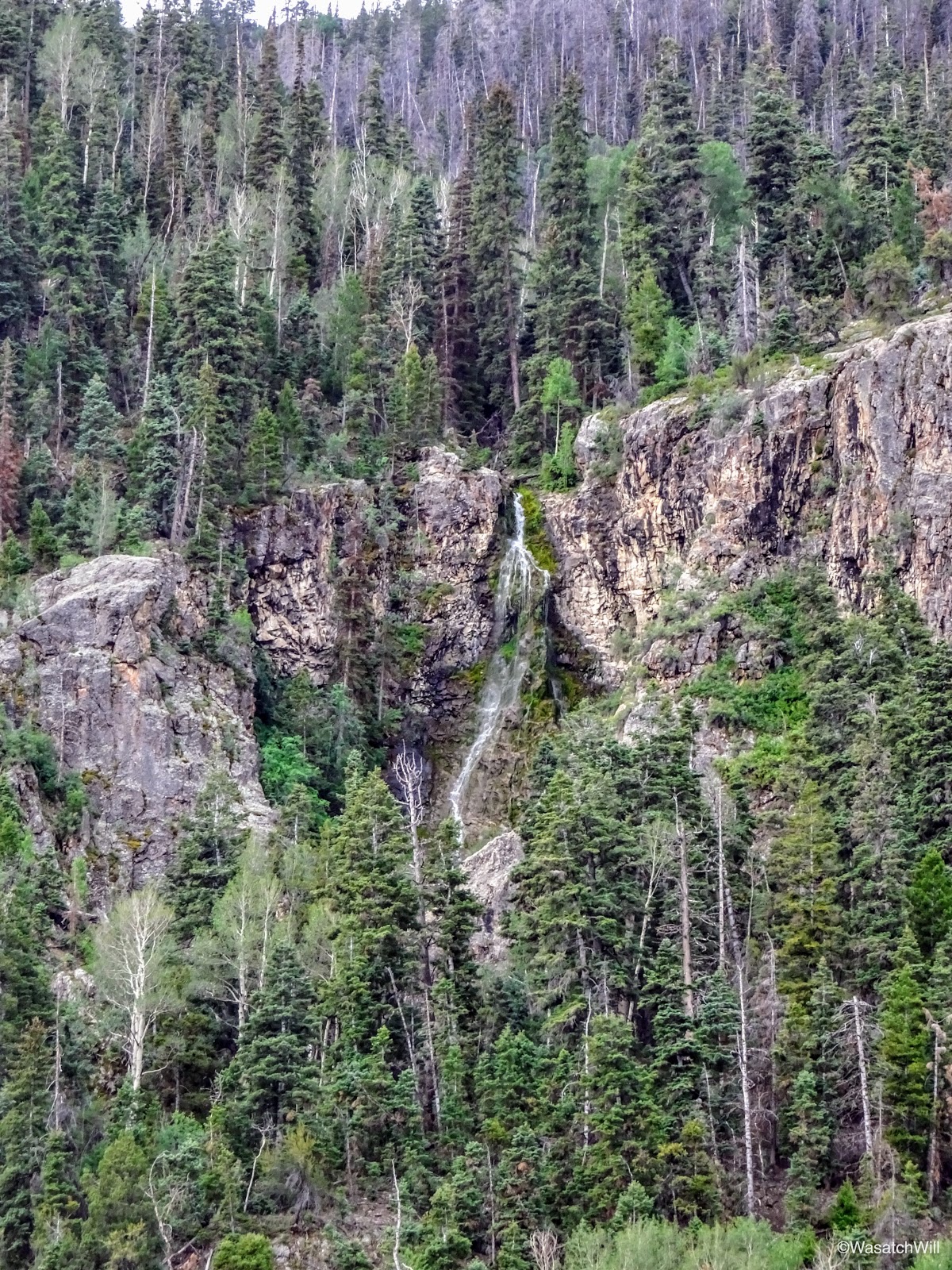
Cascade Falls
Cascade Falls
Shortly after passing the viewpoint for Cascade Falls, I walked through another trailhead, officially signed as Miners Park Trailhead. This was the point where ATV's could not go further and riders had to park their ATVs before continuing on up to Bullion Falls. Where I had parked further down was a small lot for standard vehicles.

Miners Park Trailhead sign

What's left of trailhead board
In reading over what was left of the trailhead board, I could see that the route I had mapped out for myself consisted of all the trails described on the board.

I incorporated all four of these trails
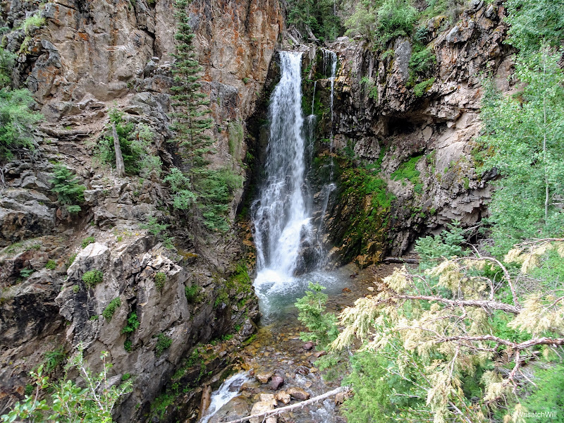
As I hiked on, the sound of Bullion Falls was quickly followed by the sight of the falls. I stepped on down to a good viewpoint but opted to hold back from descending down to the bottom. It can be done with careful scrambling and down-climbing, and the group ahead of me had proceeded to do so, but it is very steep and slick, with a hand-line someone had set up for one particular spot. Having only my dog as company, I did not want to jeopardize my chances of finishing out my trip.
Bullion Falls begins to come into view
Bullion Falls
Longer exposure of Bullion Falls
While viewing the falls, a light rain began to sprinkle down from the sky and not knowing if it would get worse before it got better, I took the time to throw on a light poncho I had brought along.
Just around a corner of the trail from the falls was a sign saying the trail was closed due to a rock slide. Normally I would heed such a sign, but in this case I could see no rock slide around, so I decided I'd continue on until I could at least see and evaluate the alleged rock slide for myself. I also figured that if it was really that hazardous, there ought to be some yellow tape across the trail as well.

Trail Closed...uh oh!

Progressing up canyon anyways

Just before arriving at the rock slide
After about another quarter mile, including some high-climbing switchbacks, I encountered what must have been the rock slide. Unfortunately, I did not think to actually take a picture of it, but I did shoot some video of it which can be viewed at 6:12 into my trip video at the bottom of the post. I questioned in my mind how long ago the trail closed sign had been posted. Perhaps it had been placed there earlier in the spring, when perhaps there could have considerable snow and ice mixed into the slide making it much riskier and hazardous. At this point in the season however, there was no trace of snow or ice amongst it and there was nothing more hazardous looking about it than any other trail with a small section of moderate exposure. In fact, there really was no deadly cliff lying in wait below the slide to take anyone over if they were to slip and take a tumble down the slide as there was elsewhere nearby along the side of the trail. It also looked like others had gone on across and actually stabilized and leveled out what rocks were covering the trail.
I proceeded along.
Looking back down canyon after crossing rock slide
Just after passing over the rock slide, the trail took me into a thickly wooded area for a little way. While going through the first section of woods, the weather began to break and the sun was unmasked.
The sun makes emerges

Into the woods
Before long, I was in a small clearing where I could see that the weather was turning to my favor, at least for the next while. The storm that had been over me was now retreating to the east behind me and blue skies with light white clouds were to the west ahead.

A brief clearing
As I continued up the trail, the landscape was almost continually changing with sections of thickly wooded areas, mixed in with meadows of grasses and flowers, followed by crossings over tributary streams flowing into Pine Creek which the trail would run parallel to all the way up the canyon.

Tributary of Pine Creek
Great Spangled Fritillary

The retreating storm
After about two miles from the start, which was halfway up, I reached the fork with South Fork Pine Creek and it's accompanying trail. For a more direct route up to Delano Peak, I could have taken the left and gone straight up and sought out a camp in the upper drainage of South Fork and was thus tempted to do so. Because I really wanted to still see the Pocket aglow from the eastern sun in the morning, I chose to keep to my original plan. In hindsight, I'm very happy I did.

Junction with South Fork...halfway up
2 more miles to Bullion Pasture
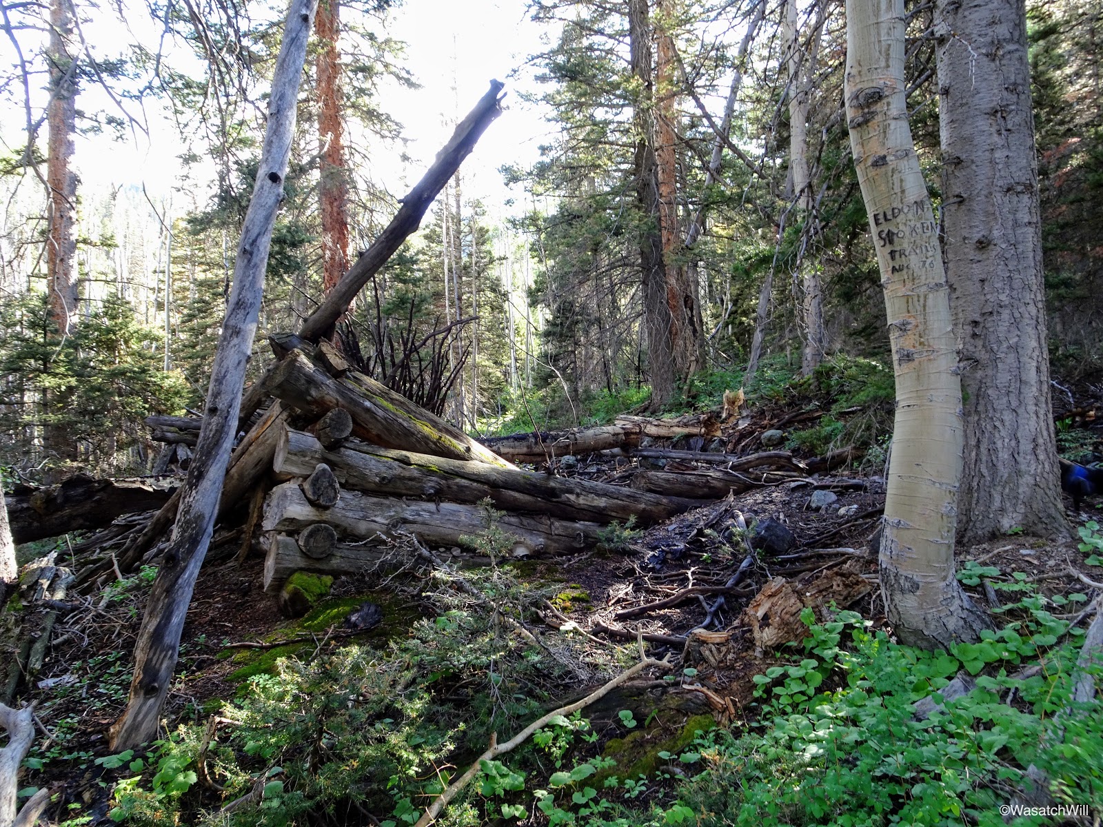
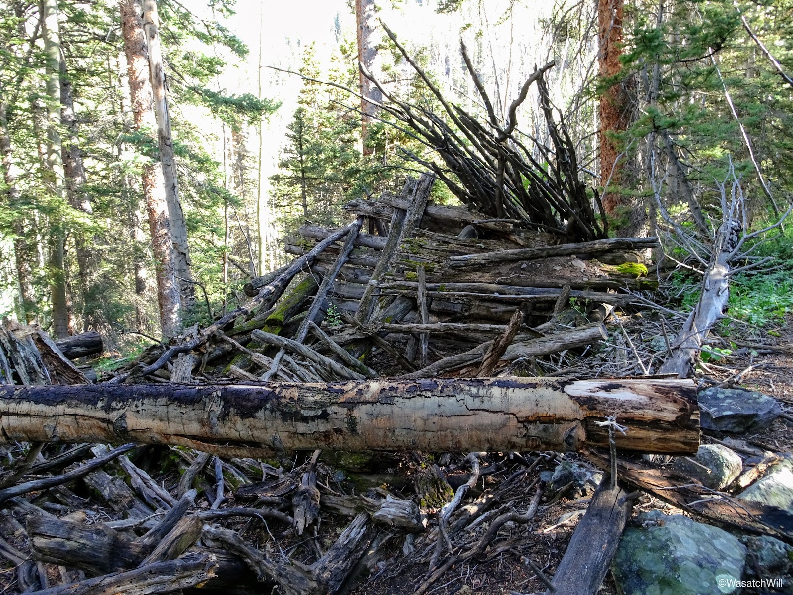
Shortly after the trail (and creek) fork, sits the remains of an old cabin structure, likely remnants from the mining operations that took place further down canyon.
What's left of an old cabin
What's left of the other end of the old cabin

Another angle on the old cabin
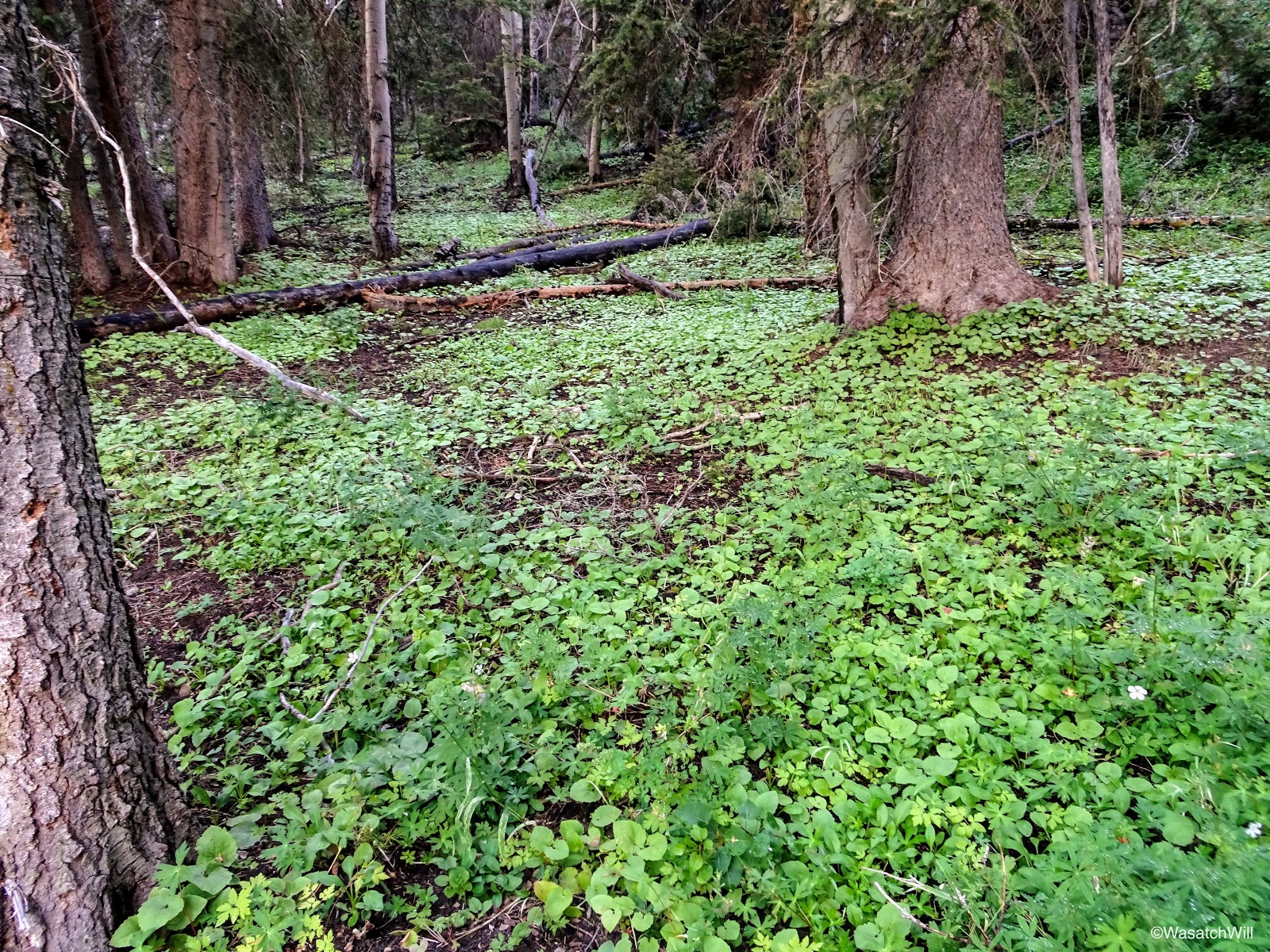
The forest floor soon gave way to a green carpet made by a low-growing plant. Pictures and video don't do this spot justice. It was really neat, something I would've only expected to find in the forests of the Northwest and other similar environments.
Green carpet
Trail marker and green carpet
Further on up the trail was a waterfall just visible from the trail. These falls (and many others up both forks of the canyon) were not marked or named on the map. So in my mind, I kept it simple and just named these particular falls, "Pine Creek Falls".

"Pine Creek" Falls
"Pine Creek" Falls
Not long after passing by "Pine Creek Falls", I descended down from the trail to a nice spot along the creek featuring some smaller falls and patches of various flowers for a bit of a rest.
Larkspurs and Pine Creek
Larkspurs and Pine Creek
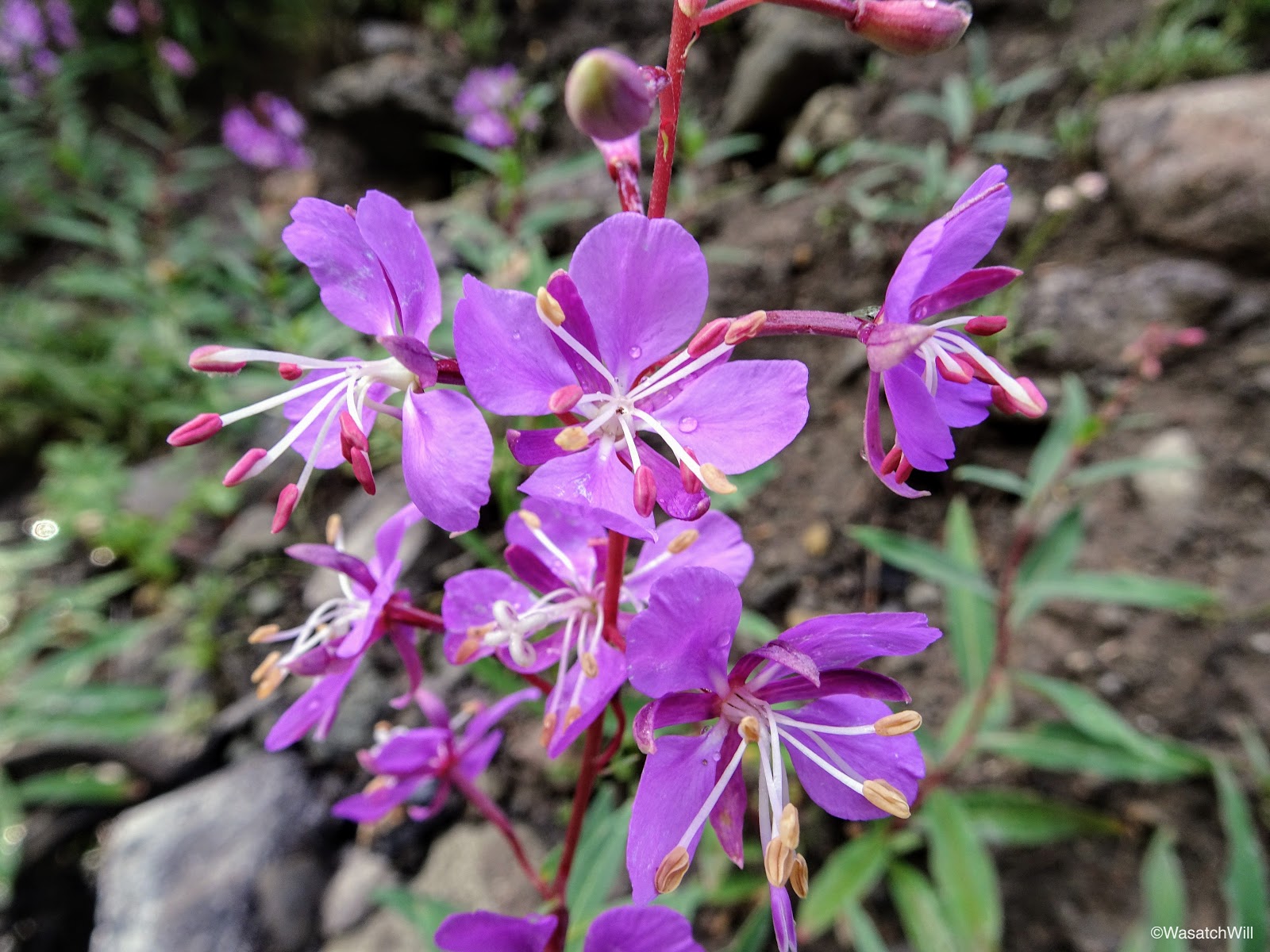
Fireweed
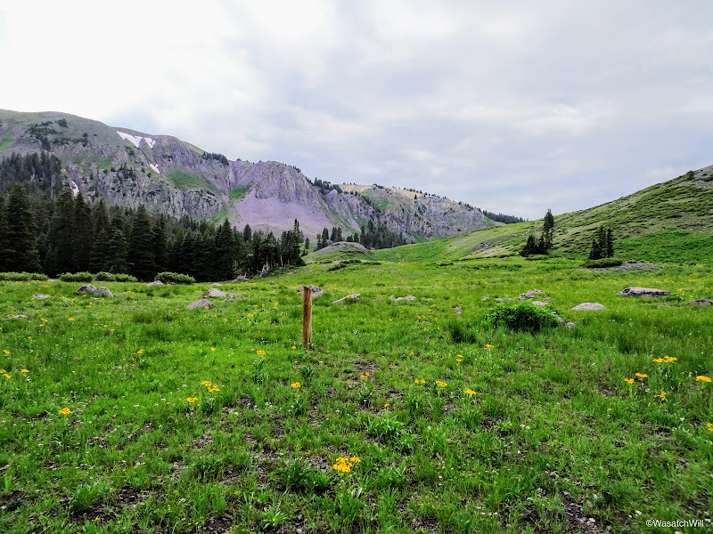
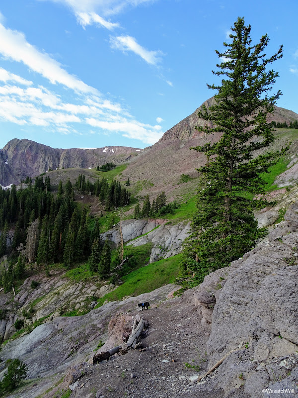
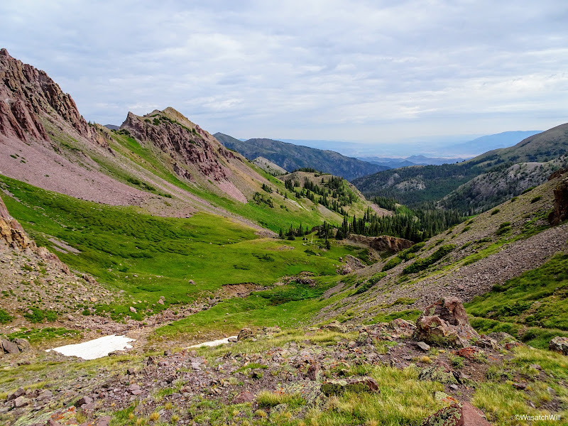
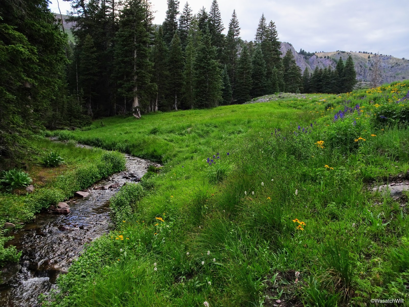
Back up on the trail, I continued to ascend up toward Bullion Pasture. The thicker forests the trail had been meandering through cleared away to larger meadows with broad views of the mountains at the upper reaches of the canyons. In the final approach up into Bullion Pasture, the trail would seemingly kiss the banks of the creek only to switchback up the slope and then repeat a few times.
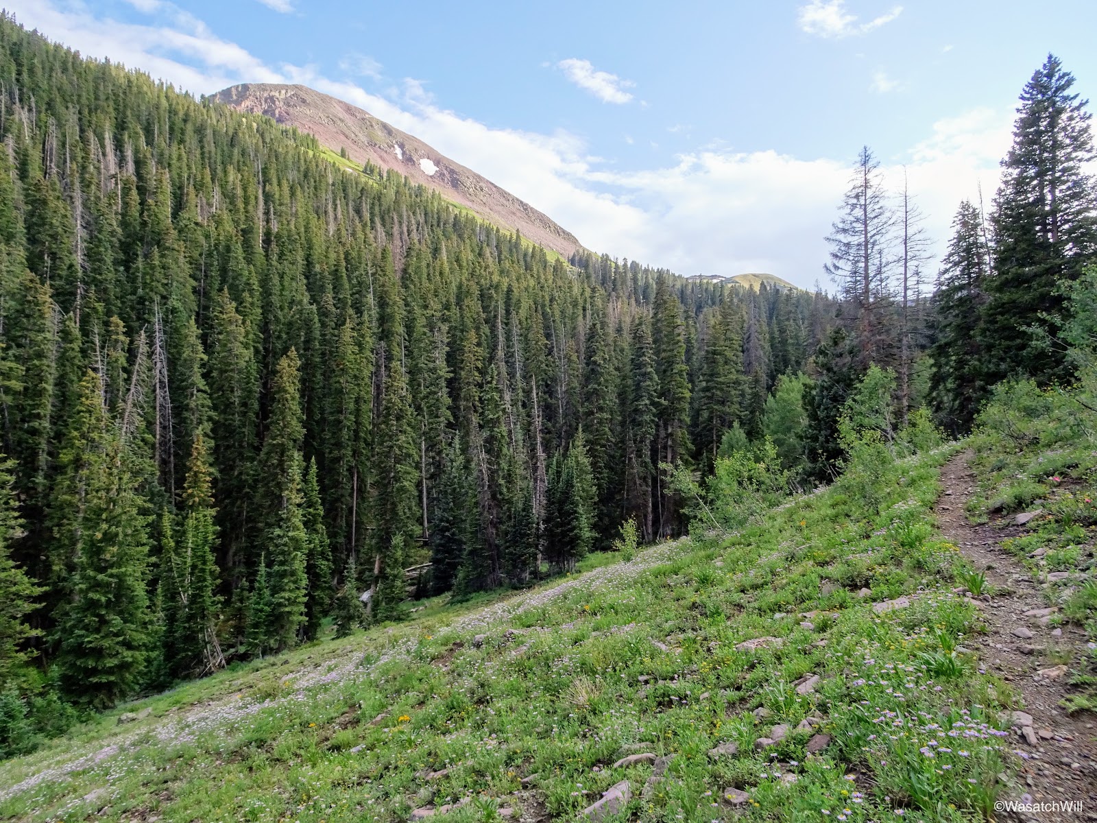
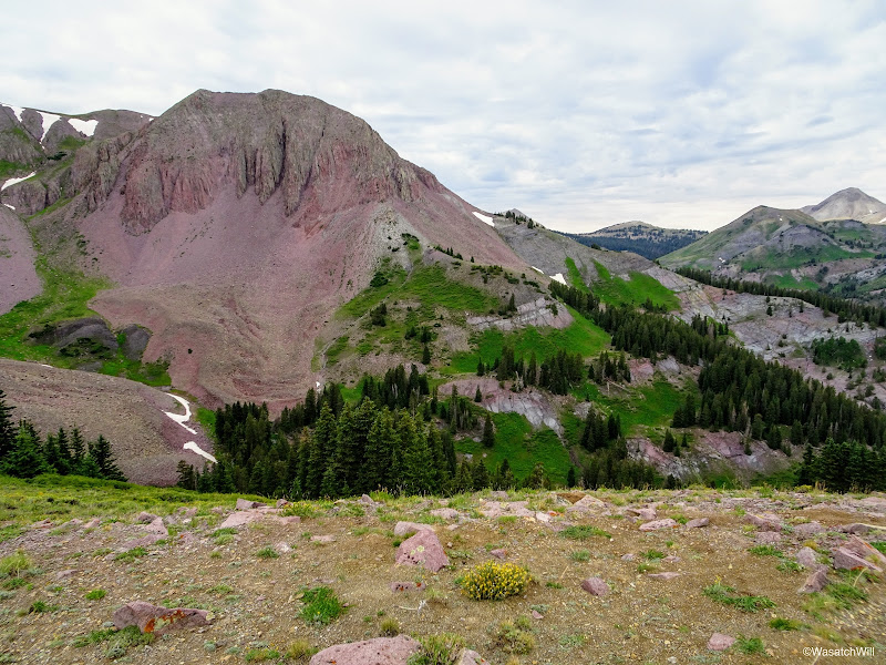
Higher up in Bullion Canyon
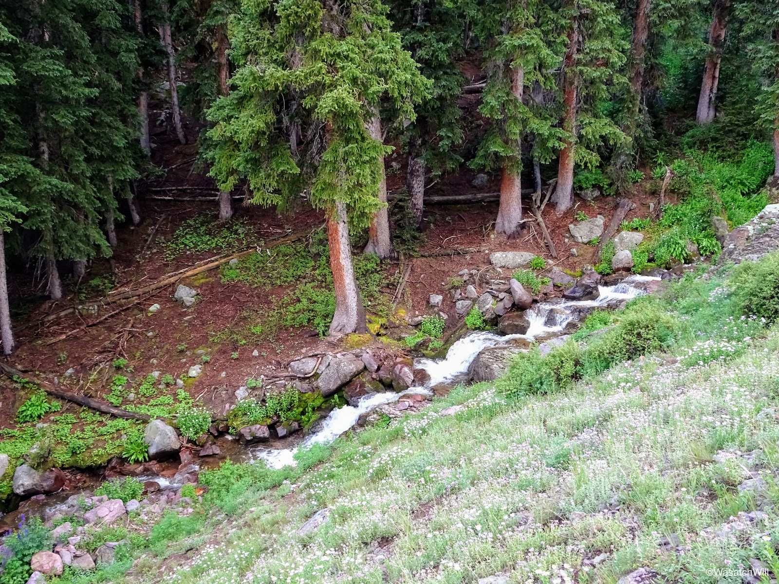
Pine Creek
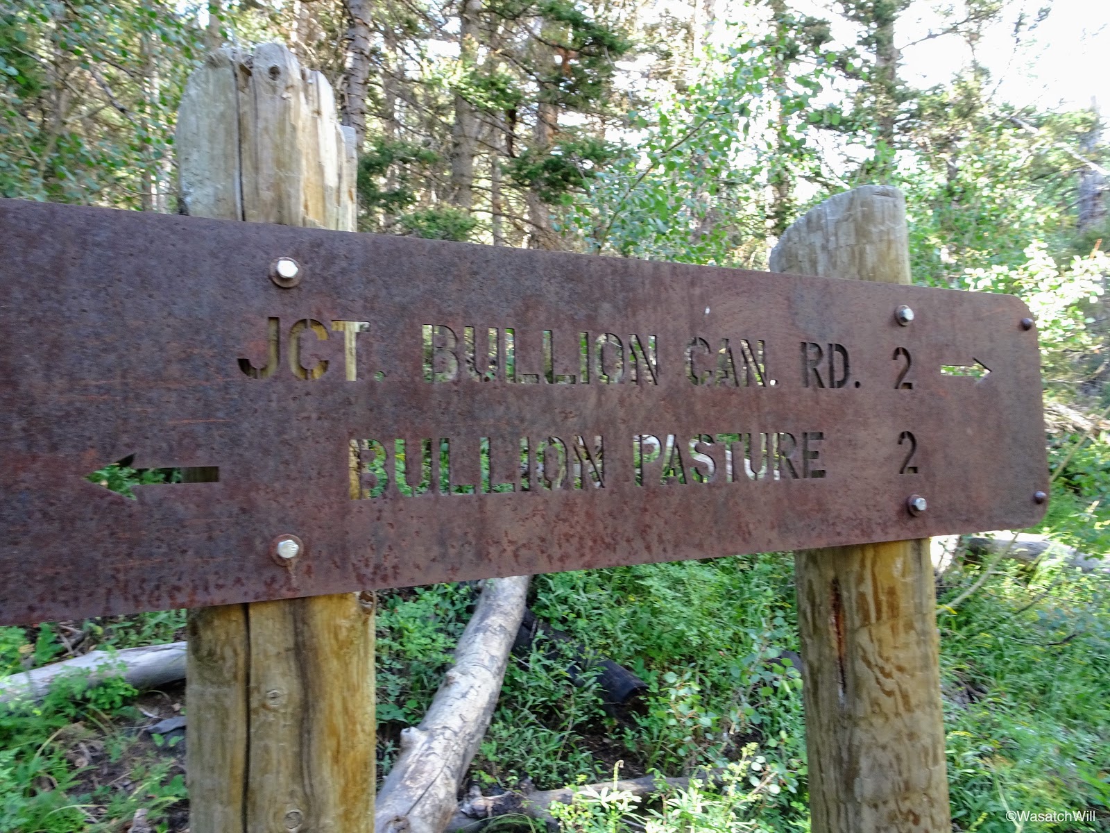
Finally, I had arrived in Bullion Pasture and there reached the junction with the Pocket trail that I intended to take the following morning in order to connect me with the next junction over with the route up to Delano Peak. For this evening though, I moved on past it in search of a site to camp.
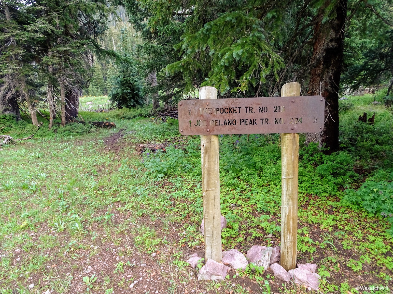
Junction with the Pocket Trail

Bullion Pasture
A little ways up the hill from the junction I left the trail and crossed over the creek where I found a pleasant little area to set up camp for the evening.
Pine Creek and Bullion Pasture
While I set up camp, Sophie sat still guarding a chipmunk she had chased up a tree. She was not to be distracted.

Sophie on guard
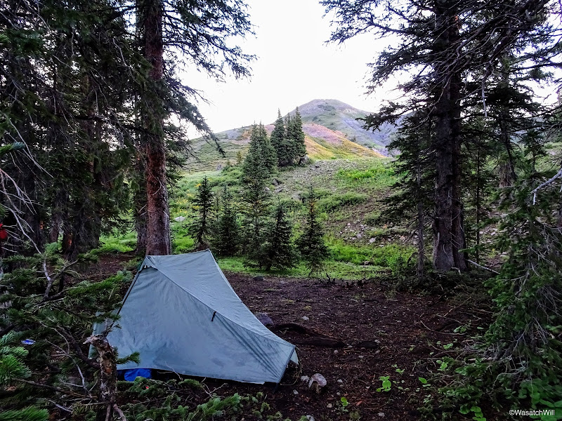
By now the clouds were starting to gather back in and it wasn't looking like I'd be falling asleep with any views of the stars. With camp all setup, I went a few hundred feet further out where I cooked up some dinner and hung up my food before returning to my tent to retire for the evening.
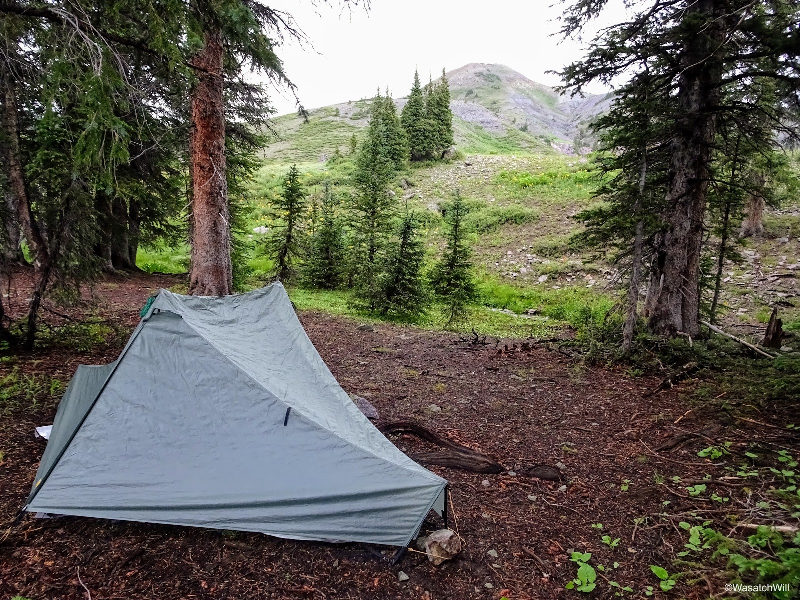
Camp
Day 2
Monday - July 24, 2017
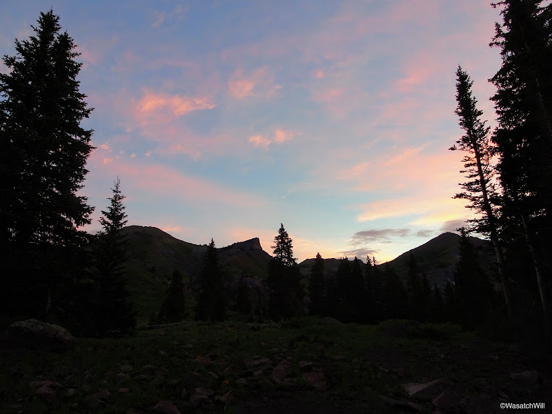
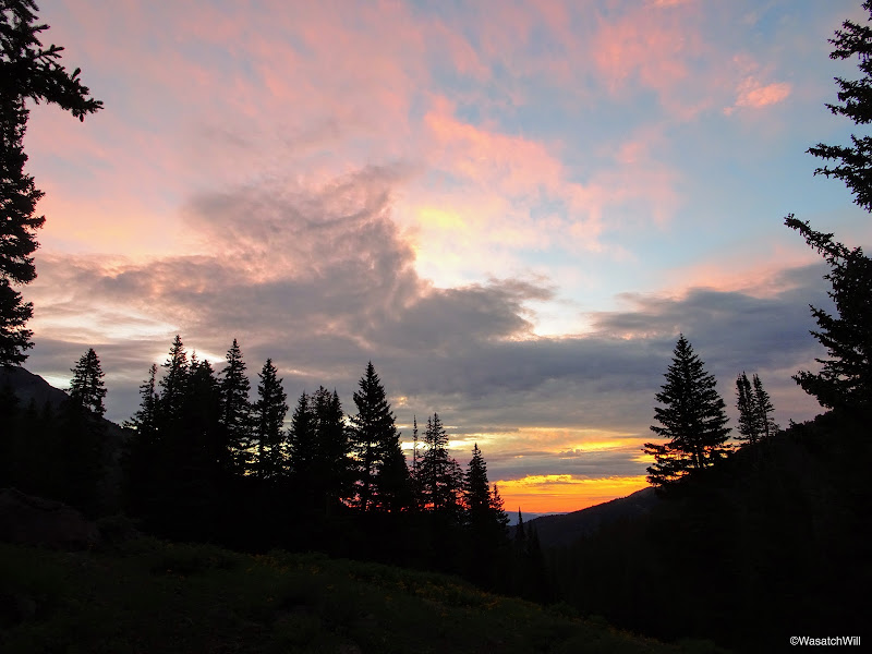
In the morning I was treated to a spectacular sunrise.

Morning view from camp
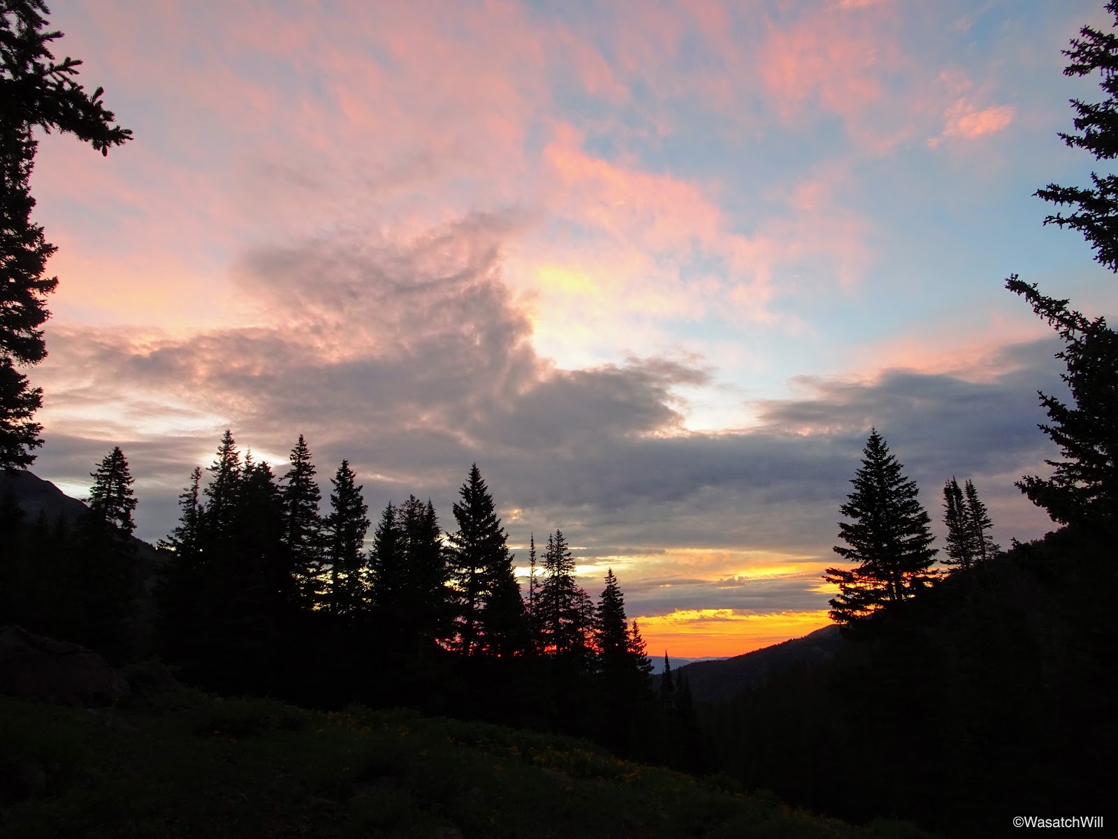
Sunrise from near camp
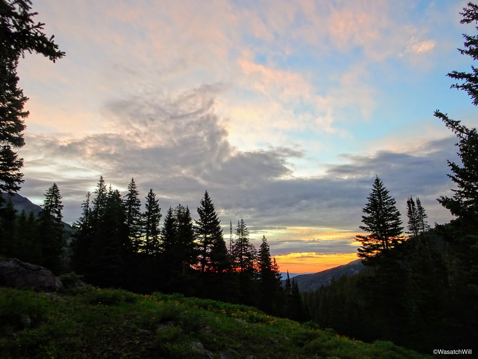
Sunrise from near camp
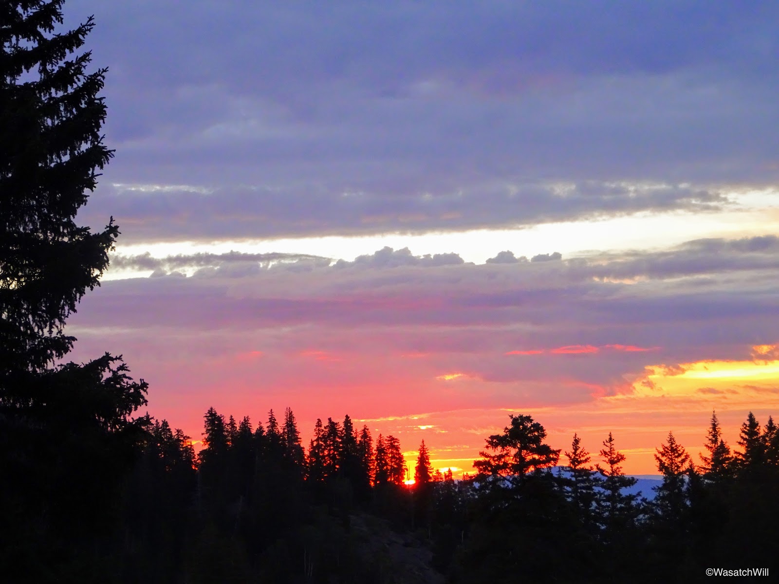
Sunrise from near camp
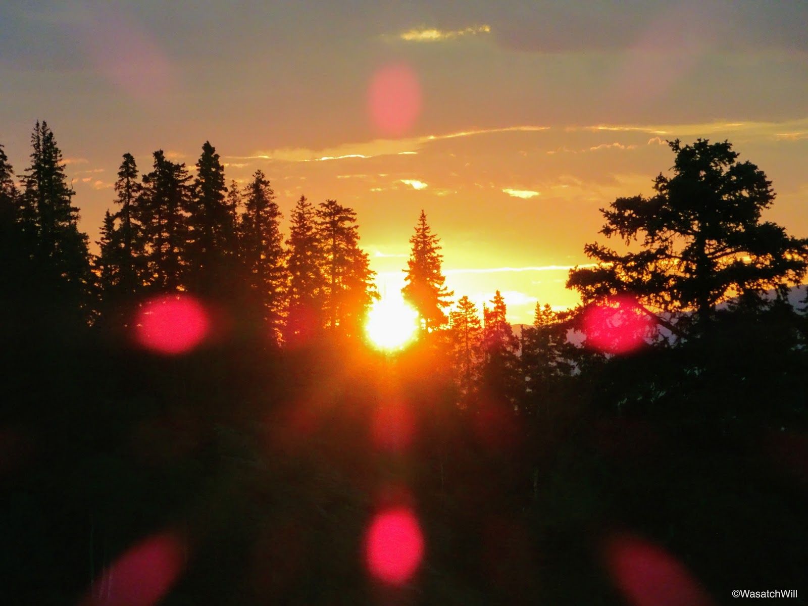
Sunrise lens flare
Once the morning show faded away, I took a few moments to snap up some shots of the creek near my camp.
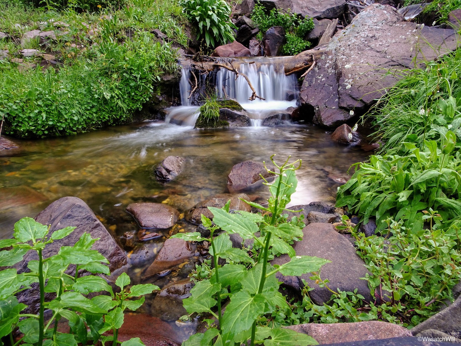
Pine Creek near camp
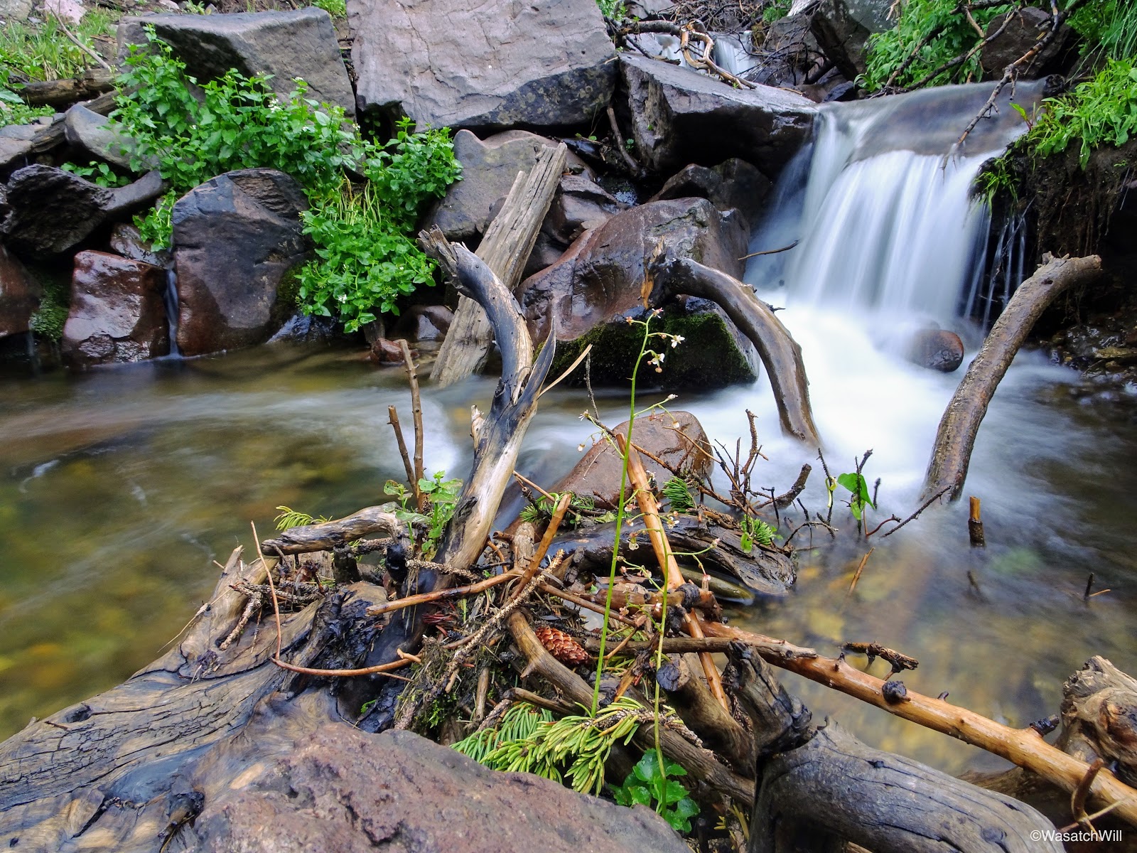
Pine Creek near camp
Pine Creek near camp

Pine Creek near camp
I then broke camp, gathered my food, took out some breakfast to go, and got back on the trail.

Ready to break camp
Back at the junction, I joined up with the Pocket Trail and made my way up into the Pocket.

Back to hike the Pocket Trail
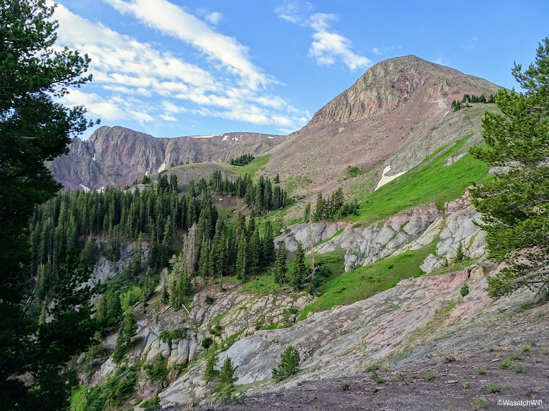
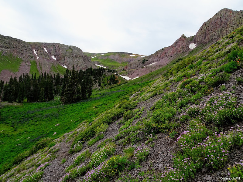
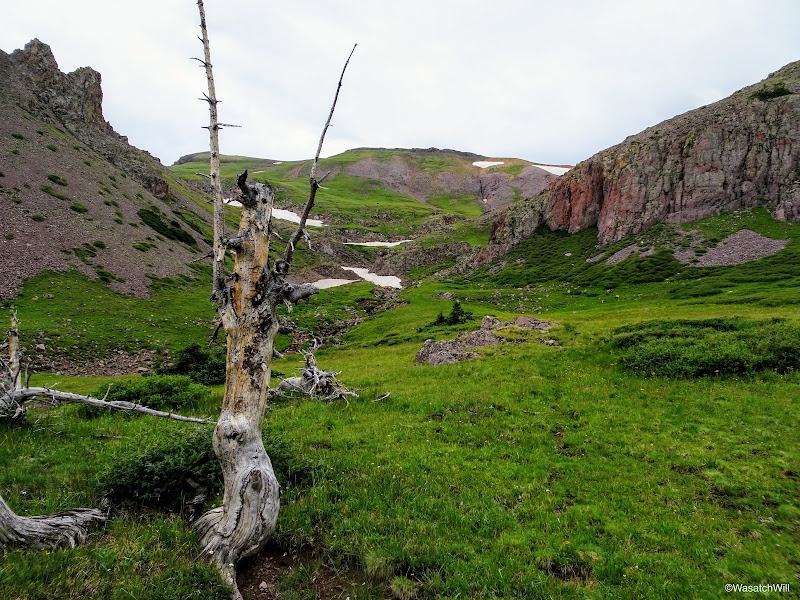
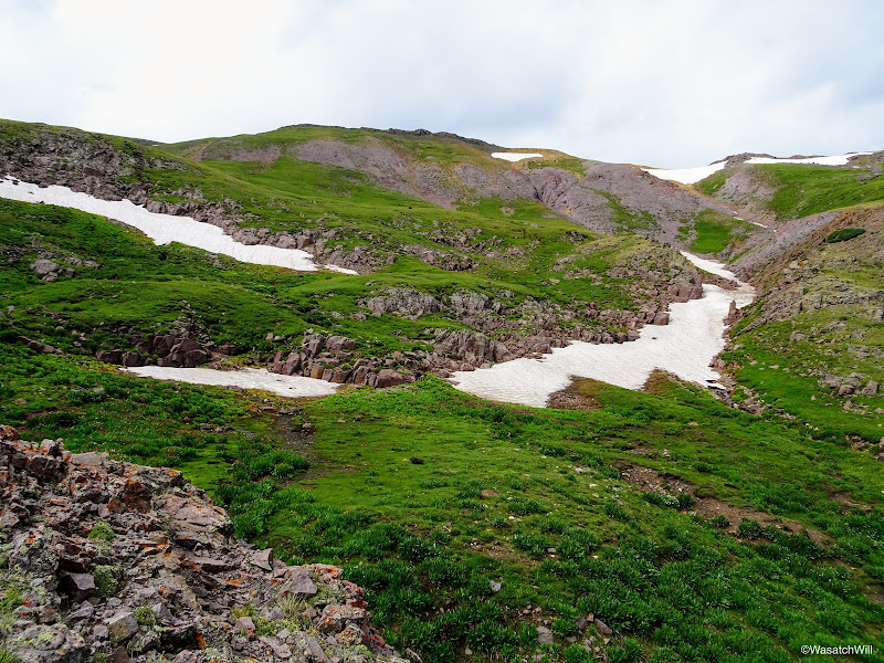
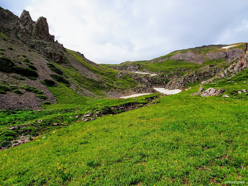
Prior to the Pocket, there was another beautiful little cirque to wander through.

Entering the cirque prior to the Pocket
The cirque prior to the Pocket

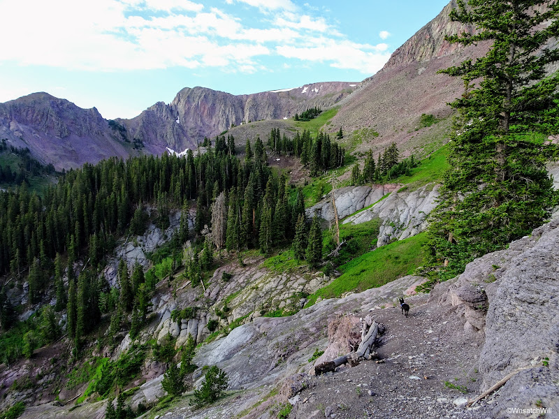
Along the Pocket Trail
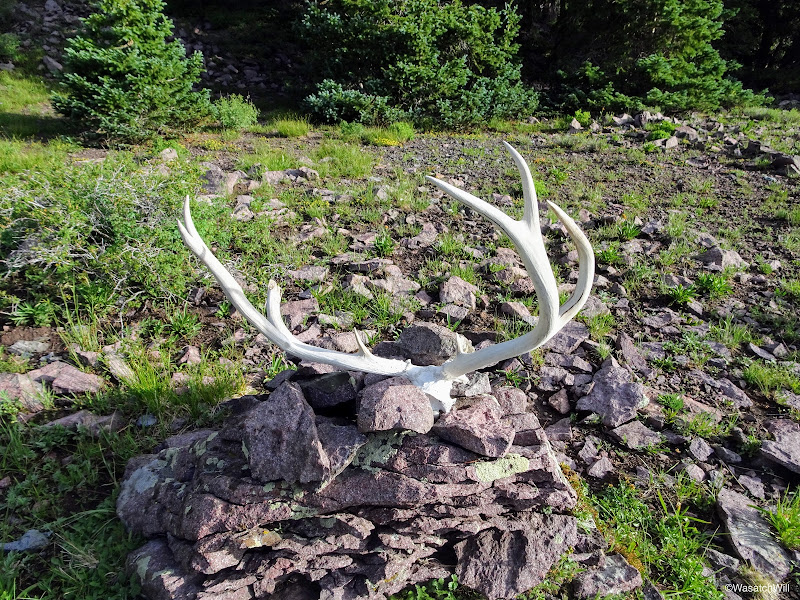
Upon entering the Pocket, there was a set of deer antlers there to greet me. I'm not sure how long they'll remain there, but it was nice to see whoever set them up there didn't prize them for whatever money they could have cashed them in for.

Deer antlers upon arrival into the Pocket
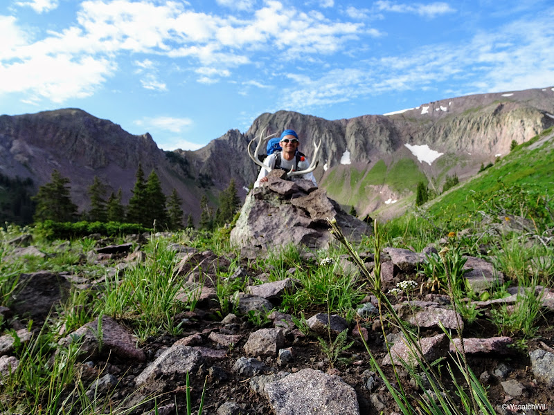
Somewhat blurry photo of myself with the deer antlers at the Pocket
I expected the Pocket to be pretty, but wow...once again, I was surprised and impressed.

Entering the Pocket
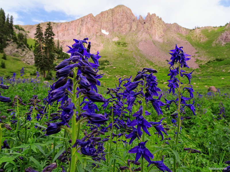
The upper meadows were packed with beautiful violet Larkspur flowers. With how much there was, this would not be a good place to run cattle. Given that there was no livestock in the area, and few signs of human impact beyond the trail itself and the markers along the way, it was very pristine. How was this area so pristine while other actual designated wilderness areas I've visited were so full of human impact? The answer alluded me. Short of having any lakes, this was a gem of an alpine paradise.
So many Larkspurs!
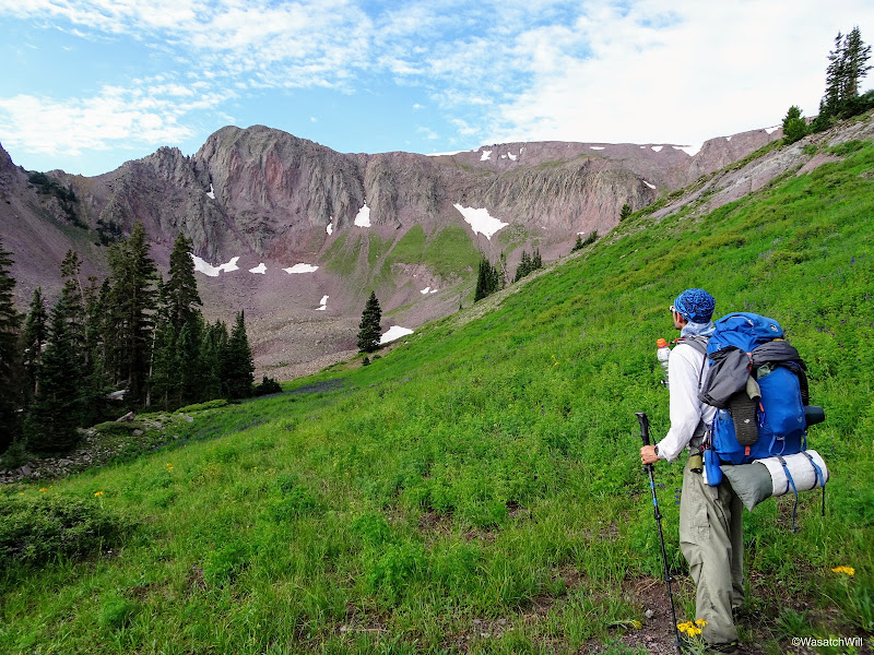
From the Pocket, I continued on over to the junction for Delano Peak. Clouds began to thicken, shutting out much of the blue sky there had been up to this point.

Looking back north from across the other side of the Pocket

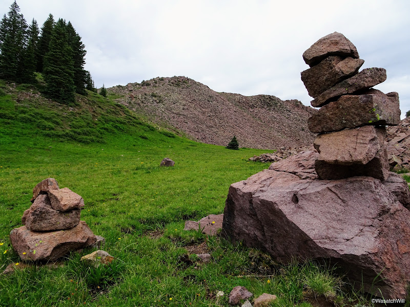
Cairn looking back along the Pocket Trail
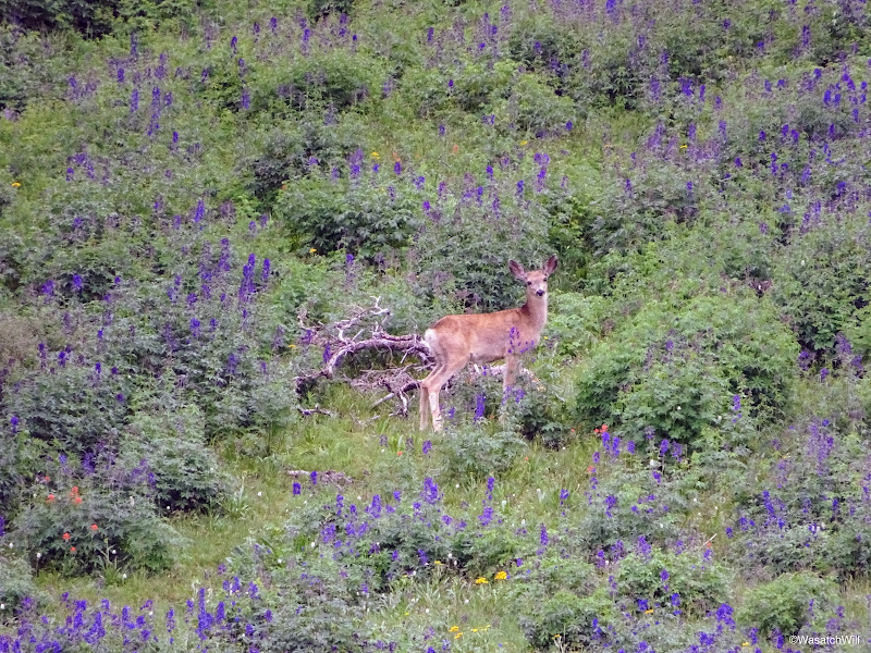
Just before descending the final stretch down to the junction I was after, I observed a couple deer down in the meadows below.
Deer #1 down in meadow
Deer #2 down in meadow
Approaching the junction for Delano Peak and South Fork trails
Once again, I was immersed into a huge field of Larkspurs among other flowers.

Many more Larkspurs

Larkspur closeup

Admiring the beauty of the Larkspur field against an unnamed peak
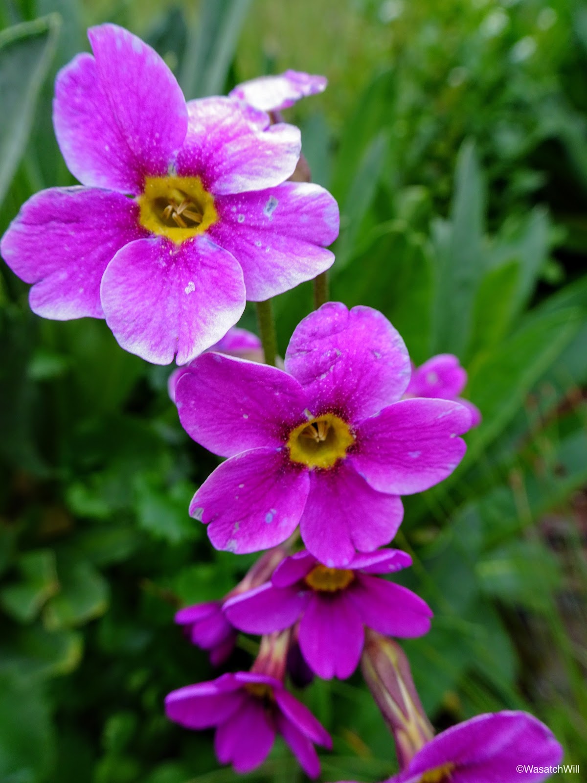
Primrose
Once at the junction, I dropped my pack and evaluated the skies. Hardly any trace of blue sky to be seen anywhere, but nothing all that dark anywhere along the visible horizon either. It was not quite 10 am yet and the peak sat only a mile up, so I determined I would be ok. After all, the forecast did not show any chance of thunderstorm activity over the area until the afternoon.
I transferred over some essentials into my little summit pack and up I went.

Heading up to Delano Peak
Once again, I was blown away by the scenery, and now greenery, before me. How could I still be in Utah, I wondered? This was looking a lot more like pictures I'd seen of places like Ireland or Iceland. Having spent a couple years throughout New Zealand in my past, I'd say this even resembled parts of that paradisiacal country.

Snow bridge
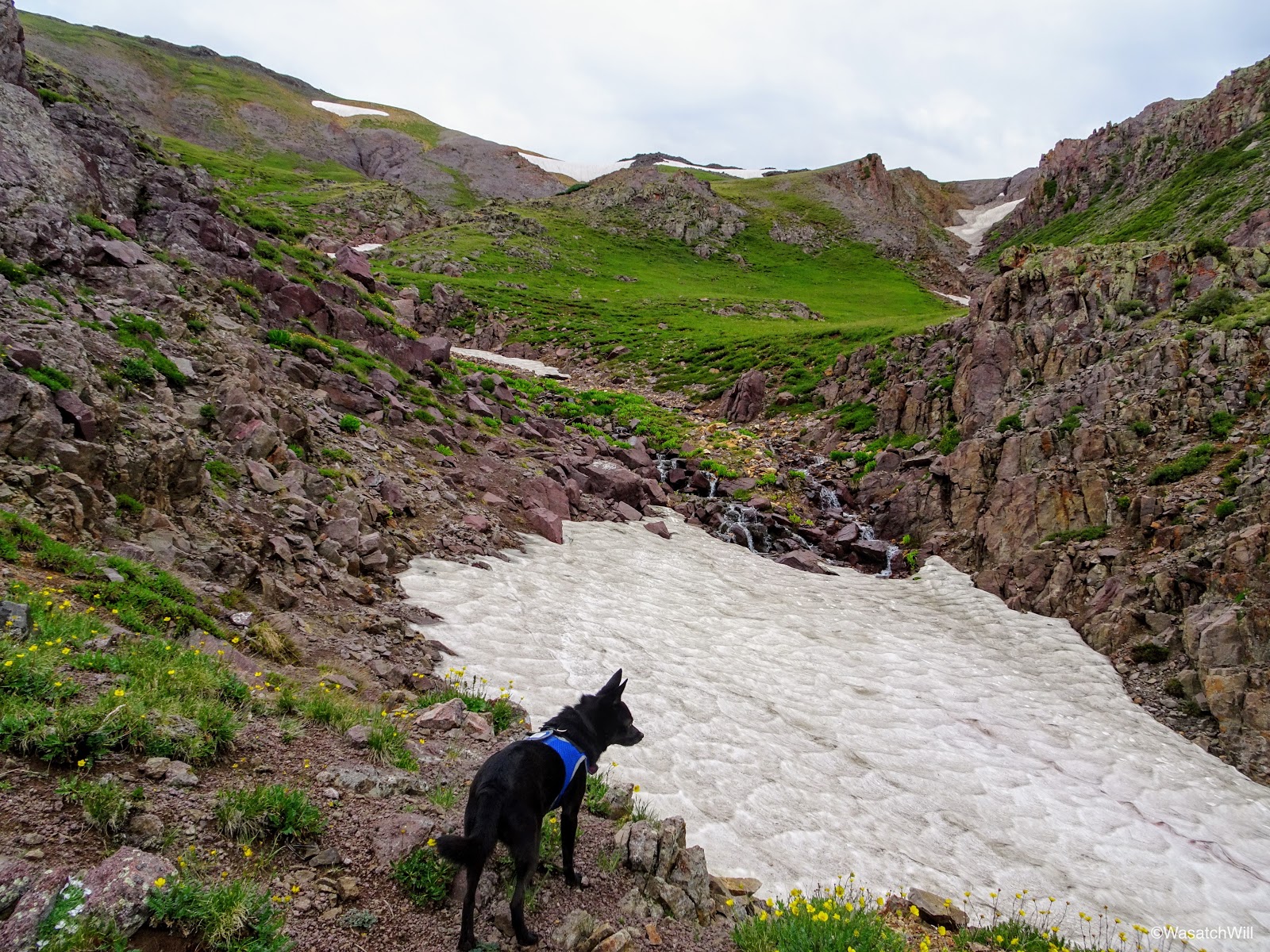
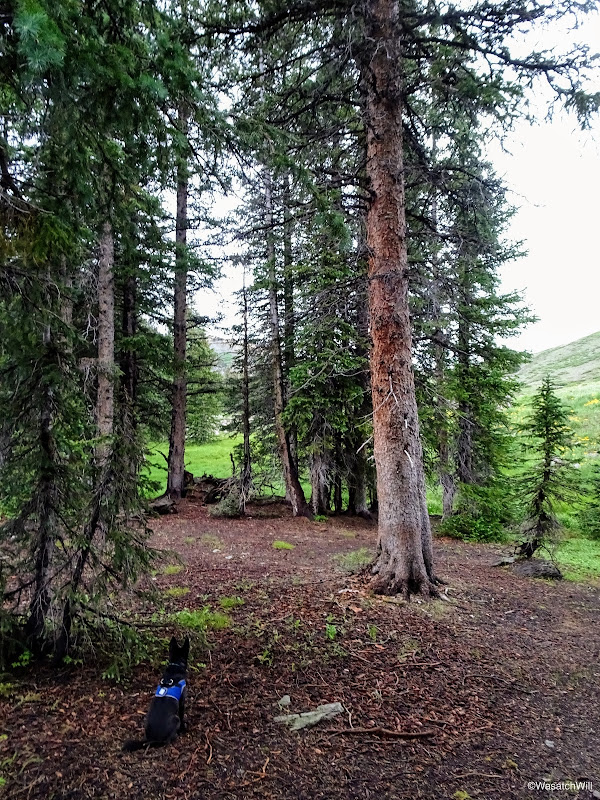
Sophie scanning for marmots and the like
So much green!
Looking back downward
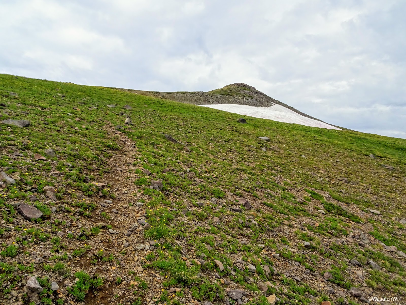
The trail appeared on and off until finally fading away as it gained a saddle in the broad ridge. Once on the ridge, it was almost a straight shoot through the high tundra toward the peak. Off in the distance, I saw what I can only believe to be a gray fox scampering up ahead of me, but by the time I could get my camera back out and turned on, it was out of sight.
Delano Peak off in the distance (middle)
From a distance I could see that there was somebody else up there taking in the view, the first person I had seen since passing Bullion Falls the day before. They would be long gone by the time I got up there, however.
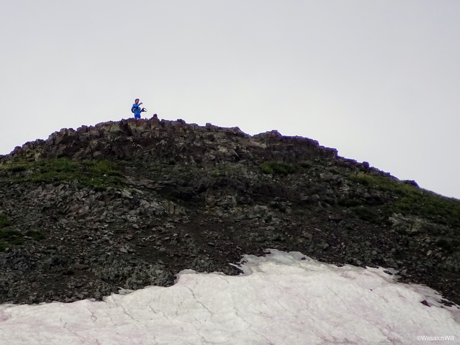
A hiker on Delano Peak
As I got within a quarter mile of the peak, a faint trail emerged once again.
Regaining a faint trail with Delano Peak above right
At last, I could go no higher and arrived on the summit of Delano Peak with nobody else in sight.

Delano Peak Summit
A distant selfie on the summit

A closer-up summit selfie with Sophie
Delano Peak is named after Columbus Delano who served as Secretary of the Interior for the Ulysses S. Grant administration during the years 1869-1877.
The views were spectacular with a muted but somewhat glowing green hue blanketing much of the landscape below. Patches of snow provided a nice accent. I had been hoping for clearer skies, but the light cloud cover actually added to the ambience of the whole scene.
Looking eastward from Delano
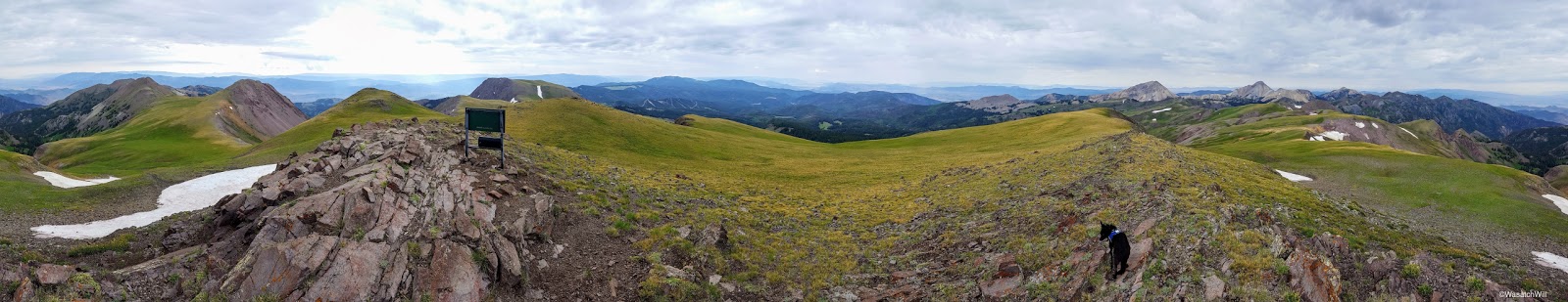
360 Pano from Delano Peak

180 Pano from Delano Peak
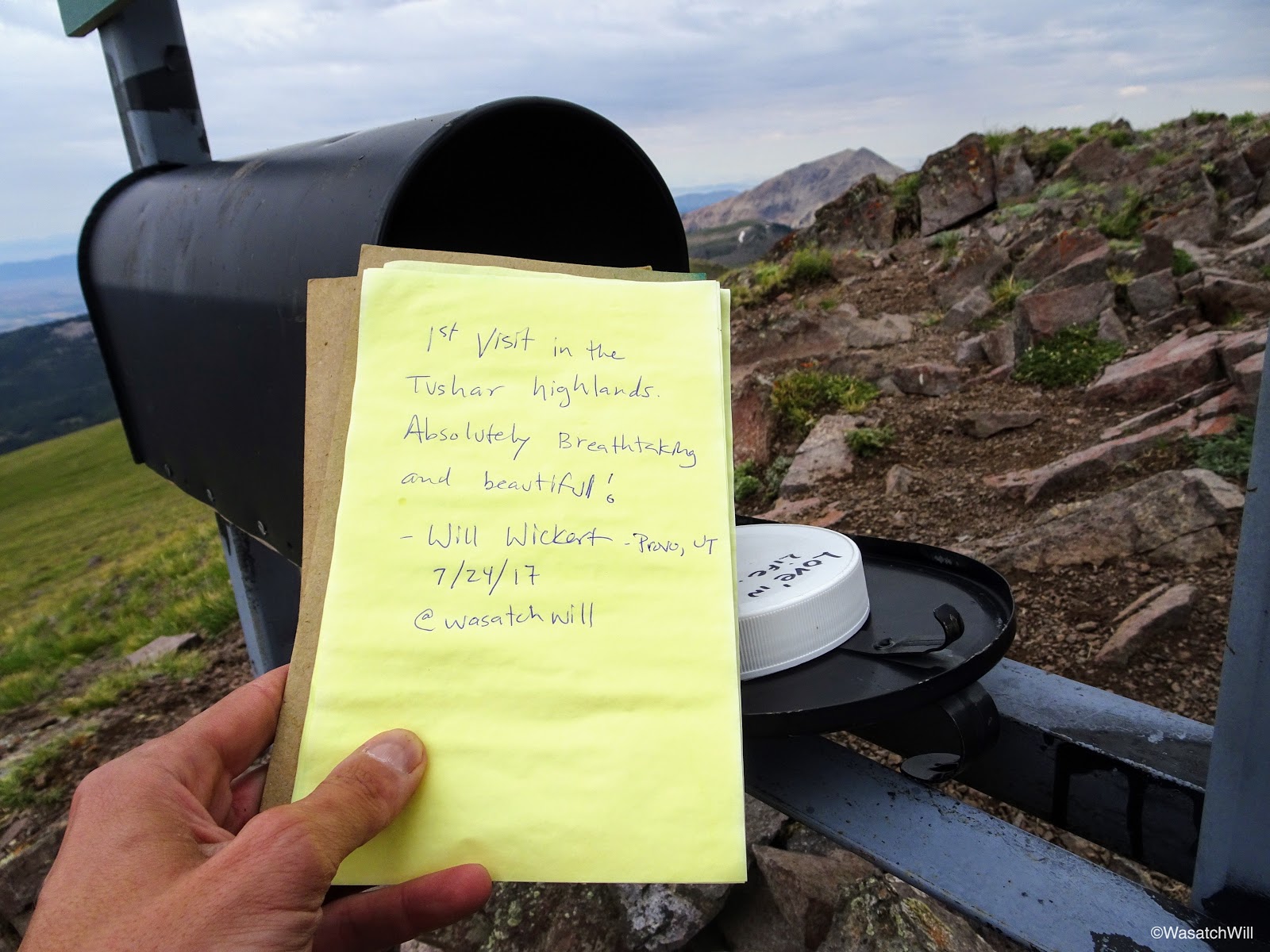
Signing the register
I did not linger very long, as much as I would have enjoyed it. I did not want to give the weather any more opportunity to stir up something bad while I was up there and I was also eager to return back to my family to enjoy the remainder of the day with them. So back on down Sophie and I went, ever enjoying the magnificent views all the way back to the pack.

Pink Indian Paintbrush beneath Delano Peak

Sophie surveys the route back down...that, or she just spotted another little critter
Part way down, I looked back up at the peak and could see another person on the summit. As I said earlier in the post, there is a much shorter way up the west face of the peak. Due to that route being so much shorter, and being in closer proximity with the I-15 corridor out of Beaver, it is by far the more traveled route up to the peak.

Another hiker gets their turn on Delano
But in my case, the extra miles just gave me all the more scenery to savor.
Descending the fields of green

Rejoining the trail back down

Looking back up toward Delano Peak

Looking back downward again
And looking back up again

Another shot of some Larkspurs and the unnamed peak
Back at the junction, I reclaimed my pack and began the two mile descent down the South Fork Trail back to the junction with the Bullion Canyon trail where I'd close out the lollipop loop.

Back at the trail junction

Primrose

Posing with the unnamed peak
Shortly after heading down, I passed by a spot where the South Fork of Pine Creek flowed through a meadow full of flowers of just about every color. The beauty just kept on coming!

Upper South Fork Pine Creek sandwiched by an array of wild flowers

Upper South Fork Pine Creek
Bluebells and Indian Paintbrush along South Fork Pine Creek

Bluebells and Indian Paintbrush along South Fork Pine Creek
I continued to meander on down the slope. The trail faded away at times, leaving me to navigate and route-find on my own, occasionally checking my GPS to ensure I wasn't getting too far off track. The sights remained delightful.
Small cascading tributary of South Fork Pine Creek

A field of Lupines
Larkspur
Another little tributary of South Fork Pine Creek
And another cascading tributary of South Fork Pine Creek

More flowers surrounding South Fork Pine Creek
Soon enough, I reached a creek crossing where I was able to pick up a more defined trail that remained so for the remainder of the route down.

Crossing South Fork Pine Creek to recapture the trail
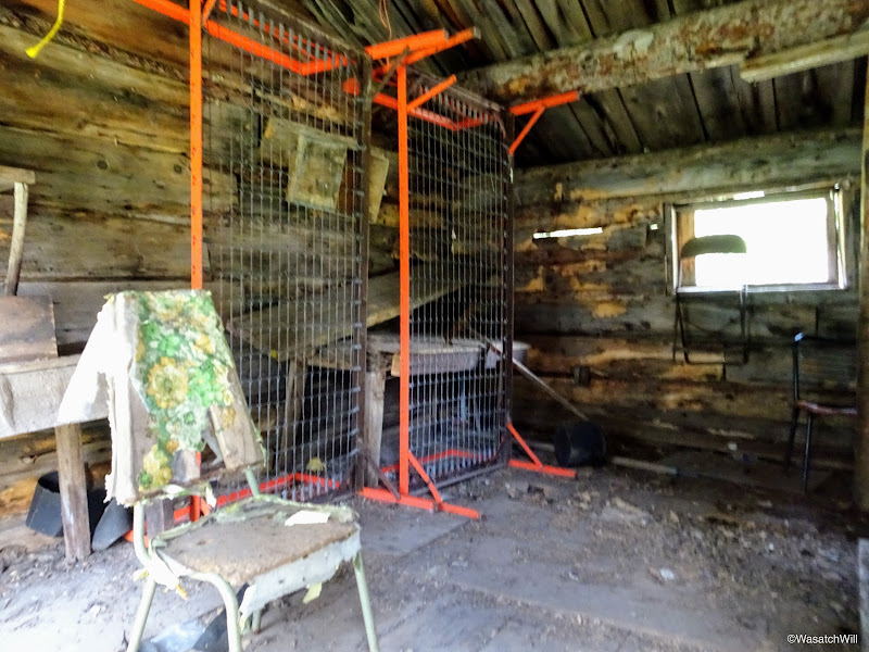
As I continued down, I came up on another older cabin, this time, one with it's roof still in tact. It too was a cabin, likely built in the late 1800's to serve as housing quarters for a miner. Relics, older and newer, were found scattered about, inside and out.

Indian Paintbrush with old miner cabin in the background
Old miner cabin
Other side of old miner cabin

Old stove inside one of the cabin rooms
Looking inside the other room
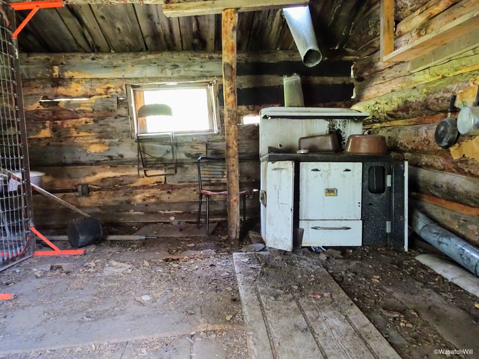
Old kitchen inside cabin
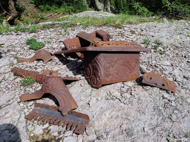
Old relics from the cabin
Close-up of the relics
Another relic close-up
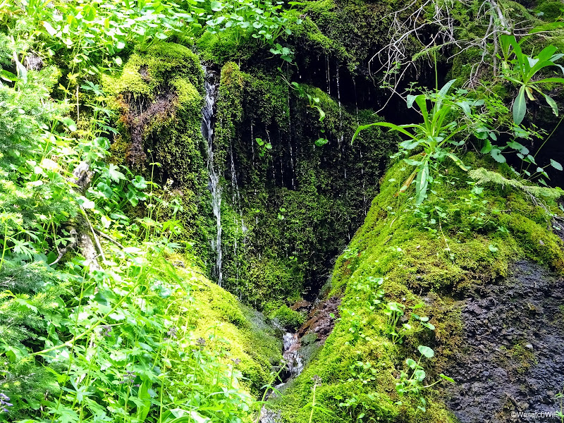
As I continued on down, I passed by another interesting and unique spot where some green algae and moss covered a large section of rock face off the side of the trail. With some trickling strands of water flowing off it, it presented a scene from a rain forest jungle.
'Mini' rain-forest
A good way down from the jungle scene was another waterfall way off the trail flowing down South Fork Pine Creek.

Distant waterfall along South Fork Pine Creek
And further down, yet another waterfall well away from the trail.

Another waterfall along South Fork Pine Creek
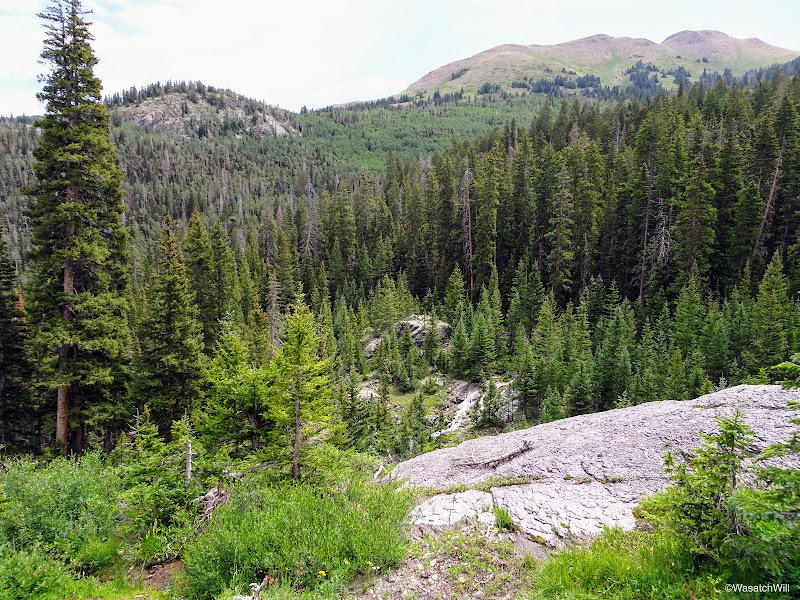
The trail continued to descend steeply down through some thick stands of conifers before crossing the creek yet again (there are a few creek crossings with this trail) where it then rode the flower-packed slope of the South Fork while the creek continued downward.

Following the trail above South Fork Pine Creek

A batch of Fireweed above South Fork Pine Creek
Cascading South Fork Pine Creek
The trail then began to switch back downward to catch up with the creek's elevation loss and then veered away from the creek for a ways through another wooded section. Here, wild alpine strawberries could be found across the forest floor, however, the berries themselves were few and far between.
Wild alpine strawberry
Soon, the trail reached the biggest creek crossing of the trip. At this crossing, Pine Creek and its South Fork had already merged upstream, making for a very wide creek. Water was shallow enough to not pose a danger, but it didn't make it any less cold. I marched right on through with little effort and against her own will, Sophie forced herself to follow along. For her little legs, it took much more effort, but she handled it like a champ. Luckily, she forgave me for not thinking to just carry her over myself.

The big creek crossing
Back on the main Bullion Canyon trail, I worked my way back down the rest of the canyon, where I encountered a couple of day hikers on their way up the trail just before crossing back over the rock slide myself. Aside from the two different people I saw on Delano from afar, this was the only time I encountered anybody on the trail above Bullion Falls.
We paused for another view of Bullion Falls on the way down. Again it was tempting to make the effort to go all the way down to their base, but nobody else was around, darker clouds were looming with a bit of rain starting to fall and thunder in the distance. Sophie wouldn't have been happy about it either. I resisted the temptation and just enjoyed the view from above.

Approaching Bullion Falls

Sophie observing the falls

Closer-up shot of Bullion Falls

Wider shot of Bullion Falls
Longer exposure of Bullion Falls
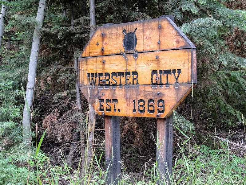
Once back at the car, we loaded up and drove another quarter mile up the road to check out the remains of Webster City (aka Bullion City) and the actual Miners Park.

Webster City sign
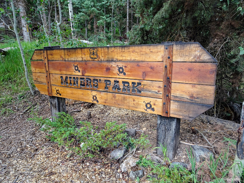
Again, Miners Park is a little park with interpretive trail maintained by the Forest Service to offer a quick glance into the history of the mining operations that formerly took place in this part of the canyon. Quite a collection of mining relics and artifacts can be found on display here.

Miners Park sign

Intro to Miners Park
Inside Dalton Cabin
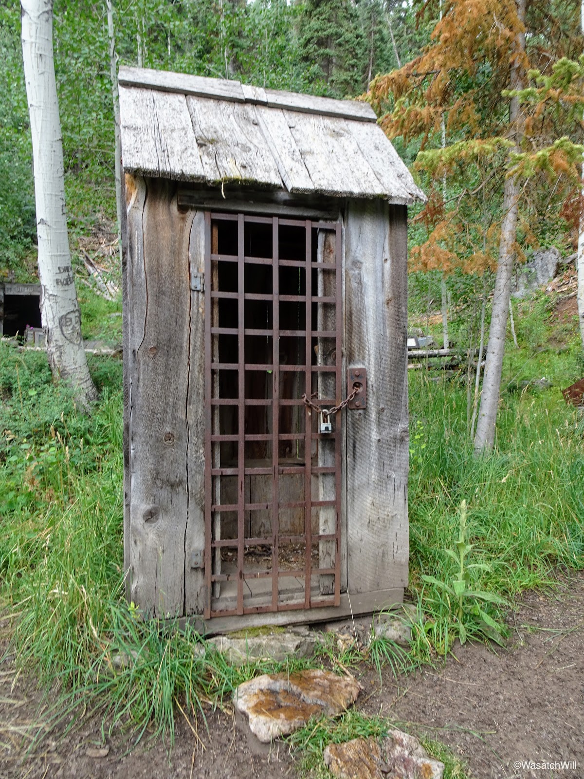
Locked up outhouse
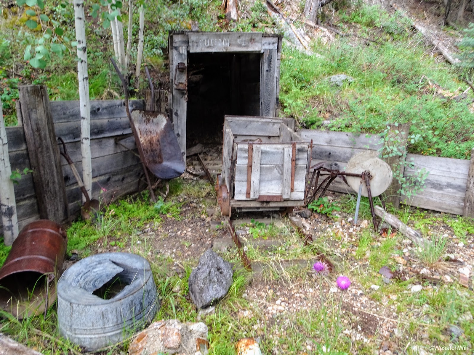
Mining tunnel and cart
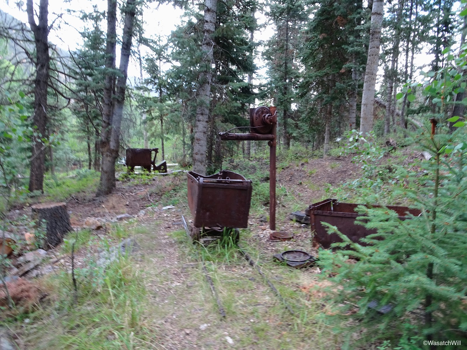
Mining cart

Old air compressor
Sheet metal silhouette sculptures

Old boiler
Mine shaft replica
Old lantern

Old lantern
Another mining cart display
Even the pit toilet restrooms follow the theme, perhaps the most decorative pit toilet structure I've ever seen.

The contemporary pit toilets

AKA - the "Assay Office"
On the way out, I pulled over to have a view of the old mining mills. Private Property and No Trespassing signs abound, so it is not appropriate to go any closer than the main road takes you. Not only is it private property, but it's assumed that with the age and condition of these old mills, it could be dangerous and hazardous to allow people up close views of them, given the temptation many would have to enter into them or climb on them.
Old mining mill

Old mining mill
On my way back to rejoin my family and in-laws in Torrey, I picked up some dinner to take home in addition to some pies, root beer, apple beer, and ice cream. After all, it was Pioneer Day for the state of Utah which celebrates the day the first Mormon pioneer wagon train arrived in the Salt Lake Valley where they would ultimately erect what is now Salt Lake City in a barren desert valley. Many who aren't devout with their faith and many who aren't of the Mormon faith at all now celebrate it as "Pie'n'Beer Day". I like it! But as a devout Mormon myself, however, I don't drink the real beer, so I adapted. And our whole family was able to indulge in the sweets!

Pie-n-beer!
Some final thoughts on the trail...I'm not sure if it had to do with the "Trail Closed" sign or if the Bullion Canyon trails really just don't see a whole lot of foot traffic, but I was astounded to find myself the only one present up there for the night on what was a three day weekend for much of the state of Utah, especially when considering alternate access into Bullion Pasture and the Pocket from the Bullion Pasture trailhead just a mile up the northeast edge of Bullion Pasture. Perhaps the road up to the Bullion Pasture trailhead was still impassable due to some lingering snowdrift from the big winter we had across the West. Or perhaps the Tushars are simply seen by outsiders as more of the ATV destination that they are rather than a destination for good hiking all while their backcountry beauty is kept secret by the locals.
Instead of writing this all up with pictures and video, perhaps I should be keeping it a secret too...
Video: