Cody
Member
- Joined
- Mar 4, 2012
- Messages
- 100
On a river trip through Cataract Canyon last fall, two side canyons converging from the Needles side of the river caught my eye eight or so miles below the confluence. I thought of these for a possible loop hike back into Cataract. I put it at the top of my list for spring trips and gave it a go last weekend.
A picture from last fall's raft trip. Cross Canyon on the right, Y canyon on the left.
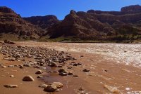
Cross Canyon and Y Canyon meet in Cataract Canyon after slicing through across the southern tips of the The Grabens on the south end of the Needles District of Canyonlands. On the image below you can see Cross Canyon and Y canyon in the bottom left, and The Grabens in the center of the image.
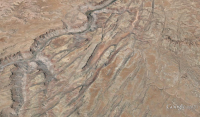
Grabens are large parallel trenches formed by collapsed blocks of rock along faults. Separating the grabens are parallel “horsts”—the un-collapsed strips that remain creating sheer cliffs and steep slopes rising hundreds of feet into the air. The NPS has a good description on the formation of grabens and horsts here: http://www.nps.gov/cany/learn/nature/grabens.htm
I worked out a route that would weave through a number of grabens to get me to and from Cross and Y Canyons and to the bottom of Cataract Canyon. An afternoon start at Elephant Hill on Saturday got me as far as Cyclone Canyon where I set up camp for the night to rest up for a big day Sunday—hopefully getting into Cross Canyon and most of the way down to the bottom to Cataract.
Great Needles scenery starting out:


Cyclone Canyon. This photo is from the return trip, but I spent Saturday night right here.
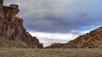
Using all of Sunday's available daylight and some twilight too, I worked my way to the southern end of Cyclone Canyon, across Butler Wash, down the length of both Aztec Canyon and Deep Canyon and into one of the upper forks of Cross Canyon all the way to within a mile of the Colorado River for night two.
Looking up Butler Wash to the saddle where I will climb over into Aztec Canyon.
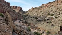
Aztec Canyon, Deep Canyon and beyond.
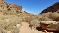
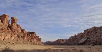
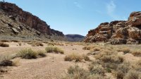
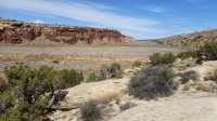
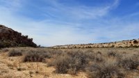
Starting down into Cross Canyon...
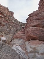
From studying satellite images, I was aware of at least one large dryfall in Cross Canyon that would require bypass, and I knew there could be other possibly impassable obstacles. I strongly considered the possibility that I would not find a passable route down Cross and would have to backtrack with no water sources along the way. That meant carrying a lot of water. I carried 7 Liters of water in case of needing to backtrack or re-route prior to reaching the Colorado River. Heavy.
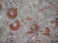
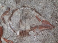
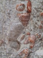
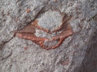
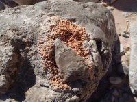
Fortunately, I found reasonable bypasses around each obstacle in the canyon Sunday, including the big dryfall (turned out to be a 150’ drop) and a number of smaller dryfalls. I made it easily into Cataract Canyon Monday early morning bypassing a section of limestone narrows headed by a dryfall. Lots of interesting marine fossils in the canyon. Towards the bottom of Cross, the fossils were all red in color and stood out nicely against the rock.
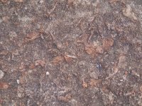
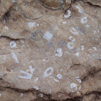
Cataract--Monday morning.
Looking upriver at Rapid 9
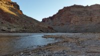
Looking downriver at Rapid 10
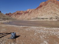
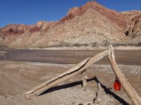
Once in Cataract, I went to work replenishing my water from the river. I settled the water in a collapsible 10L bucket using an Alum concentrate to flocculate sediment and then treated with AquaMira. I got some nice clear water out of the process; tasted great too. Between getting water, cooking breakfast, and soaking in the phenomenal scenery of Cataract Canyon, I spent about two hours in that spot—directly across the river from where I ate lunch six months ago on a raft trip.
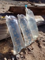
Next leg of the journey was to find a way up Y Canyon. Only one big dryfall required bypass in Y canyon, but there was lots of boulder jumble on the canyon bottom, much like Cross Canyon had--especially in the lower sections. I was able to climb out of the north fork of the canyon as I had planned. I had a few backup routes in mind that might have gone through as well. As a last resort, I would have reversed Cross Canyon (adding an extra day to the trip) if I couldn’t find a reasonable exit from Y Canyon.
Looking back down the north fork of Y Canyon after climbing out.
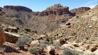
Once I got back up into The Grabens, I weaved back through a graben and up over a low side of a horst into the top end Red Canyon and followed the length of Red Canyon to where the Red Lake Canyon Trail comes in and then and walked back out to Elephant Hill.
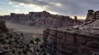
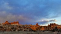
The route ended up at 38 miles total with all but a dozen of them way off the beaten path. I passed a French hiker in Aztec Canyon early Sunday and his footprints were the last I saw until I got to the bottom of Cross Canyon, where river runners had explored up a short distance recently. Significant stretches of sand slogging through the bottoms of the grabens made me work for each mile but it was It was three days of stunning scenery and solitude.
Featured image for home page:
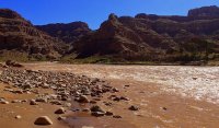
A picture from last fall's raft trip. Cross Canyon on the right, Y canyon on the left.

Cross Canyon and Y Canyon meet in Cataract Canyon after slicing through across the southern tips of the The Grabens on the south end of the Needles District of Canyonlands. On the image below you can see Cross Canyon and Y canyon in the bottom left, and The Grabens in the center of the image.

Grabens are large parallel trenches formed by collapsed blocks of rock along faults. Separating the grabens are parallel “horsts”—the un-collapsed strips that remain creating sheer cliffs and steep slopes rising hundreds of feet into the air. The NPS has a good description on the formation of grabens and horsts here: http://www.nps.gov/cany/learn/nature/grabens.htm
I worked out a route that would weave through a number of grabens to get me to and from Cross and Y Canyons and to the bottom of Cataract Canyon. An afternoon start at Elephant Hill on Saturday got me as far as Cyclone Canyon where I set up camp for the night to rest up for a big day Sunday—hopefully getting into Cross Canyon and most of the way down to the bottom to Cataract.
Great Needles scenery starting out:


Cyclone Canyon. This photo is from the return trip, but I spent Saturday night right here.

Using all of Sunday's available daylight and some twilight too, I worked my way to the southern end of Cyclone Canyon, across Butler Wash, down the length of both Aztec Canyon and Deep Canyon and into one of the upper forks of Cross Canyon all the way to within a mile of the Colorado River for night two.
Looking up Butler Wash to the saddle where I will climb over into Aztec Canyon.

Aztec Canyon, Deep Canyon and beyond.


Starting down into Cross Canyon...

From studying satellite images, I was aware of at least one large dryfall in Cross Canyon that would require bypass, and I knew there could be other possibly impassable obstacles. I strongly considered the possibility that I would not find a passable route down Cross and would have to backtrack with no water sources along the way. That meant carrying a lot of water. I carried 7 Liters of water in case of needing to backtrack or re-route prior to reaching the Colorado River. Heavy.
Fortunately, I found reasonable bypasses around each obstacle in the canyon Sunday, including the big dryfall (turned out to be a 150’ drop) and a number of smaller dryfalls. I made it easily into Cataract Canyon Monday early morning bypassing a section of limestone narrows headed by a dryfall. Lots of interesting marine fossils in the canyon. Towards the bottom of Cross, the fossils were all red in color and stood out nicely against the rock.


Cataract--Monday morning.
Looking upriver at Rapid 9

Looking downriver at Rapid 10

Once in Cataract, I went to work replenishing my water from the river. I settled the water in a collapsible 10L bucket using an Alum concentrate to flocculate sediment and then treated with AquaMira. I got some nice clear water out of the process; tasted great too. Between getting water, cooking breakfast, and soaking in the phenomenal scenery of Cataract Canyon, I spent about two hours in that spot—directly across the river from where I ate lunch six months ago on a raft trip.


Next leg of the journey was to find a way up Y Canyon. Only one big dryfall required bypass in Y canyon, but there was lots of boulder jumble on the canyon bottom, much like Cross Canyon had--especially in the lower sections. I was able to climb out of the north fork of the canyon as I had planned. I had a few backup routes in mind that might have gone through as well. As a last resort, I would have reversed Cross Canyon (adding an extra day to the trip) if I couldn’t find a reasonable exit from Y Canyon.
Looking back down the north fork of Y Canyon after climbing out.

Once I got back up into The Grabens, I weaved back through a graben and up over a low side of a horst into the top end Red Canyon and followed the length of Red Canyon to where the Red Lake Canyon Trail comes in and then and walked back out to Elephant Hill.


The route ended up at 38 miles total with all but a dozen of them way off the beaten path. I passed a French hiker in Aztec Canyon early Sunday and his footprints were the last I saw until I got to the bottom of Cross Canyon, where river runners had explored up a short distance recently. Significant stretches of sand slogging through the bottoms of the grabens made me work for each mile but it was It was three days of stunning scenery and solitude.
Featured image for home page:

