The Lakeside Range - April 22, 2018

scatman

Member
.
Joined
Dec 23, 2013
Messages
3,666
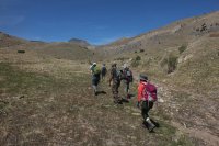
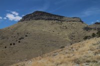
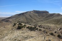
Every now and then the Wasatch Mountain Club has a hike on their event calendar that tickles my fancy and I will tag along with them for a day of hiking. Today, they were attempting to reach Peak 6551, second tallest, in the Lakeside Range which is located just west of the Great Salt Lake. The route to 6551 was off-trail up Vindicator Canyon which has a couple of old mine shafts that we will pass. Unfortunately, as we arrived at the beginning of the trail, one of the drivers who shuttled us to the trail, punched a hole in her oil pan and lost all of her motor oil. At this point, we had to use a tow strap and tow her back to pavement so that she could get AAA to come tow her. This cost us two hours of hiking time, and since people had to get back to Salt Lake before 6:00 pm, we did not summit. It was still perfect weather (maybe a little hot) for a hike with a good group of people.
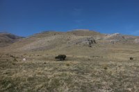
LS_01.jpg
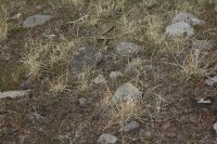
View to the west from the beginning of our hike
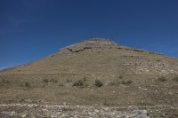
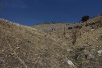
LS_02.jpg
Unnamed peak to the north of our route
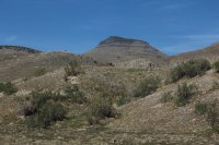
LS_03.jpg
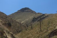
Peak 6551 in the distance

LS_04.jpg
Who the hell are these folks? Oh, that's right Wasatch Mountain Club members. A good group of hikers.
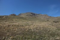
LS_05.jpg
Craner Peak, which is the highest in the range
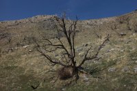
LS_06.jpg
A fire at some point in the past had burned all the Juniper trees which made for heavy sun exposure the entire route
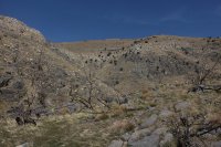
LS_07.jpg
Another view to the north from Vindicator Canyon
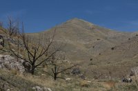
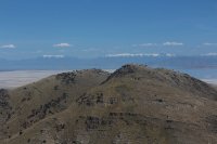
LS_08.jpg
Peak 5546

LS_09.jpg
Peak 5927

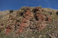
LS_11.jpg
A touch of red rock along our route

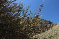
LS_12.jpg
Some Mountain Mahogany in bloom

LS_13.jpg
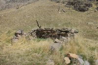
Old foundation at the first tungsten mine we passed
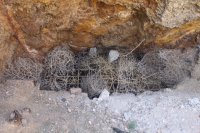
LS_14.jpg
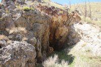
Sealed mining shaft

LS_15.jpg
Wider view of shaft

LS_16.jpg
View from the canyon

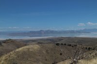
LS_17.jpg
The Great Salt Lake and distant Wasatch Front coming into view
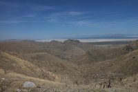
LS_18.jpg
Looking northeast from the ridgeline

LS_19.jpg
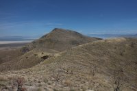
Peak 6551 - our hopeful destination

LS_20.jpg
A look south at Craner Peak

LS_21.jpg
Stansbury Island to the east.

LS_22.jpg
Ben Lomond and Mount Ogden in the distance - distant left of image
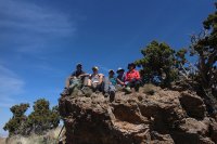
LS_23.jpg
A quick lunch before heading back. The lady second from the left is the third oldest female to climb Mount Everest! :twothumbs:
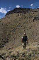
LS_24.jpg
The guy in this shot is the 1st 53 year old not to summit Peak 6551! :cry:
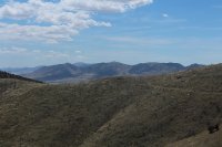
LS_25.jpg
The Cedar Range to the southwest

LS_26.jpg
Can you make out the Gopher Snake we saw on our way down?
 
Last edited:
Looks like a fun day. Unless there's an earthquake Peak 6551 will still be there later. It could even be a little higher next time.
 
Still looks like a beautiful day to be out despite cutting it short. Are there any remains of old roads that go to those mining shafts?
 
Still looks like a beautiful day to be out despite cutting it short. Are there any remains of old roads that go to those mining shafts?

Good question. At the shaft itself there was an old track bed for ore cars. Donn, who led our hike and likes to poke around in the Lakesides, said there were remnants of the bed further up at another shaft which he called the Vindicator Mine. Unfortunately, we took a right along the canyon to head towards Peak 6551 instead of left towards the other shaft and Craner Peak. Did the track only run between the shafts? I'm not up on my historic mining operations and do not know if this is a likely scenario. On our way down, I could not see evidence of this track bed in Vindicator Canyon below the first mine shaft. Perhaps it contoured around the ridge and ran out in the canyon to the south of Vindicator. I should have been more inquisitive. :facepalm:

Mine_01.jpg
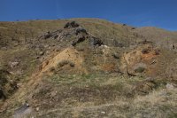
The old track bed can be seen in the lower part of the image below the tailings. I'm almost standing on it for the picture

Mine.jpg
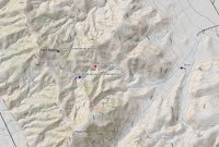
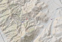
Map of our hike - Peak 6551 is labeled as Black Mountain
 

Attachments

  • Mine.jpg
    Mine.jpg
    485.2 KB · Views: 6
Very interesting. I was curious about the road because there is a mine in Harriman State Park called Boston Mine that I’ve hiked to and I’ve always found it interesting how what used to be a road used by workers had been restored by time and nature to just a faint hiking trail.
 
Similar threads
Thread starter Title Forum Replies Date
scatman Peak 6551 - Lakeside Mountains - April 17, 2021 Hiking & Camping 7
regehr looking for a mountain range with few mosquitoes in early/mid August Trip Planning 12
Outdoor_Fool Brooks Range trek - Anaktuvuk Pass to the Haul Road - Cancelled Flight - last minute change-up Backpacking 21
scatman The Wyoming Range (Scatman version) - June 26, 2023 Backpacking 21
Bob Wyoming Range Backpacking 14
Dreamer Wyoming Range conditions 2023 Trip Planning 62
W Greetings from the West Side of the Winds (Wind River range) Noobs: Introduce yourself! 5
marquiri Wind River Range - Angel Pass Trip Planning 24
Writhdar Day hikes in the White Clouds and Lost River Range Hiking & Camping 1
Mikjik86 Backpacking The Wind River Range - Wyoming, September 2022 Trip Reports 3
R Wind River Range: Green River Lakes/Clarks Trail/Porcupine Creek Trail Trip Planning 3
wsp_scott Wind River Range Sept 2021 (part 2) Backpacking 4
wsp_scott Wind River Range Sept 2021 (part 1) Backpacking 16
B Wind river range mid sept. Trip Planning 8
andyjaggy Wind River Range Roberts Mountain Trip Planning 4
marquiri Wind River Range - September 2022 Trip Planning 31
J Pahranagat, Desert NWR, and Arrow Canyon Range to start Nov. 2021 Desert time Hiking & Camping 6
seekinglost 1000 Mile Nevada Thru Hike on the Basin and Range Trail Trip Reports 14
regehr Fox Creek, Teton Range Hiking & Camping 19
RyanP Snowy Range (WY) easy backpacking recommendations? Trip Planning 4
westy Wind River Range Backpacking 4
wsp_scott Wind River Range (beginning of Sept 2021) Meet Up (Members Only) 11
TheMountainRabbit NW Wind River Range (Bridger Wilderness) - August 2020 Backpacking 3
travel2walk trip report: Wind River Range – Ross Lakes, Bear Basin, Grasshopper Glacier, & Dinwoody Creek loop, Aug-Sep 2020 Trip Reports 41
marquiri Wind River Range - Green River Lakes Trailhead Trip Planning 9
Outdoor_Fool Snowshoeing to Castner Glacier Ice Cave, Alaska Range Winter Sports 5
NorthwestWanderer The Bailey Range Traverse | An 8 Day Olympic National Park Epic Backpacking 15
Gunnahafta Green River <> Big Sandy WIND RIVER RANGE Trip Planning 1
NorthwestWanderer Backpacking the Lost River Range in Idaho : Bear Creek Lake & Upper Basin Backpacking 7
TheMountainRabbit Invite Never Summer Range, June 27th-29th Meet Up (Members Only) 0
Matt Van Natta HELP: Wind River Range, Baker Lake to Green River Lakes Trip Planning 7
regehr bears in Jarbidge Range? Trip Planning 2
Ugly Front Range Friday Fun Winter Sports 5
J Grenadier Range, San Juan Mtns. Weminuche Wilderness, CO June 27-30, 2007 Retro Backpacking 9
NorthwestWanderer Chelan-Sawtooth Range : Sunrise to Cooney Lake Loop Backpacking 3
NorthwestWanderer Haunted by Washington's Tiffany Range Hiking & Camping 11
TrektheWorld Wind River Range 5 Day Loop Backpacking 16
WasatchWill Wyoming Grizzly Range Tracker and DMA General Discussion 11
H Wind River Range route planning Trip Planning 6
10KFly Wind River Range in Late September Trip Planning 6
Stephanie B Suggestions for Maze Hikes and Range Canyon Intel? Trip Planning 2
westy McCullough Range Hiking & Camping 7
b.stark Wind River Range 2009 "From The Vault" Backpacking 9
blueeyes Wind River Range August 2018 Backpacking 11
Lowro East Temple Peak - Wind River Range Backpacking 13
DuneElliot Backpacking Wyoming's Wind River Range, August 2018 Backpacking 4
Born to Hike Backpacking Northern Windriver Range, solo 60+ miles, 5 days, mid September 2018 Backpacking 17
b.stark Wind River Range 2007 "From The Vault" Backpacking 4
Wolverine1875 Wind River Range: Llama Trekking from Dickinson Park to The Cirque of The Towers Trip Planning 19
TrektheWorld Booth Lake Basin - Gore Range, Colorado Backpacking 7

Similar threads

Back
Top