Udink
Still right here.
- Joined
- Jan 17, 2012
- Messages
- 1,692
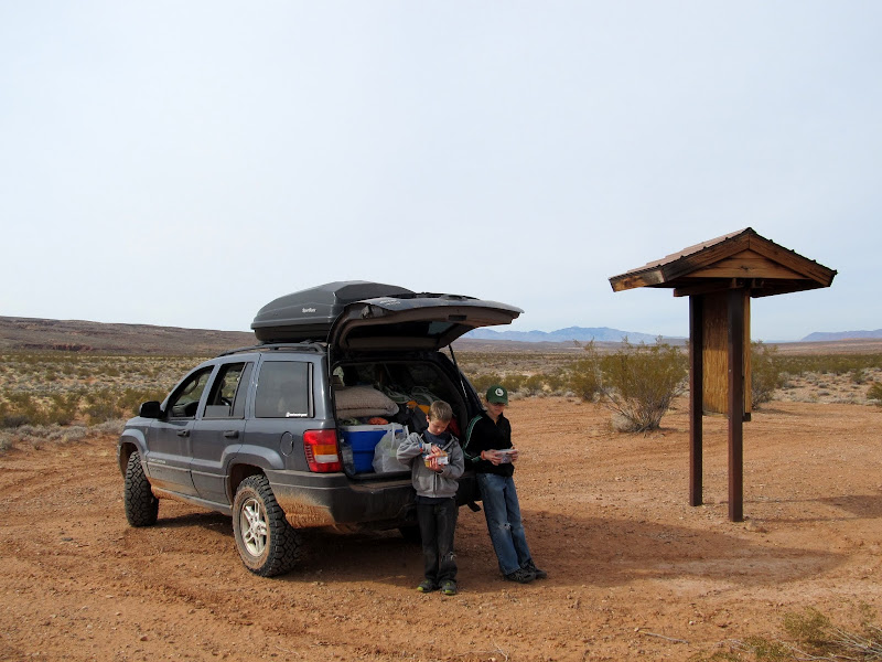
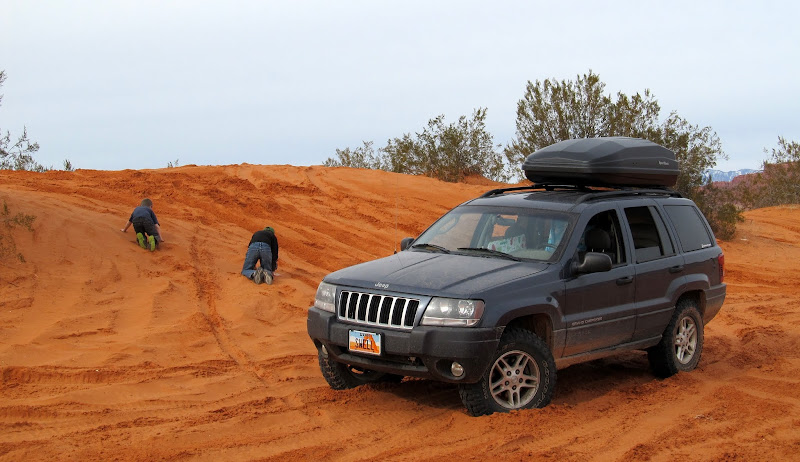
I couldn't take it anymore--the snow, ice, freezing daytime temperatures, and then mud even after it warms up. I almost took the kids hiking in the San Rafael Reef this past weekend, but instead I got a wild hair up my ass and we ended up in the St. George area. I usually only go there once each year in March, though I think this weekend has changed that. Perhaps four or five times a year would be appropriate. The nighttime low temperatures in St. George were the same as the daytime highs in Price--how could I pass that up? I took half a day off work Friday and got the kids out of school a little early so that we could get to my planned camp spot before dark. On the advice of some friends who live in the area, we camped at the south end of Sand Mountain. I fueled up in Hurricane (which, I'm told, rhymes with La Verricane ") ) and called Eric, hoping to meet up with him and Sherie at least briefly, but they were out of town. The boys and I then headed south out of town and found a few geocaches on the way to camp. The camp spot was much as I'd envisioned it, and I was thankful for the recommendations to stay there.
) and called Eric, hoping to meet up with him and Sherie at least briefly, but they were out of town. The boys and I then headed south out of town and found a few geocaches on the way to camp. The camp spot was much as I'd envisioned it, and I was thankful for the recommendations to stay there.
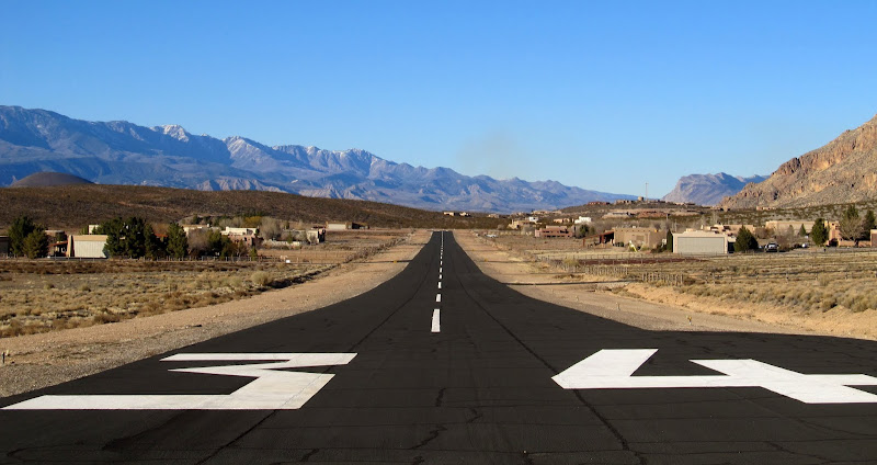
Sky Ranch
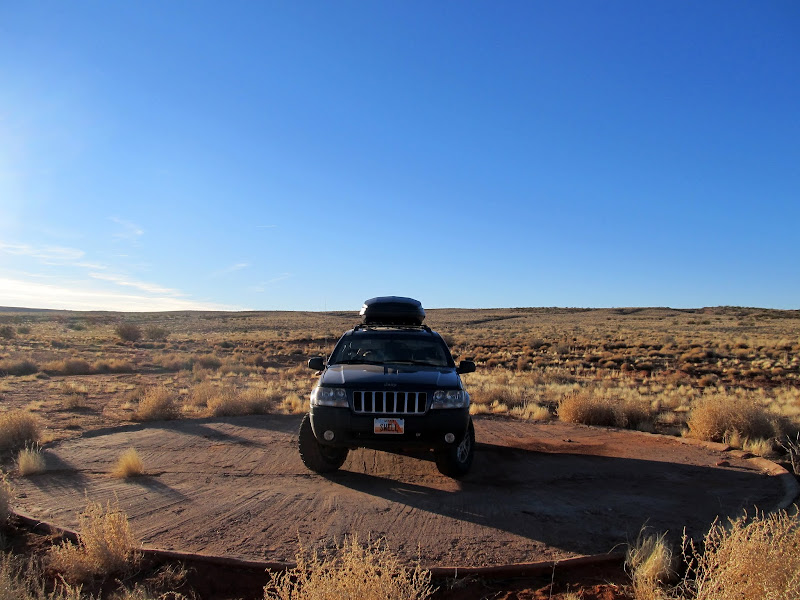
A random circular concrete pad in the middle of nowhere
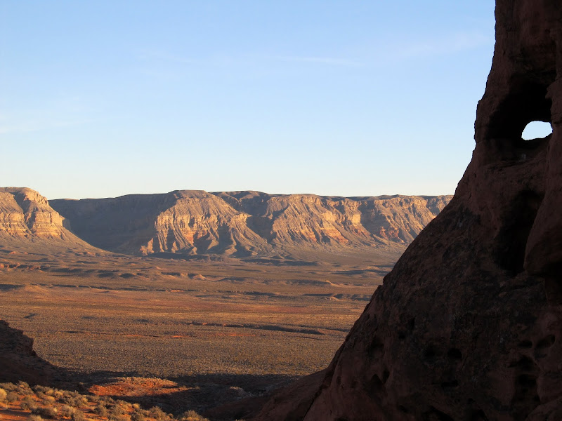
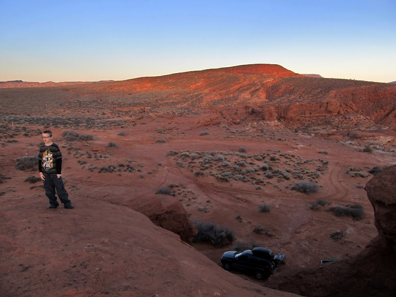
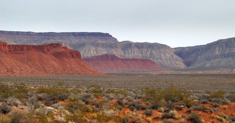
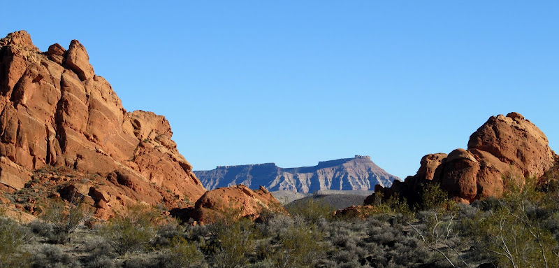
View from camp toward the Hurricane Cliffs
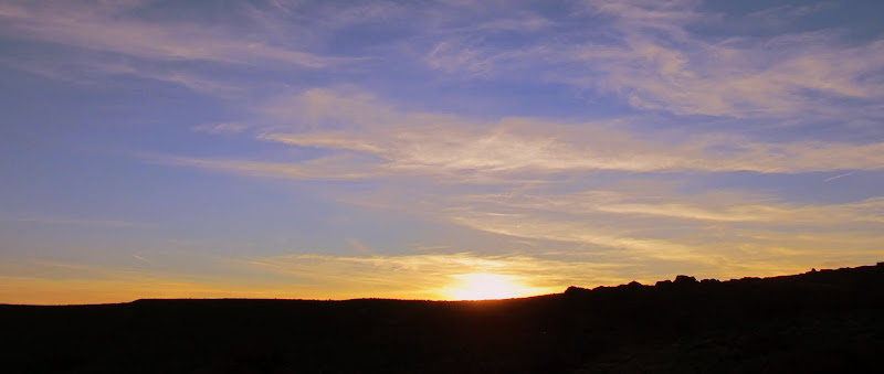
Sunset on Friday evening
Above our camp on Friday
We started a small fire with the meager amount of firewood I was able to fit into the Jeep, then set up the tent while our dinner warmed up. Dinner consisted of tortilla wraps filled with turkey lunch meat, sharp cheddar, and chopped green onions, all prepared and wrapped in foil the evening before. I'd purchased a roof-top cargo carrier for the Jeep more than a week earlier, and it arrived Thursday evening just in time for this trip. It made it so much easier managing all our gear--all the overnight stuff (sleeping bags & pads, tent, and camp chairs) went into the cargo box while everything else went into the back of the Jeep. We went to bed very early, just after 8PM, and I slept fitfully (normal for any camping trip) while the kids said they slept well. I got up at around 7:30AM and roused the boys, and we ate a quick breakfast while taking down camp. It was overcast and the skies stayed hazy most of the day, but at least it was warmer than we were used to.
Sunrise at camp on Saturday
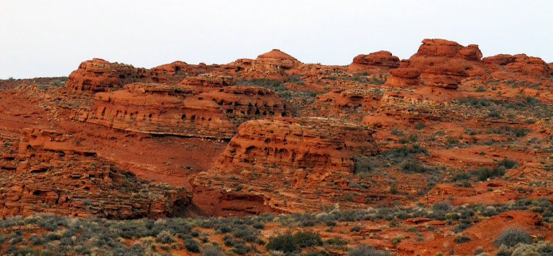
Holey domes on Sand Mountain
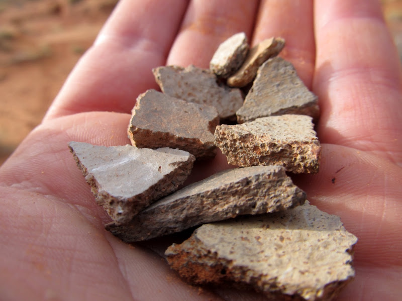
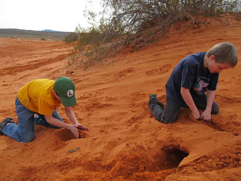
We had no fixed plans for the weekend, but I had a list of things for Michael and Bradley to choose from. I offered them the choice of exploring more of Sand Mountain, or visiting the dinosaur tracks just south of our current location. They chose the dino tracks, which were just half a mile south of us, but since there was no road leading south off of Sand Mountain, it took a 15-mile detour to get there. Before leaving I wanted to scour the ground looking for arrowheads (after seeing many flint chips on the ground the previous evening), and surprisingly managed to find many pottery shards directly under where our tent was set up, and a single broken arrowhead point almost under one of the Jeep's tires. Before leaving, we hiked to a geocache that was less than a quarter-mile away that offered a nice view over Warner Valley to the southwest.
Broken pottery that was under the spot where we set up our tent
Torrey
The Jeep near our camp spot and the Pine Valley Mountains in the distance
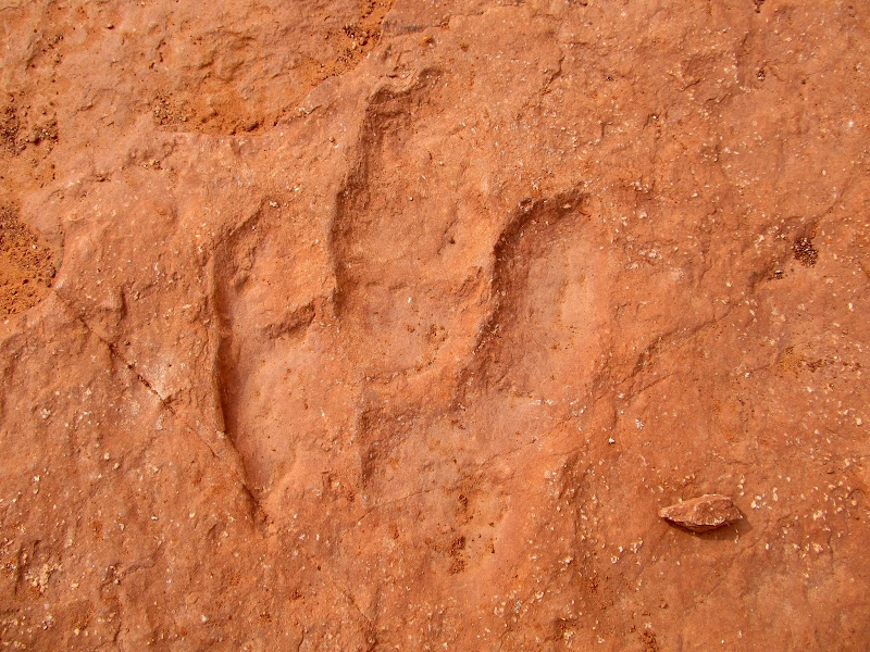
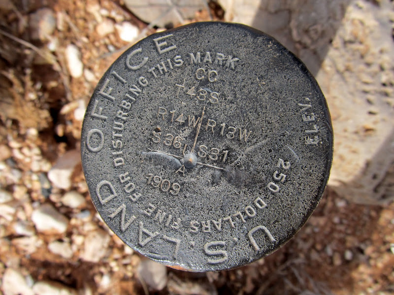
We found a few more geocaches on the way to the dinosaur tracks. At those locations we saw a 1909 survey marker and an old Dominguez-Escalante trail marker. We arrived at the dinosaur track trailhead to find several vehicles there, and we saw quite a few people on the trail. There were more people there than we'd previously seen since leaving Hurricane. The dinosaur tracks were well worth the visit. Most of the tracks were easy to make out, and an interpretive sign helped us make out the less distinct tracks. The tracks were concentrated in a pretty small area, so we were done there quickly. We got back to the Jeep around lunchtime, and since we were less than two miles from the Arizona border and Michael had never been to Arizona, we headed south. Just south of the state line we stopped for lunch, where the boys ate Lunchables and I had a tuna sandwich accompanied with carrot and celery sticks.
1909 section marker
Parked in a wash while finding a geocache
Hurricane Cliffs viewed from the dinosaur tracks
Dinosaur track
Just across the border into Arizona to eat lunch
1909 section corner on the UT-AZ border
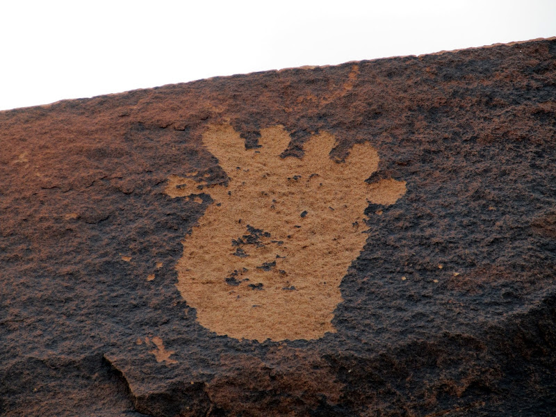
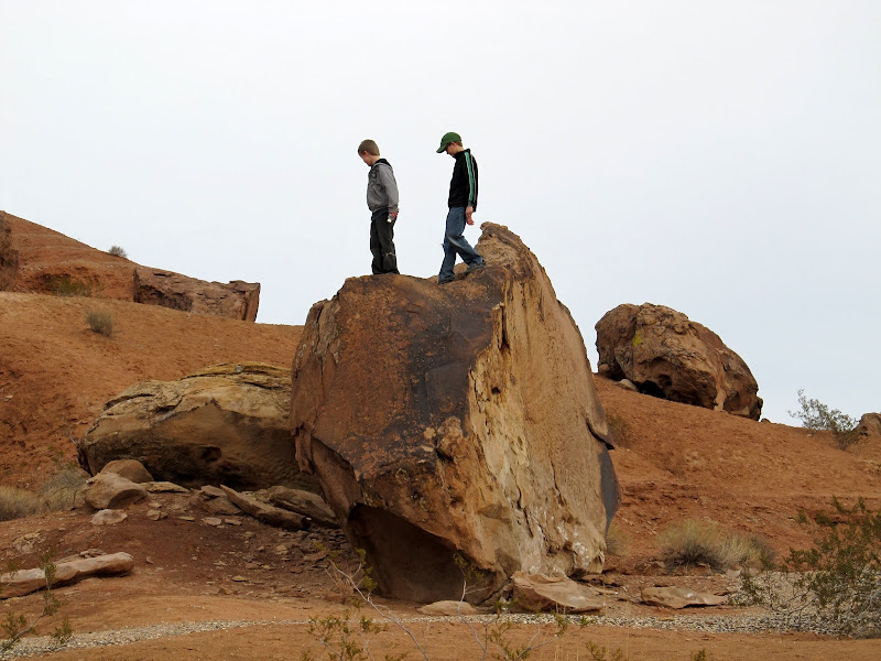
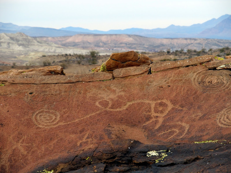
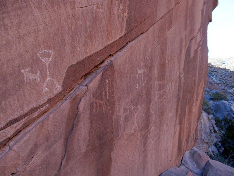
For our after-lunch activity I got to choose where to go. The Little Black Mountain petroglyph site wasn't too far a drive and that's what I really wanted to see. On the way there the road passed through some sand dunes where I did a few donuts in the Jeep then stopped to let Michael and Bradley dig in the sand for a bit before moving along. We had Little Black Mountain all to ourselves--a small group was just leaving as we arrived and the Jeep was the only vehicle in the parking lot. While we were on the trail looking for petroglyphs on boulders, I got a phone call from Ken, a friend who lives in Hurricane. He was in nearby in Warner Valley and wanted to know where we were so we could meet up. He arrived with his two youngest girls and we met up on the trail and chatted for a bit while we hiked. We talked some more back at the trailhead, then I followed him part of the way back toward town before turning off on my way to our next camp site.
Playing on some sand dunes in Warner Valley
The boys digging in the sand
Little Black Mountain petroglyphs
Little Black Mountain boulder
Little Black Mountain petroglyphs
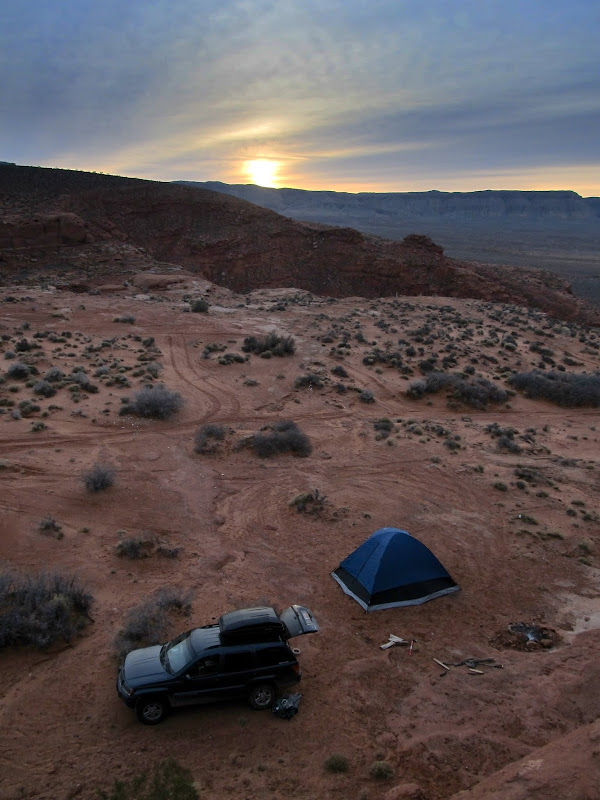
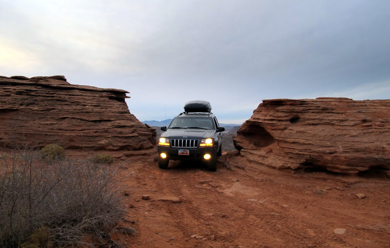
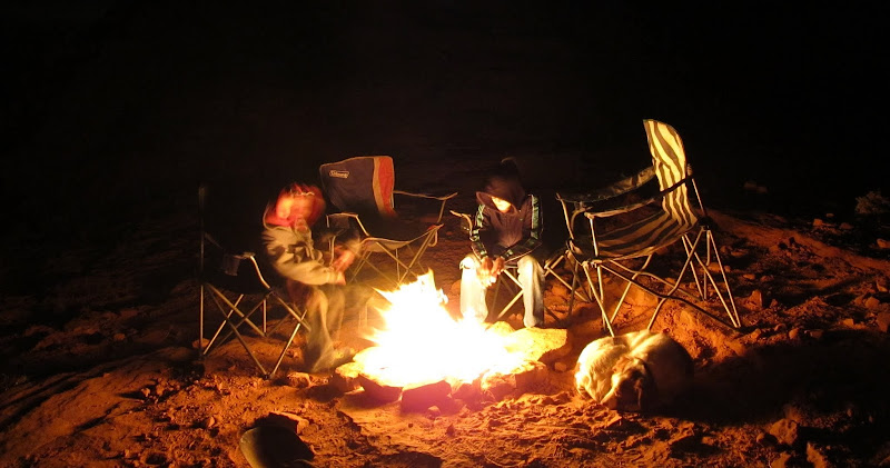
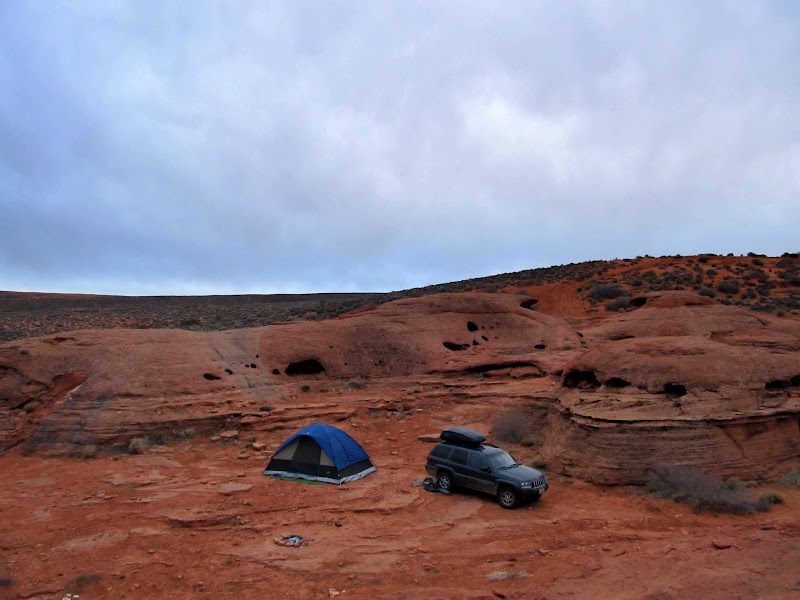
I hadn't made specific plans for camping on Saturday evening, but I had a rough idea of where I could find a spot. I drove up the west rim of Sand Mountain, where I'd been last year in Eric's Jeep, and started exploring. We first drove up a deep, sandy canyon that looked promising, but there wasn't a spot of ground that didn't appear to be well-traveled. Despite being just after sunset, there were also quite a few OHVs in the area, so it was unlikely we'd have any seclusion there for the night. Just south of the canyon I found a secluded spot between some slickrock domes that looked perfect, so we set up camp there. Again we had a small fire and cooked dinner on it, this time consisting simply of ramen noodles and Lit'l Smokies. We'd found a little extra firewood during the day, and we were able to keep the fire going until almost 10PM before it was time for bed.
Pulling in to Saturday night's camp
'Round the fire on Saturday evening
After rising for the day on Sunday, I got a text from Eric. He was back in town and on his way out to see us. The kids and I ate a quick breakfast of oatmeal and started taking down camp. Eric arrived when I was collapsing the tent, and we drove back into the canyon I'd driven in the evening before to explore the two box canyons at its head. Eric brought his dog, Bosley, and he and Torrey got along nicely--I think they wore each other out. We hiked and Jeeped around in the canyon for an hour or two before Eric had to leave. I had brought bread and peanut butter for lunch, but I forgot the jam or honey for sandwiches, so Michael and Bradley and I went into town and ate fast food for lunch.
Camp on Sunday morning
Torrey and Bosley on the dunes
Michael and Bradley on the dunes
Bosley and Torrey

Michael, Eric, and Bradley heading up the canyon
Bosley and Eric
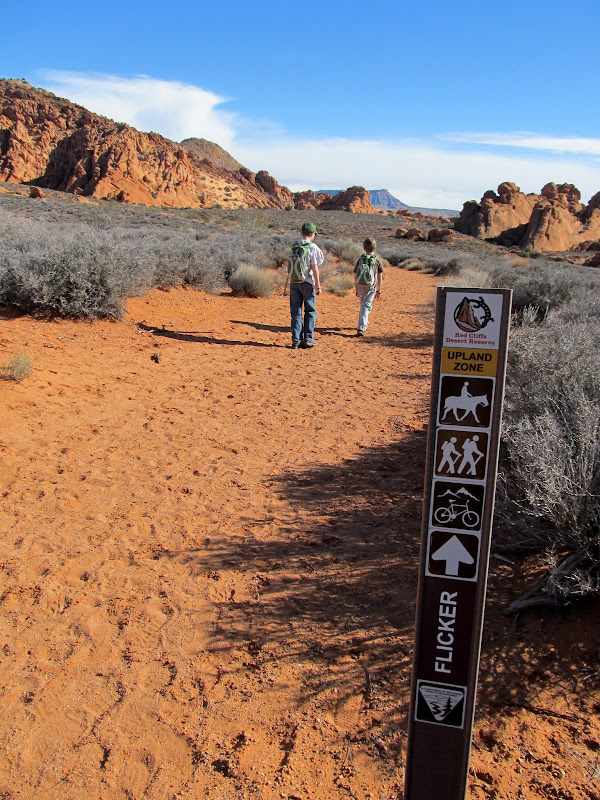
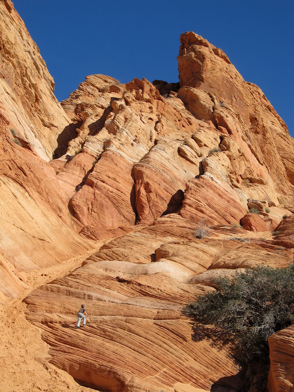
I had no additional plans or ideas for the rest of the day, and I think the kids were missing home. While we ate lunch I looked at the maps in my GPS and found what I'd hoped would be a good place to explore and keep the kids engaged for a little longer. It was outside of the area I'd scouted in Google Earth from home while planning this trip, but I remembered looking at it a year or two ago before one of mine and Traci's trips down south. It was just north of Sky Mountain, on the north side of the Virgin River. Geocaches can usually be a great guide to an area, but unfortunately the 950 geocaches I'd downloaded to my GPS only reached about an 11-mile diameter from the south end of Sand Mountain, which came up short by two miles from the area to which we were headed. My memory of the area didn't fail me, however, and we found some fun stuff to do despite knowing very little about the place. During the drive there I saw a sign for Sand Cove, which just sounded like a fun place--and, importantly, the boys agreed. We parked at the trailhead, donned our backpacks, and followed the trail to Sand Cove and Sandstone Mountain. At Sand Cove we found a few springs that flowed down Sandstone Mountain but disappeared into the sand dunes at the base of the mountain. The boys enjoyed climbing the steep dunes and then running down them. I enjoyed the textures in the sandstone and the warm, sunny day that emerged out of what had begun as an overcast and dreary morning. We followed some trail signs that pointed toward an arch, and the trail kept descending toward the Virgin River. The signs didn't indicate how far the arch was, and after following them for a while the kids began to tire. I knew we'd have to ascend the trail to get back to the Jeep, and I decided that following the signs without knowing how far the arch was could be problematic for keeping the kids motivated. We turned around, and only after returning home did I find out the arch was a mere 0.18 miles from our turnaround spot.
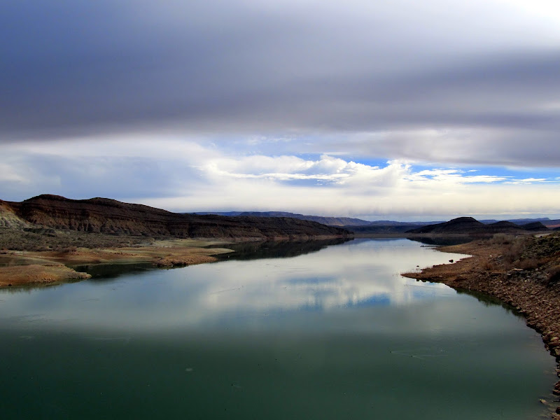
Quail Creek Reservoir
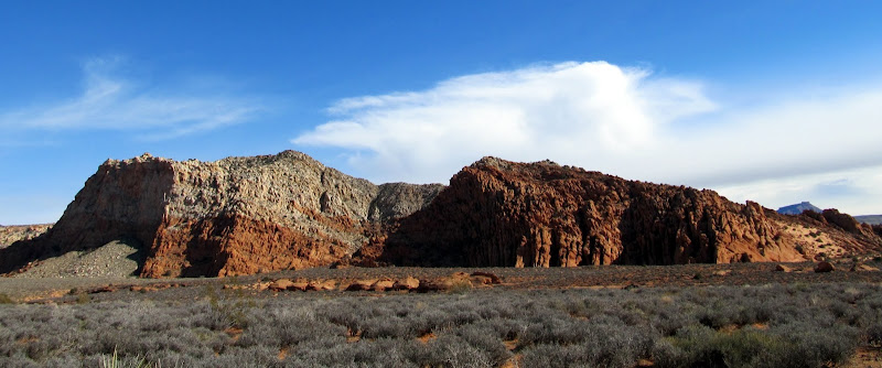
Sandstone Mountain
On the trail to Sand Cove
Playing at Sand Cove
Hiking southwest of Sandstone Mountain
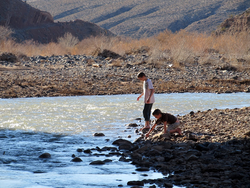
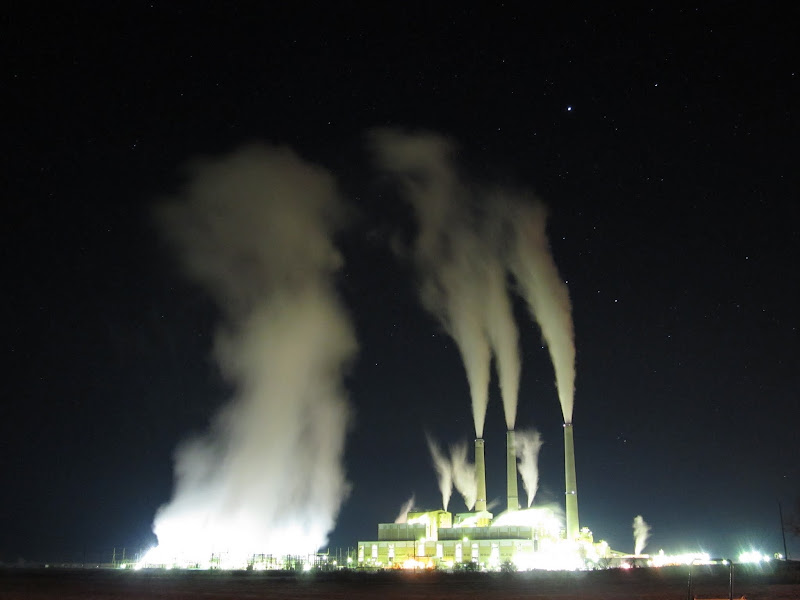
Back at the Jeep we ate a snack then continued south on the road toward the river. I figured a quick visit to the river would be the perfect ending to our trip after we all returned from Sand Cove sweating. While driving toward the river, I was waved to a stop by a Washington County sheriff deputy who was parked on the side of the road. He was a very friendly guy and only wanted to let me know about some rock art and dinosaur footprints that were along the road in the direction we were heading. I thanked him for the info and we continued toward the river. There, Michael and Bradley took off their shoes, rolled up their pants, and waded in the river for a very short while--apparently the water was quite cold. We skipped some rocks then got back into the Jeep and returned north on the road. I couldn't find the spot where the deputy told me the dino footprints would be, but I easily found the petroglyphs. That was our last exploration of the weekend. I got on I-15 near Leeds and started the long drive home. We stopped in Cedar City for fuel, and dug around in the back of the Jeep for some snacks that we ate for dinner. The kids just barely tolerated me stopping near Castle Dale for a couple of photos of the Hunter Power Plant at night. It's a shot I've long wanted to take, but never before taken the opportunity. The trip wasn't terribly more expensive than a more local trip would have been, and the kids are now old enough to handle the longer drive, so I can envision this type of thing happening much more in the future.
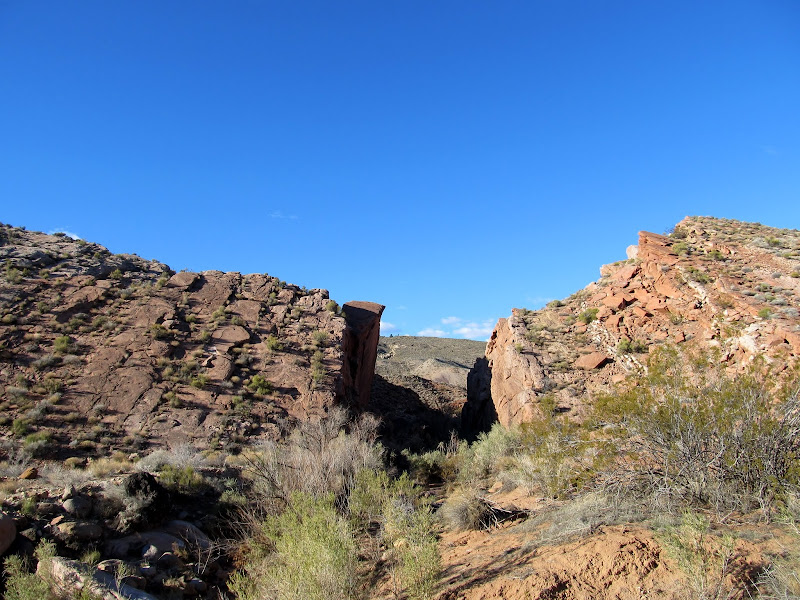
Hurricane Cliffs north of Toquerville
Gooseberry Mesa
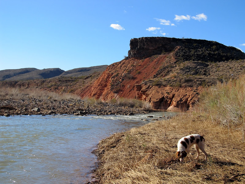
Virgin River
East Reef/Grapevine Wash petroglyphs
East Reef/Grapevine Wash
Hunter Power Plant
Full photo gallery:
[picasa]https://picasaweb.google.com/Dennis.Udink/SouthernUtahFebruary2013[/picasa]
https://picasaweb.google.com/Dennis.Udink/SouthernUtahFebruary2013
GPS tracklog and photo waypoints:
[parsehtml]<iframe width="640" height="480" frameborder="0" scrolling="no" marginheight="0" marginwidth="0" src="https://maps.google.com/maps?q=http:%2F%2Fudink.org%2Fgeo%2FSouthernUtahFebruary2013.kmz&hl=en&sll=39.499761,-111.547028&sspn=4.907901,10.821533&t=h&ie=UTF8&ll=37.123096,-113.37204&spn=0.52559,0.878906&z=10&output=embed"></iframe><br /><small><a href="https://maps.google.com/maps?q=http:%2F%2Fudink.org%2Fgeo%2FSouthernUtahFebruary2013.kmz&hl=en&sll=39.499761,-111.547028&sspn=4.907901,10.821533&t=h&ie=UTF8&ll=37.123096,-113.37204&spn=0.52559,0.878906&z=10&source=embed" style="color:#0000FF;text-align:left">View Larger Map</a></small>[/parsehtml]http://udink.org/geo/SouthernUtahFebruary2013.kmz
Featured image for home page:

) and called Eric, hoping to meet up with him and Sherie at least briefly, but they were out of town. The boys and I then headed south out of town and found a few geocaches on the way to camp. The camp spot was much as I'd envisioned it, and I was thankful for the recommendations to stay there.Sky Ranch
A random circular concrete pad in the middle of nowhere
View from camp toward the Hurricane Cliffs
Sunset on Friday evening
Above our camp on Friday
We started a small fire with the meager amount of firewood I was able to fit into the Jeep, then set up the tent while our dinner warmed up. Dinner consisted of tortilla wraps filled with turkey lunch meat, sharp cheddar, and chopped green onions, all prepared and wrapped in foil the evening before. I'd purchased a roof-top cargo carrier for the Jeep more than a week earlier, and it arrived Thursday evening just in time for this trip. It made it so much easier managing all our gear--all the overnight stuff (sleeping bags & pads, tent, and camp chairs) went into the cargo box while everything else went into the back of the Jeep. We went to bed very early, just after 8PM, and I slept fitfully (normal for any camping trip) while the kids said they slept well. I got up at around 7:30AM and roused the boys, and we ate a quick breakfast while taking down camp. It was overcast and the skies stayed hazy most of the day, but at least it was warmer than we were used to.
Sunrise at camp on Saturday
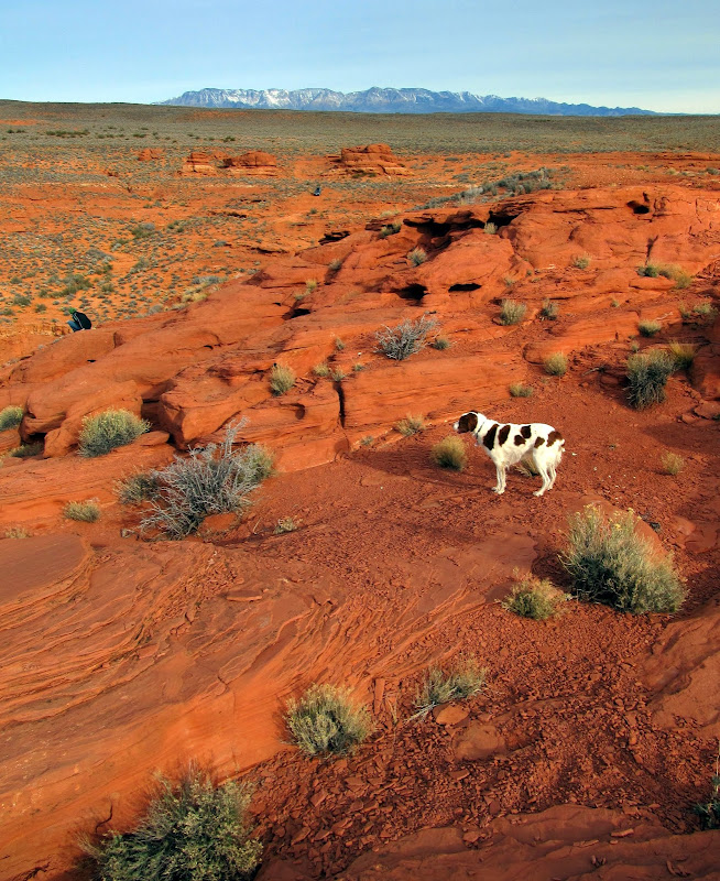
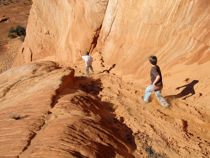
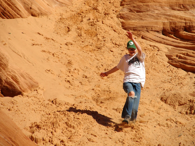
Holey domes on Sand Mountain
We had no fixed plans for the weekend, but I had a list of things for Michael and Bradley to choose from. I offered them the choice of exploring more of Sand Mountain, or visiting the dinosaur tracks just south of our current location. They chose the dino tracks, which were just half a mile south of us, but since there was no road leading south off of Sand Mountain, it took a 15-mile detour to get there. Before leaving I wanted to scour the ground looking for arrowheads (after seeing many flint chips on the ground the previous evening), and surprisingly managed to find many pottery shards directly under where our tent was set up, and a single broken arrowhead point almost under one of the Jeep's tires. Before leaving, we hiked to a geocache that was less than a quarter-mile away that offered a nice view over Warner Valley to the southwest.
Broken pottery that was under the spot where we set up our tent
Torrey
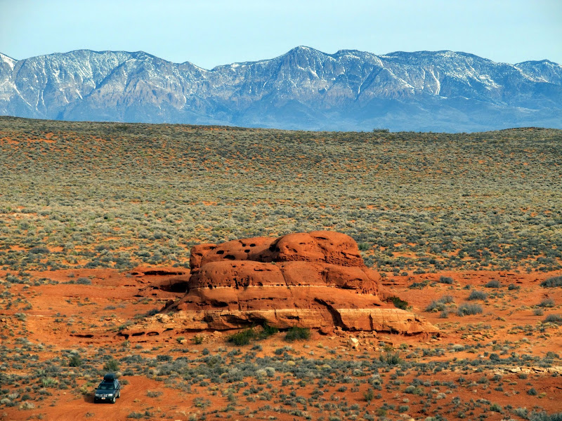
The Jeep near our camp spot and the Pine Valley Mountains in the distance
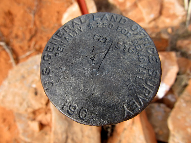
We found a few more geocaches on the way to the dinosaur tracks. At those locations we saw a 1909 survey marker and an old Dominguez-Escalante trail marker. We arrived at the dinosaur track trailhead to find several vehicles there, and we saw quite a few people on the trail. There were more people there than we'd previously seen since leaving Hurricane. The dinosaur tracks were well worth the visit. Most of the tracks were easy to make out, and an interpretive sign helped us make out the less distinct tracks. The tracks were concentrated in a pretty small area, so we were done there quickly. We got back to the Jeep around lunchtime, and since we were less than two miles from the Arizona border and Michael had never been to Arizona, we headed south. Just south of the state line we stopped for lunch, where the boys ate Lunchables and I had a tuna sandwich accompanied with carrot and celery sticks.
1909 section marker
Parked in a wash while finding a geocache
Hurricane Cliffs viewed from the dinosaur tracks
Dinosaur track
Just across the border into Arizona to eat lunch
1909 section corner on the UT-AZ border
For our after-lunch activity I got to choose where to go. The Little Black Mountain petroglyph site wasn't too far a drive and that's what I really wanted to see. On the way there the road passed through some sand dunes where I did a few donuts in the Jeep then stopped to let Michael and Bradley dig in the sand for a bit before moving along. We had Little Black Mountain all to ourselves--a small group was just leaving as we arrived and the Jeep was the only vehicle in the parking lot. While we were on the trail looking for petroglyphs on boulders, I got a phone call from Ken, a friend who lives in Hurricane. He was in nearby in Warner Valley and wanted to know where we were so we could meet up. He arrived with his two youngest girls and we met up on the trail and chatted for a bit while we hiked. We talked some more back at the trailhead, then I followed him part of the way back toward town before turning off on my way to our next camp site.
Playing on some sand dunes in Warner Valley
The boys digging in the sand
Little Black Mountain petroglyphs
Little Black Mountain boulder
Little Black Mountain petroglyphs
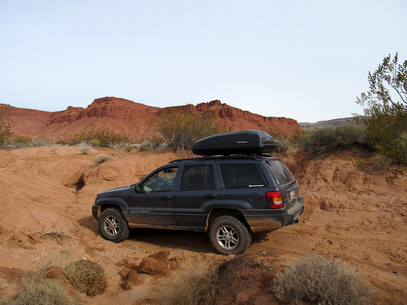
I hadn't made specific plans for camping on Saturday evening, but I had a rough idea of where I could find a spot. I drove up the west rim of Sand Mountain, where I'd been last year in Eric's Jeep, and started exploring. We first drove up a deep, sandy canyon that looked promising, but there wasn't a spot of ground that didn't appear to be well-traveled. Despite being just after sunset, there were also quite a few OHVs in the area, so it was unlikely we'd have any seclusion there for the night. Just south of the canyon I found a secluded spot between some slickrock domes that looked perfect, so we set up camp there. Again we had a small fire and cooked dinner on it, this time consisting simply of ramen noodles and Lit'l Smokies. We'd found a little extra firewood during the day, and we were able to keep the fire going until almost 10PM before it was time for bed.
Pulling in to Saturday night's camp
'Round the fire on Saturday evening
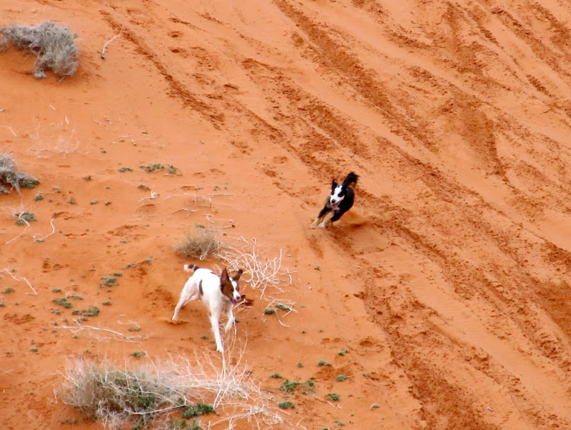
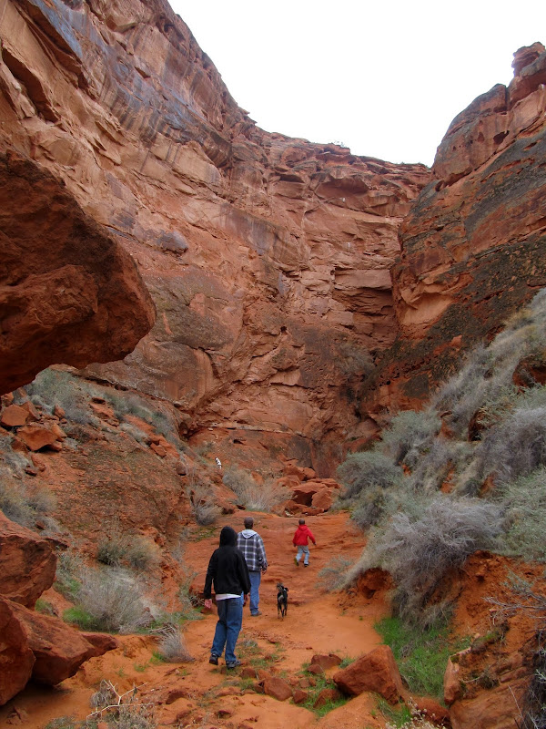
After rising for the day on Sunday, I got a text from Eric. He was back in town and on his way out to see us. The kids and I ate a quick breakfast of oatmeal and started taking down camp. Eric arrived when I was collapsing the tent, and we drove back into the canyon I'd driven in the evening before to explore the two box canyons at its head. Eric brought his dog, Bosley, and he and Torrey got along nicely--I think they wore each other out. We hiked and Jeeped around in the canyon for an hour or two before Eric had to leave. I had brought bread and peanut butter for lunch, but I forgot the jam or honey for sandwiches, so Michael and Bradley and I went into town and ate fast food for lunch.
Camp on Sunday morning
Torrey and Bosley on the dunes
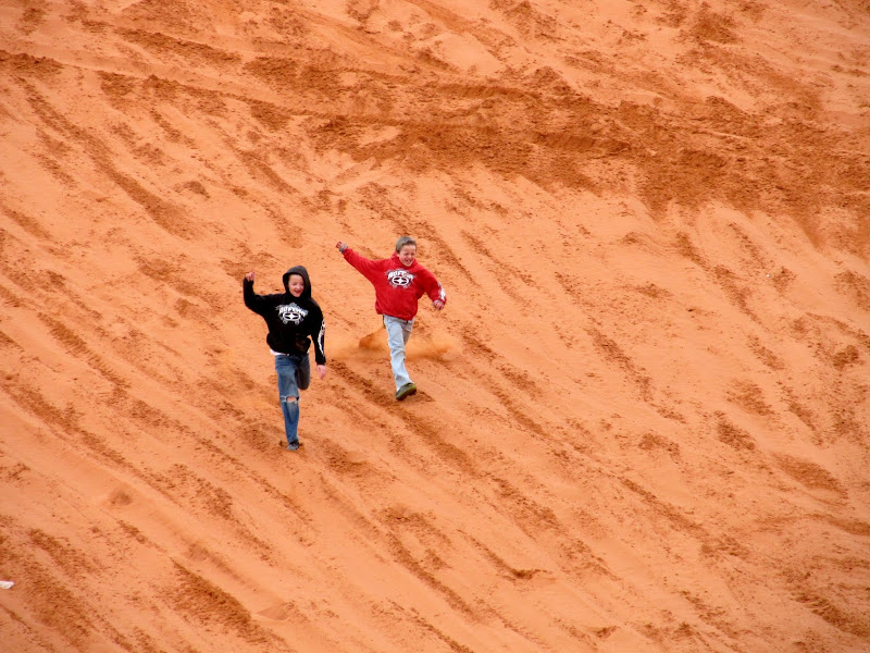
Michael and Bradley on the dunes
Bosley and Torrey
Michael, Eric, and Bradley heading up the canyon
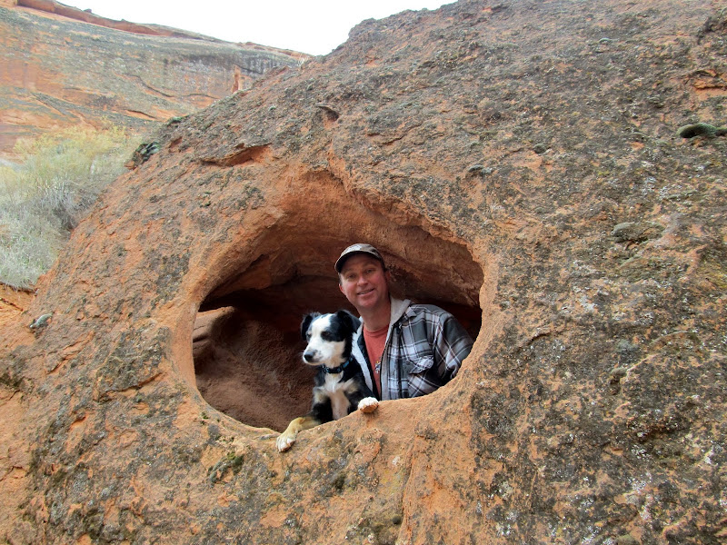
Bosley and Eric
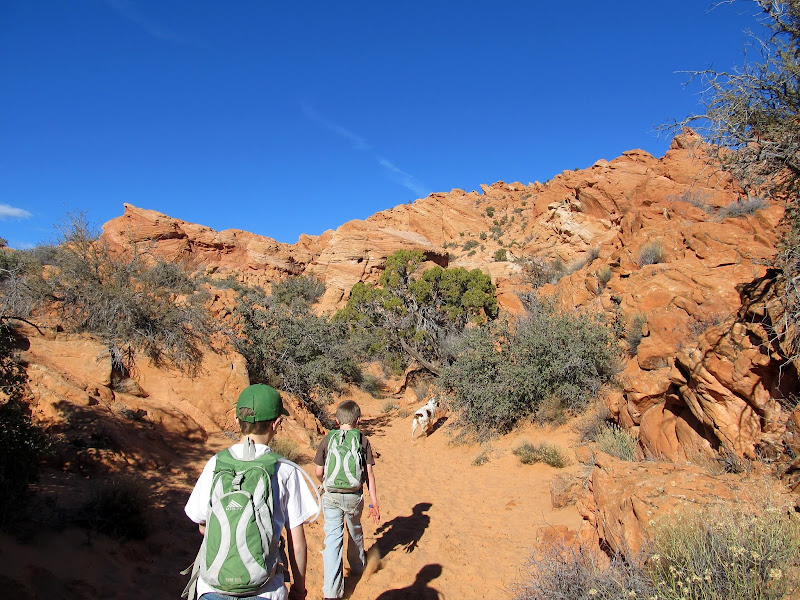
I had no additional plans or ideas for the rest of the day, and I think the kids were missing home. While we ate lunch I looked at the maps in my GPS and found what I'd hoped would be a good place to explore and keep the kids engaged for a little longer. It was outside of the area I'd scouted in Google Earth from home while planning this trip, but I remembered looking at it a year or two ago before one of mine and Traci's trips down south. It was just north of Sky Mountain, on the north side of the Virgin River. Geocaches can usually be a great guide to an area, but unfortunately the 950 geocaches I'd downloaded to my GPS only reached about an 11-mile diameter from the south end of Sand Mountain, which came up short by two miles from the area to which we were headed. My memory of the area didn't fail me, however, and we found some fun stuff to do despite knowing very little about the place. During the drive there I saw a sign for Sand Cove, which just sounded like a fun place--and, importantly, the boys agreed. We parked at the trailhead, donned our backpacks, and followed the trail to Sand Cove and Sandstone Mountain. At Sand Cove we found a few springs that flowed down Sandstone Mountain but disappeared into the sand dunes at the base of the mountain. The boys enjoyed climbing the steep dunes and then running down them. I enjoyed the textures in the sandstone and the warm, sunny day that emerged out of what had begun as an overcast and dreary morning. We followed some trail signs that pointed toward an arch, and the trail kept descending toward the Virgin River. The signs didn't indicate how far the arch was, and after following them for a while the kids began to tire. I knew we'd have to ascend the trail to get back to the Jeep, and I decided that following the signs without knowing how far the arch was could be problematic for keeping the kids motivated. We turned around, and only after returning home did I find out the arch was a mere 0.18 miles from our turnaround spot.
Quail Creek Reservoir
Sandstone Mountain
On the trail to Sand Cove
Playing at Sand Cove
Hiking southwest of Sandstone Mountain
Back at the Jeep we ate a snack then continued south on the road toward the river. I figured a quick visit to the river would be the perfect ending to our trip after we all returned from Sand Cove sweating. While driving toward the river, I was waved to a stop by a Washington County sheriff deputy who was parked on the side of the road. He was a very friendly guy and only wanted to let me know about some rock art and dinosaur footprints that were along the road in the direction we were heading. I thanked him for the info and we continued toward the river. There, Michael and Bradley took off their shoes, rolled up their pants, and waded in the river for a very short while--apparently the water was quite cold. We skipped some rocks then got back into the Jeep and returned north on the road. I couldn't find the spot where the deputy told me the dino footprints would be, but I easily found the petroglyphs. That was our last exploration of the weekend. I got on I-15 near Leeds and started the long drive home. We stopped in Cedar City for fuel, and dug around in the back of the Jeep for some snacks that we ate for dinner. The kids just barely tolerated me stopping near Castle Dale for a couple of photos of the Hunter Power Plant at night. It's a shot I've long wanted to take, but never before taken the opportunity. The trip wasn't terribly more expensive than a more local trip would have been, and the kids are now old enough to handle the longer drive, so I can envision this type of thing happening much more in the future.
Hurricane Cliffs north of Toquerville
Gooseberry Mesa
Virgin River
East Reef/Grapevine Wash petroglyphs
East Reef/Grapevine Wash
Hunter Power Plant
Full photo gallery:
[picasa]https://picasaweb.google.com/Dennis.Udink/SouthernUtahFebruary2013[/picasa]
https://picasaweb.google.com/Dennis.Udink/SouthernUtahFebruary2013
GPS tracklog and photo waypoints:
[parsehtml]<iframe width="640" height="480" frameborder="0" scrolling="no" marginheight="0" marginwidth="0" src="https://maps.google.com/maps?q=http:%2F%2Fudink.org%2Fgeo%2FSouthernUtahFebruary2013.kmz&hl=en&sll=39.499761,-111.547028&sspn=4.907901,10.821533&t=h&ie=UTF8&ll=37.123096,-113.37204&spn=0.52559,0.878906&z=10&output=embed"></iframe><br /><small><a href="https://maps.google.com/maps?q=http:%2F%2Fudink.org%2Fgeo%2FSouthernUtahFebruary2013.kmz&hl=en&sll=39.499761,-111.547028&sspn=4.907901,10.821533&t=h&ie=UTF8&ll=37.123096,-113.37204&spn=0.52559,0.878906&z=10&source=embed" style="color:#0000FF;text-align:left">View Larger Map</a></small>[/parsehtml]http://udink.org/geo/SouthernUtahFebruary2013.kmz
Featured image for home page: