Hubert Poul
Member
- Joined
- Apr 20, 2015
- Messages
- 10
Hi everyone!
I was just able to put together photos from my recent bike trip around southern Utah from this September so it’ll be my pleasure to share it with you – especially since this fantastic site was invaluable source for me during the preparation and research.
This is PART ONE (of the two parts): I decided to split the report into two separate parts so it’s more reader friendly. Hopefully it won’t be too exhaustive!
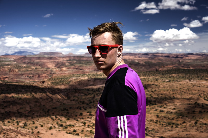
So just a little bit of background for the trip: it was a project of me and my cousin. Only two of us did the whole thing and the idea was to travel as much of a southern Utah as possible on a bikes without any outside support (car or whatever). We mostly tried to minimize the technology and enjoy travelling in the very old school spirit: with topographic map printed-out and compass, but without GPS devices (we had only SPOT tracker to check-in through satellite back home with confirmation that we’re ok) and (unfortunately) also one smartphone.
Overall it was a wonderful trip for 37 days, about a 1000 miles long, full of nice encounters with other travelers, countless really breathtaking places and of course the state of mind when on one hand you experience almost transcendental astonishment by the landscape and on the other you’re tickling the very edge of the physical capabilities. It was quite interesting this mix of very different feelings and exhaustion which always blended together.
Here’s the map of the trip (this is the intended route – there were only minor diversions from it):
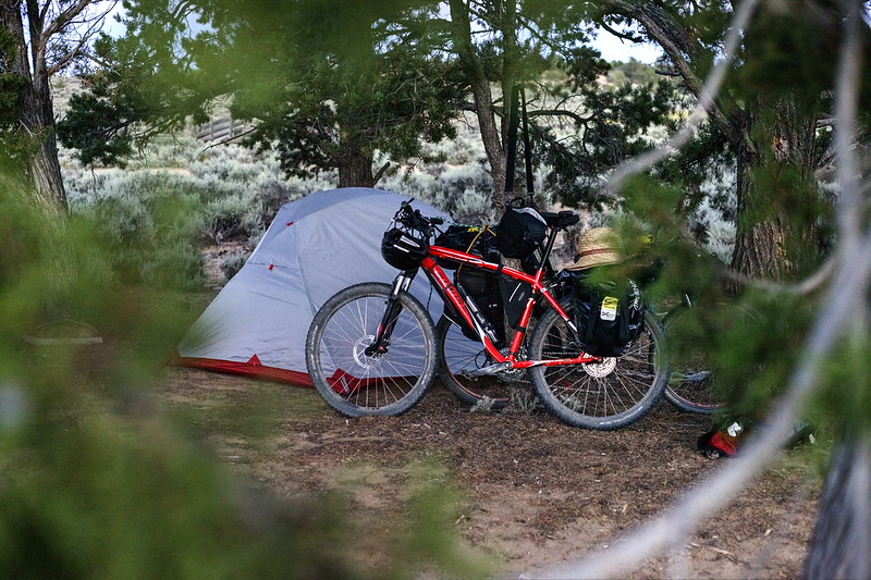
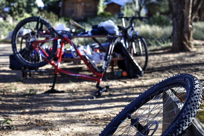
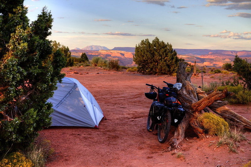
The biggest challenge at the end wasn’t the hot temperatures as we thought, but rather the remoteness of our route and therefore the inability to re-fill our water supplies. We had to carry food for two weeks (we did the shopping only in Cedar City, then Escalante, Green River and Moab) which ended up us eating day after day only tortillas with peanut butter (it has quite good weight to energy input ratio). With water it was even much more difficult as we had to carry on water for as much as five days – fortunately in most cases we crossed water sources every second or third day – but still this took almost all our weight and space and caused the unfortunate massive overload of the bike carriers. After two days we realized that besides tent, sleeping-bags and several other crucial things we have to throw away anything else, otherwise we won’t make it. Thus everything unnecessary went to garbage and thanks God for that!
Our bikes then looked like this:
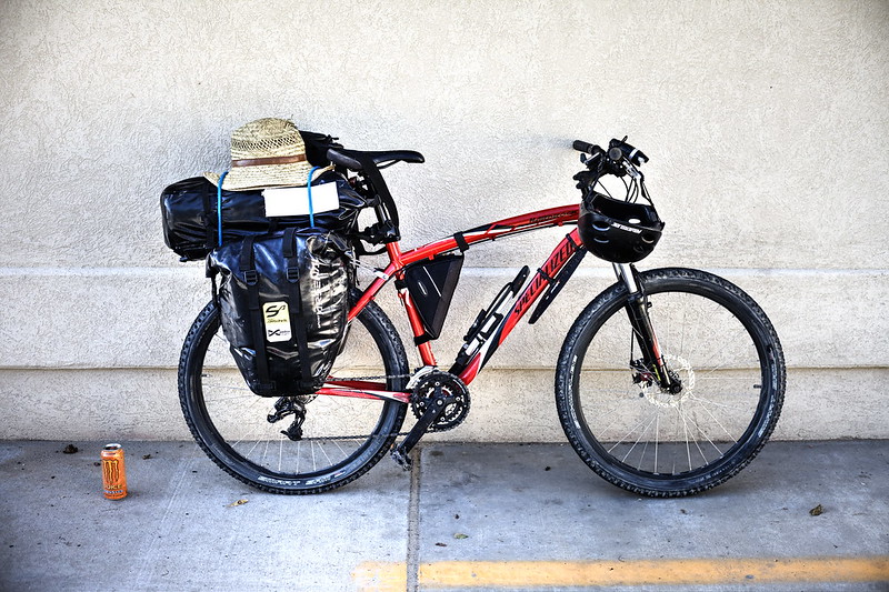 Hardrock, the best bike ever. by hubert poul, on Flickr
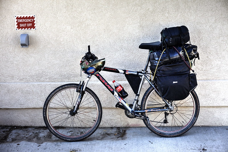 The other one... by hubert poul, on Flickr
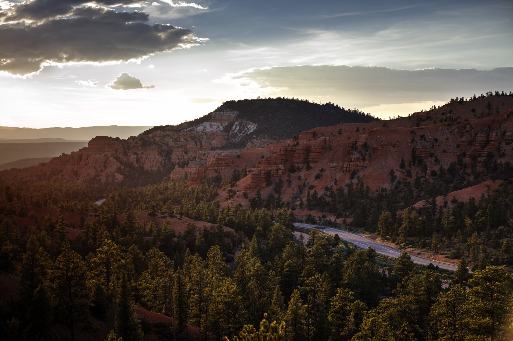
We started from Cedar City and did the quite exhaustive climb to Cedar Breaks and then back down to Red Canyon. Wonderful place! So sad that there is quite a heavy flow of tourists, though…
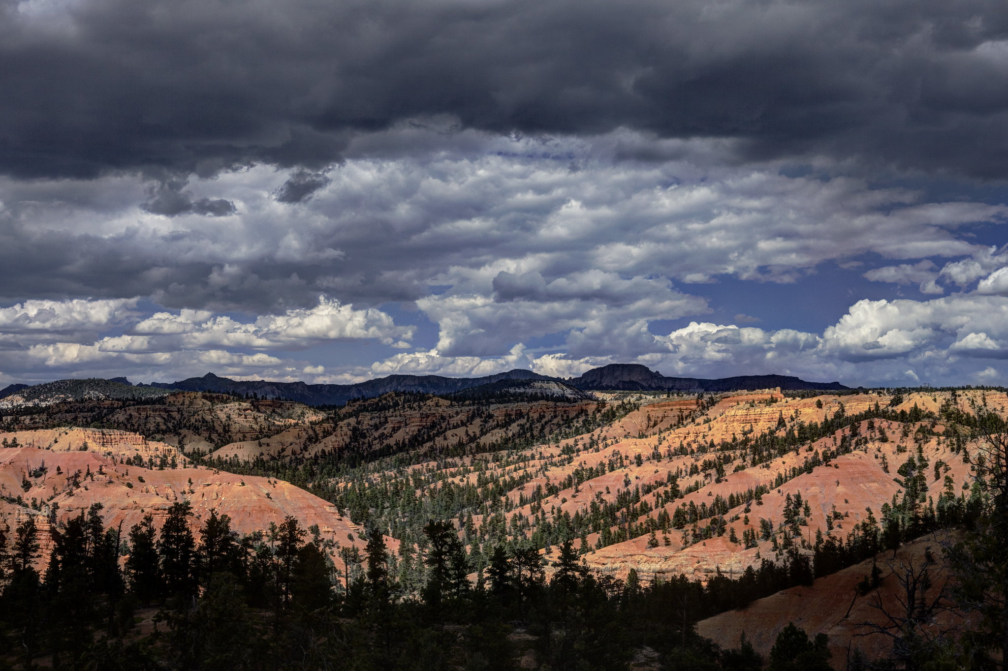 Red Canyon by hubert poul, on Flickr
 Red Canyon by hubert poul, on Flickr
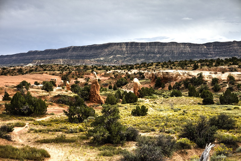
Fortunately, we soon left the Highway 12 behind us and continued on the Kodachrome road with noticeably less traffic")
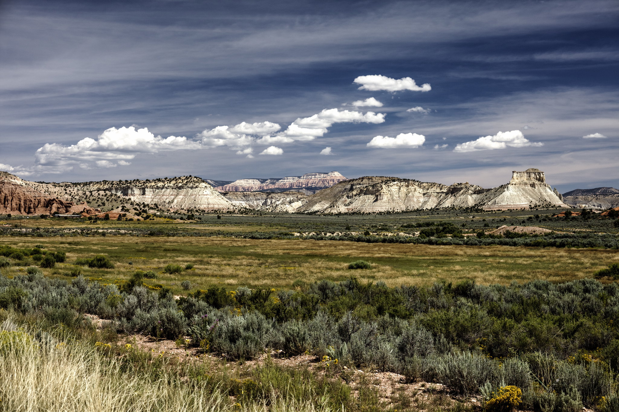 Canyonville, on our way to Kodachrome by hubert poul, on Flickr
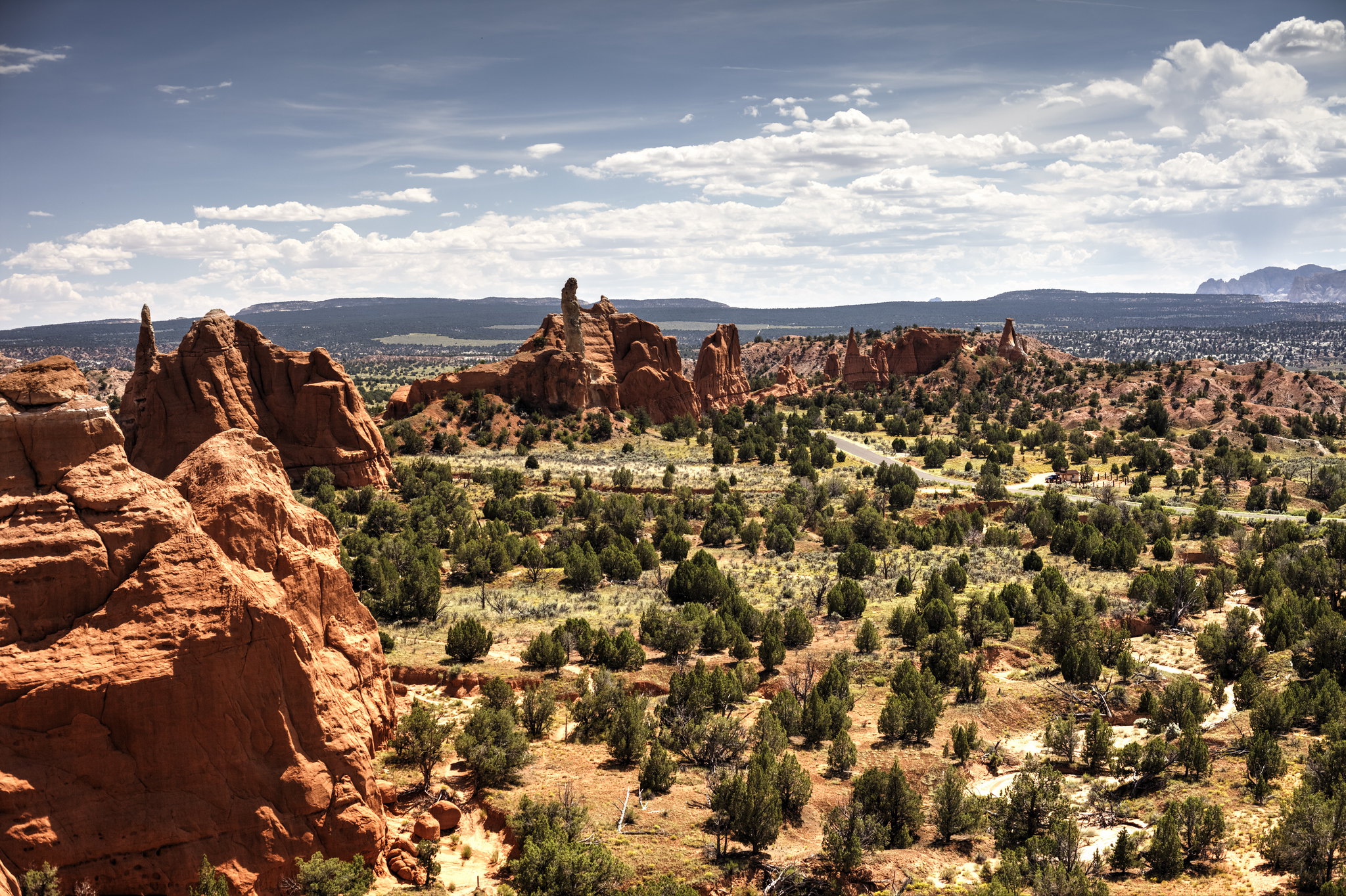 Kodachrome State Park by hubert poul, on Flickr
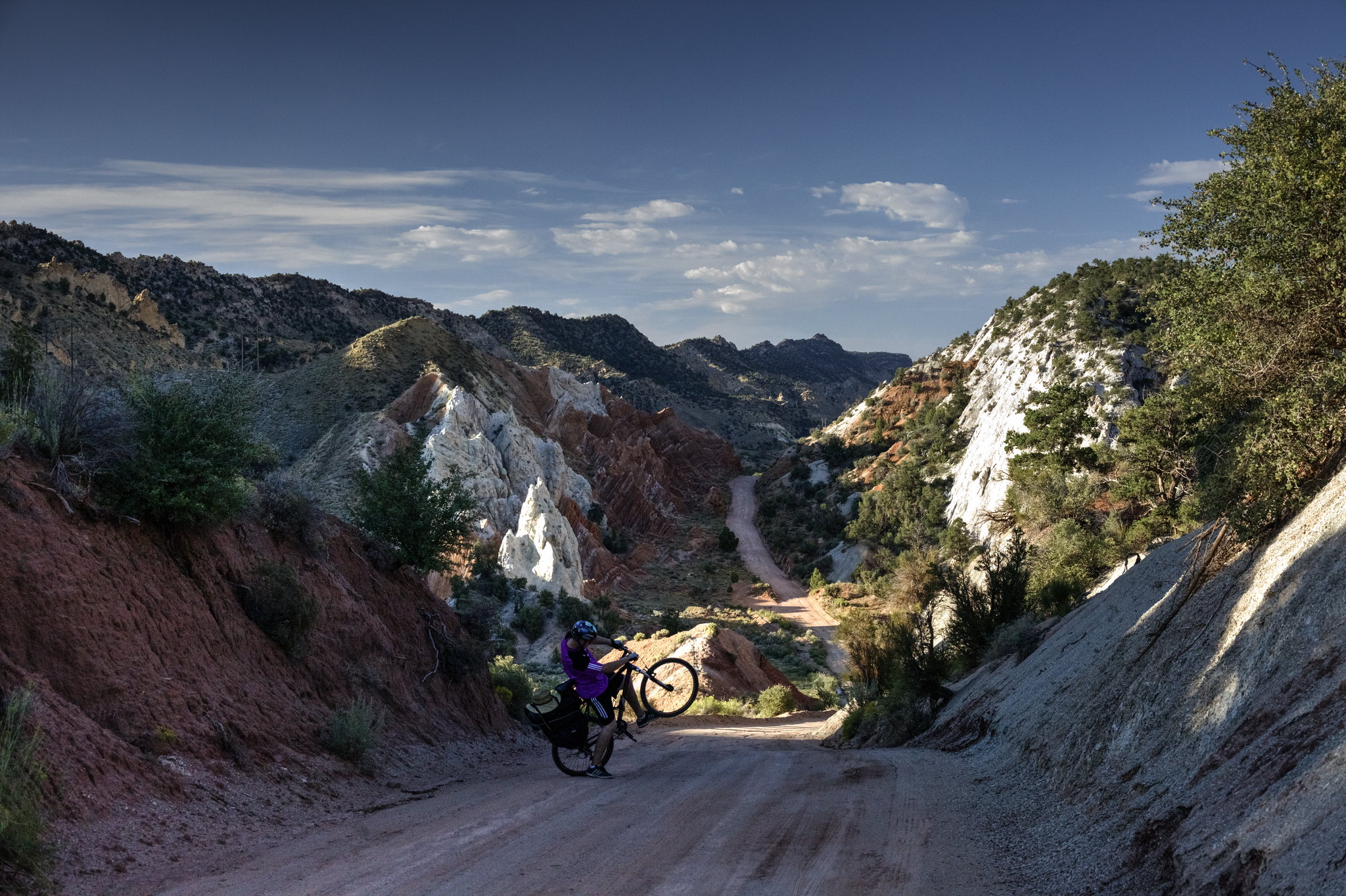
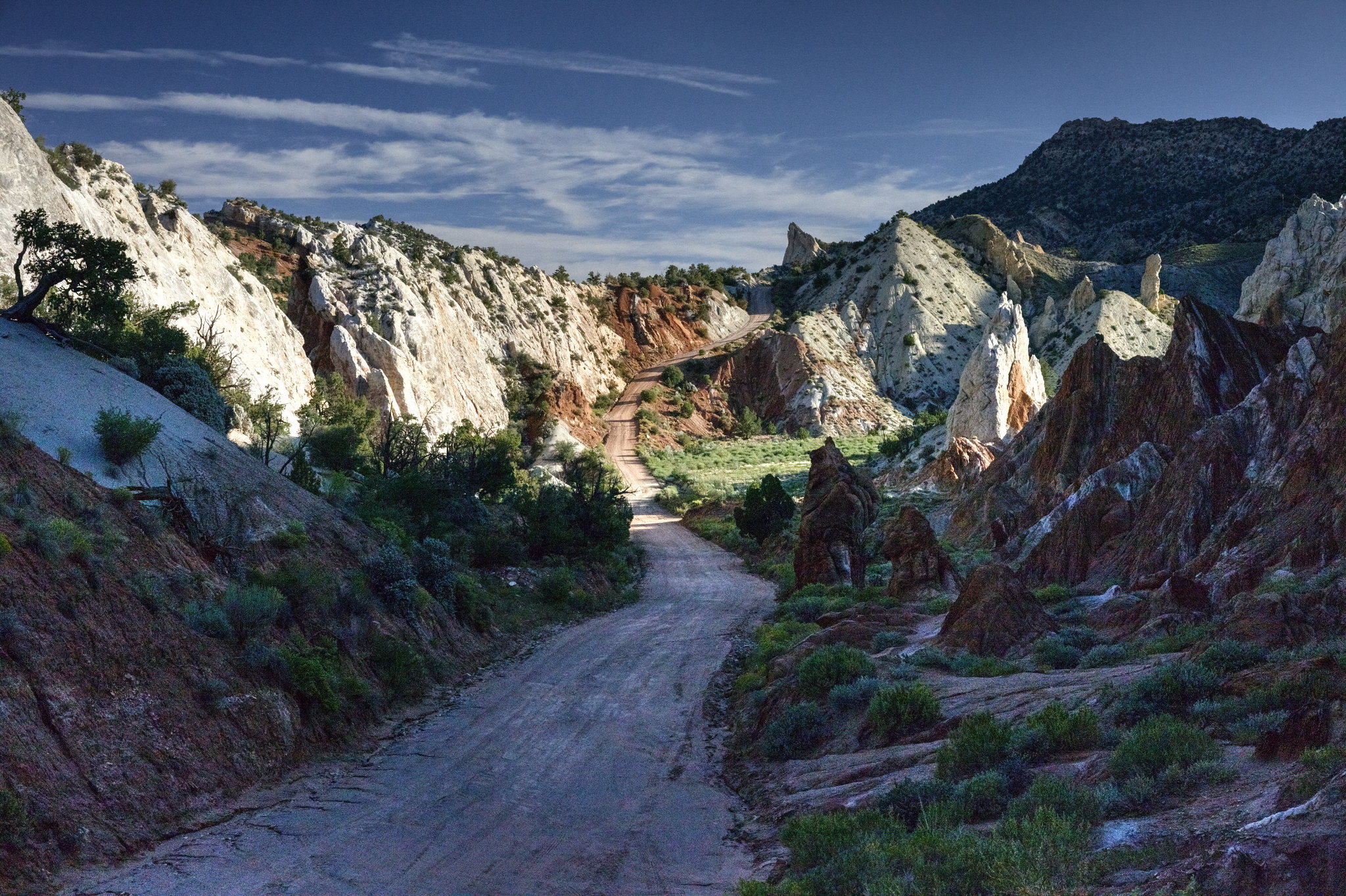
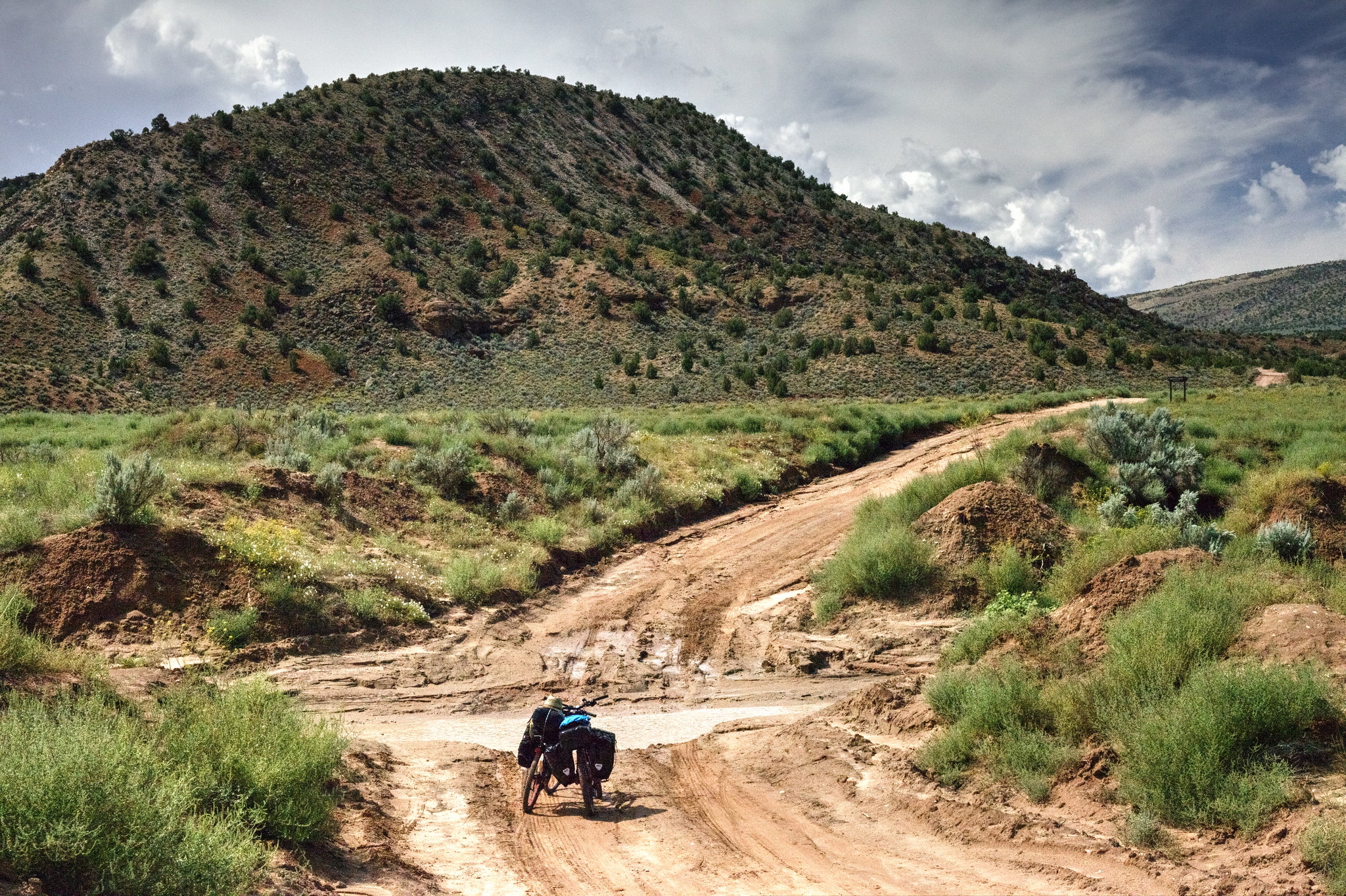
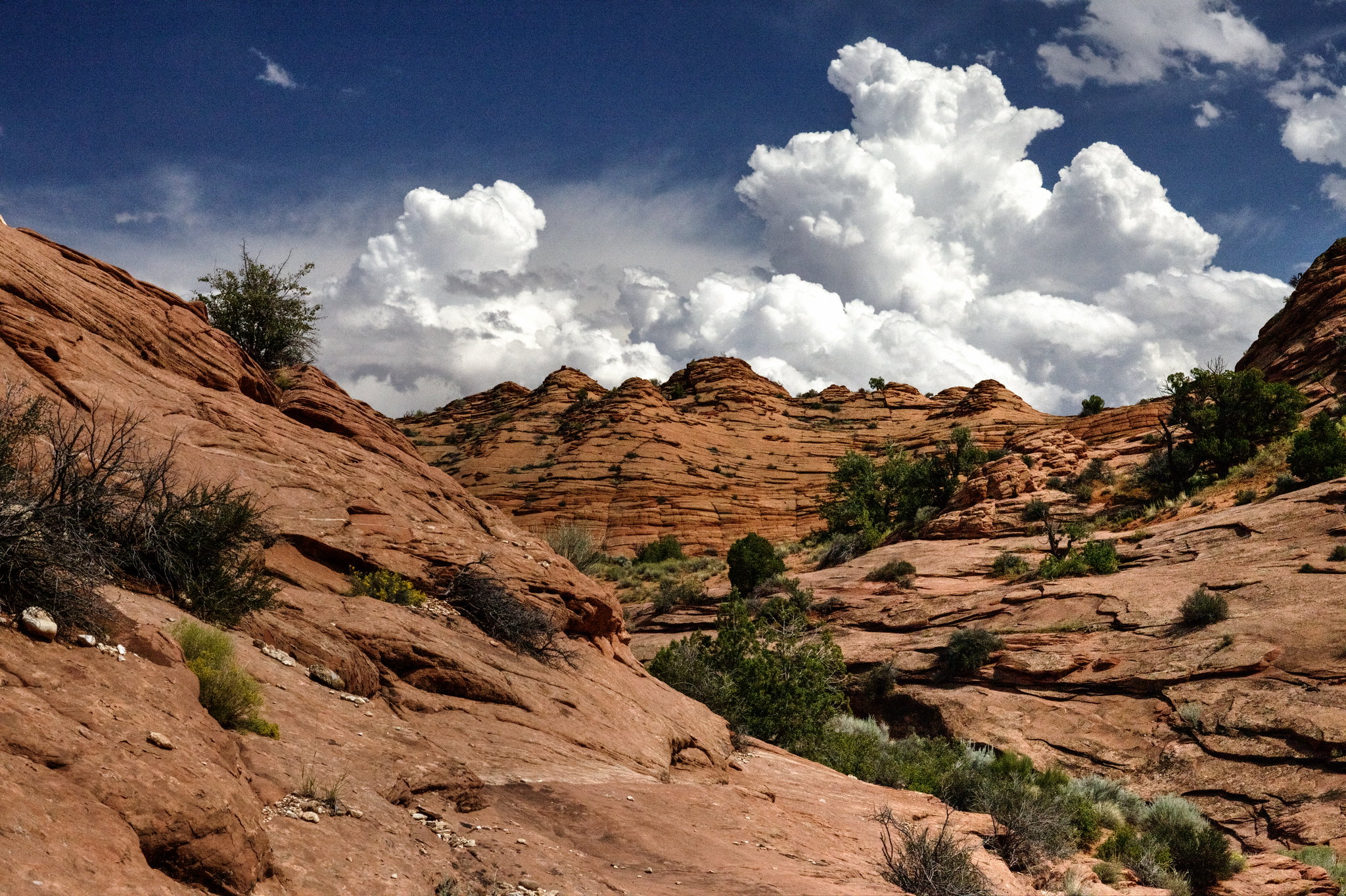
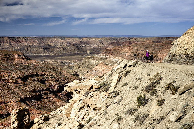
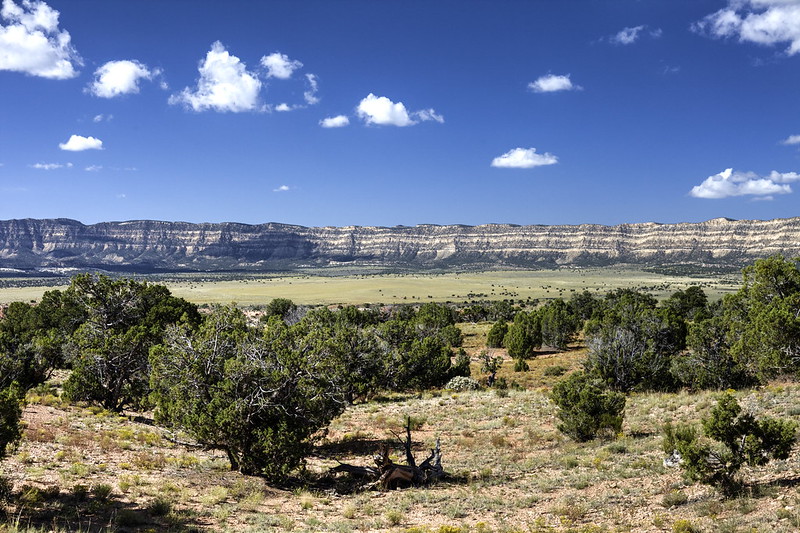
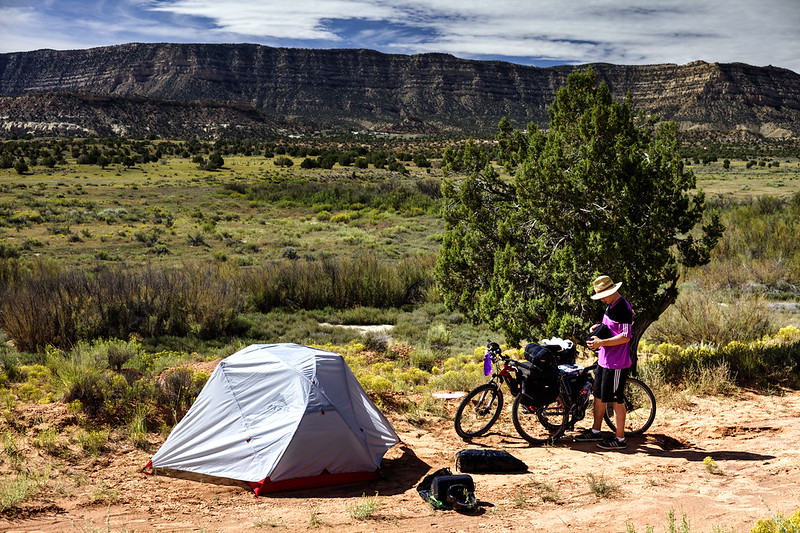
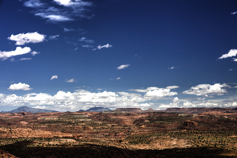
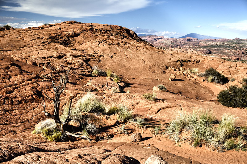
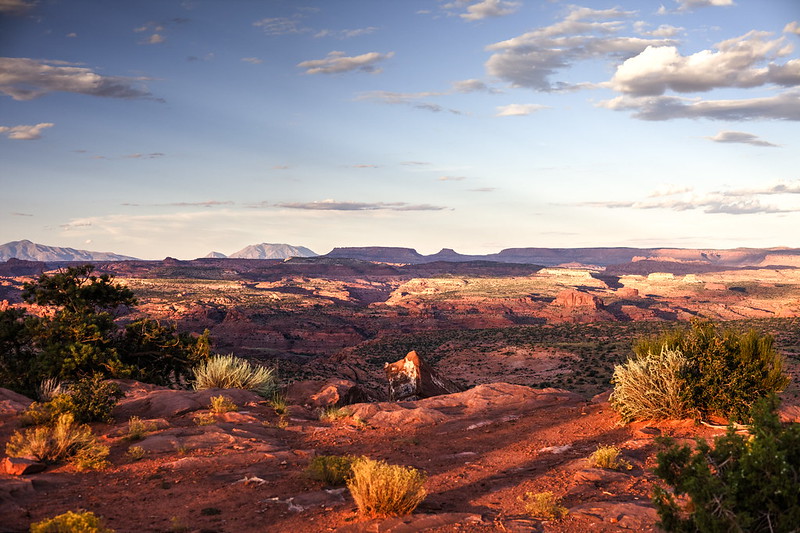
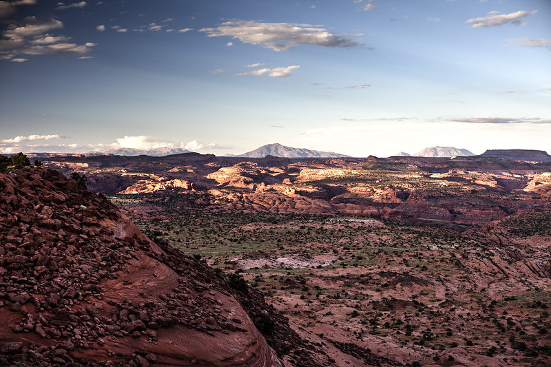
But it was nothing in comparison to Cottonwood Rd – we could count the passing cars on one hand! And very interesting landscape alongside! We did a handful of breaks to take pictures, but also to catch a breath. As we left asphalt behind us, we begun to realize how hard it’ll be to ride the sandy roads – we had to walk beside the bike through many portions of the route, but even if we were sitting on the saddle, it was at least twice as hard to keep it moving.
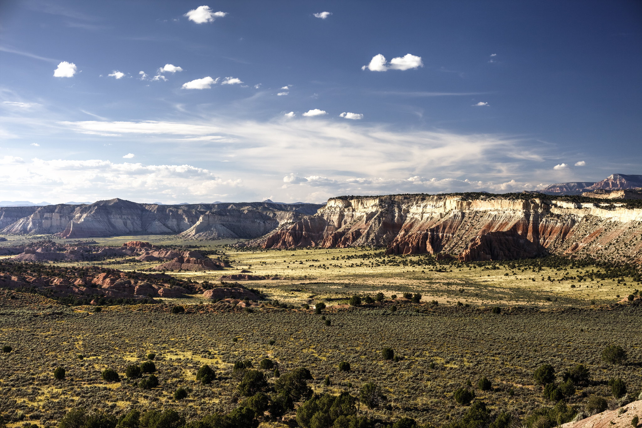 Cottonwood Canyon Road by hubert poul, on Flickr
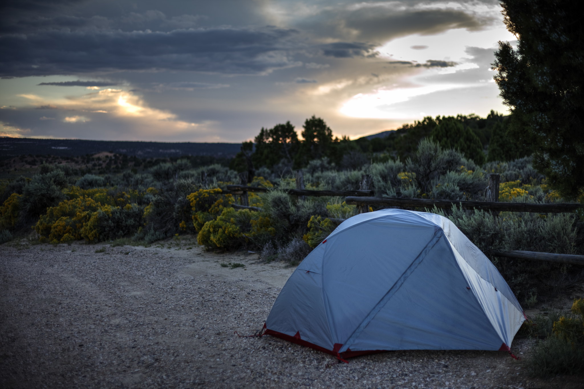 Camping near Grosvenor Arch by hubert poul, on Flickr
 Cottonwood Canyon Road by hubert poul, on Flickr
 Cottonwood Canyon Road by hubert poul, on Flickr
 Cottonwood Canyon Road by hubert poul, on Flickr
 Cottonwood Canyon Road by hubert poul, on Flickr
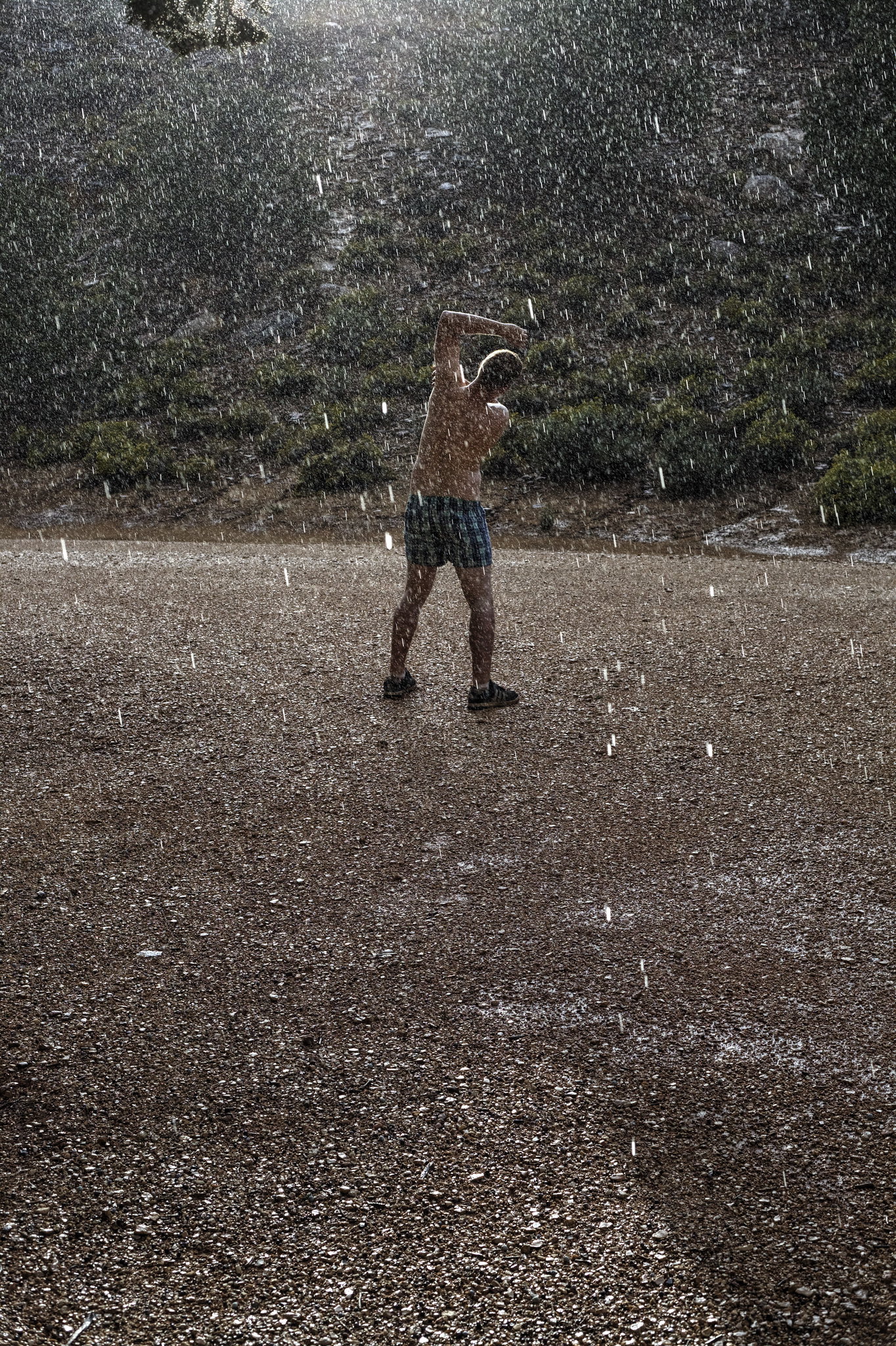
We were hit by the big storm almost at the end of the Cottonwood Rd. The funniest thing was that in the middle of the heavy rain and lightings we experienced the first flat tire of the trip. The fully loaded bike was simply too heavy so it was just a matter of time when it happens – of course it had to be in the most inconvenient moment.
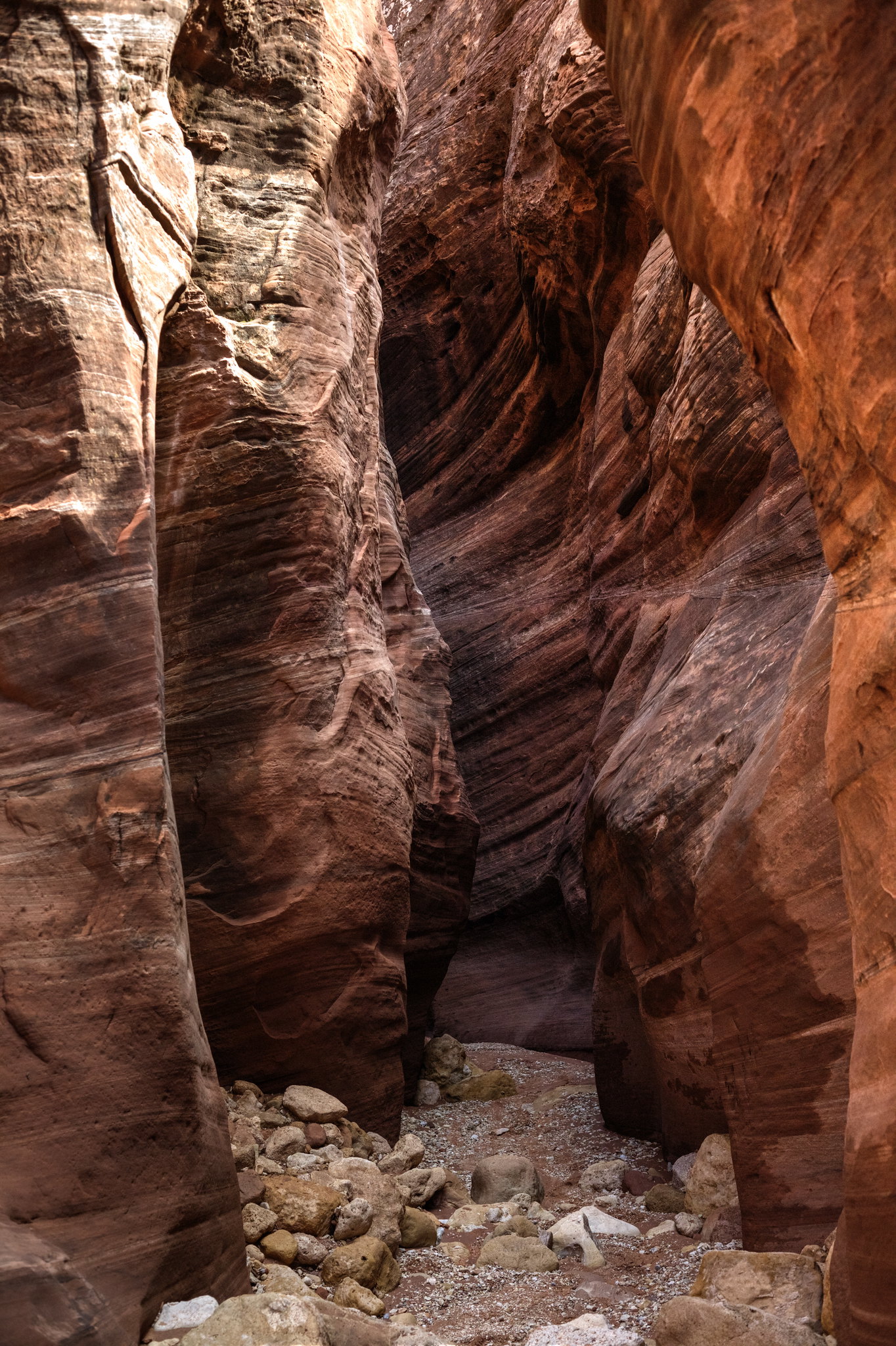
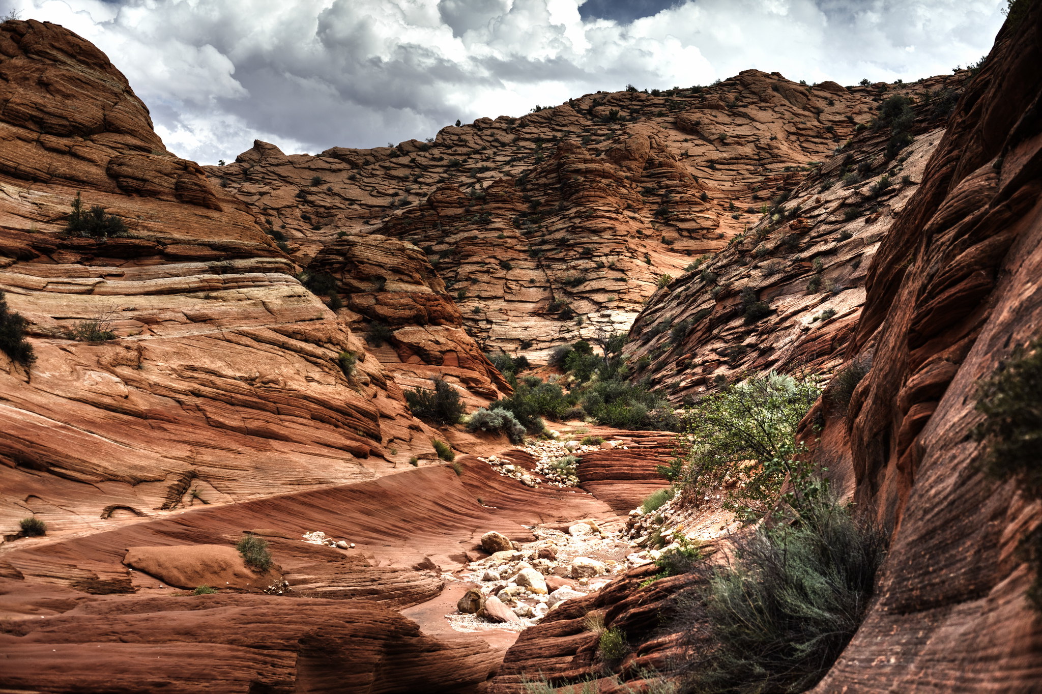
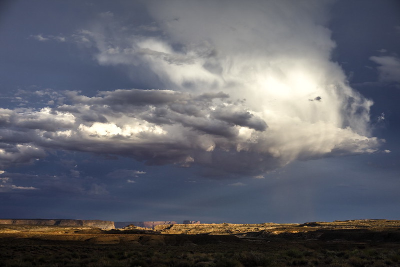
The next day we refilled the water supplies at the Paria Station and continued to the probably greatest area of the trip: Vermilion Cliffs. The first photo captures the ending flash-flood from the previous day. At first, we tried to find a good spot to trespass without stepping in the water, but at the end it was clear that we have to get wet.
 Vermillion Cliffs National Monument by hubert poul, on Flickr
 Vermillion Cliffs National Monument by hubert poul, on Flickr
 Vermillion Cliffs National Monument by hubert poul, on Flickr
 Wire Pass, Vermillion Cliffs National Monument by hubert poul, on Flickr
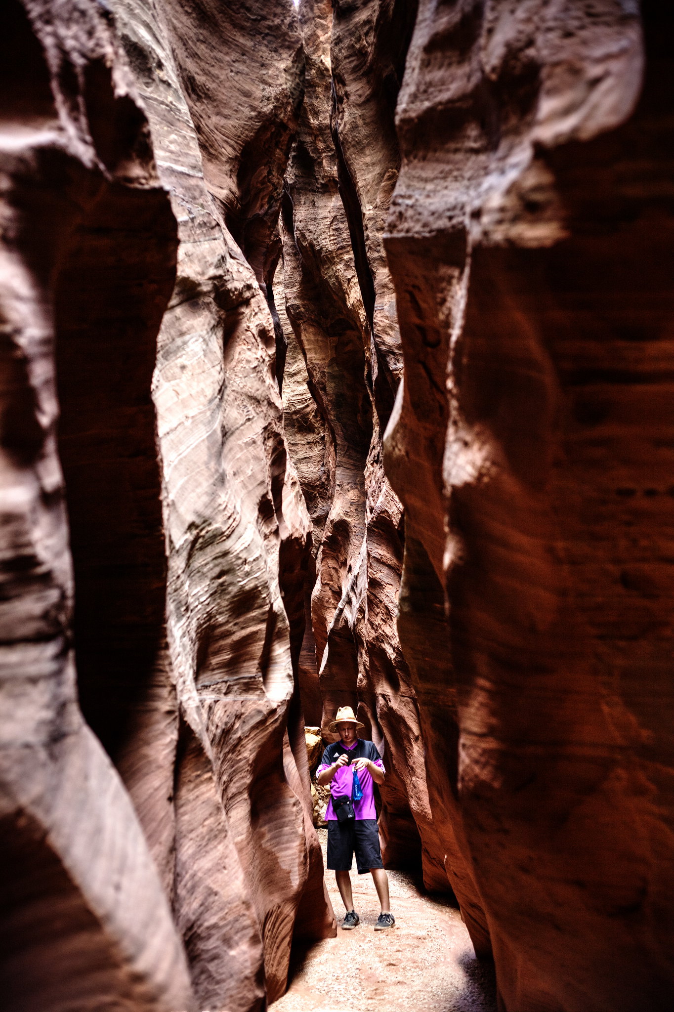 Buckskin Gulch, Vermillion Cliffs National Monument by hubert poul, on Flickr
 Vermillion Cliffs National Monument by hubert poul, on Flickr
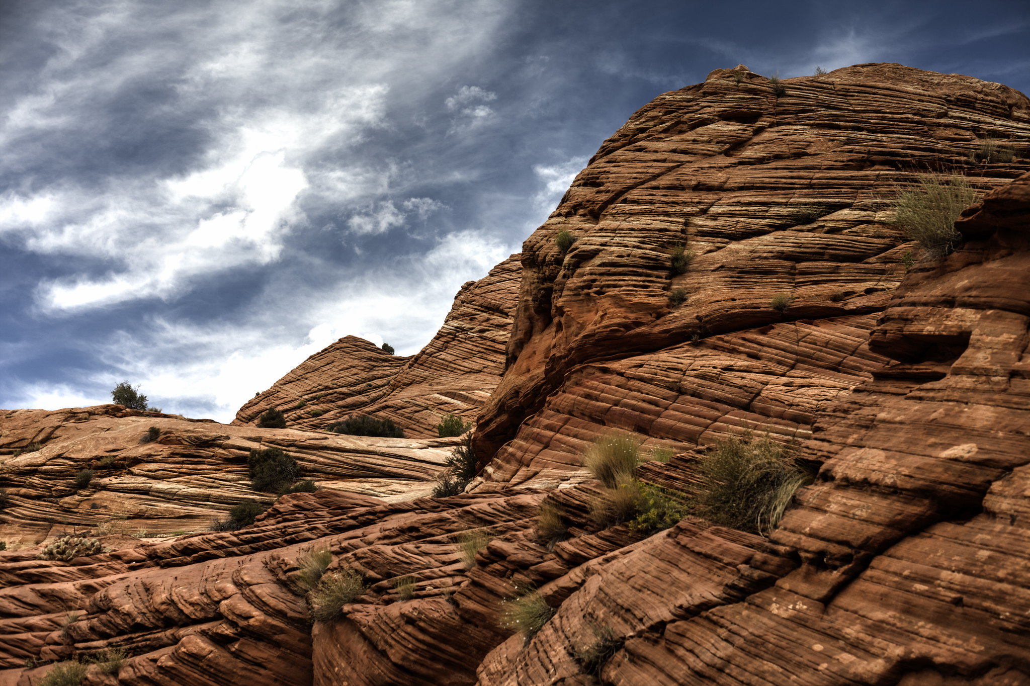 Vermillion Cliffs National Monument by hubert poul, on Flickr
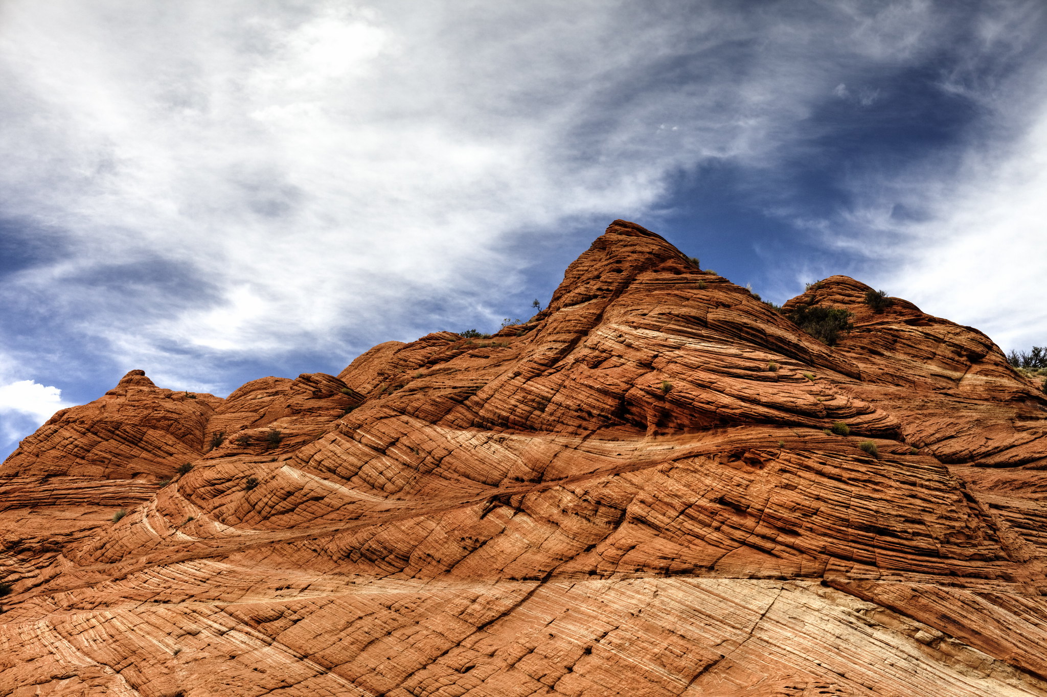 Vermillion Cliffs National Monument by hubert poul, on Flickr
 Stateline Campground, Vermillion Cliffs National Monument by hubert poul, on Flickr
 Searching for mobile network, Vermillion Cliffs National Monument by hubert poul, on Flickr
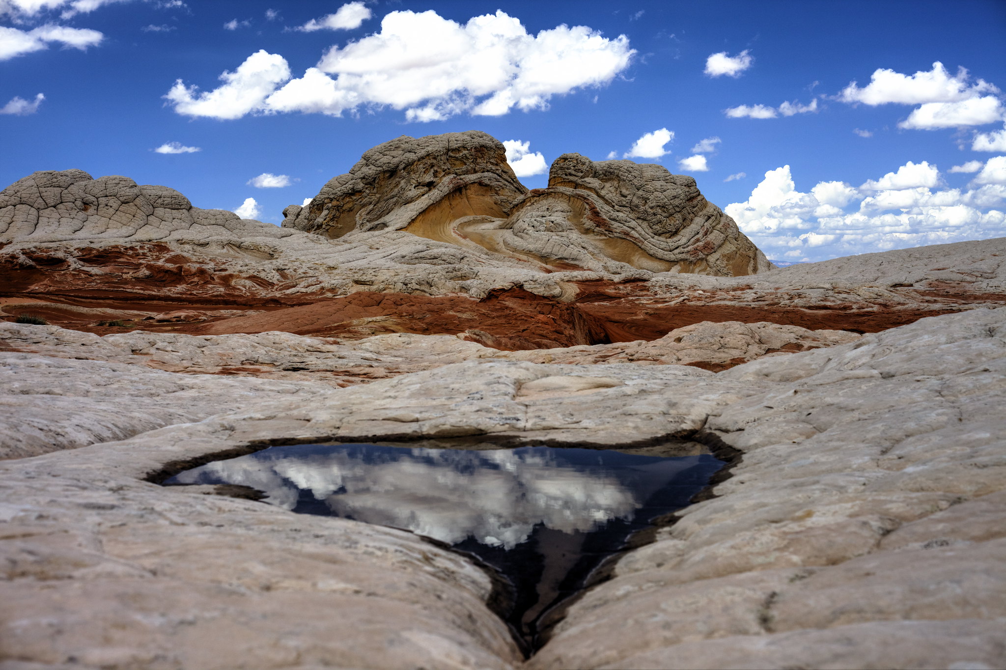
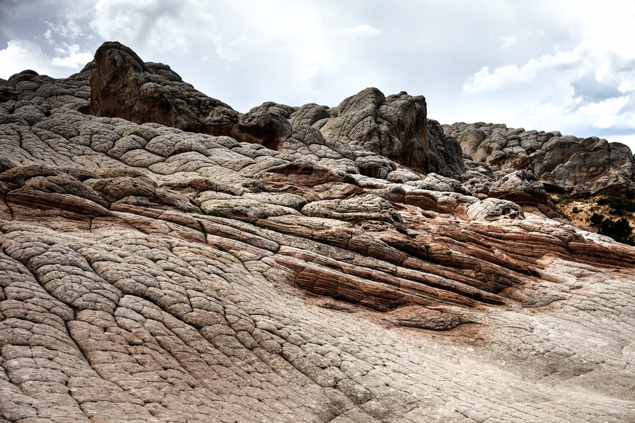
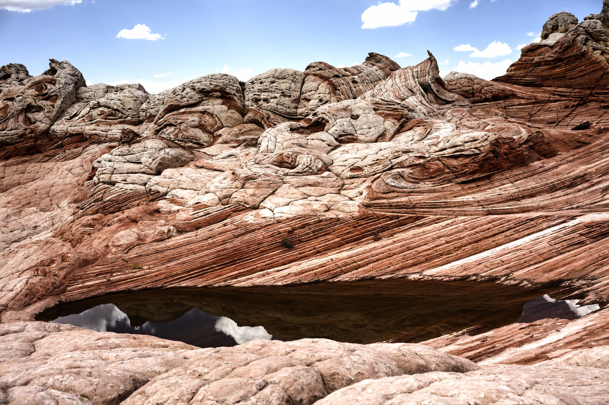
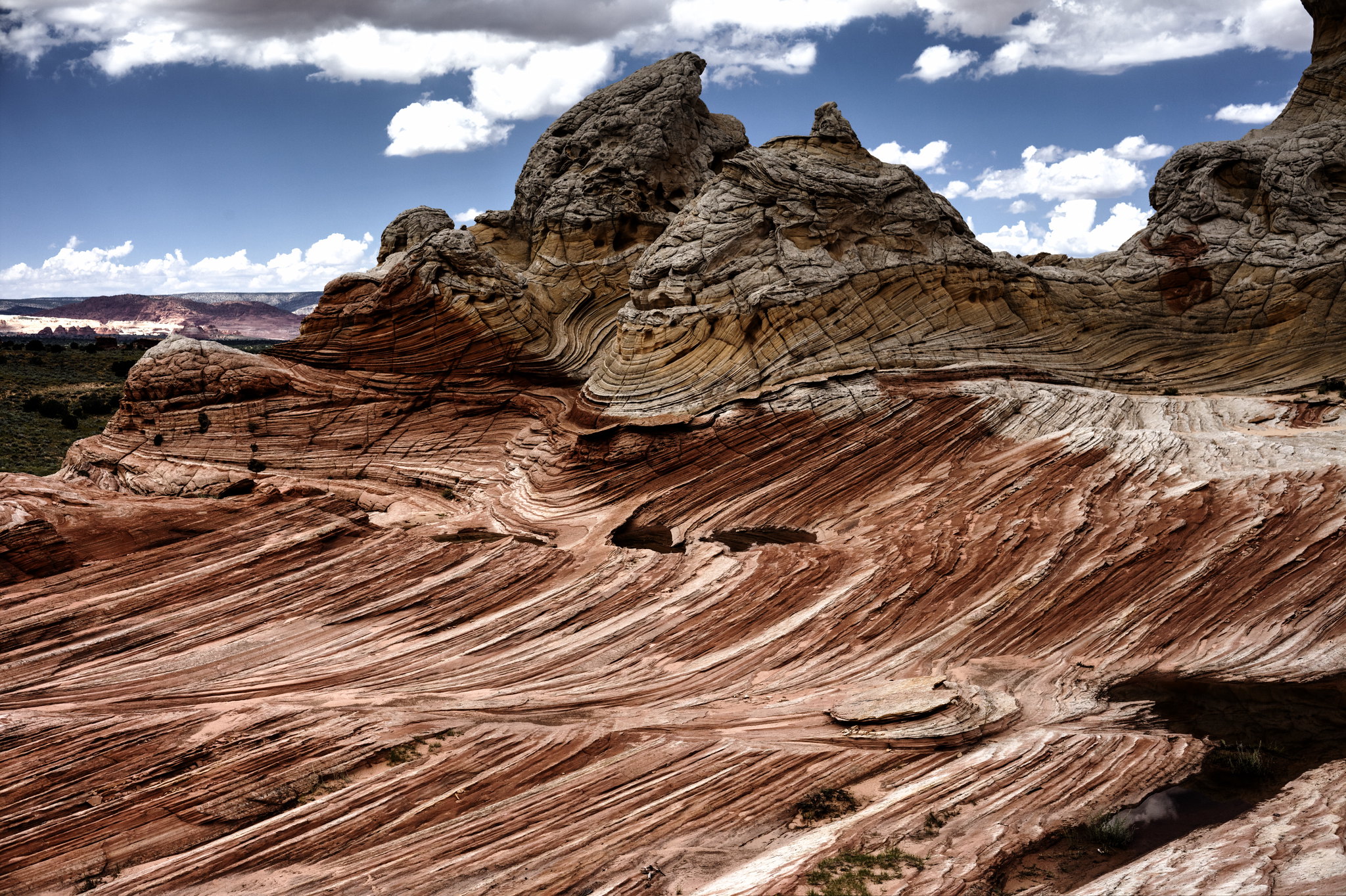
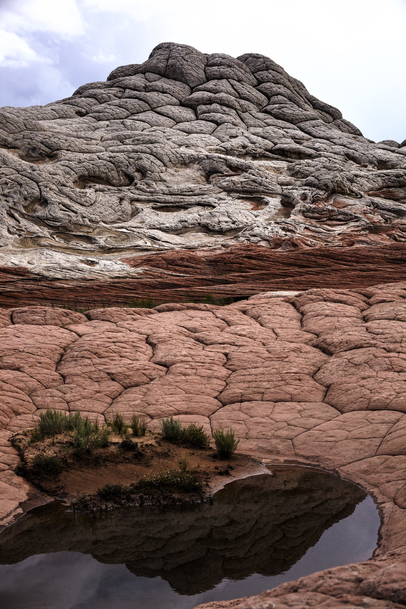
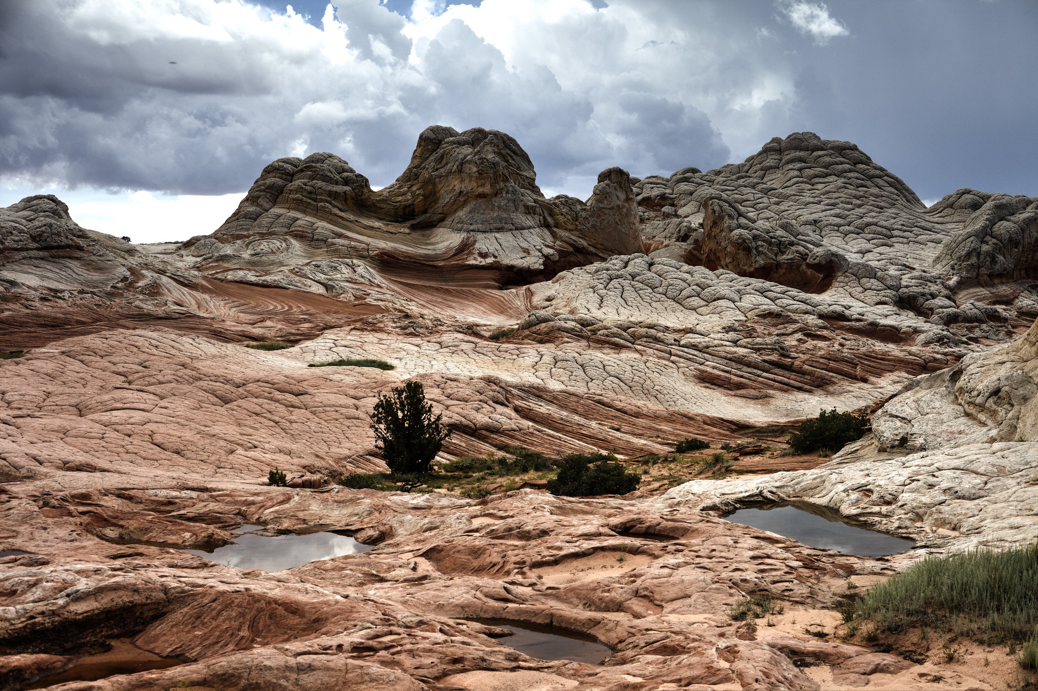
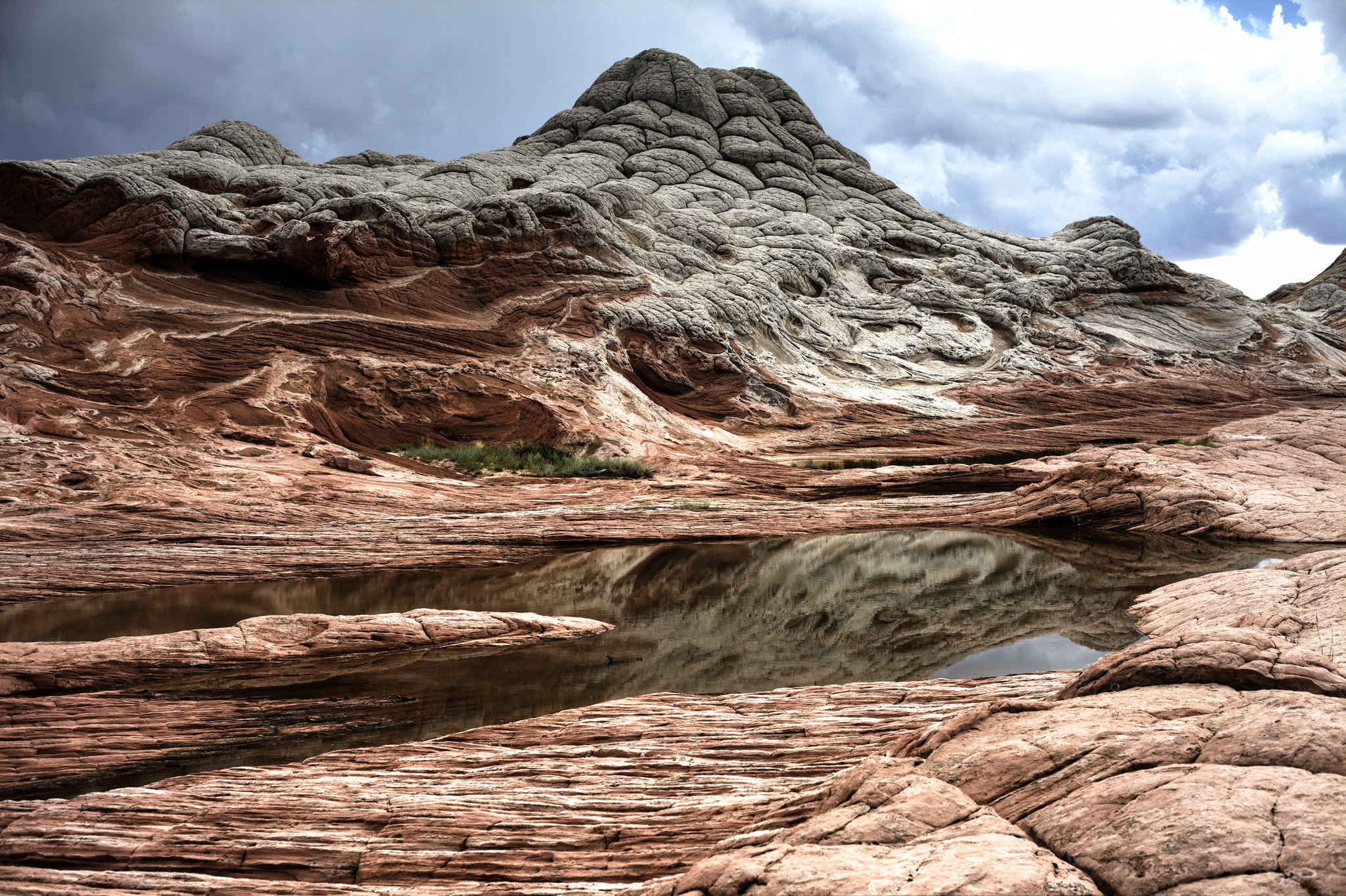
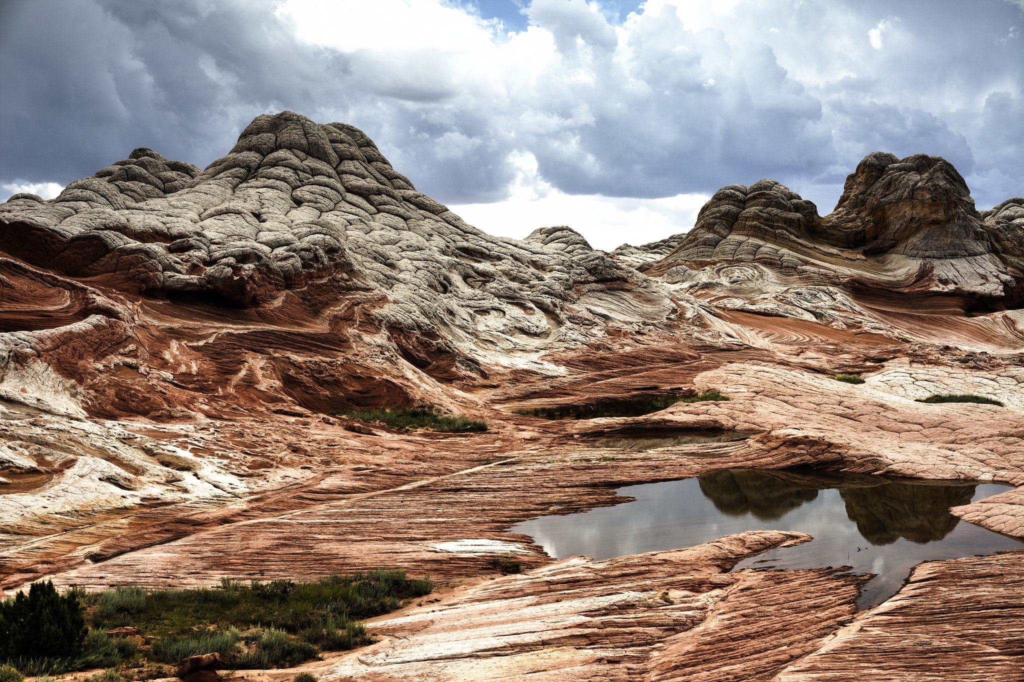
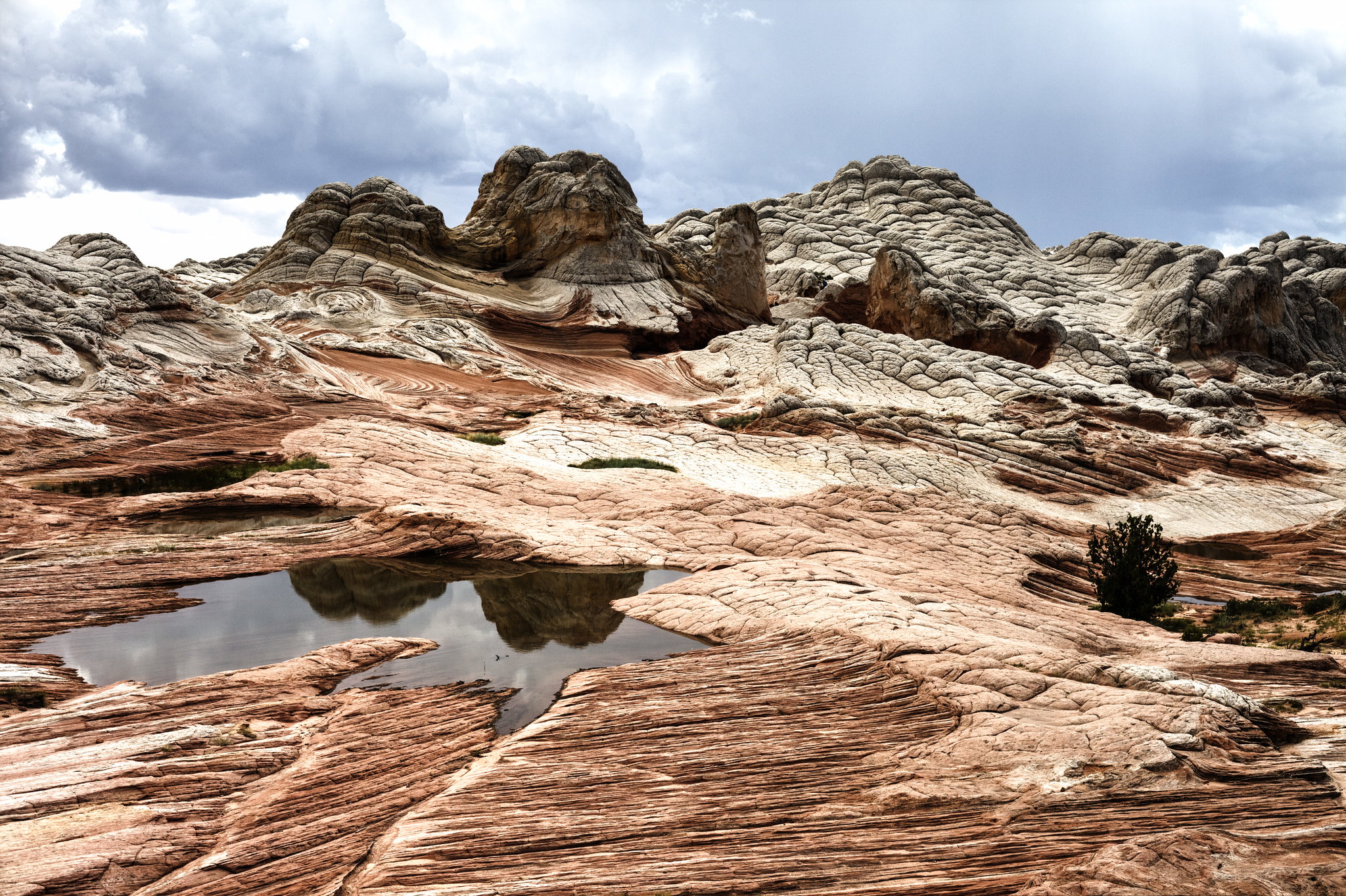
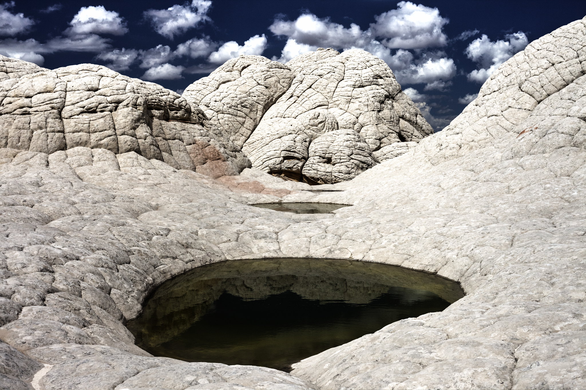
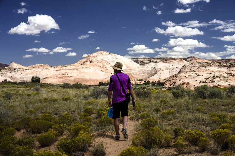
We had a permit for the South Coyote Buttes, but at the end we ended up only going around, as we gave preference to the White Pocket trip. We did as much of the road on bike as possible, but it was only few miles. The rest of it we walked because the sand on the trail was too deep for the mountain bike. Also, one thing to point out – as we realized that we are quite short on the water the night before, we decided to do the trip from Stateline to White Pocket and back in just one day – and of course by just walking most of it. It was about 30 miles in total I think, but due to heat we really had enough by the end of the day. Back in Czech republic, it’s not a exceptional for me to take a day trips of similar length, but I have to admit that the desert climate really makes it harder than I expected.
 Paw Hole, Vermillion Cliffs National Monument by hubert poul, on Flickr
 White Pocket, Vermillion Cliffs National Monument by hubert poul, on Flickr
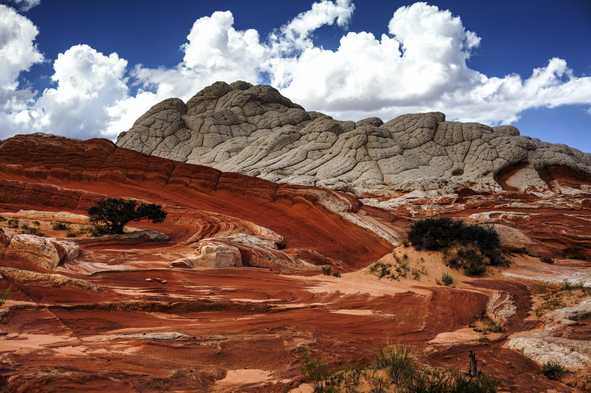 White Pocket, Vermillion Cliffs National Monument by hubert poul, on Flickr
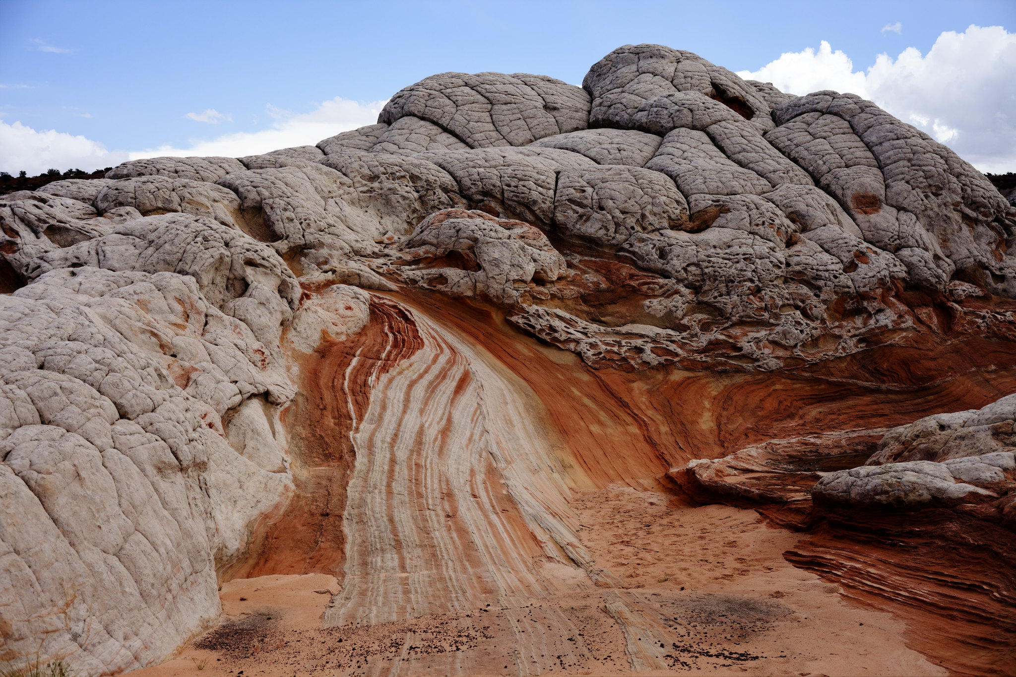 White Pocket, Vermillion Cliffs National Monument by hubert poul, on Flickr
 White Pocket, Vermillion Cliffs National Monument by hubert poul, on Flickr
 White Pocket, Vermillion Cliffs National Monument by hubert poul, on Flickr
 White Pocket, Vermillion Cliffs National Monument by hubert poul, on Flickr
 White Pocket, Vermillion Cliffs National Monument by hubert poul, on Flickr
 White Pocket, Vermillion Cliffs National Monument by hubert poul, on Flickr
 White Pocket, Vermillion Cliffs National Monument by hubert poul, on Flickr
 White Pocket, Vermillion Cliffs National Monument by hubert poul, on Flickr
 White Pocket, Vermillion Cliffs National Monument by hubert poul, on Flickr
 White Pocket, Vermillion Cliffs National Monument by hubert poul, on Flickr
 Vermillion Cliffs National Monument by hubert poul, on Flickr
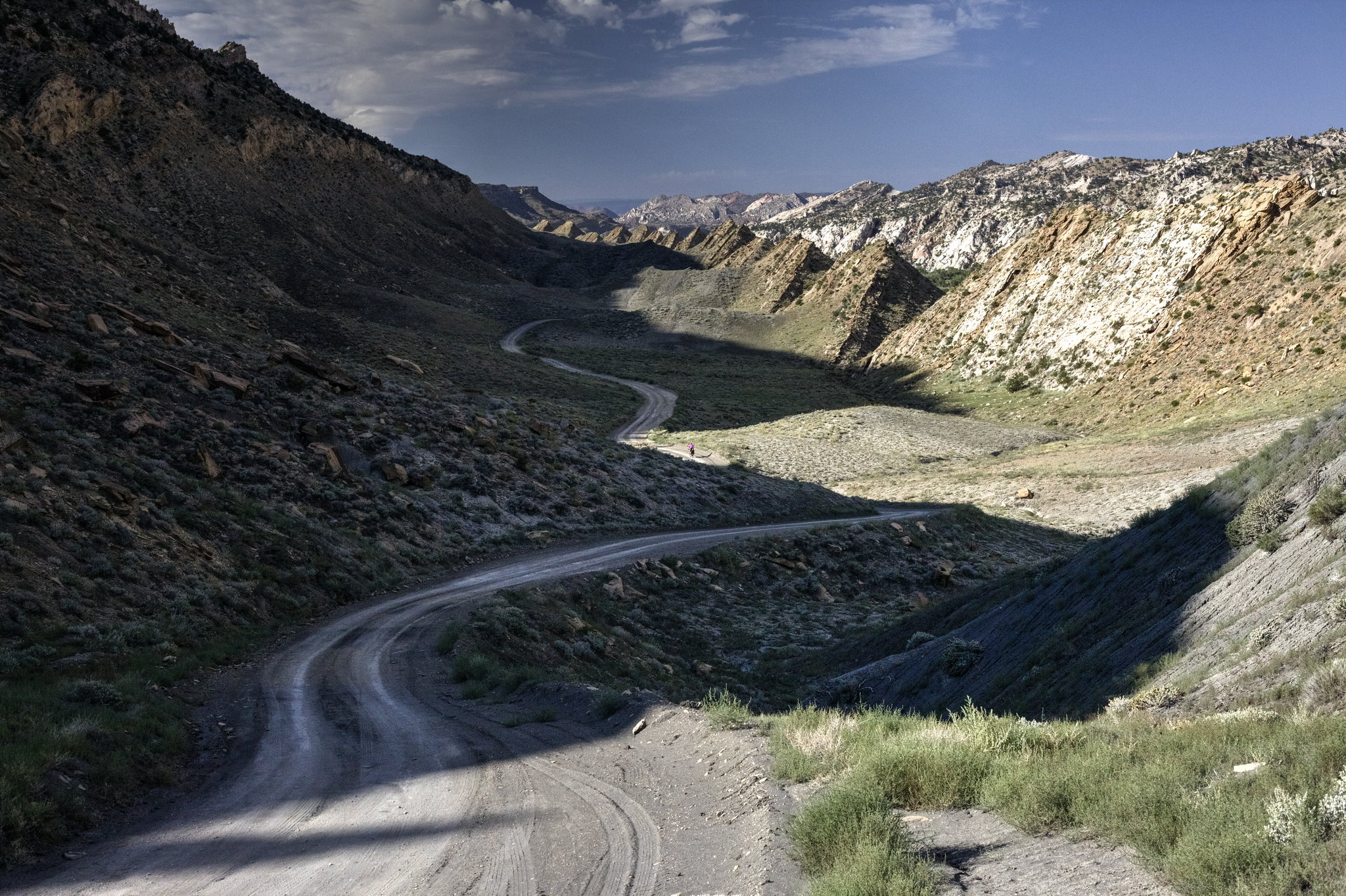
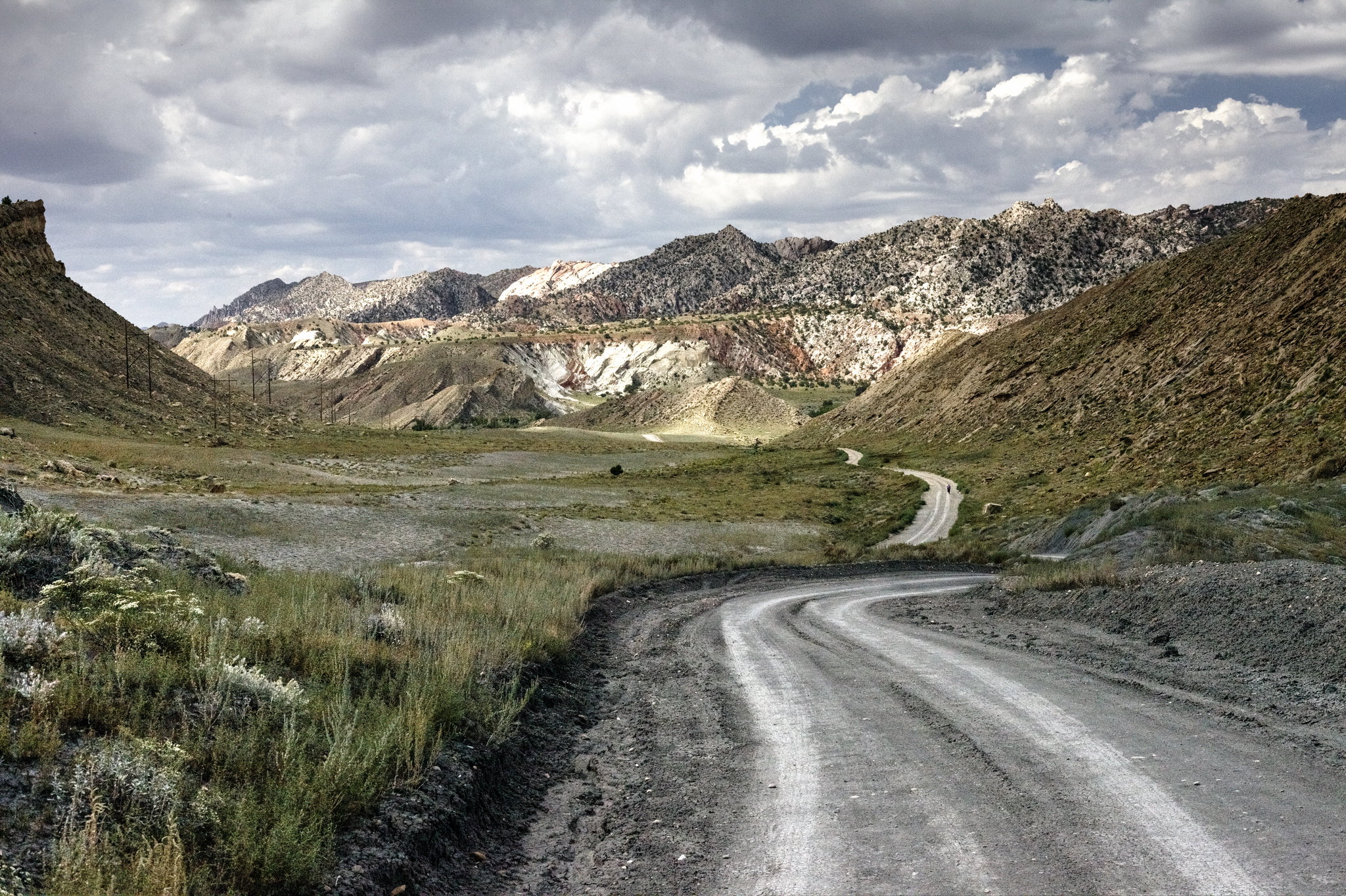
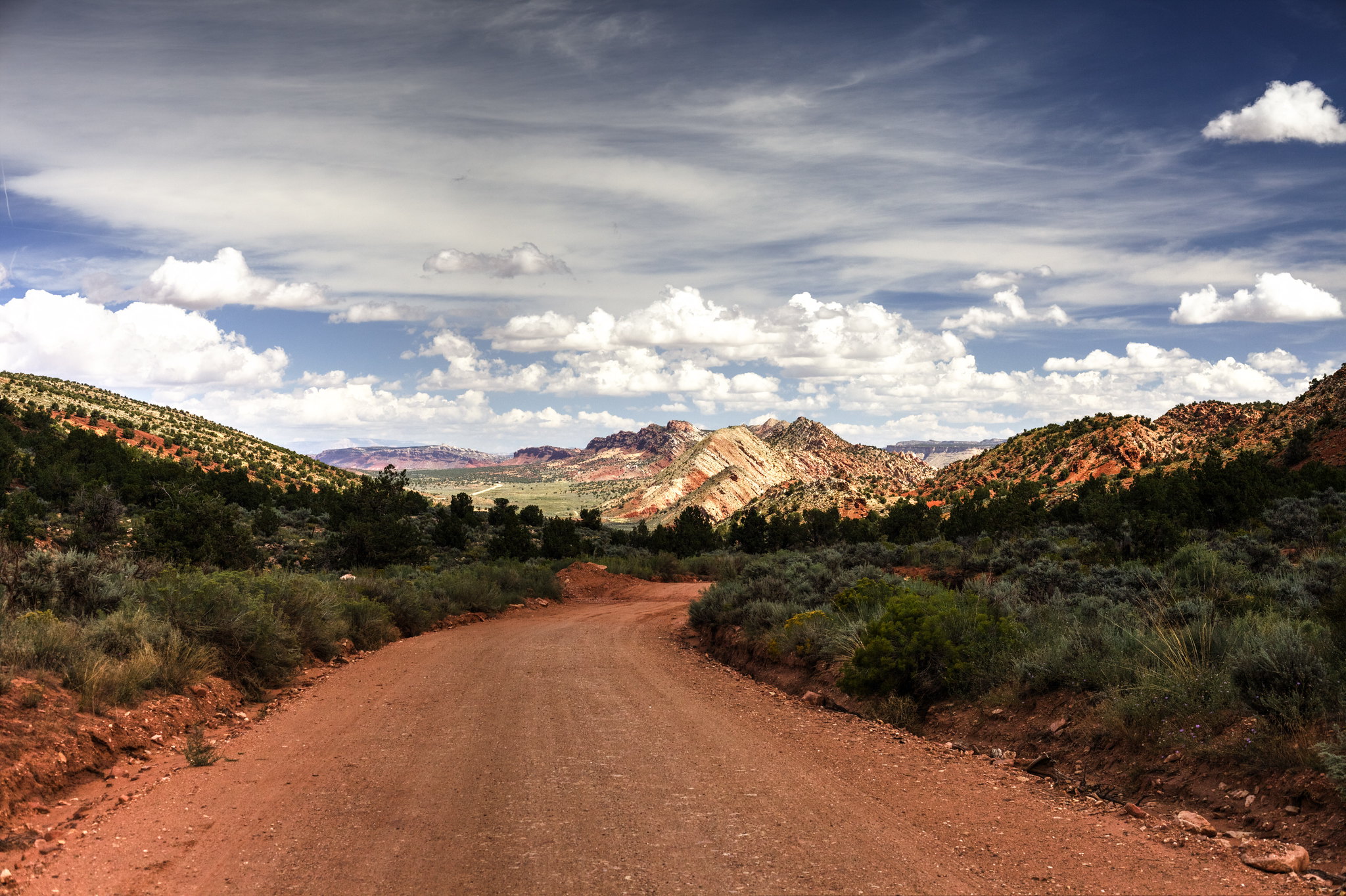
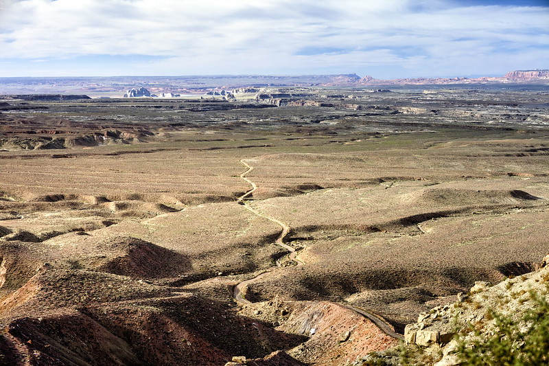
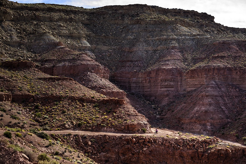
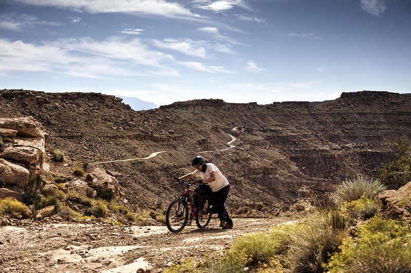
From the Vermilion Cliffs, we continued to Big Water and the Smokey Mountain Road. We heard few stories about it and had quite a respect for it, especially for the rough terrain and elevation differences. It was damaged at some parts from the storm that surprised us few days ago on the Cottonwood Rd, but we decided to do it anyway, regardless of the recommendation of the ranger at the Visitors Station in Big Water. It was perhaps reckless, but with bikes we felt that we have quite a good chance to cross any possible obstacles – even if that means walking and pulling the bike next to us. After all, there was no alternative way for us, as it would take some precious days to drive around it on a boring asphalted highway.
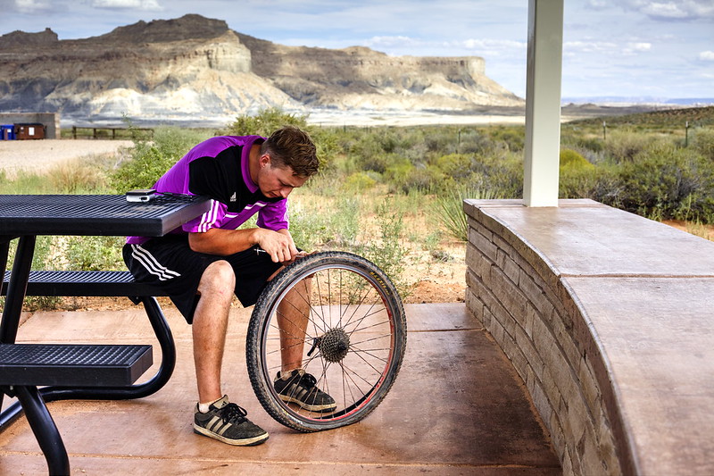 Flat tire, Big Water by hubert poul, on Flickr
 Smokey Mountain Road by hubert poul, on Flickr
 Smokey Mountain Road by hubert poul, on Flickr
 Smokey Mountain Road by hubert poul, on Flickr
 Smokey Mountain Road by hubert poul, on Flickr
 Smokey Mountain Road by hubert poul, on Flickr
 Smokey Mountain Road by hubert poul, on Flickr
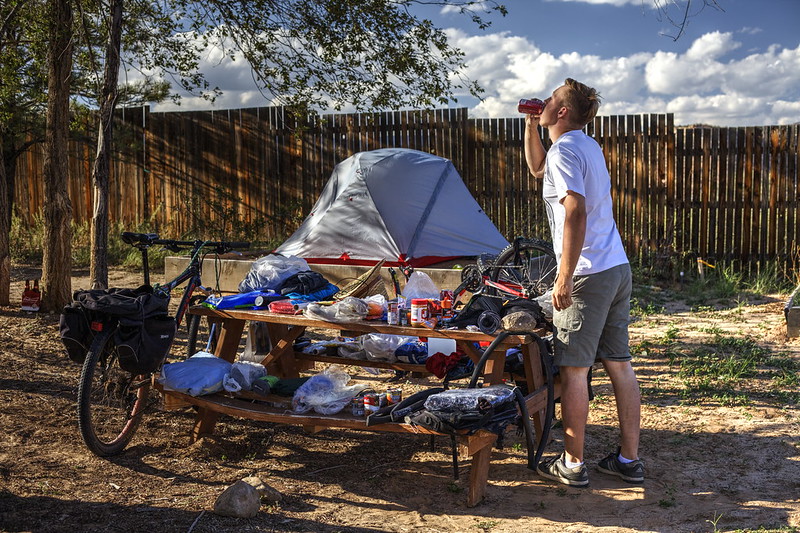
We were so afraid of the Smokey Mnt Rd that we found ourselves finishing the road within only a day and half! It was quite surprise to suddenly see Escalante. Hence we took the advantage of the campsite (second designated campground on our trip) and its facilities (shower after two weeks, yay!). We had to do some repairs and maintenance on the bikes as well.
 Escalante Outfitters by hubert poul, on Flickr
 Escalante Outfitters by hubert poul, on Flickr
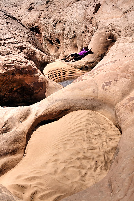
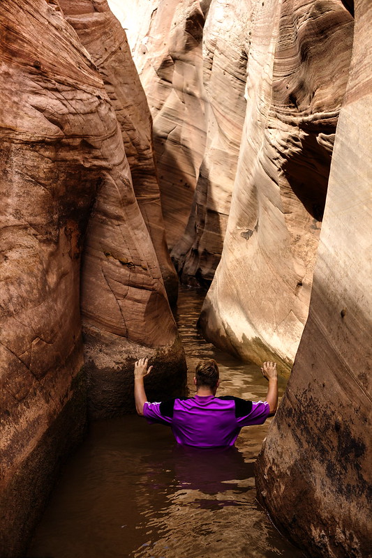
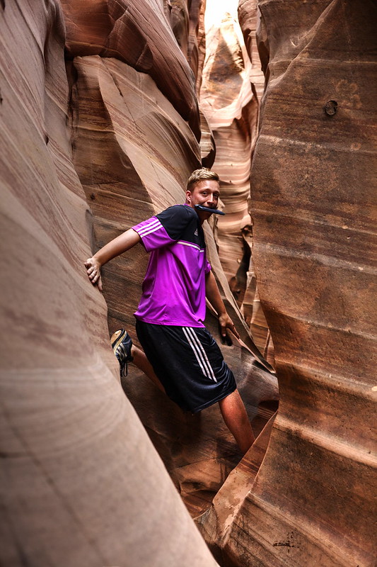
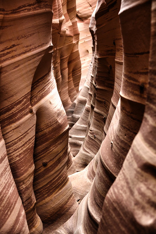
And after two days of rest, we took the Hole in the Rock Rd for seven days. As bicyclists, we have to confess that from that moment we begun to hate the wrinkles of the road. It was almost unbearable and complete suffering that constant bumping! Fortunately, the frustration always fell down as we encountered many of the interesting sites along the road.
 Grand Staircase-Escalante National Monument by hubert poul, on Flickr
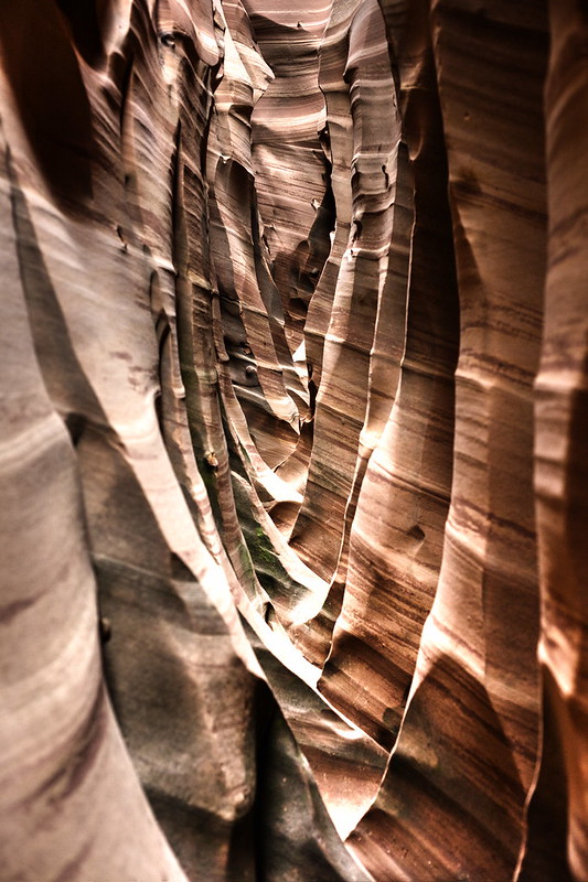
 Zebra Slot, Grand Staircase-Escalante National Monument by hubert poul, on Flickr
 On our way to Zebra Slot, Grand Staircase-Escalante National Monument by hubert poul, on Flickr
 Zebra Slot, Grand Staircase-Escalante National Monument by hubert poul, on Flickr
 Zebra Slot, Grand Staircase-Escalante National Monument by hubert poul, on Flickr
 Zebra Slot, Grand Staircase-Escalante National Monument by hubert poul, on Flickr
 Zebra Slot, Grand Staircase-Escalante National Monument by hubert poul, on Flickr
 Zebra Slot, Grand Staircase-Escalante National Monument by hubert poul, on Flickr
Zebra Slot, Grand Staircase-Escalante National Monument by hubert poul, on Flickr
Zebra Slot, Grand Staircase-Escalante National Monument by hubert poul, on Flickr
Zebra Slot, Grand Staircase-Escalante National Monument by hubert poul, on Flickr
 Devils Garden, Grand Staircase-Escalante National Monument by hubert poul, on Flickr
 Camping nearby Hole In The Rock Rd, Grand Staircase-Escalante National Monument by hubert poul, on Flickr
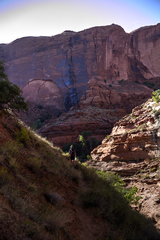
 Egypt Road, Grand Staircase-Escalante National Monument by hubert poul, on Flickr
 Egypt Trail, Grand Staircase-Escalante National Monument by hubert poul, on Flickr
 Egypt Trail, Grand Staircase-Escalante National Monument by hubert poul, on Flickr
 Egypt Trail sunset, Grand Staircase-Escalante National Monument by hubert poul, on Flickr
 Egypt Trail sunset, Grand Staircase-Escalante National Monument by hubert poul, on Flickr
 Egypt Trail, Grand Staircase-Escalante National Monument by hubert poul, on Flickr
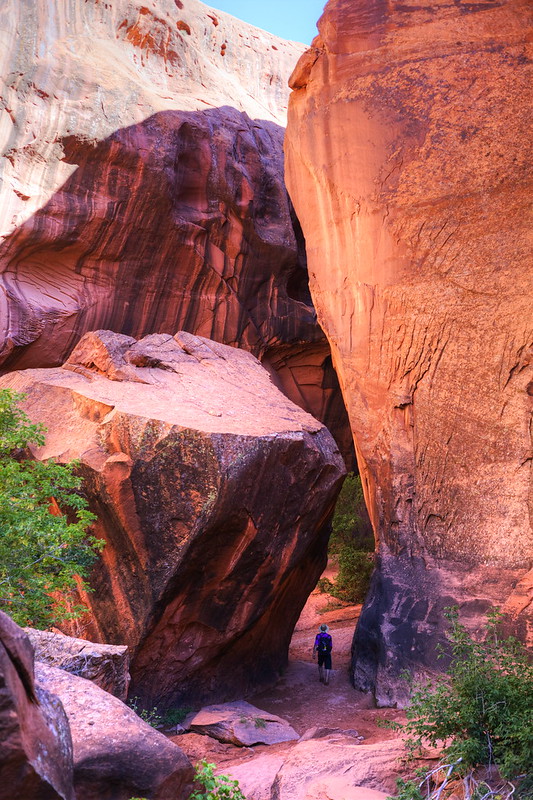 Golden Cathedral Trail, Grand Staircase-Escalante National Monument by hubert poul, on Flickr
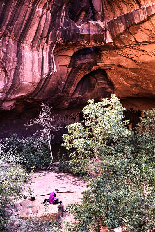 Golden Cathedral, Grand Staircase-Escalante National Monument by hubert poul, on Flickr
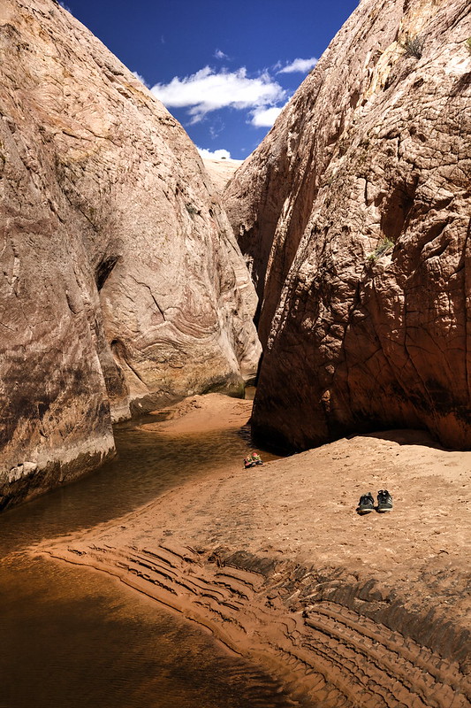
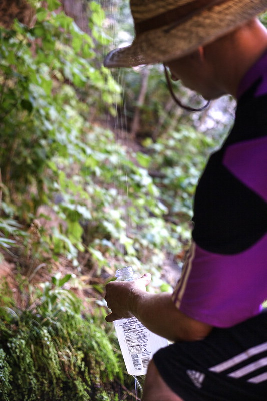
What was the surprise when suddenly on our way to Golden Cathedral we found a hidden pool of cool and unpolluted water! This was so amazing that we had to stop for a quick refreshment and re-fill our almost empty Nalgenes.
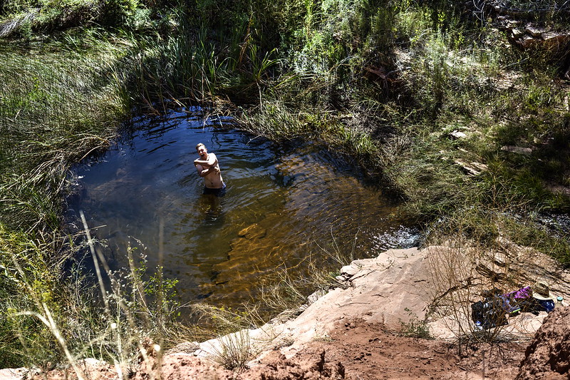 Golden Cathedral Trail, Grand Staircase-Escalante National Monument by hubert poul, on Flickr
 Golden Cathedral Trail, Grand Staircase-Escalante National Monument by hubert poul, on Flickr
 Golden Cathedral Trail, Grand Staircase-Escalante National Monument by hubert poul, on Flickr
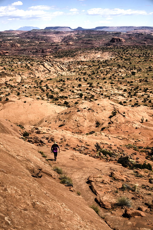
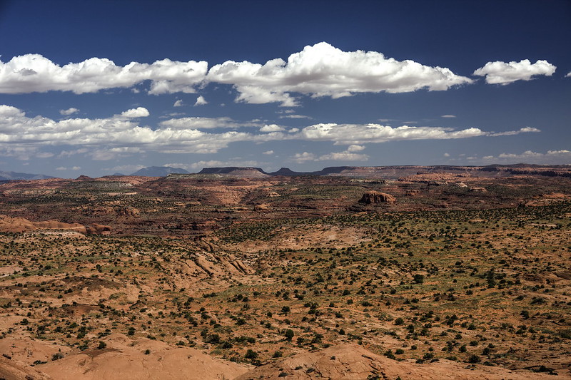
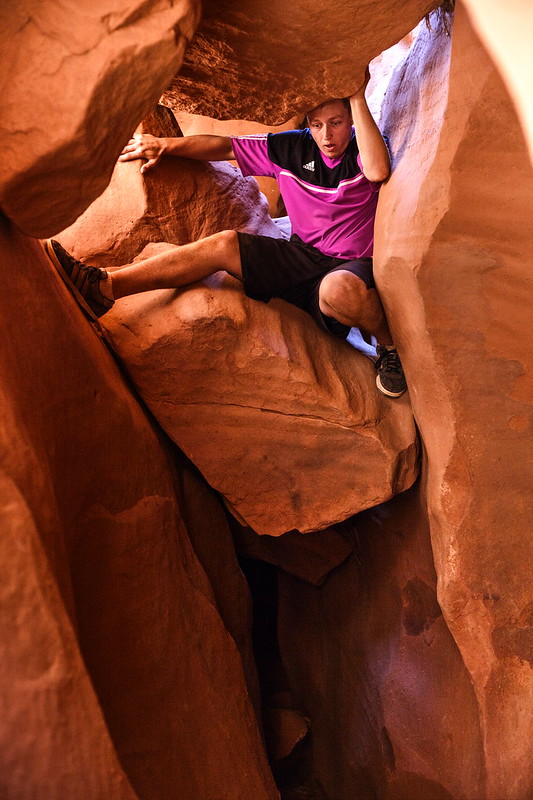 Dry Fork Slot Canyons, Grand Staircase-Escalante National Monument by hubert poul, on Flickr
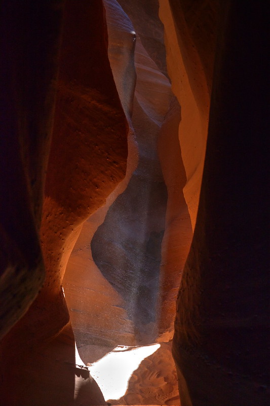 Dry Fork Slot Canyons, Grand Staircase-Escalante National Monument by hubert poul, on Flickr
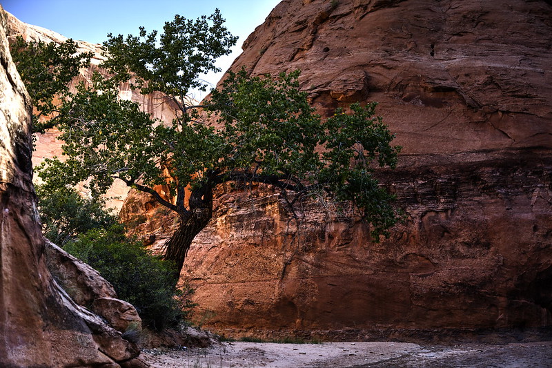
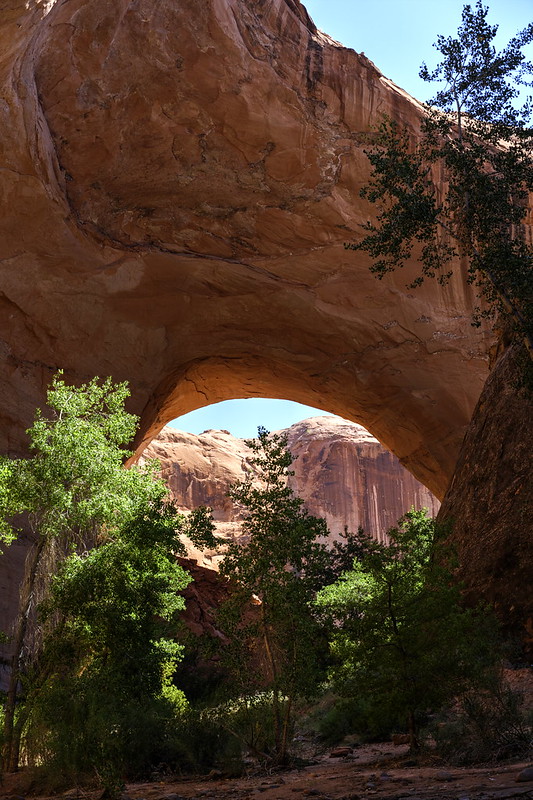
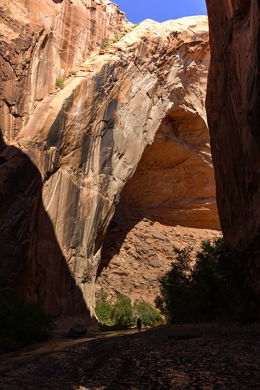
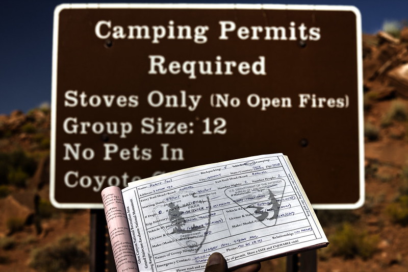 Coyote Gulch, Grand Staircase-Escalante National Monument by hubert poul, on Flickr
 Coyote Gulch, Grand Staircase-Escalante National Monument by hubert poul, on Flickr
 Coyote Gulch, Grand Staircase-Escalante National Monument by hubert poul, on Flickr
 Coyote Gulch, Grand Staircase-Escalante National Monument by hubert poul, on Flickr
 Coyote Gulch, Grand Staircase-Escalante National Monument by hubert poul, on Flickr
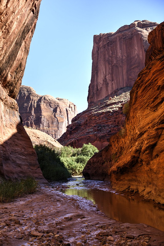 Coyote Gulch, Grand Staircase-Escalante National Monument by hubert poul, on Flickr
 Coyote Gulch, Grand Staircase-Escalante National Monument by hubert poul, on Flickr
 Coyote Gulch, Grand Staircase-Escalante National Monument by hubert poul, on Flickr
That damned wrinkles! They took the price! As we were on the way back from Coyote Gulch back to the Highway 12 (which is for a day on bike) I suddenly hear cracking and then the bike stops moving. The screws of the carrier didn’t endure the overload and together with the constant bouncing on this road, it led to collapse of the carrier and it broke the screws into two halves. Thus, we had to return to Escalante and do some DIY fixing as you can see on the picture below
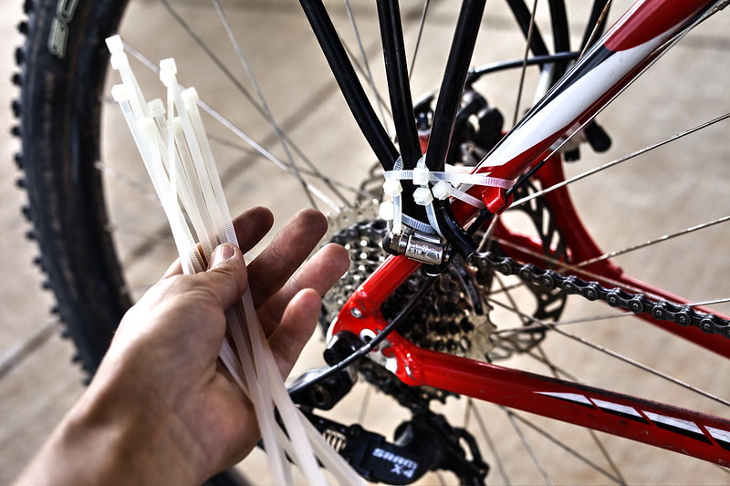 Topeak carrier never more! by hubert poul, on Flickr
Thanks for reading this through! I’ll upload the second half within next few days!
Cheers!
I was just able to put together photos from my recent bike trip around southern Utah from this September so it’ll be my pleasure to share it with you – especially since this fantastic site was invaluable source for me during the preparation and research.
This is PART ONE (of the two parts): I decided to split the report into two separate parts so it’s more reader friendly. Hopefully it won’t be too exhaustive!
So just a little bit of background for the trip: it was a project of me and my cousin. Only two of us did the whole thing and the idea was to travel as much of a southern Utah as possible on a bikes without any outside support (car or whatever). We mostly tried to minimize the technology and enjoy travelling in the very old school spirit: with topographic map printed-out and compass, but without GPS devices (we had only SPOT tracker to check-in through satellite back home with confirmation that we’re ok) and (unfortunately) also one smartphone.
Overall it was a wonderful trip for 37 days, about a 1000 miles long, full of nice encounters with other travelers, countless really breathtaking places and of course the state of mind when on one hand you experience almost transcendental astonishment by the landscape and on the other you’re tickling the very edge of the physical capabilities. It was quite interesting this mix of very different feelings and exhaustion which always blended together.
Here’s the map of the trip (this is the intended route – there were only minor diversions from it):
The biggest challenge at the end wasn’t the hot temperatures as we thought, but rather the remoteness of our route and therefore the inability to re-fill our water supplies. We had to carry food for two weeks (we did the shopping only in Cedar City, then Escalante, Green River and Moab) which ended up us eating day after day only tortillas with peanut butter (it has quite good weight to energy input ratio). With water it was even much more difficult as we had to carry on water for as much as five days – fortunately in most cases we crossed water sources every second or third day – but still this took almost all our weight and space and caused the unfortunate massive overload of the bike carriers. After two days we realized that besides tent, sleeping-bags and several other crucial things we have to throw away anything else, otherwise we won’t make it. Thus everything unnecessary went to garbage and thanks God for that!
Our bikes then looked like this:
Hardrock, the best bike ever. by hubert poul, on FlickrThe other one... by hubert poul, on FlickrWe started from Cedar City and did the quite exhaustive climb to Cedar Breaks and then back down to Red Canyon. Wonderful place! So sad that there is quite a heavy flow of tourists, though…
Red Canyon by hubert poul, on FlickrRed Canyon by hubert poul, on FlickrFortunately, we soon left the Highway 12 behind us and continued on the Kodachrome road with noticeably less traffic
Canyonville, on our way to Kodachrome by hubert poul, on FlickrKodachrome State Park by hubert poul, on FlickrBut it was nothing in comparison to Cottonwood Rd – we could count the passing cars on one hand! And very interesting landscape alongside! We did a handful of breaks to take pictures, but also to catch a breath. As we left asphalt behind us, we begun to realize how hard it’ll be to ride the sandy roads – we had to walk beside the bike through many portions of the route, but even if we were sitting on the saddle, it was at least twice as hard to keep it moving.
Cottonwood Canyon Road by hubert poul, on FlickrCamping near Grosvenor Arch by hubert poul, on FlickrCottonwood Canyon Road by hubert poul, on FlickrCottonwood Canyon Road by hubert poul, on FlickrCottonwood Canyon Road by hubert poul, on FlickrCottonwood Canyon Road by hubert poul, on FlickrWe were hit by the big storm almost at the end of the Cottonwood Rd. The funniest thing was that in the middle of the heavy rain and lightings we experienced the first flat tire of the trip. The fully loaded bike was simply too heavy so it was just a matter of time when it happens – of course it had to be in the most inconvenient moment.
The next day we refilled the water supplies at the Paria Station and continued to the probably greatest area of the trip: Vermilion Cliffs. The first photo captures the ending flash-flood from the previous day. At first, we tried to find a good spot to trespass without stepping in the water, but at the end it was clear that we have to get wet.
Vermillion Cliffs National Monument by hubert poul, on FlickrVermillion Cliffs National Monument by hubert poul, on FlickrVermillion Cliffs National Monument by hubert poul, on FlickrWire Pass, Vermillion Cliffs National Monument by hubert poul, on FlickrBuckskin Gulch, Vermillion Cliffs National Monument by hubert poul, on FlickrVermillion Cliffs National Monument by hubert poul, on FlickrVermillion Cliffs National Monument by hubert poul, on FlickrVermillion Cliffs National Monument by hubert poul, on FlickrStateline Campground, Vermillion Cliffs National Monument by hubert poul, on FlickrSearching for mobile network, Vermillion Cliffs National Monument by hubert poul, on FlickrWe had a permit for the South Coyote Buttes, but at the end we ended up only going around, as we gave preference to the White Pocket trip. We did as much of the road on bike as possible, but it was only few miles. The rest of it we walked because the sand on the trail was too deep for the mountain bike. Also, one thing to point out – as we realized that we are quite short on the water the night before, we decided to do the trip from Stateline to White Pocket and back in just one day – and of course by just walking most of it. It was about 30 miles in total I think, but due to heat we really had enough by the end of the day. Back in Czech republic, it’s not a exceptional for me to take a day trips of similar length, but I have to admit that the desert climate really makes it harder than I expected.
Paw Hole, Vermillion Cliffs National Monument by hubert poul, on FlickrWhite Pocket, Vermillion Cliffs National Monument by hubert poul, on FlickrWhite Pocket, Vermillion Cliffs National Monument by hubert poul, on FlickrWhite Pocket, Vermillion Cliffs National Monument by hubert poul, on FlickrWhite Pocket, Vermillion Cliffs National Monument by hubert poul, on FlickrWhite Pocket, Vermillion Cliffs National Monument by hubert poul, on FlickrWhite Pocket, Vermillion Cliffs National Monument by hubert poul, on FlickrWhite Pocket, Vermillion Cliffs National Monument by hubert poul, on FlickrWhite Pocket, Vermillion Cliffs National Monument by hubert poul, on FlickrWhite Pocket, Vermillion Cliffs National Monument by hubert poul, on FlickrWhite Pocket, Vermillion Cliffs National Monument by hubert poul, on FlickrWhite Pocket, Vermillion Cliffs National Monument by hubert poul, on FlickrWhite Pocket, Vermillion Cliffs National Monument by hubert poul, on FlickrVermillion Cliffs National Monument by hubert poul, on FlickrFrom the Vermilion Cliffs, we continued to Big Water and the Smokey Mountain Road. We heard few stories about it and had quite a respect for it, especially for the rough terrain and elevation differences. It was damaged at some parts from the storm that surprised us few days ago on the Cottonwood Rd, but we decided to do it anyway, regardless of the recommendation of the ranger at the Visitors Station in Big Water. It was perhaps reckless, but with bikes we felt that we have quite a good chance to cross any possible obstacles – even if that means walking and pulling the bike next to us. After all, there was no alternative way for us, as it would take some precious days to drive around it on a boring asphalted highway.
Flat tire, Big Water by hubert poul, on FlickrSmokey Mountain Road by hubert poul, on FlickrSmokey Mountain Road by hubert poul, on FlickrSmokey Mountain Road by hubert poul, on FlickrSmokey Mountain Road by hubert poul, on FlickrSmokey Mountain Road by hubert poul, on FlickrSmokey Mountain Road by hubert poul, on FlickrWe were so afraid of the Smokey Mnt Rd that we found ourselves finishing the road within only a day and half! It was quite surprise to suddenly see Escalante. Hence we took the advantage of the campsite (second designated campground on our trip) and its facilities (shower after two weeks, yay!). We had to do some repairs and maintenance on the bikes as well.
Escalante Outfitters by hubert poul, on FlickrEscalante Outfitters by hubert poul, on FlickrAnd after two days of rest, we took the Hole in the Rock Rd for seven days. As bicyclists, we have to confess that from that moment we begun to hate the wrinkles of the road. It was almost unbearable and complete suffering that constant bumping! Fortunately, the frustration always fell down as we encountered many of the interesting sites along the road.
Grand Staircase-Escalante National Monument by hubert poul, on FlickrZebra Slot, Grand Staircase-Escalante National Monument by hubert poul, on FlickrOn our way to Zebra Slot, Grand Staircase-Escalante National Monument by hubert poul, on FlickrZebra Slot, Grand Staircase-Escalante National Monument by hubert poul, on FlickrZebra Slot, Grand Staircase-Escalante National Monument by hubert poul, on FlickrZebra Slot, Grand Staircase-Escalante National Monument by hubert poul, on FlickrZebra Slot, Grand Staircase-Escalante National Monument by hubert poul, on FlickrZebra Slot, Grand Staircase-Escalante National Monument by hubert poul, on FlickrZebra Slot, Grand Staircase-Escalante National Monument by hubert poul, on FlickrZebra Slot, Grand Staircase-Escalante National Monument by hubert poul, on FlickrZebra Slot, Grand Staircase-Escalante National Monument by hubert poul, on FlickrDevils Garden, Grand Staircase-Escalante National Monument by hubert poul, on FlickrCamping nearby Hole In The Rock Rd, Grand Staircase-Escalante National Monument by hubert poul, on FlickrEgypt Road, Grand Staircase-Escalante National Monument by hubert poul, on FlickrEgypt Trail, Grand Staircase-Escalante National Monument by hubert poul, on FlickrEgypt Trail, Grand Staircase-Escalante National Monument by hubert poul, on FlickrEgypt Trail sunset, Grand Staircase-Escalante National Monument by hubert poul, on FlickrEgypt Trail sunset, Grand Staircase-Escalante National Monument by hubert poul, on FlickrEgypt Trail, Grand Staircase-Escalante National Monument by hubert poul, on FlickrGolden Cathedral Trail, Grand Staircase-Escalante National Monument by hubert poul, on FlickrGolden Cathedral, Grand Staircase-Escalante National Monument by hubert poul, on FlickrWhat was the surprise when suddenly on our way to Golden Cathedral we found a hidden pool of cool and unpolluted water! This was so amazing that we had to stop for a quick refreshment and re-fill our almost empty Nalgenes.
Golden Cathedral Trail, Grand Staircase-Escalante National Monument by hubert poul, on FlickrGolden Cathedral Trail, Grand Staircase-Escalante National Monument by hubert poul, on FlickrGolden Cathedral Trail, Grand Staircase-Escalante National Monument by hubert poul, on FlickrDry Fork Slot Canyons, Grand Staircase-Escalante National Monument by hubert poul, on FlickrDry Fork Slot Canyons, Grand Staircase-Escalante National Monument by hubert poul, on FlickrCoyote Gulch, Grand Staircase-Escalante National Monument by hubert poul, on FlickrCoyote Gulch, Grand Staircase-Escalante National Monument by hubert poul, on FlickrCoyote Gulch, Grand Staircase-Escalante National Monument by hubert poul, on FlickrCoyote Gulch, Grand Staircase-Escalante National Monument by hubert poul, on FlickrCoyote Gulch, Grand Staircase-Escalante National Monument by hubert poul, on FlickrCoyote Gulch, Grand Staircase-Escalante National Monument by hubert poul, on FlickrCoyote Gulch, Grand Staircase-Escalante National Monument by hubert poul, on FlickrCoyote Gulch, Grand Staircase-Escalante National Monument by hubert poul, on FlickrThat damned wrinkles! They took the price! As we were on the way back from Coyote Gulch back to the Highway 12 (which is for a day on bike) I suddenly hear cracking and then the bike stops moving. The screws of the carrier didn’t endure the overload and together with the constant bouncing on this road, it led to collapse of the carrier and it broke the screws into two halves. Thus, we had to return to Escalante and do some DIY fixing as you can see on the picture below
Topeak carrier never more! by hubert poul, on FlickrThanks for reading this through! I’ll upload the second half within next few days!
Cheers!