Cool Danish
Member
- Joined
- Jan 13, 2013
- Messages
- 136
This is my first Trip Report here on Backcountry Post. I thought it was time to try to give a little back, since a majority places I visited stemmed from all the excellent TRs on this awesome site.
For some years now I have had a yearly tradition to travel around the Southwest with my best friend Bo from my native Denmark.
Sunday, April 27, 2014
Home to White Pocket.
After packing the Jeep the previous night, we started off for Utah from my house in Southern California around 8:30am. The drive from California, thru Las Vegas is just something that has to be done like any other boring chore and it is not until we get to the Virgin River gorge the trip really starts. We turned off I-15 in St. George and headed east towards our first campsite at White Pocket on the Paria Plateau.
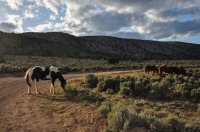
As we were turning off House Rock Valley Rd onto the sandy road that is going to take us across the Paria Plateau, we saw small band of horses. No idea if they are wild or belong to some local rancher, but they did not seem to take notice of us.
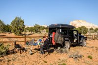
When we arrived at White Pocket we discovered the campsite spot we had been planning on using was already occupied by quite a large group, with several vehicles and even a generator running. We retreated back to the White Pocket trail head parking area and setup camp there. I was relegated to the parking area since I was sleeping in the Maggiolina Roof Top Tent and my friend Bo took his little 2-person tent into the fenced in area south of the parking area. For dinner we heated up a homemade Pork tenderloin casserole with rice. It had been a long drive, so we headed straight for bed after cleaning up after dinner.
Monday, April 28, 2014
White Pocket to Escalante.
I got up before sunrise, but Bo decided to sleep in as he had been a little cold during the cloudless and windy night. I spend about 1.5 hour walking around taking pictures and exploring the strange colors and swirls in the sandstone.
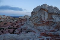
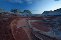
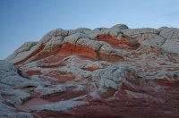
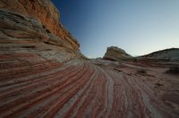
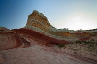
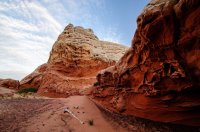
In the pre-dawn light it did not look like it would be a great morning for pictures, but the clouds cooperated and the light was awesome.
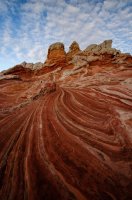
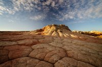
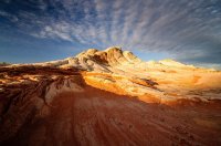
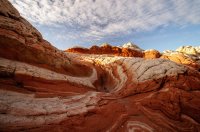
I did not see anyone else that morning which was great. As I was walking back to the Jeep, I could see that Bo was up and getting breakfast ready.
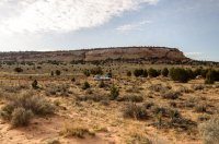
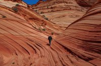
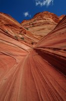
We had permits for Coyote Buttes South that day, but we had already been to the main northern part of CBS, so we concentrated on the southern portion and entered into the area via Paw Hole. We wanted to ease into our hiking as we had big hiking plans for tomorrow.
Mini Wave reminiscent of the Wave in CBN.
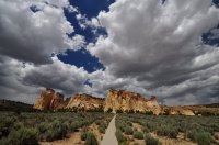
After finishing exploring the area we hit the road again and drove north on Cottonwood Canyon road to Cannonville with a short side trip to Grosvenor Arch and then onwards to Escalante.
We had originally planned on camping on Old Sheffield road, but a cold wind and rain had kicked up, so we
decided to get a hotel room in Escalante and rest up before our planned hike the next morning.
Tuesday, April 29, 2014
Escalante to Kiva Koffee House.
We got an early start and had some pastries & coffee from Escalante outfitters and were soon on the way out the Hole-in-the-rock road. There was a slight wind and cool temperatures, but perfect for hiking. The HITR road looked like it had recently been graded and we made quick progress to the Harris Wash TH. The plan for the day was to do a loop hike up Red breaks slots and over to the strange feature called the “Volcano” and then back on the now closed V-road. We crossed Harris Wash and started up a side wash and soon encountered a dry fall that we bypassed on the left. After that is was pretty easy walking with a little bit of stemming over a couple of choke stones.
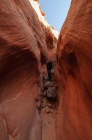
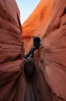
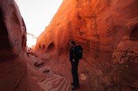
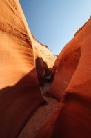
When the drainage started to widen, we started heading east towards the “Volcano”.
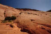
Route finding was fun and we ended up on the south side of the sandstone feature where we had a lunch snack.
I have a personal theory on how the “Cosmic Ashtray” was formed; Wind erosion. When we were sitting and eating lunch the wind kicked up a little from the South. The wind went thru the gap we were sitting and started a clock-wise swirling mini sand storm down in the depression, with sand scouring the outer walls.
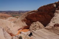
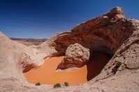
The views were great over the Escalante River gorge and of Fiftymile and Navajo Mountains in the background. After relaxing awhile and enjoying the views, we went south down an un-named drainage and soon hit the old V-road that lead us back to our Jeep. The GPS read 12.9 miles as we reached the Harris Wash TH parking. Not bad for a couple of middle aged office cube dwellers.
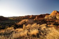
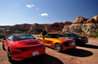
We drove back to Escalante where we had dinner at Cowboy Blues restaurant, before heading to our reserved cabin at Kiva Koffee house. The cabin had an awesome view down the Escalante River. I didn’t take any pictures but here is a picture the view down the Escalante River from the previous time we stayed at the Kiva Koffee house. This was also during this time we encountered three nice convertibles being road tested by Car and Driver journalists. It was a pretty sweet sound hearing each of the cars taking off up the hill towards Escalante. It must be a very tough job of having to drive $120k convertibles up and down scenic highway 12.
Wednesday, April 30, 2014
Kiva Koffee House to Bullfrog Marina.
We had a great fresh cooked breakfast at the Kiva Koffee house which was included with our stay and they even sent us on our way with a couple of muffins and to-go coffees. I highly recommend both the cabins and the cafe.
We started the drive over the Hogback to Boulder, then turned down the Burr Trail and made our way over to Strike Valley overlook.
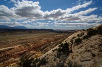
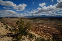
Then down the mule twist switchbacks down onto the road towards Bullfrog marina. We made a quick side trip to Halls Creek overlook.
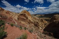
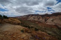
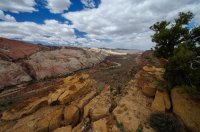
We crossed the bone dry Bullfrog creek and then stopped for a short hike to Pedestal Alley. The winds had really kicked up as we were hiking out to the area with the pedestals and we got a good sand blasting.
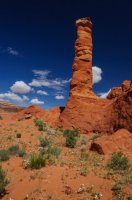
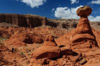
We decided to get a hotel room in Bullfrog marina, rather than driving to the Dirty Devil River to camp for the night. Our original plan had been to camp above the Black Jump in Poison Spring canyon and then hike down to Happy Canyon narrows in the morning.
When we were sitting and having dinner in Bullfrog we could see a huge sandstorm blowing across Lake Powel from the west.
Thursday, May 1, 2014
Bullfrog Marina to Panorama Point.
In the morning we refueled the Jeep and filled up our two Rotopax gas cans for a total of 8 gallons extra. We left Bullfrog driving north and 45 minutes later we turned onto Poison Spring Canyon road heading towards the Maze District. Crossing the Dirty Devil River did not cause any problems as it was only running at about 50cfs.
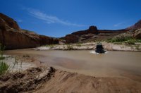
Right above the river we stopped for lunch and deployed my new awning for some much needed shade. The drive up thru Hatch Canyon towards Sunset Pass was very nice and the views back towards the Henry Mountains was awesome. The desert wildflowers were out in full form.
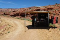
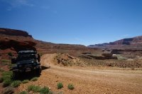
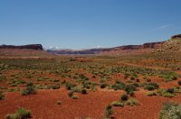
We went over sunset pass and headed towards the Flint trail switchbacks. The switchbacks were pretty easy and when we reached the top, we poured the extra gas cans into the Jeeps fuel tank. We did not stop at the Ranger Station, but continued out the North point road towards Cleopatra’s chair and Panorama point. The trail out North point was very slow going. Nothing super technical, but the 9.5 miles took little over an hour.
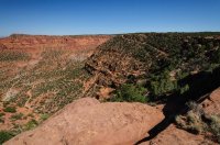
Flint Trail switchbacks.
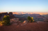
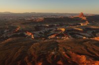
We quickly set up camp and started the charcoal grill. While the grill was getting ready we walked around the point enjoying the amazing 180 degree views in the direction of the Island-in-the-Sky district and La Sal Mountains, almost all the way to the Henry Mountains. We could see the chocolate drops formation in the direction of the Maze overlook campsite and the Land of Standing Rocks further in the distance. We even found the perfect location for the portable toilet.
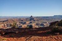
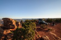
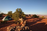
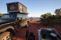
I grilled a couple of thick Filet Mignon steaks on the grill while Bo prepared potatoes and Béarnaise Sauce. We shared a good bottle of red wine with the food while enjoying the last of rays hit Elaterite Butte below the point. We sat talking for a several hours before finally retiring to our tents. When I went to bed there was a full moon, but when I got up to pee around 3am the moon had set and the stars were out in full force. Absolutely breathtaking and not a single man made light anywhere on the horizon.
Friday, May 2, 2014
Panorama Point to Doll House #3.
I made crêpes sprinkled with powdered sugar and raspberry jam for breakfast. While we were eating and drinking our coffee we discussed the plan for the day. Our next campsite was at Doll House #3, but when we pulled into camp the evening before I noticed our fuel consumption much higher than I had planned for. Even with our extra 8 gallons it was going to be very hard to make it on the fuel we had left. I think the reason for the fuel shortage was that when I reserved our campsites 4 months prior, I was not able to get one of the Maze Overlook campsites and we had to settle for the Panorama Point CS. The extra mileage up/down flint trail and the slow crawl out the North Point road had taken its toll on our fuel reserves.
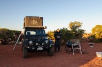
We decided to play it safe and drive out to Hanksville for refueling and then south on SR-95 to Hite and take the quicker road back into the Maze from the south. We made a quick stop at Hog Springs and saw the Moki Queen pictograph.
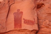
The drive from Hite to Waterhole Flat was very scenic and a good road, so we arrived at the 4-way intersection fairly fast.
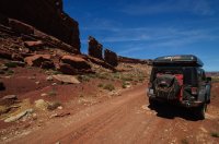
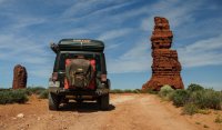
Shortly after we made the turn towards the Land of Standing Rocks we hit Teapot canyon and everything slowed to a crawl. After about two hours of driving the high clearance trail we passed The Wall, Lizard Rock, The Plug, Standing Rock and lastly Chimney Rock. Finally we rolled into Doll House #3 campsite and setup camp. Campsite #3 sets away from the two other Doll House campsites and that evening we were treated to a nice view of the Doll House formations which were lit up nicely from the setting sun.
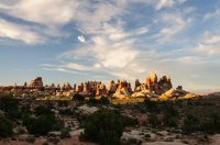
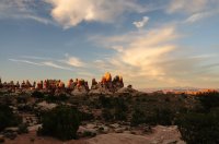
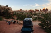
I heated up some Tortellini and Broccoli in Fettuccine Alfredo sauce which turned out kind of disappointing. But at least some ice cold beers from the fridge and the beautiful surrounding scenery made up for it.
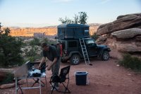
We were both pretty tired from the long exhausting drive, so we hit the sack fairly early.
Saturday, May 3, 2014
Dollhouse #3 to Bullfrog Marina.
After a quick breakfast we packed up the Jeep and headed over to the Doll House formation where we parked the Jeep. We then made the loop hike to the granary ruins with a side trip a little ways down the trail to Spanish Bottom. The views were great the whole way, including Surprise Valley and route through cracks in the rocks on the way to the Jeep.
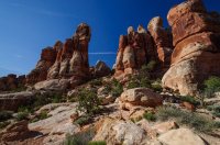
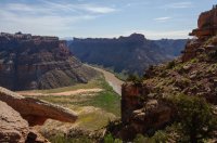
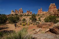
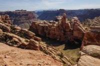
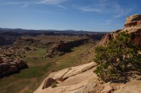
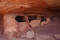
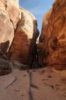
We felt like we should have stayed at least another night at the Doll House, but after the hike we had to start the drive back out of the Maze since our permit only allowed one night. The sections around Teapot canyon did not seem as bad as on the way in, probably because we were well rested and knew what to expect.
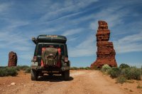
We hit asphalt at Lake Powell by Hite and started up SR-95 and then SR-276 onto Bullfrog Marina to get a hotel room. It was great to get a shower and some food.
Sunday, May 4, 2014
Bullfrog Marina to Devils Kitchen #4.
Our next destination was the Needles District of Canyonlands, so we started the drive once again past the Henry Mountains and then turned on SR-95 down North Wash. A few miles down North Wash we stopped for a short hike up Leprechaun canyon. Pretty neat sandstone canyon.
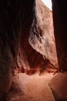
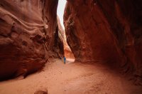
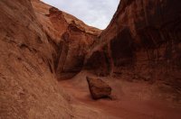
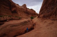
After the short hike we continued down North Wash and crossed first the Dirty Devil and then the Colorado River where they empty into Lake Powell at Hite.
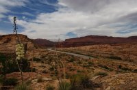
From Hite we drove by Cedar Mesa and thru the gap in Comb Ridge and eventually found ourselves at the bottom of Elephant Hill in the Needles District. We aired down the Jeeps tires and headed over the fun Elephant Hill 4x4 trail towards our reserved campsite #4 in Devils Kitchen. This campsite was nested in between huge boulder and gave nice shelter from the wind.
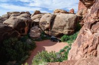
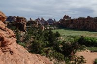
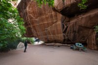
After setting up camp we explored the needles close around camp.
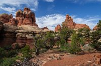
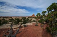
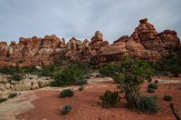
Later that night we BBQ’ed some steaks for dinner and ate them with some fried potatoes, onions, bellpepers and a creamy pesto sauce. We stayed up for a few hours and finished off a good bottle of wine before we headed off to bed.
Monday, May 5, 2014
Devils Kitchen #4 to Moab.
After breakfast and packing up camp, we drove south to the Joint trail head and started the hike to Druid arch. The Joint trail was pretty interesting and soon we were hiking across Chesler Park.
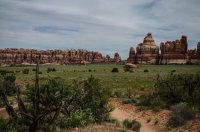
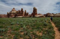
We exited Chesler Park thru a gap in the rock formations and descended into beautiful Elephant Canyon.
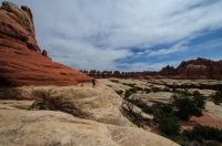
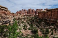
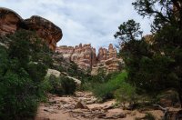
A couple of miles later we arrived at the impressive Druid Arch. There were a couple of people at the Arch when we arrived, but they soon left and we had the place to ourselves. After taking pictures and ate a snack, we relaxed in the shade for half an hour just listening to birds and enjoyed the otherwise quiet.
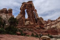
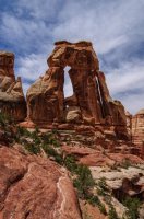
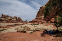
Then we heard voices a short way down the canyon, so we decided it was a good time to start the hike back to the Jeep.
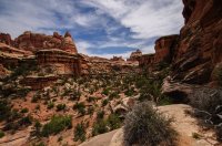
It was nice getting back to the Jeep and get some lunch in the shade of the awning. Next we drove back over Elephant Hill and then onto Moab where we had dinner at Pasta Jay’s.
Tuesday, May 6, 2014
Moab.
After breakfast we drove to Arches NP to do the Devils Garden hike. We did the hike in reverse starting with the primitive trail. Strange to see so many people after the solitude in the Maze and Needle districts.
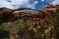
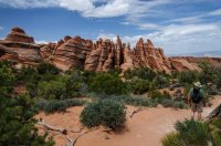
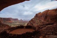
After the hike we drove back out of the park via Willow Flats road and headed over to Canyonlands NP to do the short hike to False Kiva. There was still a lot of dust in the air, so visibility was pretty poor. There were several people at the False Kiva. On a previous visit I have not seen anyone else, so it must be more known.
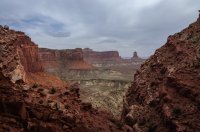
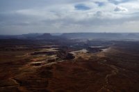
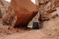
We stopped at the Green River overlook and then went down thru scenic Long Canyon on the way back to Moab.
Wednesday, May 7, 2014
Moab.
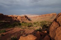
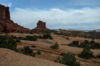
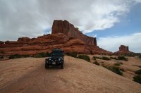
We slept in this morning and took our time. We didn’t have anything planed for our last day in Moab, so we decided on running the Seven Mile Rim 4x4 trail. I was not super impressed with the first part on the trails scenic value. Just a rocky, dusty and bumpy ride. Eventually the trail ended up on Courthouse Pasture and was alternating between slickrock and sand.
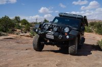
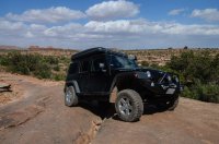
The ride around Monitor & Merrimac Buttes was interesting and at some points very off-camber and the roof rack with the tent did not help matters. But we made it safely back to town in the afternoon without rolling the Jeep .
.
Thursday, May 8, 2014
Moab to Home.
This was a travel day and we got up early to get a head start on the long 730 miles back to my house in Southern California, where we arrived 12 long hours later. It had been a great trip with some good hikes mixed in. We both agreed that next time we visit the maze or needles district of Canyonlands, we need to slow down and stay much longer at each campsite.
Featured image for home page:
For some years now I have had a yearly tradition to travel around the Southwest with my best friend Bo from my native Denmark.
Sunday, April 27, 2014
Home to White Pocket.
After packing the Jeep the previous night, we started off for Utah from my house in Southern California around 8:30am. The drive from California, thru Las Vegas is just something that has to be done like any other boring chore and it is not until we get to the Virgin River gorge the trip really starts. We turned off I-15 in St. George and headed east towards our first campsite at White Pocket on the Paria Plateau.
As we were turning off House Rock Valley Rd onto the sandy road that is going to take us across the Paria Plateau, we saw small band of horses. No idea if they are wild or belong to some local rancher, but they did not seem to take notice of us.

When we arrived at White Pocket we discovered the campsite spot we had been planning on using was already occupied by quite a large group, with several vehicles and even a generator running. We retreated back to the White Pocket trail head parking area and setup camp there. I was relegated to the parking area since I was sleeping in the Maggiolina Roof Top Tent and my friend Bo took his little 2-person tent into the fenced in area south of the parking area. For dinner we heated up a homemade Pork tenderloin casserole with rice. It had been a long drive, so we headed straight for bed after cleaning up after dinner.
Monday, April 28, 2014
White Pocket to Escalante.
I got up before sunrise, but Bo decided to sleep in as he had been a little cold during the cloudless and windy night. I spend about 1.5 hour walking around taking pictures and exploring the strange colors and swirls in the sandstone.


In the pre-dawn light it did not look like it would be a great morning for pictures, but the clouds cooperated and the light was awesome.


I did not see anyone else that morning which was great. As I was walking back to the Jeep, I could see that Bo was up and getting breakfast ready.


We had permits for Coyote Buttes South that day, but we had already been to the main northern part of CBS, so we concentrated on the southern portion and entered into the area via Paw Hole. We wanted to ease into our hiking as we had big hiking plans for tomorrow.
Mini Wave reminiscent of the Wave in CBN.


After finishing exploring the area we hit the road again and drove north on Cottonwood Canyon road to Cannonville with a short side trip to Grosvenor Arch and then onwards to Escalante.

We had originally planned on camping on Old Sheffield road, but a cold wind and rain had kicked up, so we
decided to get a hotel room in Escalante and rest up before our planned hike the next morning.
Tuesday, April 29, 2014
Escalante to Kiva Koffee House.
We got an early start and had some pastries & coffee from Escalante outfitters and were soon on the way out the Hole-in-the-rock road. There was a slight wind and cool temperatures, but perfect for hiking. The HITR road looked like it had recently been graded and we made quick progress to the Harris Wash TH. The plan for the day was to do a loop hike up Red breaks slots and over to the strange feature called the “Volcano” and then back on the now closed V-road. We crossed Harris Wash and started up a side wash and soon encountered a dry fall that we bypassed on the left. After that is was pretty easy walking with a little bit of stemming over a couple of choke stones.


When the drainage started to widen, we started heading east towards the “Volcano”.

Route finding was fun and we ended up on the south side of the sandstone feature where we had a lunch snack.
I have a personal theory on how the “Cosmic Ashtray” was formed; Wind erosion. When we were sitting and eating lunch the wind kicked up a little from the South. The wind went thru the gap we were sitting and started a clock-wise swirling mini sand storm down in the depression, with sand scouring the outer walls.


The views were great over the Escalante River gorge and of Fiftymile and Navajo Mountains in the background. After relaxing awhile and enjoying the views, we went south down an un-named drainage and soon hit the old V-road that lead us back to our Jeep. The GPS read 12.9 miles as we reached the Harris Wash TH parking. Not bad for a couple of middle aged office cube dwellers.
We drove back to Escalante where we had dinner at Cowboy Blues restaurant, before heading to our reserved cabin at Kiva Koffee house. The cabin had an awesome view down the Escalante River. I didn’t take any pictures but here is a picture the view down the Escalante River from the previous time we stayed at the Kiva Koffee house. This was also during this time we encountered three nice convertibles being road tested by Car and Driver journalists. It was a pretty sweet sound hearing each of the cars taking off up the hill towards Escalante. It must be a very tough job of having to drive $120k convertibles up and down scenic highway 12.


Wednesday, April 30, 2014
Kiva Koffee House to Bullfrog Marina.
We had a great fresh cooked breakfast at the Kiva Koffee house which was included with our stay and they even sent us on our way with a couple of muffins and to-go coffees. I highly recommend both the cabins and the cafe.
We started the drive over the Hogback to Boulder, then turned down the Burr Trail and made our way over to Strike Valley overlook.


Then down the mule twist switchbacks down onto the road towards Bullfrog marina. We made a quick side trip to Halls Creek overlook.


We crossed the bone dry Bullfrog creek and then stopped for a short hike to Pedestal Alley. The winds had really kicked up as we were hiking out to the area with the pedestals and we got a good sand blasting.


We decided to get a hotel room in Bullfrog marina, rather than driving to the Dirty Devil River to camp for the night. Our original plan had been to camp above the Black Jump in Poison Spring canyon and then hike down to Happy Canyon narrows in the morning.
When we were sitting and having dinner in Bullfrog we could see a huge sandstorm blowing across Lake Powel from the west.
Thursday, May 1, 2014
Bullfrog Marina to Panorama Point.
In the morning we refueled the Jeep and filled up our two Rotopax gas cans for a total of 8 gallons extra. We left Bullfrog driving north and 45 minutes later we turned onto Poison Spring Canyon road heading towards the Maze District. Crossing the Dirty Devil River did not cause any problems as it was only running at about 50cfs.

Right above the river we stopped for lunch and deployed my new awning for some much needed shade. The drive up thru Hatch Canyon towards Sunset Pass was very nice and the views back towards the Henry Mountains was awesome. The desert wildflowers were out in full form.


We went over sunset pass and headed towards the Flint trail switchbacks. The switchbacks were pretty easy and when we reached the top, we poured the extra gas cans into the Jeeps fuel tank. We did not stop at the Ranger Station, but continued out the North point road towards Cleopatra’s chair and Panorama point. The trail out North point was very slow going. Nothing super technical, but the 9.5 miles took little over an hour.

Flint Trail switchbacks.
We quickly set up camp and started the charcoal grill. While the grill was getting ready we walked around the point enjoying the amazing 180 degree views in the direction of the Island-in-the-Sky district and La Sal Mountains, almost all the way to the Henry Mountains. We could see the chocolate drops formation in the direction of the Maze overlook campsite and the Land of Standing Rocks further in the distance. We even found the perfect location for the portable toilet.


I grilled a couple of thick Filet Mignon steaks on the grill while Bo prepared potatoes and Béarnaise Sauce. We shared a good bottle of red wine with the food while enjoying the last of rays hit Elaterite Butte below the point. We sat talking for a several hours before finally retiring to our tents. When I went to bed there was a full moon, but when I got up to pee around 3am the moon had set and the stars were out in full force. Absolutely breathtaking and not a single man made light anywhere on the horizon.


Friday, May 2, 2014
Panorama Point to Doll House #3.
I made crêpes sprinkled with powdered sugar and raspberry jam for breakfast. While we were eating and drinking our coffee we discussed the plan for the day. Our next campsite was at Doll House #3, but when we pulled into camp the evening before I noticed our fuel consumption much higher than I had planned for. Even with our extra 8 gallons it was going to be very hard to make it on the fuel we had left. I think the reason for the fuel shortage was that when I reserved our campsites 4 months prior, I was not able to get one of the Maze Overlook campsites and we had to settle for the Panorama Point CS. The extra mileage up/down flint trail and the slow crawl out the North Point road had taken its toll on our fuel reserves.

We decided to play it safe and drive out to Hanksville for refueling and then south on SR-95 to Hite and take the quicker road back into the Maze from the south. We made a quick stop at Hog Springs and saw the Moki Queen pictograph.

The drive from Hite to Waterhole Flat was very scenic and a good road, so we arrived at the 4-way intersection fairly fast.

Shortly after we made the turn towards the Land of Standing Rocks we hit Teapot canyon and everything slowed to a crawl. After about two hours of driving the high clearance trail we passed The Wall, Lizard Rock, The Plug, Standing Rock and lastly Chimney Rock. Finally we rolled into Doll House #3 campsite and setup camp. Campsite #3 sets away from the two other Doll House campsites and that evening we were treated to a nice view of the Doll House formations which were lit up nicely from the setting sun.


I heated up some Tortellini and Broccoli in Fettuccine Alfredo sauce which turned out kind of disappointing. But at least some ice cold beers from the fridge and the beautiful surrounding scenery made up for it.

We were both pretty tired from the long exhausting drive, so we hit the sack fairly early.
Saturday, May 3, 2014
Dollhouse #3 to Bullfrog Marina.
After a quick breakfast we packed up the Jeep and headed over to the Doll House formation where we parked the Jeep. We then made the loop hike to the granary ruins with a side trip a little ways down the trail to Spanish Bottom. The views were great the whole way, including Surprise Valley and route through cracks in the rocks on the way to the Jeep.


We felt like we should have stayed at least another night at the Doll House, but after the hike we had to start the drive back out of the Maze since our permit only allowed one night. The sections around Teapot canyon did not seem as bad as on the way in, probably because we were well rested and knew what to expect.

We hit asphalt at Lake Powell by Hite and started up SR-95 and then SR-276 onto Bullfrog Marina to get a hotel room. It was great to get a shower and some food.
Sunday, May 4, 2014
Bullfrog Marina to Devils Kitchen #4.
Our next destination was the Needles District of Canyonlands, so we started the drive once again past the Henry Mountains and then turned on SR-95 down North Wash. A few miles down North Wash we stopped for a short hike up Leprechaun canyon. Pretty neat sandstone canyon.


After the short hike we continued down North Wash and crossed first the Dirty Devil and then the Colorado River where they empty into Lake Powell at Hite.

From Hite we drove by Cedar Mesa and thru the gap in Comb Ridge and eventually found ourselves at the bottom of Elephant Hill in the Needles District. We aired down the Jeeps tires and headed over the fun Elephant Hill 4x4 trail towards our reserved campsite #4 in Devils Kitchen. This campsite was nested in between huge boulder and gave nice shelter from the wind.


After setting up camp we explored the needles close around camp.


Later that night we BBQ’ed some steaks for dinner and ate them with some fried potatoes, onions, bellpepers and a creamy pesto sauce. We stayed up for a few hours and finished off a good bottle of wine before we headed off to bed.
Monday, May 5, 2014
Devils Kitchen #4 to Moab.
After breakfast and packing up camp, we drove south to the Joint trail head and started the hike to Druid arch. The Joint trail was pretty interesting and soon we were hiking across Chesler Park.


We exited Chesler Park thru a gap in the rock formations and descended into beautiful Elephant Canyon.


A couple of miles later we arrived at the impressive Druid Arch. There were a couple of people at the Arch when we arrived, but they soon left and we had the place to ourselves. After taking pictures and ate a snack, we relaxed in the shade for half an hour just listening to birds and enjoyed the otherwise quiet.


Then we heard voices a short way down the canyon, so we decided it was a good time to start the hike back to the Jeep.

It was nice getting back to the Jeep and get some lunch in the shade of the awning. Next we drove back over Elephant Hill and then onto Moab where we had dinner at Pasta Jay’s.
Tuesday, May 6, 2014
Moab.
After breakfast we drove to Arches NP to do the Devils Garden hike. We did the hike in reverse starting with the primitive trail. Strange to see so many people after the solitude in the Maze and Needle districts.


After the hike we drove back out of the park via Willow Flats road and headed over to Canyonlands NP to do the short hike to False Kiva. There was still a lot of dust in the air, so visibility was pretty poor. There were several people at the False Kiva. On a previous visit I have not seen anyone else, so it must be more known.


We stopped at the Green River overlook and then went down thru scenic Long Canyon on the way back to Moab.


Wednesday, May 7, 2014
Moab.
We slept in this morning and took our time. We didn’t have anything planed for our last day in Moab, so we decided on running the Seven Mile Rim 4x4 trail. I was not super impressed with the first part on the trails scenic value. Just a rocky, dusty and bumpy ride. Eventually the trail ended up on Courthouse Pasture and was alternating between slickrock and sand.


The ride around Monitor & Merrimac Buttes was interesting and at some points very off-camber and the roof rack with the tent did not help matters. But we made it safely back to town in the afternoon without rolling the Jeep


Thursday, May 8, 2014
Moab to Home.
This was a travel day and we got up early to get a head start on the long 730 miles back to my house in Southern California, where we arrived 12 long hours later. It had been a great trip with some good hikes mixed in. We both agreed that next time we visit the maze or needles district of Canyonlands, we need to slow down and stay much longer at each campsite.
Featured image for home page:

Last edited:

