Udink
Still right here.
- Joined
- Jan 17, 2012
- Messages
- 1,734
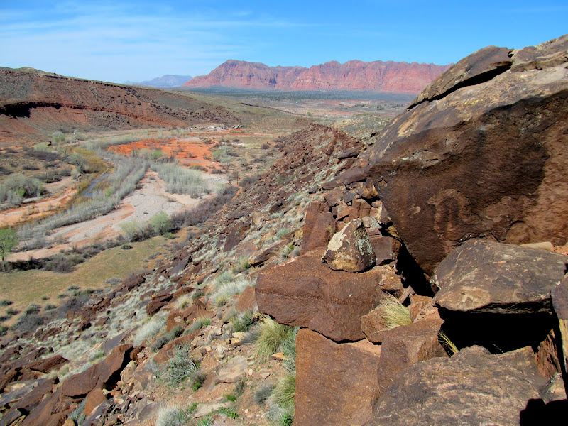
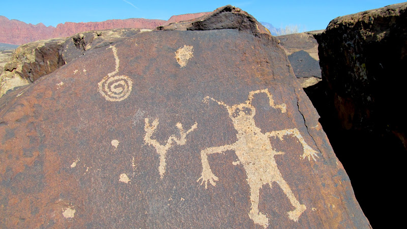
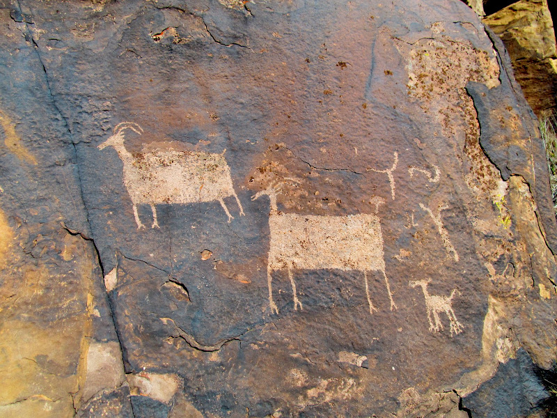
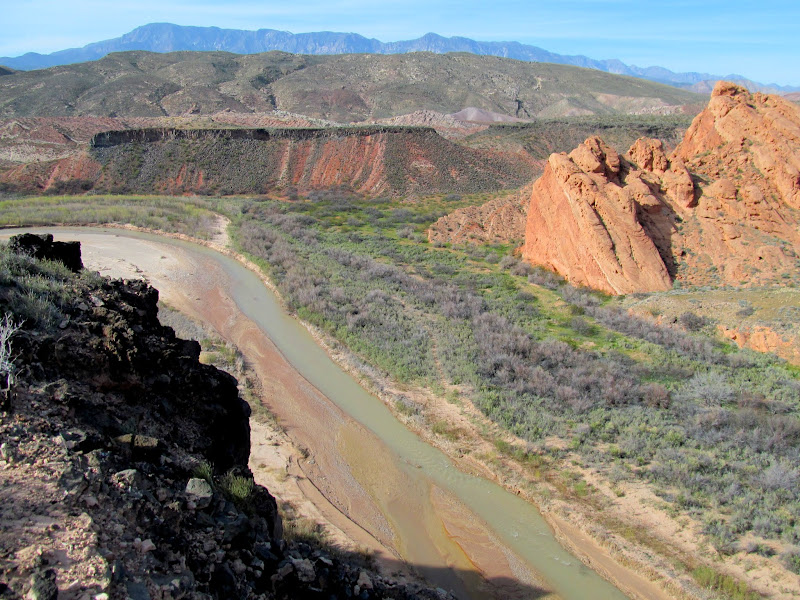
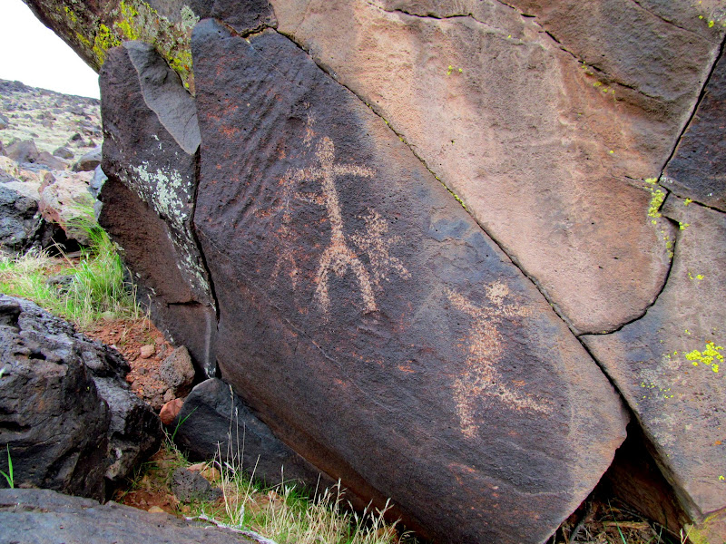
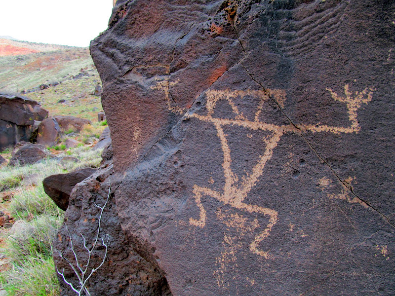
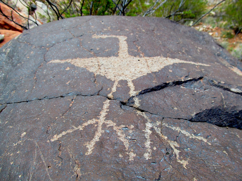
My wife and I spent the first weekend in March in the St. George area hiking, jeeping, and hanging out with friends. We arrived Thursday evening and on Friday morning we went with Sherie to Anasazi Ridge--formally known as Land Hill on the USGS topo map--south of Ivins. It's a well-known area with a ridiculously-overbuilt trail that leads to some pit houses and petroglyphs. I scrambled around the boulders and cracks looking at the rock art while Traci and Sherie relaxed at the top of the hill. We returned to Hurricane but, on the way, made a quick stop at a nice overlook of the Virgin River. That evening we joined our rowdy band of friends at Paul and Pam's house for burgers and drinks.
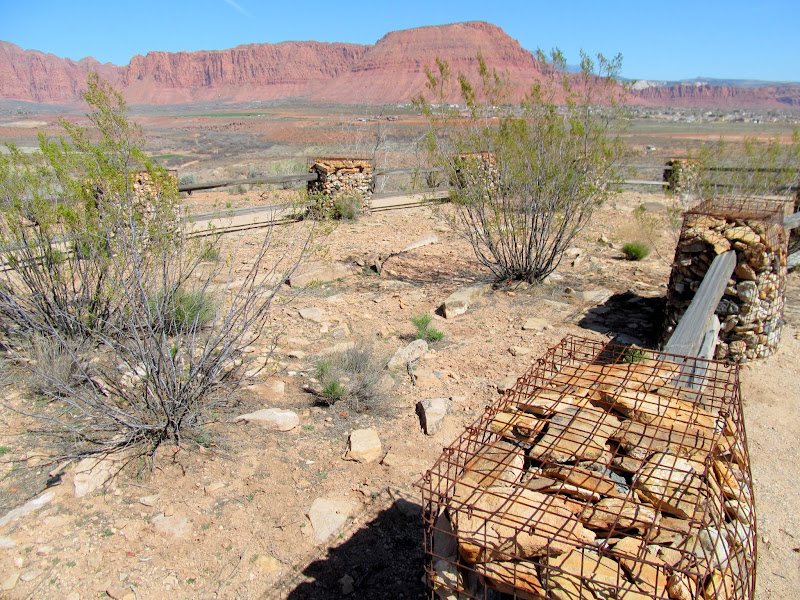
Pit houses on Anasazi Ridge
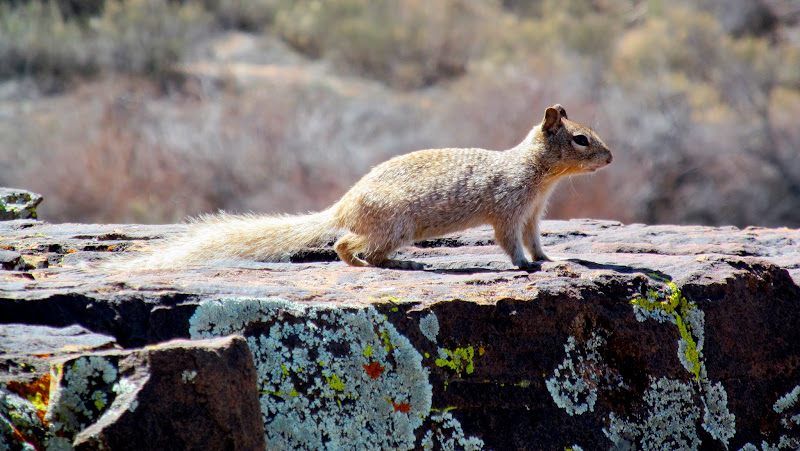
Squirrel!
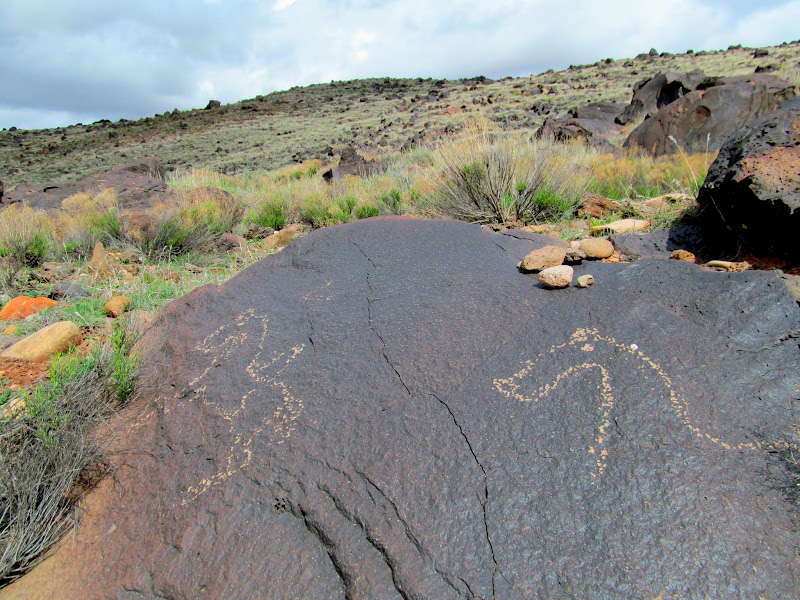
Anasazi Ridge petroglyphs
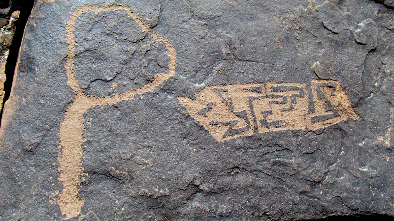
Anasazi Ridge petroglyphs
Anasazi Ridge petroglyphs

Santa Clara River and Red Mountains
Anasazi Ridge petroglyphs
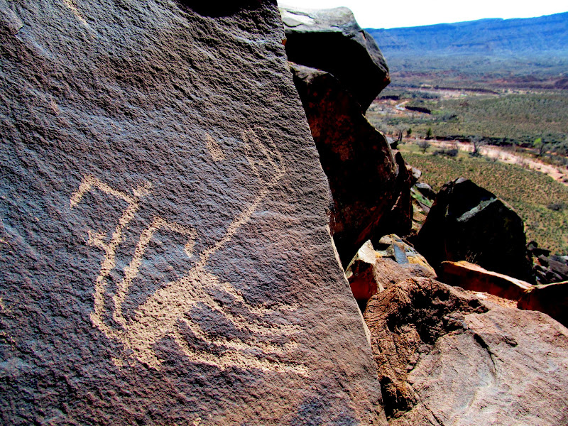
Anasazi Ridge petroglyphs
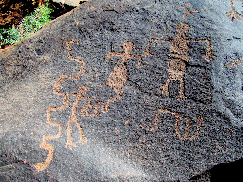
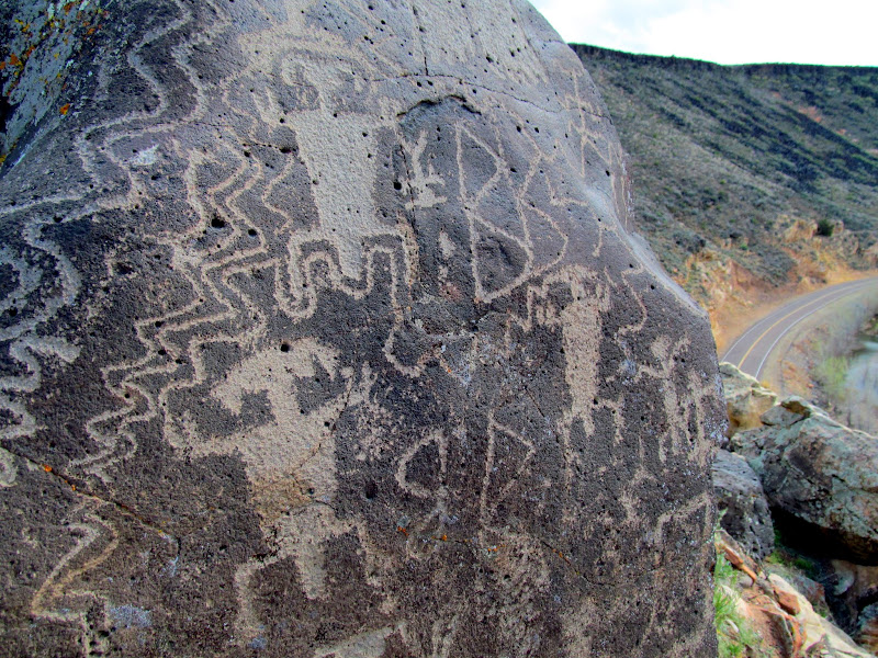
Large bighorn sheep petroglyphs
Virgin River
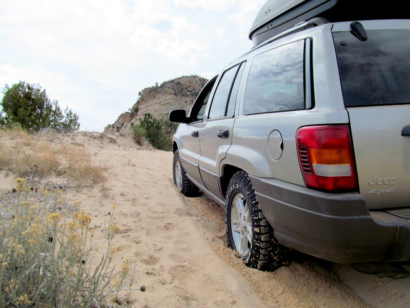
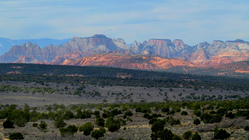
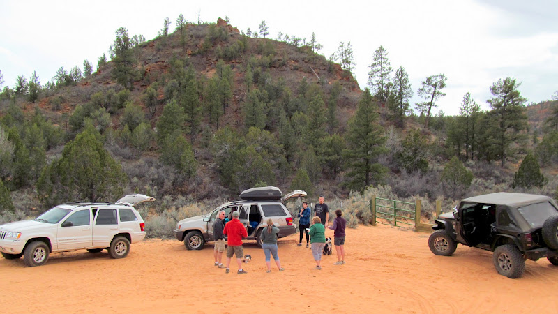
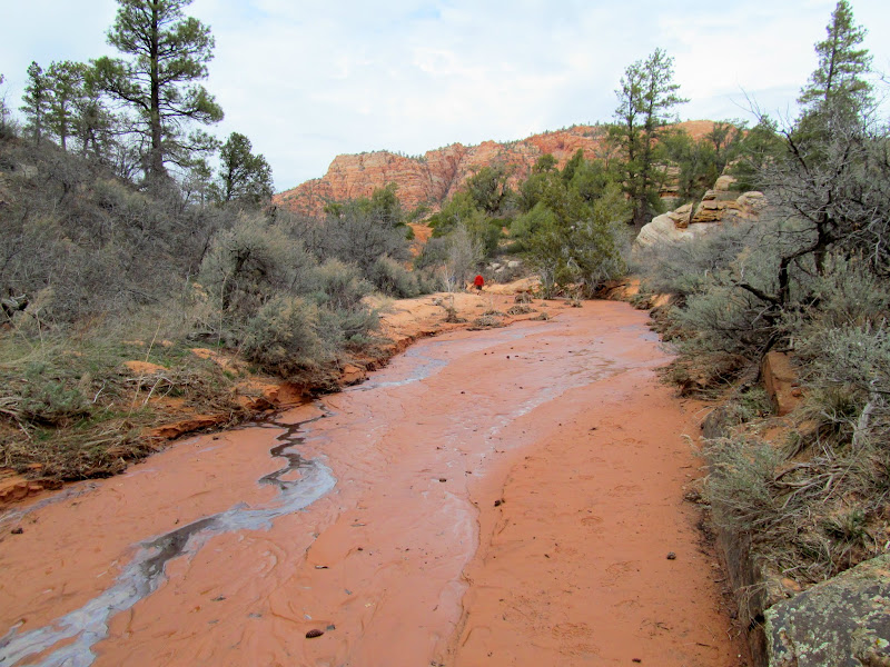
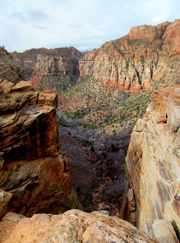
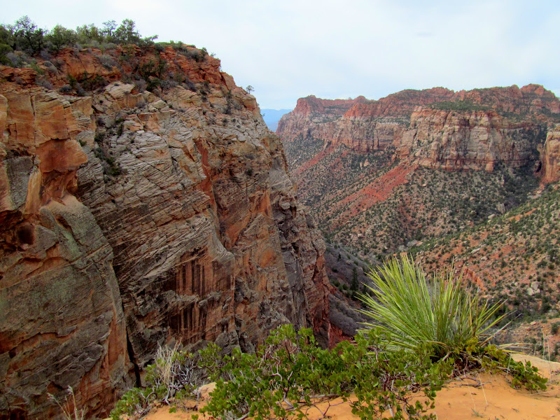
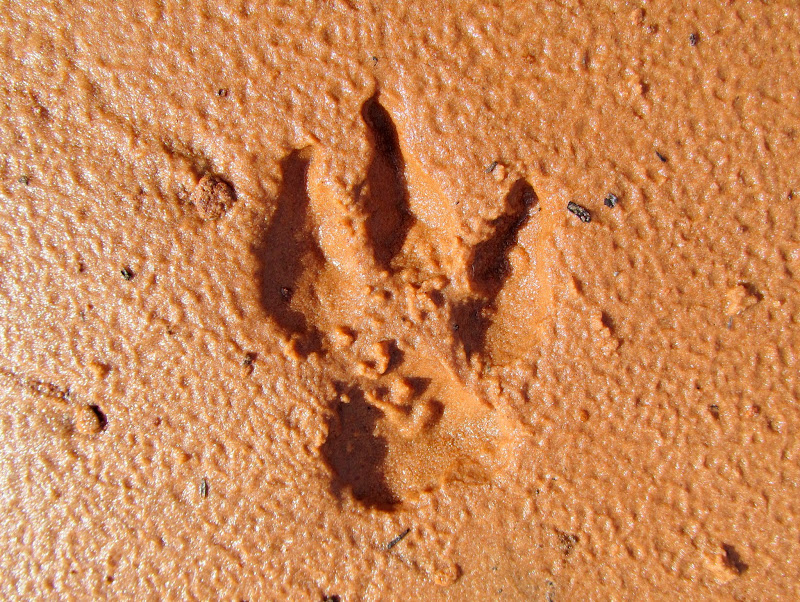
On Saturday we had a larger group and everyone piled into three Jeeps--Paul and I drove our WJs and Ken took his JK--to explore an area northwest of Coral Pink Sand Dunes. We drove past Elephant Butte, stopping briefly for a geocache, and continued north to Shunes Hollow where we parked at the end of the road at the wilderness boundary. My Grand Cherokee got stuck in the soft, deep sand several times and I had to shift into 4WD to get unstuck. I was using the 4WD sparingly, though, because of a noise coming apparently from the front driveshaft. From the parking area we made an easy 1/2-mile walk through a wash to the top of the Shunesburg mail drop. Here, in the late 1800s, mail was raised and lowered over the tall cliffs on a rope (a good history of Shunesburg and the mail drop can be found here). In the wash there were a number of different animal tracks including cougar, bobcat, and a three-toed coyote! We stopped for a couple more geocaches on the way back to the pavement, then regrouped at Eric and Sherie's place for pizza and cocktails.
Bogged down in the sand at Elephant Butte
Zion National Park in the distance
Rock at Elephant Butte

End of the road in Shunes Hollow
Hiking the wash in Shunes Hollow
View into Shunes Creek from the mail drop
Shunes Creek cliffs

Shunes Creek cliffs
Three-toed coyote tracks
Broad Hollow

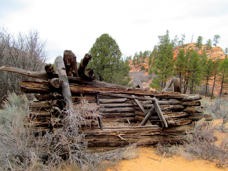
Cabin in Broad Hollow
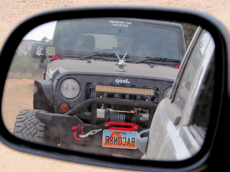
The BACON8R in my mirror
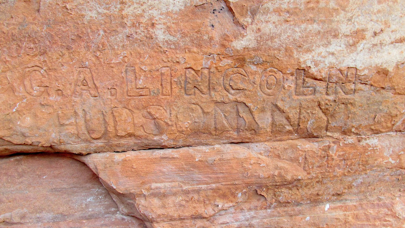
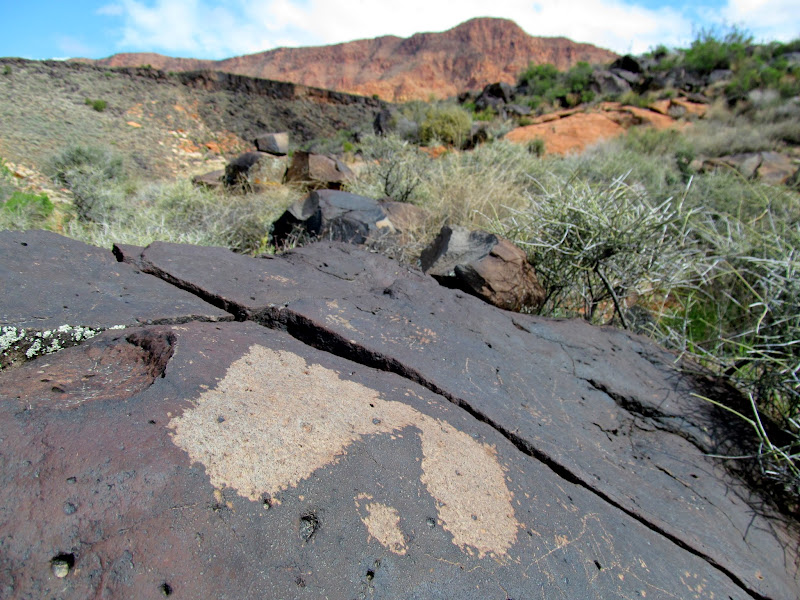
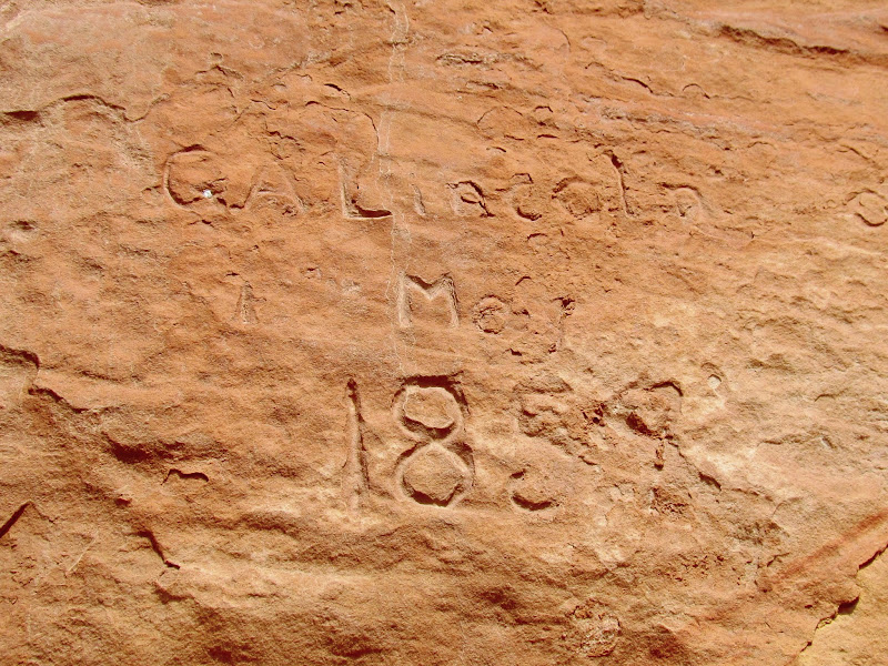
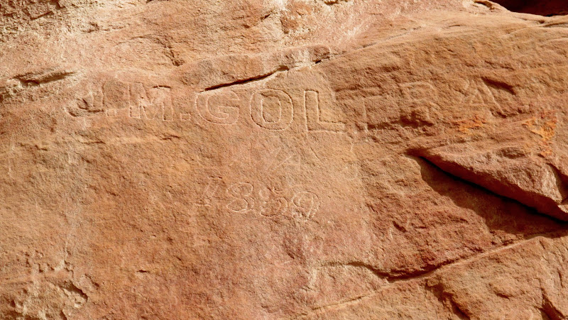
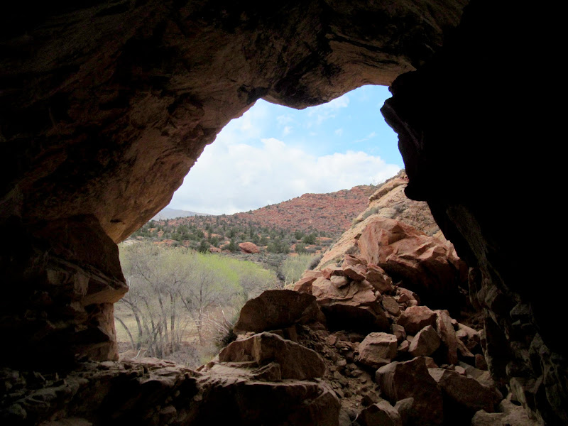
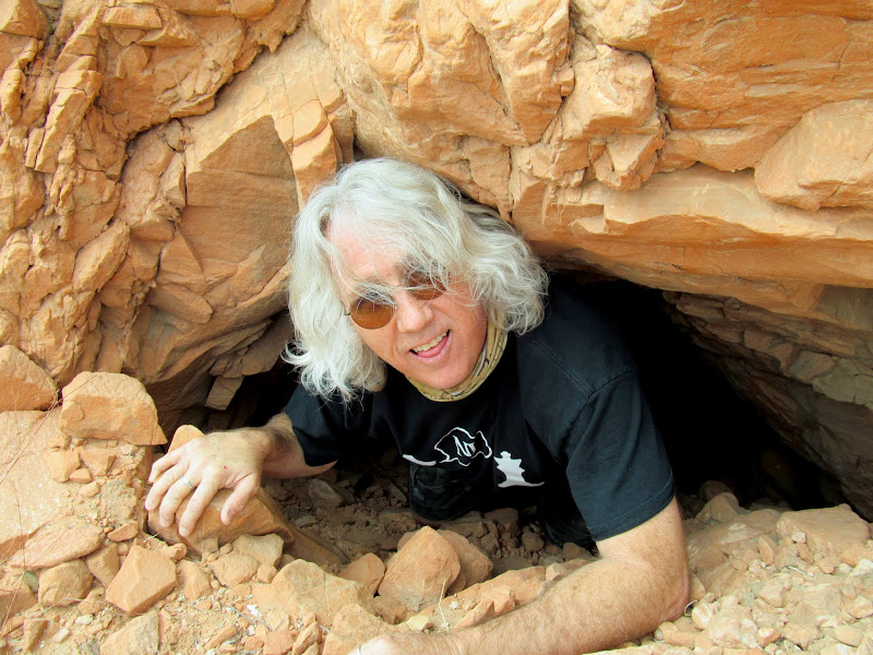
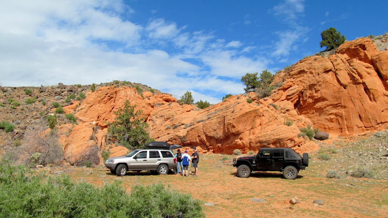
There was no set plan for Sunday, but I searched the internet and sniffed out some rock art along the Santa Clara River near Gunlock that seemed like it would make for an easy outing before having to head home. This time we had my WJ, Sherie's LJ and Ken's JK along for the drive, but we stuck mostly to paved roads. We made short hikes to a couple of places that had petroglyphs on basalt boulders. I was surprised to find a few old inscriptions, the oldest dating back to 1859. While walking along the road looking for inscriptions, Ken and I spotted what looked like a shallow alcove with soot on the ceiling. It was a sketchy climb up to it, and we found that it was actually an entrance to a short tunnel blasted through the sandstone. We followed it to the other end where it emerged, mostly buried, above the road. Later we surmised that it may have been an old irrigation tunnel--parts of a canal are visible in satellite imagery immediately downstream of the tunnel.
Santa Clara River petroglyphs
Santa Clara River petroglyphs
Horse petroglyphs
Rose Young, Jan. ??, 1913

G.A. Lincoln, Hudson, NY, 1859
Our Jeeps parked along the highway

Santa Clara River petroglyphs
Santa Clara River petroglyphs
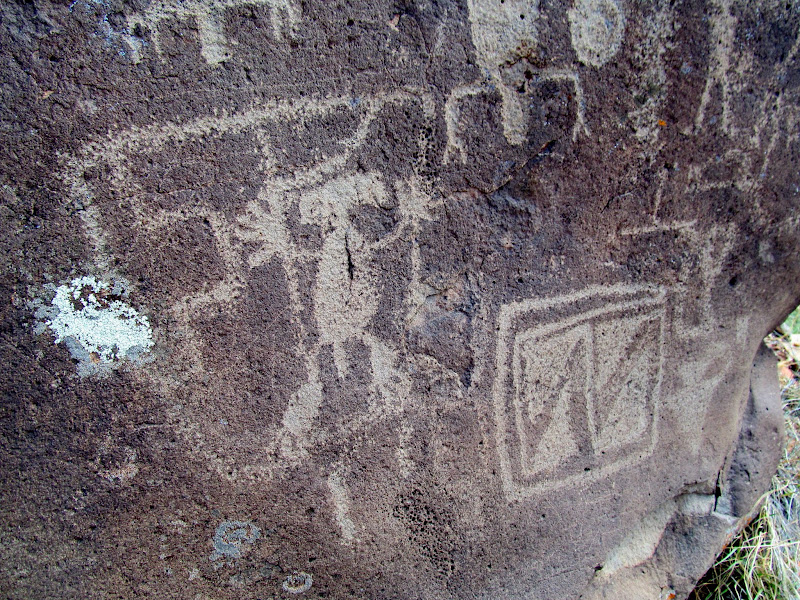
Santa Clara River petroglyphs
Footprint petroglyphs
Another G.A. Lincoln inscription from May 1859
J.M. Goltra 1859
View out of a tunnel
Ken on the other side of the tunnel
We found a spot to eat lunch, then headed back to town where Traci and I packed the Jeep and started the drive home. Parts of the drive were pretty harrowing. A storm was just moving in, and before we reached Cedar City it began to snow. The roads were snowy or slushy for almost the whole rest of the drive, and after darkness fell we slowed to a crawl up Salina Canyon in white-out conditions. Finally, near Fremont Junction, we entered the rain shadow of the Wasatch Plateau and had dry roads for the rest of the drive home where our kids and doggies were eagerly waiting for us. As is almost always the case, it was difficult making the transition from warm, sunny weather to cold and snow.
Lunch spot
Snowy drive home on I-15

Warp speed on I-70 in Salina Canyon
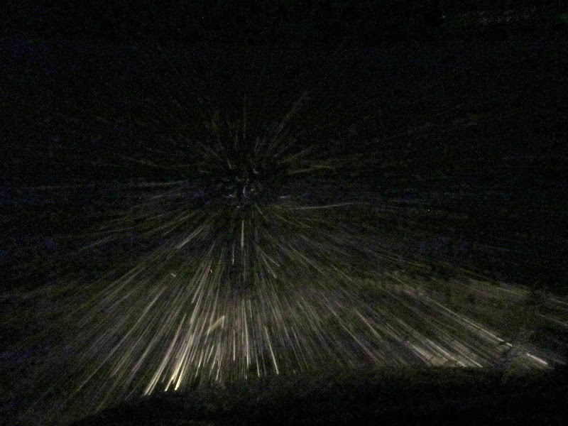
Photo Gallery: Southern Utah, March 2016
Pit houses on Anasazi Ridge
Squirrel!
Anasazi Ridge petroglyphs
Anasazi Ridge petroglyphs
Anasazi Ridge petroglyphs
Santa Clara River and Red Mountains
Anasazi Ridge petroglyphs
Anasazi Ridge petroglyphs
Large bighorn sheep petroglyphs
Virgin River
On Saturday we had a larger group and everyone piled into three Jeeps--Paul and I drove our WJs and Ken took his JK--to explore an area northwest of Coral Pink Sand Dunes. We drove past Elephant Butte, stopping briefly for a geocache, and continued north to Shunes Hollow where we parked at the end of the road at the wilderness boundary. My Grand Cherokee got stuck in the soft, deep sand several times and I had to shift into 4WD to get unstuck. I was using the 4WD sparingly, though, because of a noise coming apparently from the front driveshaft. From the parking area we made an easy 1/2-mile walk through a wash to the top of the Shunesburg mail drop. Here, in the late 1800s, mail was raised and lowered over the tall cliffs on a rope (a good history of Shunesburg and the mail drop can be found here). In the wash there were a number of different animal tracks including cougar, bobcat, and a three-toed coyote! We stopped for a couple more geocaches on the way back to the pavement, then regrouped at Eric and Sherie's place for pizza and cocktails.
Bogged down in the sand at Elephant Butte
Zion National Park in the distance
Rock at Elephant Butte
End of the road in Shunes Hollow
Hiking the wash in Shunes Hollow
View into Shunes Creek from the mail drop
Shunes Creek cliffs
Shunes Creek cliffs
Three-toed coyote tracks
Broad Hollow
Cabin in Broad Hollow
The BACON8R in my mirror
There was no set plan for Sunday, but I searched the internet and sniffed out some rock art along the Santa Clara River near Gunlock that seemed like it would make for an easy outing before having to head home. This time we had my WJ, Sherie's LJ and Ken's JK along for the drive, but we stuck mostly to paved roads. We made short hikes to a couple of places that had petroglyphs on basalt boulders. I was surprised to find a few old inscriptions, the oldest dating back to 1859. While walking along the road looking for inscriptions, Ken and I spotted what looked like a shallow alcove with soot on the ceiling. It was a sketchy climb up to it, and we found that it was actually an entrance to a short tunnel blasted through the sandstone. We followed it to the other end where it emerged, mostly buried, above the road. Later we surmised that it may have been an old irrigation tunnel--parts of a canal are visible in satellite imagery immediately downstream of the tunnel.
Santa Clara River petroglyphs
Santa Clara River petroglyphs
Horse petroglyphs
Rose Young, Jan. ??, 1913
G.A. Lincoln, Hudson, NY, 1859
Our Jeeps parked along the highway
Santa Clara River petroglyphs
Santa Clara River petroglyphs
Santa Clara River petroglyphs
Footprint petroglyphs
Another G.A. Lincoln inscription from May 1859
J.M. Goltra 1859
View out of a tunnel
Ken on the other side of the tunnel
We found a spot to eat lunch, then headed back to town where Traci and I packed the Jeep and started the drive home. Parts of the drive were pretty harrowing. A storm was just moving in, and before we reached Cedar City it began to snow. The roads were snowy or slushy for almost the whole rest of the drive, and after darkness fell we slowed to a crawl up Salina Canyon in white-out conditions. Finally, near Fremont Junction, we entered the rain shadow of the Wasatch Plateau and had dry roads for the rest of the drive home where our kids and doggies were eagerly waiting for us. As is almost always the case, it was difficult making the transition from warm, sunny weather to cold and snow.
Lunch spot
Snowy drive home on I-15
Warp speed on I-70 in Salina Canyon
Photo Gallery: Southern Utah, March 2016
