stretch
Member
- Joined
- Dec 16, 2020
- Messages
- 18
From June to October of 2020, myself and a buddy hiked a counterclockwise route from the southern terminus of the ICT to the eastern terminus of the ODT, using the entirety of both trails plus sections of the PNT and PCT to tie them together. The whole trip clocks in at somewhere around 2,800 miles. This is a great route of the northwest that I think we'll see more and more people doing over the coming years.
ICT: A beautiful and rugged route. I really enjoyed this hike, even when I didn't. I loved how remote it felt. This route is not as hard as it's made out to be, but it is on a whole other level from, say, the CDT.
PNT: (upper priest lake area to PCT). Sometimes remote and beautiful, sometimes a lot of road walking. Temps around 100F almost every day when not at altitude. I enjoyed it, but I was also ready to get up into the cascades.
PCT: (3mi south of Canadian border to Bend, OR). The most beautiful, well built long trail I've ever walked on. Stunning, but crowded.
ODT: The Oregon desert is beautiful, the little towns are charming, and the route is remote and at times very adventurous.
Pics (in chronological order):
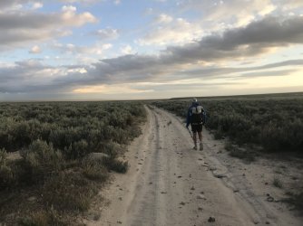
ICT - Owhyee Desert. Vast rolling oceans of sage with massive river canyons cut out of the volcanic rock.
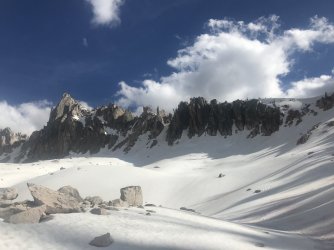
ICT - Sawtooths. I took an alpine lakes alternate route through the Sawtooths in lieu of following the ICT. Lots of snow, lakes, and beautiful high passes.
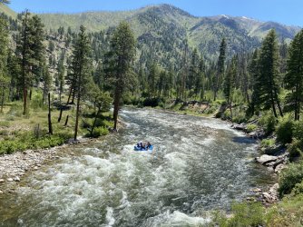
ICT - Frank Church River of No Return Wilderness. Middle fork of the Salmon River. Named for the salmon that get here by swimming upstream all the way from the Pacific.
ICT: Stateline Trail. A beautiful section of trail that follows the crest of the Bitterroot Mountains on the Montana/Idaho border.
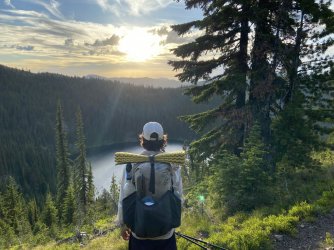
ICT- Lake Pend O'Reille. So deep they used to test submarines here.
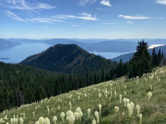
ICT - Idaho Panhandle. The old growth cedar forests in the northern part of the state were incredible. Miles and miles of gigantic old trees.
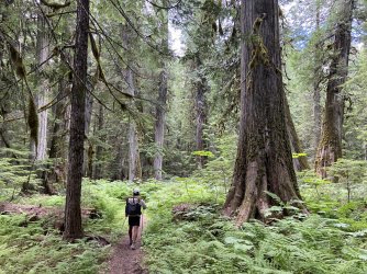
PNT: Just after meeting up with the PNT and heading west.
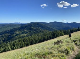
PNT: Okanogan Highlands. Dry, hot, but very pretty. An interesting change of pace after leaving the much wetter and higher purcells and selkirks.
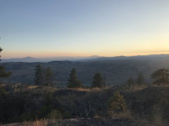
PNT or PCT: This is either the Pasayten or north cascades. Brisk morning at a great campsite high on a saddle.
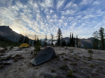
PCT: North Cascades. North Cascades sunrise.
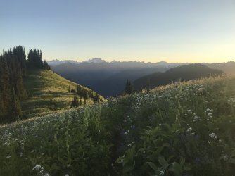
PCT: Glacier Peaks. Glacier Peaks sunrise.
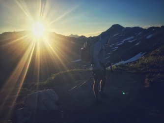
PCT: Somewhere in Washington. heaven = i get to stay, but everyone else has to leave.
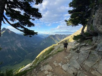
PCT: Three Sisters Wilderness, Oregon. This was the night that a large windstorm fueled wildfires and destroyed several small Oregon towns. Probably 40 miles or so north of this spot.
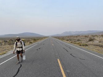
ODT - One of the longer water carries. Paved road walking on this route is blessedly rare, and always short-lived.
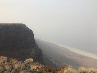
ODT- The Alvord Rim. Smoke obscured our view of the salt lake below, but it was still a beautiful spot.
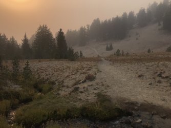
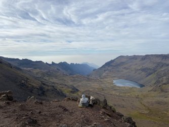
ODT- We walked up out of the desert into aspens, a high lake, and basin vistas.
ODT- Navigating our way up and over the rocky hillside seen in the background.
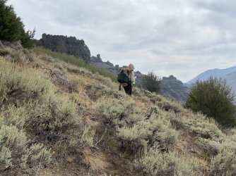
ODT- Alvord Desert. I love waking up in the desert.
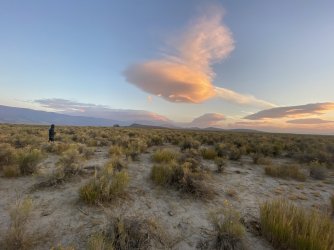
ODT - They call this the playa. Fast, easy, beautiful hiking.
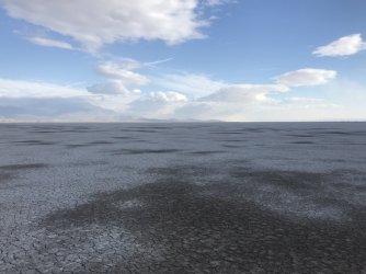
ODT- the Pueblos. All off-trail, all beautiful.
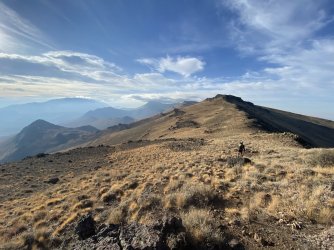
ODT: NV/OR border. We crossed the plain below to the mountains on the far side.
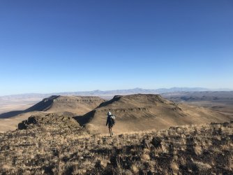
ODT- Owhyee River Canyon. Beautiful hiking. Often difficult and slow, rarely as wide open as the pic below would suggest.
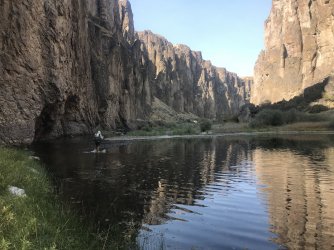
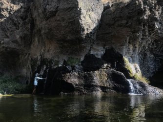
ODT: Owhyee River Canyon. The springs would at times gush out of the canyon walls. Some warm, some cold.
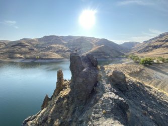
ODT: Eastern Terminus. The end!
ICT: A beautiful and rugged route. I really enjoyed this hike, even when I didn't. I loved how remote it felt. This route is not as hard as it's made out to be, but it is on a whole other level from, say, the CDT.
PNT: (upper priest lake area to PCT). Sometimes remote and beautiful, sometimes a lot of road walking. Temps around 100F almost every day when not at altitude. I enjoyed it, but I was also ready to get up into the cascades.
PCT: (3mi south of Canadian border to Bend, OR). The most beautiful, well built long trail I've ever walked on. Stunning, but crowded.
ODT: The Oregon desert is beautiful, the little towns are charming, and the route is remote and at times very adventurous.
Pics (in chronological order):
ICT - Owhyee Desert. Vast rolling oceans of sage with massive river canyons cut out of the volcanic rock.

ICT - Sawtooths. I took an alpine lakes alternate route through the Sawtooths in lieu of following the ICT. Lots of snow, lakes, and beautiful high passes.

ICT - Frank Church River of No Return Wilderness. Middle fork of the Salmon River. Named for the salmon that get here by swimming upstream all the way from the Pacific.

ICT: Stateline Trail. A beautiful section of trail that follows the crest of the Bitterroot Mountains on the Montana/Idaho border.

ICT- Lake Pend O'Reille. So deep they used to test submarines here.

ICT - Idaho Panhandle. The old growth cedar forests in the northern part of the state were incredible. Miles and miles of gigantic old trees.

PNT: Just after meeting up with the PNT and heading west.

PNT: Okanogan Highlands. Dry, hot, but very pretty. An interesting change of pace after leaving the much wetter and higher purcells and selkirks.

PNT or PCT: This is either the Pasayten or north cascades. Brisk morning at a great campsite high on a saddle.

PCT: North Cascades. North Cascades sunrise.

PCT: Glacier Peaks. Glacier Peaks sunrise.

PCT: Somewhere in Washington. heaven = i get to stay, but everyone else has to leave.

PCT: Three Sisters Wilderness, Oregon. This was the night that a large windstorm fueled wildfires and destroyed several small Oregon towns. Probably 40 miles or so north of this spot.

ODT - One of the longer water carries. Paved road walking on this route is blessedly rare, and always short-lived.

ODT- The Alvord Rim. Smoke obscured our view of the salt lake below, but it was still a beautiful spot.

ODT- We walked up out of the desert into aspens, a high lake, and basin vistas.

ODT- Navigating our way up and over the rocky hillside seen in the background.

ODT- Alvord Desert. I love waking up in the desert.

ODT - They call this the playa. Fast, easy, beautiful hiking.

ODT- the Pueblos. All off-trail, all beautiful.

ODT: NV/OR border. We crossed the plain below to the mountains on the far side.

ODT- Owhyee River Canyon. Beautiful hiking. Often difficult and slow, rarely as wide open as the pic below would suggest.

ODT: Owhyee River Canyon. The springs would at times gush out of the canyon walls. Some warm, some cold.

ODT: Eastern Terminus. The end!

Last edited:

