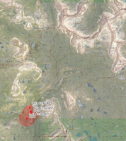
Uintas Conditions 2018

Certainly sad about the drier year it's been and gets me more concerned that this will trend more normal as time goes on with only the occasional banner year for precipitation and snowfall to bring reservoirs back up. Silver lining though is that the mosquitos will fade out quicker and as others have alluded to, many areas that have been known to be muddy or marshy all through the year will be easier to hike through.
 
Hell Hole Lake and the trail in there was extremely dry. Areas you could tell on a normal year would be muddy bogs were completely dry. Even the river crossing was low making it a breeze compared to my failed attempt to get to Hell Hole Lake when I crossed the river last year. Bonus was there were really no mosquitoes. Its great when you do not have to slather in bug spray. I think I saw one or two the whole weekend we were up there. Plenty of water running in the streams up there, but you could tell the ground is bone dry. I'd keep fires in the Western Uintas which does not have a no fire order currently small and manageable. But if this dry spell continues, I expect that will change.

Looks like the Ashley National Forest currently has a no burn order in place. I have not been out to the east side this year. FYI for anyone heading there here is the order. The Wasatch Cache side is currently only under the permanent restrictions of 1/4 mile from lakes in the usual areas.

https://www.fs.usda.gov/Internet/FSE_DOCUMENTS/fseprd585549.pdf
 
I spent last weekend backpacking along the duck lake, long lake trail. Drier conditions up there than I can remember ever being. It got cloudy each day and we say 6 or 7 raindrops, but that was about it. Nice not having any mosquitoes though.
 
I spent 4 days in Naturalist and Middle Basins. So very dry! I couldn't believe how many people disregard the fire restrictions! Half the groups I saw had fires. Crazy considering how dry it is. Are there ever rangers up there enforcing? There where two groups that left fires still smoking that I put out properly. With the number of recently used fire rings I saw is this just common practice now? Given we have a few wet years, I think the high wilderness ban could be lifted for a few years as there is an abundance of new dead fall, at least in the areas I stayed.

Sent from my SM-G930V using Tapatalk

If there's one thing I extra appreciate about the Cloud Peak Wilderness...it's no fires above 9200ft (which is most of the wilderness) and the use a fire blanket beneath the fire below that. Of course wilderness rules didn't stop the assholes who drove their ATV on a non-motorized trail and another half mile into the wilderness :mad:
 
Trying to decide between the Swell, and Uinta's this weekend. How Smoky is it looking up there? Would the Murdock fire make the middle basin kind of miserable?
 
I was up on the Bear River Smith Fork trail on Saturday. It varied from nice blue skies to really bad to the point of a jacking up my lungs a bit. We had those strong south winds and it was bringing in smoke from the fire down in Spanish Fork Canyon. If the winds are not from the south I think you'd be fine. In fact, I'm thinking about going back again tomorrow.... the weather is pretty much perfect for the Uintas.

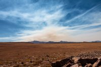
This is when the smoke stayed off to the west. You can see a bank of of it way off in the distance. Later on in the day it got pretty smokey locally.

DSC04718.jpg

I could actually see the smoke rising from the fire in SF Canyon when the south winds kicked up about midday...
DSC04739.jpg
 
Last edited:
The smoke isn't moving in until late in the afternoon. Most of the day is clear and then around 4 or 5 clouds and smoke will move in. I say go for it!
 
I was up on the Bear River Smith Fork trail on Saturday. It varied from nice blue skies to really bad to the point of a jacking up my lungs a bit. We had those strong south winds and it was bringing in smoke from the fire down in AF Canyon. If the winds are not from the south I think you'd be fine. In fact, I'm thinking about going back again tomorrow.... the weather is pretty much perfect for the Uintas.

This is when the smoke stayed off to the west. You can see a bank of of it way off in the distance. Later on in the day it got pretty smokey locally.

View attachment 69369

I could actually see the smoke rising from the fire in AF Canyon when the south winds kicked up about midday...
View attachment 69370
I think you mean the fires in Spanish Fork canyon, no? Pole Creek and Bald Mountain.
 
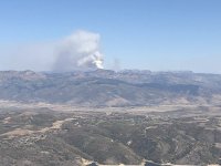
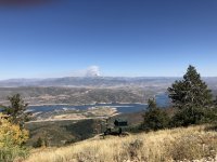
Eyes wide open. Beck is reporting in new plumes right now in the Western Uintas she can see from her hike in Deer Valley. I could find no mention of anything new or active on the MLH just now at the Forest site or Utah Fire Info. Check before you drive.
IMG_2153.jpeg

IMG_2154.jpeg
 
Last edited:
Eyes wide open. Beck is reporting in new plumes in the Western Uintas she can see from her hike in Deer Valley. I could find no mention of anything new or active on the MLH just now at the Forest site or Utah Fire Info. Check before you drive.
View attachment 69451

View attachment 69452
Oh no! Not another new fire.

Great info and photos though. Thanks for sharing that. To Beck as well.
 
I was up on the Bear River Smith Fork trail on Saturday. It varied from nice blue skies to really bad to the point of a jacking up my lungs a bit. We had those strong south winds and it was bringing in smoke from the fire down in Spanish Fork Canyon. If the winds are not from the south I think you'd be fine. In fact, I'm thinking about going back again tomorrow.... the weather is pretty much perfect for the Uintas.

This is when the smoke stayed off to the west. You can see a bank of of it way off in the distance. Later on in the day it got pretty smokey locally.

View attachment 69369

I could actually see the smoke rising from the fire in SF Canyon when the south winds kicked up about midday...
View attachment 69370
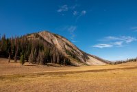
Hey, that big meadow looks cool. Above treeline? Do you have coords?
 
Hey, that big meadow looks cool. Above treeline? Do you have coords?

Heh! I knew you would notice it. When I got up there it totally reminded me of the Leidy Peak-North Pole Pass stretch. I thought about your fondness for the high altitude tundra. I’m working on a trip report but basically head south on the ridge line from Cataract Basin Pass on the Bear River Smith Fork Trail. Once on top it’s huge and has great views of many prominent peaks from Hayden/ A1 to the Cathedral, the Beulahs, to Tokawanna and even Red Knob. Views of the various drainages in the area. I wanted more time. Would be good access to the ridge line leading up to Dead Horse lake for those mountaineeringly inclined. If one were to go, BRING WATER. There are zero water sources unless you drop down into Cataract Basin/West Fork Blacks Fork.


Sent from my iPhone using Tapatalk
 
Last edited:
Back
Top