Navigation
Install the app
How to install the app on iOS
Follow along with the video below to see how to install our site as a web app on your home screen.
Note: This feature may not be available in some browsers.
More options
Style variation
You are using an out of date browser. It may not display this or other websites correctly.
You should upgrade or use an alternative browser.
You should upgrade or use an alternative browser.
Guess the spot
- Thread starter Backcountry Post
- Start date
mike_offerman
Member
- Joined
- Feb 8, 2012
- Messages
- 566
Less than 58 summits! The photo is looking directly at the North face. I would guess that 99.5% of the hikers don't it see straight on as they are coming up the West ridge.
mike_offerman
Member
- Joined
- Feb 8, 2012
- Messages
- 566
If you were super rich, you could have bought this peak and 10's of thousands of acres around it a few years ago when it was for sale.
- Joined
- Jun 11, 2017
- Messages
- 4,612
Culebra?
mike_offerman
Member
- Joined
- Feb 8, 2012
- Messages
- 566
Correct! a Colorado 14er that is part of the 83k acres Cielo Vista Ranch that sold a few years ago for $105 million!Culebra?
- Joined
- Jun 11, 2017
- Messages
- 4,612

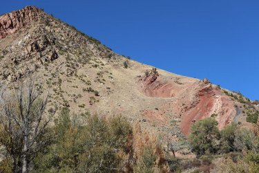
Some hints: The super red areas are from burning coal seams. When it rains, fumeroles can be seen coming out. A lot of things in the nearby town are named after this feature, which runs for miles. A few years ago one of its many coal seams caught some vegetation on fire and burned part of a nearby town (27 homes IIRC). It's technically the geologic dividing point between the Rockies and the Colorado Plateau.
Name the feature which this is a small portion of.
- Joined
- May 31, 2015
- Messages
- 3,329
Grand Hogback? I went on quite a Google excursion using those hints you gave. Seems like there's a decent amount of stuff with "Hogback" in its name around New Castle, CO.View attachment 100082
Some hints: The super red areas are from burning coal seams. When it rains, fumeroles can be seen coming out. A lot of things in the nearby town are named after this feature, which runs for miles. A few years ago one of its many coal seams caught some vegetation on fire and burned part of a nearby town (27 homes IIRC). It's technically the geologic dividing point between the Rockies and the Colorado Plateau.
Name the feature which this is a small portion of.
- Joined
- Jun 11, 2017
- Messages
- 4,612
It’s all yours. I was actually looking for Burning Mountain, which is part of the Grand Hogback. That particular photo is right above the elementary school in New Castle, so you were right on. Nice job.Grand Hogback? I went on quite a Google excursion using those hints you gave. Seems like there's a decent amount of stuff with "Hogback" in its name around New Castle, CO.
ETA The town that lost a number of houses is Glenwood Springs Colorado. The name of the fire was the Coal Seam Fire.
- Joined
- Jun 11, 2017
- Messages
- 4,612
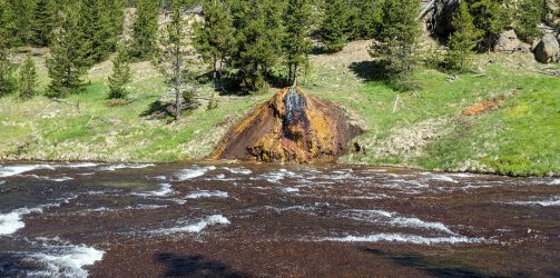
Is this along the Firehole?
- Joined
- May 31, 2015
- Messages
- 3,329
No, but the river this feature is on does have a confluence with the Firehole. This is a roadside spot that probably 99.999% of visitors drive by unknowingly. It's named and easily findable online though.Is this along the Firehole?
- Joined
- Jun 11, 2017
- Messages
- 4,612
Along the Gardner?
- Joined
- May 31, 2015
- Messages
- 3,329
Nope but that's the right first letter for this river.Along the Gardner?
- Joined
- Jun 11, 2017
- Messages
- 4,612
LOL Is it on the Gallatin? Maybe the other side of the park, or maybe not even in the park?
- Joined
- May 31, 2015
- Messages
- 3,329
In the park! Firehole has been your closest guess. There's also a very well known and heavily visited waterfall on the river. This is upstream of the waterfall.LOL Is it on the Gallatin? Maybe the other side of the park, or maybe not even in the park?
- Joined
- Dec 11, 2015
- Messages
- 2,094
Chocolate Pots along the Gibbon.
- Joined
- May 31, 2015
- Messages
- 3,329
Have at it!Chocolate Pots along the Gibbon.
- Joined
- Dec 11, 2015
- Messages
- 2,094
Bob Wire
Member
- Joined
- Dec 21, 2013
- Messages
- 304
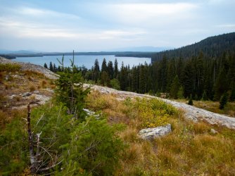
Heart Lake YNP
- Joined
- Dec 11, 2015
- Messages
- 2,094
Nope. Right state though.
Don't like ads? Become a BCP Supporting Member and kiss them all goodbye. Click here for more info.


