- Joined
- Jun 11, 2017
- Messages
- 4,612
McDonald Creek?
Follow along with the video below to see how to install our site as a web app on your home screen.
Note: This feature may not be available in some browsers.
As it turns out, places that don't exist receive very little visitation.The one near Fremont Peak probably never gets any visitors would be my guess.
Wow that was a stab in the dark. I've never even been on that creek but thought it resembled some photos I've seen and some of the other creeks in the area that I have actually seen. Haha.@Jackson You're up!

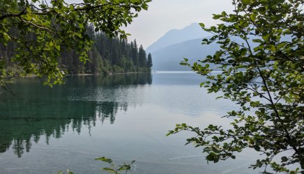
You're in the right park! This is not in the same area as Two Medicine Lake though.I'll start with Two Medicine Lake.
You're on the right side of the divide now, but still a little ways off.Well then I'll go with Lake McDonald. Not the one near Fremont Peak.
Proof that it's good to trust your gut! I believe it was right around 48.94271, -114.34604. You're up.Alright, I'll go with my original impression, Kintla Lake. I couldn't reconcile that sharp-looking left turn to the shoreline but figure it's smaller than it appears in the photo. Definitely looks west-side.
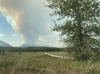
Not super far. Probably went about three miles up the trail then turned around. I kind of wanted to get up to the backcountry camp site and poke around to see the old remnants of the oil drilling site, but the group (my wife and I) instead decided to turn around early and go swimming near where that photo was taken, then spend some time checking out the historic homesteads in the Big Prairie area. Glad we went that day because the Hay Creek fire flared up in the late afternoon as we were driving out. Covered the whole place in smoke. Not sure how the fire is now, but they were warning on Saturday that they may have to evacuate some of the residents.@Jackson How far up did you hike?

Don't like ads? Become a BCP Supporting Member and kiss them all goodbye. Click here for more info.
