Navigation
Install the app
How to install the app on iOS
Follow along with the video below to see how to install our site as a web app on your home screen.
Note: This feature may not be available in some browsers.
More options
Style variation
You are using an out of date browser. It may not display this or other websites correctly.
You should upgrade or use an alternative browser.
You should upgrade or use an alternative browser.
Guess the spot: Utah Edition
- Thread starter Ben
- Start date
regehr
Member
- Joined
- Mar 28, 2012
- Messages
- 2,457
yeah, that looks like the black box down there. but I've been up on this reef in many spots and the colors aren't matching up for me, perhaps just a camera/screen issue.I think many of the guessers are out on summer trips or vacations
@SteveR is the San Rafael in view?
I have never been up on top of the Reef there, but it feels like this is north of Black Dragon.
SteveR
Member
- Joined
- Sep 22, 2016
- Messages
- 1,026
I think many of the guessers are out on summer trips or vacations
@SteveR is the San Rafael in view?
I have never been up on top of the Reef there, but it feels like this is north of Black Dragon.
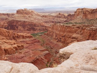
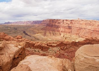
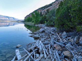
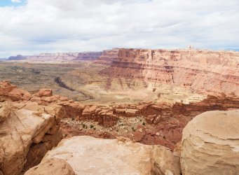
Yes @Ugly, you are up next! This hike started by ascending northwest from the Black Dragon access, topping out at an overlook of the San Rafael river.yeah, that looks like the black box down there. but I've been up on this reef in many spots and the colors aren't matching up for me, perhaps just a camera/screen issue.
@regehr I had a look at the RAW files and yes, the white balance as set in camera is not correct (maybe fooled by the bright but overcast sky), hence the overly red cast. Revised version with Camera Raw setting the white balance.
- Joined
- Apr 20, 2013
- Messages
- 1,509
Udink
Still right here.
- Joined
- Jan 17, 2012
- Messages
- 1,742
Udink
Still right here.
- Joined
- Jan 17, 2012
- Messages
- 1,742
Not so W! A few weeks ago I hiked around the southeast side of Joe's Valley Reservoir hoping to make it to the cliffs on the south side of the dam, but the terrain got too rough and I got cliffed out. But I had already been to those cliffs on an earlier trip via canoe so I probably didn't miss much.WAG: Joe's
You're up, @regehr!
- Joined
- Apr 20, 2013
- Messages
- 1,509
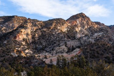
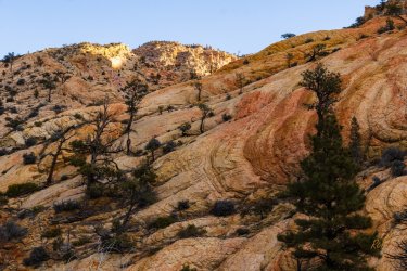
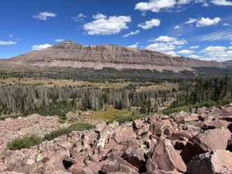
ok I need this one to go sort of quickly since I'm heading out of town on Friday! what's the peak or else what drainage am I standing in?
Haha, I am also trying to get out of town tomorrow... but chances are now 30/70.
This looks like you just came over Red Knob Pass. Maybe it is more bouldery than I remember.
I believe those are the ramparts of Mt Lovenia.
- Joined
- Apr 20, 2013
- Messages
- 1,509
Thus the bigger boulders than what I remember... but it was years ago anyways.This is not right near the pass but maybe a couple miles over.
Good luck getting away!
Well, the percentage split is now 99/1. Taking one of my sons and nephew to hopefully see some of the pre-perseids. They peak Monday.
Uintas bound, somewhere easy and front-country, with a few neighbors, but still better than the heat. I know a few places we should be able to go incognito amongst the hordes.
Let me find something to post.
Bob Wire
Member
- Joined
- Dec 21, 2013
- Messages
- 304
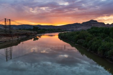
Price river?Maybe this is easy?
Name the place...
If anyone gets it right, after lunch today, go ahead. I am offline until at least Sunday afternoon.
View attachment 133294
- Joined
- Jun 11, 2017
- Messages
- 4,608
Dewey
- Joined
- Apr 20, 2013
- Messages
- 1,509
Price river?
Not Price, much larger.
Dewey
Yes, you are right. That's the remains of the old Dewey Suspension bridge.
- Joined
- Jun 11, 2017
- Messages
- 4,608
Don't like ads? Become a BCP Supporting Member and kiss them all goodbye. Click here for more info.

