Uinta Highline Trail Part II Planning

Perry

Formerly Cuberant
.
Joined
Aug 8, 2016
Messages
2,072
So I'm starting some initial planning for my brother and I to finish the Highline trail. Got a couple of questions for all you experts out there.

Given our unusually heavy snow pack this year do you think we'll have problems over the high passes if we were to do our trip on the last week of July, first week of August? Also I'm assuming bugs will likely be a real issue this year with all of the standing water that will be around.

Moved the second question to a separate post "Chain Lakes / Lake Atwood Trail to Painters Basin... What's It Like?"

https://backcountrypost.com/threads...painters-basin-whats-it-like.6616/#post-78745

Thoughts?
 
Last edited:
It all depends how spring goes. It could melt really fast and be fine, or it could snow some more and Dead Horse will be snow covered all year.
 
It all depends how spring goes. It could melt really fast and be fine, or it could snow some more and Dead Horse will be snow covered all year.

Yeah I guess I can take the micro spikes if it doesn't look good.
 
@Parma is exactly right, but my bet is that regardless of what happens this spring, there is enough up there now that July could be tricky on passes like Dead Horse. If it's really bad, microspikes might not make it doable. Unless you have gigantic juevos.
 
@Parma is exactly right, but my bet is that regardless of what happens this spring, there is enough up there now that July could be tricky on passes like Dead Horse. If it's really bad, microspikes might not make it doable. Unless you have gigantic juevos.

Has anyone been over Dead Horse Pass with snow on it? What was it like? Any advice?

It looks like there are two alternate routes, one, over Cleveland Pass that adds 8.7 miles. The other out West Fork Blacks Fork and back on East Fork Bear River past Priord Lake to Head of Rock Creek net difference +13.4 miles. Hrm.
 
Has anyone been over Dead Horse Pass with snow on it? What was it like? Any advice?

I think @Artemus mentioned doing it once when it was scary. Am I remembering right, Art? I did it in August 2005, another pretty good snow year. There was still snow covering the trail in a few places but it was okay. A week or two earlier probably would not have been.

The other out West Fork Blacks Fork and back on East Fork Bear River past Priord Lake to Head of Rock Creek net difference +13.4 miles. Hrm.

If Dead Horse Pass is in bad shape, that old trail over 'Priord Pass' is likely as bad or worse.

I guess if you're really comfy on near vertical snow slopes, you could make it up with spikes. I'll never forget hearing @Dan's story about climbing up the snowy side of Knapsack Col in early July 2012. He was in lightweight hiking shoes, and maybe had microspikes at best, I don't recall anymore. He got to the top of the col and there was a big, vertical cornice. He pounded his trekking poles in one by one and climbed up it. Way bigger balls than I have, that's for sure.
 
I think @Artemus mentioned doing it once when it was scary. Am I remembering right, Art? I did it in August 2005, another pretty good snow year. There was still snow covering the trail in a few places but it was okay. A week or two earlier probably would not have been.


If Dead Horse Pass is in bad shape, that old trail over 'Priord Pass' is likely as bad or worse.

I guess if you're really comfy on near vertical snow slopes, you could make it up with spikes. I'll never forget hearing @Dan's story about climbing up the snowy side of Knapsack Col in early July 2012. He was in lightweight hiking shoes, and maybe had microspikes at best, I don't recall anymore. He got to the top of the col and there was a big, vertical cornice. He pounded his trekking poles in one by one and climbed up it. Way bigger balls than I have, that's for sure.

Holy cow! Yeah that would be *way* out of my comfort zone!
 
Dead Horse with snow is pretty spicy. If it's snow-covered, the best way to attack it is straight uphill, but you better have an ice axe. End of July might be cutting it pretty close. If you've got the flexibility, late August would be ideal for lack of bugs, tstorms, and snow.
 
I think @Artemus mentioned doing it once when it was scary. Am I remembering right, Art? I did it in August 2005, another pretty good snow year. There was still snow covering the trail in a few places but it was okay. A week or two earlier probably would not have been.
.....
If Dead Horse Pass is in bad shape, that old trail over 'Priord Pass' is likely as bad or worse.
Well I've gone up and down Dead Horse Pass it a few times in mostly but not 100% snow. Even the worst time it wasn't too scary. And with an ice axe and crampons it would be relatively safe if you knew how to self arrest. Important Note: When I say not that scary, that is for a climber with high angle experience. Out in the boonies without an axe or much experience I would say it would be ill-advised if that traverse is snow covered. The crux is the crossing near the top from north to south (going up hill) to traverse over the actual col. It is dangerous because you are traversing above cliff bands without much time to self arrest in case of a fall. If you slipped before you traversed you might go for a fast ride into boulders but it would be less dangerous. Sorry for possible TMI but this is important.

And where is this Priord Pass you speak of? I don't know much about Cuberant's alternate route he listed.
 
Well, I've been over the next pass west that I call Amethyst Pass and there is a trip report here about it.
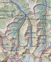
This pass you show with a redline over it is impassable, pun intended. I know of no one that has been over it although I do know of people that have walked that ridge and climbed Yard Peak. I have seen it but many others have been up in the Norice/Priord Basin and probably even have pictures of it here. I would think it would be *much* harder than DHP. There is no trail there.

Does that red line mean you have traversed it and created this as a GPS track?
 
Last edited:
Wait one. I misread the map. Let me look again.

No, that's just how caltopo rendered the trails with the map builder overlay.

Definitely looking like Cleveland Pass to the south will be a better alternative.
 
Also I'm assuming bugs will likely be a real issue this year with all of the standing water that will be around.
You can't let the bugs keep you on the couch! They should be tailing off by August, but you never know...:whistle:
 
You can't let the bugs keep you on the couch! They should be tailing off by August, but you never know...:whistle:

Yeah they won't keep us home but we did the east end last year last week of August/first week of September and the bugs we hardly noticeable. Just a nice thing.
 
Definitely looking like Cleveland Pass to the south will be a better alternative.

Agreed, if it means your goals and point to point location needs. I don't really know your route. If it is the Highline than you can use Cleveland as a bypass to stay on the south side to get to Upper Rock Creek without traversing to the north side of the Uintas divide as the Highline does. Alternatively you can use Cleveland as an escape plan. I think you can see Deadhorse Pass from Red Knob pass or just shortly after you start your descent from Red Knob. If you see too much snow on Deadhorse you can turn around and head down to Cleveland. Just check mileage and plan for that contingency.
 
Yeah they won't keep us home but we did the east end last year last week of August/first week of September and the bugs we hardly noticeable. Just a nice thing.
I hear that. Usually in the Uintas and the Windies August is more bug free and September is really bug quiet and that is one of the reasons September is a great high country month. That and it is people quiet.
 
This pass you show with a redline over it is impassable, pun intended. I know of no one that has been over it although I do know of people that have walked that ridge and climbed Yard Peak. I have seen it but many others have been up in the Norice/Priord Basin and probably even have pictures of it here. I would think it would be *much* harder than DHP. There is no trail there.

There is still a remnant of an old sheep trail on the north side of 'Priord Pass'. I've read about it being used, including Geesaman's jaunt with his heavy pack, and the south side looks even more doable from what I've seen. Is there something on the south I'm missing? Didn't you get up to the top of that from the south in the winter on skis once upon a time?
 
Agreed, if it means your goals and point to point location needs. I don't really know your route. If it is the Highline than you can use Cleveland as a bypass to stay on the south side to get to Upper Rock Creek without traversing to the north side of the Uintas divide as the Highline does. Alternatively you can use Cleveland as an escape plan. I think you can see Deadhorse Pass from Red Knob pass or just shortly after you start your descent from Red Knob. If you see too much snow you can turn around and head down to Cleveland. Just check mileage and plan for that contingency.

When we get close to the event we'll see if we can get some back-country forest service folks by calling the office at Duchesne. They were very helpful last year in providing trail conditions. I would still like to do what you suggest by going up to Red Knob Pass and having a look before committing.
 
BTW these issues are probably what got our Australian friend in trouble. He was seen, a little confused, down by Cleveland. He went back up on the Highline and apparently balked at the snow on Dead Horse and fell and died trying to go over the trailless pass due west from Deadhorse Lake.
 
Last edited:
Similar threads
Thread starter Title Forum Replies Date
J Uinta Highline Trail Shuttle Trip Planning 0
Parma Uinta Highline Trail Website General Discussion 1
Born to Hike 85 miles on the Uinta Highline Trail including Crater Lake and a Dinosaur: July 26 - Aug 1, 2020 Backpacking 35
S Uinta Highline Trail shuttle options? Trip Planning 5
Born to Hike Early June 3-day jaunt on the Uinta Highline Trail: Naturalist Basin, Pinto Lake, Margo Lake Backpacking 8
sydissoocool Looking for a backpacking buddy for Uinta Highline Trail Noobs: Introduce yourself! 6
Parma Highline: A feature documentary on the Uinta Highline Trail General Discussion 21
DuneElliot Trip Report: Backpacking the Uinta Highline Trail, July 2018 Backpacking 6
K Uinta Highline Trail, July 4-8 2018 Backpacking 6
Perry Uinta Highline trail - East to West - Mission Accomplished! Backpacking 24
Amanda Mitchell Vernal, Utah Uinta Highline Trail shuttle offer Noobs: Introduce yourself! 9
Perry Uinta Highline Trail - East to West Backpacking 21
Perry Uinta Highline Trail: Food and Bears. General Discussion 39
Blake Merrell Planning a Uinta Highline Trail Trip Trip Planning 51
DaveW Uinta Highline - Chepeta Lake to Hayden Pass Backpacking 6
M Backpacking 50 miles in the Uinta Mountains for 5 days with ~50 pound pack Backpacking 4
regehr uinta snow? Trip Planning 6
R Eastern Uinta Solo Trip Advice Request Trip Planning 5
Perry In Search of a Prime Uinta Vista Trip Reports 8
Dave High Uinta sheep grazing EIS General Discussion 2
Stickerbumper Uinta Discovery Trail 2018 Backpacking 17
jdfut66 Uinta Loop suggestion Trip Planning 3
jar155 Murdock Basin, Uinta Mountains 7.28.2018 Hiking & Camping 2
uintafly Kid Uinta backpacking trip Trip Planning 7
jar155 North Erickson Lake, Uinta Mountains (off trail approach) Backpacking 9
jdfut66 Uinta trip - Priord to Dead horse Loop Trip Planning 9
Nick 19 Highest Uinta Peaks in 33 Hours General Discussion 13
Luke High elevation uinta campgrounds/lakes General Discussion 9
Perry Suggestions for 3-day/2-night Uinta's Route Trip Planning 10
westy Uinta waterfalls Trip Planning 5
jtarheel1 Uinta Trip in Mid October? Trip Planning 34
andyjaggy Missing Uinta Man Found General Discussion 0
Devin Ashby Ostler Peak - Amethyst Basin - High Uinta Wilderness Backpacking 0
Devin Ashby Packard Lake - Uinta Mountains Backpacking 6
ogg Bear precautions at Uinta trailheads? Trip Planning 5
Utsbeme North Erickson Lake, Uinta Mountains Backpacking 7
Blake Merrell 50 miles of High Uinta Majesty! - A dream come true. Backpacking 24
weston Uinta car camping- few spots picked out, help needed! Trip Planning 0
Ralph Perry I am a long-time backpacker needing UINTA suggestions Noobs: Introduce yourself! 1
gloo Uinta's in late sept Trip Planning 3
Nick Invite Backcountrypost Uinta Fest 2012! Meet Up (Members Only) 75
uintafly 3 days in the Uinta's, looking for somewhere new Trip Planning 2
Yellowstone 1 Uinta's 6/15-6/17 Fairy Forest Hiking & Camping 1
gloo Uinta Conditions? Trip Planning 2
leatherman Uinta backpacking recommendations Trip Planning 4
JBG Water Beta 2022 - Highline Trail Trip Planning 6
JBG Water on the Highline Trail - 2021 Trip Planning 2
LarryBoy Looping the Highline: Gilbert Peak Edition Backpacking 13
Perry Looping the Highline - Episode Three: The Crossing Backpacking 6
DrNed Highline Movie General Discussion 6

Similar threads

Back
Top