ridings82
Member
- Joined
- Feb 2, 2017
- Messages
- 38
It'll be a piece of cake by then!!Oh and BTW... We managed to reschedule to the last week of August. Hopefully things will be golden by then.
Sent from my iPhone using Tapatalk
Follow along with the video below to see how to install our site as a web app on your home screen.
Note: This feature may not be available in some browsers.
It'll be a piece of cake by then!!Oh and BTW... We managed to reschedule to the last week of August. Hopefully things will be golden by then.
Sent from my iPhone using Tapatalk
I took this picture of Dead Horse Pass yesterday a few feet above the lake as I lost the tree line. I hiked about halfway up the pass; it was a 21-mile day hike so the entire thing wasn't in the deck of cards. I crossed one small snowfield that was low in difficulty and danger. I did the Highline last year and know exactly what that trail is like. If I'm in your shoes, I probably wouldn't be carrying any extra gear to get over the pass. At best, microspikes only, to feel more comfortable. I suppose there could be some snow at the tippy top but that's about it. I could also see Red Knob Pass from the trail and that was clear of snow.
Great report - I see it is snow-free mostly and easy-peasy, relatively. Thanks. Heading up to climb Hayden Peak tomorrow, also snow-free.I took this picture of Dead Horse Pass yesterday a few feet above the lake as I lost the tree line. I hiked about halfway up the pass; it was a 21-mile day hike so the entire thing wasn't in the deck of cards. I crossed one small snowfield that was low in difficulty and danger. I did the Highline last year and know exactly what that trail is like. If I'm in your shoes, I probably wouldn't be carrying any extra gear to get over the pass. At best, microspikes only, to feel more comfortable. I suppose there could be some snow at the tippy top but that's about it. I could also see Red Knob Pass from the trail and that was clear of snow.
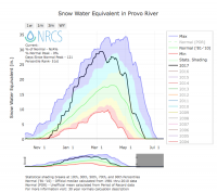
Interestingly, we had a bunch of storms approach from the south this winter. That's why Brighton got slammed so much more than the other Cottonwoods resorts. Dead Horse, being north facing, should have gotten all of that wind loading on the lee side of the ridge. Perhaps the ridge is too sheer and steep for storms to wind load effectively? Maybe storms that blow in from the W/NW are better for loading Dead Horse?There must be more in play to how the drifts pile up on the north side of Dead Horse than just sheer snowfall. Maybe wind loading plays a role. I know for a fact that it's been snowier in August on some years that we had less snow in the winter.
I'm not sure what the temps in the Uintas were like, but in there were more 100 degree days in the SLC valley than I ever remember. There's usually a few of those each year and there was a streak of eight days in a row with 100+. I did some hiking in late June in the Uintas and snow was everywhere. I went over Cleveland Pass on July 1st and it was practically clear of snow. It was amazing what happened in just a few weeks.There must be more in play to how the drifts pile up on the north side of Dead Horse than just sheer snowfall. Maybe wind loading plays a role. I know for a fact that it's been snowier in August on some years that we had less snow in the winter.
It was amazing what happened in just a few weeks.

Don't like ads? Become a BCP Supporting Member and kiss them all goodbye. Click here for more info.