- Joined
- Dec 2, 2019
- Messages
- 196
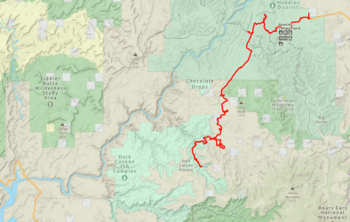
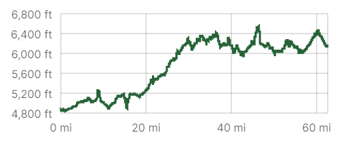
Despite the many frustrations of the Covid restrictions of 2020 and 2021, I had plenty of time to pore over maps, blogs, and guide-books and plan a big hike on the Colorado Plateau for Spring 2022. My previous long-distance hike in the US South-West in 2019 was a fantastic experience and I wanted to attempt something similar this year. I estimated that my planned route would be approximately 500 miles and take me about 1 month.
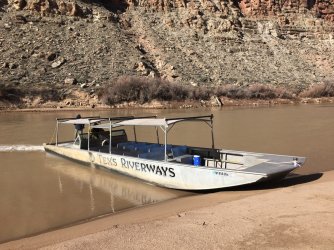
The starting point of the hike was the Needles Outpost, just on the edge of Canyonlands National Park. I had dropped off my first food cache a couple of weeks previously, and the wonderful owners of the Outpost, Amber and Calib, were generously looking after it for me. To reach here, I took the Tex's Riverways jet-boat from Moab to Spanish Bottom, and alighted at the Needles district side of the Colorado River. It then had a 16 mile hike through the park to reach Needles Outpost, where I would camp for the night. I was literally the first passenger of the jet-boat of the 2022 season, and my excitement and anticipation was at fever-pitch when I set off on a chilly morning from Moab.
Although I was very much looking forward to my trek, I was determined that the 2022 version would be considerably less incident-packed than in 2019; on that occasion, I had a few unexpected 'adventures' along the way, including a sprained ankle, that halted my progress for several days. My hope was that with meticulous preparation, thorough planning, a following wind, and a song in my heart, I could avoid any unexpected episodes; this time, all eventualities should be covered. Or, so I thought !
"I'm going to level with you man, I've just taken a whole load of hallucinogens"
Let me introduce Rick, who I ran into after 2 hours of hiking on my very first day.
I had alighted the jet-boat and made my way up the Red Lake Canyon trail towards the Grabens area of the park. I had just crossed the first of the long shallow valleys (or grabens), and saw someone sitting on a rock next to the trail. I hadn't really expected to meet someone in this relatively remote spot.
I felt immediately that something wasn't quite right, as Rick and I started chatting; he was jumpy, hyper, distracted, and panicky. I really had no idea what was going on. I could't really leave him in such a state, so I sat down, and tried to calm him down a little. Over the next 30 minutes or so, he seemed to settle somewhat, but I was still concerned.
It was then that he dropped the bombshell about his recent drug-taking exploits. I was pretty shocked, but just decided to keep on chatting calmly, to see how this would play out. I was guessing he was experienced enough in his consumption to know how to deal with it personally. And, if things took a nasty turn, then I had my emergency response beacon in my bag, to be able to get help for him. This was not really something that I expected to be thinking about, only a few hours into my first day !
Thankfully, he become much more settled over the next half-hour, and I felt confident that he would be fine, and that I could continue on my way. He was hiking the Hayduke Trail from Arches National Park to Zion National Park, covering over 800 miles of southern Utah. He was a very experienced thru-hiker, so I had no doubts about his abilities to continue on the trail from here, towards Beef Basin.
And so off I went; I still had a fair distance to complete today. Much as I wanted to enjoy the remainder of my day, my bizarre encounter with Rick was playing heavily on my mind. I wondered, especially, if I'd done the right thing to leave him, when I did. Well, what was done was done, and tomorrow would be a fresh start, mentally, as much as anything.
I arrived at Needles Outpost about 7pm, and found an empty campsite. As I headed off to the toilet block to clean up, I saw someone familiar walking towards me. It was Rick !! I was gob-smacked. It turns out that he had decided to abandon his hike, and hitch a ride from the trailhead, back to the campground. His plan was to return to Moab in the morning.
So much for my plans for an incident-free hike; this was definitely a memorable first day.
=====
As I set off early the next morning, the bizarre incidents of the previous day were a distant memory. I was bursting with excitement to start my 2022 hike. There was one particular cloud on the mental horizon however, which I knew would regularly distract me over the next few weeks. I couldn't do much about it now, but there was one tiny section of my planned route that involved a fair degree of risk, and I was very nervous about it. Let me explain.
Although my intended journey would pass through some remote and little-visited areas, most of the route followed well-known canyon trails, mesa tops, dirt roads, old jeep trails, and paved highway. I was reasonably confident that, except for unforeseen circumstances or an accident, I should be able to hike 499 of the planned 500 miles of this route over the next 30-odd days.
There was however one big issue: the remaining 1 mile. I hoped to reach the location of this stretch of the route after about 3 weeks of walking. I really was not certain if it was even feasible to traverse this short section; it was arguably a fool-hardy idea to even try. However, I eventually decided that I had to attempt to cross 'Miracle-Mile', even if it ended in failure. I will admit though, that the thought of it did give me a few sleepless nights both before I set off, and during my trek. But, for now, let's get this show on the road.
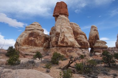
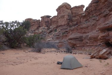
From the Needles Outpost, it was an 8 mile road-walk to reach the Elephant Hill trailhead inside the National Park. The parking lot at the trailhead was already overflowing with vehicles, and was abuzz with the chatter of excited day-hikers, mostly heading along the park trails towards magnificent Chesler Park or Druid Arch. I had reserved a backcountry camping spot in the Needles North zone, so initially headed along the 4WD route from the trailhead. It is quite a sight to watch the 4WD vehicles negotiate the challenging steep slickrock terrain in this part of the park. I only had 2 more miles to walk to reach a little side canyon, that allowed access to the Needles North zone. Park rules dictate that hikers must camp at least 1 mile from the nearest road, so I needed to proceed a little further up the sandy wash to enter the official camping zone.
(Day 1 11.3 miles)
=====
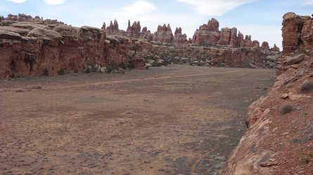
Returning to the 4WD road on the next morning, I proceeded towards The Grabens area of the park, with its typical wide, long, shallow valleys, lying parallel to each other. I had (with Park Service permission) left a water cache close to the trail, and was glad to find this intact, where I had left it a couple of weeks previously. I attached the gallon container to my pack and headed off, only to feel water on my legs a couple of minutes later. It turned out I had accidentally punctured the flimsy container, and it had been leaking. Very fortunately, it was a tiny flow of water, and I only lost a small amount, but I would have been in a sticky situation if I hadn't noticed the leak when I did; it was another 15 miles until the next reliable water source.
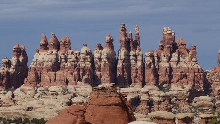
I hiked along the Devils Pocket graben and past the Horsehoof and Bobby Jo 4WD sites, and found a nice camping spot for the night. The evening views of the needles formations in this area are quite magnificent, with the rocks glowing red and orange, as the sun sets.
(Day 2 10.3 miles, Total 21.6)
=====
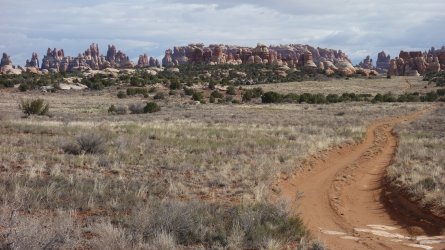
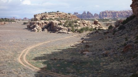
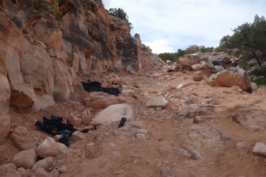
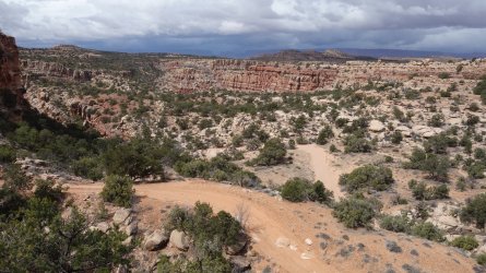
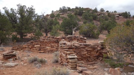
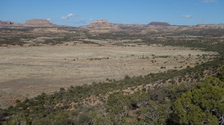
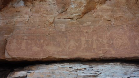
I left the National Park the next morning and continued along the wide drainage towards the notorious Bobby's Hole and the super-steep rock-strewn dugway, that climbs upto the north-west entrance to Beef Basin. This road presents a considerable challenge to 4WD vehicles, and also offers quite a morning work-out for hikers ! It was great to return to Beef Basin again, and I was really looking forward to visiting a few new archaeological sites I had recently learned about. It is such a fascinating, and little researched area of the southwest, with considerable evidence of habitation and farming by the Ancient Ones in the 12th century.
(Day 3 13 miles, Total 34.6)
=====
I headed south in Beef Basin the next day, doing some exploring along the way. By early-afternoon I was setting up camp in a dry wash just past the Fable Valley trailhead. I had hoped there may be some water flowing in the drainage originating from South Spring, but unfortunately there was none. I had the option of hiking a few miles to the reliable water source at Stanley Spring, but in fact there was good water from a nearby little spring just above Gypsum Canyon. I spent a lovely sunny spring evening visiting some superb ruins in the surrounding area.
(Day 4 16.5 miles, Total 51.1)
=====
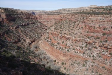
I had taken the westward route from Beef Basin on my previous long hike 3 years ago, and so confidently set off the next morning on the trail towards Fable Valley. The views of Gypsum Canyon quickly opened up to provide some superb vistas, but after hiking for an hour I literally ran out of trail. How could this be ? I had in fact taken completely the wrong route after leaving camp, and actually just walked out to the end of a promontory. What an idiot ! I scrambled up and over the ridge, and had a tedious walk around several deep drainages, but eventually found my way back to the correct trail. I really do need to consult my maps before I set off in the morning ! This trail, suspended above Gypsum Canyon, is one of my very favorites, with glorious views of the rugged valley below, as it snakes its way down to the Colorado River.
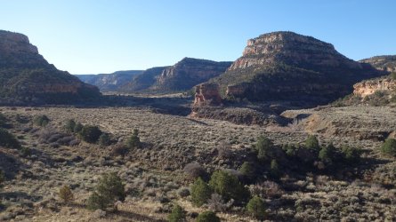
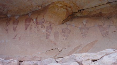
There was plenty of flowing water in Fable Valley, and it is a very pretty walk alongside the stream and across the drainage bedrock. I was keen to do some exploring of the canyon, since when I previously visited the weather was poor and I didn't have the chance to look for all the ruins and rock-art I hoped to. After a quick lunch, I left my rucksack under a tree, and headed up canyon. I quickly found a stunning pictograph panel that I had previously missed. The sky was getting very dark by this point, but there was another site I hoped to find, so I continued on. Big mistake ! The heavy rain came soon after, and was followed by hail. I had left my waterproofs in my rucksack, and I realized that I didn't put a cover over my pack.
I jogged back, and returned soaked through, but I was mainly concerned about the contents of my bag, especially my sleeping bag. There were plenty of wet items, but luckily my sleeping bag remained dry. Sheltering under a tree as the torrential rain continued to fall, I was able to get some dry clothes and my waterproofs on, but I wouldn't be able to put up my tent until the rain eased. It was an uncomfortable couple of hours, but finally I was able to erect my tent, and prepare a nice warm meal. I slept well that night !
(Day 5 12.8 miles, Total 63.9)
=====
The other parts of the adventure can be found here:
"I Would Walk 500 Miles ..." - A Utah Adventure - April 2022 - Part 2
I was unsure whether to spend another day in Fable Valley to look for archaeological sites, but decided it was worth staying on a bit longer, if only to dry out my still wet clothes from the previous day. I hiked almost to the end of the canyon, which was a beautiful walk, but I didn't find any...
backcountrypost.com
"I Would Walk 500 Miles ..." - A Utah Adventure - April 2022 - Part 3
After the magnificent hike through Dark Canyon, and the desert traverse to Hite on Lake Powell, I hadn't really been looking forward to the next day of my trip, since it involved an early morning 7 mile road-walk along Highway 95. In order to reach the far side of the lake, and proceed on my...
backcountrypost.com
"I Would Walk 500 Miles ..." - A Utah Adventure - April 2022 - Part 4
Update and warning December 2022: @IntrepidXJ Randy Langstraat reports in October 2022 that the narrow rock chute leading from Hole-in-the-Rock trailhead, down to the shore of Lake Powell, may now be impassable. It was certainly a much trickier descent than I had envisaged, in April 2022, but...
backcountrypost.com
"I Would Walk 500 Miles ..." - A Utah Adventure - April 2022 - Part 5
I had now been camped at the beach below the Hole-in-the-Rock for almost 48 hours. It did appear that my plan to hike almost 300 miles from Needles to Lake Powell and catch a ride across the lake to Cottonwood Canyon and Grey Mesa had ended in failure. Not a single boat had passed by during the...
backcountrypost.com
"I Would Walk 500 Miles ..." - A Utah Adventure - April 2022 - Final Part
Although I had been carrying plenty of water, I hoped that I'd be able to refill my bottles at Lake Canyon. The dirt road from the highway out to Aladdins Lamp Pass used to skirt the edge of the canyon, but it has now completely collapsed and 4WD drivers now need to take a detour further south...
backcountrypost.com
=====
.
.
.
.
See you in 1 month !
.
.
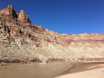
Red Lake Canyon Trail from the Colorado River into Needles, with the iconic Doll House formation of the Maze District in the background
.
.
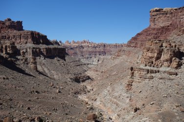
Dirt road towards Elephant Hill trailhead
.
.
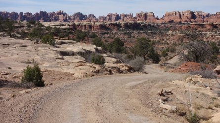
Descending into Needles North zone
.
.
.
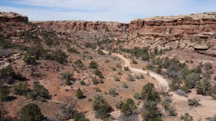
Camping in Needles North zone
..
Red Lake Canyon Trail from the Colorado River into Needles, with the iconic Doll House formation of the Maze District in the background

.
.
Dirt road towards Elephant Hill trailhead

.
.
Descending into Needles North zone
.

.
.
Camping in Needles North zone

.
Grabens area
.
.
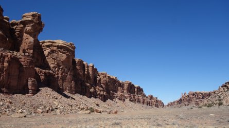
Grabens area
.
.
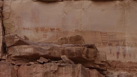
Sadly significantly faded pictograph panel
.
.
Grabens area
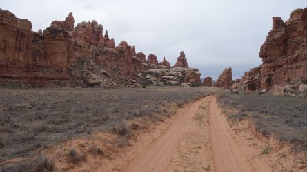
.
.
Evening view of Needles
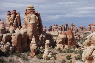
.
.
Evening view of Needles.
Grabens area

.
.
Sadly significantly faded pictograph panel

.
.
Grabens area

.
.
Evening view of Needles

.
.
Evening view of Needles
.
.
Road towards Beef Basin
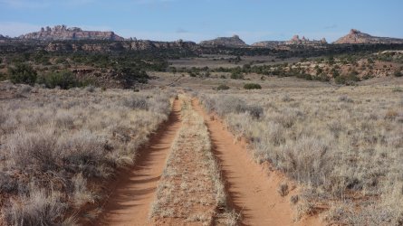
.
.
Looking back towards Needles
.
.
Looking back towards Needles after exiting the National Park, and heading towards Beef Basin
.
.
Bobby's Hole dugway
.
.
Descending into Beef Basin
.
.
Beef Basin ruin
.
.
Beef Basin vista
.
.
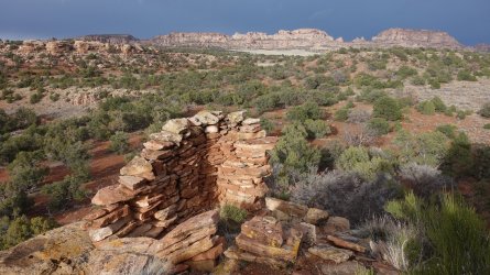
Beef Basin lookout tower
.
.
Beef Basin petroglyphs
.
.
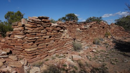
Beef Basin ruin
.
.
View into Gypsum Canyon from route into Fable Valley from Beef Basin
.
.
Fable Valley
.
.
Fable Valley pictograph panel
.
.
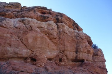
Fable Valley granaries
.
.
"I would walk 500 miles,
And I would walk 500 more,
Just to be the man who walked a thousand
miles to fall down at your door" ... The Proclaimers
Last edited:

