- Joined
- Dec 2, 2019
- Messages
- 182
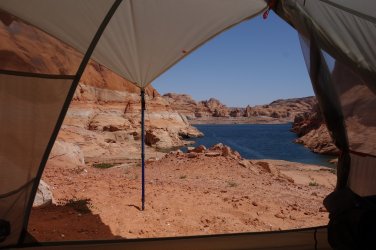
I had now been camped at the beach below the Hole-in-the-Rock for almost 48 hours. It did appear that my plan to hike almost 300 miles from Needles to Lake Powell and catch a ride across the lake to Cottonwood Canyon and Grey Mesa had ended in failure. Not a single boat had passed by during the past 2 days. I was feeling rather deflated.
But then again ! ... I woke early on Easter Monday morning, and heard a faint buzzing sound. As soon as I looked out of my tent, I could see 3 speedboats zipping along the lake, heading towards Wahweap. It was before 8am. I had no time to try to attract their attention, but I was overjoyed to see some traffic on the lake. Perhaps all the boats had headed up the lake on Friday, before I arrived, and now were returning to the marina after a fun weekend on the water. At least this is what I convinced myself of ! Realizing that there would likely be a steady flow of returning vessels on the water over the next couple of hours, I immediately got up, and had my tent and rucksack all packed up within half an hour. I'd need to be ready to jump aboard a passing boat at short notice, so I was now good-to-go, and headed down to the edge of the water before 9am to greet the imminent arrival of my 'water-taxi'
It was about 4pm when I finally accepted that things were not going to pan out the way I had hoped first thing this morning. One more boat had passed around 9.30am, but it was going so fast, that I barely had time to get to my feet, never mind attempt to attract its attention. Oddly, it was heading away from Wahweap, towards the far end of the lake. Apart from that, not a single vessel had passed my beach all day. I decided that 5pm was my deadline; this would give me time to ascend through the Hole-in-the-Rock gap, and set up camp close to the trailhead. I could then start to think about hitching a ride north towards Escalante tomorrow morning.
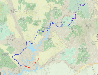
I had brought enough food to realistically last me 6 days; a maximum of 3 days on the beach, and 3 days to reach my next food cache, close to Highway 276, after I had crossed Lake Powell. Since it appeared that I wouldn't be accessing this resupply anytime I soon, it was time to start thinking about my alternatives. By the afternoon, my Nat Geo maps were spread out on the beach and I was seriously thinking about what I would do next. The initial part would be to try to hitch back to Escalante along the Hole-in-the-Rock road, and buy some food in the store there. After that, I hoped to design a fun route that would get me back towards Needles and eventually Moab.
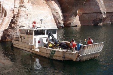
Then, around 4.30pm, I noticed a house-boat had entered my field-of-view from stage-left. Oh my goodness, was this my chance ? It was moving very slowly, and so I leapt to my feet and started to wave and shout. It continued to move away, but then it appeared to slow down and stop. Had they seen me ? I continued to shout. Suddenly another vessel appeared travelling in the same direction; it was moving very fast, and I realized that it was the same boat that I had seen after 9am this morning. It stopped quickly, and made its way slowly over to the house-boat. What on earth was going on ? After a few minutes the boat started up again, and instead of continuing down the lake, it headed towards my beach. I was stunned and couldn't quite believe it. As the vessel approached I realized that it was a National Park boat and I could now recognize the familiar colors of the Park Service uniforms being worn by the crew. Oh ! Was I going to get in trouble here ?
As the boat reached the beach, one member of the crew shouted out to ask if I was ok, and if I needed rescued. The passengers in the house-boat had, in fact, seen me and alerted the passing Park Service craft, since they thought it was an SOS-type situation. I was a bit embarrassed when I told the Ranger that I was fine, and just needed a ride to the far shore. I thought he wouldn't be happy that I had wasted their time, but he immediately invited me onboard and said that it would be no trouble to drop me across the lake. I could not believe my luck.
The crew were great and were all interested in my adventure. They had spent the day inspecting buoys and doing some important maintenance before the boating season gets started. They did confirm (as if I didn't know by now ) that very, very few people take their boats out on Lake Powell this early in the year. I was unbelievably fortunate. One of the boat crew was Native American and, as I disembarked the vessel, he offered me a fresh avocado. I don't really know why he did this, but his kindness was much appreciated, and I carried the fruit with me in my rucksack for the remainder of my trip.
But then again ! ... I woke early on Easter Monday morning, and heard a faint buzzing sound. As soon as I looked out of my tent, I could see 3 speedboats zipping along the lake, heading towards Wahweap. It was before 8am. I had no time to try to attract their attention, but I was overjoyed to see some traffic on the lake. Perhaps all the boats had headed up the lake on Friday, before I arrived, and now were returning to the marina after a fun weekend on the water. At least this is what I convinced myself of ! Realizing that there would likely be a steady flow of returning vessels on the water over the next couple of hours, I immediately got up, and had my tent and rucksack all packed up within half an hour. I'd need to be ready to jump aboard a passing boat at short notice, so I was now good-to-go, and headed down to the edge of the water before 9am to greet the imminent arrival of my 'water-taxi'
It was about 4pm when I finally accepted that things were not going to pan out the way I had hoped first thing this morning. One more boat had passed around 9.30am, but it was going so fast, that I barely had time to get to my feet, never mind attempt to attract its attention. Oddly, it was heading away from Wahweap, towards the far end of the lake. Apart from that, not a single vessel had passed my beach all day. I decided that 5pm was my deadline; this would give me time to ascend through the Hole-in-the-Rock gap, and set up camp close to the trailhead. I could then start to think about hitching a ride north towards Escalante tomorrow morning.
I had brought enough food to realistically last me 6 days; a maximum of 3 days on the beach, and 3 days to reach my next food cache, close to Highway 276, after I had crossed Lake Powell. Since it appeared that I wouldn't be accessing this resupply anytime I soon, it was time to start thinking about my alternatives. By the afternoon, my Nat Geo maps were spread out on the beach and I was seriously thinking about what I would do next. The initial part would be to try to hitch back to Escalante along the Hole-in-the-Rock road, and buy some food in the store there. After that, I hoped to design a fun route that would get me back towards Needles and eventually Moab.
Then, around 4.30pm, I noticed a house-boat had entered my field-of-view from stage-left. Oh my goodness, was this my chance ? It was moving very slowly, and so I leapt to my feet and started to wave and shout. It continued to move away, but then it appeared to slow down and stop. Had they seen me ? I continued to shout. Suddenly another vessel appeared travelling in the same direction; it was moving very fast, and I realized that it was the same boat that I had seen after 9am this morning. It stopped quickly, and made its way slowly over to the house-boat. What on earth was going on ? After a few minutes the boat started up again, and instead of continuing down the lake, it headed towards my beach. I was stunned and couldn't quite believe it. As the vessel approached I realized that it was a National Park boat and I could now recognize the familiar colors of the Park Service uniforms being worn by the crew. Oh ! Was I going to get in trouble here ?
As the boat reached the beach, one member of the crew shouted out to ask if I was ok, and if I needed rescued. The passengers in the house-boat had, in fact, seen me and alerted the passing Park Service craft, since they thought it was an SOS-type situation. I was a bit embarrassed when I told the Ranger that I was fine, and just needed a ride to the far shore. I thought he wouldn't be happy that I had wasted their time, but he immediately invited me onboard and said that it would be no trouble to drop me across the lake. I could not believe my luck.
The crew were great and were all interested in my adventure. They had spent the day inspecting buoys and doing some important maintenance before the boating season gets started. They did confirm (as if I didn't know by now
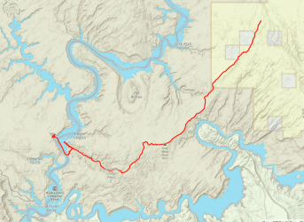
I couldn't quite believe it, but I had succeeded (mostly by luck, of course) in hitching a ride across Lake Powell, for that crucial one mile !
(Day 23 1.0 + 5.9 miles, Total 305.1)
=====
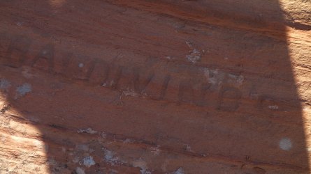
After reaching Cottonwood Canyon yesterday evening, I had wasted little time in setting up camp and getting to bed early. Despite my 3 days of rest on the beach, I felt mentally exhausted by the whole affair, such that the relief was quite overwhelming at first. But today was a new day, and it felt incredible to wander back down to Lake Powell in the morning and look across at 'my beach'. I spent some time exploring and looking for Register Rock, a place where the pioneer party had carved their names into the rock, after crossing the Colorado River. I did find some random signatures in several places, but I'm not entirely convinced that these were the actual Register.
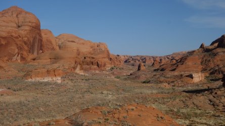
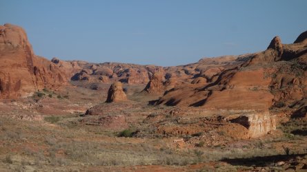
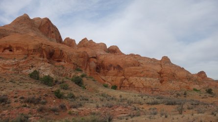
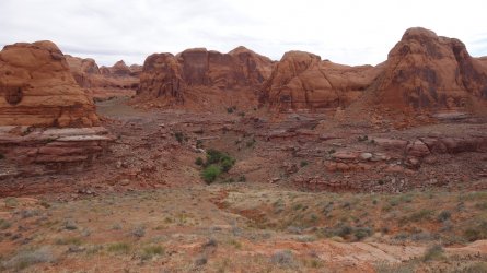
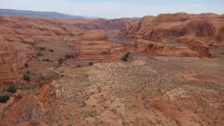
The walk up Cottonwood Canyon was very enjoyable, with a flat, easy-to-follow trail. It was easy to forget that although this is not a well-trodden area by backpackers, it is very well known to Lake Powell boaters, who often moor their boats and explore the nearby canyons. In fact, Michael Kelsey has written a whole book on hiking the canyons around the lake. The scenery of the wide valley was wonderful, with large areas of cottonwood trees and a pretty creek running through it. The huge red-rock buttes and side-canyons of the surrounding area were very picturesque. I was heading towards Aladdins Lamp Pass at the end of the valley.
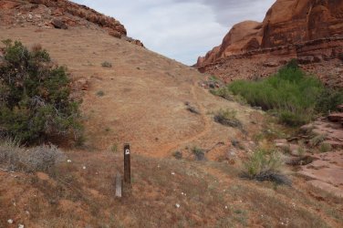
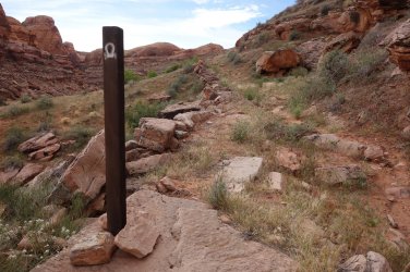
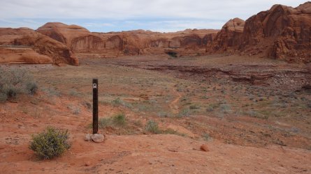
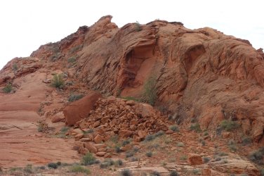
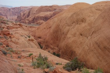
As the trail began to climb more steeply, I was surprised to see several brown wooden stakes in the ground, with the characteristic 'wagon train' symbol painted in white at the top. I had seen these a few days previously alongside the Hole-in-the-Rock road where the 1880 pioneers had passed through in their journey from Escalante to Bluff, but I didn't know that there would more in this area. As always, it felt fantastic to be following in the footsteps of the pioneers on this part of the trail. The route towards the top of the pass involved bypassing some huge sandstone buttes, and it did appear that some of the trail had been blasted out here also. The 'road' that the pioneers constructed up towards the pass was very obvious.
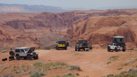
The views from the top of the pass, back down Cottonwood Canyon, and across Lake Powell to Waterpocket Fold and beyond, were magnificent. I was a little surprised to find 4 Jeeps parked at the pass, but it turns out that this area is very popular with 4WD enthusiasts. The group that were currently here were The Greater Southwestern Exploration Company, and one of the party told me that they had been exploring the back-roads of Utah and beyond in their vehicles for more than 50 years !
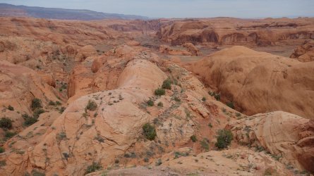
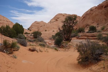
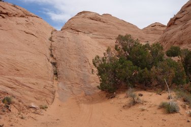
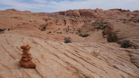
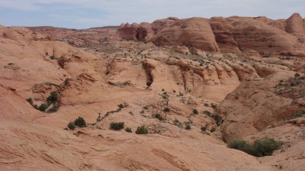
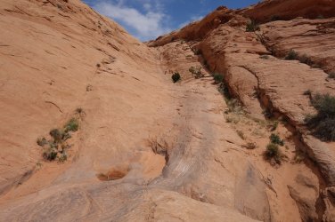
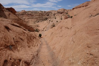
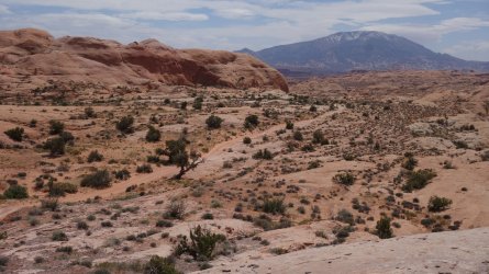
As I proceeded above the pass, towards Grey Mesa, I entered an extraordinary slickrock world, with enormous undulating sandstone mounds stretching in every direction as far as the eye can see. In scale, I haven't encountered anything quite like it. Although the 'trail' is easy to follow using the cairns set out by the 4WD crowd, I really wouldn't want to get lost out here, without a compass or GPS device. It would definitely be possible to become disorientated in this incredible slickrock desert.
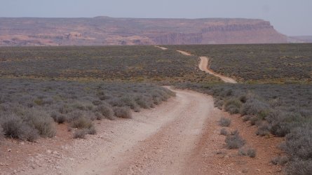
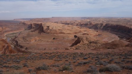
Grey Mesa appears as a stark contrast to the previous miles of rolling sandstone; it is utterly barren scrubland, for many miles. If I remember, I saw literally one tree in this entire stretch. It's not the most scenic of areas, but the walking is fast and easy, along a good dirt road. A wonderful relief from the monotony comes in the form of The Great Bend of the San Juan River, which is rather self-explanatory, but a stunning sight, never-the-less.
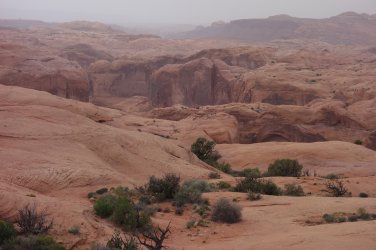
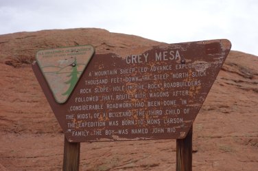
The topographical feature names are rather confusing in the maps of this area, with Grey Mesa and Wilson Mesa both commonly appearing. The vast expanses of sandstone reappear further north, as the route drops significantly into an attractive narrow canyon. In this area brown 'wagon' posts make a reappearance, as we rejoin the route of the pioneers. My goodness, they must have had (yet another !) adventure crossing the sandstone sea beyond Aladdins Lamp pass. There is a descriptive sign also, which mentions that it was here that the third baby of the expedition was born in 1880, which is very interesting.
It was late in the afternoon, and I was beginning to think about finding a camping spot for the night. I had seen a group of Jeeps parked in the distance, so decided I'd hike beyond them to set up camp. As I got chatting to this very friendly bunch, the 'leader' of the group asked if I had seen the descriptive sign along the trail, which I had. He then proceeded to tell me that he was the great-grandson of the baby mentioned on the sign !! How extraordinary to meet such a significant descendant of the pioneer party in this place. He was a wonderful story-teller and was able to entertain myself and his companions over the next hour with many tales of his fore-fathers. This lovely group of 4WD enthusiasts, also on their way towards Aladdins Lamp pass, offered me water, and home-made flapjacks as I said my farewells.
As I bedded down for the night, a little further on, I realized what an amazing couple of days I had just had ! Yesterday afternoon, I was stranded at the edge of Lake Powell, sitting on a beach directly beneath the Hole-in-the-Rock gap blasted out by the pioneers; this morning I followed the 1880 pioneer route out of Cottonwood Canyon, and across the mesa; and I ended the day chatting to a direct descendant of one of their party. Just incredible !
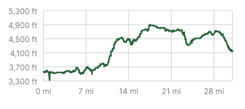
(Day 24 16.9 miles, Total 322)
=====
The other parts of the adventure can be found here:
"I Would Walk 500 Miles ..." - A Utah Adventure - April 2022 - Part 1
Despite the many frustrations of the Covid restrictions of 2020 and 2021, I had plenty of time to pore over maps, blogs, and guide-books and plan a big hike on the Colorado Plateau for Spring 2022. My previous long-distance hike in the US South-West in 2019 was a fantastic experience and I...
backcountrypost.com
"I Would Walk 500 Miles ..." - A Utah Adventure - April 2022 - Part 2
I was unsure whether to spend another day in Fable Valley to look for archaeological sites, but decided it was worth staying on a bit longer, if only to dry out my still wet clothes from the previous day. I hiked almost to the end of the canyon, which was a beautiful walk, but I didn't find any...
backcountrypost.com
"I Would Walk 500 Miles ..." - A Utah Adventure - April 2022 - Part 3
After the magnificent hike through Dark Canyon, and the desert traverse to Hite on Lake Powell, I hadn't really been looking forward to the next day of my trip, since it involved an early morning 7 mile road-walk along Highway 95. In order to reach the far side of the lake, and proceed on my...
backcountrypost.com
"I Would Walk 500 Miles ..." - A Utah Adventure - April 2022 - Part 4
Update and warning December 2022: @IntrepidXJ Randy Langstraat reports in October 2022 that the narrow rock chute leading from Hole-in-the-Rock trailhead, down to the shore of Lake Powell, may now be impassable. It was certainly a much trickier descent than I had envisaged, in April 2022, but...
backcountrypost.com
.
"I Would Walk 500 Miles ..." - A Utah Adventure - April 2022 - Final Part
Although I had been carrying plenty of water, I hoped that I'd be able to refill my bottles at Lake Canyon. The dirt road from the highway out to Aladdins Lamp Pass used to skirt the edge of the canyon, but it has now completely collapsed and 4WD drivers now need to take a detour further south...
backcountrypost.com
=====
.
.
.
.
.
.
A room with a view ... but still no boats !
.
.
My water taxi !
.
.
A well carved 'signature' near Register Rocks
.
.
Looking up Cottonwood Canyon towards Aladdins Lamp pass
.
.
Looking up Cottonwood Canyon towards Aladdins Lamp pass
.
.
Cottonwood Canyon
 .
..
.
Rejoining the route of the 1880 Mormon pioneers
.
.
'Road' created by the pioneers
.
.
Looking back down Cottonwood Canyon
.
.
Climbing higher in Cottonwood Canyon
.
.
Possible blasted road across large sandstone buttes
.
.
Looking back down Cottonwood Canyon, with the Hole-in-the-Rock visible in the far distance
.
.
The route climbs over huge sandstone buttes
.
.
Reaching the top of Cottonwood Canyon, from Aladdins Lamp pass
.
.
A 4WD group at Aladdins Lamp pass, with the Hole-in-the-Rock and Fiftymile Mountain visible in the far distance
.
.
Following the route into the slickrock sea
.
.
Steep climb in the slickrock sea
.
.
The trail across the slickrock sea
.
.
A whole lot of sandstone to be traversed !
.
.
Another steep climb
.
.
At the top of the climb
.
.
The road winds on
.
.
The scrubland of Grey Mesa
.
.
The Great Bend of the San Juan river
.
.
Looking towards Iceberg Canyon which joins Lake Powell
.
.
Rejoining the route of the pioneers .. I would meet the great-grandson of this baby, later in the day !
.
."I would walk 500 miles,
And I would walk 500 more,
Just to be the man who walked a thousand
miles to fall down at your door" ... The Proclaimers
Last edited:
