- Joined
- Dec 2, 2019
- Messages
- 182
Starting off from Moab, on a beautiful spring afternoon, the multi-day hike that I had planned seemed relatively straightforward. The route predominantly followed existing hiking trails, known backcountry routes, and dirt roads across the Colorado Plateau in south-east Utah. The initial few days would overlap several early stages of the Hayduke Trail, which runs for 800 miles from Arches National Park to Zion National Park, via The Grand Canyon. Admittedly, most of my route was in relatively remote areas but, apart from a couple of possibly challenging little-used sections, the areas I planned to traverse were well documented. Things did not exactly go to plan, and my hike was definitely not straightforward, but I had quite the adventure, South of Moab in May 2019 !
My main concern in preparing for the hike, as with any multi-day hike in the South-West, was water availability, so I had done plenty of research beforehand on likely water sources along the route. In addition, I also decided that, as well as my planned food caches, I would also cache water at strategic points along the route, in advance. Even with these in place, I was still nervous about water availability, especially because my planned start date in mid-May could potentially mean days of very hot and dry hiking conditions, later in the month.
As things turned out over the following days, my concerns regarding water proved to be very well founded, but for reasons that were completely unexpected !
In addition to the natural wonders of the area, one of the attractions of this route across the Colorado Plateau was the fact that I would be encountering so much of the history of this region along the way: from evidence of the Ancient Ones from many hundreds of years ago; to the routes of the intrepid pioneers of the 19th century; to the hardy cowboys of the early 20th century; and to the modern outdoor enthusiast.
The Colorado Plateau refers to a 130,000 square mile area of high desert, centered on the Four-Corners region of South-West US, and straddling four states: Utah, Arizona, Colorado and New Mexico. It is often referred to as ‘Red-Rock Country’. Its unrivaled beauty is encapsulated by the fact that there are 9 National Parks, and 18 National Monuments within the region; the highest concentration in the entire country, outside of Washington D.C. On my planned hike across this ‘high desert’ region, the lowest elevation would be around 4,000’, with the highest point being over 8,500’.
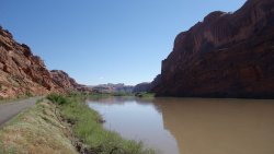
As I left bustling downtown Moab, the motorized outdoor crowd sped past me excitedly, on the way to their next adventure. The narrow road was busy with dirt-bikes, Subaru’s laden with mountain bikes, numerous RVs, and a variety of off-road vehicles. My first day’s route took me alongside the Colorado River for several miles, with magnificent views of the huge sandstone monoliths towering above the riverway.
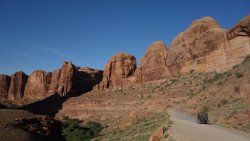
"It's coming from the North-East ... ", "No good for Tombstone then ... ", "Shall we try Cookies ‘n Cream ?". This conversation sounded like some kind of secret code to me. I had stopped for a while at the Amasa Back Trailhead to admire the incredible views of the surrounding sheer sandstone cliffs, beautifully illuminated by the evening sun. A line of jeeps slowly crawled up the steep ledges of the trail below. It turned out that Andy and Pete were BASE jumpers from Colorado, discussing the merits of attempting one of the most famous jumps in the area: Tombstone. They tried to bring me up to speed on the subtle nuances of wind direction changes in Kane Springs Canyon, but all I could do was stare up at the enormous 400' sheer face of Tombstone in wonderment, imagining what it must be like throwing yourself off the top. They finally decided that an alternative peak, Cookies ‘n Cream would be the better bet. Feeling a little queasy and on slightly shaky legs, I bade farewell to these daredevils, and continued on my way. I needed to find a camping spot for the night.
The fabulous views continued the next day, as I followed Kane Creek Road up and over a high desert pass, before plunging back down to follow a route along the lush green creek-side. There were superb views of the high red sandstone cliffs, bordering the Behind The Rocks area, as I continued south. Before long, the sound of off-road vehicles had finally disappeared, and my hiking adventure could truly begin, in earnest !
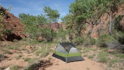
Waking up to the gentle rustling of cottonwood trees, and the burbling of a nearby stream, was a wonderful start to the following day. It would be difficult to leave such an idyllic spot in Trough Springs Canyon, on a warm, sunny morning. My map showed a thick-dashed line indicating the official trail. This route follows the main canyon, exits the drainage, and emerges at the Hatch Point mesa. One hour later, as I stood perched on a precipitous 45 degree talus slope, with some huge piano-sized boulders ahead of me, I was feeling rather confused. As I picked my way slowly across loose scree, I was fairly sure that this was not the thick-dashed line I had been promised from my map ! When I reached the bottom of an unscalable 40’ pour-off, 30 minutes later, it was obvious something wasn’t right: either I couldn’t read a simple map, or the map was wrong.
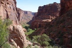
I reversed course and followed a side canyon, which turned out to be just as gnarly as the previous one. The walking was no fun, and the going very slow, but miraculously the drainage eventually wound its way up and out, onto the mesa-top. I was very relieved to have finally reached Hatch Point, with only one small final concern: the fresh bear-tracks in the damp drainage at the head of the canyon, I had just exited !
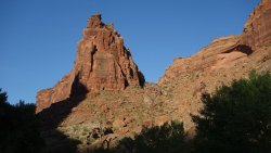
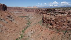
Although, I was delighted to be out of the canyon, I was still very confused as to where I had gone wrong, after I left camp this morning. How could I have missed the main trail ? Curiosity got the better of me and I decided to rim-walk Trough Springs Canyon to try to figure out this mystery. As I stood on the canyon rim and looked 800’ straight down to my previous night’s camping spot, I realized the issue: the map was wrong ! The actual trail, in fact, does not follow the main canyon, or the side canyon I took, but instead diverts via a small ravine to the north. Probably, if I had been paying a little more attention this morning, instead of blindly following my map, I should have noticed a trail up this ravine, as I left camp.
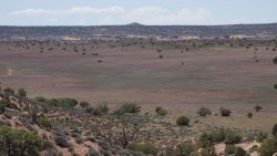
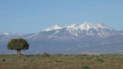
As I made my way across Hatch Point, I was able to pick up one of my water caches, that I had left here a couple of weeks previously. Hatch Point is really a huge mesa, towering above Lockhart Basin to the west. Anyone who has driven to Needles Overlook or the Anticline Overlook from US-191 will have traversed Hatch Point. From my glorious camping spot overlooking the vast desert expanse of Lockhart Basin, the snow-clad peaks of the La Sal Mountains, east of Moab, looked stunning in the evening sun.
There were some fantastic classic Utah desert views when descending to Lockhart Basin from Hatch Point. The route was quite a challenge, and involved a 75 minute descent down an incredibly steep rubble slope, which drops 1,200’ in just over 1 mile. It wasn't overly dangerous, as such, but every step seemed to be over scree or loose rocks, so great care had to be taken. The descent has been termed the Striped Monster, which is a great name, but I will probably think of it as the Boot Shredder, since the sharp rocks and regular sliding across the rubble definitely takes its toll on footwear.
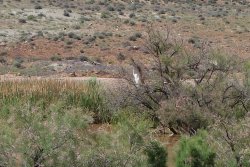
When descending to the basin, I noticed that there was a large area of water a few hundred yards away from the bottom of the talus slope. This turned out to be a rather mucky pool that the local cows had obviously been thoroughly enjoying recently. However, perched on a branch on the sole tree next to the water was the amazing sight of a beautiful egret.
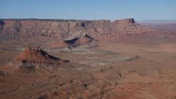
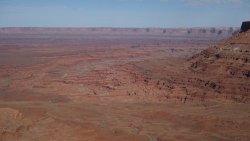
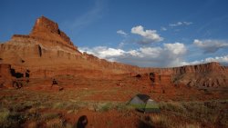
I was expecting the dirt road across Lockhart Basin to be a rather hot and laborious walk, but it turned out to be very enjoyable, with stunning mesa views for much of the way, and one of my favorite camping spots. The sweeping red-rock vistas throughout the day encompassed fantastic views of the 3 main districts of Canyonlands: the Island-in-the-Sky mesa, the buttes of The Maze, and the distinctive sandstone spires of Needles. The imposing snow-capped peaks of the Henry Mountains shimmered in the far distance.
For some reason, I had somehow expected a lot of vehicles on this dirt road, but over the entire day I only saw two jeeps, one of which was a National Park patrol, who very kindly gave me some water. It was a baking hot day, as I traversed the wide desert. The only other vehicles I saw were 2 separate cyclists, one of whom was doing an epic cycle trip across the wilds of Utah from Kanab to Moab. His journey involved hitching a ride on a houseboat to cross Lake Powell at the Hole in the Rock !
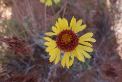
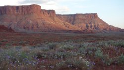
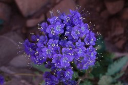
The wet springtime across the Colorado Plateau meant that there was a glorious carpet of wildflowers in almost every canyon on this trip, and the floral display was nowhere more colorful than in Lockhart Basin.
It was great to arrive at Needles Outpost, and meet the owners, Amber and Calib, again. They are such a friendly couple, and make everyone feel welcome. They have a real infectious enthusiasm for the Outpost and the South-West in general. I picked up the food cache I had left there a few weeks previously, and sat outside the main cabin devouring some refreshing ice-cream.
Following a relaxing afternoon at my camp-spot, I headed to the toilet block. I could see that a dog was tied up outside. This seemed to be the same dog that had taken a dislike to me, as I checked in earlier. As I approached, it started barking aggressively, and baring its fangs. Although I did my best to steer a wide berth past him, he somehow managed to lunge under a metal partition, and attempted to bite my ankle as I entered the toilet. Fortunately, he was only able to reach the bottom of my pants, and put a tear in them. I was absolutely furious, and began shouting at the dog's owner as I entered the toilet block, telling him that he should be keeping his dog under control, and that I could have been bitten by this hell-hound. I ranted on and on for a couple of minutes, with no response from the owner. He just sat there, saying nothing. I guess I should probably point out, that the owner was actually inside one of the cubicles at the time, sitting on the toilet ! By the time he came out, I had calmed down a bit, and was starting to feel pretty silly for shouting at a man sitting on the john. He was in no mood for apologizing however, and told me it was my fault, and that I shouldn't have got so close to his dog. Extraordinary ! I was probably quite lucky, in hindsight, since if the dog had bitten me and drawn blood, I might have had to abandon my hike, and get a tetanus injection.
A fearsome, whirling wind was whipping the red desert sand around the campground, as I made my way back to my tent, for an afternoon cup of tea.
"So, what do you think of Trump ?" the polite lady from Texas, inquired. My neighbor at the Needles Outpost campground and I had been having a nice chat about our favorite National Park, when the subject was suddenly switched. Her two small (friendly) dogs were cradled in her arms, panting gently, in need of a drink. There probably isn't a person alive who doesn't have a view on the American President, but I realized a long time ago, that it's probably best to steer clear of domestic politics when visiting another country. "That sounds like a loaded question, to me", I responded. She smiled, and let the dogs run back to her RV, while we both waxed lyrical about the apple pie at Capitol Reef.
It was just about time for my freeze-dried Teriyaki chicken dinner, and then an early night, in preparation for my big hiking day tomorrow.
Part 2 of the trip can be found here
Part 3 of the trip can be found here
Part 4 of the trip can be found here
.
.
.
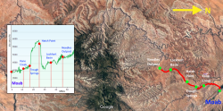
Trail Map and Elevation Profile
.
 .
.
.
.
.
Colorado River
.
.
.
Sandstone monoliths, including Tombstone
.
.
.
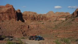
Behind-the-Rocks
.
.
.
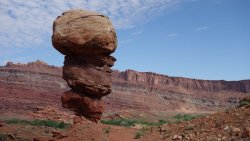
Devils Golf-Ball, Kane Creek Road
.
.
.
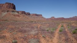
Kane Springs Canyon
.
.
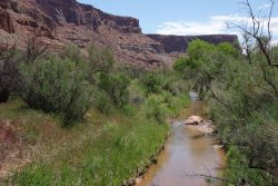
Kane Creek
.
.
.
Wildflower
.
.
.
Trough Springs
.
.
.
Exit route from Trough Springs Canyon is via the ravine, to the right of the sandstone pinnacle (the incorrect map route goes left)
.
.
.
Gnarly escape route from Trough Springs Canyon
.
.
.
View from 800' above Trough Springs Canyon, with the La-Sal mountains in the background
.
.
.
Hatch Point mesa
.
.
.
La-Sal Mountains
.
.
.
Lockhart Basin from Hatch Point
.
.
.
Lockhart Basin from Hatch Point
.
.
.
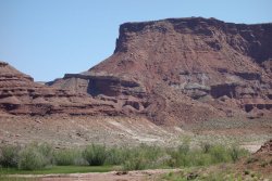
At the bottom of the Striped Monster, after descending from Hatch Point
.
.
.
The surprising sight of an egret in Lockhart Basin
.
.
.
Lockhart Basin (Needles Overlook on the far right)
.
.
.
Lockhart Basin wildflowers
.
.
.
Purple wildflowers carpeted the desert
.
.
.
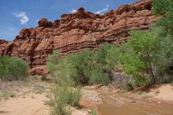
Indian Creek
.
.
.
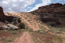
Indian Creek sand-slope
.
.
.
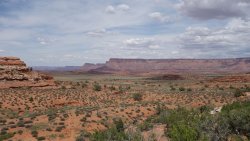
Indian Creek backcountry
.
.
.
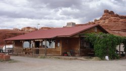
Needles Outpost
-----
My main concern in preparing for the hike, as with any multi-day hike in the South-West, was water availability, so I had done plenty of research beforehand on likely water sources along the route. In addition, I also decided that, as well as my planned food caches, I would also cache water at strategic points along the route, in advance. Even with these in place, I was still nervous about water availability, especially because my planned start date in mid-May could potentially mean days of very hot and dry hiking conditions, later in the month.
As things turned out over the following days, my concerns regarding water proved to be very well founded, but for reasons that were completely unexpected !
-----
In addition to the natural wonders of the area, one of the attractions of this route across the Colorado Plateau was the fact that I would be encountering so much of the history of this region along the way: from evidence of the Ancient Ones from many hundreds of years ago; to the routes of the intrepid pioneers of the 19th century; to the hardy cowboys of the early 20th century; and to the modern outdoor enthusiast.
The Colorado Plateau refers to a 130,000 square mile area of high desert, centered on the Four-Corners region of South-West US, and straddling four states: Utah, Arizona, Colorado and New Mexico. It is often referred to as ‘Red-Rock Country’. Its unrivaled beauty is encapsulated by the fact that there are 9 National Parks, and 18 National Monuments within the region; the highest concentration in the entire country, outside of Washington D.C. On my planned hike across this ‘high desert’ region, the lowest elevation would be around 4,000’, with the highest point being over 8,500’.
-----
As I left bustling downtown Moab, the motorized outdoor crowd sped past me excitedly, on the way to their next adventure. The narrow road was busy with dirt-bikes, Subaru’s laden with mountain bikes, numerous RVs, and a variety of off-road vehicles. My first day’s route took me alongside the Colorado River for several miles, with magnificent views of the huge sandstone monoliths towering above the riverway.
"It's coming from the North-East ... ", "No good for Tombstone then ... ", "Shall we try Cookies ‘n Cream ?". This conversation sounded like some kind of secret code to me. I had stopped for a while at the Amasa Back Trailhead to admire the incredible views of the surrounding sheer sandstone cliffs, beautifully illuminated by the evening sun. A line of jeeps slowly crawled up the steep ledges of the trail below. It turned out that Andy and Pete were BASE jumpers from Colorado, discussing the merits of attempting one of the most famous jumps in the area: Tombstone. They tried to bring me up to speed on the subtle nuances of wind direction changes in Kane Springs Canyon, but all I could do was stare up at the enormous 400' sheer face of Tombstone in wonderment, imagining what it must be like throwing yourself off the top. They finally decided that an alternative peak, Cookies ‘n Cream would be the better bet. Feeling a little queasy and on slightly shaky legs, I bade farewell to these daredevils, and continued on my way. I needed to find a camping spot for the night.
-----
The fabulous views continued the next day, as I followed Kane Creek Road up and over a high desert pass, before plunging back down to follow a route along the lush green creek-side. There were superb views of the high red sandstone cliffs, bordering the Behind The Rocks area, as I continued south. Before long, the sound of off-road vehicles had finally disappeared, and my hiking adventure could truly begin, in earnest !
-----
Waking up to the gentle rustling of cottonwood trees, and the burbling of a nearby stream, was a wonderful start to the following day. It would be difficult to leave such an idyllic spot in Trough Springs Canyon, on a warm, sunny morning. My map showed a thick-dashed line indicating the official trail. This route follows the main canyon, exits the drainage, and emerges at the Hatch Point mesa. One hour later, as I stood perched on a precipitous 45 degree talus slope, with some huge piano-sized boulders ahead of me, I was feeling rather confused. As I picked my way slowly across loose scree, I was fairly sure that this was not the thick-dashed line I had been promised from my map ! When I reached the bottom of an unscalable 40’ pour-off, 30 minutes later, it was obvious something wasn’t right: either I couldn’t read a simple map, or the map was wrong.
I reversed course and followed a side canyon, which turned out to be just as gnarly as the previous one. The walking was no fun, and the going very slow, but miraculously the drainage eventually wound its way up and out, onto the mesa-top. I was very relieved to have finally reached Hatch Point, with only one small final concern: the fresh bear-tracks in the damp drainage at the head of the canyon, I had just exited !
Although, I was delighted to be out of the canyon, I was still very confused as to where I had gone wrong, after I left camp this morning. How could I have missed the main trail ? Curiosity got the better of me and I decided to rim-walk Trough Springs Canyon to try to figure out this mystery. As I stood on the canyon rim and looked 800’ straight down to my previous night’s camping spot, I realized the issue: the map was wrong ! The actual trail, in fact, does not follow the main canyon, or the side canyon I took, but instead diverts via a small ravine to the north. Probably, if I had been paying a little more attention this morning, instead of blindly following my map, I should have noticed a trail up this ravine, as I left camp.
As I made my way across Hatch Point, I was able to pick up one of my water caches, that I had left here a couple of weeks previously. Hatch Point is really a huge mesa, towering above Lockhart Basin to the west. Anyone who has driven to Needles Overlook or the Anticline Overlook from US-191 will have traversed Hatch Point. From my glorious camping spot overlooking the vast desert expanse of Lockhart Basin, the snow-clad peaks of the La Sal Mountains, east of Moab, looked stunning in the evening sun.
-----
There were some fantastic classic Utah desert views when descending to Lockhart Basin from Hatch Point. The route was quite a challenge, and involved a 75 minute descent down an incredibly steep rubble slope, which drops 1,200’ in just over 1 mile. It wasn't overly dangerous, as such, but every step seemed to be over scree or loose rocks, so great care had to be taken. The descent has been termed the Striped Monster, which is a great name, but I will probably think of it as the Boot Shredder, since the sharp rocks and regular sliding across the rubble definitely takes its toll on footwear.
When descending to the basin, I noticed that there was a large area of water a few hundred yards away from the bottom of the talus slope. This turned out to be a rather mucky pool that the local cows had obviously been thoroughly enjoying recently. However, perched on a branch on the sole tree next to the water was the amazing sight of a beautiful egret.
I was expecting the dirt road across Lockhart Basin to be a rather hot and laborious walk, but it turned out to be very enjoyable, with stunning mesa views for much of the way, and one of my favorite camping spots. The sweeping red-rock vistas throughout the day encompassed fantastic views of the 3 main districts of Canyonlands: the Island-in-the-Sky mesa, the buttes of The Maze, and the distinctive sandstone spires of Needles. The imposing snow-capped peaks of the Henry Mountains shimmered in the far distance.
For some reason, I had somehow expected a lot of vehicles on this dirt road, but over the entire day I only saw two jeeps, one of which was a National Park patrol, who very kindly gave me some water. It was a baking hot day, as I traversed the wide desert. The only other vehicles I saw were 2 separate cyclists, one of whom was doing an epic cycle trip across the wilds of Utah from Kanab to Moab. His journey involved hitching a ride on a houseboat to cross Lake Powell at the Hole in the Rock !
The wet springtime across the Colorado Plateau meant that there was a glorious carpet of wildflowers in almost every canyon on this trip, and the floral display was nowhere more colorful than in Lockhart Basin.
-----
It was great to arrive at Needles Outpost, and meet the owners, Amber and Calib, again. They are such a friendly couple, and make everyone feel welcome. They have a real infectious enthusiasm for the Outpost and the South-West in general. I picked up the food cache I had left there a few weeks previously, and sat outside the main cabin devouring some refreshing ice-cream.
Following a relaxing afternoon at my camp-spot, I headed to the toilet block. I could see that a dog was tied up outside. This seemed to be the same dog that had taken a dislike to me, as I checked in earlier. As I approached, it started barking aggressively, and baring its fangs. Although I did my best to steer a wide berth past him, he somehow managed to lunge under a metal partition, and attempted to bite my ankle as I entered the toilet. Fortunately, he was only able to reach the bottom of my pants, and put a tear in them. I was absolutely furious, and began shouting at the dog's owner as I entered the toilet block, telling him that he should be keeping his dog under control, and that I could have been bitten by this hell-hound. I ranted on and on for a couple of minutes, with no response from the owner. He just sat there, saying nothing. I guess I should probably point out, that the owner was actually inside one of the cubicles at the time, sitting on the toilet ! By the time he came out, I had calmed down a bit, and was starting to feel pretty silly for shouting at a man sitting on the john. He was in no mood for apologizing however, and told me it was my fault, and that I shouldn't have got so close to his dog. Extraordinary ! I was probably quite lucky, in hindsight, since if the dog had bitten me and drawn blood, I might have had to abandon my hike, and get a tetanus injection.
A fearsome, whirling wind was whipping the red desert sand around the campground, as I made my way back to my tent, for an afternoon cup of tea.
"So, what do you think of Trump ?" the polite lady from Texas, inquired. My neighbor at the Needles Outpost campground and I had been having a nice chat about our favorite National Park, when the subject was suddenly switched. Her two small (friendly) dogs were cradled in her arms, panting gently, in need of a drink. There probably isn't a person alive who doesn't have a view on the American President, but I realized a long time ago, that it's probably best to steer clear of domestic politics when visiting another country. "That sounds like a loaded question, to me", I responded. She smiled, and let the dogs run back to her RV, while we both waxed lyrical about the apple pie at Capitol Reef.
It was just about time for my freeze-dried Teriyaki chicken dinner, and then an early night, in preparation for my big hiking day tomorrow.
Part 2 of the trip can be found here
Part 3 of the trip can be found here
Part 4 of the trip can be found here
.
.
.
Trail Map and Elevation Profile
.
 .
..
.
.
Colorado River

.
.
.
Sandstone monoliths, including Tombstone

.
.
.
Behind-the-Rocks

.
.
.
Devils Golf-Ball, Kane Creek Road

.
.
.
Kane Springs Canyon

.
.
Kane Creek

.
.
.
Wildflower

.
.
.
Trough Springs

.
.
.
Exit route from Trough Springs Canyon is via the ravine, to the right of the sandstone pinnacle (the incorrect map route goes left)

.
.
.
Gnarly escape route from Trough Springs Canyon

.
.
.
View from 800' above Trough Springs Canyon, with the La-Sal mountains in the background

.
.
.
Hatch Point mesa

.
.
.
La-Sal Mountains

.
.
.
Lockhart Basin from Hatch Point

.
.
.
Lockhart Basin from Hatch Point

.
.
.
At the bottom of the Striped Monster, after descending from Hatch Point

.
.
.
The surprising sight of an egret in Lockhart Basin

.
.
.
Lockhart Basin (Needles Overlook on the far right)

.
.
.
Lockhart Basin wildflowers

.
.
.
Purple wildflowers carpeted the desert

.
.
.
Indian Creek

.
.
.
Indian Creek sand-slope

.
.
.
Indian Creek backcountry

.
.
.
Needles Outpost

Last edited:

