- Joined
- Dec 2, 2019
- Messages
- 182
Part 1 of the trip report available here
“The canyons are calling, and I must go ”. I don’t think John Muir would mind too much if I misquote him.
Muir was heading into the mountains of course, but today this famous quote from the great Scottish Naturalist, and ‘father’ of the US National Parks, came very much to mind. I felt an incredible sense of excitement this morning, as I headed into possibly the most spectacular canyon system in the entire South-West: Needles.
Although excited, I also felt a little nervous as I left the Needles Outpost and headed in the direction of Salt Creek in the Needles District of Canyonlands National Park. Although I was full of energy and enthusiasm for the 6th day of my hike (I had covered 65 miles so far), this was likely to be my longest single day at over 15 miles. It was also the day where my pack would be at its heaviest, with 8 days worth of food to carry.
My plan was to traverse Needles in a single day via a series of side canyons. This little-known route culminates in the crossing of a spectacular high saddle at the edge of the park, after scaling a steep rubble slope. The advantage of crossing the Needles District as a day-hike, is that it isn’t necessary to obtain an overnight backcountry permit, nor to carry a hard-sided, bear-resistant canister, which is required when camping in this area of Canyonlands. As part of a recent 10-day backpacking trip to Needles, I had checked out this route, and was able to cache some water outside of the park, to be collected this evening. This was the plan anyway, and hopefully it would work out as intended.
I was delighted that the weather forecast had proved to be correct, and that the high temperatures of the previous few days had gone, to be replaced by a chilly, cloudy morning, which should prove ideal conditions for this long hike.
It looked like the local wildlife was already up and about this morning: a couple of piles of bear scat along the trail, and also what looked suspiciously like a set of mountain lion tracks in the damp wash. These magnificent elusive creatures frequent the mountains and canyons of this area, but are rarely seen, never mind encountered.
As I left beautiful Salt Creek, and followed a significant side canyon, I felt great, and my heavy pack wasn't bothering me in the slightest. The side canyons here can be very brushy, and it takes considerable effort at times, to find a route through the tamarisk-choked drainages. I finally reached an easier section of the canyon, with a series of large flat sandstone slabs to walk over. This was all going very well.
TRIP ... STUMBLE ... CRUNCH ... TWIST ... CRUMPLE ... SMASH ... down I went, like the proverbial ton of bricks. Somehow, I'd stumbled on a 3-inch ledge between two sandstone slabs, and came crashing down, knee-first, onto the hard surface, turning my ankle in the process. After a couple of minutes, I was able to get to my feet easily enough, and test if I could walk ok. My knee was fine, and my ankle hurt a little, but it didn't seem too bad at all, so off I went once more. My hiking pants weren’t faring well; the rip at the ankle from yesterday’s canine encounter was now supplemented by a large rip across the knee !
It was getting very chilly, and the sky was darkening considerably as I stopped an hour later for lunch. I reached over to my pack to get my rain jacket, but something wasn't right. I tried to get to my feet and literally couldn't do it; my ankle was completely seized up, and it was agony to move it in any direction. This wasn't good. I literally couldn’t walk. As the first thunder clap echoed through the canyon, I realized I’d need to put up my tent as quickly as possible. It must have been a comical sight to see me crawling on my hands and knees back and forth across the ground, trying to erect the tent in double-quick time. It was a close-run thing, but I got the tent up and secure and threw my pack inside, only seconds before the skies opened and the hail began to fall. And, oh my goodness, what a storm it turned out to be; the hail fell like bullets from the pitch-black sky for over an hour, and was followed by several hours of torrential rain. I certainly wasn’t going anywhere today.
When I woke the next day, my left ankle still hurt badly. I had had a restless night, constantly struggling to get comfortable with one leg inside my sleeping bag, and the other one outside. I daren’t take off my boot, just in case my ankle swelled badly, and I couldn’t get it back on again. Whatever happened, I was going to need my boots on, if I was to hobble out of here, at some point.
Of course, if this was in fact a serious injury, then I wouldn’t be hobbling anywhere. Given the remote location I had reached, there was also little chance of another hiker or ranger passing by, and being able to help me. I checked in my pack for my emergency location beacon, just in case I’d need to leave here by helicopter !
It was all getting to be a bit depressing, as the realization that my hike was probably over was beginning to sink in. In addition, I was feeling incredibly guilty about camping in Canyonlands without a permit. It's something I'd never consider attempting in normal circumstances, but the fact that this was an emergency situation didn't make me feel a whole lot better about it. I was feeling low. On the plus-side of course, I still had 7 days of food in my pack, so it's not as if I was going to starve out here ! Of course, if the local bears find out that I have 7 days worth of food, they'll be making a rapid bee-line in my direction. It's lucky I didn't pack those 2 jars of honey !
It was a desperately boring and frustrating day. Listening to a couple of ‘Wittertainment’ podcasts did manage to cheer me up a little. However, as the afternoon progressed, I was able to start to move my ankle up and down and left to right. So maybe I'd be able to hobble out of here tomorrow, after all, and get back to the Needles Outpost. Later in the afternoon I was able to walk gingerly for a few minutes outside my tent, so it seemed that I was on the mend. I guess I would have a better idea in the morning, but at least I wouldn’t have to trigger my rescue beacon.
'Whoosh-whoosh-whoosh-whoosh' That seemed like a familiar sound, but I couldn't quite place it at first. It got progressively louder, and I realized what it was: a helicopter flying low over the canyon. Oh my goodness, I thought, maybe the Park Service have found out that I'm camping here without a permit, and have sent out a group of elite rangers to track me down and bring me back to Park jail. The whoosh of the helicopter blades faded into the night, as I sat nervously inside my tent. I finished off my tasty dinner of Ramen noodles (Oriental flavor) realizing that I had escaped justice; for now ! This trip wasn't supposed to turn out to be a re-creation of the adventures of Butch Cassidy and the Sundance Kid, and I did hope that I wouldn't have to jump off a high cliff into a raging river anytime soon.
I slept well, but woke up with a very stiff and tender ankle. This wasn't looking promising at all. It seemed likely that this would be the final day of my adventure. However, I was able to get to my feet and walk for a few minutes, and as I walked, it did seem that the ankle had loosened up a bit and felt slightly better. I slowly dismantled my tent and was soon in auto-pilot mode of organizing my gear and packing my rucksack. This was a good sign, since it meant I wasn't aware of every tiny movement of my ankle. When I thought about it, I could feel it was sore, but I wasn't in any great pain at all.
So, off I went, continuing south on my original route, more in hope than expectation. My intention was to follow several more side canyons, and then exit the park via a tricky 500’ high scree slope, and finally head in the direction of Butler Wash. My ankle was sore, and some movements resulted in a sharp pain, but it was actually fine to walk on, and as I continued, I became less aware of it. I was hesitant to feel too confident, and my fledgling tap-dancing career may be over, but it appeared that I was on my way again !
After exiting Canyonlands, and reaching Butler Wash, my next goal was Beef Basin. However, I had to negotiate a tricky route around a plethora of cliffs, drop-offs, dead-ends, dry-falls and shallow drainages across the Butler Wash Wilderness Study Area, as I made my way south. My prior research using Topo maps and Google Earth had indicated this cross-country route to be fairly benign, but my goodness, there is some complex topography here, and it was quite a challenge navigating this area at ground level.
Although my ankle continued to hurt, I had hoped to make up some lost time today, but the arrival (yet again !) of heavy afternoon rain and hail meant that I had to set up camp earlier than intended. The thunder overhead growled menacingly, late into the evening.
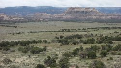
Beef Basin initially had the appearance of an enormous grass amphitheater, with huge rock outcrops surrounding the vast flat meadows. It was a magnificent sight, as I arrived through a narrow gap in the rocks from Butler Wash WSA.
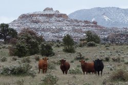
This appeared to be ideal grazing land, and as I strolled across the lush meadows, the local cattle and their young calves were certainly keeping a very close eye on me. The area is also known for the large quantity of archaeological sites, especially the tower structures. Many of the best known habitation sites in the wider South-West are located in alcoves in high cliffs, but Beef Basin probably has the largest number of ruins that were built on open ground.
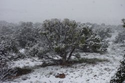
After setting up camp, I headed off to explore some of the nearby cliffs, in search of some granaries that I had read about. Unfortunately my adventures were curtailed by the arrival of some heavy snow, which fell for several hours, forcing me to take shelter in a cosy alcove. I was able to pass the time supplementing my water supplies by gathering snow from the surrounding tree branches into some zip-loc bags. I did have to remind myself that this was Southern Utah in late May, and here I was collecting snow !
Despite being behind schedule, I was determined to spend the next day visiting as many of the significant ruins in Beef Basin, as I could. There are some superb tower structures here, and one can only imagine the activity in the area during its main occupation period over 800 years ago.
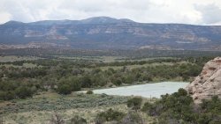
There is a little-known but impressive piece of technology in the northern section of Beef Basin. It is referred to as 'The Guzzler', and is effectively a large rain-catchment system, that distributes the water, by gravity, to a series of 12 cattle troughs in the surrounding area. Amazingly, my entrance to Beef Basin on the previous day, brought me within 200 yards of the Guzzler. In preparation for my hike, I had hoped that it might be possible to collect some water from the tanks here, but a high metal fence and padlocked gate makes it inaccessible.
Although I wasn't relying on collecting water here, and had sufficient supplies in my pack, it was a little frustrating. I had to wait until later in the afternoon to collect clean water from the troughs at Stanley Spring. There are other locations with streams running in Beef Basin, but they are quite ‘cow-ey’, so it was nice to be able to fill my bottles directly from the permanent pipe feeding directly from the fence-protected source at Stanley Spring.
I spent a couple of hours exploring the side-canyons of the area, and found several more ancient ruins. One structure in particular, perched on a ridge is perhaps the most impressive single building I have seen, in the entire south-west. As one would imagine, almost all ancient structures across this region prioritize function over style, and it is likely that it is only the modern eye that sees 'beauty' in these ruins. However, this particular structure appears to have been designed by a retired architect, such is the glorious design of this 3 story building. The walls of every room appear to be curved, and the precision of the curves allows each connecting room to flow seamlessly into the next. As one approaches the structure, there is a beautiful narrow, curved entrance corridor, that leads to an open courtyard, onto which the interior rooms face. The building must have been stunning to behold when it was occupied 1,000 years ago, and it was a true privilege to be able to visit it, and imagine the lives of the family that called this place home. This site is undoubtedly a place of outstanding beauty.
Again, a late afternoon thunderstorm and deluge forced me into my tent early to keep dry. I was using a new lightweight tent during this trip. It wasn't really purchased for its storm-proof qualities, especially as the intention was to test it for the first time during late spring in beautiful, sunny, dry Utah ! However, since the Colorado Plateau in late May 2019 resembled Scotland in mid-November, at times, I was certainly glad that the tent stood up to everything that was thrown at it during this trip.
I had now completed 124 miles over 11 days (10 hiking days)
Part 1 of the trip available here
Part 3 of the trip available here
Part 4 of the trip available here
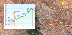
Trail Map and Elevation Profile
.
.
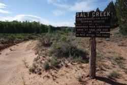
Salt Creek, Needles District, Canyonlands National Park
.
.
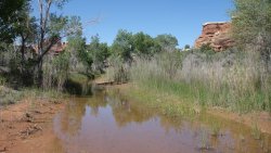
Plenty of water around Peekaboo Spring
.
.
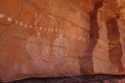
White pictographs ~1,000 years old, on top of faint red pictographs ~4,000 years old
.
.
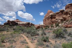
Beautiful Salt Creek
.
.
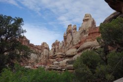
Brushy side-canyons
.
.
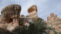
The Molar
.
.
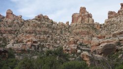
500' talus slope to exit the National Park via a high saddle
.
.
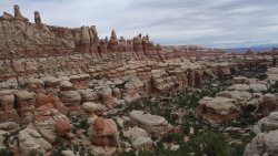
View back into Needles from the high saddle
.
.
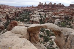
Anne's Arch
.
.
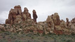
Dropping into a grassy pocket from the high saddle and entering Butler Wash WSA
.
.
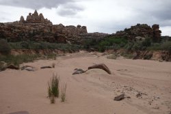
Approaching Butler Wash
.
.
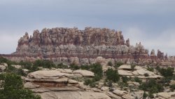
The Needles Castle
.
.
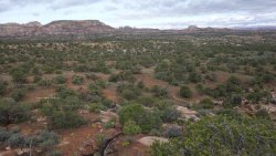
Cross-country to reach Beef Basin
.
.
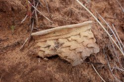
Rim of an ancient pot
.
.
Lush pastures of Beef Basin
.
.
The Guzzler, a rain-catchment system which supplies 12 troughs in the northern section of Beef Basin
.
.
Curious cattle
.
.
Heavy snow in late May !
.
.
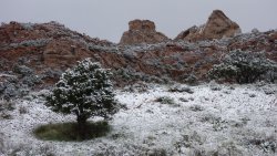
A sheltering tree
.
.
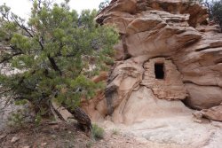
An iconic granary
.
.
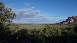
Big sky across Beef Basin
.
.
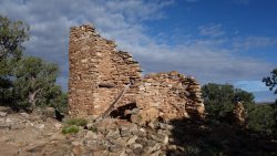
Tower ruin
.
.
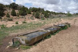
The welcoming waters of Stanley Spring
.
.
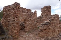
Stunning family home
.
.
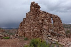
Approaching storm
“The canyons are calling, and I must go ”. I don’t think John Muir would mind too much if I misquote him.
Muir was heading into the mountains of course, but today this famous quote from the great Scottish Naturalist, and ‘father’ of the US National Parks, came very much to mind. I felt an incredible sense of excitement this morning, as I headed into possibly the most spectacular canyon system in the entire South-West: Needles.
Although excited, I also felt a little nervous as I left the Needles Outpost and headed in the direction of Salt Creek in the Needles District of Canyonlands National Park. Although I was full of energy and enthusiasm for the 6th day of my hike (I had covered 65 miles so far), this was likely to be my longest single day at over 15 miles. It was also the day where my pack would be at its heaviest, with 8 days worth of food to carry.
My plan was to traverse Needles in a single day via a series of side canyons. This little-known route culminates in the crossing of a spectacular high saddle at the edge of the park, after scaling a steep rubble slope. The advantage of crossing the Needles District as a day-hike, is that it isn’t necessary to obtain an overnight backcountry permit, nor to carry a hard-sided, bear-resistant canister, which is required when camping in this area of Canyonlands. As part of a recent 10-day backpacking trip to Needles, I had checked out this route, and was able to cache some water outside of the park, to be collected this evening. This was the plan anyway, and hopefully it would work out as intended.
I was delighted that the weather forecast had proved to be correct, and that the high temperatures of the previous few days had gone, to be replaced by a chilly, cloudy morning, which should prove ideal conditions for this long hike.
It looked like the local wildlife was already up and about this morning: a couple of piles of bear scat along the trail, and also what looked suspiciously like a set of mountain lion tracks in the damp wash. These magnificent elusive creatures frequent the mountains and canyons of this area, but are rarely seen, never mind encountered.
As I left beautiful Salt Creek, and followed a significant side canyon, I felt great, and my heavy pack wasn't bothering me in the slightest. The side canyons here can be very brushy, and it takes considerable effort at times, to find a route through the tamarisk-choked drainages. I finally reached an easier section of the canyon, with a series of large flat sandstone slabs to walk over. This was all going very well.
TRIP ... STUMBLE ... CRUNCH ... TWIST ... CRUMPLE ... SMASH ... down I went, like the proverbial ton of bricks. Somehow, I'd stumbled on a 3-inch ledge between two sandstone slabs, and came crashing down, knee-first, onto the hard surface, turning my ankle in the process. After a couple of minutes, I was able to get to my feet easily enough, and test if I could walk ok. My knee was fine, and my ankle hurt a little, but it didn't seem too bad at all, so off I went once more. My hiking pants weren’t faring well; the rip at the ankle from yesterday’s canine encounter was now supplemented by a large rip across the knee !
It was getting very chilly, and the sky was darkening considerably as I stopped an hour later for lunch. I reached over to my pack to get my rain jacket, but something wasn't right. I tried to get to my feet and literally couldn't do it; my ankle was completely seized up, and it was agony to move it in any direction. This wasn't good. I literally couldn’t walk. As the first thunder clap echoed through the canyon, I realized I’d need to put up my tent as quickly as possible. It must have been a comical sight to see me crawling on my hands and knees back and forth across the ground, trying to erect the tent in double-quick time. It was a close-run thing, but I got the tent up and secure and threw my pack inside, only seconds before the skies opened and the hail began to fall. And, oh my goodness, what a storm it turned out to be; the hail fell like bullets from the pitch-black sky for over an hour, and was followed by several hours of torrential rain. I certainly wasn’t going anywhere today.
-----
When I woke the next day, my left ankle still hurt badly. I had had a restless night, constantly struggling to get comfortable with one leg inside my sleeping bag, and the other one outside. I daren’t take off my boot, just in case my ankle swelled badly, and I couldn’t get it back on again. Whatever happened, I was going to need my boots on, if I was to hobble out of here, at some point.
Of course, if this was in fact a serious injury, then I wouldn’t be hobbling anywhere. Given the remote location I had reached, there was also little chance of another hiker or ranger passing by, and being able to help me. I checked in my pack for my emergency location beacon, just in case I’d need to leave here by helicopter !
It was all getting to be a bit depressing, as the realization that my hike was probably over was beginning to sink in. In addition, I was feeling incredibly guilty about camping in Canyonlands without a permit. It's something I'd never consider attempting in normal circumstances, but the fact that this was an emergency situation didn't make me feel a whole lot better about it. I was feeling low. On the plus-side of course, I still had 7 days of food in my pack, so it's not as if I was going to starve out here ! Of course, if the local bears find out that I have 7 days worth of food, they'll be making a rapid bee-line in my direction. It's lucky I didn't pack those 2 jars of honey !
It was a desperately boring and frustrating day. Listening to a couple of ‘Wittertainment’ podcasts did manage to cheer me up a little. However, as the afternoon progressed, I was able to start to move my ankle up and down and left to right. So maybe I'd be able to hobble out of here tomorrow, after all, and get back to the Needles Outpost. Later in the afternoon I was able to walk gingerly for a few minutes outside my tent, so it seemed that I was on the mend. I guess I would have a better idea in the morning, but at least I wouldn’t have to trigger my rescue beacon.
'Whoosh-whoosh-whoosh-whoosh' That seemed like a familiar sound, but I couldn't quite place it at first. It got progressively louder, and I realized what it was: a helicopter flying low over the canyon. Oh my goodness, I thought, maybe the Park Service have found out that I'm camping here without a permit, and have sent out a group of elite rangers to track me down and bring me back to Park jail. The whoosh of the helicopter blades faded into the night, as I sat nervously inside my tent. I finished off my tasty dinner of Ramen noodles (Oriental flavor) realizing that I had escaped justice; for now ! This trip wasn't supposed to turn out to be a re-creation of the adventures of Butch Cassidy and the Sundance Kid, and I did hope that I wouldn't have to jump off a high cliff into a raging river anytime soon.
-----
I slept well, but woke up with a very stiff and tender ankle. This wasn't looking promising at all. It seemed likely that this would be the final day of my adventure. However, I was able to get to my feet and walk for a few minutes, and as I walked, it did seem that the ankle had loosened up a bit and felt slightly better. I slowly dismantled my tent and was soon in auto-pilot mode of organizing my gear and packing my rucksack. This was a good sign, since it meant I wasn't aware of every tiny movement of my ankle. When I thought about it, I could feel it was sore, but I wasn't in any great pain at all.
So, off I went, continuing south on my original route, more in hope than expectation. My intention was to follow several more side canyons, and then exit the park via a tricky 500’ high scree slope, and finally head in the direction of Butler Wash. My ankle was sore, and some movements resulted in a sharp pain, but it was actually fine to walk on, and as I continued, I became less aware of it. I was hesitant to feel too confident, and my fledgling tap-dancing career may be over, but it appeared that I was on my way again !
After exiting Canyonlands, and reaching Butler Wash, my next goal was Beef Basin. However, I had to negotiate a tricky route around a plethora of cliffs, drop-offs, dead-ends, dry-falls and shallow drainages across the Butler Wash Wilderness Study Area, as I made my way south. My prior research using Topo maps and Google Earth had indicated this cross-country route to be fairly benign, but my goodness, there is some complex topography here, and it was quite a challenge navigating this area at ground level.
Although my ankle continued to hurt, I had hoped to make up some lost time today, but the arrival (yet again !) of heavy afternoon rain and hail meant that I had to set up camp earlier than intended. The thunder overhead growled menacingly, late into the evening.
-----
Beef Basin initially had the appearance of an enormous grass amphitheater, with huge rock outcrops surrounding the vast flat meadows. It was a magnificent sight, as I arrived through a narrow gap in the rocks from Butler Wash WSA.
This appeared to be ideal grazing land, and as I strolled across the lush meadows, the local cattle and their young calves were certainly keeping a very close eye on me. The area is also known for the large quantity of archaeological sites, especially the tower structures. Many of the best known habitation sites in the wider South-West are located in alcoves in high cliffs, but Beef Basin probably has the largest number of ruins that were built on open ground.
After setting up camp, I headed off to explore some of the nearby cliffs, in search of some granaries that I had read about. Unfortunately my adventures were curtailed by the arrival of some heavy snow, which fell for several hours, forcing me to take shelter in a cosy alcove. I was able to pass the time supplementing my water supplies by gathering snow from the surrounding tree branches into some zip-loc bags. I did have to remind myself that this was Southern Utah in late May, and here I was collecting snow !
-----
Despite being behind schedule, I was determined to spend the next day visiting as many of the significant ruins in Beef Basin, as I could. There are some superb tower structures here, and one can only imagine the activity in the area during its main occupation period over 800 years ago.
There is a little-known but impressive piece of technology in the northern section of Beef Basin. It is referred to as 'The Guzzler', and is effectively a large rain-catchment system, that distributes the water, by gravity, to a series of 12 cattle troughs in the surrounding area. Amazingly, my entrance to Beef Basin on the previous day, brought me within 200 yards of the Guzzler. In preparation for my hike, I had hoped that it might be possible to collect some water from the tanks here, but a high metal fence and padlocked gate makes it inaccessible.
Although I wasn't relying on collecting water here, and had sufficient supplies in my pack, it was a little frustrating. I had to wait until later in the afternoon to collect clean water from the troughs at Stanley Spring. There are other locations with streams running in Beef Basin, but they are quite ‘cow-ey’, so it was nice to be able to fill my bottles directly from the permanent pipe feeding directly from the fence-protected source at Stanley Spring.
I spent a couple of hours exploring the side-canyons of the area, and found several more ancient ruins. One structure in particular, perched on a ridge is perhaps the most impressive single building I have seen, in the entire south-west. As one would imagine, almost all ancient structures across this region prioritize function over style, and it is likely that it is only the modern eye that sees 'beauty' in these ruins. However, this particular structure appears to have been designed by a retired architect, such is the glorious design of this 3 story building. The walls of every room appear to be curved, and the precision of the curves allows each connecting room to flow seamlessly into the next. As one approaches the structure, there is a beautiful narrow, curved entrance corridor, that leads to an open courtyard, onto which the interior rooms face. The building must have been stunning to behold when it was occupied 1,000 years ago, and it was a true privilege to be able to visit it, and imagine the lives of the family that called this place home. This site is undoubtedly a place of outstanding beauty.
Again, a late afternoon thunderstorm and deluge forced me into my tent early to keep dry. I was using a new lightweight tent during this trip. It wasn't really purchased for its storm-proof qualities, especially as the intention was to test it for the first time during late spring in beautiful, sunny, dry Utah ! However, since the Colorado Plateau in late May 2019 resembled Scotland in mid-November, at times, I was certainly glad that the tent stood up to everything that was thrown at it during this trip.
I had now completed 124 miles over 11 days (10 hiking days)
Part 1 of the trip available here
Part 3 of the trip available here
Part 4 of the trip available here
Trail Map and Elevation Profile

.
.
Salt Creek, Needles District, Canyonlands National Park

.
.
Plenty of water around Peekaboo Spring

.
.
White pictographs ~1,000 years old, on top of faint red pictographs ~4,000 years old

.
.
Beautiful Salt Creek

.
.
Brushy side-canyons

.
.
The Molar

.
.
500' talus slope to exit the National Park via a high saddle

.
.
View back into Needles from the high saddle

.
.
Anne's Arch

.
.
Dropping into a grassy pocket from the high saddle and entering Butler Wash WSA

.
.
Approaching Butler Wash

.
.
The Needles Castle

.
.
Cross-country to reach Beef Basin

.
.
Rim of an ancient pot

.
.
Lush pastures of Beef Basin

.
.
The Guzzler, a rain-catchment system which supplies 12 troughs in the northern section of Beef Basin

.
.
Curious cattle

.
.
Heavy snow in late May !

.
.
A sheltering tree

.
.
An iconic granary

.
.
Big sky across Beef Basin

.
.
Tower ruin

.
.
The welcoming waters of Stanley Spring

.
.
Stunning family home

.
.
Approaching storm

Last edited:

