Guess the spot

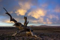
We have a winner. (Technically I'd call it the western edge of the White River Valley, but it kind of sits between the White River and the Coal.) In my opinion, Basin and Range is one of the best, but also most overlooked, National Monuments in the country. Glad to see others appreciate it as well. Rockskipper, you're up.


@3d3vart How about a trip report from Basin and Range National Monument ?;)
 
I had to look that one up. Very interesting.

Back when I was a teenager, my brother and some friends drove out there to cowboy camp and watch for alien space craft. Also went to see the Integritron. All very fascinating to us at that time.
 
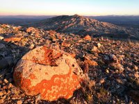
Ok, another hint they say. Two of the American West's most iconic mountain ranges (in two different states, respectively) can be viewed from the top of those 8K' elevation hills/peaks in the background of the photo. And another photo from another angle below.IMG_0554.JPG
 
Last edited:
Ok, we seem to have hit a wall. This place is in Wyoming. The Uintas and Wind River Ranges are visible from the peaks. They're also a Wilderness Study Area.

That should help....
 
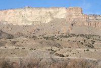
My main computer crashed, and I don't have many photos, but I'll post this one. It may be kind of obscure, so I'll give some hints:

About 300 years ago, a huge landslide brought down the face of this cliff. All the hummocky hills are the result of that, and it totally blocked one of the main riverways in the western U.S. for some time. Lots of people drive by it everyday on a major interstate and few probably realize what they're looking at. The landslide is named for a small coal mining town that is now gone, as was a coal-fired powerplant that was removed a few years ago. (Not in Utah.)

IMG_2835.JPG
 
Last edited:
Back
Top