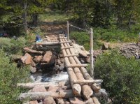
Now as for this area, I have camped here in the camping sites along the Snake River here off and on for years and years. And have hiked everywhere in the area. It is such a nice nice area. I really love the huge meadows nearby. Also have hiked the trail near here that goes on down to the head of Jackson Lake .... really nice. At this little bridge have photos both upstream and downstream from that bridge. But the camping spots near here along the Snake River are really hard to beat and free also. Seeing this photo brought back so many good memories.
Navigation
Install the app
How to install the app on iOS
Follow along with the video below to see how to install our site as a web app on your home screen.
Note: This feature may not be available in some browsers.
More options
Style variation
You are using an out of date browser. It may not display this or other websites correctly.
You should upgrade or use an alternative browser.
You should upgrade or use an alternative browser.
Guess the spot
- Thread starter Backcountry Post
- Start date
Absarokanaut
Member
- Joined
- Sep 17, 2014
- Messages
- 703
- Joined
- Jan 4, 2015
- Messages
- 2,903
Cub?Sadly the Park Service has forbidden soaking in the source Springs. I too love this area, great wildlife and one of the greatest Camas displays I've ever seen. Kamtjhwy, that's a great trail. Glade Creek, Flagg Canyon, some great Frontcountry stuff.
OK,
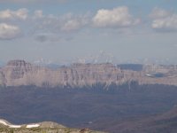
What Creek Drainage am I looking down here?
View attachment 61334
Absarokanut, good country here in your photo. My guess here in your photo is ...
... looking down the East Fork Sixmile Creek with the upper Wind River Valley in the distance. Ramshorm Peak is on the left side of the photo on top of the mountain ridge and the northern part of the Wind River Mountains in the distance. And in taking the photo, you must of been up on top or near the top of the Ramshorn Plateau nearby. This in saying the Ramshorn Plateau is to differentiate from Ramshorn Peak in the photo.
... looking down the East Fork Sixmile Creek with the upper Wind River Valley in the distance. Ramshorm Peak is on the left side of the photo on top of the mountain ridge and the northern part of the Wind River Mountains in the distance. And in taking the photo, you must of been up on top or near the top of the Ramshorn Plateau nearby. This in saying the Ramshorn Plateau is to differentiate from Ramshorn Peak in the photo.
Last edited:
Absarokanaut
Member
- Joined
- Sep 17, 2014
- Messages
- 703
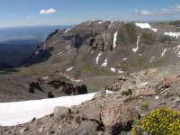
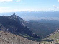
Your are correct Kmathjhy and are up. I'm out of the bad wind not far below Point 11,894; the top of the Ramshorn Plateau. The Wild and wonderful Washakie Wilderness. Here's the view another direction. Couple more summit shots. I was fortunate to have access down below but If you can drive Burroughs Creek Loop [Rough] the hike on that side is far shorter but still very rugged with off trail. Scary as you know what. Make a lot of noise and just be bear smart. I would hard side vehicle camp only up there right at the Creek.


- Joined
- Jun 25, 2012
- Messages
- 4,430
x10!Boy, I sure didn't get that hint, though I'm not that familiar with YP. But I think it would be cool if we could extend YP on down into Arizona. Just take a strip about 300 miles wide all the way to Mexico, kick all the people out (which would include myself), and make it a national park.
- Joined
- Jun 25, 2012
- Messages
- 4,430
Dang, I have to pay closer attention. I saw, and specifically remembered that burnt post just this past summer while out exploring this drainage from our high camp this summer while exploring YNP and Union Falls. I remember that post!
Last edited:
Absarokanaut
Member
- Joined
- Sep 17, 2014
- Messages
- 703
I have always been somewhat amazed that the Continental Divide Trail goes from Brooks Lake over Bear Cub Pass and that it doesn't go up Bonneville Pass onto the crest of the Divide and go all the way to Marston Pass. That would be one of the most spectacular crest walks of the entire 3K+ mile trail. However, I kind of like having that country to myself too. Just babbling.
- Joined
- Dec 11, 2015
- Messages
- 2,094
Coffin Butte?
- Joined
- Jan 4, 2015
- Messages
- 2,903
I did that last summer and am tentatively planning to do the same this summer on my CDT home.I have always been somewhat amazed that the Continental Divide Trail goes from Brooks Lake over Bear Cub Pass and that it doesn't go up Bonneville Pass onto the crest of the Divide and go all the way to Marston Pass. That would be one of the most spectacular crest walks of the entire 3K+ mile trail. However, I kind of like having that country to myself too. Just babbling.
I was looking at it, and even from marston pass, you can continue to loosely follow the divide all the way to two oceans pass
Outdoor Fool, No it is not Coffin Butte ... look to the north and see Absarokanut's hint.
Now I hear exactly what you are saying Absarokanut. Yes just how spectacular is that Continental Divide Country is from Togwotee Pass to Marston Pass and then on up to Two Ocean Pass. And then all the offshoot ridges in there ... enough country to live in and explore for how many lifetimes. Have been in there and loved it. And sooooo often when am back in there, am back in there all by my lonesome and Love It!
Life is Great!!!
Last edited:
LarryBoy, Now you are really really close .... and since have to go to work, will give it to you on that answer. Go ahead now for you are up.
Go For It!
Actually this was taken from the pass right between Younts Peak and Thorofare Peak at 11,000 feet, looking south over the huge bowl at the head of the South Fork of the Yellowstone. Then the mountains and the Buffalo Plateau beyond. And in the far distance, which can be barely seen, is the Wind River Mtns. I am right on the slopes of Thorofare Mtn. in taking this photo. Here one can see wild country as far as one can see, just as it should be. This is excellent Grizzzly Country for right in here have seen a dozen grizzlies in one day. Again good good good wild country, being here all by my lonesome and enjoying everything.
Now would camp down the South Fork of the Yellowstone a ways , and then spend days and days up in here just enjoying everything. And climbing the peaks with getting their glad tiding as Muir would say. One could spend lifetimes back in here and never see it all. And in here if one looks closely, one can find artifacts left behind by the old Sheepeater (Mountain Shoshone) natives. Life is Great with this country still around.
@LarryBoy, you're up .... so really close with the answer.
Wishing Everyone the Best!
Don't like ads? Become a BCP Supporting Member and kiss them all goodbye. Click here for more info.


