John Morrow
Member
- Joined
- May 22, 2015
- Messages
- 1,119
Darn, I gotta come up with something.
Follow along with the video below to see how to install our site as a web app on your home screen.
Note: This feature may not be available in some browsers.
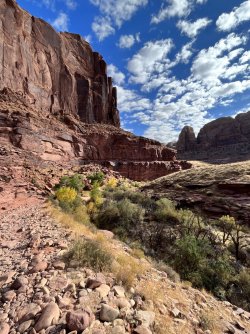
If that is so it must be a part of Pleasant Creek I haven't been.Ah, Pleasant Creek
yes! not far from where it exits the reef. I don't think most people get up onto the rim here, but it's easy and niceAh, Pleasant Creek
@SteveR - very funny, ha... it's the second photo with the nice red walls we are guessingWell.......Pleasant Creek comes to mind.

Titans - thank you - have hiked along the creek also. Curious about a way down from the top of Waterpocket Canyon to the creek - would be a nice loop going up the slickrock expanse N of the creek and then down S to the creek - tried but got cliffed out at the top
Don't like ads? Become a BCP Supporting Member and kiss them all goodbye. Click here for more info.
