Guess the spot: Utah Edition

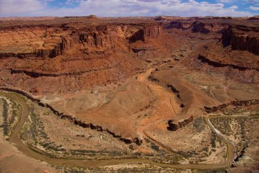
Stevens Canyon?
Yup you got it!

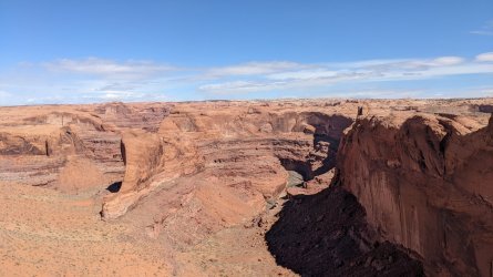
Did Lake Powell ever rise that high? I'm not sure if thats a bath tub ring in the canyon but it kind of looks like it. All the maps show it was lower than the mouth of the canyon.

Sx-zoHW_43_hpEou-8HkIqwV7XBNnUhGzHSs3wEnK-Oa5e2LsFsmF0NRMLCd0TuHWmXPbIQf-DqfxRgWIg4peFulMjIvMxRIBOQNOIN-GjqAXwRiBZUV-PR9Q-GKLTZtNiCCE57EQ25zm-GBsmvttIB5-dMfxrI1xQ6AFHAcIDwW0aLXF_H3tyu-YFBhuFQQCq9XbqOv7J-9nE3s2u7J51afLghQ47yvUSNhi8CRwQ85EUCsn_f6LseYUBpvIMJRNOvvPp6R3VS6o5Sah3V6OiB-FXeUo-vP3h_h8KSK20_s_yuUuWioi65QZFPJkOdtRh-ktZNYtofsgi3pgdtwJxlqj9OyrbGmhVuam_UTJVK8r1qJspvjEpzxjeOiPdhVbZI3hgdqmaOi4RWo3EYmbRpJdKQ6MHlow-yGntSBmGXQASdWOADyeAiQY5rQqzovAG7DI4ZnIKPJFFMVkcdt7HuXyL_VEMZ_V1l6eWGjJ_udwvg7ioGyScqEbh6bvfy87CKeFTYTpywyFsU9DOEJBE9aelChZnDYHTcH25BDbCmEEdrPEntZgyhioLEoNas2wrTHbZqb8zvtAt3TFyUU02wUzETEMLpBEu72uzBRprxMi5r5paDqzRkDGYZSmaO8tUh9C6B7HU1QjruyGW9u5gHU7ar47sbPnuElIeajLnuXNCoXEiKBES7V3JJ4Gfs4JDQgFEEEDsdHa3QDqeK9184jQ0LVPFG4UhN3sVvSoH8gIMqpsyXSWFJg9jC7Mcy8AkoIWWEoONzvcY5MJqfGvhT8R1sgz1elyQW2Q2NjipxXLRBkRjs55_A6XLohalqcrJnTboug51Y08Ap-JmAhvGLqFWO2pYGD4KU0D6Y8Auz1z0GwjK4eI8yYWkBRKp_PWvwYcOvpmQnWtuO2uDD76HC515kq96na-1f75x-7vXzLRYusPzaENPnDKscibTwP3Mygj3d0gXOuJK-6dXQBvV-FkS-dkjGSohSiWLV1i563B1wopQezlUzC6crtH7S3Wb7qG34RnVm6MVy34BDPD6YmsXM=w2440-h1830-no
 
Yup you got it!

Did Lake Powell ever rise that high? I'm not sure if thats a bath tub ring in the canyon but it kind of looks like it. All the maps show it was lower than the mouth of the canyon.
Sx-zoHW_43_hpEou-8HkIqwV7XBNnUhGzHSs3wEnK-Oa5e2LsFsmF0NRMLCd0TuHWmXPbIQf-DqfxRgWIg4peFulMjIvMxRIBOQNOIN-GjqAXwRiBZUV-PR9Q-GKLTZtNiCCE57EQ25zm-GBsmvttIB5-dMfxrI1xQ6AFHAcIDwW0aLXF_H3tyu-YFBhuFQQCq9XbqOv7J-9nE3s2u7J51afLghQ47yvUSNhi8CRwQ85EUCsn_f6LseYUBpvIMJRNOvvPp6R3VS6o5Sah3V6OiB-FXeUo-vP3h_h8KSK20_s_yuUuWioi65QZFPJkOdtRh-ktZNYtofsgi3pgdtwJxlqj9OyrbGmhVuam_UTJVK8r1qJspvjEpzxjeOiPdhVbZI3hgdqmaOi4RWo3EYmbRpJdKQ6MHlow-yGntSBmGXQASdWOADyeAiQY5rQqzovAG7DI4ZnIKPJFFMVkcdt7HuXyL_VEMZ_V1l6eWGjJ_udwvg7ioGyScqEbh6bvfy87CKeFTYTpywyFsU9DOEJBE9aelChZnDYHTcH25BDbCmEEdrPEntZgyhioLEoNas2wrTHbZqb8zvtAt3TFyUU02wUzETEMLpBEu72uzBRprxMi5r5paDqzRkDGYZSmaO8tUh9C6B7HU1QjruyGW9u5gHU7ar47sbPnuElIeajLnuXNCoXEiKBES7V3JJ4Gfs4JDQgFEEEDsdHa3QDqeK9184jQ0LVPFG4UhN3sVvSoH8gIMqpsyXSWFJg9jC7Mcy8AkoIWWEoONzvcY5MJqfGvhT8R1sgz1elyQW2Q2NjipxXLRBkRjs55_A6XLohalqcrJnTboug51Y08Ap-JmAhvGLqFWO2pYGD4KU0D6Y8Auz1z0GwjK4eI8yYWkBRKp_PWvwYcOvpmQnWtuO2uDD76HC515kq96na-1f75x-7vXzLRYusPzaENPnDKscibTwP3Mygj3d0gXOuJK-6dXQBvV-FkS-dkjGSohSiWLV1i563B1wopQezlUzC6crtH7S3Wb7qG34RnVm6MVy34BDPD6YmsXM=w2440-h1830-no
Looking at the USGS map the high water mark is within a 1/4 mi of where Stevens meets the Escalante, so it seems at least possible. Need to ask someone who was there in the 90s!

Loved the direct view into this remote canyon:
DSC02148 (1).jpeg
 
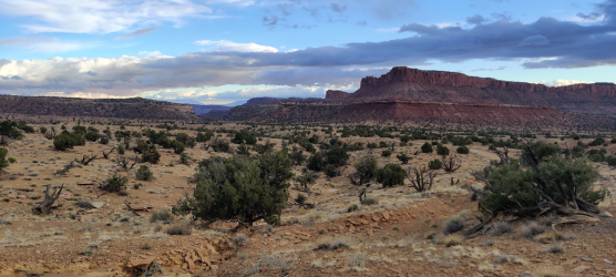
This ought to be an easy one: river, uranium mine road at the base of the Chinle and a very characteristic canyon mouth formation to compare to maps. What river cuts through kayenta flats, wingate and chinle with distant navajo domelands? Likely looking north from an opposite rim having access. Regehr is probably in the backcountry or he'd answer. Did you cross the river and enter said canyon?
 
Sams Mesa Box Canyon?

Has anyone biked or hiked that road? I think it would be a cool bike ride from Poison Springs.
 
@BeardoMcGrath If you go via the black jump, I would be very interested in a road report!
there's a note on Road Trip Ryan that Black Jump is blocked by a big rockfall, and a friend told me that he got this confirmed by the Hanksville BLM office. so I'd plan on either walking or biking this and it might be a long day depending on where the rockfall is.
 
also, a couple weeks ago I crossed the DD (on foot) from where that road that heads north along the west rim of the DD inner gorge from highway 95 drops down to river level. this was not that easy or fun. be careful this year!

on the other hand, we shouted back and forth a bit with a group of packrafters who were having a great time with the higher flows. unlike when I packrafted this river a few years ago and we were out of the boats dragging them as much as we were in the boats.
 
Last I heard it was an extra 4.5 miles to get to the normal black jump trailhead. Here is the next picture!
 

Attachments

  • PXL_20220309_182151094.jpg
    PXL_20220309_182151094.jpg
    371.5 KB · Views: 23
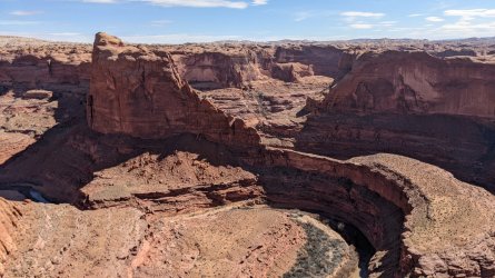
This looks like looking down into the Escalante canyon just SE of the Crack in the Wall access to Coyote Gulch. Pan to the left of your photo for Stevens Arch
Yep! Here is said picture! Stevens Arch is kinda hard to see, but it's there.
 

Attachments

  • PXL_20220309_182637872.jpg
    PXL_20220309_182637872.jpg
    285.3 KB · Views: 18
there's a note on Road Trip Ryan that Black Jump is blocked by a big rockfall, and a friend told me that he got this confirmed by the Hanksville BLM office. so I'd plan on either walking or biking this and it might be a long day depending on where the rockfall is.
Last I heard it was an extra 4.5 miles to get to the normal black jump trailhead. Here is the next picture!

Thanks for the update! I was wondering/worried this road would have experienced damage after the past couple strong monsoon seasons. As is our plan to go to the Abajos and Beef Basin may be complicated by a late melt out.
 
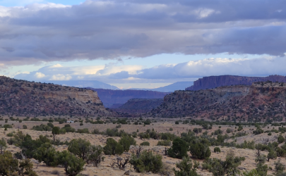
Zooming in on the notch in the center, give you a better view of a major landmark in the area.
Utah14a.png
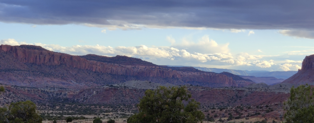
Moving to the right of the original pic, looking down canyon, gives you a view of another major landmark in the area.
Utah14b.png
 
Bridger Jack mesa?
Nope. The mesa in the photo does not contain 'mesa' in its place name. Does that not make it a mesa? I'll let the community decide once the answer is revealed.
 
Last edited:
Back
Top