Navigation
Install the app
How to install the app on iOS
Follow along with the video below to see how to install our site as a web app on your home screen.
Note: This feature may not be available in some browsers.
More options
Style variation
You are using an out of date browser. It may not display this or other websites correctly.
You should upgrade or use an alternative browser.
You should upgrade or use an alternative browser.
Guess the spot: Utah Edition
- Thread starter Ben
- Start date
Udink
Still right here.
- Joined
- Jan 17, 2012
- Messages
- 1,742
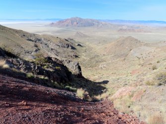
How about I just post my own photo from almost the exact same location?ok!! View attachment 103113to take over the thread tell me what mountain range this picture in from. for bonus points, give a more precise location.
- Joined
- May 31, 2015
- Messages
- 3,329
I feel like that's a reference to my Sheets Draw guess. Haha. I can't place it exactly off of personal experience, but I'm gonna guess Pleasant Creek Flats.This might be a bit obscure, although it's very close to a wrong guess to one of my recent posts in this thread. I'll accept anything relatively close to the area and will be dropping hints along the way.
View attachment 103115
Udink
Still right here.
- Joined
- Jan 17, 2012
- Messages
- 1,742
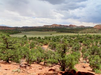
Nailed it! Taken from inside an alcove along Pleasant Creek Flats, with Jorgenson Flats in the distance across Pleasant Creek.I feel like that's a reference to my Sheets Draw guess. Haha. I can't place it exactly off of personal experience, but I'm gonna guess Pleasant Creek Flats.
- Joined
- May 31, 2015
- Messages
- 3,329
Absolutely love that whole area. It's my favorite spot for spring backpacking. And the fact it's now 11ish hours away from me is my least favorite part about living in Montana. Haha.Nailed it! Taken from inside an alcove along Pleasant Creek Flats, with Jorgenson Flats in the distance across Pleasant Creek.
Next up.
regehr
Member
- Joined
- Mar 28, 2012
- Messages
- 2,454
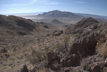
we poked into the mineshafts just a bit-- I'm scared of going too far into these, though one that goes all the way through should probably have good ventilation!How about I just post my own photo from almost the exact same location?Silver Island Mountains, just west of Lamus Peak. I'm really surprised we've both been in that same canyon. Did you walk through the 500' mine shaft going through the ridge? I'll BRB with a new photo to guess.
Reef&Ruins
Colorado Plateau is calling...
- Joined
- Feb 3, 2017
- Messages
- 926
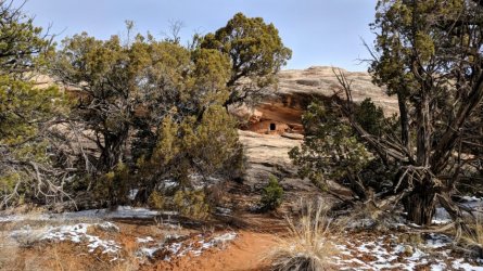
I will take Cedar Mesa for 1$ please (since I don't know the exact ruin).
- Joined
- May 31, 2015
- Messages
- 3,329
How about a canyon name? Cedar Mesa is pretty large. This is near the top of this canyon, and it feeds into Grand Gulch.I will take Cedar Mesa for 1$ please (since I don't know the exact ruin).
Reef&Ruins
Colorado Plateau is calling...
- Joined
- Feb 3, 2017
- Messages
- 926
Oh yeah, I wasn't saying I won.... just getting it started.How about a canyon name? Cedar Mesa is pretty large. This is near the top of this canyon, and it feeds into Grand Gulch.
Now I will try Shieks for $100
- Joined
- May 31, 2015
- Messages
- 3,329
Got it! Have at it.Oh yeah, I wasn't saying I won.... just getting it started.
Now I will try Shieks for $100
Reef&Ruins
Colorado Plateau is calling...
- Joined
- Feb 3, 2017
- Messages
- 926
John Morrow
Member
- Joined
- May 22, 2015
- Messages
- 1,119
Long shot....Divide between Shot and Water Canyons?
Reef&Ruins
Colorado Plateau is calling...
- Joined
- Feb 3, 2017
- Messages
- 926
No. Right park though.Long shot....Divide between Shot and Water Canyons?
Reef&Ruins
Colorado Plateau is calling...
- Joined
- Feb 3, 2017
- Messages
- 926
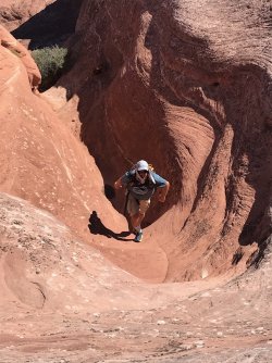
Correct. Except I am ascending from Big Spring up over, but whatever! You are up @SteveR! Sorry for the late reply. Been a busy day.Reminds me of the descent from the divide separating Big Spring and Squaw canyons at Needles.
SteveR
Member
- Joined
- Sep 22, 2016
- Messages
- 1,024
I'm actually surprised that I got it, as it was 2003 when we hiked that route, in reverse to you which is why I said "descent". I guess my memory isn't that bad, yet.Correct. Except I am ascending from Big Spring up over, but whatever! You are up @SteveR! Sorry for the late reply. Been a busy day.
Up next, we have this:
SteveR
Member
- Joined
- Sep 22, 2016
- Messages
- 1,024
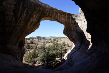
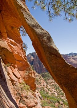
Got it! Take it away...Two Pine Arch
Don't like ads? Become a BCP Supporting Member and kiss them all goodbye. Click here for more info.

