Navigation
Install the app
How to install the app on iOS
Follow along with the video below to see how to install our site as a web app on your home screen.
Note: This feature may not be available in some browsers.
More options
Style variation
You are using an out of date browser. It may not display this or other websites correctly.
You should upgrade or use an alternative browser.
You should upgrade or use an alternative browser.
Guess the spot: Utah Edition
- Thread starter Ben
- Start date
John Morrow
Member
- Joined
- May 22, 2015
- Messages
- 1,119
Lower Indian Creek?
- Joined
- May 19, 2012
- Messages
- 2,017
UtahBrian
God bless America. Let's save some of it.
- Joined
- Feb 15, 2018
- Messages
- 54
Paria River?Ok. I am assuming no one knows where that pic is from, it is Little Bridge Canyon.
Here is a new one, that should be really easy. An old scan of a 35mm slide, taken 38 years ago today. That's my wife Nancy on our honeymoon, her 1st backpacking trip.
View attachment 89508
John Morrow
Member
- Joined
- May 22, 2015
- Messages
- 1,119
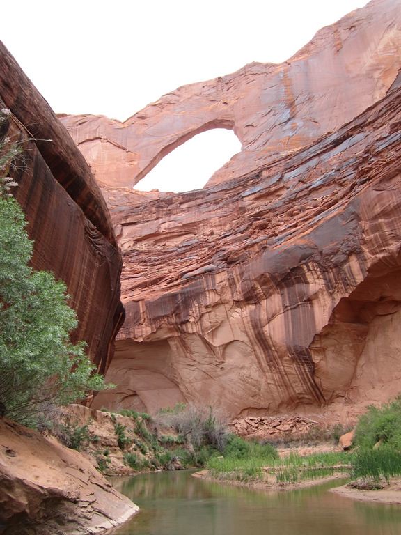
Oh yeah, right. That's right under Stevens Arch downstream of Stevens Canyon entrance.

Stevens Arch over river by John Morrow, on Flickr
In the lower right of your photo gnwatts, is that the high water bathtub ring do you think?

Stevens Arch over river by John Morrow, on Flickr
In the lower right of your photo gnwatts, is that the high water bathtub ring do you think?
Last edited:
John Morrow
Member
- Joined
- May 22, 2015
- Messages
- 1,119
That 1983 "tragedy narrowly averted" is fascinating history.
Reef&Ruins
Colorado Plateau is calling...
- Joined
- Feb 3, 2017
- Messages
- 926
is it in the Needles District of Canyonlands? It doesn't look like the Needles, but it if it isn't that and it has to be east of the Colorado and administered by the NPS then it's gonna have to be Hovenweep or Natural Bridges neither of which also look right.
Ben
Member
- Joined
- Sep 12, 2014
- Messages
- 1,873
is it in the Needles District of Canyonlands? It doesn't look like the Needles, but it if it isn't that and it has to be east of the Colorado and administered by the NPS then it's gonna have to be Hovenweep or Natural Bridges neither of which also look right.
Not Needles
Bob Wire
Member
- Joined
- Dec 21, 2013
- Messages
- 304
Kachina Bridge at Natural BridgesNot Needles
Ben
Member
- Joined
- Sep 12, 2014
- Messages
- 1,873
Kachina Bridge at Natural Bridges
That’s the one
Don't like ads? Become a BCP Supporting Member and kiss them all goodbye. Click here for more info.


