Arizona Jones
Member
- Joined
- Aug 1, 2020
- Messages
- 71
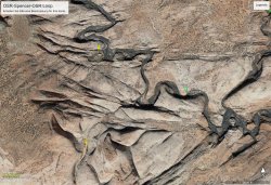
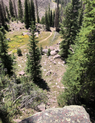
Here is the same canyon later in the day as I hike Northeast. The first was from my camp site first thing in the morning.
Follow along with the video below to see how to install our site as a web app on your home screen.
Note: This feature may not be available in some browsers.
Here is the same canyon later in the day as I hike Northeast. The first was from my camp site first thing in the morning.
Yep! Lower Hackberry. Your Turn! The first one I camped on the rim of the canyon just west of Yellow Rock 37°15'55.0"N 111°56'12.1"W. Then I hiked up to the top of Hog Eye and Sam Pollock and camped and explored. Then went down Sam Pollock and down Hackberry to my car. Never saw another person.There’s Castle Rock. Must be lower Hackberry Cyn.
That’s a very beautiful area.
Gesendet von iPad mit Tapatalk
I would say after 11 days, no one knows.Some clues.
This trail was constructed by humans - partially. An old unpaved road leads to the TH. Some members of BCP were there in the near.

I think so too.
- the old unpaved road is Old Sheffield Rd.
- the trail is a horse/cattle trail and leads to the Escalante river, if you like to follow the river upwards
- the canyon mouth we've bypassed is Spencer canyon
- members of BCP were there in the near: @Nick, @slc_dan and @NateGeesaman - Moqui Madness Tour
View attachment 91640
Or did the spot actually consist of the spot the water was flowing across?
I don’t think even with that hint people can guess it. It’s high on a mountain and windy with cool algae swirls, which is awesome, but we’re gonna need some sort of a horizon view or a larger macro scale view of some sort to be able to guess it.

Don't like ads? Become a BCP Supporting Member and kiss them all goodbye. Click here for more info.
