Navigation
Install the app
How to install the app on iOS
Follow along with the video below to see how to install our site as a web app on your home screen.
Note: This feature may not be available in some browsers.
More options
Style variation
You are using an out of date browser. It may not display this or other websites correctly.
You should upgrade or use an alternative browser.
You should upgrade or use an alternative browser.
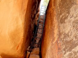
Guess the spot: Utah Edition
- Thread starter Ben
- Start date
IntrepidXJ
ADVENTR
- Joined
- Jan 17, 2012
- Messages
- 3,489
Close... (If nobody gets closer pretty soon then I'll turn it over to you)
I know exactly where it is...but I'm certainly not going to out the location of these ruins on a public forum.
RyanP
Member
- Joined
- Mar 1, 2015
- Messages
- 742
I believe you, so you're up! And I wasn't necessarily expecting or wanting someone to describe the exact location with coordinates or the like, just a general statement about its location (e.g., "in the Needles District in the vicinity of such and such canyons"). (for those who are wondering, it is indeed in the Needles district, but @IntrepidXJ is correct and I should probably leave it at that)I know exactly where it is...but I'm certainly not going to out the location of these ruins on a public forum.
Udink
Still right here.
- Joined
- Jan 17, 2012
- Messages
- 1,741
John Morrow
Member
- Joined
- May 22, 2015
- Messages
- 1,119
about a mile or two from the last one...
Udink
Still right here.
- Joined
- Jan 17, 2012
- Messages
- 1,741
Aww fetch...what do we do now?about a mile or two from the last one...
Ben
Member
- Joined
- Sep 12, 2014
- Messages
- 1,873
Aww fetch...what do we do now?
probably time to scrap the Utah Edition, too many ruins out there
UtahBrian
God bless America. Let's save some of it.
- Joined
- Feb 15, 2018
- Messages
- 54
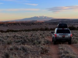
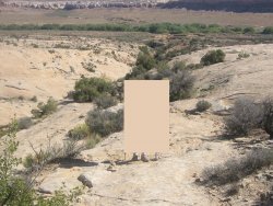
"Swell" placard is a red herring.Okay, I'll stop foolin' around.Here's one that won't give the previous two away:
View attachment 89289
We're looking at the La Sal Mountains from the south on a two track. Somewhere between upper Kane Creek and the Harts Draw Road, I think.
Udink
Still right here.
- Joined
- Jan 17, 2012
- Messages
- 1,741
Yep, nice job--you're up! This is just off Highway 211 near upper Hart's Draw, taken right about here."Swell" placard is a red herring.
We're looking at the La Sal Mountains from the south on a two track. Somewhere between upper Kane Creek and the Harts Draw Road, I think.
UtahBrian
God bless America. Let's save some of it.
- Joined
- Feb 15, 2018
- Messages
- 54
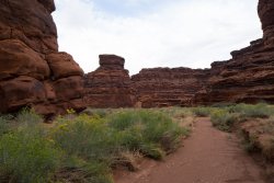
We are indeed looking down into Butler Wash. Go.Butler wash?
Udink
Still right here.
- Joined
- Jan 17, 2012
- Messages
- 1,741
Lathrop?
John Morrow
Member
- Joined
- May 22, 2015
- Messages
- 1,119
Lathrop was a good answer, Gooseberry then? Seems like organ rock sandstone.
Don't like ads? Become a BCP Supporting Member and kiss them all goodbye. Click here for more info.


