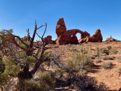
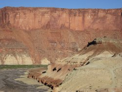
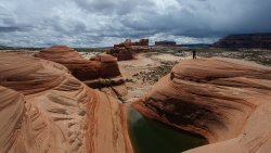
Guess the spot: Utah Edition

@UtahBrian - no, it's nowhere near Capitol Reef.

2 more photos. The photos were taken at what location? Same rock formation in the photos.
This particular formation isn't named on any map, but there's a named trailhead in the area, though I ventured off trail most of that day.
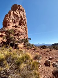
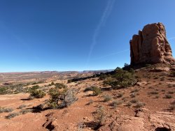
IMG_1600.jpeg

IMG_1583.jpeg
 
Sundance Trailhead?

No. But you are looking along the correct river, Colorado River. The location is much further northeast than Sundance TH.

One photo has well known peaks in the distance. I walked from the TH and later off trail towards the general direction of the cliffs of the river with those peaks in the far distance.
 
Looks like the area around the Amasa Back mtn bike trails to the West of Moab. Maybe even the Cliffhanger trail?
 
We are getting a lot closer now with the 2 guesses above, but the 2 guesses are on the wrong side of highway 191.
Here's a photo from closer to where I parked:

IMG_1637.jpeg
 
@John Morrow - well done, take it away! It's close enough. The photos were taken at 38.680704,-109.521786 , so more towards the Salt Wash & Colorado River direction with La Sal Mountains in the far distance. Such a large NP but few trails. There's lots to explore. Funny you mention the Petrified Dunes, that was my initial target from another parking area, but it was much more difficult to find a route, so I switched.
 
I couldn't remember which side of the main Windows that Turrett Arch was located. But it is a recognizable arch for sure (had to look at some old pics). Hmm...now where to take us?
 
Looks kinda like near Castle Valley by Moab. Not so much in the valley itself but near/at where the valley comes out to the Colorado River.
 
Green River in Canyonlands NP? Reminds me of where we camped at the mouth of Upheaval Canyon.
 

Don't like ads? Become a BCP Supporting Member and kiss them all goodbye. Click here for more info.

Back
Top