Navigation
Install the app
How to install the app on iOS
Follow along with the video below to see how to install our site as a web app on your home screen.
Note: This feature may not be available in some browsers.
More options
Style variation
You are using an out of date browser. It may not display this or other websites correctly.
You should upgrade or use an alternative browser.
You should upgrade or use an alternative browser.
Guess the spot: Maps Edition
- Thread starter Backcountry Post
- Start date
Udink
Still right here.
- Joined
- Jan 17, 2012
- Messages
- 1,742
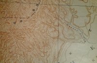
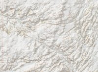
Yep, on Twin Corral Flats (though I counted at least four corrals there).Above French Spring Fork of Happy...
Udink
Still right here.
- Joined
- Jan 17, 2012
- Messages
- 1,742
Ahh...Cottonwood/Diamond, then?pretty close...head a bit west of westwater creek. It's surprisingly difficult to place it even side by side with a current topo.
- Joined
- Jun 25, 2012
- Messages
- 4,430
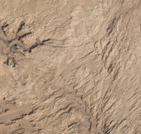
Mars.
Udink
Still right here.
- Joined
- Jan 17, 2012
- Messages
- 1,742
Close.Mars.
slc_dan
Desert Rat-Weekend Warrior
- Joined
- Jun 7, 2012
- Messages
- 1,687
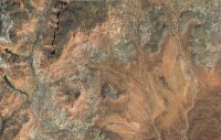
aha! Found it. Took me a good few minutes, but mostly because I'd get sidetracked looking at other shit close by 
On the left is Cottonwood Canyon. Great trail names there! Aladdin's Lamp Pass? Yes please! Is the Emmigrant 4wd Trail pretty gnarly? Are you looking at destroying the f150 again so soon?
On the left is Cottonwood Canyon. Great trail names there! Aladdin's Lamp Pass? Yes please! Is the Emmigrant 4wd Trail pretty gnarly? Are you looking at destroying the f150 again so soon?
- Joined
- Aug 9, 2007
- Messages
- 12,962
aha! Found it. Took me a good few minutes, but mostly because I'd get sidetracked looking at other shit close by
On the left is Cottonwood Canyon. Great trail names there! Aladdin's Lamp Pass? Yes please! Is the Emmigrant 4wd Trail pretty gnarly? Are you looking at destroying the f150 again so soon?
Haha! That's more commonly just called the Hole-in-the-Rock Trail, but more specifically the one on the east side of the river. My brother in law keeps trying to get me to do it with him. The F150 would not be welcome there...
Not my video:
Don't like ads? Become a BCP Supporting Member and kiss them all goodbye. Click here for more info.


