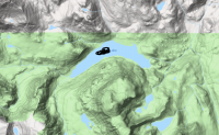
Guess the spot: Maps Edition

7.5' quads are just part of the Deep State conspiracy.
Yes, there are many mysteries contained therein. If you study the contour lines and match them up with the directionals indicated by the grid lines, then multiply it all by the number of fire towers in that section and divide by the number of times magnetic north has reversed, you will learn the hidden secrets of the Rogue Rangers who are Deep State minions one and all.

Or you can just wander around aimlessly in your mind, which I prefer.
 
Now Rockskipper, am lot like you when I look at the 7.5' quads ... in that I just love to wander all over the map in my mind and dream. Just Love Your Reply!!!

Yes! Wishing you the Best!
 
I worked in a cubicle once and had every square inch plastered with maps. It wasn’t long before it started getting crowded with like-minded colleagues hiding out from reality, studying where to go for the weekend. Many fine escapades were plotted out in that small space. :)
 
Rockskipper, can understand. Interesting. Now looking and studying maps is a wintertime occupation for myself when everything is covered with snow.
 
I worked in a cubicle once and had every square inch plastered with maps. It wasn’t long before it started getting crowded with like-minded colleagues hiding out from reality, studying where to go for the weekend. Many fine escapades were plotted out in that small space. :)

Now i would like to see a photo of that cube!
 
Yes, there are many mysteries contained therein. If you study the contour lines and match them up with the directionals indicated by the grid lines, then multiply it all by the number of fire towers in that section and divide by the number of times magnetic north has reversed, you will learn the hidden secrets of the Rogue Rangers who are Deep State minions one and all.

Or you can just wander around aimlessly in your mind, which I prefer.

Love it!
 
Now i would like to see a photo of that cube!
Well, to continue this thread derail, all photos of that previous life were abandoned when I called upon the Rogue Rangers to guide me forthwith to a life of sanity, a life where contour lines are all that matters - The Way of the Map.
 
Last edited:
Well, I know where it is, but I don't know the name of it. It's NE of the Brown Cliffs and east of Knife Point Mtn and Indian Pass. I'll try to find its name...
 
Well, I know where it is, but I don't know the name of it. It's NE of the Brown Cliffs and east of Knife Point Mtn and Indian Pass. I'll try to find its name...

It lives up to its name...
 
You've got it. One of the most appropriately named places I've ever been.

The story to which some of us are referring to is this: https://www.backpacker.com/trips/trapped-the-mike-turner-story

A solo hiker was pinned by boulders while hiking in the pass and died in 1998. I was aware of that even before planning our route through the pass. It seemed to me that there was a pdf writeup of the story somewhere that gave the detail of which of the lakes in the pass he got pinned by, and it was the small lake just south of lake 11495 to my memory. It's not surprising somebody could get pinned there, it's some of the tougher boulder hiking I've ever done. Here's a pic of the area from my hike through in 2013, my friend in the pic is himself maybe 6'2". The going along the lake was brutal, a lot of the boulders were car sized at minimum.
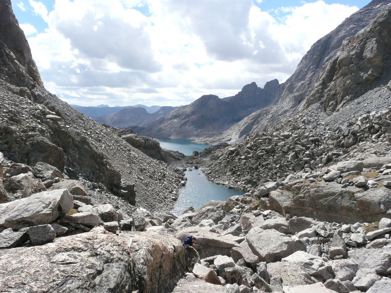
P1080847-L.jpg


We stopped at the far end (per the picture) of the small lake for a break and to eat, and I thought of the story while sitting there. It's a very remote and peaceful place, with more pikas than I've seen anywhere else. We met either one or two other hikers who had hiked this pass when we were there, though we saw nobody while going through it ourselves.
A formidable place for sure. It didn't bother me that much but I probably would not solo it. I documented our crossing in a TR here about our Wind Xing Part 1 and 2.
 
Last edited:
Back
Top