You've got it. One of the most appropriately named places I've ever been.
The story to which some of us are referring to is this:
https://www.backpacker.com/trips/trapped-the-mike-turner-story
A solo hiker was pinned by boulders while hiking in the pass and died in 1998. I was aware of that even before planning our route through the pass. It seemed to me that there was a pdf writeup of the story somewhere that gave the detail of which of the lakes in the pass he got pinned by, and it was the small lake just south of lake 11495 to my memory. It's not surprising somebody could get pinned there, it's some of the tougher boulder hiking I've ever done. Here's a pic of the area from my hike through in 2013, my friend in the pic is himself maybe 6'2". The going along the lake was brutal, a lot of the boulders were car sized at minimum.
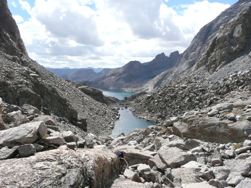
We stopped at the far end (per the picture) of the small lake for a break and to eat, and I thought of the story while sitting there. It's a very remote and peaceful place, with more pikas than I've seen anywhere else. We met either one or two other hikers who had hiked this pass when we were there, though we saw nobody while going through it ourselves.
")
