- Joined
- Dec 11, 2015
- Messages
- 2,094
Said no one, ever!sounds like you're spending too much time outside, and not enough on the internet.
Follow along with the video below to see how to install our site as a web app on your home screen.
Note: This feature may not be available in some browsers.
Said no one, ever!sounds like you're spending too much time outside, and not enough on the internet.
North Fork Little Humboldt River with Chimney Reservoir at the bottom.
I was being cute. Fail...Uh, where exactly would treeline be 29k?
You're always cute, Art.I was being cute. Fail...
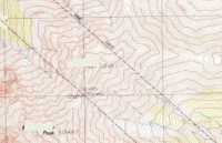
That O'Fool is tricky. What can we glean from the map? Two parallel lines - park boundary? It is also below treeline and it looks like there are green rectangular lakes on the summits.....i could've sworn that i'd known where this was, but it turns out that it just looks like every other mountain i've ever seen on topo.
No they don’t. In fact I have posted a map from Mars before but it was guessed pretty quick. These guys and gals are pretty good but sometimes not good enough to guess through some people’s chicanery and obfuscation.Do the rules say it has to be on Earth? It's probably a topo of someplace on Mars that he doctored up a little.
You know I think it is totally possible that O_F may have added the two parallel lines in to the map. Although not strictly within the rules it sure would be a good diversion/distraction.
(I know, I know, there aren't really that many rules in the game...)
Do the rules say it has to be on Earth? It's probably a topo of someplace on Mars that he doctored up a little.
I didn't see a confirmation.You guys saw that Larry got this already right? Those lines are the Nevada state line. And Outdoor isn't being that tricky. If you zoom in enough, you can make out the elevation of Montgomery peak at 13441. That's what I did.

Don't like ads? Become a BCP Supporting Member and kiss them all goodbye. Click here for more info.
