Guess the spot: Maps Edition

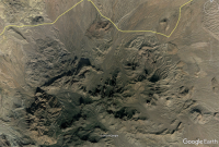
This is south of Ballarat, CA, in the Panamint Valley, but I don't know what it's called. I found it on Google Earth, but it's not named. I'm going to guess it's a trona mine.
That's it! Ironically (or maybe not), I'm currently sitting at a camp fire 12 miles north of Trona, CA.

The "spot" is Manly Fall, where William Manly and John Rogers had some difficulty going for help for some 49ers stuck in Death Valley on their way to the gold rush.
 
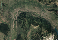
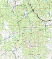
I just came back from DV, though mostly further north. I'm getting ready to head out to this place, the opposite direction from where I'm at in Colorado:

yellow rose.png
 
The name of the photo file Is a hint (which you can view if you drag the file to your desktop).
 
Last edited:
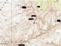
hint: I would guess that most people on here have driven within 3 miles of this area. Notice that the named areas are not on the rim (the one on the rim is just a benchmark).
 
Hey, you guys remember when the Welcome to Utah sign at the Colorado/Utah state line by Grand Junction used to read - "Utah, the Right Place" - and someone would always paint in the word "Wing" so it read "the Right Wing Place" - it was an ongoing battle with UDOT. Anyone here have some insider info on that? :)
 
Back
Top