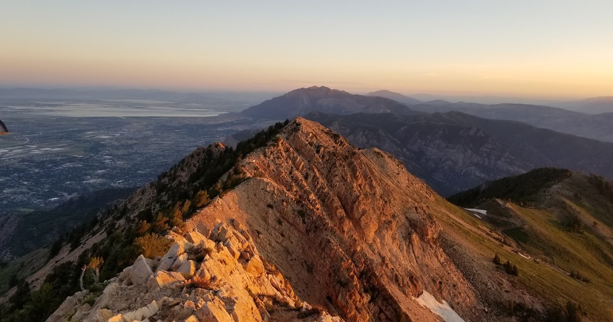
A Route In Between: Mexico to Canada Through the Heart of the West

One word.....WOW! “Kudos” is insufficient compared to your achievement.

Just curious.....Do you ever get lonely on what I imagine are hikes with few-to-no people around? Or, perhaps what are your tips/tricks for warding off loneliness? And what about boredom?
Interesting questions...

1) Boredom - that's one of the reasons I really like these DIY/more obscure adventures. It keeps my brain constantly engaged. I can't just zone out and follow the trail for a while. I'm focused on navigation, water management, and all the mundane bits of day-in, day-out hiking life. Of course, when I do get a long boring roadwalk, I can let my mind wander and it comes up with all sorts of wacky things - little jokes that seem WAY funnier to me than they would to anyone else, song parodies ("I'm an Ida-Dude, with an Ida-tude", to the tune of the Barbie Song), philosophical ruminations, etc. Basically, my brain usually does a great job of keeping itself entertained. I will also pop in a podcast occasionally when I just need to go off in la-la land for a bit. Educational podcasts are my preference, as it feeds the nerdy intellectual side that hiking sometimes starves.
2) I have definitely gotten lonely before, but only when there are other people around. As a cannonical example, I hiked a three-week section of the Hayduke Trail last year, an off-trail route on which I saw basically nobody. The end point was Zion Canyon. I wasn't lonely at all when I saw nobody, but as soon as I got to Zion and saw scads of people, I started to feel it. There were people, but they weren't my people. Everybody else is roasting their marshmallows over the fire and doing a really crappy job of observing quiet time and generally just reveling in their relationships, and I'm out here camped behind the dumpsters. But when there's no people around, I generally don't miss them too badly - aside from the obvious desire to see family and friends of course.
 
Yeah, I don't mind dirt road walking at all...as long as their isn't much traffic. Sounds like you timed it right. Water sources and traffic can be tough up there on the Skyline in late summer.

Ok, great. I'll send you a kmz of my route through your website when I have a chance. I've been reluctant to share route details over the years, because half the fun is coming up with your own route (like the CDT used to be not that long ago) but given the explosion in long-distance hiking over the last decade, I think it may be time.
Yeah I was driven to do this route in part because of the changing nature of the CDT. I did it last year and found that it's really not the remote, you're-on-your-own test piece that it has served as for decades. It's increasingly well-marked, busier, and of course, there's the magic Guthook app which basically eliminates the navigational challenge for many users. None of that is a bad thing; the CDT is simply growing into its status as a National Scenic Trail. An NST is supposed to be, ya know, an actual trail. But as much as I enjoyed the CDT, I wanted something that was a little more CDT-a-few-decades-ago. And the RIB was my answer to that.

That's coincidentally also why I've thought a lot about whether I'm ok sharing this route, as I'd hate for it to turn into even another Hayduke, which now has an app and all the rest. So I settled on the idea of making it publically available, with certain restrictions (the first being a trail work requirement) that I'll iron out as I prepare it for publication. I definitely hear you on the "keep it to yourself" front. It's just a really tough balance to strike. How exactly do we share a route so others can have a wonderful experience out there, without losing what made it so wonderful in the first place?
 
Great accomplishment! There must be so many other stories from this trip. I would be interested in the Wolverine siting . So rare and so special.

tv
 
Nice...

I'd be interested in your route across the bitteroots .. iv had my eye on a bitteroot divide trip from Darby to Lolo west of Hamilton . If you got in that part...
 
Nice...

I'd be interested in your route across the bitteroots .. iv had my eye on a bitteroot divide trip from Darby to Lolo west of Hamilton . If you got in that part...
Between the CDT last year and the RIB this year, I've walked nearly the entire ID/MT border... except for the section you've mentioned. The ICT doesn't hit the state line until north of Lolo pass. I'm with you though; honestly, that section of the state line looks like the most scenic and adventurous part. Definitely have it on the back burner to hopefully do a route there someday!
 
Between the CDT last year and the RIB this year, I've walked nearly the entire ID/MT border... except for the section you've mentioned. The ICT doesn't hit the state line until north of Lolo pass. I'm with you though; honestly, that section of the state line looks like the most scenic and adventurous part. Definitely have it on the back burner to hopefully do a route there someday!
Maybe we can put a trip in.....
 
Thanks for sharing this, this is the best stuff on here.
Also, it’s SawTOOTHS (where are you from, East Coast?)
Hehehehehehe I'm very aware. It's just one of those little jokes that you play over and over in your head as you walk along, and it becomes wayyyyy funnier to you than it is to everyone else. Hiker delirium at its finest! :)
Maybe we can put a trip in.....
I'm down! Sounds like an absolutely blast!
 
Congrats, that must have been an incredible journey! There's a good chance I'll be PMing you for some intel on a few areas along your route. I was driving through the Snake River Basin area this summer looking for an interesting way through it myself(planning a new thru hike route), there is none, and yeah that was a shitty few days for you I'm sure!

Which sections of the Frank were the worst BTW?
 
Last edited:
Congrats, that must have been an incredible journey! There's a good chance I'll be PMing you for some intel on a few areas along your route. I was driving through the Snake River Basin area this summer looking for an interesting way through it myself(planning a new thru hike route), there is none, and yeah that was a shitty few days for you I'm sure!

Which sections of the Frank were the worst BTW?
The trails along the Middle and Main forks if the Salmon were alright. The trails in between them were pretty rough. Marble Cteek stands out as particularly terrible. If you're going N/S through the Frank, my recommendation would be to check out the route that Aria Zoner describes for his Hot Springs Trail. By all accounts, it just seems like a better, more maintained route.
 
Thanks. I couldn't find any info on the route itself, outside of purchasing the guidebook. I have all of the Idaho hot springs plotted on my caltopo map and am willing to bet his route skips Marble Creek and continues north along the Middle Fork, sound about right? Looked like a several more hot springs along the Middle Fork farther north.

Were there any nice ridge walks or anything up high you liked through the Frank? It's nice to follow a river for a while but 200 miles might be a bit much haha.
It definitely skips Marble Creek but I don't know the route it takes off-hand - my copy is on the other side of the country currently. I'd definitely recommend dropping the money on his guidebook. It's well-written, very deeply researched, and the route goes through interesting terrain I'd like to visit. I have no desire to do the whole thing as a continuous journey, but rather borrow pieces for my own routes.
 
For those interested, a complete guide to the Deseret Hiking Route is now available for free. Descriptions, maps, GPS waypoints, and more.

 
Last edited:
Amazing! Props, my man! You make such light of such distance and difficulty. What do you think your total number of days on the trail and the avg. miles per day were. You said 25 miles per day which seems hard for 4 or 6 months. Thanks for sharing!
 
Amazing! Props, my man! You make such light of such distance and difficulty. What do you think your total number of days on the trail and the avg. miles per day were. You said 25 miles per day which seems hard for 4 or 6 months. Thanks for sharing!

Well the whole "miles per day" is fraught with enough accounting tricks to give an Enron exec a creepy grin... but that being said, here goes:

I began on March 25 and ended on September 14. But I also took over a month off in May-June due to the enormous snowpack. My dates were about perfect for a normal snow year, but this was not a normal snow year. And start the AZT any later, and it'd be crazy hot down there. So excluding that break, I think I spent about 130ish days on trail, including the occasional rest ("zero") day. I conservatively estimate about 2500 miles for the whole thing, which works out to just shy of 20/day.

That doesn't really tell the whole story though, as that figure includes all the time I didn't spend hiking - waiting for new shoes to get mailed to me, a few days off for a family event on the other side of the country, or just the occasional rest after a particularly grueling section. I'd say an "average" day on the trail was as follows:

AZT - 26-27
DHR - 25
ICT - 20

So for example, I typically carried about 3.5 days of food for a hundred-mile stretch of the AZT, 4 on the DHR, and 5 on the ICT. The Idaho Centennial Trail leg was a lot tougher due to trail conditions and my pace did slow somewhat on that leg as you can see. Overall, my pace conformed pretty well to an "average" thru-hiker pace on one of our other modern long-distance trails in the West (PCT, CDT, AZT, Colorado Trail, etc). It was almost identical to my pace on the CDT in 2018, which was right around average.

Coincidentally, that's one of the things that's great about the DHR - it has a much wider weather window than either the PCT or CDT. There are two reasons for this:

1) The high plateaus of S Utah melt out 2-3 weeks before the San Juans (CDT) or Sierra (PCT). This allows you to start several weeks earlier than you would the other trails.
2) It's "only" 2500 miles long - 150ish miles shorter than the PCT and about 350 shorter than most folks' CDT hike.

As proof, I completed the hike in the biggest snow year ever, while being a slower-than-average hiker.
 
Similar threads
Thread starter Title Forum Replies Date
Kullaberg63 15 day canyon route Backpacking 13
fossana A challenging week on the Escalante Overland Route Backpacking 21
TheMountainRabbit Dana Meadows to Twin Lakes via the High Route (Yosemite/Hoover Wilderness) - August 2023 Backpacking 8
meowtaingal Wind river high route mid september Trip Planning 7
D Wind River offtrail route questions Trip Planning 28
scatman Grandeur Peak - Dragon Tail Route - June 10, 2023 Hiking & Camping 13
B Sawtooths - Off Trail Route Plan Trip Planning 9
TheMountainRabbit Red's Meadow to Tuolumne Meadows via the High Route (Ansel Adams/Yosemite Wilderness) - August 2022 Backpacking 5
climbhigh1119 How doable is the sneak route out of Death Hollow with kids and a dog? Trip Planning 6
PaulMags Grand - Moab Route Backpacking 1
seekinglost Introducing the Mojave-Sonoran Trail: A NEW 625-mile Winter Thru-Hiking Route Backpacking 4
RyanP Young's/Lean-To Route in DC Trip Planning 7
M Grand Canyon NP, Royal Arch Route Backpacking 0
Yvonne Climbing Mount Saint Helens via Monitor Ridge Route, July 2021 Hiking & Camping 16
scatman Grandeur Peak - Dagon's Tail Route - November 21, 2021 Hiking & Camping 9
RyanP Coyote Gulch to Halls Creek via Steven's Canyon and the Baker Route (car/key swap) Meet Up (Members Only) 8
stretch Most Scenic Route to Traverse the Gros Ventre? Trip Planning 17
W 9 Days Solo Escalante Loop in October (water advice) - Stevens Canyon, Baker Route over Waterpocket fold, Halls Narrows to Moody Canyons Trip Planning 11
M 5 days Green > Elk Wind River route advice August 17th Trip Planning 9
Mikjik86 FULL Video Part 2 Backpacking Glacier National Park "North Circle Route" Backpacking 0
Mikjik86 Backpacking Glacier National Park (Part 2 Preview) "North Circle Route" Montana, August 2019 Backpacking 2
Nick Dirty Devil Miner's Route Trip Planning 0
K Cycling The Divide Mountain Route Trip Planning 16
Mikjik86 Backpacking Glacier National Park - North Circle Route Part 1 Preview Video. Backpacking 1
b.stark Wrangell-St Elias "Seven Pass Route" Backpacking 29
Devin Ashby The Lower Gulch - Escalante (Seeking info on the route) Trip Planning 14
Perry Any Beta in this Proposed Route Near Coffin Benchmark? Trip Planning 5
NorthwestWanderer Route Finding adventure, Copper Pass to Blue Lake - Goats, Bears, Lions, Oh my! Backpacking 3
Hiker Seth Thinking about this Wind River Route. Trip Planning 11
H Wind River Range route planning Trip Planning 6
NorthwestWanderer 6 Day backpacking trip in Glacier Peak Wilderness (3 days of off trail route) Backpacking 9
RyanP 5-day route in Winds in late July? Trip Planning 0
C Route 9 Through Zion closed indefinitely. General Discussion 25
DrNed Recommendation for 35-45 Mile Route in the Uintas Trip Planning 7
LarryBoy Critique the Route: Deseret Hiking Route Trip Planning 11
fossana Stephens Canyon Loop, part of Escalante Overland Route or ? Trip Planning 18
scatman Grandeur Peak - West Slope Route - September 3, 2018 Hiking & Camping 12
Jimmy Glacier Route Help Trip Planning 0
J White Cloud Route. 2018 June 22 Trip Planning 3
SKLund Cat Mesa via Alternate Pfeiffer Route Hiking & Camping 2
Gregg B. Powell Route Gypsum Canyon, UT Trip Planning 0
D Wind River High Route Trip Planning 4
LarryBoy Absarokas Fun Route - 12 Days of High Adventure Backpacking 21
S White Cloud route, Big Boulder Lakes to Boulder Chain Lakes Trip Planning 3
Perry Suggestions for 3-day/2-night Uinta's Route Trip Planning 10
Kullaberg63 Allen's Dark Canyon route Trip Planning 18
T Advice Needed for 5 night Backpack route in Southern Utah Trip Planning 2
A Escalante Route - Grand Canyon in late May 2017 Trip Planning 4
LarryBoy Absorokas Fun Route Trip Planning 13
Brian Skibbe 200 mile Yellowstone loop in June. Route advice needed. Trip Planning 15

Similar threads

Back
Top