- Joined
- Jan 4, 2015
- Messages
- 2,886
Between March and September of 2019, I hiked an absolutely amazing route through the heart of the West. I began atop a "sky island" on the Arizona/Mexico border and finished in a deep, dark ancient cedar and hemlock forest on the Idaho/Canada border. And in between, I saw a lot of cool stuff!
I apologize in advance, as this TR is by necessity only going to be a brief overview. But I wanted to post something (exclusive content, doncha know ) as a thanks to the members of this board who contributed with route suggestions. Those route suggestions were helpful because the middle 40% of my route was a make-it-up-yourself endeavor. Briefly, the route consisted of the following sections:
Arizona Trail (800 mi): A well-used, well-maintained National Scenic Trail with ample information available. Starts on the US/Mexico border and terminates on the Arizona/Utah border
Deseret Hiking Route (1,000 mi): Exists only in my own mind (and in yours, dear BCPers). Starts on the Arizona/Utah border and terminates where it intersects the Idaho Centennial Trail in the Sawtooth Range of central Idaho.
Idaho Centennial Trail (700 mi): A trail designated by the State of Idaho a few decades ago, but it's a complete mess. One kinda-okay mapset is available, but hikers largely rely on the grapevine to get the information we need to complete the ICT - by all accounts, there are fewer than 5 finishers per year. While the full ICT is over 900 mi long and starts on the Idaho/Nevada border, my route picks it up in the Sawtooths and follows it the rest of the way to Canada.
I guess the best way to do this is to organize it by landform, from south to north. This post won't be a particularly useful planning resource for your own journey (though I do hope to make some planning resources available at some point), but more a satellite view of my own journey.
Sky Islands: Southern Arizona was dominated by sky island mountain ranges that rise thousands of feet above the surrounding desert floor. This meant long periods of easy walking across the flats, followed by gigantic (5,000+) climbs. On one occasion, I did two such climbs in the span of three days. The views were terrific though, and I really enjoyed this section.
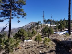
Central AZ Mountains: After a few scorching miles (the better to boil your blood with, my dear!) through the lowlands around the Gila River, I climbed into the Superstition and Mazatzal Ranges of central Arizona. These ranges were more expansive than the Sky Islands, and really offered a feeling of being quite remote, even though I was within a stone's throw of suburban Phoenix. This was also where I got sick, for the first time ever on trail. Hiking 25 mi/day becomes really unpleasant when you're feeling like garbage to begin with.
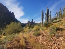
Arizona High Plateaus: After the town of Pine, the character of the AZT changes dramatically. I climbed up onto the Mogollon Rim, marking the southern extent of the Colorado Plateau. I'd be consistently at 7-8,000' for the rest of my journey through Arizona. The terrain was not nearly as dramatic here, but stately ponderosa forests made for quick and pleasant walking. Also I went through the Grand Canyon, which is a giant [checks notes]. Oh, you know all about the Grand Canyon already? Carry on then.
At the Stateline trailhead, near Wire Pass, I ended the AZT and began the DHR.
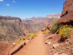
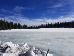
Utah High Plateaus: After a few days headed up the Paria River, I passed through the super touristy part of Bryce Canyon. The selfie-stick crowd (certified members of Generation Bluetooth) gave me a few strange looks; to be fair, I was toting my overnight pack and looking generally homeless. It's nothing I haven't seen before, but Bryce is really that cool, crowds notwithstanding. I would again climb into the Pink Cliffs a few days later, but these ones were north of Tropic, just as beautiful, and there was nobody there.
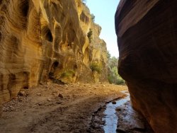
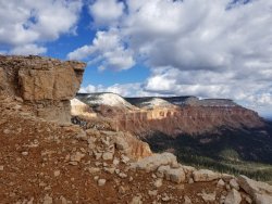
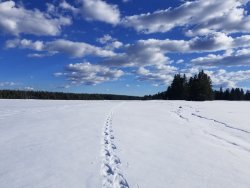
I continued over Boulder Mountain, trudging through deep, deep snow. When I got to Torrey, I looked at the snotels, looked at the forecast, and saw that for the next two weeks at least, it was going to storm and storm and storm. So I made a business decision, stuck out my thumb, and headed out to the Oregon coast for a month to do some casual hiking while I waited for the snow to melt.
In mid-late June, I resumed my journey northward from Torrey. At this point, Thousand Lakes Mountain was mostly thawed out, but the Manti Skyline was still completely locked in snow. But boy oh boy, was it beautiful! And, unlike a month before, the snowpack had consolidated a bit in the hot June sun, so I only postholed half of each day instead of all of it. So that's a plus!
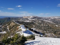
The Wasatch: One of the key factors in my route planning was the desire to do a full traverse of the Wasatch. The devastating 2018 fire complex near Mt. Nebo made that an impossibility, at least for the next few years until the ecosystem starts to heal and trails get re-cut, but I did join the Wasatch just north of Spanish Fork and follow it all the way to Idaho. There was still some lingering snow, but very managable with an ice axe and spikes. I passed Snowbird the day after it closed. 2019 - what a winter!
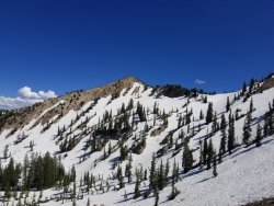
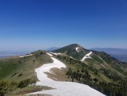
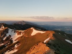
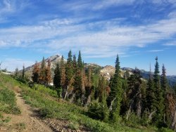
The DHR north of Salt Lake was particularly stunning. I walked the crest of the Wasatch most of the way to Idaho and the views were outstanding. This was also the land of huge, steep climbs. Living in Wasatch for a while makes you numb to just how steep the trails are here, compared to other places. As far as I know, all previous Wasatch traverses utilized the Wellsvilles, but I opted to veer a little east and follow the Bear River Range farther north into Idaho.
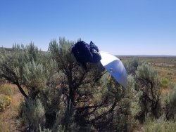
Snake River Plain: This area totally sucked, but didn't suck for long. I was pretty aggressive in taking the most direct route possible, as it was mid-July and it was 100 degrees with a paucity of water sources. All in all, I think I only spent 5 days on the valley floor before I was back up in the mountains again. This is the one part of my route that was pure "filler". Compared to other long-distance hiking routes, 5 days of filler isn't really that bad, but still, no fun sir. A silver umbrella was worth its weight in gold in this section.
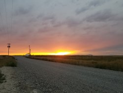
Central Idaho Mountains: Returning to the mountains, I climbed back up into the Pioneer Range, which was lovely, albeit brief. I passed through the town of Ketchum, which has everything except for affordable lodging and a welcoming attitude. I continued NW and connected up with the ICT in the Sawtooth Range. The official ICT takes a pretty terrible route through the Sawteeth (NOT "Sawtooths"; what am I, three years old?), so I'd recommend that future hikers do the logical thing and plan their own route through the area. It's really not that hard, as there's a well-developed and well-maintained network of Sawtooth trails.
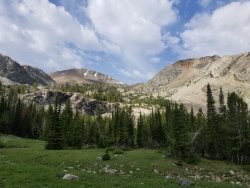
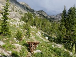
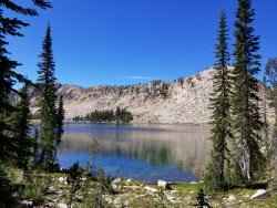
Central Idaho Wilderness: Leaving the Sawteeth behind, I entered two of the largest Wilderness areas in the Lower 48 - the Frank Church and the Selway-Bitterroot. To be honest, the Frank kind of sucked. Trail maintainence was quite awful and progress was frustrating. Plus it rained on me most of the time and I was still recovering from some Giardia (ran out of Aquamira for a few days in the Bear River Range and paid the price. Oops.). Everything was so overgrown that, whenever it rained, I'd get completely soaked for days, as I pushed through thick, heavy brush. One bright spot was the hospitality of the random backcountry homestead that I sent a resupply package to. They let me get a shower, wash my clothes, and even share a a meal. I certainly did not expect that in a place so remote, the only access is via bushplane.
The Selway-Bitterroot promised better trail conditions, but I hit the one and only fire closure of my route and had to detour around it. That detour was mostly fine, except for a 1.6 mi section of trail that had burned badly maybe a decade ago. It was all on a steep mountainside (2,200' descent in 1.6 mi), and the trail had been completely abandoned. It took me 4.5 hours to pick my way through the mess of fallen trees and head-high brush, all down a steep slope with mud and debris on the ground. This is where you earn Canada!
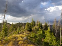
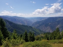
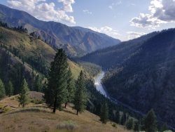
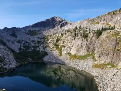
The State Line: At this point, I was pretty bummed out about the ICT. Its routing through the Sawteeth had been subpar, and the Wilderness areas had totally kicked my butt. But on the state line section the ICT went and totally redeemed itself. For miles I walked the crest of the Bitterroots, my right foot in Montana and my left in Idaho. Beautiful alpine lakes nestled against steep mountainsides. I had mostly good weather through here and finally, finally, the ICT lived up to its potential.
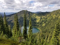
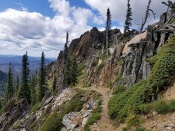
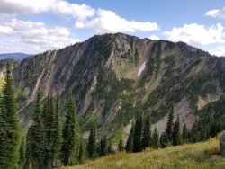
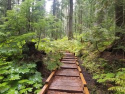
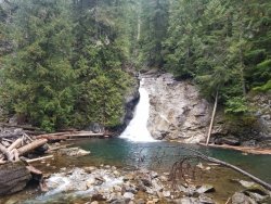
North Idaho: When I crossed the Clark Fork River and entered Idaho's panhandle, I left behind the Bitterroots, but not the alpine beauty. At least, I think so. The route passed through the Cabinet and Selkirk Ranges, but despite the mostly good ridgeline trail, I saw very little of the area. At this point, it was early September, and the PNW fall strikes with a vengence. I was rained on more or less continuously for the last 10 days of my hike. I spent days at a time inside the low-hanging clouds. Fortunately, it cleared up the one time I really needed it - an off-trail crossing of the Selkirk crest. And it was beautiful. I ended my journey with a walk through an ancient cedar forest, with gigantic trees and mossy rocks. I reached the waterfall that marked the approximate US/Canada border, and that was that. There was no welcoming party, no sign to mark the occasion. Seems fitting, don't you think?
I'd like to conclude by thanking some BCP members who contributed with helpful information along the way. And apologies to anyone I missed, I think I got everybody but, whether you're mentioned or not, I took every bit of information to heart and appreciated all of it:
@Titans for helpful intel on the resupply situation in the Loa/Bicknell/Torrey area
@WasatchWill for route suggestions (and an on-the-fly GPX track) in the Provo Pk and Timpanogos areas
@JulieKT for first-hand knowledge of the Donkey Point area
@boulder for in-depth insight into the Boulder Mtn area
@Jackson for offering a ride back to Boulder. Making the call to sit out for a few more weeks was definitely the right decision!
Thank you all!
I apologize in advance, as this TR is by necessity only going to be a brief overview. But I wanted to post something (exclusive content, doncha know
Arizona Trail (800 mi): A well-used, well-maintained National Scenic Trail with ample information available. Starts on the US/Mexico border and terminates on the Arizona/Utah border
Deseret Hiking Route (1,000 mi): Exists only in my own mind (and in yours, dear BCPers). Starts on the Arizona/Utah border and terminates where it intersects the Idaho Centennial Trail in the Sawtooth Range of central Idaho.
Idaho Centennial Trail (700 mi): A trail designated by the State of Idaho a few decades ago, but it's a complete mess. One kinda-okay mapset is available, but hikers largely rely on the grapevine to get the information we need to complete the ICT - by all accounts, there are fewer than 5 finishers per year. While the full ICT is over 900 mi long and starts on the Idaho/Nevada border, my route picks it up in the Sawtooths and follows it the rest of the way to Canada.
I guess the best way to do this is to organize it by landform, from south to north. This post won't be a particularly useful planning resource for your own journey (though I do hope to make some planning resources available at some point), but more a satellite view of my own journey.
Sky Islands: Southern Arizona was dominated by sky island mountain ranges that rise thousands of feet above the surrounding desert floor. This meant long periods of easy walking across the flats, followed by gigantic (5,000+) climbs. On one occasion, I did two such climbs in the span of three days. The views were terrific though, and I really enjoyed this section.

Central AZ Mountains: After a few scorching miles (the better to boil your blood with, my dear!) through the lowlands around the Gila River, I climbed into the Superstition and Mazatzal Ranges of central Arizona. These ranges were more expansive than the Sky Islands, and really offered a feeling of being quite remote, even though I was within a stone's throw of suburban Phoenix. This was also where I got sick, for the first time ever on trail. Hiking 25 mi/day becomes really unpleasant when you're feeling like garbage to begin with.

Arizona High Plateaus: After the town of Pine, the character of the AZT changes dramatically. I climbed up onto the Mogollon Rim, marking the southern extent of the Colorado Plateau. I'd be consistently at 7-8,000' for the rest of my journey through Arizona. The terrain was not nearly as dramatic here, but stately ponderosa forests made for quick and pleasant walking. Also I went through the Grand Canyon, which is a giant [checks notes]. Oh, you know all about the Grand Canyon already? Carry on then.
At the Stateline trailhead, near Wire Pass, I ended the AZT and began the DHR.


Utah High Plateaus: After a few days headed up the Paria River, I passed through the super touristy part of Bryce Canyon. The selfie-stick crowd (certified members of Generation Bluetooth) gave me a few strange looks; to be fair, I was toting my overnight pack and looking generally homeless. It's nothing I haven't seen before, but Bryce is really that cool, crowds notwithstanding. I would again climb into the Pink Cliffs a few days later, but these ones were north of Tropic, just as beautiful, and there was nobody there.


I continued over Boulder Mountain, trudging through deep, deep snow. When I got to Torrey, I looked at the snotels, looked at the forecast, and saw that for the next two weeks at least, it was going to storm and storm and storm. So I made a business decision, stuck out my thumb, and headed out to the Oregon coast for a month to do some casual hiking while I waited for the snow to melt.
In mid-late June, I resumed my journey northward from Torrey. At this point, Thousand Lakes Mountain was mostly thawed out, but the Manti Skyline was still completely locked in snow. But boy oh boy, was it beautiful! And, unlike a month before, the snowpack had consolidated a bit in the hot June sun, so I only postholed half of each day instead of all of it. So that's a plus!

The Wasatch: One of the key factors in my route planning was the desire to do a full traverse of the Wasatch. The devastating 2018 fire complex near Mt. Nebo made that an impossibility, at least for the next few years until the ecosystem starts to heal and trails get re-cut, but I did join the Wasatch just north of Spanish Fork and follow it all the way to Idaho. There was still some lingering snow, but very managable with an ice axe and spikes. I passed Snowbird the day after it closed. 2019 - what a winter!
The DHR north of Salt Lake was particularly stunning. I walked the crest of the Wasatch most of the way to Idaho and the views were outstanding. This was also the land of huge, steep climbs. Living in Wasatch for a while makes you numb to just how steep the trails are here, compared to other places. As far as I know, all previous Wasatch traverses utilized the Wellsvilles, but I opted to veer a little east and follow the Bear River Range farther north into Idaho.


Snake River Plain: This area totally sucked, but didn't suck for long. I was pretty aggressive in taking the most direct route possible, as it was mid-July and it was 100 degrees with a paucity of water sources. All in all, I think I only spent 5 days on the valley floor before I was back up in the mountains again. This is the one part of my route that was pure "filler". Compared to other long-distance hiking routes, 5 days of filler isn't really that bad, but still, no fun sir. A silver umbrella was worth its weight in gold in this section.


Central Idaho Mountains: Returning to the mountains, I climbed back up into the Pioneer Range, which was lovely, albeit brief. I passed through the town of Ketchum, which has everything except for affordable lodging and a welcoming attitude. I continued NW and connected up with the ICT in the Sawtooth Range. The official ICT takes a pretty terrible route through the Sawteeth (NOT "Sawtooths"; what am I, three years old?), so I'd recommend that future hikers do the logical thing and plan their own route through the area. It's really not that hard, as there's a well-developed and well-maintained network of Sawtooth trails.


Central Idaho Wilderness: Leaving the Sawteeth behind, I entered two of the largest Wilderness areas in the Lower 48 - the Frank Church and the Selway-Bitterroot. To be honest, the Frank kind of sucked. Trail maintainence was quite awful and progress was frustrating. Plus it rained on me most of the time and I was still recovering from some Giardia (ran out of Aquamira for a few days in the Bear River Range and paid the price. Oops.). Everything was so overgrown that, whenever it rained, I'd get completely soaked for days, as I pushed through thick, heavy brush. One bright spot was the hospitality of the random backcountry homestead that I sent a resupply package to. They let me get a shower, wash my clothes, and even share a a meal. I certainly did not expect that in a place so remote, the only access is via bushplane.
The Selway-Bitterroot promised better trail conditions, but I hit the one and only fire closure of my route and had to detour around it. That detour was mostly fine, except for a 1.6 mi section of trail that had burned badly maybe a decade ago. It was all on a steep mountainside (2,200' descent in 1.6 mi), and the trail had been completely abandoned. It took me 4.5 hours to pick my way through the mess of fallen trees and head-high brush, all down a steep slope with mud and debris on the ground. This is where you earn Canada!


The State Line: At this point, I was pretty bummed out about the ICT. Its routing through the Sawteeth had been subpar, and the Wilderness areas had totally kicked my butt. But on the state line section the ICT went and totally redeemed itself. For miles I walked the crest of the Bitterroots, my right foot in Montana and my left in Idaho. Beautiful alpine lakes nestled against steep mountainsides. I had mostly good weather through here and finally, finally, the ICT lived up to its potential.


North Idaho: When I crossed the Clark Fork River and entered Idaho's panhandle, I left behind the Bitterroots, but not the alpine beauty. At least, I think so. The route passed through the Cabinet and Selkirk Ranges, but despite the mostly good ridgeline trail, I saw very little of the area. At this point, it was early September, and the PNW fall strikes with a vengence. I was rained on more or less continuously for the last 10 days of my hike. I spent days at a time inside the low-hanging clouds. Fortunately, it cleared up the one time I really needed it - an off-trail crossing of the Selkirk crest. And it was beautiful. I ended my journey with a walk through an ancient cedar forest, with gigantic trees and mossy rocks. I reached the waterfall that marked the approximate US/Canada border, and that was that. There was no welcoming party, no sign to mark the occasion. Seems fitting, don't you think?


I'd like to conclude by thanking some BCP members who contributed with helpful information along the way. And apologies to anyone I missed, I think I got everybody but, whether you're mentioned or not, I took every bit of information to heart and appreciated all of it:
@Titans for helpful intel on the resupply situation in the Loa/Bicknell/Torrey area
@WasatchWill for route suggestions (and an on-the-fly GPX track) in the Provo Pk and Timpanogos areas
@JulieKT for first-hand knowledge of the Donkey Point area
@boulder for in-depth insight into the Boulder Mtn area
@Jackson for offering a ride back to Boulder. Making the call to sit out for a few more weeks was definitely the right decision!
Thank you all!
