Udink
Still right here.
- Joined
- Jan 17, 2012
- Messages
- 1,692
I was planning on going backpacking to Island Lake in the Uintas with the BCP group this past weekend, but early in the week I started having back pain that I was hoping would subside by Friday. I had some relief from the pain by late Thursday but not enough to risk strapping on my 40+ pound backpack. I had to back out of the trip. I didn't decide until Friday afternoon that I would still go camping and day hiking in the desert. Since it would be closer to home and I wouldn't be saddled with all that extra weight, I could easily bail out and drive home if my back got worse. After work I quickly loaded up the Jeep (it's fun just saying that--"the Jeep!"), then fueled up and made a stop at the grocery store before hitting the road around 5PM. During the short drive on I-70 west of Green River there were a few light sprinkles, but just before turning off the interstate onto the dirt road it came down a little harder. I was on the edge of a storm that stretched far to the south, and south was the direction I intended to go. I drove south along the eastern edge of the San Rafael Reef through the Squeeze (a narrow low-lying spot between the Reef and Shadscale Mesa) and witnessed a lot of lightning. As I continued south I encountered a few washes that were flowing with water, and some areas of the road where water was flowing or pooled up. The Jeep cruised through them all easily.
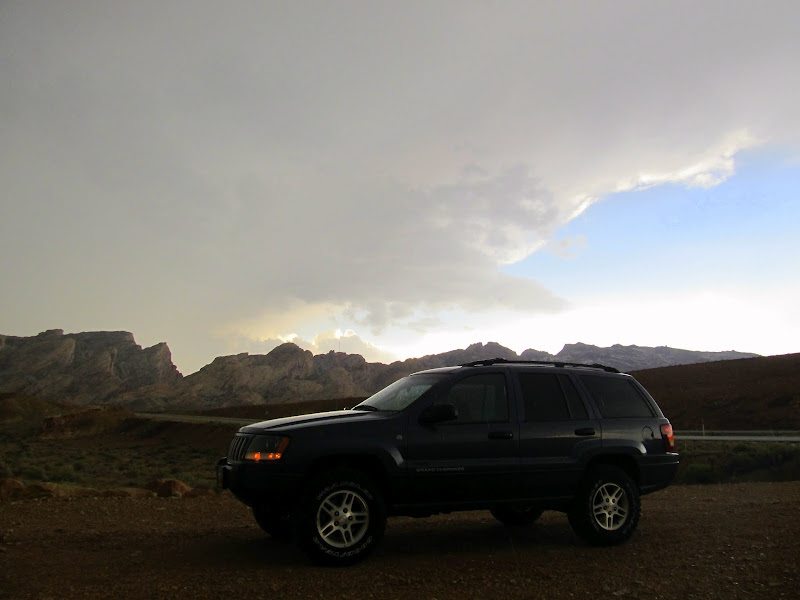
Under the edge of the storm as I pull off of I-70 onto the dirt road
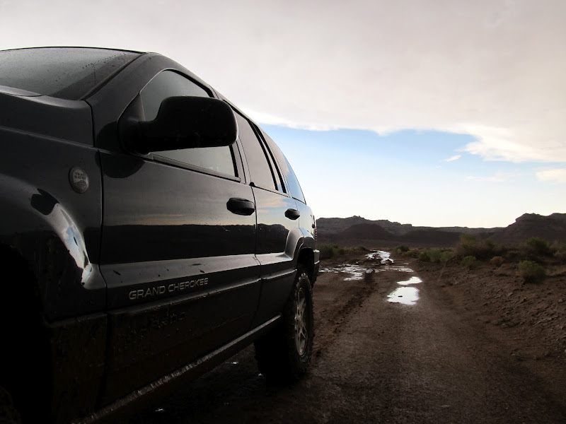
After passing through a muddy mess on the road
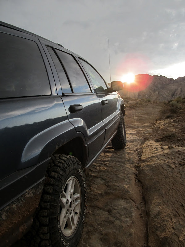
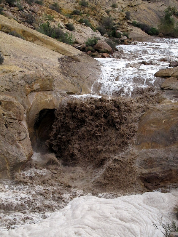
I did use 4WD a couple of times, but I'm not sure I needed it. Better safe than stuck. I stopped for a photo op when the clouds cleared just as the sun was setting behind the Reef. I was still more than a mile from where I planned on camping at the mouth of Three Finger Canyon, but when I got out of the Jeep I could hear the sound of water rushing coming from the direction of the canyon. I took a few photos then hurriedly drove the remaining distance. I parked at the end of the road and walked to the edge of the wash and saw a flash flood in progress in what is normally a dry canyon. The collection area for this drainage is fairly large, though there was more water flowing that I would have expected. I walked up and down the canyon for some time watching the flood while taking photos and video.
Clouds clearing up just as the sun sets behind the San Rafael Reef
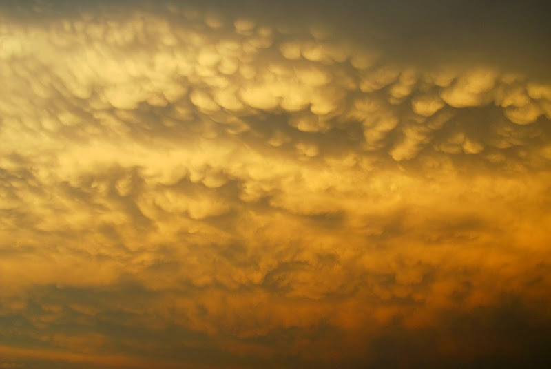
Mammatus clouds forming in the trailing edge of the storm
Flash flood in Three Finger Canyon
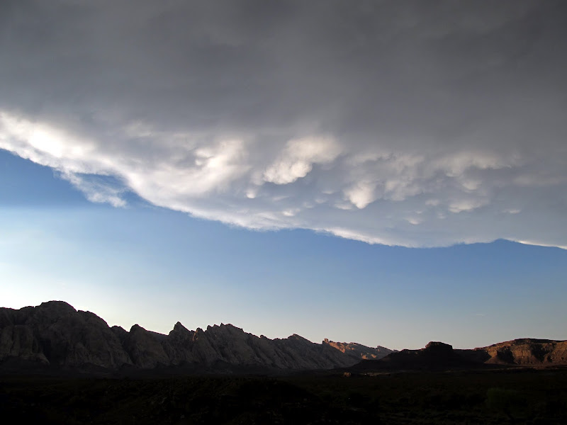
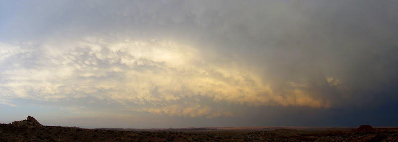
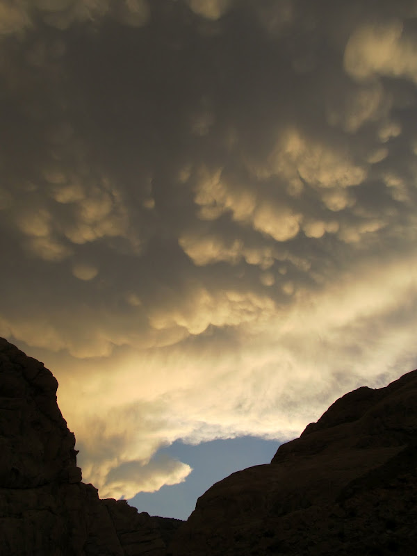
I started setting up camp after nearly an hour of enjoying the flowing water. Some mammatus clouds formed in the trailing edge of the storm, and though the sun had already set it was lighting the clouds up beautifully. I noticed a few larger toads hopping through camp only when Torrey took notice of them first. Unfortunately I think she ate one. While I was attempting to take some night shots she returned from the darkness twitching her head funny as though she'd eaten something unpleasant (and possibly still moving). I ate dinner, chili-mac cold straight from the can, in the darkness and then turned in a little after 10PM. I slept well for several hours, only waking to urinate before 4AM. I'd been sleeping on top of my sleeping bag before then, but it was chilly enough that I climbed inside for the rest of the night. I didn't sleep as well after then, but still had one of the better nights I've spent in a tent.
The retreating storm
Mammatus clouds over Three Finger Canyon
Mammatus clouds
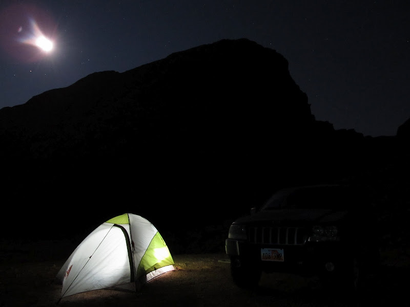
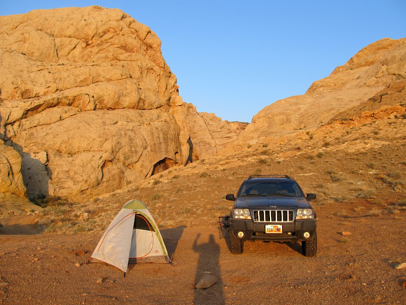
Tent and Jeep
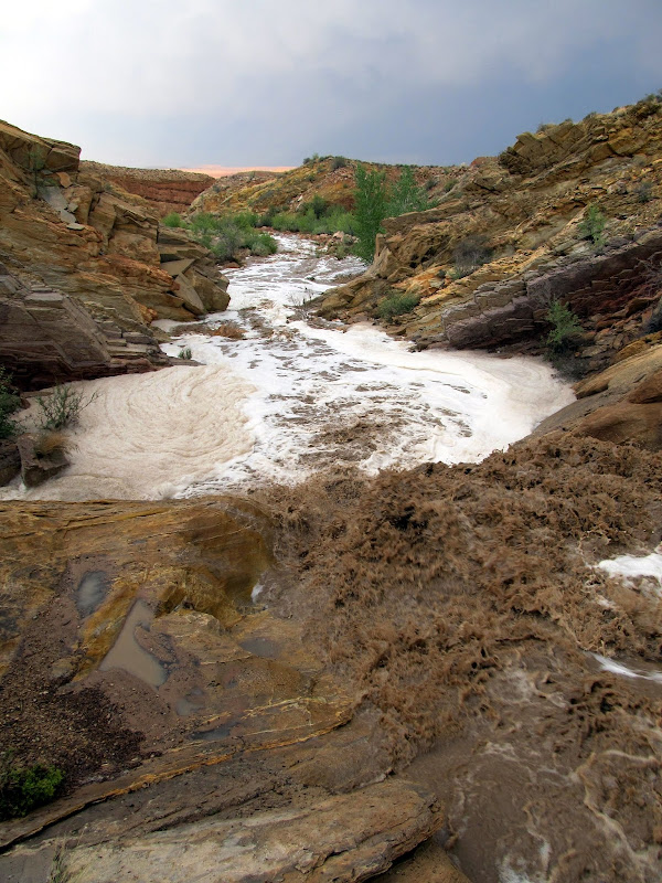
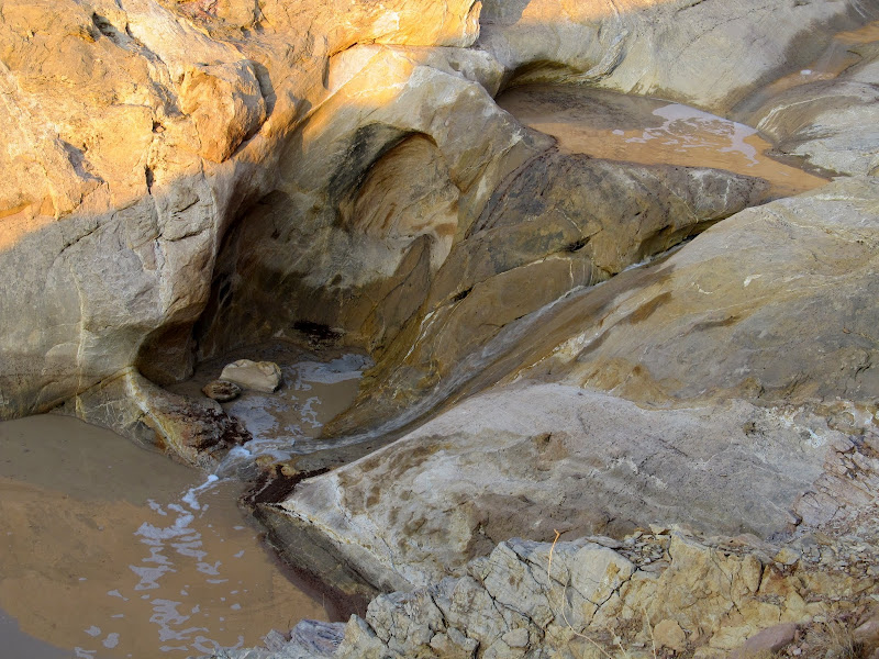
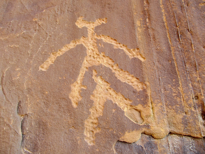
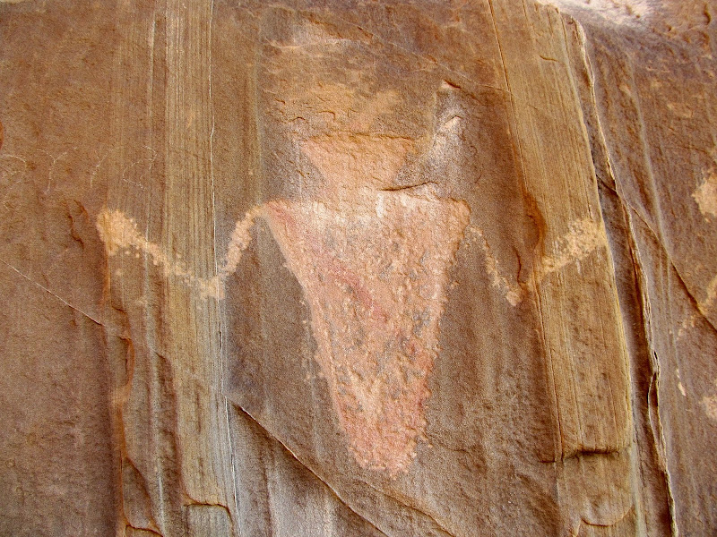
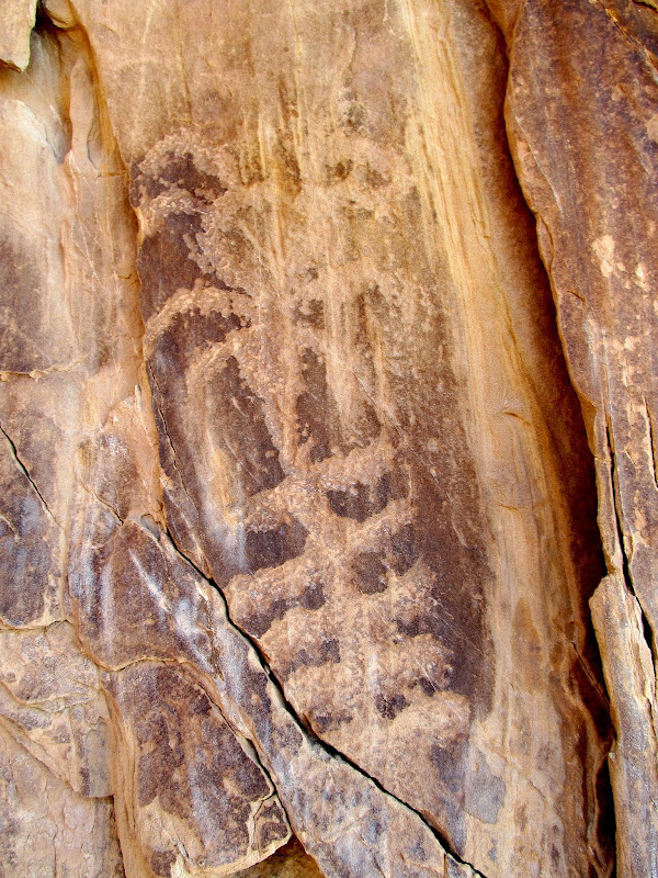
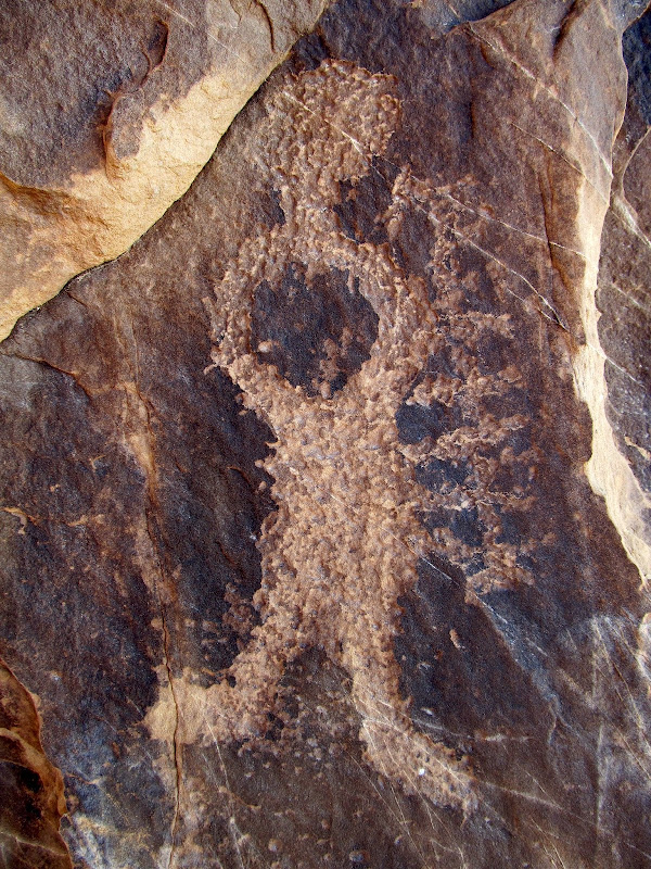
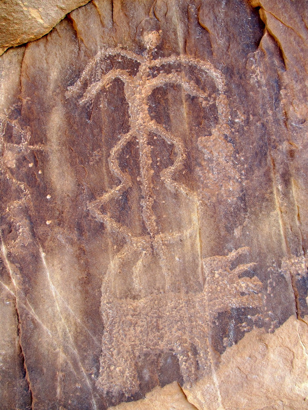
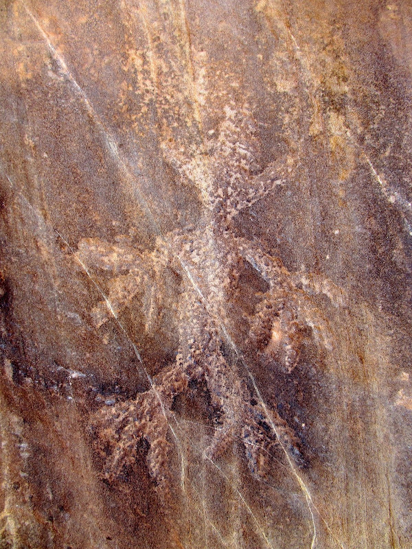
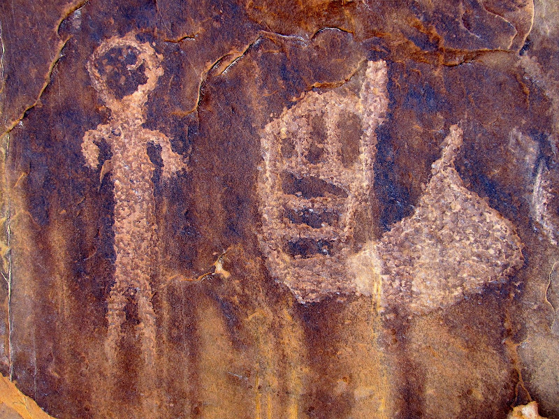
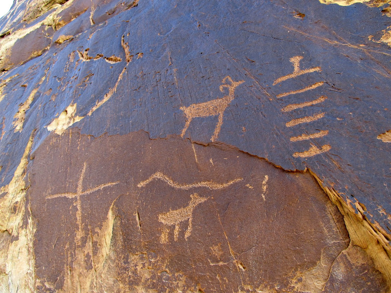
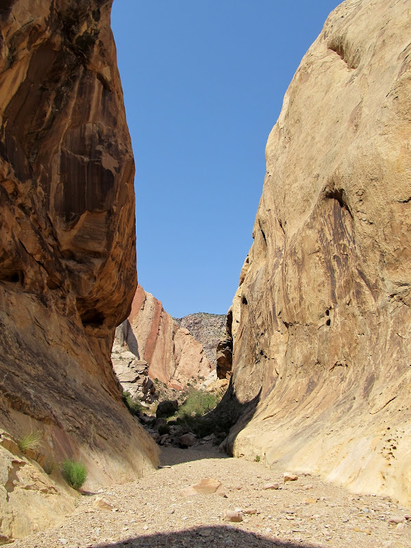
I awoke around 7AM and rolled out of the tent about 15 minutes later. The water in the canyon had dwindled to a trickle. I walked up the canyon a ways and took photos of the rock art there. I had stumbled across the rock art five years earlier while helping some friends with a contest they were playing. I only took a handful of photos then, and I'd forgotten how extensive the petroglyphs are. I documented them well this time by taking about 120 photos. I returned and took down camp, packed up the Jeep, and readied myself for some hiking. I wanted to hike from there along the outside of the San Rafael Reef to Uneva Canyon, exploring the small canyons/cracks in the Reef on the way. I planned on passing through Uneva Canyon and returning to Three Finger via some major north-south drainages behind the Reef.
Good morning!
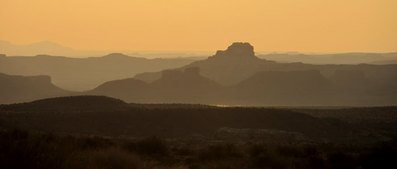
View east at sunrise
The flow was down to a trickle by morning
Petroglyphs in Three Finger Canyon
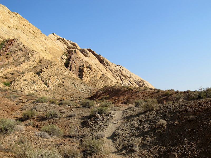
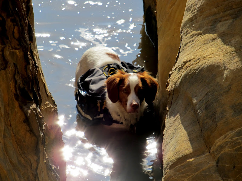
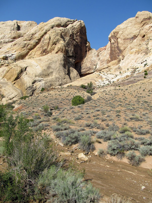
I started hiking a little after 9AM. I was surprised to find a well-used trail that I later found out (from the droppings) is used primarily by horsemen. The terrain had a lot of small ups-and-downs and the hiking wasn't terribly difficult. I got to the first small crack in the Reef that I planned on exploring and I wasn't at all surprised to find a lot of standing water there. I had to scramble up a few ledges where Torrey couldn't follow, and I could only proceed a few hundred feet before the crack narrowed up. Chimneying up the crack might have been possible, but not without wading through a pool of water, which I wasn't prepared to do. I continued another third of a mile to the next crack, which proved to be similar to the first--full of water and choked down to a narrow spot that I couldn't climb.
The beginning of my hike along the outside of the San Rafael Reef from Three Finger Canyon to Uneva Canyon
A crack in the Reef that I explored
This is as far as Torrey could go
Torrey waiting for me to return from exploring the crack
The end of my exploration of this crack
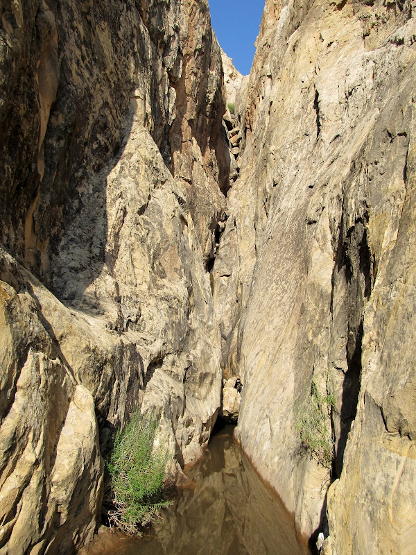
Looking up from where I stopped in the second crack. It was too steep to climb any further.
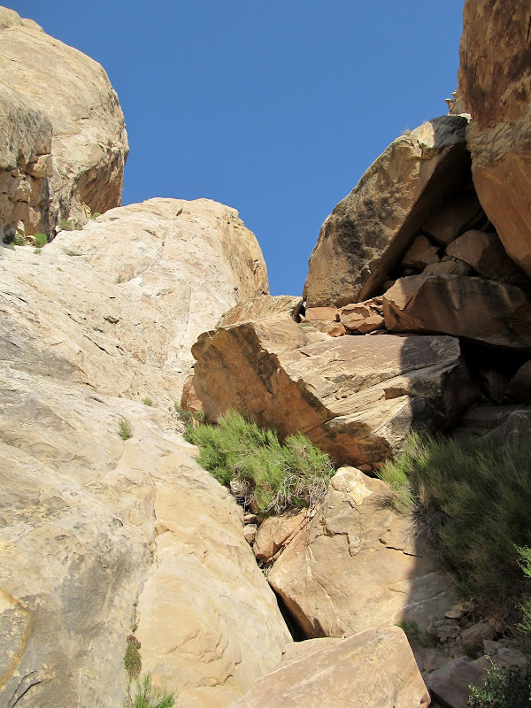
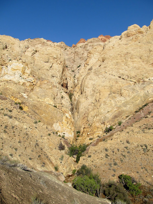
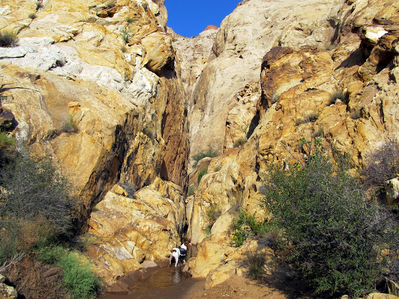
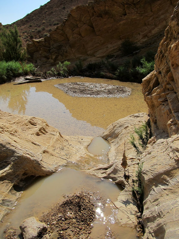
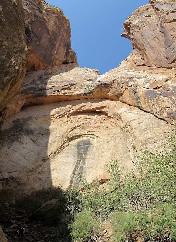
The next crack was a little larger than the rest, and it was my primary reason for wanting to do this hike. In the Bing Maps satellite imagery it looked like there was a huge alcove in this small canyon. I found water still running in the lower part of the canyon, and algae beneath the flowing water indicated that it's spring-fed and probably flows nearly year-round. I had to climb out of the bottom of the drainage a couple of times to avoid some deep water which Torrey just swam through. At the end of the canyon there was a very tall alcove, but it wasn't as deep as I'd hoped. Water was flowing over a lip at the top, free-hanging for a moment, then landing on the back wall of the alcove and running down the sandstone into a large pool. I could only imagine what it must have looked like when it was flash-flooding, which it surely must have done the previous evening.
View south toward Three Finger Canyon
Judging from the wash coming out of this canyon, it likely flash-flooded the night before
Large pool of water
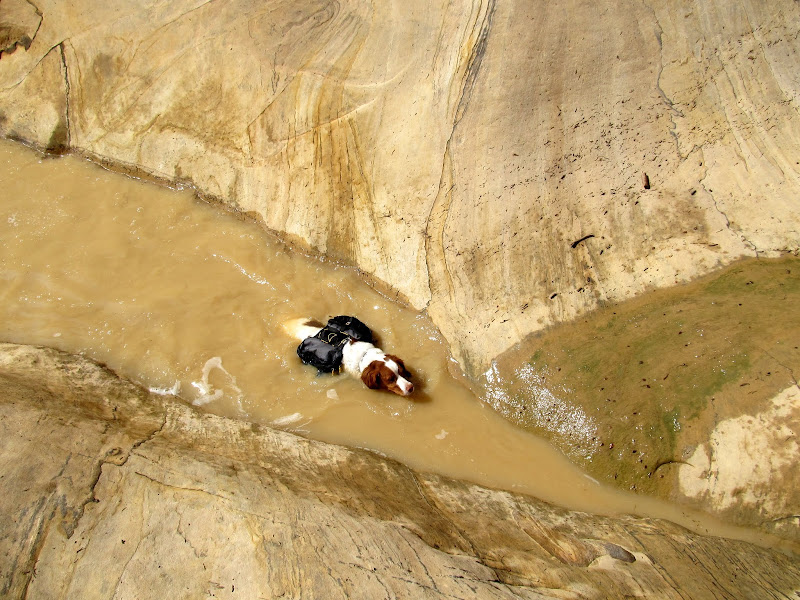
Torrey swimming
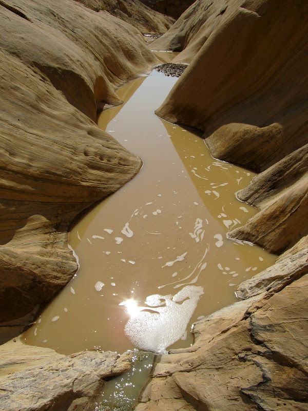
Water in the canyon
Water falling down the canyon. The algae indicates that water flows nearly year-round here.
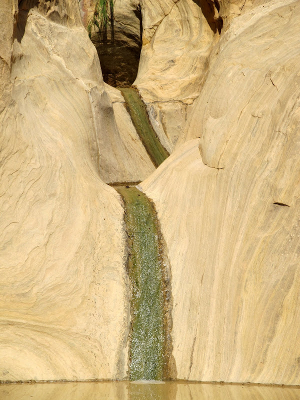
The big fall
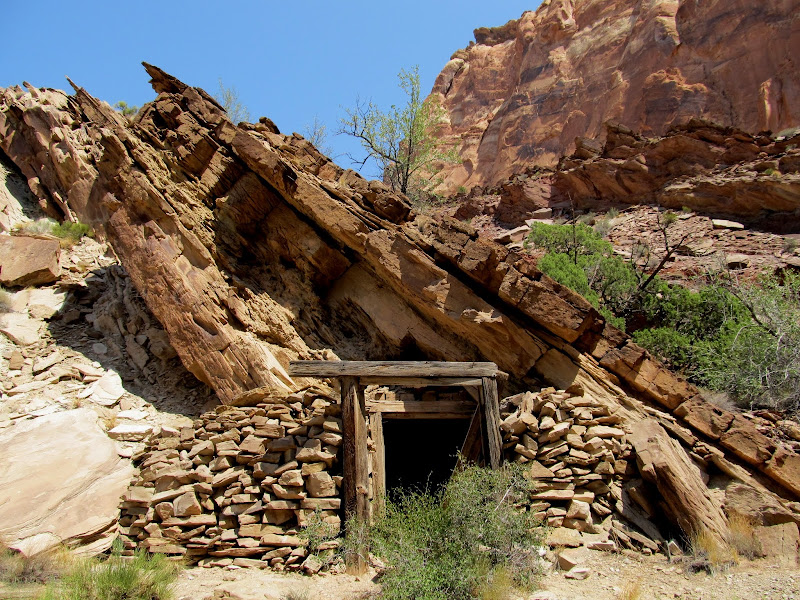
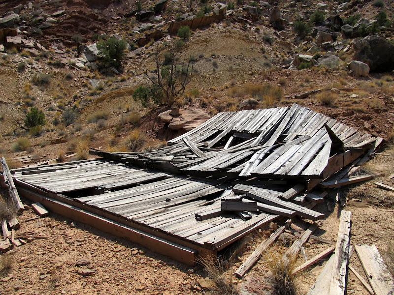
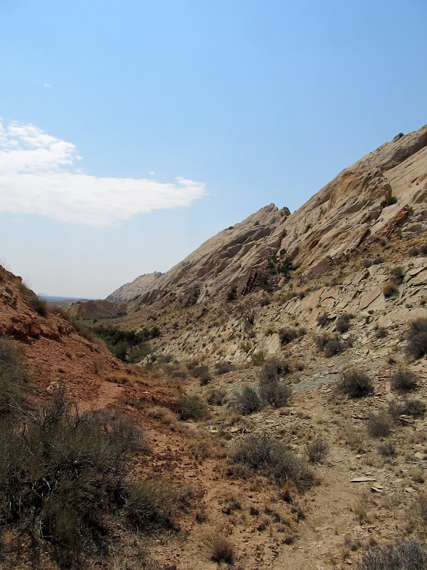
The canyon wasn't as spectacular as I envisioned in front of my computer, but it was still worth a visit. I passed up the fourth and final crack that I planned on checking out because the entrance looked too brushy and I was already getting a little tired from hiking. I continued to Uneva Canyon, then turned west and passed through the canyon to the backside of the Reef. I made a short stop at the Uneva Mine, but I'd been there a year and a half ago and there wasn't much reason to stick around long. I'd never been beyond the mine, and I followed the drainage then turned slightly south until I found myself on a washed out road leading to an old mining camp. I knew from the topo map that there were a couple of mine prospects here, but I wasn't expecting to find two collapsed mining shacks and all the old, rusty junk lying around. I also wasn't expecting the route behind the Reef to climb so steeply toward Three Finger Canyon. As soon as I saw how difficult it would be I decided to just reverse my route and return the same way I'd come.
Uneva Canyon
Uneva Mine
Old, washed out mining road behind the Reef
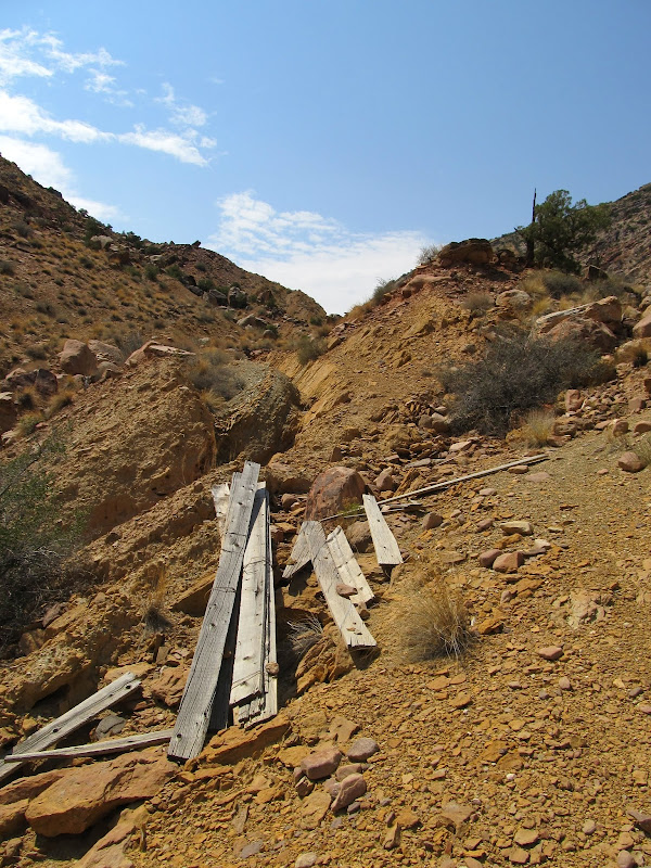
Collapsed mining shack
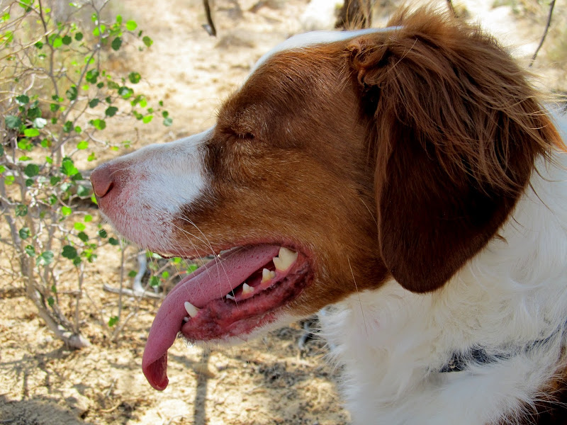
I stopped in the shade of Uneva Canyon and took a lunch break. I ate a couple of granola bars, fed Torrey and let her drink her fill of water, then I lied down on the cool sandstone and rested. I enjoy loop hikes much more than out-and-back hikes, so I pushed myself going back to Three Finger and the waiting Jeep--there was nothing new to see on the return hike. What had taken me three and a half hours to hike going in, took an hour and a half on the return trip. I only stopped to rest twice, for Torrey's sake--once in the shade of a small tree, and again at a deep, cool pool of water that she swam in and drank from. I returned to the Jeep about five and a half hours after setting out on the hike and I covered 8.2 miles. I was beat. I took a different road out, heading south then east near Greasewood Draw toward Highway 24. There were several stretches of muddy road and a couple of somewhat washed out wash crossings, but I left the Jeep in 2WD to see how it handled. With better tires and a little more weight over the rear wheels than my truck, it got me back to the pavement with ease.
Route back to Three Finger Canyon
Poor Torrey, she was hot and tired so we rested here in the shade for a long while
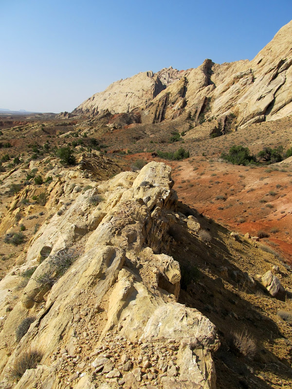
Panorama of the San Rafael Reef along my entire hiking route
Full photo gallery:
https://picasaweb.google.com/Dennis.Udink/ThreeFingerAndUnevaCanyons
[parsehtml]<iframe width="600" height="500" frameborder="0" scrolling="no" marginheight="0" marginwidth="0" src="https://maps.google.com/maps?q=http:%2F%2Fudink.org%2Fgeo%2FThreeFingerAndUnevaCanyons.kmz&hl=en&sll=39.499761,-111.547028&sspn=4.950576,10.821533&t=h&ie=UTF8&ll=38.87179,-110.461693&spn=0.033412,0.051413&z=14&output=embed"></iframe><br /><small><a href="https://maps.google.com/maps?q=http:%2F%2Fudink.org%2Fgeo%2FThreeFingerAndUnevaCanyons.kmz&hl=en&sll=39.499761,-111.547028&sspn=4.950576,10.821533&t=h&ie=UTF8&ll=38.87179,-110.461693&spn=0.033412,0.051413&z=14&source=embed" style="text-align:left">View Larger Map</a></small>[/parsehtml]http://udink.org/geo/ThreeFingerAndUnevaCanyons.kmz
Featured image for home page:

Under the edge of the storm as I pull off of I-70 onto the dirt road
After passing through a muddy mess on the road
I did use 4WD a couple of times, but I'm not sure I needed it. Better safe than stuck. I stopped for a photo op when the clouds cleared just as the sun was setting behind the Reef. I was still more than a mile from where I planned on camping at the mouth of Three Finger Canyon, but when I got out of the Jeep I could hear the sound of water rushing coming from the direction of the canyon. I took a few photos then hurriedly drove the remaining distance. I parked at the end of the road and walked to the edge of the wash and saw a flash flood in progress in what is normally a dry canyon. The collection area for this drainage is fairly large, though there was more water flowing that I would have expected. I walked up and down the canyon for some time watching the flood while taking photos and video.
Clouds clearing up just as the sun sets behind the San Rafael Reef
Mammatus clouds forming in the trailing edge of the storm
Flash flood in Three Finger Canyon
I started setting up camp after nearly an hour of enjoying the flowing water. Some mammatus clouds formed in the trailing edge of the storm, and though the sun had already set it was lighting the clouds up beautifully. I noticed a few larger toads hopping through camp only when Torrey took notice of them first. Unfortunately I think she ate one. While I was attempting to take some night shots she returned from the darkness twitching her head funny as though she'd eaten something unpleasant (and possibly still moving). I ate dinner, chili-mac cold straight from the can, in the darkness and then turned in a little after 10PM. I slept well for several hours, only waking to urinate before 4AM. I'd been sleeping on top of my sleeping bag before then, but it was chilly enough that I climbed inside for the rest of the night. I didn't sleep as well after then, but still had one of the better nights I've spent in a tent.
The retreating storm
Mammatus clouds over Three Finger Canyon
Mammatus clouds
Tent and Jeep
I awoke around 7AM and rolled out of the tent about 15 minutes later. The water in the canyon had dwindled to a trickle. I walked up the canyon a ways and took photos of the rock art there. I had stumbled across the rock art five years earlier while helping some friends with a contest they were playing. I only took a handful of photos then, and I'd forgotten how extensive the petroglyphs are. I documented them well this time by taking about 120 photos. I returned and took down camp, packed up the Jeep, and readied myself for some hiking. I wanted to hike from there along the outside of the San Rafael Reef to Uneva Canyon, exploring the small canyons/cracks in the Reef on the way. I planned on passing through Uneva Canyon and returning to Three Finger via some major north-south drainages behind the Reef.
Good morning!
View east at sunrise
The flow was down to a trickle by morning
Petroglyphs in Three Finger Canyon
I started hiking a little after 9AM. I was surprised to find a well-used trail that I later found out (from the droppings) is used primarily by horsemen. The terrain had a lot of small ups-and-downs and the hiking wasn't terribly difficult. I got to the first small crack in the Reef that I planned on exploring and I wasn't at all surprised to find a lot of standing water there. I had to scramble up a few ledges where Torrey couldn't follow, and I could only proceed a few hundred feet before the crack narrowed up. Chimneying up the crack might have been possible, but not without wading through a pool of water, which I wasn't prepared to do. I continued another third of a mile to the next crack, which proved to be similar to the first--full of water and choked down to a narrow spot that I couldn't climb.
The beginning of my hike along the outside of the San Rafael Reef from Three Finger Canyon to Uneva Canyon
A crack in the Reef that I explored
This is as far as Torrey could go
Torrey waiting for me to return from exploring the crack
The end of my exploration of this crack
Looking up from where I stopped in the second crack. It was too steep to climb any further.
The next crack was a little larger than the rest, and it was my primary reason for wanting to do this hike. In the Bing Maps satellite imagery it looked like there was a huge alcove in this small canyon. I found water still running in the lower part of the canyon, and algae beneath the flowing water indicated that it's spring-fed and probably flows nearly year-round. I had to climb out of the bottom of the drainage a couple of times to avoid some deep water which Torrey just swam through. At the end of the canyon there was a very tall alcove, but it wasn't as deep as I'd hoped. Water was flowing over a lip at the top, free-hanging for a moment, then landing on the back wall of the alcove and running down the sandstone into a large pool. I could only imagine what it must have looked like when it was flash-flooding, which it surely must have done the previous evening.
View south toward Three Finger Canyon
Judging from the wash coming out of this canyon, it likely flash-flooded the night before
Large pool of water
Torrey swimming
Water in the canyon
Water falling down the canyon. The algae indicates that water flows nearly year-round here.
The big fall
The canyon wasn't as spectacular as I envisioned in front of my computer, but it was still worth a visit. I passed up the fourth and final crack that I planned on checking out because the entrance looked too brushy and I was already getting a little tired from hiking. I continued to Uneva Canyon, then turned west and passed through the canyon to the backside of the Reef. I made a short stop at the Uneva Mine, but I'd been there a year and a half ago and there wasn't much reason to stick around long. I'd never been beyond the mine, and I followed the drainage then turned slightly south until I found myself on a washed out road leading to an old mining camp. I knew from the topo map that there were a couple of mine prospects here, but I wasn't expecting to find two collapsed mining shacks and all the old, rusty junk lying around. I also wasn't expecting the route behind the Reef to climb so steeply toward Three Finger Canyon. As soon as I saw how difficult it would be I decided to just reverse my route and return the same way I'd come.
Uneva Canyon
Uneva Mine
Old, washed out mining road behind the Reef
Collapsed mining shack
I stopped in the shade of Uneva Canyon and took a lunch break. I ate a couple of granola bars, fed Torrey and let her drink her fill of water, then I lied down on the cool sandstone and rested. I enjoy loop hikes much more than out-and-back hikes, so I pushed myself going back to Three Finger and the waiting Jeep--there was nothing new to see on the return hike. What had taken me three and a half hours to hike going in, took an hour and a half on the return trip. I only stopped to rest twice, for Torrey's sake--once in the shade of a small tree, and again at a deep, cool pool of water that she swam in and drank from. I returned to the Jeep about five and a half hours after setting out on the hike and I covered 8.2 miles. I was beat. I took a different road out, heading south then east near Greasewood Draw toward Highway 24. There were several stretches of muddy road and a couple of somewhat washed out wash crossings, but I left the Jeep in 2WD to see how it handled. With better tires and a little more weight over the rear wheels than my truck, it got me back to the pavement with ease.
Route back to Three Finger Canyon
Poor Torrey, she was hot and tired so we rested here in the shade for a long while
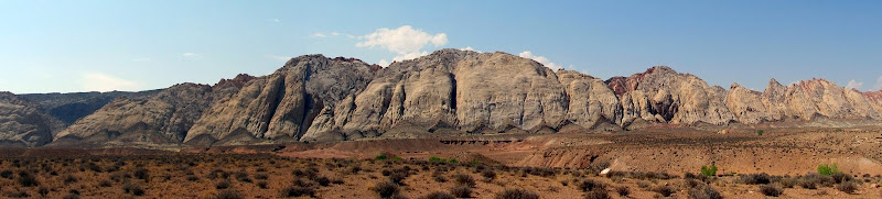
Panorama of the San Rafael Reef along my entire hiking route
Full photo gallery:
https://picasaweb.google.com/Dennis.Udink/ThreeFingerAndUnevaCanyons
[parsehtml]<iframe width="600" height="500" frameborder="0" scrolling="no" marginheight="0" marginwidth="0" src="https://maps.google.com/maps?q=http:%2F%2Fudink.org%2Fgeo%2FThreeFingerAndUnevaCanyons.kmz&hl=en&sll=39.499761,-111.547028&sspn=4.950576,10.821533&t=h&ie=UTF8&ll=38.87179,-110.461693&spn=0.033412,0.051413&z=14&output=embed"></iframe><br /><small><a href="https://maps.google.com/maps?q=http:%2F%2Fudink.org%2Fgeo%2FThreeFingerAndUnevaCanyons.kmz&hl=en&sll=39.499761,-111.547028&sspn=4.950576,10.821533&t=h&ie=UTF8&ll=38.87179,-110.461693&spn=0.033412,0.051413&z=14&source=embed" style="text-align:left">View Larger Map</a></small>[/parsehtml]http://udink.org/geo/ThreeFingerAndUnevaCanyons.kmz
Featured image for home page:
")