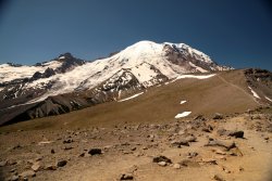
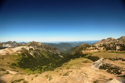
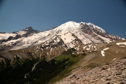
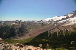
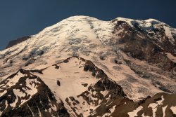
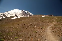
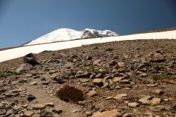
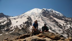
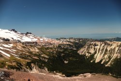
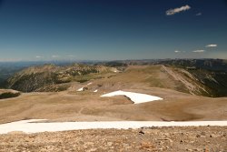
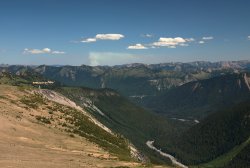
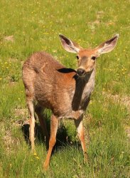
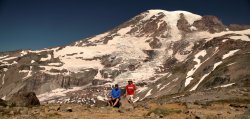
Three Days at Mount Rainier in late July.

TractorDoc

Member
.
Joined
Aug 21, 2018
Messages
553
About 18 years or so ago I had driven from Ohio to the West Coast stopping at various National Parks/Outdoor Points of Interest along the way. I was able to spend one day at Mount Rainier and made the hike/climb up to Camp Muir before camping at Cougar Rock and heading off to Olympic the next day. I've always wanted to get back to see more of what I missed, and all these years later I finally took the time to head back to the mountain this past July.

Things are a little different this time around. Instead of driving we flew into Seattle. I brought along my brother in law from Louisiana to give him some perspective on different topography. Due to flying and logistics we did not backpack the trip (don't think less of us) but we did try to venture out for some meaningful hiking each day.

We arrived in Seattle about noon on Tuesday the 23rd of July. The skies were cloudy and fog was thick in some areas. I had been telling BIL (Brother-in-Law) about how Rainier dominated the landscape for miles around but he was having a difficult time believing me at this point. Rather than go straight to Rainier we ventured a bit further South to an area I had missed on my previous trip but always wanted to see: Mount Saint Helens. I was a boy when it erupted (BIL was not even thought of yet!) and the images/story were fascinating to a nerdy kid.

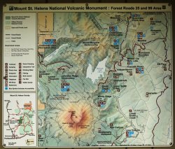
We made the drive South from Randle on Forest Roads -- they were drivable but you had to be careful not to bottom out. The destination was Norway Pass Trailhead for a quick two mile hike to get a view of Mt. Saint Helens and Spirit Lake from Norway Pass.
5J5A0137A.JPG

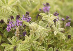
Right off we were greeted with wildflowers all around us. The flowers were something I was looking forward to seeing; I like to think I have a bit of a green thumb and our family runs a small greenhouse in the spring months. . . I'm always interested in new and exotic plants.
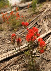
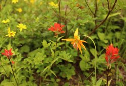
5J5A0142.JPG

5J5A0154.JPG

The lower elevations were covered in stumps and trees all downed in the same direction -- probably from a combination of logging and the effect of the blast almost 40 years ago.
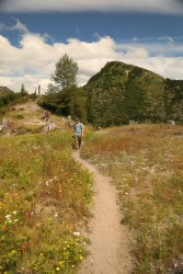
5J5A0145.JPG

In no time we had made our way to the Norway Pass viewpoint. Sadly the clouds were still obstructing the view but getting to see Spirit Lake and all the logs/trees still floating in the water was worth the effort.
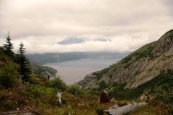
5J5A0164.JPG

We had talked about hiking all the way to Mount Margaret but the clouds were getting thicker by the minute and the sun was heading down so we headed back. Along the way we heard a grunting sound along the trail and noticed a Grouse causing the commotion.
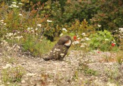
5J5A0177.JPG

The return drive on the forest roads was just as intense as before, but we made it to Rainier with no hubcaps lost.

I will make new post for each day -- mostly so I can keep my pictures/story in order. :)
 
Day One (ok, officially Day Two, but Day One on Rainier). Wednesday, July 24th.

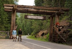
As mentioned, we arrived at Rainier the night before with no problems. Please excuse my ghostly legs.

5J5A0187A.JPG

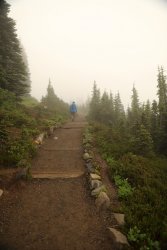
Our pre-trip plan was simple. We had several good hikes we wanted to accomplish, but really did not have a set itinerary due to all the unknowns that come with travel. We targeted the Skyline Trail, Burroughs Mountain, Summerland, and several others (including Camp Muir) as possibilities. When we started Wednesday morning the clouds were still thick as the night before and visibility was poor. Somehow the two of us decided that it made the most sense to head upward on the Skyline Trail. . . and hope the clouds would thin out. This made as much sense as driving to another cloudy part of the mountain so we headed up and into the mist.

5J5A0198A.JPG

One benefit of the clouds (and a weekday) was an absolute absence of people. We would occasionally pass someone on the trail, but I knew this time of year would be in the realm of peak travel season and avoiding crowds was something we hoped for. . . and somehow accomplished 90% of the trip. Another advantage was the trailside flowers took on as much of the cloud vapor as we did (I think I stayed hydrated just by breathing). My favorites were the Dr. Seuss Trees.

5J5A0204.JPG

5J5A0199.JPG

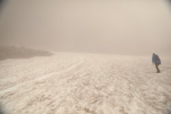
Eventually we reached to top of Skyline and the crossing of Pebble Creek. . . still surrounded by clouds. Higher, we decided, was the only thing that made sense for two lowlanders unacclimated to the elevation to do. Up the Muir Snowfield we climbed.

5J5A0218A.JPG

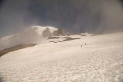
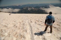
We did not realize it at the time, but this was probably the best hike we could have picked for today. The temperatures were cool enough and the snow was firm enough for comfortable climbing. As we rose in elevation something started to become visible above us. . . . I started to feel my justification for bringing the BIL up here at Mount Rainier became visible.

5J5A0219A.JPG

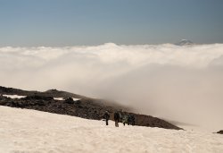
Hike up a little higher and soon we were above the clouds. Mt Adams became visible in the distance. Many of the people we met on the snowfield were planning on "overnighting" at Muir then attempting the Summit the next day. I was glad I was not lugging 70lbs. of gear up at this point!

5J5A0223A.JPG

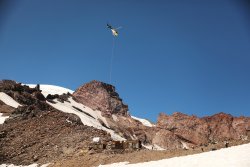
After huffing up 10-15 steps I'd take 30 seconds or so to catch my breath. When Camp Muir looked to be within touching distance a supply helicopter made its delivery during one of my rest sessions.

5J5A0229A.JPG

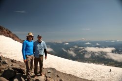
We made it to Camp Muir at 10,100+ish feet elevation. BIL did wear boots up during the hike. ;)

5J5A0244B.JPG

We sat, relaxed, and enjoyed a feast of jerky/yogurt covered cranberries/Reese's Pieces for about half an hour before heading back down. The clouds even began to thin out and provide us with views of Mount Hood and Mount Saint Helens. The downward journey would have been aided by a trash bag or two but we made it down safely even with some unintentional glissading.

5J5A0247A.JPG

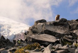
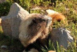
Local resident "Get off my Lawn!"

5J5A0267A.JPG

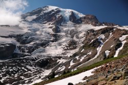
View back up the mountain. . . one that we did not see on the way up.

5J5A0284A.JPG

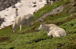
Did you notice the goats in the previous picture? Several Mountain Goats were resting/grazing on the meadow grass.

5J5A0294A.JPG

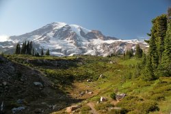
Another view back up the mountain. This is one of my favorites from the trip.

5J5A0305A.JPG

More of these guys were out on the trail than people.

5J5A0324A.JPG

One final look back before the mountain dropped down out of view.

5J5A0331A.JPG

Before the morning I was not sure if Camp Muir would even be attempted. . . much less accomplished. Four miles up and four miles down, but with 4600 feet of gained elevation a lot of which was on snow. I have a few more years on me now but apparently still had enough to get there. I certainly felt it; I think I was asleep before the sun even set that evening. I blame still being on Eastern Time and wanting to be ready for tomorrow's adventures. . . coming in the next post.
 
Day Two, Thursday July 25th.

I was typically up and moving by 5am Washington time while BIL was still sound asleep. Today and tomorrow I would take a mile walk out this path where I had cell service and check in with the office back home. Most scenic commute to work I've ever had.

5J5A0348A.JPG

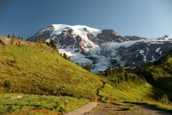
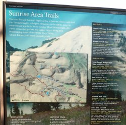
The clouds were not to be seen today so we made the decision to drive to Sunrise on the East side of the mountain. The plan was to hike the Burroughs Mountains: Burroughs One, Two and Three. The official park map shows the trail to First and Second Burroughs, but we knew the trail continued out to Third Burroughs.

5J5A0366A.JPG

We followed the Sourdough Ridge Trail up to Frozen lake to connect to the First Burroughs Trail. A look back at the Sourdough Ridge and Trail:

5J5A0378A.JPG

Before we could head up First Burroughs a ranger was heading down the trail to inform us the section we wanted to take would be closed while work could be done on snow covered areas. We were directed to take the trail down to Sunrise Camp/Shadow Lake and hike back up to First Burroughs from there. This resulted in 2.5 miles with some elevation loss and gain vs. the 0.7 miles the original route called for, but it was a nice day so we took the detour. It also provided some great views of Emmons Glacier and the mountain:

5J5A0386A.JPG

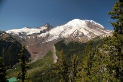
Reaching the top of First Burroughs provides a nice view of Rainier; the trail to Second Burroughs beckons our bootsteps.

5J5A0396A.JPG

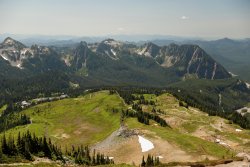
A view North into the Cascades from First Burroughs.

5J5A0395A.JPG

We made it to Second Burroughs without incident. It was a good time for a lunch break of jerky and miscellaneous prepackaged meal bars while taking in the view of Rainier and the Emmons Glacier.
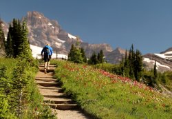
5J5A0397A.JPG

5J5A0399A.JPG

The mountain looked close. . .

5J5A0405A.JPG

But we wanted to get closer, so we started down then back up the unofficial trail to Third Burroughs.

5J5A0406A.JPG

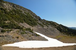
The last bit felt the steepest. Small snowfield crossings brought on flashbacks of yesterday's hike.

5J5A0408A.JPG

We made it to the top and had it all to ourselves.

5J5A0415A.JPG

The view down the valley opposite Winthrop Glacier was another reward for the effort.

5J5A0413A.JPG

Looking back towards Second Burroughs -- time to make the hike back down. . . and up.

5J5A0424A.JPG

Perhaps a forest fire somewhere to the East?

5J5A0426A.JPG

The hike back was uneventful. Rather than take the detour we were able to cross the snow covered portions of First Burroughs without trouble. As we made our way down the ridge we were greeted by another local. No official instruments recorded our distance but mapping it out suggests about 13ish miles round trip.

5J5A0439A.JPG

We headed back to Paradise happy and tired. The drive between Paradise and Sunrise was pleasant but not something I really wanted to do again tomorrow, so we decided to spend our day/morning at Paradise once more. Trails were to be determined. Before turning in we drove down to Packwood for supper at Cruiser's Pizza -- a nice local place should you be in there area.
 
Day Three, Friday July 26th.

The clouds were still in hiding for another stunning morning commute.

5J5A0444A.JPG

As mentioned we decided to stay in the Paradise area and today chose an easy hike to finish the trip off -- a counterclockwise approach to the High Skyline Trail adding in the Paradise Glacier Spur.
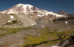
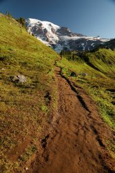
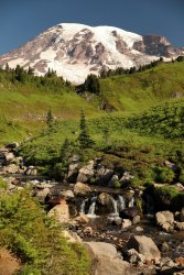
An early start left us with an empty trail and uncongested views of Rainier.
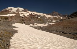
5J5A0459A.JPG

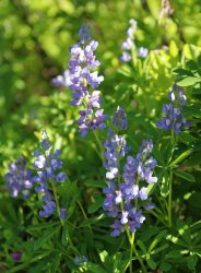
Wildflowers were more abundant on the early portions of the trail.

5J5A0472A.JPG

5J5A0492A1.JPG

Soon we arrived at the Paradise Glacier spur trail and took some time to take in the differences in landscape.

5J5A0497A.JPG

After about a mile the Paradise Glacier trail ends. I imagine one could hike farther up but we took in the view from here before heading back.

5J5A0506A.JPG

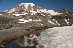
Caught a partial reflection of Rainier in some meltwater.

5J5A0517A.JPG

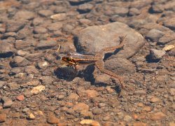
Then I noticed something moving in that water -- it turned out to be a couple frogs of all things! I believe they were red-legged frogs.

5J5A0512.JPG

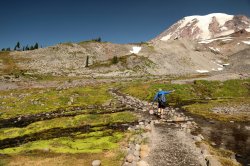
Moving on we crossed the glacier debris fields and started heading up.

5J5A0518A.JPG

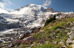
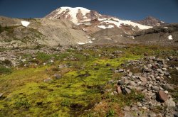
A view up the mountain. I liked the bright green contrasting against the gray.

5J5A0521A.JPG

Looking up we could make out the trail ahead of us.

5J5A0527A.JPG

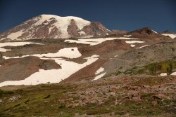
We eventually made it to a spot just above Panorama Point that provided a nice view up the mountain and Nisqually Glacier. A good spot for the last of our trail cuisine and taking in the vista before heading back down.

5J5A0536A.JPG

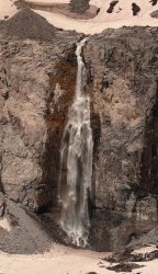
A closer up of the waterfall behind us.

5J5A0531A.JPG

One final view before heading down the mountain for the last time.

5J5A0538A.JPG

We eventually made our way back up to Seattle to catch the plane to Ohio. The weather, mountain, and locals had been kind to us and we agreed a return trip could be in the future. . . . hopefully it will not take another 18 years to make it happen!
 
Cool - I like it, lots of nice views. Stunning morning commute. Did you two have any issue with the altitude?
 
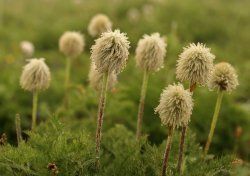
Adding that this brings back childhood memories. My parents used to take me hiking at Sunrise and Paradise as a kid. I was a big fan of pasqueflowers. Thanks again for sharing.
 
Cool - I like it, lots of nice views.
Thanks again for sharing.

Thanks for the feedback. :) A quick write up is a nice way to experience everything again while being back home.

Did you two have any issue with the altitude?

Both us managed without trouble. One of my freak of nature superpowers was/is being able to handle hiking at altitude. We definitely felt the thin air as we neared the top and a couple days acclimation would have been a better approach. . . but we pulled it off.

A fellow local hiker from Seattle that we passed/talked to on the way up really showed us how it was done though as about halfway up the snowfield she came cruising along and passed everybody on her way to the top. She said she lived in Salt Lake before recently moving so her red blood cell count was more than capable. I was impressed!
 
Holy crap...stunning.
Hahaha the one photo with the Marmot above you, looking over the rocks, I thought was a grizzly! Haha Epic photo. I am sure if Marmots had social media, that would be its profile picture.
Thanks for sharing!!
 
Hahaha the one photo with the Marmot above you, looking over the rocks, I thought was a grizzly! Haha Epic photo. I am sure if Marmots had social media, that would be its profile picture.

Ha, I can see that! A pygmy Grizzly Bear on the Mountain. The marmot did seem to have a bear sized attitude.

Amazing photography. Out of curiosity, what's your camera setup?

Thanks for the kind words. I really enjoy photography and the pictures are my way of reliving the experience -- it would be a dream to have a career in nature/outdoor photography but I know I'm probably better off sticking with the current job.

I inherited a Canon AE-1 from my parents so from the beginning I have always been a Canon guy. I know everyone has their preferences but over the years I've stuck with what I am familiar with -- the current camera body is a 5D Mark IV. The majority of the pictures were taken with a 24-70mm L II lens. I have a 16-35mm L II and 70-300mm L that usually make the hikes with me -- the pictures of the mountain goats and the close up of the waterfall were taken with the 70-300.
 
Similar threads
Thread starter Title Forum Replies Date
JDWalters Three days in Utah/Arizona Hiking & Camping 12
Tater Head Three days in Arches... Trip Planning 10
Udink Three Days in Southern Utah Everything Else 6
dennargle Three Days In The Amazon Hiking & Camping 7
TractorDoc Yellowstone's Thorofare and the Teton Wilderness 08/09/2023 - 08/18/2023 Part Three / Day Three Backpacking 10
TractorDoc Yellowstone's Shoshone Lake, Ouzel Creek, and Three Rivers Junction -- September 13-16 2021 Backpacking 62
Perry Looping the Highline - Episode Three: The Crossing Backpacking 6
J Three of my Favorite Things: Hiko Springs, NV. Narrows, peaks, petroglyph hike Hiking & Camping 0
Stephanie B Old Woman Wash, Three Finger Petroglyphs, and Wild Horse Canyon (Backcountry Fest in the San Rafael Swell) Hiking & Camping 6
Mike K Uintas Three Nighter Backpacking 13
regehr Three of the Four American Fork Twin Peaks Hiking & Camping 10
balzaccom Caribou Wilderness Three Day Trip Backpacking 1
Red Rock Rangers Three Peaks Mountain Bike Trail Everything Else 0
ZubenElGenubi Three Day/Two Night Trip: Ansel Adams Wilderness Trip Planning 5
Shannon Three-four day loop trail ideas? Trip Planning 2
mattvogt7 Canyonlands Three District Tour Backpacking 16
ram Part three- Bargain Basement Canyoneering 5
uintahiker Three Short Hikes at Gila Cliff Dwellings Hiking & Camping 1
Udink Three Finger and Uneva Canyons Hiking & Camping 8
wanderinfinn Three, Moonshine, and Blue John Canyons Canyoneering 9
Tyler Northwest Fork of Three Canyon, April 2010 Canyoneering 0
Nick Three Weeks! General Discussion 1
Nick Three Canyon & Moonshine Wash Canyoneering 7
scatman Yellowstone's Thorofare, Headwaters of Thorofare Creek, Majo Pass, Younts Peak, Bob's Canyon, and Cub Creek - August 9, 2023 - Days 7 through 10 Backpacking 34
scatman Yellowstone's Thorofare, Headwaters of Thorofare Creek, Majo Pass, Younts Peak, Bob's Canyon, and Cub Creek - August 9, 2023 - Days 1 through 6 Backpacking 56
B 5 Days in the Sawtooths Backpacking 2
M Backpacking 50 miles in the Uinta Mountains for 5 days with ~50 pound pack Backpacking 4
Bob The Thorofare to Brooks Lake - 9 Days in Pictures Backpacking 10
RyanP Four Days in the IPW (8/9 - 8/12) Backpacking 17
D Four Days in the Maze, April 17-20 2023 Backpacking 7
F 12 days in Wyoming's Teton Wilderness, part 9 of 9, 7-29 & 30, /2022 Backpacking 5
F 12 days in Wyoming's Teton Wilderness, part 8 of 9, 7/28/2022 Backpacking 5
F 12 days in Wyoming's Teton Wilderness, part 7 of 9, July 26-27, 2022 Backpacking 13
F 12 days in Wyoming's Teton Wilderness, part 6, 7/25/2022 Backpacking 17
F 12 days in Wyoming's Teton Wilderness, part 5 of 9, 7/23-24, 2022 Backpacking 10
F 12 days in Wyoming's Teton Wilderness, part 4 of 9, 7/22, 2022 Backpacking 4
F 12 days in Wyoming's Teton Wilderness, part 3 of 9, 7/20-21, 2022 Backpacking 2
F 12 days in Wyoming's Teton Wilderness, part 2, 7/19/2022 Backpacking 4
F 12 days in Wyoming's Teton Wilderness, part 1, 7/15-18, 2022 Backpacking 13
norwegianxplorer 6 days Backpacking Norway in the Fall (Part 2) Backpacking 4
norwegianxplorer 6 days backpacking Jotunheimen in the fall Trip Reports 4
regehr King's in two days Hiking & Camping 5
Desertratgal 5 Days Solo Packrafting Canyonlands On The Water 4
norwegianxplorer 7 days backpacking Breheimen/Glacier Home National Park in Norway Backpacking 2
Bob Slickhorn Canyon System - 6 days Backpacking 22
Mikjik86 4 Days Backpacking Grand Teton Wilderness/Teton Crest Trail - Wyoming, July, 2021 Backpacking 0
J Death Valley Natl. Pk. 6 Days hiking. Nov 14-19, 2021 Hiking & Camping 1
norwegianxplorer Finding Hidden Glacier, 9 days backpacking Jotunheimen National Park Pt3, Norway. Trip Reports 0
norwegianxplorer 5 days Backpacking Rondane National Park, Norway Backpacking 3
norwegianxplorer 10 days Backpacking Femundsmarka National Park and Rogen Nature Reserve, Norway and Sweden Backpacking 8

Similar threads

Back
Top