The Virgin River Narrows in Zion National Park From The Top Down

Joined
Feb 10, 2013
Messages
122
Zion has become my favorite national park. Just a couple years ago I had never even been out to southern Utah. Now we have visited it twice in person and, thanks to the internet, including Backcountrypost.com, I can read trip reports, see photos, and watch videos from Zion trips at will, and envy everyone who lives in the area and can visit just about any time they want. The first time we came to Zion it was as a one-day side trip on our way from Las Vegas to GSENM. We hiked up the narrows to Orderville Canyon. It was amazing. Anyway, when planning our next trip to the area over Memorial Day week, 2014, my wife suggested that we do the whole thing from the top down. So on May 28th and 29th, 2014, we did the narrows from the top down, camping at campsite no. 5 in the heart of the canyon.

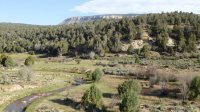
For the first three miles from the Chamberlain's Ranch trail head, the Virgin River lazily meanders through pasture land. The trail follows a dirt road alongside the river.
0859.jpg

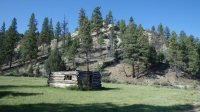
After nearly three miles you come to an old dilapidated log cabin. It signals that the dirt road trail is soon to end.
0940.jpg

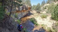
End of the trail. Time to get wet. Not for the last time.
1019.jpg

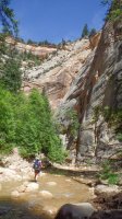
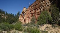
For the next few miles the canyon is wide, but the walls get progressively higher. This is a little arch above the trail.
1042.jpg

Then it starts getting narrower.
1226.jpg

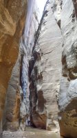
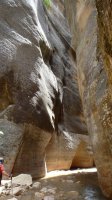
A couple more miles and you reach the first set of narrows. From here on the canyon is characterized by high walls and periodic narrows.
1452.jpg

Just jaw dropping.
1523.jpg

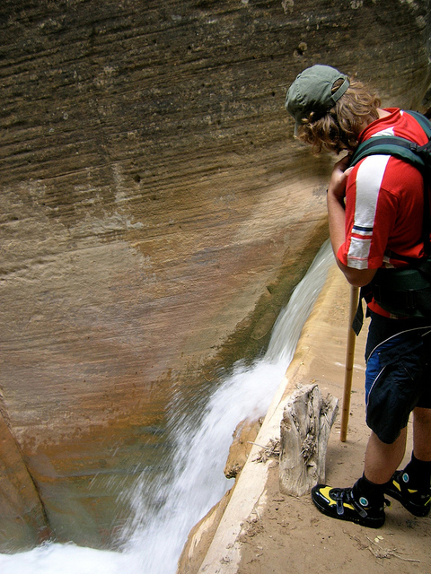
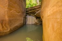
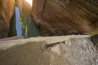
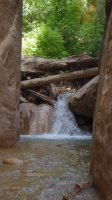
About 6 miles in you reach the waterfall. When we were there the water level was down. Usually it pours over the top log in the jam.
1544.jpg

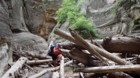
Every now and then you have to negotiate through flash flood debris.
425.JPG

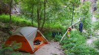
Campsite no. 5. Trying to dry out our neoprene socks and shoes.
1751.jpg

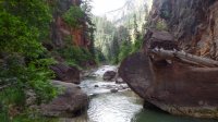
One of the best parts of the hike was the stillness of the canyon in the early morning.
454.jpg

Big Springs, about five miles from the end. It is a nice spot, but it also means that soon you will be among the crowds.
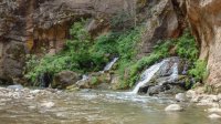
464.jpg

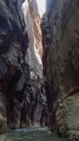
The canyon south of Big Springs is called Wall Street, for obvious reasons.
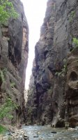
471.jpg

The views don't suck.
487.jpg

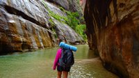
The water is cold, but you get used to it quickly.
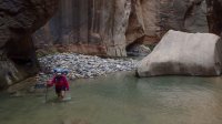
494.jpg

Near the entrance to Orderville Canyon.
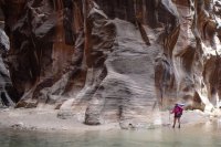
501.jpg

The end is in sight.
510.jpg

The view down canyon from Riverside Walk.
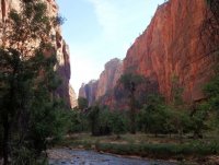
Zion Narrows 20.jpg

I can't wait to get back to Zion again.

Here's a video of the trip I put together:

Featured image for home page:
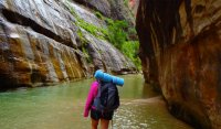
slide.jpg
 
Last edited:
Wow! You saw it in a very different condition than I have.

About 6 miles in you reach the waterfall. When we were there the water level was down. Usually it pours over the top log in the jam.

The water actually isn't necessarily low, the waterfall just changed. It looks like the old top log and a bunch of sand and debris got blown out. Usually when you're standing at the top of it, it's only a few inches deep and you're standing on solid ground.

View from the top the way it was in 2005 and 2012:
the-zion-narrows-16-jpg.3645


5576092576_c3d2b24145_z.jpg


Every now and then you have to negotiate through flash flood debris.

I never saw anything like that in my trips either. Sure, there were little obstacles and debris around, but damn, that's a big pile. So cool to see how the canyons transform from flood to flood. Thanks for the great trip report.
 
Nice report and pics. Thanks for posting.

@Nick -- glad you posted the earlier waterfall. I too was blown away how different it was and was about to dig up my pics from many years ago. Looks like soon the bypass won't be needed at all.

- Jamal
 
Thanks @Tres Westbrook! I'll be doing this with my wife in June (assuming I get the campsite permit which I can apply for on April 5th). How did you like Campsite #5? What time did you leave your site in the morning to finish up? and were you able to beat the oncoming crowds I have heard about that day hike from the bottom? Thanks for the great writeup. Excited to watch the video later tonight!
 
Thanks @Tres Westbrook! I'll be doing this with my wife in June (assuming I get the campsite permit which I can apply for on April 5th). How did you like Campsite #5? What time did you leave your site in the morning to finish up? and were you able to beat the oncoming crowds I have heard about that day hike from the bottom? Thanks for the great writeup. Excited to watch the video later tonight!
Hi Vegan. I'm excited for you to do this - y'all won't be disappointed. I chose Campsite 5 because of its location and the distance we wanted to travel that first day. It was a perfect size for the 2 of us, and it was located back just enough so that the trail doesn't run through camp, and it was shielded from the river so we had some privacy, although I can only remember one group of 4 people passing our camp after we set up (in other words, it was pretty private anyways). We hike at my wife's pace, which is fairly slow, and we take a lot of breaks so that we can enjoy our surroundings and take pictures. We left the campsite around 8:00 in the morning and got to the bus early in the afternoon. Above Big Springs we only saw maybe a half dozen people who must have come up early to get that far. By the time we got to Orderville Canyon, there were a good number of people in the river, almost all of them coming towards us as we were heading out. Of course, at the end (Riverside Walk) there were scores (maybe hundreds) of folks getting their feet wet. The area above Big Springs is where there is the most solitude. Because we hike slowly several groups passed us the first day, and we got started later than everyone else the next day, so we often seemed to be all alone in the canyon.
 
Last edited:
I also camped at site 5. There were 6 in our group and it was plenty big. The first time I went through we got site 12 and it was way too much that first day. We saw people coming down the river after dark looking for their campsite that night we were at 5. It looks like they were not having much fun.

It's definitely worth it to get an early start the next morning. The earlier you get going, the more of the goods you can experience without a thousand people around. We hardly saw anyone until we were just past the two boulders. Once we were down near Imlay, it was nuts. I didn't even get my camera out again because there were SO many people there in June. I did stop to swim a few times though.
Even with a headlamp, I can imagine that hiking down there after dark would suck big time.
 
Wow! Great stuff. Mornings are my favorite time while backpacking too - especially in a desert canyon!
 
I also camped at site 5. There were 6 in our group and it was plenty big. The first time I went through we got site 12 and it was way too much that first day. We saw people coming down the river after dark looking for their campsite that night we were at 5. It looks like they were not having much fun.

It's definitely worth it to get an early start the next morning. The earlier you get going, the more of the goods you can experience without a thousand people around. We hardly saw anyone until we were just past the two boulders. Once we were down near Imlay, it was nuts. I didn't even get my camera out again because there were SO many people there in June. I did stop to swim a few times though.

Nick - How long did it take you to get to campsite 12, if you recall?

I am going in May and I could only get campsite 12 when I booked online (despite it being on a weekday and me booking within 10 minutes of the reservation system opening).
 
Nick - How long did it take you to get to campsite 12, if you recall?

I went and checked my time stamps. We started hiking at 11:16 AM, I think because the earlier shuttle wasn't available. I must have been tired because I stopped taking photos around 4 something. That and the water gets a lot deeper and more difficult after Deep Creek. Anyway, I remember it was still light out but pretty late when we arrived. That was on 9/26/05 so sunset was around 7:20. I'd guess we got to camp maybe a little after 6, so about 7 hours to site 12. It's not easy to move fast through a lot of that canyon.
 
I checked time stamps on my trip in 2012 as well. Started hiking at 11:23 AM and arrived at Site 5 at 7:35 PM. We stopped many times that day to swim and take photos.
 
I am going in May and I could only get campsite 12 when I booked online (despite it being on a weekday and me booking within 10 minutes of the reservation system opening).

What time does the online reservation system open on the 5th of each month? Midnight? Any other tips for getting the permit? This will be my first time dealing with the Zion online system on April 5th (I applied (and was denied) a Coyote Buttes North permit last month but that seems to be a totally different system.
 
I think it was more like 10am or noon MST the last time I was waiting for it to open on the 5th. Might be worth calling the BC desk.
 
Thanks Nick, I wasn't trying to be lazy, I was looking on the website earlier and somehow missed that.
 
Wow! You saw it in a very different condition than I have.

Wow, that is crazy it burst. Summer of 2013 I actually saw it dry, but still totally stacked.

_MG_1574.jpg

_MG_1553.jpg
 
Wild! That is just so much stuff missing form behind that! Like the actual surface of the canyon there appears to have dropped by at least 10 feet behind it. It's crazy to think how another such obstacle could easily be created during a flood someday but not next to such a perfect bypass. The Narrows top-down could quickly go from a nice backpack to a technical canyon requiring ropes. So cool to see it transform.
 
Nice report, and some pics that bring back some great memories. Thanks!
I did campsite 7 the only time I have been down the North fork. But it reminds me that I need to acquaint my kids with that canyon, in spite of the crowds farther down.

Growing up we did Orderville from the top down, every Labor day weekend for over a decade. You could see changes every year, including one year where a whole tree had fallen from above, down into the canyon and landed upright and was still growing, just now at the bottom of the canyon, some years were relatively dry, or other years where we had some great, long swims.
 
Similar threads
Thread starter Title Forum Replies Date
Seldom Seen Anderson Virgin River Narrows Hiking & Camping 4
priz1234 Virgin River Rim Trail 6/6-6/7 Backpacking 4
Dave Virgin River management plan General Discussion 0
Seldom Seen Anderson THE BARRACKS (East Fork of the Virgin River) Trip Planning 22
J Death Valley Natl Pk Ibex Peak, Jubliee Mtn, Virgin Springs summits Dec. 2, 2019 Hiking & Camping 0
regehr Water higher up in Virgin Springs Canyon? Trip Planning 17
J Virgin Springs Canyon Cane Wash Loop Trip Planning 3
fossana Sheep Bridge/Lower JEM trail (Virgin, UT) Conservation Project General Discussion 5
Wapiti Virgin Springs Canyon Backpacking 1
BJett Virgin Falls Pocket Wilderness/State Natural Area - Tennessee Backpacking 3
M Lost a drone in the San Rafael River area/below the wedge. No time to hike in to retrieve. General Discussion 0
fossana Colorado River talks in Springdale, UT (March 27th, April 5th) General Discussion 4
TractorDoc Yellowstone's Gallatin River -- September 7-9th 2023 Backpacking 12
BJett Rockcastle River No Shuttle Packrafting - Kentucky On The Water 2
Janice Such a GRAND Canyon - Deer Creek / Tapeats / Thunder River Backpacking 21
Kullaberg63 Suggestions for Escalante east of river, south of Choprock Trip Planning 4
scatman The Gallatin River, Bighorn and Fawn Passes, Yellowstone National Park - September 7, 2023 Backpacking 14
shredhiker Thorofare, Heart Lake, Snake River Sept. 2023 Backpacking 16
Ugly Headless Valley- Film about traveling the Nahanni River General Discussion 5
meowtaingal Wind river high route mid september Trip Planning 7
BJett Packrafting the Obed National Wild & Scenic River - Tennessee On The Water 1
kwc Savage River, Denali NP Hiking & Camping 1
D Wind River offtrail route questions Trip Planning 28
Rockskipper You think you found a pithouse, or maybe an Ancestral Puebloan tower near Green River, UT? It's maybe something even more interesting... General Discussion 3
SteveR Sheep River Road Ride on May Day Everything Else 2
F Upper Escalante River Backpack conditions Trip Planning 6
W Greetings from the West Side of the Winds (Wind River range) Noobs: Introduce yourself! 5
marquiri Wind River Range - Angel Pass Trip Planning 24
Writhdar Day hikes in the White Clouds and Lost River Range Hiking & Camping 1
BJett Packrafting the Cumberland River Below the Falls - Kentucky On The Water 6
Mikjik86 Backpacking The Wind River Range - Wyoming, September 2022 Trip Reports 3
kwc Cedar River Flow, Central Adirondacks On The Water 1
kwc Fall paddle on the West Branch of the Sacandaga River 10/23/22 On The Water 0
Jackson Heart Lake and Snake River for Labor Day Backpacking 23
Stephanie B Dirty Devil River Impassible at Poison Springs Canyon Off Road 0
R Wind River Range: Green River Lakes/Clarks Trail/Porcupine Creek Trail Trip Planning 3
BJett Amazing Appalachians - Backpacking/Packrafting the AT and Nantahala River Backpacking 5
Georgia Yankee Snake River; Wolverine, Coulter, Pilgrim Creeks, July-Aug. 2022 Backpacking 18
Mikjik86 Another Wind River Trip Planning! Elkhart/Titcomb/Knapsack/Shannons Pass loop back to Elkhart, or continue to Green River Lakes Trailhead? Trip Planning 10
wsp_scott Wind River Range Sept 2021 (part 2) Backpacking 4
wsp_scott Wind River Range Sept 2021 (part 1) Backpacking 16
WasatchWill WRHR - Day 7: Beaver Park to Green River Lakes Backpacking 15
BJett Big South Fork National River & Recreation Area Packraft/Backpack Loop (TN) Backpacking 6
BJett Red River Gorge/Red Byrd Arch Packraft Trip - Kentucky Hiking & Camping 9
scatman Gila River - Gila Wilderness, New Mexico - April 18, 2022 Backpacking 61
B Wind river range mid sept. Trip Planning 8
andyjaggy Wind River Range Roberts Mountain Trip Planning 4
Rockskipper Application Period Open For 2023 Private River Trips Through Grand Canyon National Park General Discussion 0
marquiri Wind River Range - September 2022 Trip Planning 31
P Yellowstone Snake River weekend Backpacking 7

Similar threads

Back
Top