The Double Black Hangover.

Titans

Member
.
Joined
Aug 18, 2018
Messages
1,663
We dealt with the double black Hangover on February 8, 2018, the day before we headed a "little bit off course" (@Rockskipper ;)) to the Chiricahua National Monument. What exactly do you need for the Hangover? WINTER, MID WEEK DAY, NON-HOLIDAY, STICKY SOLES or perhaps a MTB.

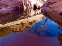
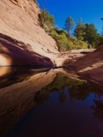
And if you are a photographer and you like WATER, RED ROCKS, BLUE SKY, UNLIMITED WATER REFLECTIONS, then you bring a camera or two.

How many people do you meet? 4 or maybe 6. How many bikers? Zero, maybe 1 biker with a dislocated shoulder.

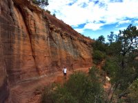
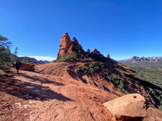
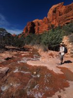
The Hangover hiking trail ( also a ONE-WAY Double Black Diamond MBT trail) wraps around Mitten ridge. It's a ledgy and steep trail on a lot of slick rock with spectacular views. It's an epic MBT trail, that is so difficult, that you actually rarely meet a biker or another hiker - assuming you pick a midweek, non holiday, winter day.
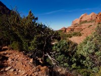
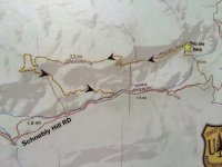
To get to the Hangover trail, you need to hike up via Munds Wagon Trail along a creek and turn onto Cow Pies trail. In the month of February the creek has flowing water, like we saw in 2017, or it has standing water, like this trip in 2018. We usually 'crawl' with a speed of 1mph up Munds Wagon, because of the many photo opportunities. If the water flows in the creek, then you need to cross the creek about 8 times or so. We have hiked this 8.5 mile loop hike about 5 times over the past few years and the pictures will give away it's location.
I attached links to some epic MBT videos at the end, if anyone is interested to watch it. Our MBTs collect a lot of dust in our basement, but they all have fun memories of throwing me off ridge trails in the Alps. Now we mostly hike, here are the pictures :

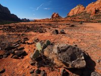
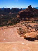
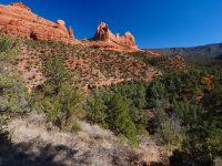
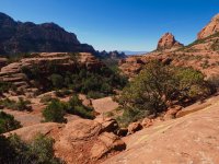
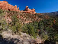
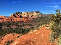
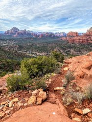
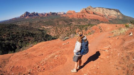
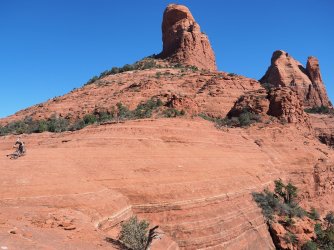
Distant view from Cow Pies of Mitten Ridge with the Hangover trail.
H1-Cow Pie view of Mitten Ridge w Hangover trail-2017-P2080646.jpg


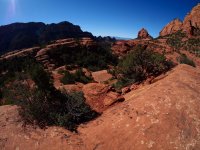
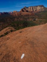
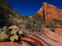
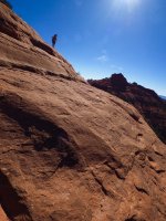
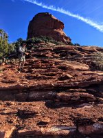
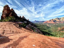
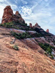
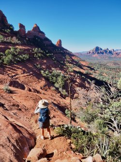
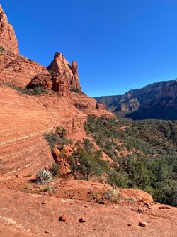
Here is a view from the steep part of the Hangover trail - on the back side of Mitten ridge. White MBT marker on the slick rock.
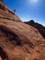
H1-Steep-Backside of Hangover-P2081569.jpg


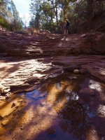
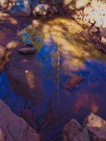
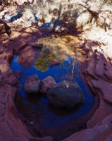
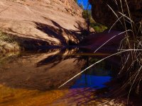
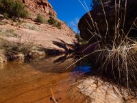
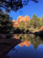
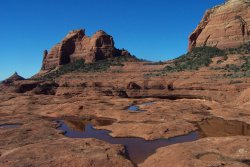
BEFORE we reached the Hangover trail, we saw all these water reflections on MUNDS WAGON trail:
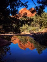
H10-reflection Munds Wagon-IMG_8231.jpg

H8-reflection1 on Munds Wagon-IMG_8229.jpg

H11-reflections-Munds Wagon-P2080861.jpg

H12-reflections- Munds Wagon-P2080875.jpg

H13-reflections- Munds Wagon-P2080889.jpg

H15-reflections-Munds Wagon-P2080995.jpg

H16-reflections-Munds Wagon-P2081041.jpg

H17-reflections- Munds Wagon-P2081107.jpg

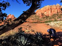
And here is Rick- the Photographer in action.
H17b-Rick working reflections-IMG_8064.jpg

Further up on Munds Wagon trail:
H18-high up on Munds Wagon-P2081111.jpg

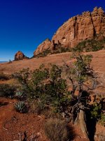
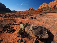
View from Cows Pie trail towards Mitten Ridge and the Hangover trail:
H1-Cow Pie view of Mitten Ridge w Hangover trail-2017-P2080646.jpg

H2-Cow Pie closer view of Mitten ridge-2017-P2080636.jpg

H21- Cow Pies view-P2080043.jpg

H22- Cow Pies- view-P2080045.jpg

H23- Cow Pies- Aase-P2081253.jpg

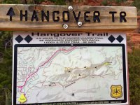
And finally the start of the Hangover trail. Bikers have to enter here, hikers can obviously come from the other side, though it requires from scrambling.
H24- Sign- Hangover trail Double Black-P2081267.jpg

H25 close up sign 2017-IMG_5489.jpg

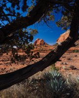
Trail is just to the right of the tree
H26-easy beginning-Hangover-P2081303.jpg


H27-Hnagover w rocks-P2081337.jpg

H28-closer to saddle-P2080681.jpg

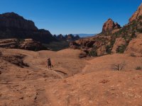
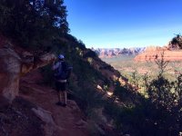
The saddle, the Hangover trail is a ledge to the right and below the woman with the dog. This is really a lot steeper than it looks.
H29-Mitten saddle P2080056.jpg

H30 - Mitten saddle-P2080055.jpg

H31-saddle -P2081397.jpg

I didn't like to stand, where Rick is......
H33- saddle-Rick--IMG_8115.jpg

Who repairs the Hangover? These fine women and men from the US Forest Service. And in no time Rick had them lined up and posing!
H32-Forest Service team-P2081404.jpg

And Rick got two of their phones and took more pictures, so they had some pictures to share. And I took a picture of Rick taking pictures.
H32- photo of photo forest service-IMG_8129.jpg

H33-Aase beginning of ledge-P2081419.jpg

On the trail, looking back to the saddle (behind the tree)
H35- looking back at saddle-IMG_8139.jpg

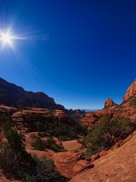
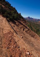
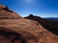
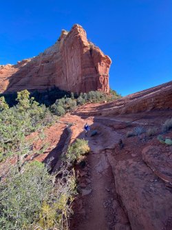
This is taken right on the Hangover trail looking back, lots of steep slick rock
H34-fisheye look-back to saddle-P2080070.jpg

H-Rick on ledge-views-IMG_8143.jpg

H-Rick along wall-IMG_8147.jpg

2017 picture:
H-Rick-rock wall-IMG_5571.jpg

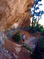
A wide Subway looking area- I feel good here!
H35-subway looking piece-P2080085.jpg

Remember it's a Mountain Bike trail - watch them pass this piece in the videos.
There is NO ROOM FOR ERROR ON THIS TRAIL. YOU WILL END UP VERY FAR DOWN, IF YOU FALL OFF THIS LEDGE.

H36-tree in the way-P2080086.jpg

Here is the 2017 iPhone picture of Rick at that tree:
H-Rick-panorama-2017-IMG_5552.jpg

And here is the steep section of the Hangover trail with spectacular views. First a hard 180 turn.
H37 hard turn-P2080097.jpg

H38-backside at hard turn-P2081511.jpg

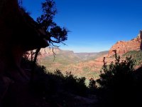
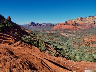
Views are incredible here (good lunch spot), but I doubt the mountain bikers get to see that.... white marker to the left.
H38-views backside towards Sedona-P2081527.jpg

H39-view bridge-P2081563.jpg

We never follow the bike line with white markers exactly- sometimes you need a different route as a hiker.
H1-Steep-Backside of Hangover-P2081569.jpg

H41-steep-P2081573.jpg

H42-steep-P2081583.jpg

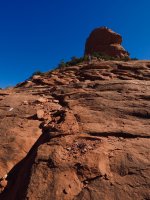
Looking back up at the steep section.
H43-steep-P2081611.jpg

Back side of Mitten ridge- or the side facing Munds Wagon trail. Lots of loose rocks and switchbacks on the return,
see second video, it shows the remaining trail better.

H44- loose rock-single trail-P2081633.jpg

We then enjoyed more water reflections on the way back:
H9-reflection2-Munds Wagon-IMG_8230.jpg

And when the water flows- like in February 2017 there are few reflections, but a lot of this: H4-water running-2017-P2080548.jpg

H6-water in creek-2017-P2080580.jpg

Hope you enjoyed the photos and the following MTB videos I found on-line. :cool:
So.... do we have any MTB'ers on BCP?

First video from Saddle to the steep section and the 180 turn:

Second part of the Hangover trail (from steep section down through the switchbacks)
 

Attachments

  • H3-start of Munds Wagon-2017-P2080525.jpg
    H3-start of Munds Wagon-2017-P2080525.jpg
    616.6 KB · Views: 52
  • H7-close to saddle-2017-P2080681.jpg
    H7-close to saddle-2017-P2080681.jpg
    556.9 KB · Views: 54
  • H14-reflections-Munds Wagon-P2080993.jpg
    H14-reflections-Munds Wagon-P2080993.jpg
    562.1 KB · Views: 53
  • H19-Cow Pies viewpoint-P2081199.jpg
    H19-Cow Pies viewpoint-P2081199.jpg
    592.2 KB · Views: 53
  • H20- Cow Pies- view towards parking-P2081237.jpg
    H20- Cow Pies- view towards parking-P2081237.jpg
    528.3 KB · Views: 55
  • H25- close up Hangover trail-sign-IMG_8103.jpg
    H25- close up Hangover trail-sign-IMG_8103.jpg
    232.3 KB · Views: 55
  • H20-saddle view w rocks-2017-P2080636.jpg
    H20-saddle view w rocks-2017-P2080636.jpg
    599.8 KB · Views: 55
  • H34-iph panorama-IMG_8126.jpg
    H34-iph panorama-IMG_8126.jpg
    289.6 KB · Views: 52
  • H37- look into valley along Oak creek-P2080087.jpg
    H37- look into valley along Oak creek-P2080087.jpg
    317.4 KB · Views: 54
  • H40-steep section-P2081569.jpg
    H40-steep section-P2081569.jpg
    501.2 KB · Views: 55
  • H45-beginning of munds wagon : end of trail-P2080525.jpg
    H45-beginning of munds wagon : end of trail-P2080525.jpg
    616.6 KB · Views: 54
Last edited:
I would hike this trail! Love the photos you posted. I do not think I would mountain bike on the trail. I love red rock riding but prefer a trail with a little more margin for error.

Sent from my SM-G935V using Tapatalk
 
Nicely photographed and an eye opener route. I am going to go there and walk that. No more MTB for me.
 
Rick says "thank you"! It's our favorite hiking trail in Sedona. It used to be a 'renegade' MTB trail, but it was converted to an official trail.

The first time we hiked the Hangover, we saw an injured mountain biker with a dislocated shoulder at the bottom of the steep hill. He was checking websites on his phone to see, if he and a runner who assisted him could pop it back in place....ouch....TMI? They couldn't, so the runner ended up riding (!) the biker's MTB down and the biker had to walk back! Hm...

We have learned to carefully select the day we go, to avoid the crowds and we stay in the Village of Oak Creek- south of Sedona. The winter weather in Sedona can be iffy with freezing rain, slush.... and very damp cold weather. But, if that is in the forecast, then we just drive to Tucson and/or Chiricahua and come back when it's better. Sedona winter weather can also consist of 5 days with 65-80F and sun, blue sky, like our February 2018 trip.

Those MTB videos are awesome. I can't stop watching them. Figured @Ben would like those too....
Sedona has lots of great mountain biking for all levels (@blueeyes).
 
Sedona has been on my list to ride for a long time. Problem is getting time off work and money to travel. Someday it will happen.

Sent from my SM-G935V using Tapatalk
 
I understand @blueeyes - some day ! :)

We had those restrictions for many decades, but a big mass layoff changed that. That might be the second best thing that ever happened to us, because now we can travel off season for little money. The best thing that ever happened to us was our neighbor's kitty moving in some years ago. When she very unexpectedly died last year, we had to fill the void. Going out West on the road trips to hike filled the void.
 
Last edited:
So much great stuff here! Thanks for posting. And really glad to have you on board here! Looking forward to more of your reports.
 
We hiked this again today, but we didn't meet any bikers on the Hangover trail. I wonder why.... the views are just fabulous!
Hiking down that cliff on the backside (second MBT video) really feels like a free fall over a cliff, it's crazy.
Stunning water reflections again today. Just iPhone pictures below, I'm sure Rick will have some great new photos to share later.

image.jpeg


image.jpeg

iPhone panorama. First time ever today, that I could stand here at this edge and feel ok! Progress.
image.jpeg

Well marked MBT !
image.jpeg

Partway down the cliff on the backside. Bikers have started a new loose rocky trail at the edge, to avoid some of the free fall sections on the slickrock. Again, this is much steeper than it looks
image.jpeg

Don't forget to watch those fun MBT videos again!
 
My neck of the woods. I used to ride with some guys from Mountain Bike Heaven in the late 90s and early 2000s when some of the mountain bike trails in Sedona were being invented. Back then that trail was not developed and it evolved over time. You are a great photographer
 
My neck of the woods. I used to ride with some guys from Mountain Bike Heaven in the late 90s and early 2000s when some of the mountain bike trails in Sedona were being invented. Back then that trail was not developed and it evolved over time. You are a great photographer

Thank you, I will let Rick know and welcome to BCP @Arizona Jones . Rick is really the photographer, I just use the iPhone. It's super cool, that you were riding on the trails very early on, probably a lot less people back then. I believe this particular trail was initially some sort of a "renegade" bike trail. We have been on it about 5 times and it's always great fun. FYI: There's a few more BCP'ers living in your "neck of the woods", like @Blake Merrell , @o2bav8 and 1 more (forgot the nickname)....

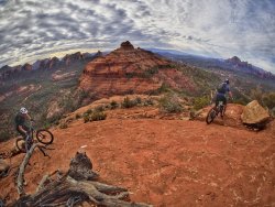
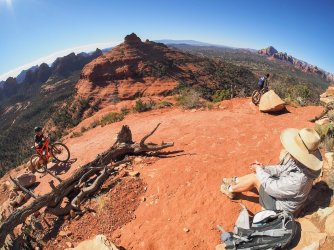
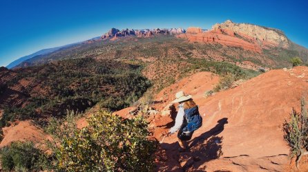
Here's some early Dec 2019 photos. We actually met 2 bikers and it was right at the most difficult double black diamond section! It was no problem for them, they made it look so easy.

Fisheye lens view:
D75F212D-AC8F-4359-A8E2-07472D54DD24.jpeg

89FB8035-B746-4F70-967F-645183994404.jpeg

IMG_4540.jpg

View from the saddle:
7B15AFB0-9AA9-4BE3-9C89-5FAEF3B6B9E7.jpeg

The trail is ahead of Rick...
1598293724621.png
 
Thank you, I will let Rick know and welcome to BCP @Arizona Jones . Rick is really the photographer, I just use the iPhone. It's super cool, that you were riding on the trails very early on, probably a lot less people back then. I believe this particular trail was initially some sort of a "renegade" bike trail. We have been on it about 5 times and it's always great fun. FYI: There's a few more BCP'ers living in your "neck of the woods", like @Blake Merrell , @o2bav8 and 1 more (forgot the nickname)....

Here's some early Dec 2019 photos. We actually met 2 bikers and it was right at the most difficult double black diamond section! It was no problem for them, they made it look so easy.

Fisheye lens view:
View attachment 91333

View attachment 91338

View attachment 91335

View from the saddle:
View attachment 91334

The trail is ahead of Rick...
View attachment 91337
Yea "renegade" is one way to put it. The So called "gnarly crew" from Mountain Bike Heaven just went off trail and made up trails, back then, and this was part of that. The High On the Hog trail was a route Mountain bikers invented and the Forest service would try and block it with trees and rocks to stop it, but now it is an "official trail" . Same with the Highline Trail. In the late 90s we found an unofficial trail running from Courthouse Butte over to Little Horse and we really loved it so we kept riding it. A few weeks latter we ran into a guy with Llamas taking people camping using the trail. He was upset that we were on "his trail" that he developed for his llama tours. That trail is still called Llama trail. Out west of Sedona we invented what is now Chuck Wagon trail. We used to call it "Lost Watch Trail" because the day we were making up the route a girl that was with us lost her watch and we went back looking for it in hopes of finding it. So for years we called it Lost Watch. The trail system at Dead Horse Park in Cottonwood was also invented by Mountain Bikers in the late 90s.
 
We dealt with the double black Hangover on February 8, 2018, the day before we headed a "little bit off course" (@Rockskipper ;)) to the Chiricahua National Monument. What exactly do you need for the Hangover? WINTER, MID WEEK DAY, NON-HOLIDAY, STICKY SOLES or perhaps a MTB.

And if you are a photographer and you like WATER, RED ROCKS, BLUE SKY, UNLIMITED WATER REFLECTIONS, then you bring a camera or two.

How many people do you meet? 4 or maybe 6. How many bikers? Zero, maybe 1 biker with a dislocated shoulder.

The Hangover hiking trail ( also a ONE-WAY Double Black Diamond MBT trail) wraps around Mitten ridge. It's a ledgy and steep trail on a lot of slick rock with spectacular views. It's an epic MBT trail, that is so difficult, that you actually rarely meet a biker or another hiker - assuming you pick a midweek, non holiday, winter day.
To get to the Hangover trail, you need to hike up via Munds Wagon Trail along a creek and turn onto Cow Pies trail. In the month of February the creek has flowing water, like we saw in 2017, or it has standing water, like this trip in 2018. We usually 'crawl' with a speed of 1mph up Munds Wagon, because of the many photo opportunities. If the water flows in the creek, then you need to cross the creek about 8 times or so. We have hiked this 8.5 mile loop hike about 5 times over the past few years and the pictures will give away it's location.
I attached links to some epic MBT videos at the end, if anyone is interested to watch it. Our MBTs collect a lot of dust in our basement, but they all have fun memories of throwing me off ridge trails in the Alps. Now we mostly hike, here are the pictures :

Distant view from Cow Pies of Mitten Ridge with the Hangover trail.
View attachment 69212


Here is a view from the steep part of the Hangover trail - on the back side of Mitten ridge. White MBT marker on the slick rock.
View attachment 69237


BEFORE we reached the Hangover trail, we saw all these water reflections on MUNDS WAGON trail:
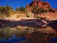
View attachment 69220

View attachment 69218

View attachment 69221

View attachment 69222

View attachment 69223

View attachment 69225

View attachment 69226

View attachment 69227

And here is Rick- the Photographer in action.
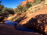
View attachment 69235

Further up on Munds Wagon trail:
View attachment 69228

View from Cows Pie trail towards Mitten Ridge and the Hangover trail:
View attachment 69212

View attachment 69213

View attachment 69231

View attachment 69232

View attachment 69233

And finally the start of the Hangover trail. Bikers have to enter here, hikers can obviously come from the other side, though it requires from scrambling.
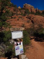
View attachment 69234

View attachment 69248

Trail is just to the right of the tree
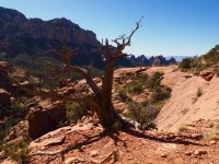
View attachment 69240


View attachment 69241

View attachment 69243

The saddle, the Hangover trail is a ledge to the right and below the woman with the dog. This is really a lot steeper than it looks.
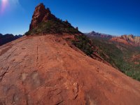
View attachment 69244

View attachment 69245

View attachment 69246

I didn't like to stand, where Rick is......
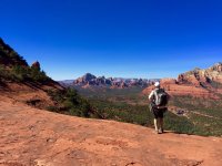
View attachment 69250

Who repairs the Hangover? These fine women and men from the US Forest Service. And in no time Rick had them lined up and posing!
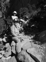
View attachment 69247

And Rick got two of their phones and took more pictures, so they had some pictures to share. And I took a picture of Rick taking pictures.
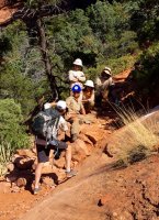
View attachment 69249

View attachment 69253

On the trail, looking back to the saddle (behind the tree)
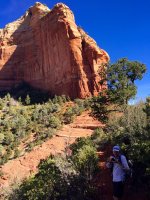
View attachment 69252

This is taken right on the Hangover trail looking back, lots of steep slick rock
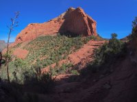
View attachment 69254

View attachment 69287

View attachment 69291

2017 picture:
View attachment 69293

A wide Subway looking area- I feel good here!
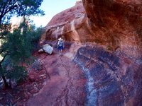
View attachment 69255

Remember it's a Mountain Bike trail - watch them pass this piece in the videos.
There is NO ROOM FOR ERROR ON THIS TRAIL. YOU WILL END UP VERY FAR DOWN, IF YOU FALL OFF THIS LEDGE.
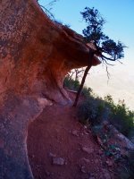
View attachment 69256

Here is the 2017 iPhone picture of Rick at that tree:
View attachment 69292

And here is the steep section of the Hangover trail with spectacular views. First a hard 180 turn.
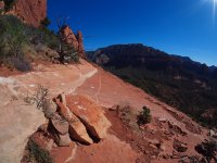
View attachment 69258

View attachment 69259

Views are incredible here (good lunch spot), but I doubt the mountain bikers get to see that.... white marker to the left.
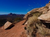
View attachment 69260

View attachment 69261

We never follow the bike line with white markers exactly- sometimes you need a different route as a hiker.
View attachment 69237

View attachment 69263

View attachment 69264

Looking back up at the steep section.
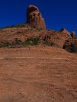
View attachment 69265

Back side of Mitten ridge- or the side facing Munds Wagon trail. Lots of loose rocks and switchbacks on the return,
see second video, it shows the remaining trail better.
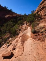
View attachment 69266

We then enjoyed more water reflections on the way back:
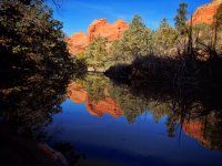
View attachment 69219

And when the water flows- like in February 2017 there are few reflections, but a lot of this: View attachment 69215
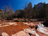
View attachment 69216

Hope you enjoyed the photos and the following MTB videos I found on-line. :cool:
So.... do we have any MTB'ers on BCP?

First video from Saddle to the steep section and the 180 turn:

Second part of the Hangover trail (from steep section down through the switchbacks)
Schnebly Hill.JPG
 
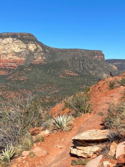
Super windy day yesterday and we saw about 18 bikers (!), as it was a Sunday. One group walked their bikes back out after a fall, sadly one biker was holding her jaw and chin, she was clearly in a lot of pain. Wish her a speedy recovery, cannot stop thinking of her. The Hangover is a tough trail and several sections will get your attention just hiking it. Surprisingly, the exposure doesn’t bother me anymore like it did several years ago, progress!

Too windy to take a lot of photos from the saddle itself
9787DF68-340F-4BD8-8804-8461F5114452.jpeg

Not exactly a hat day, it was a lot in the backpack. Waiting for the wind gusts to quiet down before heading across
C0C7307E-F565-4EAD-A150-D736AD76E4EA.jpeg

Great views
61DAF8D4-D5F2-4CE5-BEBD-F0A9F3F36383.jpeg

Some bikers cross right over the saddle and down into the area between Rick and me, see earlier video
E0AD1798-B723-4265-BCD8-81B628F27680.jpeg

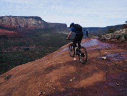
Two guys arrived behind us on trail just before the spicy section and we heard ”oh shit, yah…. hm…” and then one said to Rick: “this has been more hiking than biking”. We respect these guys for realizing their capabilities:
0D974D2F-4595-4697-B4EE-DD159EBFB5AB.jpeg

FDEC37ED-4A2C-429C-8DBD-97A88FF2E4D8.jpeg

Hm…. yah, maybe not. No photo shows how steep this section really is. But we have seen guys bike down it.
So @b.stark are you getting any ideas?
1944034D-DE5A-419C-A13D-7AEA8BA4C00A.jpeg

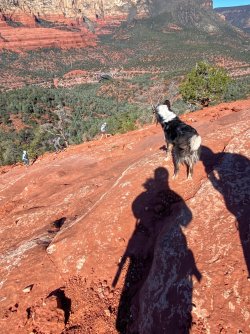
This cutie ran super fast up to us about midway, quickly found a small stick and we played together for a while. Never mind the gusty winds and the steep slope, time to play. Then he/she looked back at the owners wondering why it was taking them so long?
AE2BAE7D-8279-45AB-A600-52B1E7A59291.jpeg

F4C0F604-1E4A-4225-A8DF-3BB735800A9B.jpeg
66010E23-D964-45B2-9048-2F3688370131.jpeg

Another biker in between the trees, he started the fastest downhill part
1BFA63AF-24BF-48BD-843F-5FB3EA31FE79.jpeg
 
one of my fears is that I'll be in an exposed spot, my hat blows off, and I'll lunge for it without thinking!!!
 
Similar threads
Thread starter Title Forum Replies Date
Parma Camping with a double high air mattress? General Discussion 2
fossana cottonwood [x] wilderness double shot Hiking & Camping 13
kimbur96 Tarptent Double Rainbow or Big Agnes Copper Spur HV UL2? Gear 2
Blake Merrell High Adventure 2015 - Day 1 - Canyoneering Double Arch Canyon Canyoneering 2
Blake Merrell kIdDiE cAnYoNeErInG Part II - Double Arch Canyon Canyoneering 4
uintahiker suggestion- get rid of the double click logout! Questions, Suggestions & Support 3
scatman Black Mountain Ridge - May 13, 2023 Hiking & Camping 49
TheMountainRabbit Black Lake (Rocky Mountain NP) - January 2023 Hiking & Camping 3
R Pony Express Trail, Black Rock to Simpson Springs Hiking & Camping 3
LarryBoy Is there anything technical in White Canyon above the Black Hole? Trip Planning 16
ram Black Hole 1-1-22 Canyoneering 1
marquis20 Day 1: Grand Teton Wilderness and Black Canyon of the Yellowstone - June 2021 Backpacking 0
J Death Valley Natl. Pk. A Black Mtns and Canyons Traverse Nov 30, 2021 Hiking & Camping 2
scatman Foothill Follies Part 2 - Black Mountain Ridge and City Creek Canyon Loop - November 11, 2021 Hiking & Camping 6
XID_AZ Poison Spring Canyon / Black Jump Fall 2021 Trip Planning 2
scatman Black Mountain - May 22, 2021 Hiking & Camping 9
J Death Valley NP Black Mountains and beyond Hiking Dec 19-20, 2020 Hiking & Camping 1
J North Cascades National Park Black and Corteo Peaks Traverse Aug 21-23, 2007 Retro Backpacking 3
Perry SOLD! For Sale: GoPro Hero 7 Black Gear 1
ram Black Hole 1-1-20 Canyoneering 4
TeamJenkins17 Black bear killing baby elk Photography 0
b.stark Black Hills February 2019 Hiking & Camping 2
ram Black Hole 1-1-19 Canyoneering 9
blueeyes Black Canyon Trail Arizona December 2018 Everything Else 10
Ugly Saturday in Black and White, with a smudge of Green Hiking & Camping 3
pstm13 Black Diamond Revolt Battery Charging Hack Gear 4
blueeyes Black Canyon Water Trail On The Water 16
R Badlands and black hills Backpacking 8
R Black hills trip advice Trip Planning 7
b.stark Black Hills Bummin' Hiking & Camping 9
b.stark Black Hills SD in winter? Trip Planning 7
LizardAZ Packrafting Black Canyon On The Water 3
AbinadiWitness Chicago Basin: Part 2: Sunlight & Windom Peaks, Black Canyon Camp, Mt. Peale, UT - 16 -18 Aug. 2017 Backpacking 2
AbinadiWitness Part 2: Wetterhorn, Matterhorn, Uncompahgre Peaks, Black Canyon of the Gunnison NP - CO Trip # 1 Backpacking 4
SteveR Happy Canyon via Black Jump? Trip Planning 29
Wanderlust073 Black Ridge Canyons Wilderness / Rattlesnake Canyon maps Trip Planning 6
WasatchWill UHT - Day 5: West Fork Black Fork to Olga Lake Backpacking 2
George_Washington_Hayduke Clearwater Canyon, Black Hole of White Canyon, Dark Canyon, Swett Canyon "Packraftoneering" Canyoneering 6
ram January 1st 2017- Black Hole Canyoneering 0
Rye Jones Black Dragon Debunked General Discussion 6
blueeyes Black Magic Canyon, Idaho April 2016 Canyoneering 8
DrNed Black Dragon Wash Trip Planning 8
DiscGo Black Magic Canyon (with kids) Hiking & Camping 5
kansas Camping along rim of Black Canyon of the Gunnison NCA Trip Planning 1
CaptnKidd Black Dragon Canyon, Crack Canyon, Little Wild Horse (2011) Hiking & Camping 4
scatman Black Mountain - November 11, 2014 Hiking & Camping 5
Udink Upper Black Box Canyoneering 10
605troutbum Hello From the Black Hills, SD Noobs: Introduce yourself! 0
Laura Black and white or color-vote Photography 14
DrNed West Fork Black's Fork Trail Head Directions Trip Planning 6

Similar threads

Back
Top