Udink
Still right here.
- Joined
- Jan 17, 2012
- Messages
- 1,692
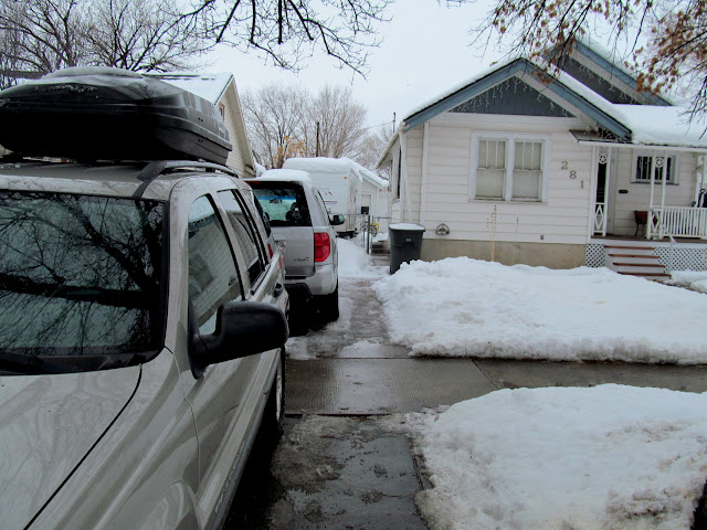
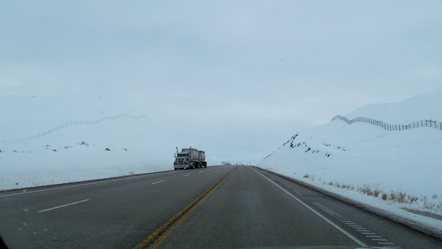
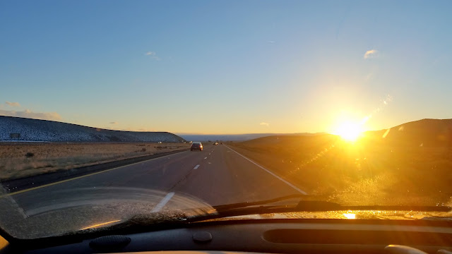
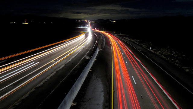
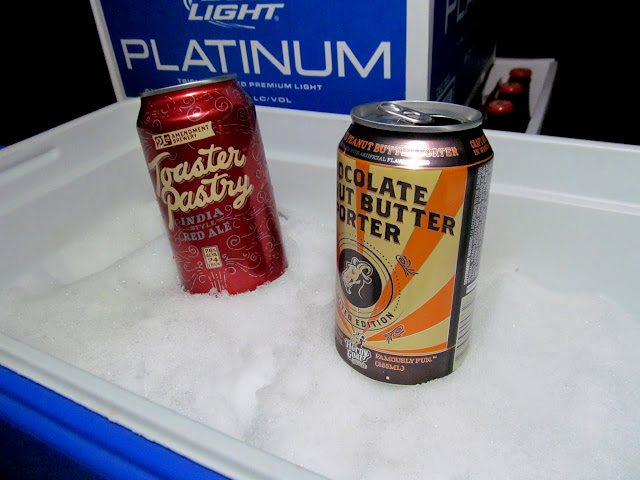
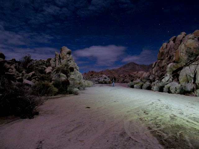
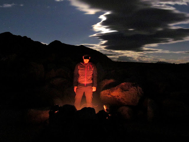
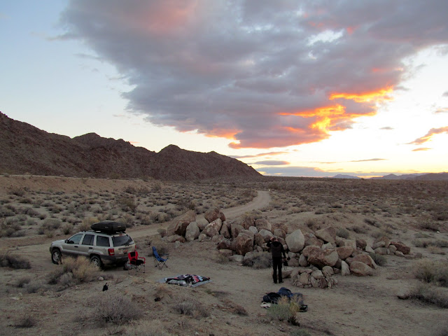
During last year's trip to Mojave National Preserve Chris and I decided we should make it an annual getaway from Utah's winter, and this winter we had an immense need to get away. There was a foot of snow in my yard and more in the forecast when we left town on Friday of the long Martin Luther King, Jr., weekend. A full year earlier we'd already decided upon Joshua Tree National Park as part of our destination, and in the week leading up to the trip I ferreted out a few other points of interest. Darkness fell on the road somewhere north of St. George. We loaded up on tasty beverages at Lee's in Mesquite, stashing a few in a cooler full of snow that I'd brought from home. After midnight local time we arrived at the spot where I'd hoped to camp--Sheep Corral, a canyon at the far south end of Mojave National Preserve. With rain in the forecast we set up our tents, then drank a beer and walked around taking a few night photos.
Ready for departure away from all this snow
Leaving Carbon County
Sunset along I-15 north of Cedar City
Nipton Road over I-15
Tasty beverages chilling in snow I brought from home
Chris doing some night photography
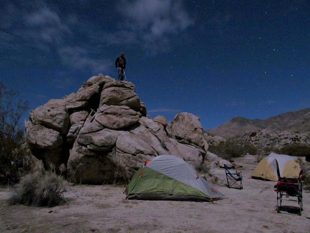
Sheep Corral
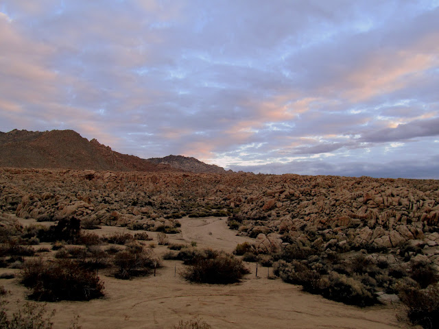
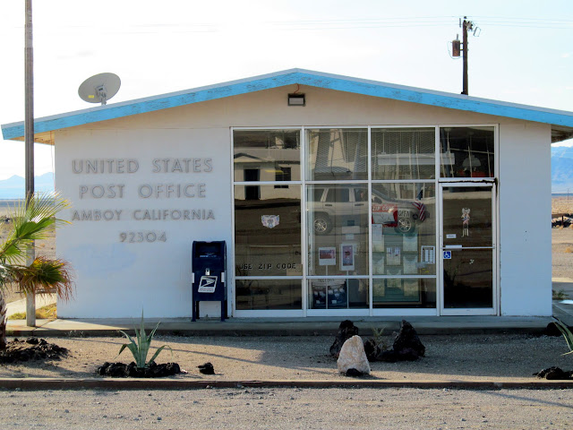
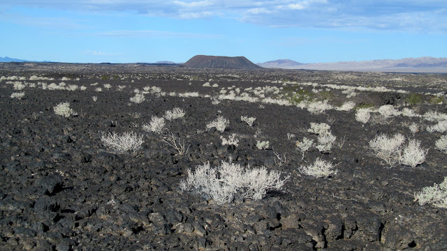
We rose before 7AM, made coffee and packed up camp, then went for a short walk up Sheep Corral. On the road we made a couple of stops along the old Route 66 near Amboy before stopping for fuel in Twentynine Palms and heading into Joshua Tree.
Morning at Sheep Corral
Marble Mountains
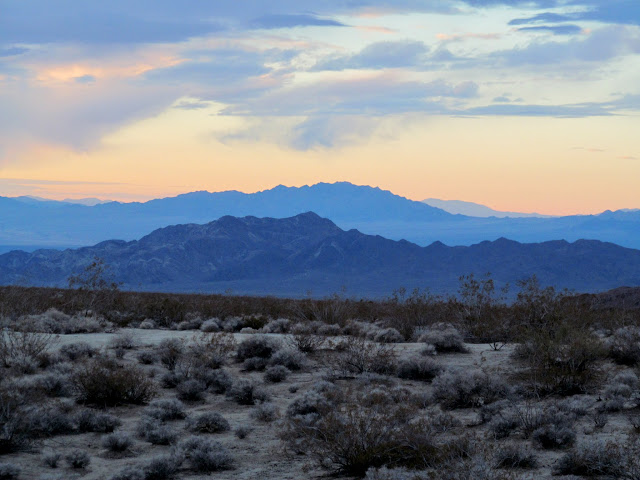
Sheep Corral
Sheep Corral
Route 66 road signage
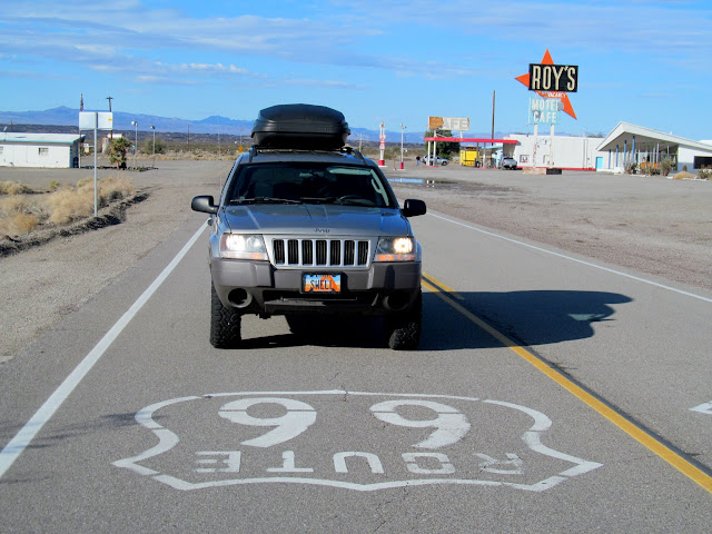
Amboy, CA 92304
Amboy Crater and lava flow
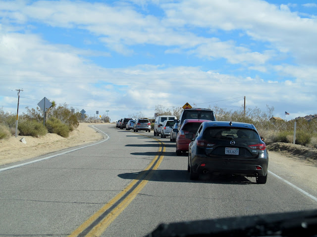
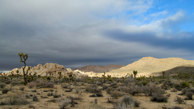
Cars backed up at the entrance to Joshua Tree
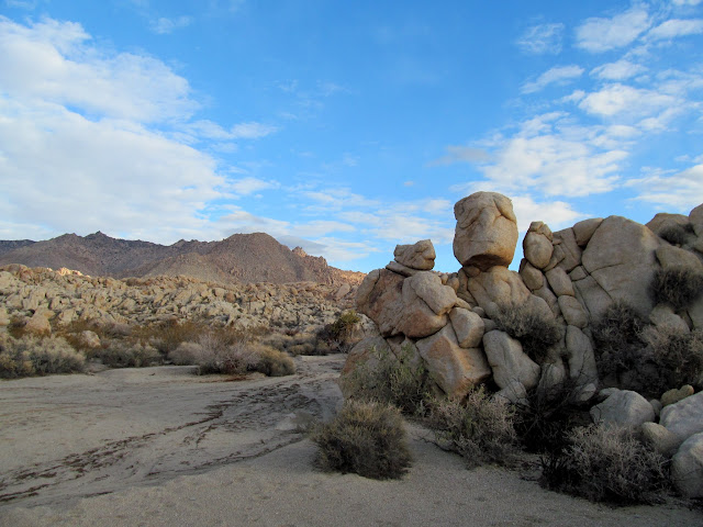
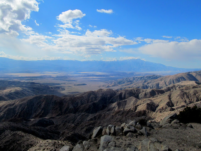
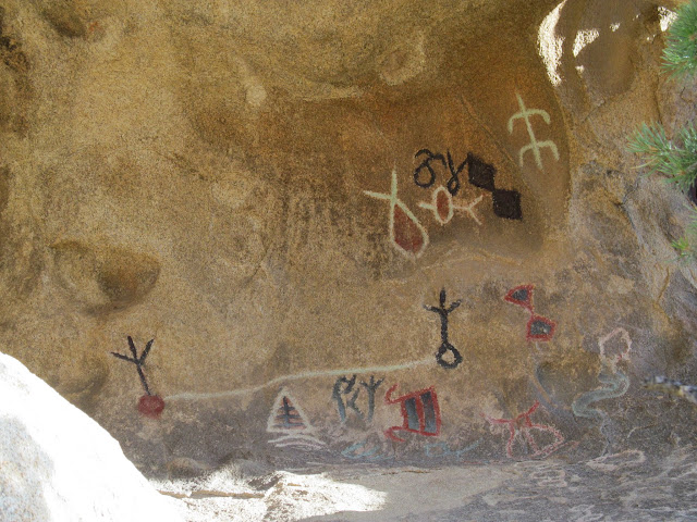
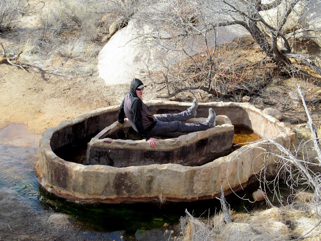
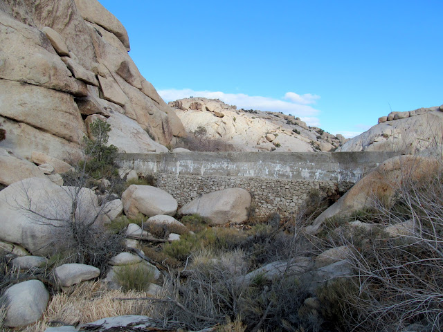
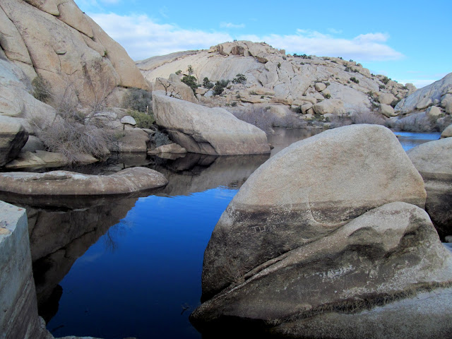
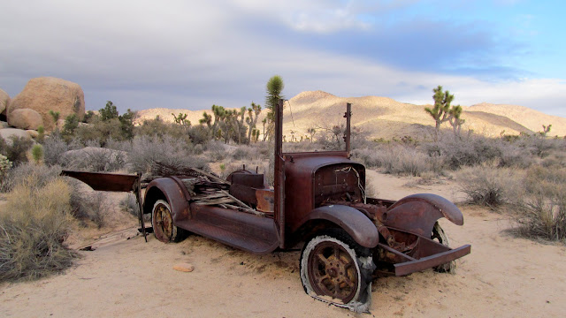
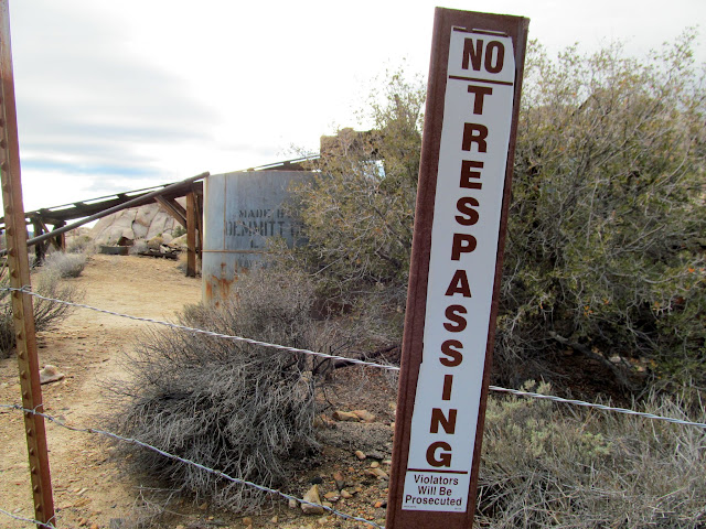
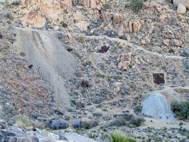
We wandered around the Barker Dam area and did some geocaching (all earth caches and virtuals). It was fairly crowded and we couldn't find a parking spot at the Barker Dam parking area so we drove to Keys View to check out the vistas overlooking Coachella Valley and Palm Springs. Returning to Barker Dam it still took a couple of circuits around the parking lot before a spot opened up. We hiked the trails to check out Barker Reservoir and some nearby petroglyphs, then headed over to Wall Street Mill. With daylight fading quickly we hurried to get a view of Desert Queen Mine and then the Cholla Cactus Garden on our way out of the park.
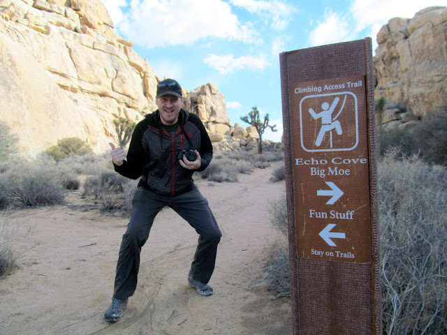
Fun Stuff
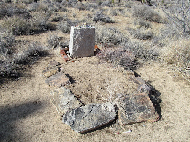
Memorial to Johnny Lang
Keys View, facing Palm Springs and the San Jacinto Mountains
Petroglyphs (painted over in modern times) near Barker Reservoir
Chris in the, uhh, err, water trough below Barker Dam
Barker Dam
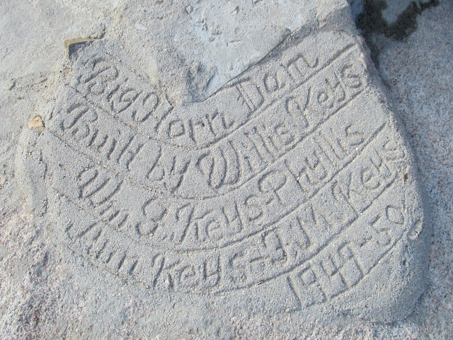
Barker Dam (aka Big Horn Dam) inscription in concrete
Barker Reservoir
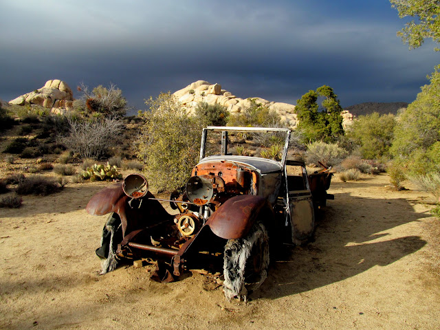
Old truck near Wall Street Mill
Spotlight and dark skies
Wall Street Mill
Wall Street Mill
Old truck near Wall Street Mill
Desert Queen Well
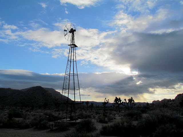
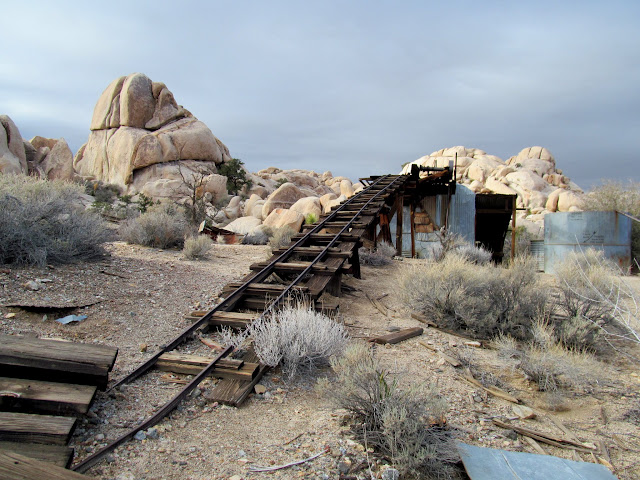
Desert Queen Mine
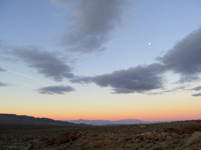
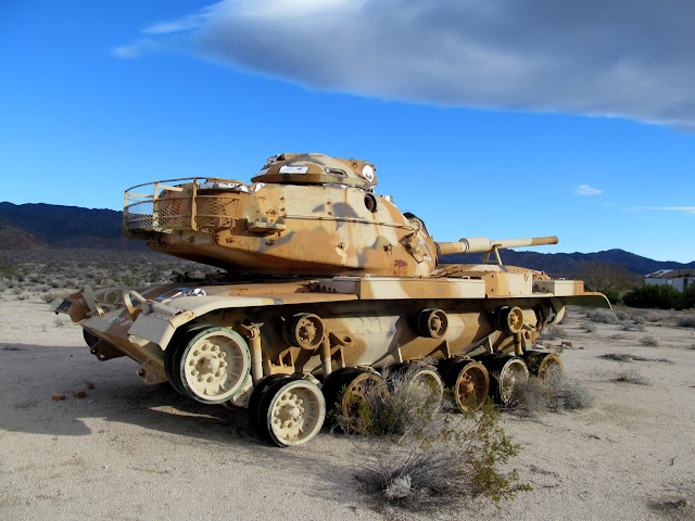
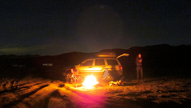
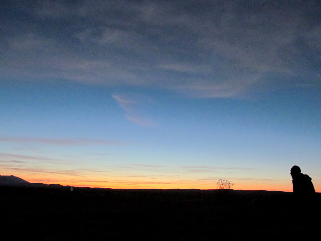
I hadn't planned a particular camp spot for the evening. I just knew there were plenty of primitive spots just outside the park all along the southern border. After exiting the park we drove west first and didn't find anything that did it for us, but along the dirt road to the east we found a great spot with some flat ground and a nice fire pit. We gathered up some wood and had a small fire that night, sleeping right on the ground sans tents. Up well before 7:00 on Sunday morning, we made our way toward Painted Canyon with a quick stop to look at some military equipment at Chiriaco Summit.
Camp at Shavers Valley
Earth shadow over the San Jacinto Mountains
Sunrise at camp
Tank at Chiriaco Summit
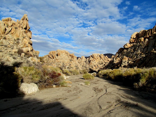
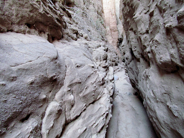
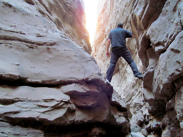
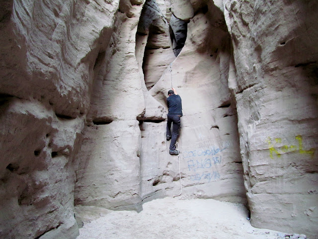
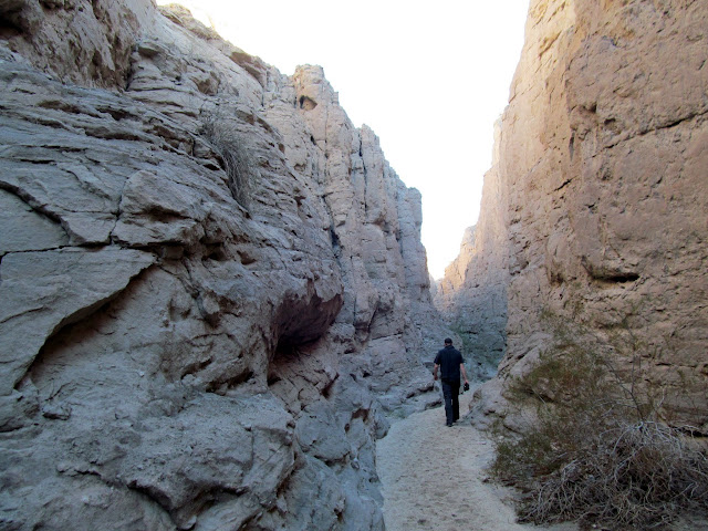
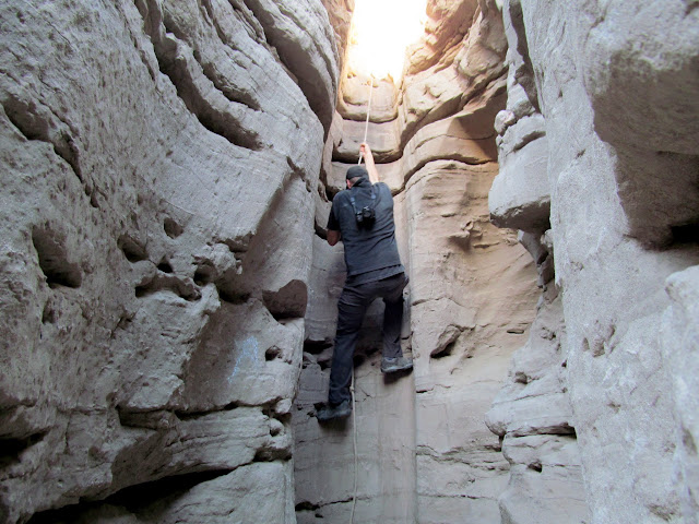
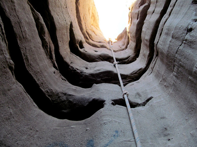
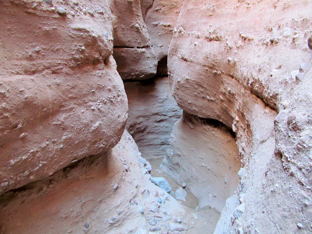
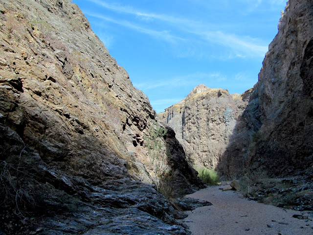
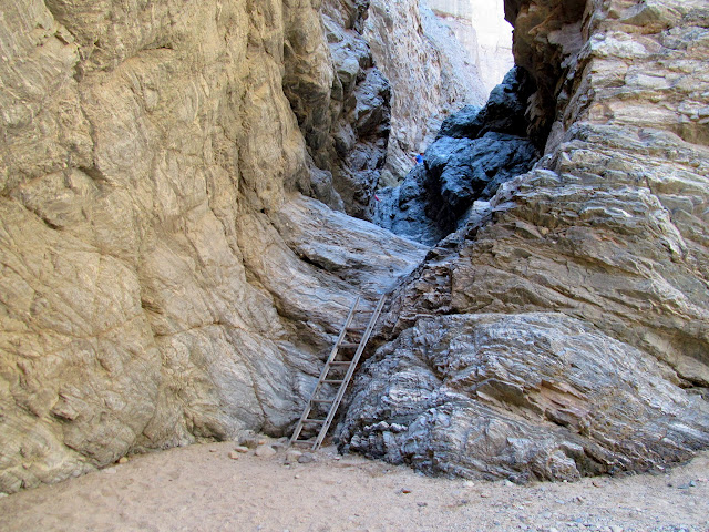
The trailhead for Painted Canyon was already busy by 9:30. Neither of us had specific route information for Painted Canyon/Ladder Canyon, and as we began hiking we just took a left into the first side canyon we encountered a short distance from the trailhead, although everyone else seemed to be going straight up the main canyon. That turned out to be a perfect decision. The canyon constricted into a slot that required some stemming over narrow portions, and after a while we came to a dryfall with a knotted rope hanging from the top. We climbed it easily, then encountered a couple more roped sections and chimneys that required more stemming. As the climbing grew more difficult, I worried about having to reverse the route if we reached an impassible obstacle. It became clear that we were nearing the top as the canyon grew more shallow. The final rope climb looked daunting, not just to climb up but also down if we couldn't find a way back into the main section of Painted Canyon. Chris climbed ahead of me and scouted a route for us to return to the main canyon, then returned and gave me the thumbs up. I completed the last climb and we followed a trail into another side canyon.
Entering the slot canyon fork of Painted Canyon
Chris stemming high
Climbing the first knotted rope
Shallow, narrow passage
Final knotted rope climb
Knotted rope in slot
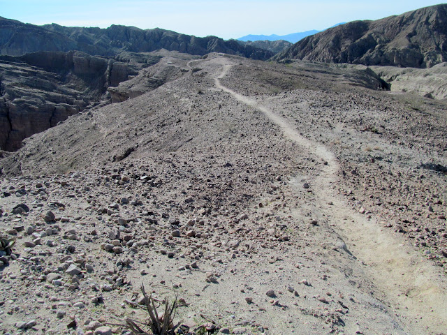
Trail on top of Mecca Hills
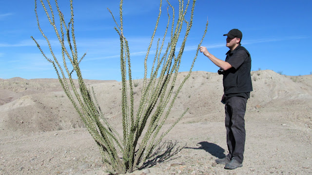
Touching the ocotillo
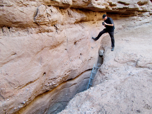
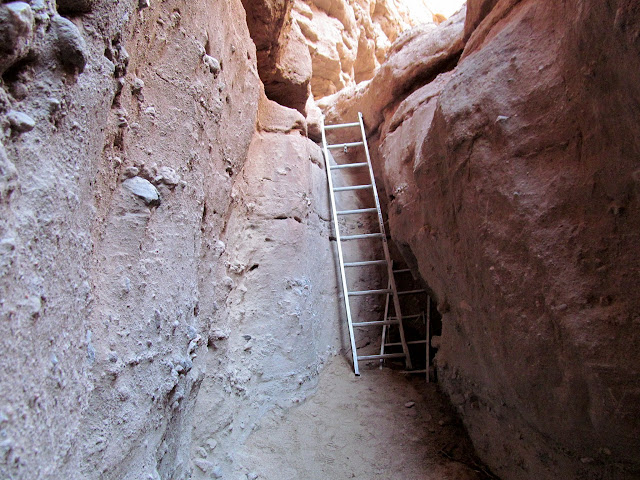
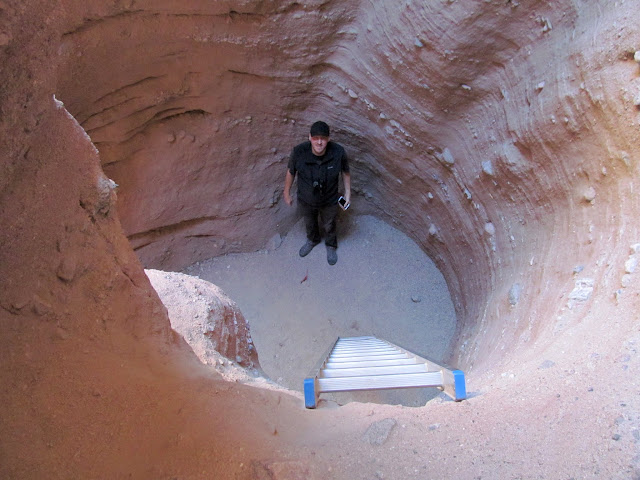
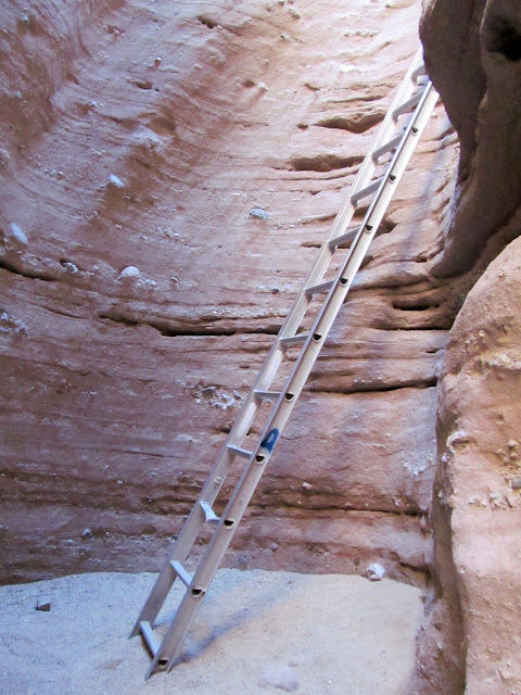
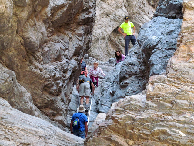
We hadn't seen anyone in the slot with all the fixed ropes on the dryfalls, but we began seeing people in this other canyon--good, we must be on the right track! I heard voices before we reached the ladder that people were ascending. We waited for a group to climb up before we headed down, then ran into more people and ladders as we descended. Eventually dropping back into Painted Canyon, I realized that we'd done a more difficult loop involving Ladder Canyon than most people do. It had been quite adventurous, fun, and satisfying--easily the most fun I had on the entire trip. Chris and I continued farther up Painted Canyon and climbed a couple more ladders before turning back and returning to the TH.
Ladder Canyon
Ladder Canyon
Ladder Canyon
Ladder Canyon
Ladder Canyon
Painted Canyon
Painted Canyon
Large group in Painted Canyon
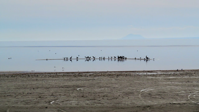
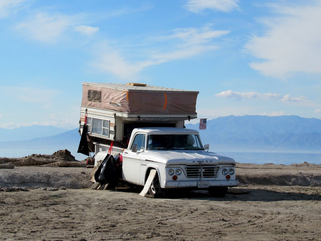
It was barely noon and I felt as though we'd had a nice, full day. The next stop was the Salton Sea. We visited a couple of spots along the shore of the inland sea, beginning at Bombay Beach and ending up at the abandoned Niland County Marina. While eating a lunch of chips and salsa, an old man who was camped in an old Dodge with a camper along the beach approached us and seemed genuinely concerned that we be saved by Jesus. I'd normally be dismissive (maybe not to his face) but somehow it came off as a nice gesture.
Birds on the Salton Sea
Cap'n Chris
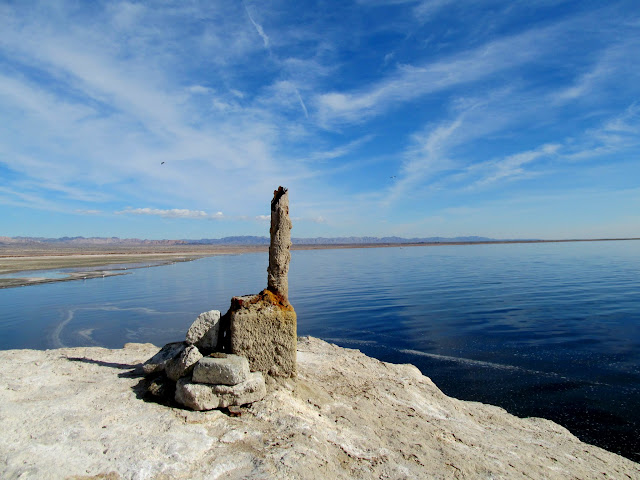
Salton Sea
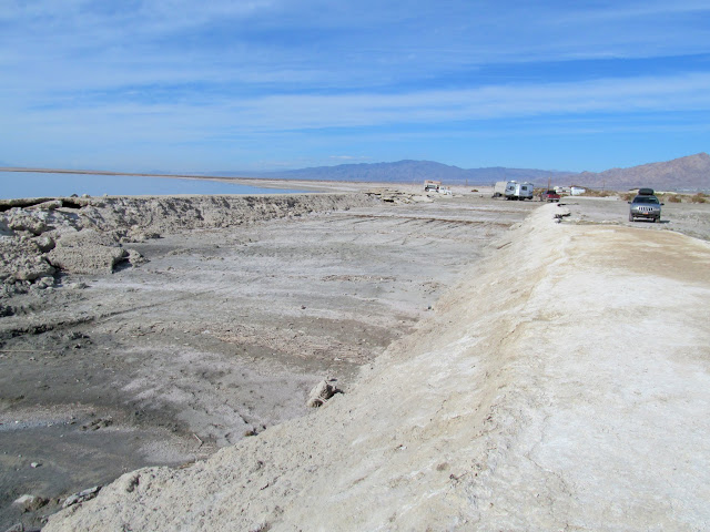
Boat launch at the abandoned Niland County Marina
Dodge and camper
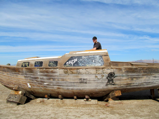
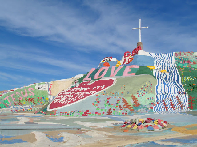
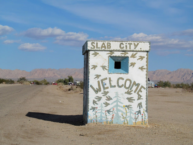
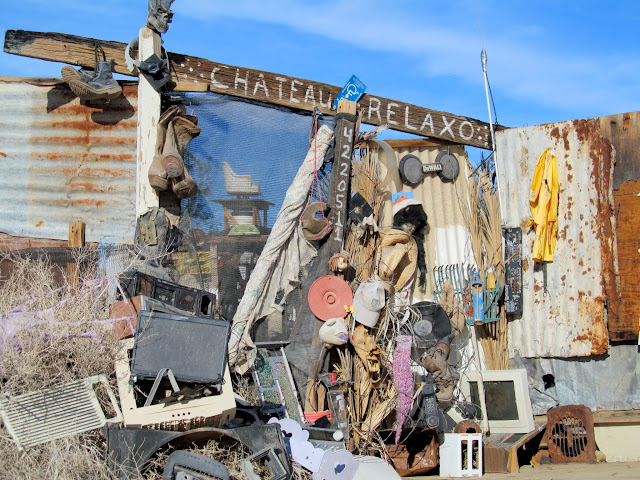
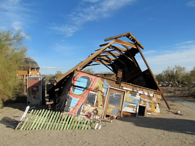
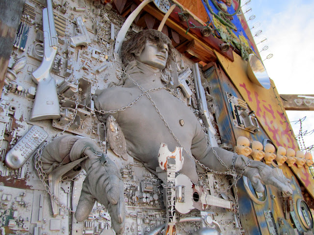
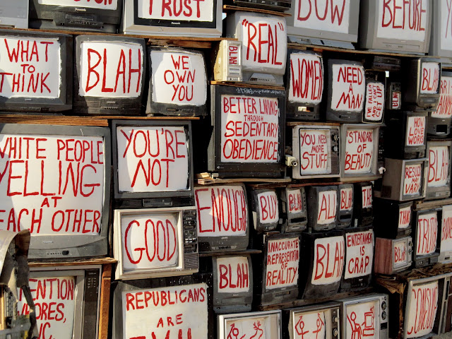
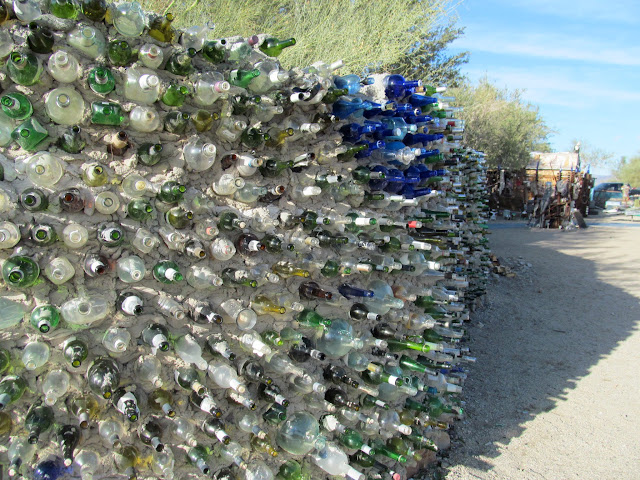
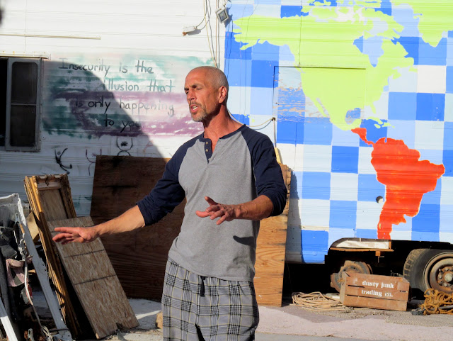
We progressed into the surreal at our next destination: Slab City. It's essentially a camp of squatters with varying degrees of civility. Some camp in apparent squalor and would rather be left alone, while others demonstrate sophistication and welcome visitors. After driving through the main part of Slab City, we ended up at East Jesus. It consists of a large public art installation alongside private living quarters. I'm not sure if we were simply lucky or if tours are a regular occurrence, but we got there just as one of the residents hollered at the small crowd and offered a tour of the private side of East Jesus. He showed the group how the residents handle issues like sanitation, electricity, food, and other basic needs.
Salvation Mountain
Slab City visitor center
Camp Goonies
Chateau Relaxo
Fame Retardant
Tower of Barbarella
TV Wall
Bottle Wall
Our East Jesus tour guide
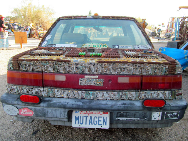
Mutagen
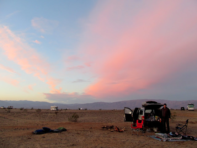
Leaving Slab City, it was a long drive around the south end of the Salton Sea westward to Anza-Borrego Desert State Park. Our not-very-well-researched plan was to camp near Fonts Point to either catch sunset or sunrise the following morning. We arrived at Fonts Point after sunset without finding any suitable (i.e., good cell service) camp spots along the way. Without even bothering to walk from the parking area to the viewpoint overlooking the Borrego Badlands, we retreated and found a spot near Borrego Springs at the south end of Clark Valley. A stop to use the bathroom and buy firewood in Borrego Springs put us in good spirits as we settled in for a comfortable evening around a big fire. We slept on the ground again and enjoyed sunrise from our sleeping bags, abandoning any idea of catching good light at Fonts Point.
Camp at the south end of Clark Valley
Sitting up in our sleeping bags to watch the sunrise
Colorful clouds over camp at sunrise
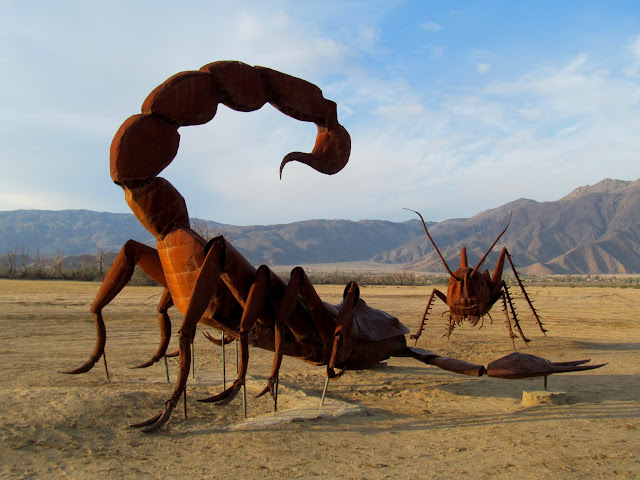
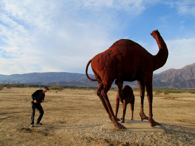
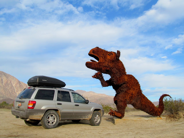
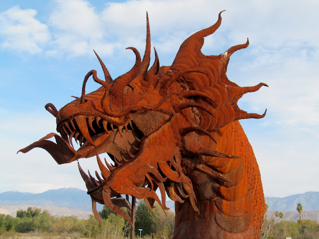
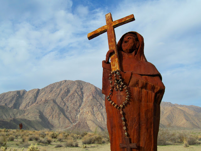
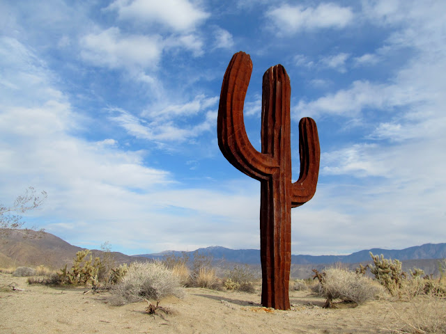
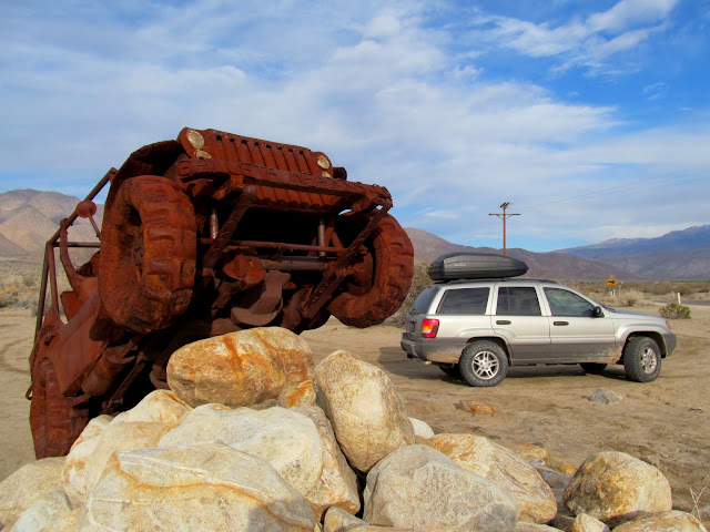
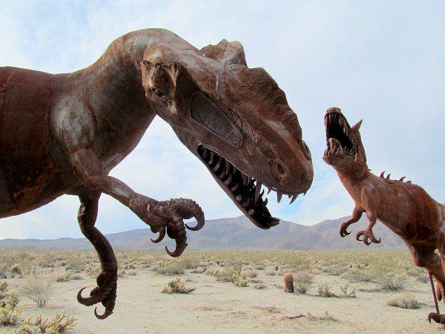
The rest of the morning was spent checking out all the great metal sculptures around Borrego Springs. We spent time north of town wandering around Galleta Meadows, then shifted our attention south of town closer to Yaqui Meadows. I was astounded at the sheer number of sculptures and the amount of work it must have been to make them so detailed. A few people were represented, along with many creatures of myth and the ancient past. After finishing up at Borrego Springs we headed toward home in an attempt to get Chris home to SLC before midnight. Running through Emery County I noticed I was getting low on fuel but pressed on anyway, arrving home with the readout on the Jeep showing six miles to empty, and half an hour behind schedule.
Scorpion and grasshopper
Camels
Woolly something-or-other
Dragon
Padre
Saguaro
Jeeps!
T-Rex and Sassy
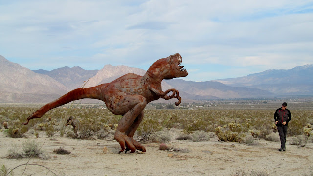
Dinosaurs
Signpost along Highway 62 in Ward Valley
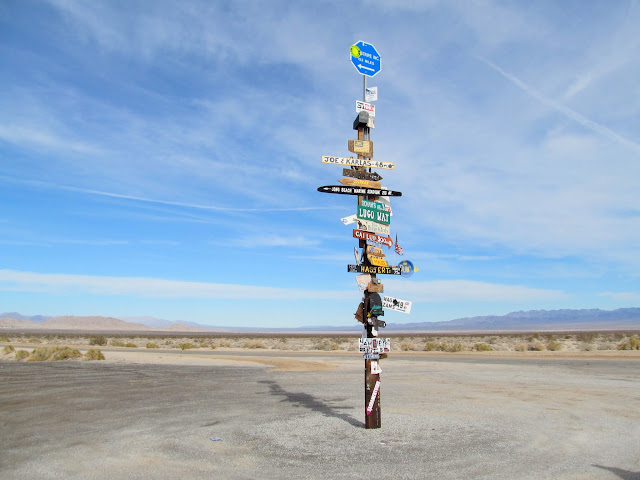
Photo Gallery: JOTR and Beyond
GPS Track and Photo Waypoints:
[ Google Earth KMZ ] [ Gmap4 Satellite ] [ Gmap4 Topo ]
Ready for departure away from all this snow
Leaving Carbon County
Sunset along I-15 north of Cedar City
Nipton Road over I-15
Tasty beverages chilling in snow I brought from home
Chris doing some night photography
Sheep Corral
We rose before 7AM, made coffee and packed up camp, then went for a short walk up Sheep Corral. On the road we made a couple of stops along the old Route 66 near Amboy before stopping for fuel in Twentynine Palms and heading into Joshua Tree.
Morning at Sheep Corral
Marble Mountains
Sheep Corral
Sheep Corral
Route 66 road signage
Amboy, CA 92304
Amboy Crater and lava flow
Cars backed up at the entrance to Joshua Tree
We wandered around the Barker Dam area and did some geocaching (all earth caches and virtuals). It was fairly crowded and we couldn't find a parking spot at the Barker Dam parking area so we drove to Keys View to check out the vistas overlooking Coachella Valley and Palm Springs. Returning to Barker Dam it still took a couple of circuits around the parking lot before a spot opened up. We hiked the trails to check out Barker Reservoir and some nearby petroglyphs, then headed over to Wall Street Mill. With daylight fading quickly we hurried to get a view of Desert Queen Mine and then the Cholla Cactus Garden on our way out of the park.
Fun Stuff
Memorial to Johnny Lang
Keys View, facing Palm Springs and the San Jacinto Mountains
Petroglyphs (painted over in modern times) near Barker Reservoir
Chris in the, uhh, err, water trough below Barker Dam
Barker Dam
Barker Dam (aka Big Horn Dam) inscription in concrete
Barker Reservoir
Old truck near Wall Street Mill
Spotlight and dark skies
Wall Street Mill
Wall Street Mill
Old truck near Wall Street Mill
Desert Queen Well
Desert Queen Mine
I hadn't planned a particular camp spot for the evening. I just knew there were plenty of primitive spots just outside the park all along the southern border. After exiting the park we drove west first and didn't find anything that did it for us, but along the dirt road to the east we found a great spot with some flat ground and a nice fire pit. We gathered up some wood and had a small fire that night, sleeping right on the ground sans tents. Up well before 7:00 on Sunday morning, we made our way toward Painted Canyon with a quick stop to look at some military equipment at Chiriaco Summit.
Camp at Shavers Valley
Earth shadow over the San Jacinto Mountains
Sunrise at camp
Tank at Chiriaco Summit
The trailhead for Painted Canyon was already busy by 9:30. Neither of us had specific route information for Painted Canyon/Ladder Canyon, and as we began hiking we just took a left into the first side canyon we encountered a short distance from the trailhead, although everyone else seemed to be going straight up the main canyon. That turned out to be a perfect decision. The canyon constricted into a slot that required some stemming over narrow portions, and after a while we came to a dryfall with a knotted rope hanging from the top. We climbed it easily, then encountered a couple more roped sections and chimneys that required more stemming. As the climbing grew more difficult, I worried about having to reverse the route if we reached an impassible obstacle. It became clear that we were nearing the top as the canyon grew more shallow. The final rope climb looked daunting, not just to climb up but also down if we couldn't find a way back into the main section of Painted Canyon. Chris climbed ahead of me and scouted a route for us to return to the main canyon, then returned and gave me the thumbs up. I completed the last climb and we followed a trail into another side canyon.
Entering the slot canyon fork of Painted Canyon
Chris stemming high
Climbing the first knotted rope
Shallow, narrow passage
Final knotted rope climb
Knotted rope in slot
Trail on top of Mecca Hills
Touching the ocotillo
We hadn't seen anyone in the slot with all the fixed ropes on the dryfalls, but we began seeing people in this other canyon--good, we must be on the right track! I heard voices before we reached the ladder that people were ascending. We waited for a group to climb up before we headed down, then ran into more people and ladders as we descended. Eventually dropping back into Painted Canyon, I realized that we'd done a more difficult loop involving Ladder Canyon than most people do. It had been quite adventurous, fun, and satisfying--easily the most fun I had on the entire trip. Chris and I continued farther up Painted Canyon and climbed a couple more ladders before turning back and returning to the TH.
Ladder Canyon
Ladder Canyon
Ladder Canyon
Ladder Canyon
Ladder Canyon
Painted Canyon
Painted Canyon
Large group in Painted Canyon
It was barely noon and I felt as though we'd had a nice, full day. The next stop was the Salton Sea. We visited a couple of spots along the shore of the inland sea, beginning at Bombay Beach and ending up at the abandoned Niland County Marina. While eating a lunch of chips and salsa, an old man who was camped in an old Dodge with a camper along the beach approached us and seemed genuinely concerned that we be saved by Jesus. I'd normally be dismissive (maybe not to his face) but somehow it came off as a nice gesture.
Birds on the Salton Sea
Cap'n Chris
Salton Sea
Boat launch at the abandoned Niland County Marina
Dodge and camper
We progressed into the surreal at our next destination: Slab City. It's essentially a camp of squatters with varying degrees of civility. Some camp in apparent squalor and would rather be left alone, while others demonstrate sophistication and welcome visitors. After driving through the main part of Slab City, we ended up at East Jesus. It consists of a large public art installation alongside private living quarters. I'm not sure if we were simply lucky or if tours are a regular occurrence, but we got there just as one of the residents hollered at the small crowd and offered a tour of the private side of East Jesus. He showed the group how the residents handle issues like sanitation, electricity, food, and other basic needs.
Salvation Mountain
Slab City visitor center
Camp Goonies
Chateau Relaxo
Fame Retardant
Tower of Barbarella
TV Wall
Bottle Wall
Our East Jesus tour guide
Mutagen
Leaving Slab City, it was a long drive around the south end of the Salton Sea westward to Anza-Borrego Desert State Park. Our not-very-well-researched plan was to camp near Fonts Point to either catch sunset or sunrise the following morning. We arrived at Fonts Point after sunset without finding any suitable (i.e., good cell service) camp spots along the way. Without even bothering to walk from the parking area to the viewpoint overlooking the Borrego Badlands, we retreated and found a spot near Borrego Springs at the south end of Clark Valley. A stop to use the bathroom and buy firewood in Borrego Springs put us in good spirits as we settled in for a comfortable evening around a big fire. We slept on the ground again and enjoyed sunrise from our sleeping bags, abandoning any idea of catching good light at Fonts Point.
Camp at the south end of Clark Valley
Sitting up in our sleeping bags to watch the sunrise
Colorful clouds over camp at sunrise
The rest of the morning was spent checking out all the great metal sculptures around Borrego Springs. We spent time north of town wandering around Galleta Meadows, then shifted our attention south of town closer to Yaqui Meadows. I was astounded at the sheer number of sculptures and the amount of work it must have been to make them so detailed. A few people were represented, along with many creatures of myth and the ancient past. After finishing up at Borrego Springs we headed toward home in an attempt to get Chris home to SLC before midnight. Running through Emery County I noticed I was getting low on fuel but pressed on anyway, arrving home with the readout on the Jeep showing six miles to empty, and half an hour behind schedule.
Scorpion and grasshopper
Camels
Woolly something-or-other
Dragon
Padre
Saguaro
Jeeps!
T-Rex and Sassy
Dinosaurs
Signpost along Highway 62 in Ward Valley
Photo Gallery: JOTR and Beyond
GPS Track and Photo Waypoints:
[ Google Earth KMZ ] [ Gmap4 Satellite ] [ Gmap4 Topo ]