Udink
Still right here.
- Joined
- Jan 17, 2012
- Messages
- 1,734
I've been seriously slacking off in getting my trip reports posted here. Instead of catching up right now (too busy), I'm gonna start off with the most recent from this past week (Oct. 11-12):
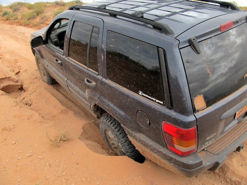
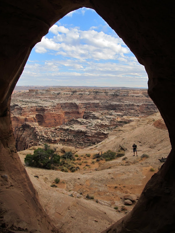
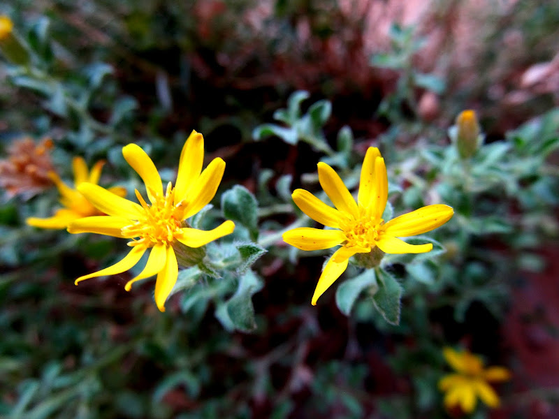
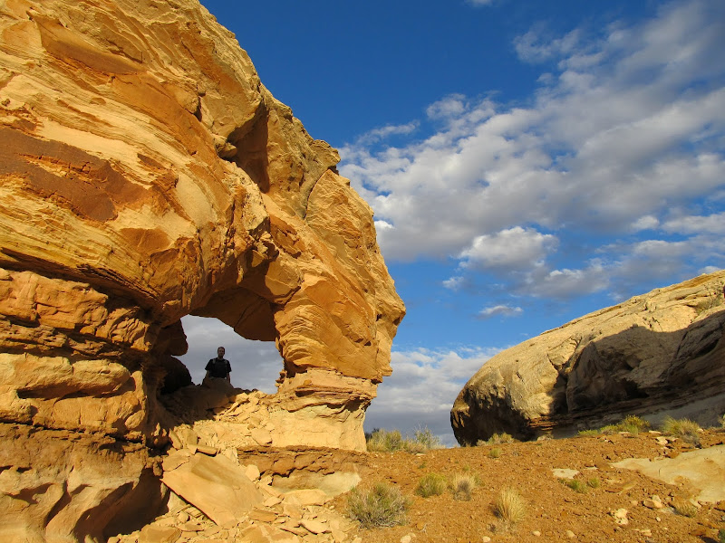
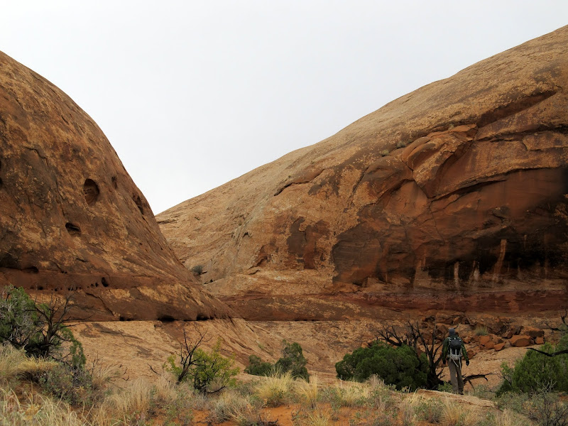
Chris and I took Thursday and Friday off work last week and, ignoring the weather forecast, went hiking and camping in the San Rafael Desert. Since I wanted to make a quick detour to the San Rafael Reef just off of I-70 to check road conditions for a camping trip I have planned for next weekend, we ended up driving into the San Rafael Desert from the west off of UT-24. The dirt road appeared to have been recently graded and conditions were much better than they were for my Maze trip in June. We'd gotten a late start from Price but we made good time toward our first stop: the end of the road at Keg Knoll where we'd begin the hike to Colonnade Arch. Somewhere on the Keg Knoll road I got stuck in the sand. There was a washout along the left side of the sandy road that I tried avoiding by going high and to the right. I was in 4WD but I went slowly to avoid sliding downhill into the washout--big mistake. The rear tires ended up digging huge holes until the rear axle was sitting in the sand. I had to dig out the sand from behind the rear tires, back up, then take a run at it with some speed to get through. We parked the Jeep at 4:15 PM and started hiking. Chris had never been to Colonnade Arch and apparently didn't know what was in store. I told him about Bill's "dragon teeth" rock which we looked for along the way but never saw. We made it to Colonnade Arch quickly--it's only a mile from where I parked the Jeep--and Chris was amazed. It really is one of the best arches I've ever seen.
Stuck in the sand on the Keg Knoll road
Starting the hike to Colonnade Arch
Colonnade Arch hike
Colonnade Arch
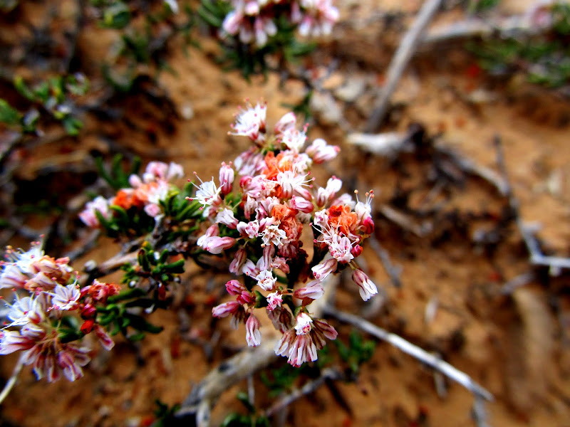
Flowers under Colonnade Arch
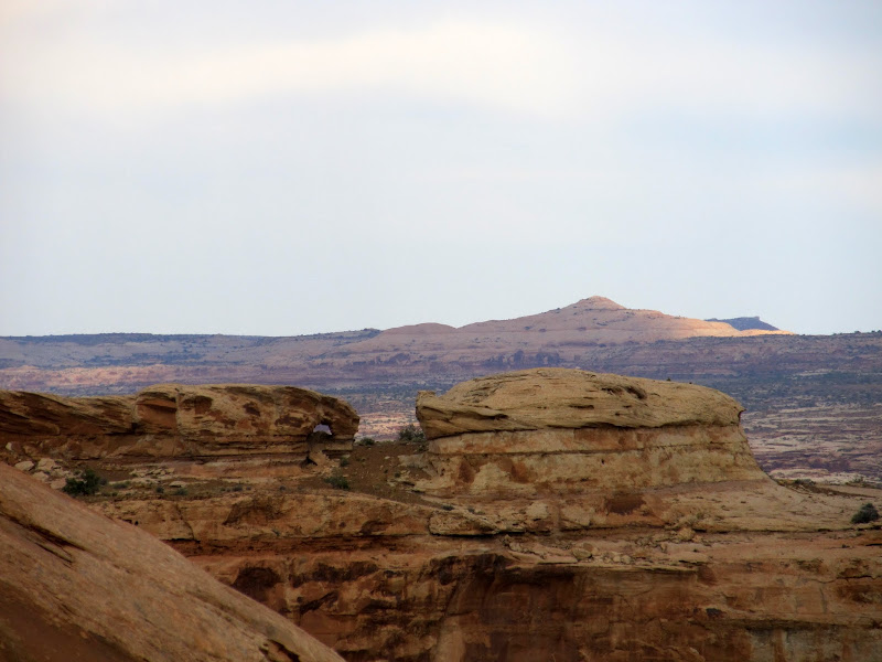
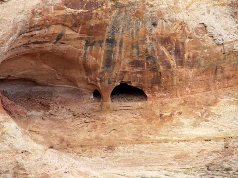
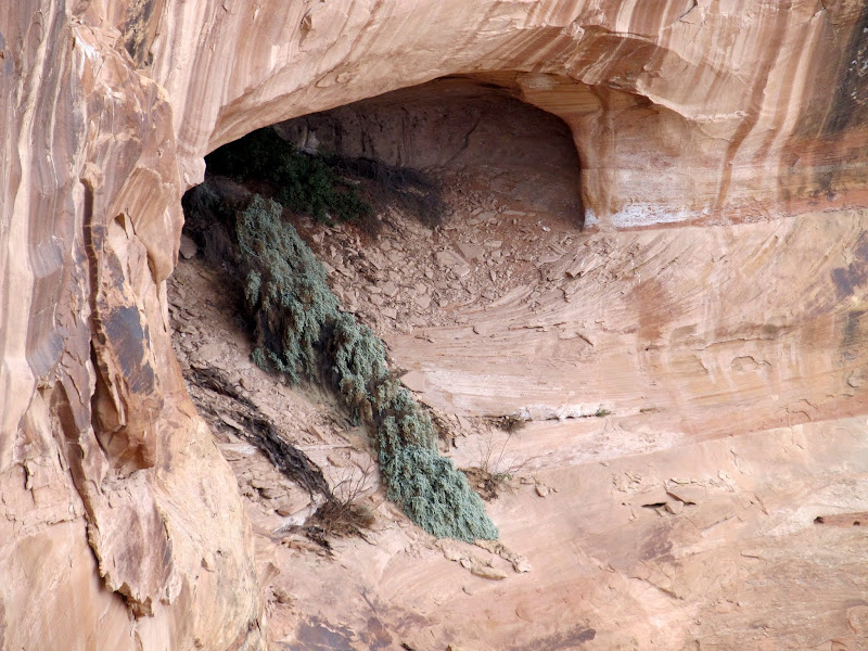
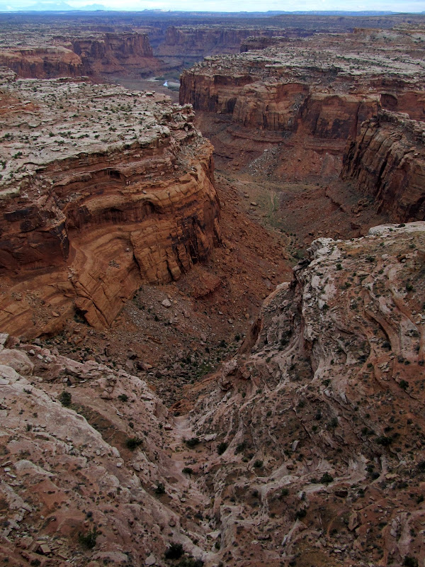
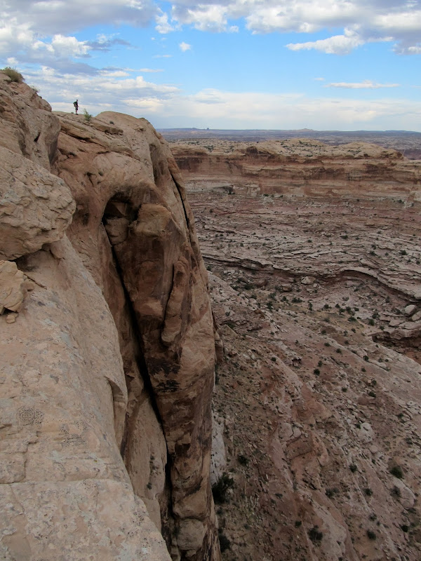
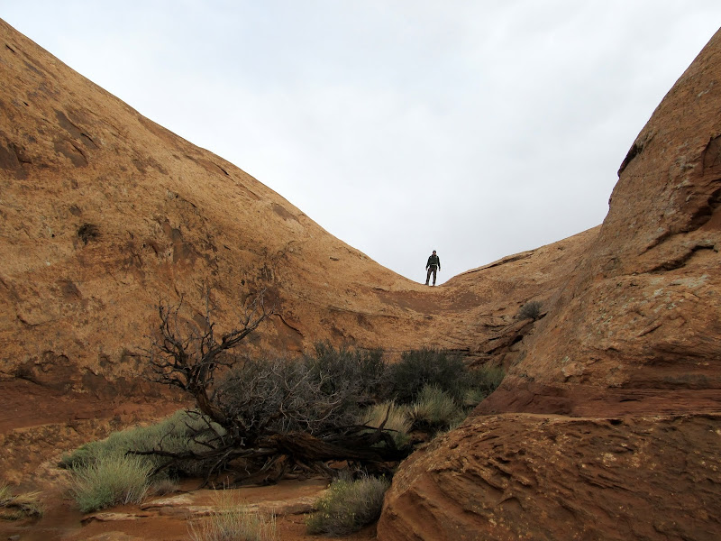
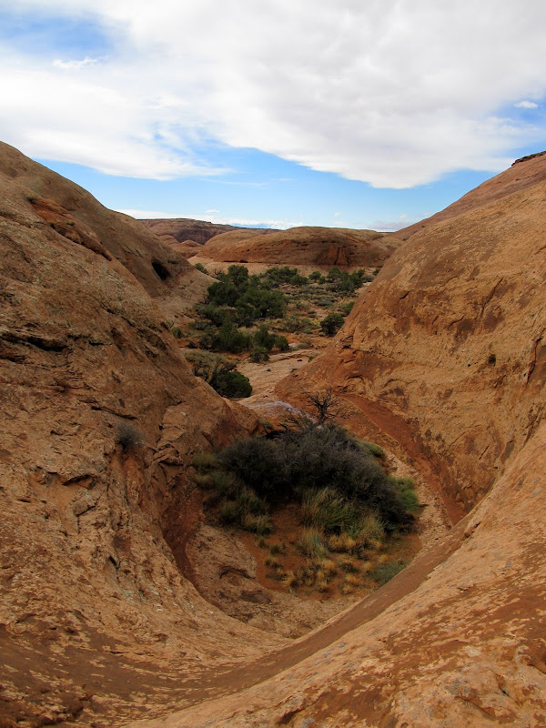
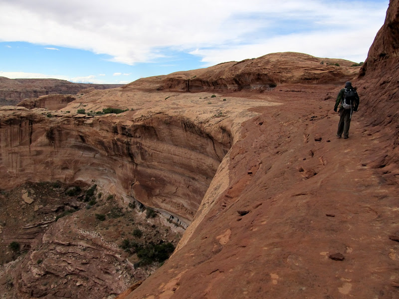
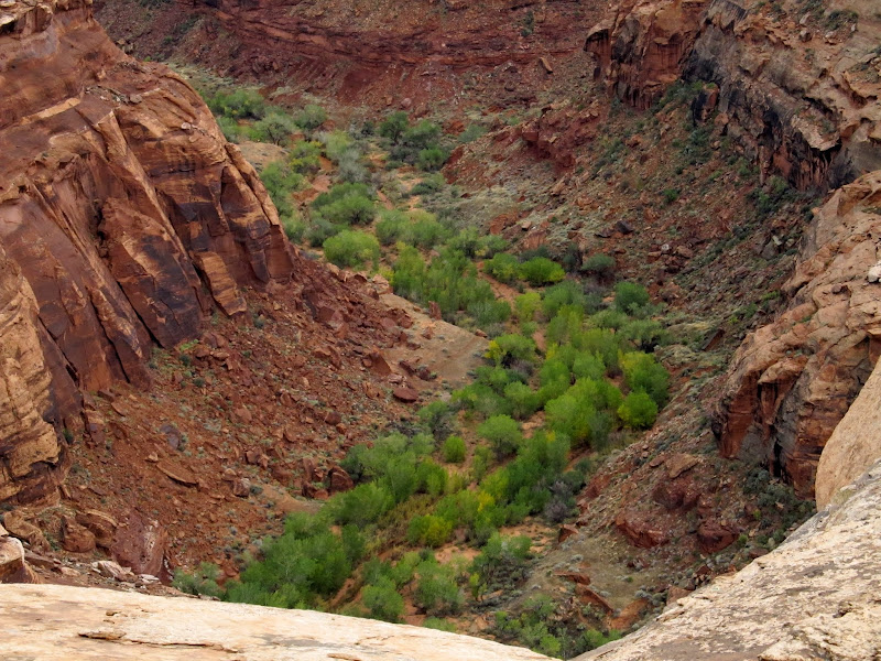
After checking out the arch we still wanted to do some exploring. As we climbed above Colonnade I spied another arch across a deep chasm that's unnamed on the map but which I would call the North Fork to Twomile Canyon. We had to skirt around the rim of the canyon to reach the arch. Below the canyon rim and embedded in the vertical cliff face were several alcoves, one of which contained yet another amazing arch. We reached the far side of the canyon and easily found the arch that I'd spotted from near Colonnade. We took a few moments to rest there and then started hiking back to the Jeep. It was almost fully dark when we returned. We drove a short distance and found a place to camp.
A small arch northeast of Colonnade
Arch in the middle of a cliff
Alcove in the middle of a cliff
Tiny wildflowers
North fork of Twomile Canyon
Chris standing on the canyon rim
Arch north of Twomile Canyon
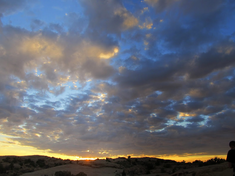
Sunset
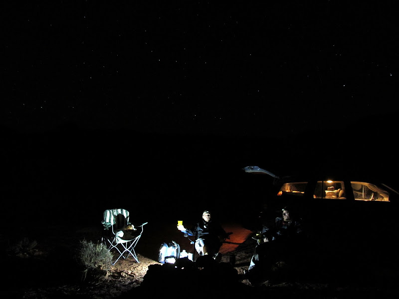
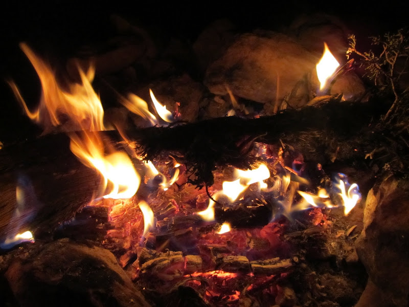
My first choice of camp spots was taken by a guy in a Tundra with Arizona plates, so Chris and I ended up about a tenth of a mile around the hillside from him. We ate dinner first, started drinking some wine, then walked down the road and collected some dead wood for a fire. The weather forecast called for certain rain during the night and following day, but we only saw a couple of small sprinkles while we sat around the campfire. We set up our tents around 10:00PM, just in case it did start raining so we could take shelter quickly, but we were up until 2AM and never got wet. Shortly after going to bed and all night thereafter, however, it rained and thundered a lot. The thunder I heard from the west was a low rumble, but that from the east echoed through Labyrinth Canyon and made the most powerfully amazing thunder sound I've heard. It was an enjoyable stormy night inside the tent.
Enjoying the night at camp
Campfire
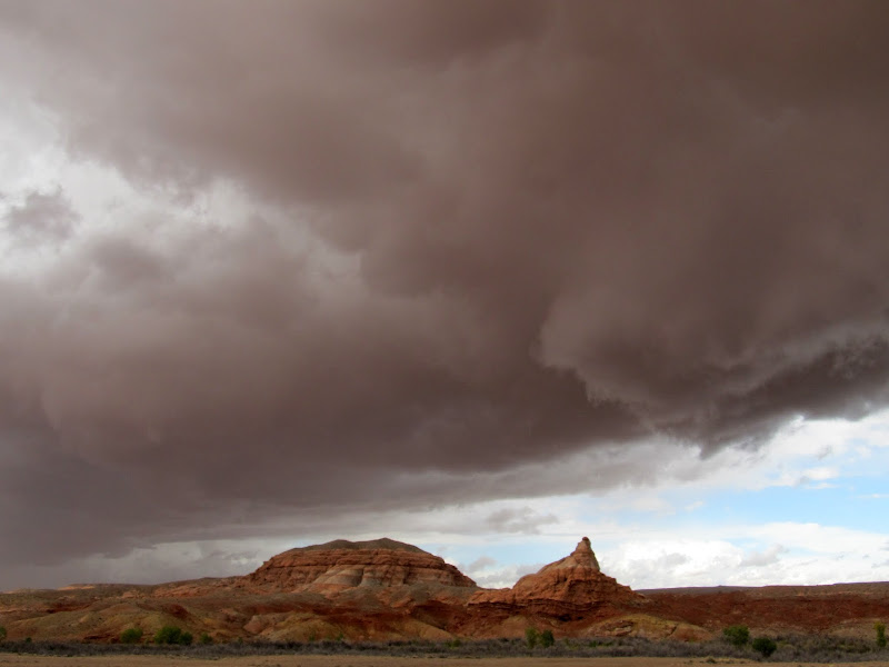
I awoke Friday morning and was surprised to see bright sunshine coming through the tent. I poked my head outside and saw dark clouds all around, though. There was a break in the storm just long enough for us to take down camp and stow our things in the Jeep before it started raining again. I'd awakened with a moderate headache but it soon turned into a huge headache and I got really sick. Before we were able to drive away I had to get out of the Jeep a few times and stand in the pouring rain while vomiting. Not pleasant. I finally felt well enough to drive, but we had no idea where we were going. The original plan was to head to the Moab area and do some hiking and maybe find some old geocaches, but I was no longer up for that. We passed the Arizona guy's camp and he was also packed up and sitting in his truck, and as we drove past he fell in line behind us and followed to the main road. I pulled over there 'cause I was feeling sick again, and the Tundra cruised past us heading north toward Green River. I decided to sit tight for a while in the hopes that I'd get feeling better, and that turned into a 20-minute nap for both of us. I was amazed when I woke up from my nap and I was feeling 100% better--headache and nausea were gone! I ate and drank something and we debated what to do with the rest of the day. While we were standing outside of the Jeep I realized that a huge storm was bearing down on us, with the front literally rolling over the desert. It was moving fast, and within a minute or two of spotting the storm it was upon us with strong wind and moderate rain. That ended my desire to try making coffee before we really got our day started. I'd brought some coordinates for what I thought might be a natural arch (spotted in Bing Maps) on the rim of Horseshoe Canyon, and we decided that would be a nice and easy place to do some hiking.
A little sunshine in the morning after a night of rain
Wet slickrock
Crazy storm front rolling over the San Rafael Desert
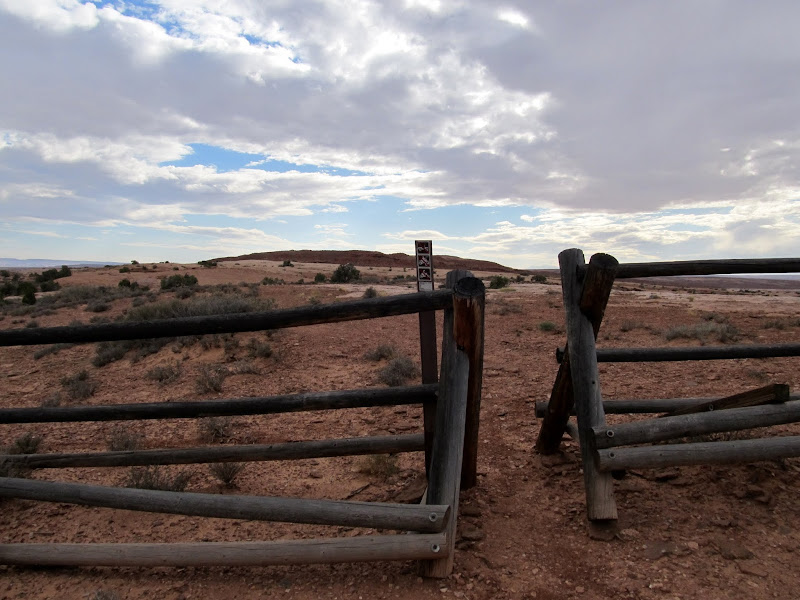
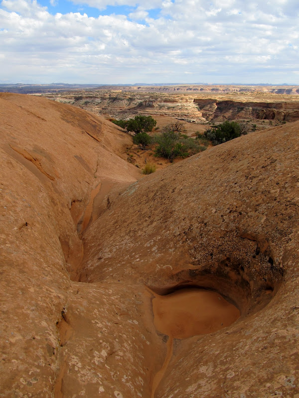
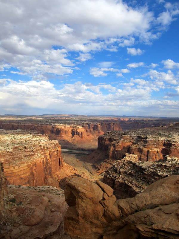
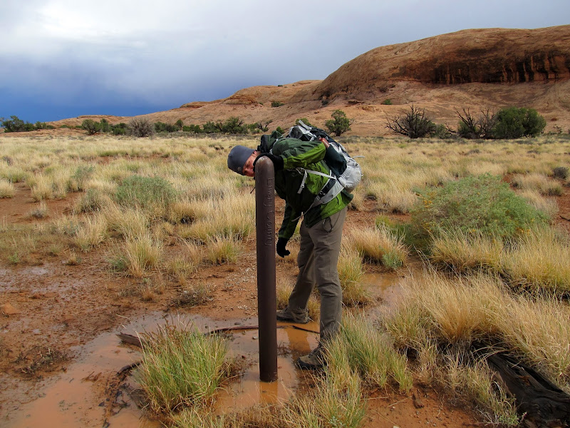
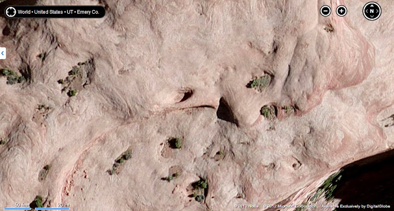
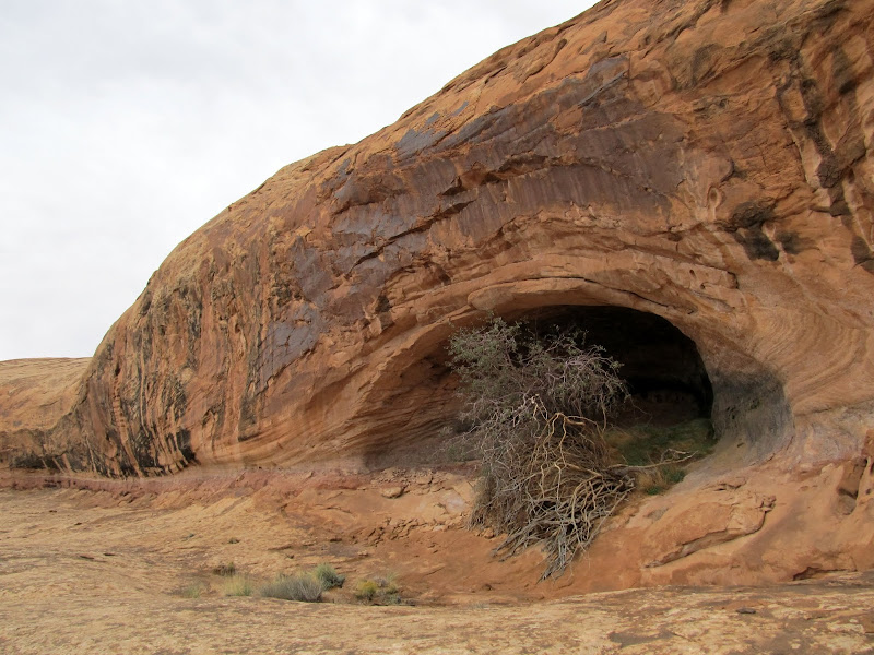
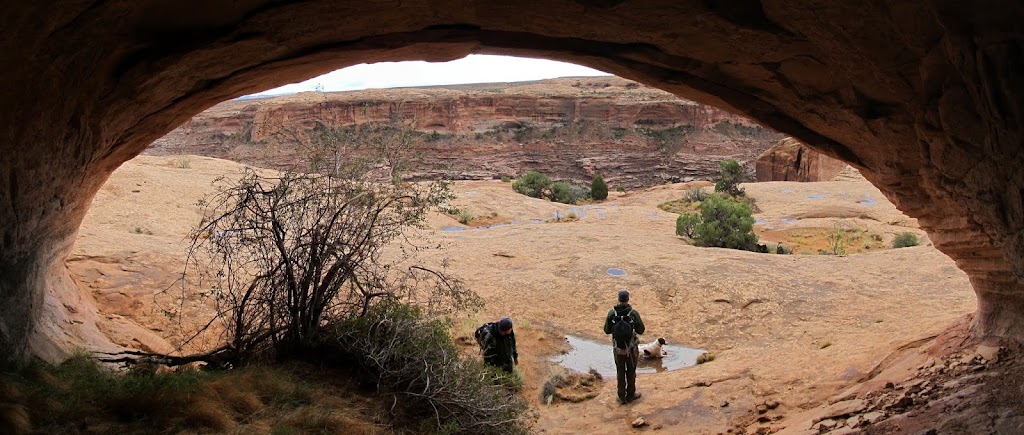
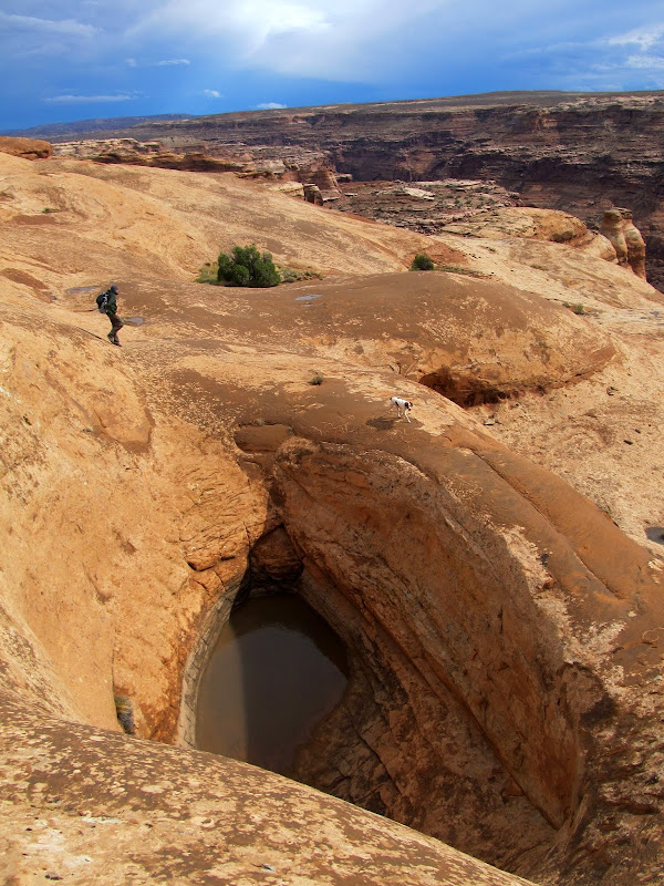
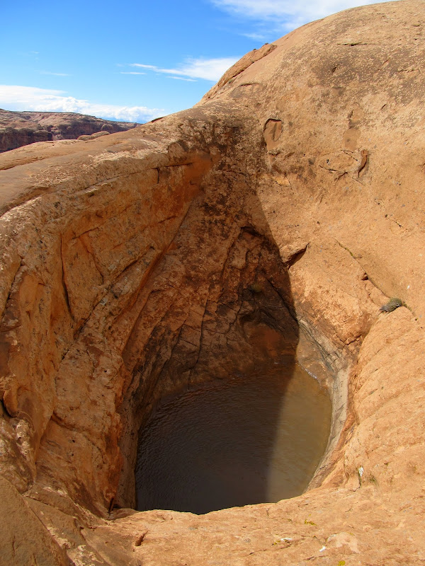
We actually backtracked down the Keg Knoll road to reach the turnoff to a two-track road that would get us close enough to start hiking. I parked the Jeep at a barricade across the road and we started hiking southeast as a cold wind chilled us. Conditions were miserable enough that we actually considered turning back, but we could see blue skies beyond the trailing edge of the storm, and it was moving so quickly that we assumed it would be calmer and sunny again soon. We hiked down a hill and onto the wet slickrock toward the rim of the canyon, crossing over sandstone domes and through chutes and gullies until we reached a flat, sandy area where we saw a capped drill hole. I found a nice four-point shed deer antler that I carried with me for the remainder of the hike. After one more short climb through a gap in some cliffs we reached the rim of Horseshoe Canyon. We followed a narrow shelf with a huge drop to the left and some smaller cliffs rising above to the right. There were many small alcoves in the upper cliffs. We hiked out onto a point to get a better view into the canyon, then climbed up a steep dome to where the possible arch should have been. We got there and only found an alcove with about 20 feet of sandstone overhead. Viewing it from below, it was difficult to imagine why I'd thought it looked like an arch in the satellite imagery. However, we scrambled around and above the alcove and found a deep pothole with a few feet of water standing in the bottom. Comparing the views from below and above, it seemed obvious that this could become a natural arch at any time--there can't be more than a few feet of sandstone between the bottom of the pool and the roof of the alcove.
Hiking to the rim of Horseshoe Canyon
Hiking to the rim of Horseshoe Canyon
Mushroom
Hiking to the rim of Horseshoe Canyon
Drill hole
At the rim of Horseshoe Canyon
Horseshoe Canyon
Satellite view from Bing Maps of what I had hoped was a natural arch (center)
What I'd hoped was an arch was merely an alcove
Inside the alcove
Pothole
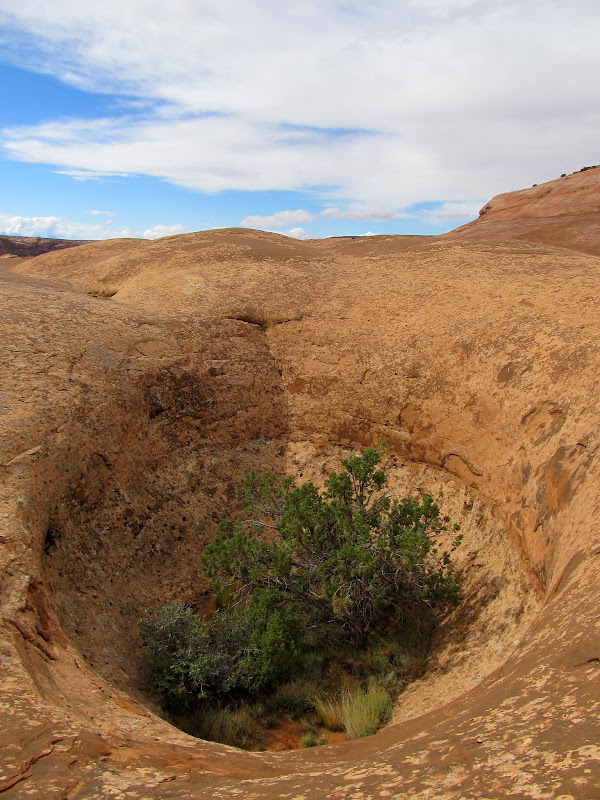
Huge pothole above the alcove
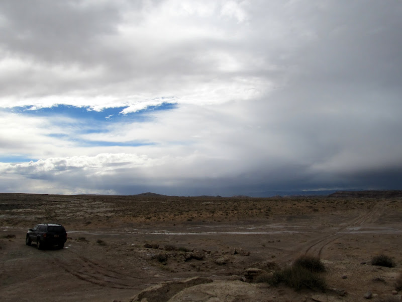
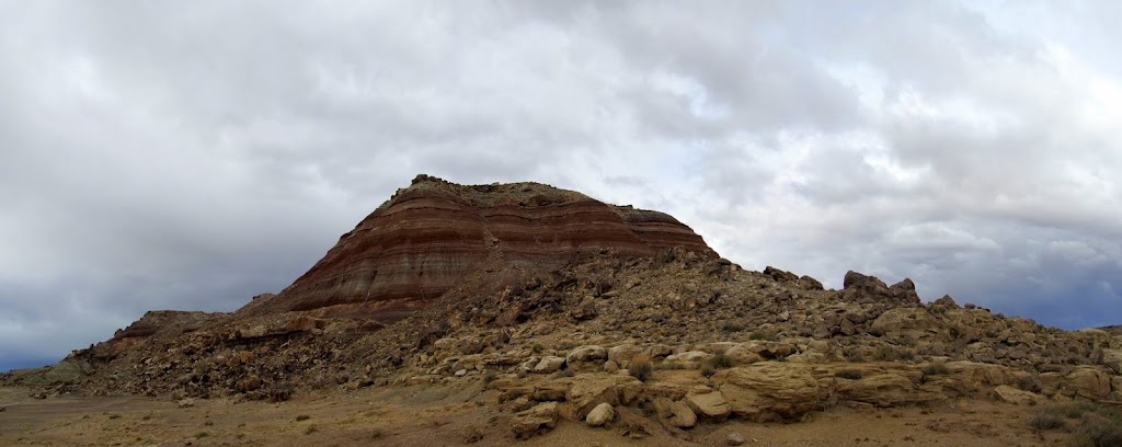
We enjoyed a period of sunshine while we took a slightly different route back to the Jeep. The climb from the canyon rim up to the plateau warmed us through and we shed layers down to our t-shirts. We got back to the Jeep and opened some snacks to eat as we headed north toward Green River. We planned to stop and Chaffin Ranch Geyser and Crystal Geyser, but as I drove I remembered reading about Fossil Point just west of Horse Bench Reservoir--we added that to our list as well. The stretch of road immediately north of the Keg Point turnoff was a little rough and washed out but passable with HC 2WD. After the rough patch the road was in pretty good condition. More storms rolled overhead and let loose rain as we traveled north, and just before reaching the Fossil Point turnoff the road crossed through a wash that had a little flowing water in it. The road to Fossil Point was a small river for about 200 yards in one spot, and there were a lot of rivulets crossing the road after that. I parked where I thought Fossil Point was--the sign at the turnoff said it was one mile down the road, but I'd driven about 1.2 miles until the road got close to the base of a Morrison Formation hill. It was easy finding the dinosaur bones in the boulders all over the hillside. There were all sorts of unidentifiable (to me, anyway) bones embedded in the rock, though some were clearly femurs from enormous animals, almost a foot wide and several feet long. We had our fill of dino bones, although I'm sure we could have spent hours there finding new things, and we continued our drive. The river on the road had subsided to only a stream, but the wash we'd crossed earlier on the main road was flowing about ten times what it had been.
Another storm that just missed us
Potholes
Jeep parked at the end of the road
Storm over Gruver's Mesa
Storm near the San Rafael River bridge
Parked at Fossil Point
Dinosaur bone fossils at Fossil Point
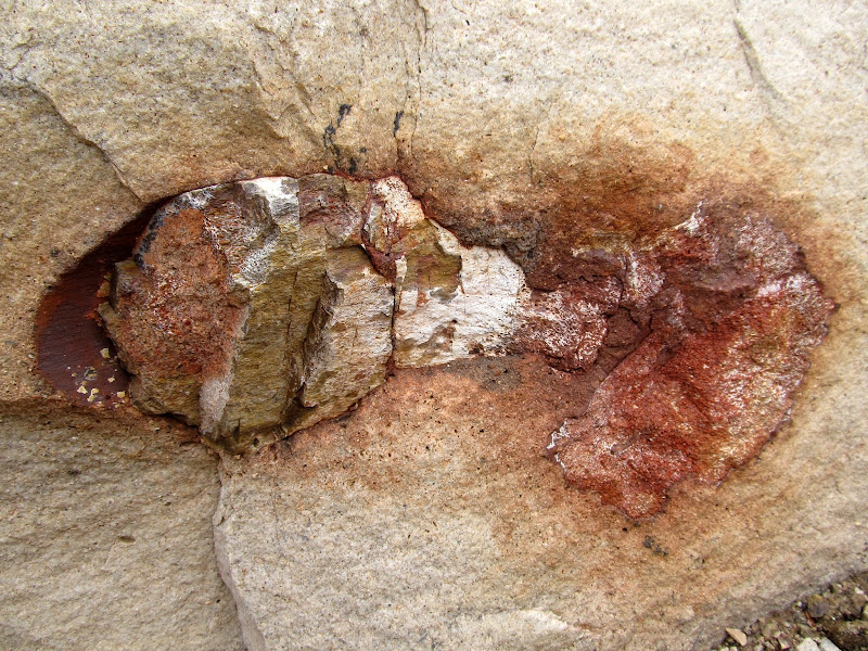
Fossil Point
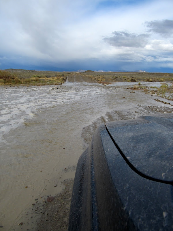
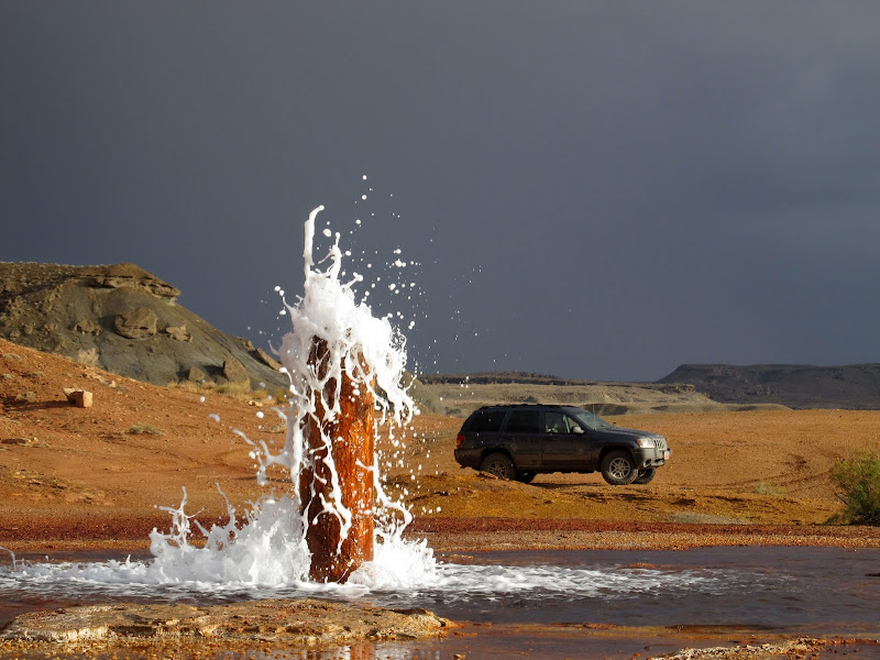
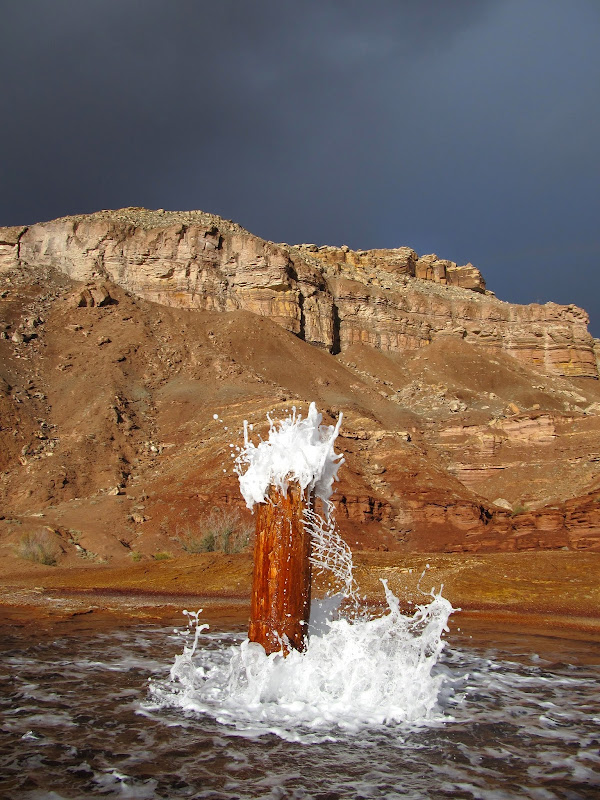
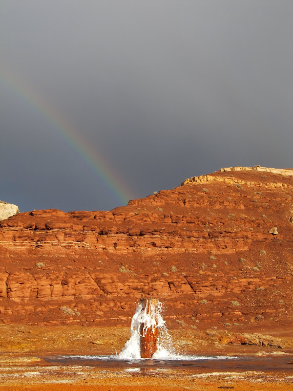
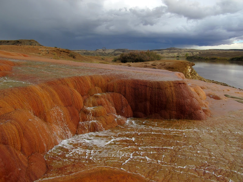
Chaffin Ranch Geyser was a bust. We waited around for a while hoping to see it erupt but the wind and rain drove us away. Closer to Green River we encountered a lot of water flowing in Ninemile Wash. The water was perhaps 75 feet wide, and I initially started driving through it but then reversed because it was much deeper than it looked. I didn't have enough fuel to backtrack to Highway 24 (and was likely to encounter more water that direction anyhow) and I didn't want to wait for the flow to subside, so I went forward again and made it through quite easily. There was another wash north of there that had some water flowing through it, and there was a couple in a rented Kia Sportage stopped to evaluate the crossing. I splashed through it quickly and I think startled them, then stopped to talk for a minute. They were tourists, and judging from their accents probably from Germany, and they were trying to get to Fossil Point. I told them about the more difficult water crossing behind me and the river flowing on the Fossil Point road, and they said they'd try again the following day. It was smooth sailing for us from there to Crystal Geyser. We arrived to find a family there enjoying a tiny bit of flow out of the geyser. Chris and I looked for a couple of nearby geocaches hoping that the flow would pick up while we killed some time. We got back to the geyser to find the family gone and the geyser bubbling and sputtering a little more. We got to watch a small eruption but it was nowhere near as high as I've seen it in the past. The sun came out briefly and made for some dramatic lighting on the geyser with black skies in the background. Our explorations ended there--I fueled up in Green River and we drove back to Price after having had a nice two days of bad weather and good times.
A lot of water flowing in Ninemile Wash
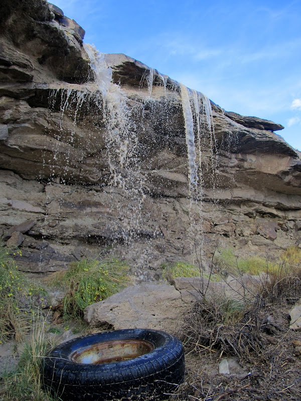
Roadside waterfall south of Green River
Crystal Geyser
Full Photo Gallery:
https://picasaweb.google.com/Dennis.Udink/ColonnadeHorseshoeFossilCrystal
GPS Tracklog and Photo Waypoints:
[parsehtml]<iframe width="640" height="480" frameborder="0" scrolling="no" marginheight="0" marginwidth="0" src="https://maps.google.com/maps?q=http:%2F%2Fudink.org%2Fgeo%2FColonnadeHorseshoeFossilCrystal.kmz&hl=en&sll=39.499761,-111.547028&sspn=4.907901,10.821533&t=h&ie=UTF8&ll=38.768004,-110.151672&spn=0.513954,0.878906&z=10&output=embed"></iframe><br /><small><a href="https://maps.google.com/maps?q=http:%2F%2Fudink.org%2Fgeo%2FColonnadeHorseshoeFossilCrystal.kmz&hl=en&sll=39.499761,-111.547028&sspn=4.907901,10.821533&t=h&ie=UTF8&ll=38.768004,-110.151672&spn=0.513954,0.878906&z=10&source=embed" style="color:#0000FF;text-align:left">View Larger Map</a></small>[/parsehtml]
Featured image for home page:

Chris and I took Thursday and Friday off work last week and, ignoring the weather forecast, went hiking and camping in the San Rafael Desert. Since I wanted to make a quick detour to the San Rafael Reef just off of I-70 to check road conditions for a camping trip I have planned for next weekend, we ended up driving into the San Rafael Desert from the west off of UT-24. The dirt road appeared to have been recently graded and conditions were much better than they were for my Maze trip in June. We'd gotten a late start from Price but we made good time toward our first stop: the end of the road at Keg Knoll where we'd begin the hike to Colonnade Arch. Somewhere on the Keg Knoll road I got stuck in the sand. There was a washout along the left side of the sandy road that I tried avoiding by going high and to the right. I was in 4WD but I went slowly to avoid sliding downhill into the washout--big mistake. The rear tires ended up digging huge holes until the rear axle was sitting in the sand. I had to dig out the sand from behind the rear tires, back up, then take a run at it with some speed to get through. We parked the Jeep at 4:15 PM and started hiking. Chris had never been to Colonnade Arch and apparently didn't know what was in store. I told him about Bill's "dragon teeth" rock which we looked for along the way but never saw. We made it to Colonnade Arch quickly--it's only a mile from where I parked the Jeep--and Chris was amazed. It really is one of the best arches I've ever seen.
Stuck in the sand on the Keg Knoll road
Starting the hike to Colonnade Arch
Colonnade Arch hike
Colonnade Arch
Flowers under Colonnade Arch
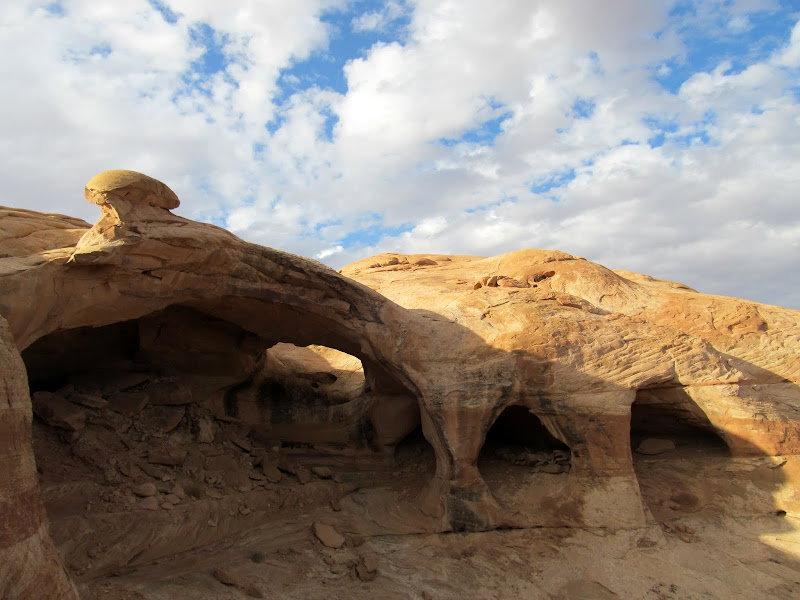
After checking out the arch we still wanted to do some exploring. As we climbed above Colonnade I spied another arch across a deep chasm that's unnamed on the map but which I would call the North Fork to Twomile Canyon. We had to skirt around the rim of the canyon to reach the arch. Below the canyon rim and embedded in the vertical cliff face were several alcoves, one of which contained yet another amazing arch. We reached the far side of the canyon and easily found the arch that I'd spotted from near Colonnade. We took a few moments to rest there and then started hiking back to the Jeep. It was almost fully dark when we returned. We drove a short distance and found a place to camp.
A small arch northeast of Colonnade
Arch in the middle of a cliff
Alcove in the middle of a cliff
Tiny wildflowers
North fork of Twomile Canyon
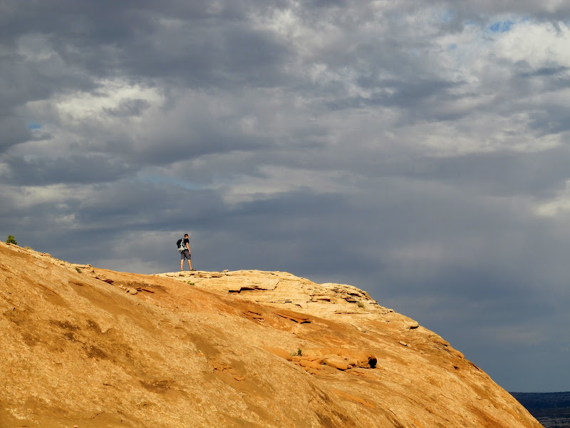
Chris standing on the canyon rim
Arch north of Twomile Canyon
Sunset
My first choice of camp spots was taken by a guy in a Tundra with Arizona plates, so Chris and I ended up about a tenth of a mile around the hillside from him. We ate dinner first, started drinking some wine, then walked down the road and collected some dead wood for a fire. The weather forecast called for certain rain during the night and following day, but we only saw a couple of small sprinkles while we sat around the campfire. We set up our tents around 10:00PM, just in case it did start raining so we could take shelter quickly, but we were up until 2AM and never got wet. Shortly after going to bed and all night thereafter, however, it rained and thundered a lot. The thunder I heard from the west was a low rumble, but that from the east echoed through Labyrinth Canyon and made the most powerfully amazing thunder sound I've heard. It was an enjoyable stormy night inside the tent.
Enjoying the night at camp
Campfire
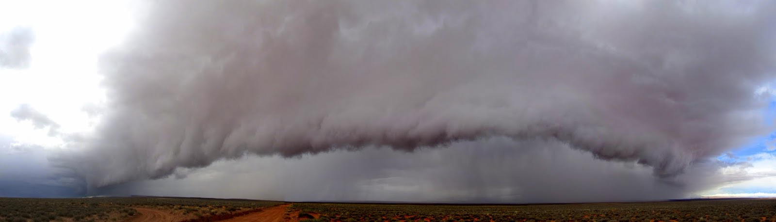
I awoke Friday morning and was surprised to see bright sunshine coming through the tent. I poked my head outside and saw dark clouds all around, though. There was a break in the storm just long enough for us to take down camp and stow our things in the Jeep before it started raining again. I'd awakened with a moderate headache but it soon turned into a huge headache and I got really sick. Before we were able to drive away I had to get out of the Jeep a few times and stand in the pouring rain while vomiting. Not pleasant. I finally felt well enough to drive, but we had no idea where we were going. The original plan was to head to the Moab area and do some hiking and maybe find some old geocaches, but I was no longer up for that. We passed the Arizona guy's camp and he was also packed up and sitting in his truck, and as we drove past he fell in line behind us and followed to the main road. I pulled over there 'cause I was feeling sick again, and the Tundra cruised past us heading north toward Green River. I decided to sit tight for a while in the hopes that I'd get feeling better, and that turned into a 20-minute nap for both of us. I was amazed when I woke up from my nap and I was feeling 100% better--headache and nausea were gone! I ate and drank something and we debated what to do with the rest of the day. While we were standing outside of the Jeep I realized that a huge storm was bearing down on us, with the front literally rolling over the desert. It was moving fast, and within a minute or two of spotting the storm it was upon us with strong wind and moderate rain. That ended my desire to try making coffee before we really got our day started. I'd brought some coordinates for what I thought might be a natural arch (spotted in Bing Maps) on the rim of Horseshoe Canyon, and we decided that would be a nice and easy place to do some hiking.
A little sunshine in the morning after a night of rain
Wet slickrock
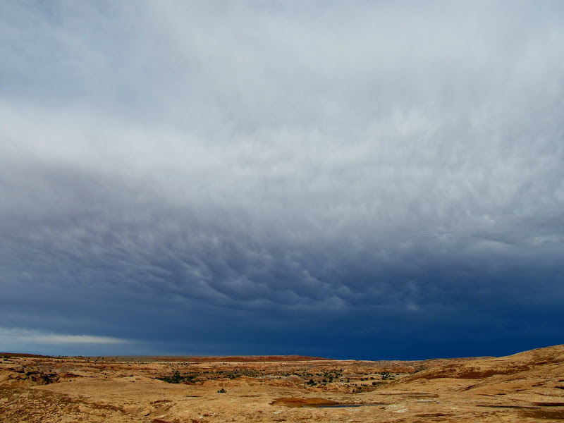
Crazy storm front rolling over the San Rafael Desert
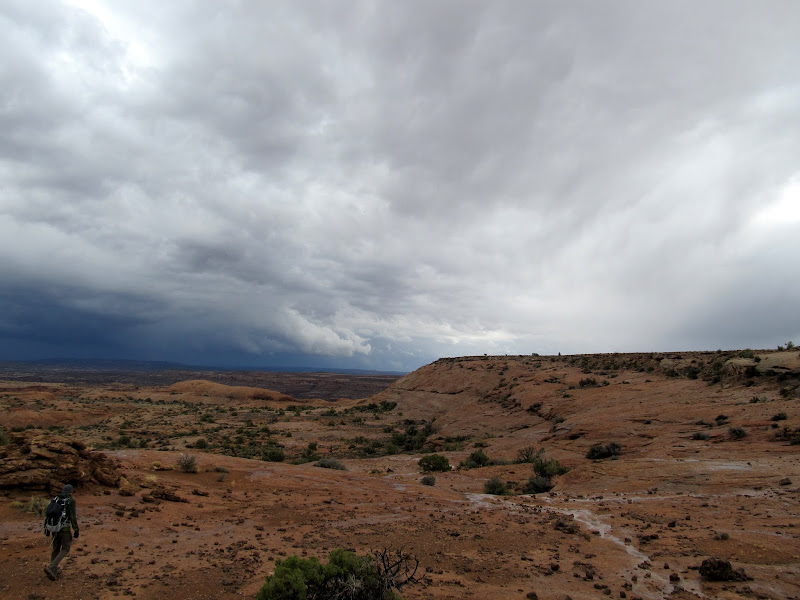
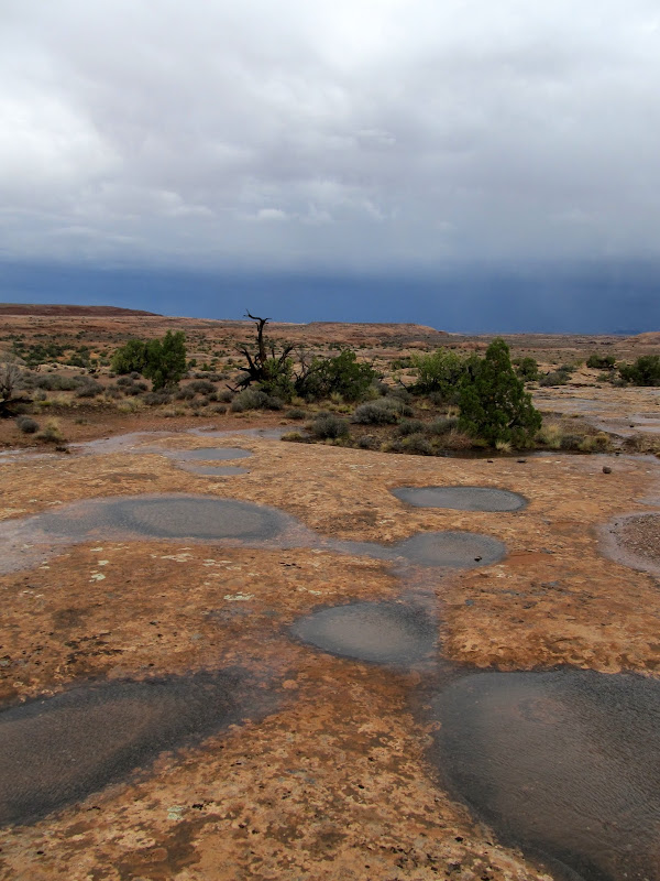
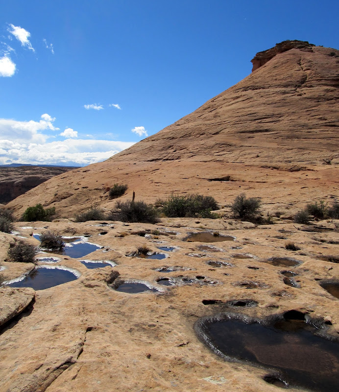
We actually backtracked down the Keg Knoll road to reach the turnoff to a two-track road that would get us close enough to start hiking. I parked the Jeep at a barricade across the road and we started hiking southeast as a cold wind chilled us. Conditions were miserable enough that we actually considered turning back, but we could see blue skies beyond the trailing edge of the storm, and it was moving so quickly that we assumed it would be calmer and sunny again soon. We hiked down a hill and onto the wet slickrock toward the rim of the canyon, crossing over sandstone domes and through chutes and gullies until we reached a flat, sandy area where we saw a capped drill hole. I found a nice four-point shed deer antler that I carried with me for the remainder of the hike. After one more short climb through a gap in some cliffs we reached the rim of Horseshoe Canyon. We followed a narrow shelf with a huge drop to the left and some smaller cliffs rising above to the right. There were many small alcoves in the upper cliffs. We hiked out onto a point to get a better view into the canyon, then climbed up a steep dome to where the possible arch should have been. We got there and only found an alcove with about 20 feet of sandstone overhead. Viewing it from below, it was difficult to imagine why I'd thought it looked like an arch in the satellite imagery. However, we scrambled around and above the alcove and found a deep pothole with a few feet of water standing in the bottom. Comparing the views from below and above, it seemed obvious that this could become a natural arch at any time--there can't be more than a few feet of sandstone between the bottom of the pool and the roof of the alcove.
Hiking to the rim of Horseshoe Canyon
Hiking to the rim of Horseshoe Canyon
Mushroom
Hiking to the rim of Horseshoe Canyon
Drill hole
At the rim of Horseshoe Canyon
Horseshoe Canyon
Satellite view from Bing Maps of what I had hoped was a natural arch (center)
What I'd hoped was an arch was merely an alcove
Inside the alcove
Pothole
Huge pothole above the alcove
We enjoyed a period of sunshine while we took a slightly different route back to the Jeep. The climb from the canyon rim up to the plateau warmed us through and we shed layers down to our t-shirts. We got back to the Jeep and opened some snacks to eat as we headed north toward Green River. We planned to stop and Chaffin Ranch Geyser and Crystal Geyser, but as I drove I remembered reading about Fossil Point just west of Horse Bench Reservoir--we added that to our list as well. The stretch of road immediately north of the Keg Point turnoff was a little rough and washed out but passable with HC 2WD. After the rough patch the road was in pretty good condition. More storms rolled overhead and let loose rain as we traveled north, and just before reaching the Fossil Point turnoff the road crossed through a wash that had a little flowing water in it. The road to Fossil Point was a small river for about 200 yards in one spot, and there were a lot of rivulets crossing the road after that. I parked where I thought Fossil Point was--the sign at the turnoff said it was one mile down the road, but I'd driven about 1.2 miles until the road got close to the base of a Morrison Formation hill. It was easy finding the dinosaur bones in the boulders all over the hillside. There were all sorts of unidentifiable (to me, anyway) bones embedded in the rock, though some were clearly femurs from enormous animals, almost a foot wide and several feet long. We had our fill of dino bones, although I'm sure we could have spent hours there finding new things, and we continued our drive. The river on the road had subsided to only a stream, but the wash we'd crossed earlier on the main road was flowing about ten times what it had been.
Another storm that just missed us
Potholes
Jeep parked at the end of the road
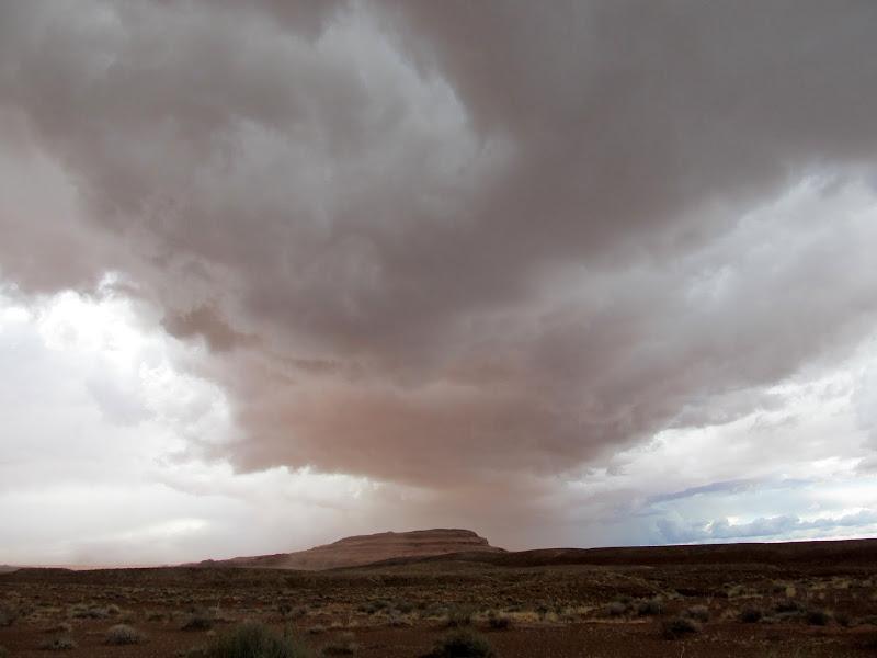
Storm over Gruver's Mesa
Storm near the San Rafael River bridge
Parked at Fossil Point
Dinosaur bone fossils at Fossil Point
Fossil Point
Chaffin Ranch Geyser was a bust. We waited around for a while hoping to see it erupt but the wind and rain drove us away. Closer to Green River we encountered a lot of water flowing in Ninemile Wash. The water was perhaps 75 feet wide, and I initially started driving through it but then reversed because it was much deeper than it looked. I didn't have enough fuel to backtrack to Highway 24 (and was likely to encounter more water that direction anyhow) and I didn't want to wait for the flow to subside, so I went forward again and made it through quite easily. There was another wash north of there that had some water flowing through it, and there was a couple in a rented Kia Sportage stopped to evaluate the crossing. I splashed through it quickly and I think startled them, then stopped to talk for a minute. They were tourists, and judging from their accents probably from Germany, and they were trying to get to Fossil Point. I told them about the more difficult water crossing behind me and the river flowing on the Fossil Point road, and they said they'd try again the following day. It was smooth sailing for us from there to Crystal Geyser. We arrived to find a family there enjoying a tiny bit of flow out of the geyser. Chris and I looked for a couple of nearby geocaches hoping that the flow would pick up while we killed some time. We got back to the geyser to find the family gone and the geyser bubbling and sputtering a little more. We got to watch a small eruption but it was nowhere near as high as I've seen it in the past. The sun came out briefly and made for some dramatic lighting on the geyser with black skies in the background. Our explorations ended there--I fueled up in Green River and we drove back to Price after having had a nice two days of bad weather and good times.
A lot of water flowing in Ninemile Wash
Roadside waterfall south of Green River
Crystal Geyser
Full Photo Gallery:
https://picasaweb.google.com/Dennis.Udink/ColonnadeHorseshoeFossilCrystal
GPS Tracklog and Photo Waypoints:
[parsehtml]<iframe width="640" height="480" frameborder="0" scrolling="no" marginheight="0" marginwidth="0" src="https://maps.google.com/maps?q=http:%2F%2Fudink.org%2Fgeo%2FColonnadeHorseshoeFossilCrystal.kmz&hl=en&sll=39.499761,-111.547028&sspn=4.907901,10.821533&t=h&ie=UTF8&ll=38.768004,-110.151672&spn=0.513954,0.878906&z=10&output=embed"></iframe><br /><small><a href="https://maps.google.com/maps?q=http:%2F%2Fudink.org%2Fgeo%2FColonnadeHorseshoeFossilCrystal.kmz&hl=en&sll=39.499761,-111.547028&sspn=4.907901,10.821533&t=h&ie=UTF8&ll=38.768004,-110.151672&spn=0.513954,0.878906&z=10&source=embed" style="color:#0000FF;text-align:left">View Larger Map</a></small>[/parsehtml]
Featured image for home page: