Navigation
Install the app
How to install the app on iOS
Follow along with the video below to see how to install our site as a web app on your home screen.
Note: This feature may not be available in some browsers.
More options
Style variation
You are using an out of date browser. It may not display this or other websites correctly.
You should upgrade or use an alternative browser.
You should upgrade or use an alternative browser.
Guess the spot
- Thread starter Backcountry Post
- Start date
Scott Chandler
Wildness is a necessity- John Muir
- Joined
- Jan 4, 2014
- Messages
- 1,099
Smith River?
Langdon Greene
Member
- Joined
- Dec 27, 2015
- Messages
- 243
Dagnabbit, I don't check in here often enough. The instant I saw @gnwatts ' photo, I recognized it as Willow Lake. But as usual, a day late and a dollar short.
Back in 2015, I took a group of 4 on a modified route in Maroon Bells, we were supposed to go over Willow Pass and camp at the lake on our last night, but they were spent at Snowmass Lake so we skipped the final day and went out West Snowmass valley instead of the one going north from Willow (East Snowmass?) Bummed that we missed Buckskin Pass, WIllow Pass, and whatever that last pass is going from WIllow into East Snowmass drainage.
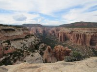
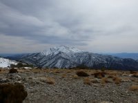
Meanwhile, Ben's photo looks vaguely familiar, but it's not registering yet.
Don't like ads? Become a BCP Supporting Member and kiss them all goodbye. Click here for more info.


