Guess the spot: Utah Edition

Was there any floating or some sort of “water activity“ involved to get to that spot? :thinking: Or was it strictly a drive, park and backpack trip? (It’s ok to laugh now, he.... got to ask some questions after looking at Google Earth and the borders of GCNRA on Gaia.)
 
It is taken from within GCNRA but you’re on the wrong side of Glen Canyon with Llewelyn/Cottonwood.

Rt 276 (and the imaginary ferry line) kind of splits up the GCNRA in 2 sections: an upper & lower area. Is it in the upper or the lower area of the Rt 276 line on the map?

When you say Llewelyn/Cottonwood is on the wrong side, do you mean we should look on the Hall's creek crossing side of the water / Glen Canyon?
 
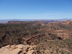
Looks like Monitor butte out in the far distance, perhaps looking south-south east from somewhere between Mikes Mesa and Nokai Dome?
 
Nice, you guys are pretty close. Taken from Grey Mesa near the Great Bend of the San Juan...Nokai Dome and Monitor Butte are on the left. On the right is the end of No Man's Mesa. @Jon Carbaugh you're up!

Awesome, were you headed to Hole in the Rock crossing? Does anyone go out there? Everything from Moqui Canyon south to the confluence of the rivers gets no attention by the masses. Blank spots on the map inspire!
 
Awesome, were you headed to Hole in the Rock crossing? Does anyone go out there? Everything from Moqui Canyon south to the confluence of the rivers gets no attention by the masses. Blank spots on the map inspire!

The Hole in the Rock Trail is a popular 4x4 location...probably UTV now, too, although I haven't been out that way for about ten years now. Off the main route, not so popular.
 
The Hole in the Rock Trail is a popular 4x4 location...probably UTV now, too, although I haven't been out that way for about ten years now. Off the main route, not so popular.
Interesting...I should have figured. Probably contributes to the lack of hiking focus in that area (on the web). My Topo shows it as a "pack trail", darn. Randy, ever explore Lake Canyon? Aerial photos show lots of water. Not sure if there was benches for farming but looks intriguing to poke around.
 
I was backpacking out there. Lots of great stuff in that area. I saw one small Jeep group from afar when I started but there’s a lot of days worth of exploring out there nowhere close to the Emigrant Trail. Steven Allen and those guys have done at least a couple 30+ day trips out in the area.
 
Last edited:
Randy, ever explore Lake Canyon? Aerial photos show lots of water. Not sure if there was benches for farming but looks intriguing to poke around.

I spent one night in Lake Canyon the time I drove the Hole-in-the-Rock Trail, but just along the road through there. The original route crossed through Lake Canyon, but has since been washed out, so a detour around the canyon is now required. There's a few photos of the huge washout at the end of my trip report for the first day here: http://adventr.co/2010/04/hole-in-the-rock-adventure-day-1/
 
I spent one night in Lake Canyon the time I drove the Hole-in-the-Rock Trail, but just along the road through there. The original route crossed through Lake Canyon, but has since been washed out, so a detour around the canyon is now required. There's a few photos of the huge washout at the end of my trip report for the first day here: http://adventr.co/2010/04/hole-in-the-rock-adventure-day-1/

Wow, just noticed that we started that trip exactly ten years ago from tomorrow. I met my friend Dave for the first time on that trip, and ever since then Jared and I have been going on backpacking trips with him ever since! Good times and memories :)
 
Wow, just noticed that we started that trip exactly ten years ago from tomorrow. I met my friend Dave for the first time on that trip, and ever since then Jared and I have been going on backpacking trips with him ever since! Good times and memories :)

Cool to have those memories. I did not know that (Castle) ruin had a name. Interesting rock art in that local area around the dwelling. With water in that canyon as well I wonder what may lie downstream on the way to the lake. Looks like jeep access for a while then trailless. Mike's Canyon also is intriguing for its isolation.
 
Sorry guy's.... didn't think I'd be away that long. Hopefully this is an easy one.

View attachment 87910

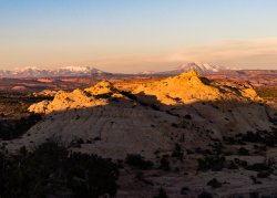
Well that's the Henry Mountains, but it's going to take some digging, to figure out where exactly you took the photo.
I have a similar "mountain peak" photo from the top of the Burr Trail switchbacks, but your photo is taken much further way from the switchbacks.
Were you inside the Grand Staircase- Escalante NM?
 
Last edited:
Well that's the Henry Mountains, but it's going to take some digging, to figure out where exactly you took the photo.
I have a similar "mountain peak" photo from the top of the Burr Trail switchbacks, but your photo is taken much further way from the switchbacks.
Were you inside the Grand Staircase- Escalante NM?

Yes, inside the NM.
 
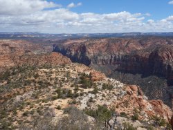
This isn't that unnamed knob west of Red Breaks, south of the Spencer Road, and just north of Zebra canyon?
Yea, that's certainly close enough, on that line of sight. It's taken pretty much from Spencer Flat road looking towards the Henry's. Yur up!
 
Similar threads
Thread starter Title Forum Replies Date
C Guess the Spot: somewhere in Southern Utah General Discussion 4
Outdoor_Fool The value of the various Guess the Spot threads General Discussion 6
wsp_scott NYTimes article: Guess the spot saves someone's life General Discussion 1
JDWalters Guess the Spot: Eastern US Edition General Discussion 515
LarryBoy Guess the Spot: Trip Reports Edition Hiking & Camping 5
balzaccom Guess the Spot--DIY version General Discussion 33
Artemus Guess the Spot: International Edition General Discussion 283
Jammer Guess the Spot (not where you think) General Discussion 10
Backcountry Post Guess the spot: Maps Edition General Discussion 4670
Backcountry Post Guess the spot General Discussion 7683
Perry Can You Guess Where The Uintas Are? General Discussion 5
J Identify the spot Utah: I don't know where it is General Discussion 2
Happyidiot Looking for camping spot close to Denver. General Discussion 2
Jammer Havasu Falls Extra Spot General Discussion 3
Nick Spot X Gear 27
SKLund Sticking with SPOT Gear 0
Ross Unofficial Where’s The Spot General Discussion 0
Perry Good Deal on a Spot Gen 3 Gear 5
Jammer Spot/InReach for May? Trip Planning 7
Bridgette Good camping spot in the Uintas with 4WD Trip Planning 0
jonmessina Spot Tracker Rental? Trip Planning 1
uintahiker The bloodiest spot in Arizona Hiking & Camping 0
Jammer InReach vs Spot Messenger 2013 Gear 32
wnorton Do you use Spot Connect or DeLorme InReach? Gear 6
Nurrgle Good car camping spot in the Uintas General Discussion 9
Nick SPOT Connect Gear 2
B Southern Utah March suggestions? Trip Planning 5
desertvic Howdy from rural Utah Noobs: Introduce yourself! 1
Ugly Floating Island- Utah Trip Planning 8
Normie Invite Looking for shuttle partner -- two trips in Southern Utah Meet Up (Members Only) 5
BeardoMcGrath Oh look yet another Utah conditions thread: mid May 2023 Trip Planning 9
Vegan.Hiker 8 day trip to Utah Trip Planning 10
ww.joedirt.do Hello from Utah! Noobs: Introduce yourself! 0
Martyn Hi from Hurricane Utah! Noobs: Introduce yourself! 1
B Good trips in Southern Utah given current conditions Trip Planning 26
saltybird SE Utah NPs in April Trip Planning 13
C Grand Gulch Cedar Mesa Utah 11 Day Backpack October 2022 Backpacking 10
T Amazing Discovery in Utah-Glen Canyon Trip Planning 65
V four day backpacking trip in southern Utah starting this weekend Trip Planning 4
regehr recent Utah meteorite General Discussion 0
TrailScot "I Would Walk 500 Miles ..." - A Utah Adventure - April 2022 - Final Part Backpacking 11
TrailScot "I Would Walk 500 Miles ..." - A Utah Adventure - April 2022 - Part 5 Backpacking 3
TrailScot "I Would Walk 500 Miles ..." - A Utah Adventure - April 2022 - Part 4 Backpacking 10
TrailScot "I Would Walk 500 Miles ..." - A Utah Adventure - April 2022 - Part 3 Backpacking 4
TrailScot "I Would Walk 500 Miles ..." - A Utah Adventure - April 2022 - Part 2 Backpacking 5
TrailScot "I Would Walk 500 Miles ..." - A Utah Adventure - April 2022 - Part 1 Backpacking 6
Rudolf_The_Red Hello from BFE, Utah! Noobs: Introduce yourself! 4
H location of thirteen faces-horse canyon Utah Hiking & Camping 4
TrailScot Dripping Canyon to Grand Gulch, Cedar Mesa, Utah - March 2022 Hiking & Camping 7
H Horse Canyon needles district Utah Off Road 0

Similar threads

Back
Top