Navigation
Install the app
How to install the app on iOS
Follow along with the video below to see how to install our site as a web app on your home screen.
Note: This feature may not be available in some browsers.
More options
Style variation
You are using an out of date browser. It may not display this or other websites correctly.
You should upgrade or use an alternative browser.
You should upgrade or use an alternative browser.
Guess the spot: Utah Edition
- Thread starter Ben
- Start date
John Morrow
Member
- Joined
- May 22, 2015
- Messages
- 1,119
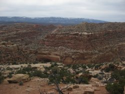
USGS Topo shows the buttress and deep gap as the end of a long point at the mouth of Spring Canyon; and places the arch high above the Nates Canyon on the next point south about 1/3 mile downstream of the Nates/Spring junction. Must be it. The high rim in the background is the crest of the Reef.I'll just add that the picture it taken within a couple miles of the San Rafael River.
IntrepidXJ
ADVENTR
- Joined
- Jan 17, 2012
- Messages
- 3,490
USGS Topo shows the buttress and deep gap as the end of a long point at the mouth of Spring Canyon; and places the arch high above the Nates Canyon on the next point south about 1/3 mile downstream of the Nates/Spring junction. Must be it. The high rim in the background is the crest of the Reef.
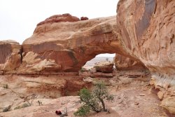
Plus, that's Delicate Arch (the San Rafael Swell version) in the background
regehr
Member
- Joined
- Mar 28, 2012
- Messages
- 2,454
You are up!USGS Topo shows the buttress and deep gap as the end of a long point at the mouth of Spring Canyon; and places the arch high above the Nates Canyon on the next point south about 1/3 mile downstream of the Nates/Spring junction. Must be it. The high rim in the background is the crest of the Reef.
John Morrow
Member
- Joined
- May 22, 2015
- Messages
- 1,119
This may be tough. In this picture there are two canyons below me. On directly below and one over to the left. The two canyons meet just behind the butte at far left. What are the names of these two canyons? The rim from which the photo is taken is in a trailless area. I took this pick 10 years ago to the day tomorrow 4/15. So wish I were there now.


John Morrow
Member
- Joined
- May 22, 2015
- Messages
- 1,119
- Joined
- May 31, 2015
- Messages
- 3,329
If it makes you feel any better, I've been down those canyons before and wouldn't have been able to guess that one.So much for tough! Take it away @regehr
regehr
Member
- Joined
- Mar 28, 2012
- Messages
- 2,454
it was a lucky break-- Boulder Mountain is pretty distinctive then I flew around in google earth and by chance landed right near that intersection.If it makes you feel any better, I've been down those canyons before and wouldn't have been able to guess that one.
@John Morrow is it easy to get up there? I've often looked longingly at this area north / east of Spring Canyon but haven't yet made a serious attempt to visit it
Last edited:
John Morrow
Member
- Joined
- May 22, 2015
- Messages
- 1,119
it was a lucky break-- Boulder Mountain is pretty distinctive then I flew around in google earth and by chance landed right near that intersection.
@John Morrow is it easy to get up there? I've often looked longingly at this area east of Spring Canyon but haven't yet made a serious attempt to visit it
Funny, I was gonna ask you if you knew of one farther up Spring Canyon. Supposedly there is an exit toward the Water Canyon System. I can map you my exit, it's hidden and fun. Class 2/3. Before the spring.
I, at the time, thought I wouldn't hesitate to go back up/down it with a multiday pack. But that was 10 years ago.
regehr
Member
- Joined
- Mar 28, 2012
- Messages
- 2,454
ack that was fast!! you are upWhitmore Arch in the Maze?
Reef&Ruins
Colorado Plateau is calling...
- Joined
- Feb 3, 2017
- Messages
- 926
Not to hijack the thread but has anyone been into the Waterpocket fold area further up (like access from near the Cathedral Valley campground back to the ford crossing of the Fremont River)?Funny, I was gonna ask you if you knew of one farther up Spring Canyon. Supposedly there is an exit toward the Water Canyon System. I can map you my exit, it's hidden and fun. Class 2/3. Before the spring.
I, at the time, thought I wouldn't hesitate to go back up/down it with a multiday pack. But that was 10 years ago.
Udink
Still right here.
- Joined
- Jan 17, 2012
- Messages
- 1,742
regehr
Member
- Joined
- Mar 28, 2012
- Messages
- 2,454
no but I've spent a lot of time scoping out routes in that area using google earth!Not to hijack the thread but has anyone been into the Waterpocket fold area further up (like access from near the Cathedral Valley campground back to the ford crossing of the Fremont River)?
Udink
Still right here.
- Joined
- Jan 17, 2012
- Messages
- 1,742
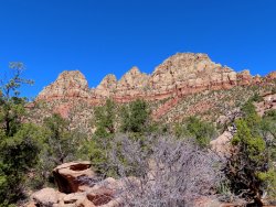
Correct area, though not inside the park. Maybe about four miles from a park boundary.Dennis's photo looks pretty Zionish is all I have
Udink
Still right here.
- Joined
- Jan 17, 2012
- Messages
- 1,742
Yep, those peaks are Smithsonian Butte. You're up.Looks like Smithsonian Butte area.
Don't like ads? Become a BCP Supporting Member and kiss them all goodbye. Click here for more info.


