Navigation
Install the app
How to install the app on iOS
Follow along with the video below to see how to install our site as a web app on your home screen.
Note: This feature may not be available in some browsers.
More options
Style variation
You are using an out of date browser. It may not display this or other websites correctly.
You should upgrade or use an alternative browser.
You should upgrade or use an alternative browser.
Guess the spot: Utah Edition
- Thread starter Ben
- Start date
- Joined
- Jul 24, 2021
- Messages
- 166
Are you thinking of Buck Canyon? I was looking at that, but was having a hard time getting things to line up.There si a named canyon between Lathrop and Gooseberry but the name evades me at the moment.
John Morrow
Member
- Joined
- May 22, 2015
- Messages
- 1,119
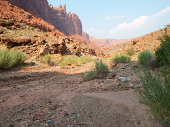
I think Shafer lines up and the wingate face on the skyline is near the Visitor Center. I am fairly sure, then, that the foreground is all organ rock snadstone and not Cedar Mesa. The CM doesn't extend that far north and goes underground at that point I think. But I have never been north of Gooseberry on the CO River side of the Is. But as far as a prominent landmark out of the pic...hmm...the Neck? Between @XID_AZ and I we've covered all but one other option. It has a very known namesake landmark! So, someone take it if Shafer is wrong!
- Joined
- May 19, 2012
- Messages
- 2,017
NopeAre you thinking of Buck Canyon? I was looking at that, but was having a hard time getting things to line up.
- Joined
- May 19, 2012
- Messages
- 2,017
NopeI think Shafer lines up and the wingate face on the skyline is near the Visitor Center. I am fairly sure, then, that the foreground is all organ rock snadstone and not Cedar Mesa. The CM doesn't extend that far north and goes underground at that point I think. But I have never been north of Gooseberry on the CO River side of the Is. But as far as a prominent landmark out of the pic...hmm...the Neck? Between @XID_AZ and I we've covered all but one other option. It has a very known namesake landmark! So, someone take it if Shafer is wrong!
- Joined
- Jun 11, 2017
- Messages
- 4,612
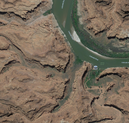
Is this perchance on the opposite side of the river from Lathrop? Like Lockhart or Horsehead?
Last edited:
- Joined
- Jul 24, 2021
- Messages
- 166
I was not going to say this one, because I thought it was further away from Lathrop, but with canyon's twisting around, I guess the neighborhood doesn't have to be solely where their mouths are.
With what @John Morrow said, I'm going to guess Little Bridge Canyon.
On Google Earth I'm convincing myself that I can get a close lineup of things, minus all the walls that look like they are melting, lol.
With what @John Morrow said, I'm going to guess Little Bridge Canyon.
On Google Earth I'm convincing myself that I can get a close lineup of things, minus all the walls that look like they are melting, lol.
- Joined
- Jul 24, 2021
- Messages
- 166
I looked over there as well, but it seemed like @gnwatts was pushing us to the Island in the Sky side.Is this perchance on the opposite side of the river from Lathrop? Like Lockhart or Horsehead?
- Joined
- May 19, 2012
- Messages
- 2,017
Bingo!I was not going to say this one, because I thought it was further away from Lathrop, but with canyon's twisting around, I guess the neighborhood doesn't have to be solely where their mouths are.
With what @John Morrow said, I'm going to guess Little Bridge Canyon.
On Google Earth I'm convincing myself that I can get a close lineup of things, minus all the walls that look like they are melting, lol.
One of my favorite campsites on the River is at Little Bridge. It's an interesting little canyon, lot's of variety.
You're up.
Last edited:
John Morrow
Member
- Joined
- May 22, 2015
- Messages
- 1,119
Bingo!
One of my favorite campsites on the River is at Little Bridge. It's an interesting little canyon, lot's of variety.
You're up.
That's sweet. I never even heard of L. Bridge Canyon. Looks like there are possible breaks in the white rim to gain access. If not along the canyon rim proper, then between it and Lathrop. Lots of navigable looking foot terrain below the rim from one canyon to the other. Lack of H2O limits things some. Unless someone would share along the jeep trail! If anyone knows of some evidence of the ancients in the area, PM me. I don't need details, just another incentive to go on an exploration.
- Joined
- Jul 24, 2021
- Messages
- 166
Yep, that was quick.Upheaval Canyon?
Reef&Ruins
Colorado Plateau is calling...
- Joined
- Feb 3, 2017
- Messages
- 926
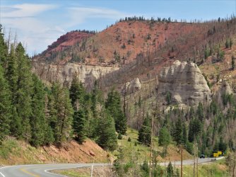
Is that a runaway vehicle ramp set of signs shown in the bottom right?
Udink
Still right here.
- Joined
- Jan 17, 2012
- Messages
- 1,742
It is, and the signs along this state highway say the road is not recommended for semi trucks.Is that a runaway vehicle ramp set of signs shown in the bottom right?
Udink
Still right here.
- Joined
- Jan 17, 2012
- Messages
- 1,742
You're pretty close. I drove a relatively short distance from Highway 14 to get to this highway.Is this UT-14? I can't seem to locate a spot that qualifies, but the general landscape it goes through gives me this impression.
Don't like ads? Become a BCP Supporting Member and kiss them all goodbye. Click here for more info.


