Navigation
Install the app
How to install the app on iOS
Follow along with the video below to see how to install our site as a web app on your home screen.
Note: This feature may not be available in some browsers.
More options
Style variation
You are using an out of date browser. It may not display this or other websites correctly.
You should upgrade or use an alternative browser.
You should upgrade or use an alternative browser.
Guess the spot: Maps Edition
- Thread starter Backcountry Post
- Start date
Kishenehn
Member
- Joined
- Dec 13, 2016
- Messages
- 138
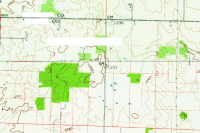
Some cool trivia I learned about that place today, while trying to figure out the map: the first person to successfully summit all of the state highpoints completed his quest with a visit to Hoosier Hill in 1936. (Of course, there were only 48 highpoints back then ... )Hoosier Hill, highest pt in Indiana
HomerJ
Member
- Joined
- Jan 19, 2012
- Messages
- 1,199
Thought you guys might be interested in this Kayaking trip into and down Bull Lake Creek. Looks crazy!!!You don't want to walk through Bull Lake... We have to talk, J. We have to talk...
- Joined
- May 31, 2015
- Messages
- 3,330
That's a good way to end such a task. Zero effort required! It probably wasn't nearly as well-marked back then.Some cool trivia I learned about that place today, while trying to figure out the map: the first person to successfully summit all of the state highpoints completed his quest with a visit to Hoosier Hill in 1936. (Of course, there were only 48 highpoints back then ... )
It's fairly close to where I lived as a kid, and I'll be within 30 minutes of it over the next few days. I need to go see it!
- Joined
- May 31, 2015
- Messages
- 3,330
Absolutely insane. First, I can't imagine hauling a kayak that far. And second, the water they ran was nuts. Looks beautiful, but I am ok knowing I'll never run that creek.Thought you guys might be interested in this Kayaking trip into and down Bull Lake Creek. Looks crazy!!!
Kishenehn
Member
- Joined
- Dec 13, 2016
- Messages
- 138
I'll look forward to that trip report.That's a good way to end such a task. Zero effort required! It probably wasn't nearly as well-marked back then.
It's fairly close to where I lived as a kid, and I'll be within 30 minutes of it over the next few days. I need to go see it!
Reading about that guy, I wondered if he lived long enough to see Alaska and Hawaii admitted as states, and if he frantically planned a McKinley climb when he heard the news ...
- Joined
- Aug 9, 2007
- Messages
- 12,962
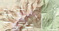
Apologies for all the whiteoutsView attachment 51253
Western United States.
- Joined
- Jan 4, 2015
- Messages
- 2,904
Actually, that's incorrect!Western United States.
I guess that's a hint as well?
mike_offerman
Member
- Joined
- Feb 8, 2012
- Messages
- 566
Mount Adams?
- Joined
- Jan 4, 2015
- Messages
- 2,904
Yep, Mt Madison is featured front and center. You're up!Mount Adams?
mike_offerman
Member
- Joined
- Feb 8, 2012
- Messages
- 566
- Joined
- Jan 4, 2015
- Messages
- 2,904
Wow, that is one grand mountain!
mike_offerman
Member
- Joined
- Feb 8, 2012
- Messages
- 566
You got it, Grand Teton!Wow, that is one grand mountain!
Langdon Greene
Member
- Joined
- Dec 27, 2015
- Messages
- 243
slc_dan
Desert Rat-Weekend Warrior
- Joined
- Jun 7, 2012
- Messages
- 1,687
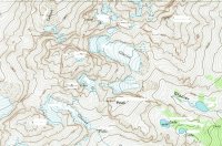
Oh sorry about that! Didn't realize I was up. In an effort to speed things up, this one will last about thirty seconds
What's the name of the lake of the lake in the upper left?
View attachment 55237
Chepeta Lake Basin. Peaks whited out, Rose, Eccentric, and Chepeta.
- Joined
- Jan 4, 2015
- Messages
- 2,904
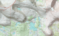
Have you ever hiked the ridgeline itself between Chipeta and, says Gilbert? That whole thing seems very doable and quite interesting.Chepeta Lake Basin. Peaks whited out, Rose, Eccentric, and Chepeta.
edit - also, you're up!
Don't like ads? Become a BCP Supporting Member and kiss them all goodbye. Click here for more info.


