Navigation
Install the app
How to install the app on iOS
Follow along with the video below to see how to install our site as a web app on your home screen.
Note: This feature may not be available in some browsers.
More options
Style variation
You are using an out of date browser. It may not display this or other websites correctly.
You should upgrade or use an alternative browser.
You should upgrade or use an alternative browser.
Guess the spot: Maps Edition
- Thread starter Backcountry Post
- Start date
- Joined
- Jan 4, 2015
- Messages
- 2,904
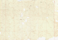
Saddle Butte Lava Field. You didn't zoom out quite enough
- Joined
- Jan 4, 2015
- Messages
- 2,904
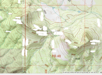
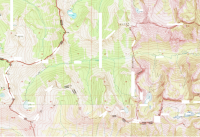
Nothing on this? Thought this one would be guessed within an hour!A very important place indeed. This shouldn't take long. View attachment 43941
- Joined
- Jun 25, 2012
- Messages
- 4,430
I would have gotten it but there are all those snow patches covering the landmarks....Nothing on this? Thought this one would be guessed within an hour!
Kullaberg63
Member
- Joined
- Mar 6, 2014
- Messages
- 668
Book Cliffs?
Langdon Greene
Member
- Joined
- Dec 27, 2015
- Messages
- 243
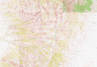
Every few hours, I keep coming back here and staring at that map, with the nagging feeling that I should know this one. (I'm fully expecting to have one of those forehead-smacking "I coulda had a V8!" moments when I find out the answer.)
I love the looks of some of those valleys, especially that curvy one up in the northeast quadrant that skirts into the greener segment. Dangit, that just looks so familiar!! I can't place it.
It is awfully hard to see those contour lines... I don't suppose you could pick an area of this and blow it up a teensy bit?
- Joined
- Jan 4, 2015
- Messages
- 2,904
Argh yeah, should have gotten that one.I knew some one would know. Still surprised it took this long.
I haven't been.
Planning a hike on the crest trail over the fourth if I can get a shuttle somehow. Hitching would be an interesting experience.
Langdon Greene
Member
- Joined
- Dec 27, 2015
- Messages
- 243
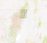
wow, I'm glad I didn't spend much time hunting for it. I would've never got it - that's an area as foreign to me as the Ross Ice Shelf. Who knew Nevada even had a lake anywhere east of Tahoe? ;-)
Langdon Greene
Member
- Joined
- Dec 27, 2015
- Messages
- 243
Oh oh oh - I think I know exactly where that is! Hopefully I can check my map and answer before a certain someone [who I know hikes there!] beats me to it.
Langdon Greene
Member
- Joined
- Dec 27, 2015
- Messages
- 243
Yep, I was right. Blodgett Creek Valley, Blodgett Pass, Lake, etc. Selway Bitterroot Wilderness.
I actually have an ~50-mile horse-shoe-shaped backpacking route pre-planned there, which would enter[/exit] via Blodgett, to Big Sand Lake, north to Frog, Colt Killed, Packbox Pass, to Big Creek Lake and out Big Creek toward Victor.
I actually have an ~50-mile horse-shoe-shaped backpacking route pre-planned there, which would enter[/exit] via Blodgett, to Big Sand Lake, north to Frog, Colt Killed, Packbox Pass, to Big Creek Lake and out Big Creek toward Victor.
Don't like ads? Become a BCP Supporting Member and kiss them all goodbye. Click here for more info.

