Guess the spot: Maps Edition

First hint. It's in, you guessed it, Montana.
I've spent WAYYY too much time trying to find this place... my guess is it's in the Lolo or Bitterroot national forest, somewhere near the Bitterroots, but other than that, no clue.
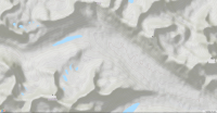
 
I give up. I tried...
 
Ha, I had been expecting to find it in the Spanish Peaks area, along the ridge running between Beehive Basin & Jerome Rock Lakes. When I couldn't find it there, I just followed along the lines of Ranger District boundaries, in areas I knew to contain lots of mines. It took me awhile - there are a LOT of mines in Montana.

OK, here's one:

GuessTheSpot2.png
 
ah, I just realized this is missing some key contextual clues (e.g., elevation labels). I have to go fix dinner, when I get back later tonight, I'll add in some more contextual data.
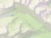
 
ah, I just realized this is missing some key contextual clues (e.g., elevation labels). I have to go fix dinner, when I get back later tonight, I'll add in some more contextual data.
Shape looks like Death Canyon in GTNP but I don't think there's a lake in the upper part of the canyon.
 
Hmmm, I hadn't thought of that, @LarryBoy but you're right about the similarity: indeed it does resemble Death Canyon quite a bit, but there's no shelf on top of the sheer cliff wall, and there's no lake in the GTNP version. But feature wise these locales are remarkably similar. The valley in the one I'm showing above is quite a bit wider/broader at the bottom, I think.

The elevation at the long, broad valley floor here runs between 6000'-6500', while the top ridgeline of the cliff face - which runs in a straight line for 20 miles! - stays close to 8000' for nearly the entire length. (This map shows mostly the upper portion of the valley / ridge / cliff.)

Here's a bit more elevation data:
GuessTheSpot2a.png
 
Oh, btw, there is of course a substantial river running through that valley, though these maps fail to show it.
 
Azure Lake, Saghali Mountain, Sunset Peak, valley of some tributary to the Athabasca River, Alberta, Canada.
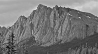
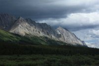
Um, yeah, that's all correct, 'tis true [btw, Blue Creek, tributary of Snake Indian, which is a tributary of Athabasca River] but I'm rather saddened :cry: that you failed to name the iconic topographic feature for which this valley [in Jasper National Park] is known. :cry:

So yes, you got it. And you're up. But come on now "say my name, baby, say my name!"

306064.jpg p11074.jpg
 
Hunh. Still doesn't do it for me. It's so much more of a turn-on when my wife calls me "The Ancient Wall." :rolleyes:

Say it again, only this time, be wearing those thigh-high fishnets I mailed you.... :wavespin:
 
Back
Top